Transcription
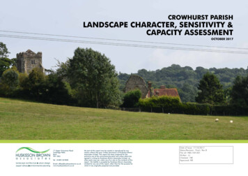
CROWHURST PARISHLANDSCAPE CHARACTER, SENSITIVITY &CAPACITY ASSESSMENTOCTOBER 201717 Upper Grosvenor RoadTunbridge WellsKentTN1 2DUTel 01892 527828Email: kNo part of this report may be copied or reproduced by anymeans without the prior written permission of Huskisson BrownAssociates Limited. This report has been prepared for theexclusive use of the commissioning party and unless otherwiseagreed in writing by Huskisson Brown Associates Limited, noother party may use, make use of or rely on the contents of thisreport. No liability is accepted by Huskisson Brown AssociatesLimited for any use of this report, other than for the purpose forwhich it was originally prepared and provided.Date of Issue: 17/10/2017Status/Revision: Final / Rev BFile ref: HBA-769-001Written : LJChecked : NBApproved: NB
CONTENTS1.0INTRODUCTION & BACKGROUND 32.0LANDSCAPE CHARACTER ASSESSMENT3.0METHODOLOGY AND APPROACH TO ASSESSMENT 286CROWHURST PARISH NEIGHBOURHOOD PLANLANDSCAPE CHARACTER, SENSITIVITY & CAPACITY ASSESSMENTOctober 2017Huskisson Brown AssociatesHBA-769-001.indd
1.0INTRODUCTION & BACKGROUND1.1Huskisson Brown Associates (HBA) is a firm of Chartered LandscapeArchitects, established in 1987 and registered since then with the LandscapeInstitute. HBA has been a member of the Institute of EnvironmentalManagement and Assessment since 1992. The practice is Quality Assuredto BS ISO 9001:2008. All directors of the practice are Chartered Membersof the Landscape Institute.1.2The practice has undertaken a range of landscape and visual assessmentwork for many clients including public bodies, private companies andindividuals. The practice experience includes projects in the commercial,industrial, retail, recreational, healthcare, agricultural, infrastructureand residential development sectors. It also has experience in providingdevelopment control advice to Local Planning Authorities.1.3The practice has been commissioned on the instruction of CrowhurstParish Council to prepare a Landscape Character, Sensitivity and CapacityAssessment.1.4The preparation of this work has been carried out following the NaturalEngland Guidance “An Approach to Landscape Character Assessment” and“How to prepare a character assessment to support design policy within aneighbourhood plan” published by Planning Aid England.1.51.6 Natural England National Landscape Character Area 122 High Weald; The East Sussex County Landscape Character Assessment 2016Character Area 10 Combe Haven Valley; The High Weald Area of Outstanding Natural Beauty (AONB)Management Plan 2014-2019; The High Weald Parish Information Pack 2016; Rother District Council LDF Core Strategy Landscape Assessment 2009; Rother District Council Strategic Housing Land Availability AssessmentReview 2013; Crowhurst Heritage & Character Assessment, Aecom Aug 2017 MAGIC website; English Heritage website; On line review of Historic Ordnance Survey mapping; Bing Map, Google Map and Google Earth;Purpose & scope of the study1.7The study has included both desk top study and field work. Site visits werecarried out on 4th July 2017 and 22nd August 2017.October 2017HBA-769-001.inddThe following documents and sources are considered to be the primary onesof relevance to the landscape character of the parish.3The purpose of this document will be to inform the preparation of the ParishNeighbourhood Plan. It will identify and describe landscape character areaswithin the parish and their key characteristics and assess 4 sites (previouslyselected by Crowhurst Parish Council) on their landscape sensitivityand capacity for residential development. These key characteristics andlandscape strategies for the 4 sites will provide the baseline which will guidefuture development and management of the landscape.CROWHURST PARISH NEIGHBOURHOOD PLANLANDSCAPE CHARACTER, SENSITIVITY & CAPACITY ASSESSMENTHuskisson Brown Associates
2 LANDSCAPE CHARACTER ASSESSMENT
2.0LANDSCAPE CHARACTER ASSESSMENTExisting Landscape Character AssessmentsJoint Character AreasMethodology of Character Assessment2.1This assessment has been carried out using the 2004 Natural Englandguidance “An Approach to Landscape Character Assessment”.2.2The guidance sets out 5 key principles for landscape assessment: “Landscape is everywhere and all landscape and seascape has character; Landscape occurs at all scales and the process of Landscape CharacterAssessment can be undertaken at any scale; The process of Landscape Character Assessment should involve anunderstanding of how the landscape is perceived and experienced bypeople; A Landscape Character Assessment can provide an integrating spatialframework - a multitude of variables come together to give us ourdistinctive landscapes.”The site lies in area NCA 122, ‘High Weald’. Below are listed keycharacteristics of the High Weald NCA which are relevant to CrowhurstParish: Ancient routeways in the form of ridgetop roads and a dense system ofradiating droveways, often narrow, deeply sunken and edged with trees andwild flower-rich verges and boundary banks; An intimate, hidden and small-scale landscape with glimpses of farreachingviews, giving a sense of remoteness and tranquillity; Step 1 - Define Scope of Assessment Step 2 - Desk Study (baseline analysis, review of existing characterassessments) Strong feeling of remoteness due to very rural, wooded character. A greatextent of interconnected ancient woods, steep-sided gill woodlands, woodedheaths and shaws in generally small holdings with extensive archaeology andevidence of long-term management; Step 3 - Field Survey Step 4 - Classification & Description (classifying, mapping & describinglandscape) Small and medium-sized irregularly shaped fields enclosed by a networkof hedgerows and wooded shaws, predominantly of medieval origin andmanaged historically as a mosaic of small agricultural holdings typically usedfor livestock grazing.“A character assessment is a document that describes the distinctappearance and feel of a settlement area. It communicates the key physicalfeatures and characteristics that combine to give a particular settlementor an area its local distinctiveness and unique identity.” (How to preparea character assessment to support design policy within a NeighbourhoodPlan, Planning Aid England)Huskisson Brown Associates2.5 Dispersed settlement pattern of hamlets and scattered farmsteads andmedieval ridgetop villages;There are 4 main steps to the process of carrying out a LandscapeCharacter Assessment as set out in “An Approach to Landscape CharacterAssessment”:CROWHURST PARISH NEIGHBOURHOOD PLANLANDSCAPE CHARACTER, SENSITIVITY & CAPACITY ASSESSMENTNatural England has divided the country into 159 National CharacterAreas (NCAs). These are areas that share similar landscape characteristics,and which follow natural lines in the landscape rather than administrativeboundaries, making them a good decision-making framework for thenatural environment. “A faulted landform of clays, sand and soft sandstones with outcropsof fissured sandrock and ridges running east–west, deeply incised andintersected with numerous gill streams forming the headwaters of a numberof the major rivers; A Landscape Character Assessment can provide a landscape evidencebase to inform a range of decisions and applications;2.32.4 An essentially medieval landscape reflected in the patterns of settlement,fields and woodland; High-quality vernacular architecture with distinct local variation using localmaterials. Horsham Slate is used on mainly timber structures and timberframed barns are a particularly notable Wealden characteristic feature of theHigh Weald.”6October 2017HBA-769-001.indd
High Weald Area of Outstanding Natural Beauty (AONB)2.6County-wide Landscape CharacterThe northern and central part of Crowhurst parish lies within the High WealdAONB. The High Weald AONB Management Plan 2014-2019 defines thenatural beauty, character and special qualities in a Statement of Significanceand the relevant characteristics to the parish are listed below:2.7The East Sussex County Landscape Assessment (updated in 2016) identifies40 unique areas and has produced management guidelines for eachcharacter area. Crowhurst parish is situated within Area: 10 - Combe HavenValley and the following characteristics are relevant to the parish: “A series of small winding High Wealden stream valleys which converge on atract of levels to join the Combe Haven Basin; “.deeply incised, ridged and faulted landform of clays and sandstone. Theridges tend east-west, and from them spring numerous gill streams that formthe headwaters of rivers; Rolling well wooded countryside with typical High Wealden character ofrolling landscape and historic field patterns; Wide river valleys dominate the eastern part of the AONB; The area is enclosed by the Battle ridge to the north; Dispersed historic settlements of farmsteads and hamlets, and late medievalvillages founded on trade and non-agricultural rural industries; Focal open, flat, winding valley floor and wetland in the Combe HavenBasin; Ancient routeways (now roads, tracks and paths) in the form of ridge-toproads and a dense system of radiating droveways. These routeways areoften narrow, deeply sunken, and edged with trees, hedges, wildflower-richverges and boundary banks; Intricate terrain of small, winding valleys and ridges around levels, withabundant woods and gills; Extensive areas of ancient woodland; Great extent of ancient woods, gills and shaws in small holdings, the value ofwhich is inextricably linked to long-term management; A sense of tranquillity away from the main settlements and roads; Small, irregular shaped and productive fields often bounded by (and forminga mosaic with) hedgerows and small woodlands, and typically used forlivestock grazing; small holdings; and a non-dominant agriculture.” Indigenous characteristic tree species are oak, ash and field maple, with wildcherry and sweet chestnut coppice in woodland on the drier slopes. Scatteredscrub and large white willow on the levels; Wetland birds are a feature in the wetland landscape; Some remnant historic parkland associated with historic manors at CrowhurstPark; Scattered historic farmsteads typical of the High Weald; Caravan and chalet developments which reflect the attractiveness of the areafor holiday makers; A large electricity sub station with associated pylons extending across thearea in several directions; The Hastings to London railway line cuts across the eastern part of the area; Remnants of the disused Bexhill to Crowhurst rail link across the CombeHavenOctober 2017HBA-769-001.indd7CROWHURST PARISH NEIGHBOURHOOD PLANLANDSCAPE CHARACTER, SENSITIVITY & CAPACITY ASSESSMENTHuskisson Brown Associates
Crowhurst Parish - Landscape Character Assessment Overview2.8Crowhurst is a rural parish in the High Weald located between Battle,Hastings and Bexhill. The parish is characterised by a landscape of ridges,valleys, gill streams, woodland, scattered farmsteads and fragmentedsettlement (see Figure 1).Landscape Character Types2.9Our assessment broadly identified 4 landscape character types within theparish;1. Northern and Eastern Crowhurst - Ridge and Gill Landscape2. Central Crowhurst - Powdermill Valley3. Southern Crowhurst - Combe Haven Valley4. Western Crowhurst - Watermill Valley“Landscape Character Types: These are single unique areas which arethe discrete geographical areas of a particular landscape type. Each hasits own individual character and identity, even though it shares the samegeneric characteristics with other types.” (An Approach to LandscapeCharacter Assessment, October 2014, Natural England)Southern Crowhurst - Combe Haven ValleyCROWHURST PARISH NEIGHBOURHOOD PLANLANDSCAPE CHARACTER, SENSITIVITY & CAPACITY ASSESSMENTHuskisson Brown Associates8October 2017HBA-769-001.indd
Figure 1: Overview of Crowhurst Parish Landscape CharacterBATTLETINGSRIDGEKeyParish BoundaryThe High Weald AONB BoundaryKey viewsFore Wood1. Northern & EasternCrowhurst - Ridge &Gill LandscapePowdermill streamvillageviews4. Western Crowhurst- Watermill ValleyFarmstead‘Scattered’ SettlementNotable buildingHye HouseWoodlandQuarryWoodWetlandWatermill streamvalley v3. Southern Crowhurst- Combe Haven ValleyheseaiewsOpen Countryside/Agricultural landotCOMBE HAVENKey open countryside betweensettlementsRail lineCrowhurst Stationviews to the seastviewMain valleyStream2. CentralCrowhurst PowdermillValleyvalleyviewsMain ridgesGill streamSt George’sChurchManor HouseHBA-769-001.inddASCrowhurstManor House1066 Country WalkBexhill LinkOctober 2017-HMain roads1066 Country Walk - Bexhill Link9CROWHURST PARISH NEIGHBOURHOOD PLANLANDSCAPE CHARACTER, SENSITIVITY & CAPACITY ASSESSMENTHuskisson Brown Associates
Landscape Character Areas2.10 Following desk top and field survey work 13 Landscape Character Areas(LCA) within the parish boundary have been identified and mapped on theLandscape Character Area Plan (see Figure 2). Each LCA is described inthis section alongside its key characteristics and typical imagery.1. Northern & Eastern Crowhurst - Ridge & Gill Landscape1a Fore Wood Nature Reserve1b Fore Wood Lane Settlement1c Station Road Settlement1d Brakes Coppice Farmland1e Crowhurst Park1f Green Street Ridge2. Central Crowhurst - Powdermill Valley2a Powdermill Valley Farmland2b Crowhurst Historic Village2c Plough Inn Settlement Area2d Southern Powdermill Valley Farmland3. Southern Crowhurst - Combe Haven Valley3a Combe Valley Slopes3b Combe Haven Country Park4. Western Crowhurst - Watermill Valley4a Watermill Valley Farmland“Landscape Character Areas: These are single unique areas which are thediscrete geographical areas of a particular landscape type. Each has its ownindividual character and identity, even though it shares the same genericcharacteristics with other types.” (An Approach to Landscape CharacterAssessment, October 2014, Natural England)Key Characteristics are “combinations of elements which help to give an areaits distinctive sense of place. If these characteristics change, or are lost, therewould be significant consequences for the current character of the landscape” (AnApproach to Landscape Character Assessment, October 2014, Natural England)Central Crowhurst - The Plough InnCROWHURST PARISH NEIGHBOURHOOD PLANLANDSCAPE CHARACTER, SENSITIVITY & CAPACITY ASSESSMENTHuskisson Brown Associates10October 2017HBA-769-001.indd
Figure 2: Landscape Character Areas1e1a1b2 Central Crowhurst - Powdermill Valley2a Powdermill Valley Farmland2b Crowhurst Historic Village2c Plough Inn Settlement Area2d Southern Powdermill Valley Farmland1d1c3 Southern Crowhurst - Combe HavenValley3a Combe Valley Slopes3b Combe Haven Country Park2b2a4a1 Northern & Eastern Crowhurst- Ridge & Gill Landscape1a Fore Wood Nature Reserve1b Fore Wood Lane Settlement1c Station Road Settlement1d Brakes Coppice Farmland1e Crowhurst Park1f Green Street Ridge1f2c4 Western Crowhurst - Watermill Valley4a Watermill Valley 8305,0.49036,173a3bOS mapping reproduced and based upon the Ordnance Surveymapping with permission of the Controller of Her Majesty’s StationeryOctober2017 copyright reserved. Licence No. 100017922.Office. CrownHBA-769-001.indd11CROWHURST PARISH NEIGHBOURHOOD PLANLANDSCAPE CHARACTER, SENSITIVITY & CAPACITY ASSESSMENTHuskisson Brown Associates
1. NORTHERN & EASTERN CROWHURST - RIDGE & GILL LANDSCAPE1A - FORE WOOD NATURE RESERVEDescription of Landscape CharacterKey/Special Landscape CharacteristicsView Point 1CROWHURST PARISH NEIGHBOURHOOD PLANLANDSCAPE CHARACTER, SENSITIVITY & CAPACITY ASSESSMENTHuskisson Brown AssociatesOS Maps: online mapping and walking, running and cycling routesA woodland landscape on the northern slopes ofPowdermill Valley. Fore Wood is designated an ancientwoodland and provides an important wildlife habitat.Powdermill stream runs along the southern boundaryand is fed by a number of tributary gills which havebeen created by the vigorous down-cutting of streamsinto the sandstone. Land use is primarily for natureconservation and recreation and is managed as anature reserve by the RSPB. Walking trails provideaccess through the interior of the woodland and thelong distance 1066 Country Walk Bexhill Link footpathskirts along the southern boundary of the woodland.The dense interior provides close internal views withperiodic openings where the woodland has beencoppiced. The rear gardens along Old Fore Wood roadand Fore Wood road denote the eastern boundary ofFore Wood. The woodland is only accessible via publicfootpaths contributing to a sense of tranquillity andremoteness. Semi-natural ancient woodland of oak, ash, beechand sweet chestnut. A strong sense of woodland enclosure andtranquillity 1066 Country Walk Bexhill Link along southernlower woodland slopes Gill Streams on steeper sandstone ravines providehabitat for rare ferns Notable spring colour of bluebells, purple orchidand wood anemones Woodland birds and butterflies Ponds within localised openings in the woodland London-Hastings Railway dissects area A section of Fore Wood is designated a Site ofSpecial Scientific Interest (SSSI) designation due toit being one of only 5 East Sussex examples of gillwoodland and also for its rich breeding communitySummary of Landscape CharacterStrong contribution to special character ofCrowhurst parish and the High Weald AONBthrough topographical variation of gill streams andridges and the presence of ancient woodland. Highconservational interest from the Ancient Woodland,SSSI and SNCI. Enclosed woodland provides sense ofenclosure and tranquillity with human activity limitedto the PRoW. Some modern influences along theeastern boundary where properties along ForewoodLane and Forewood Rise meet the woodland. Openfields are situated along the southern boundarywithin the adjacent LCA. This southern edge hasa strong time-depth and any changes would likelyhave consequences on the special characteristics ofthis LCA.1Location Plan12Plan & View Point LocationOctober 2017HBA-769-001.indd
1B FORE WOOD LANE SETTLEMENT AREADescription of Landscape CharacterTypical ViewOctober 2017HBA-769-001.inddOS Maps: online mapping and walking, running and cycling routesA well wooded residential landscape along Fore WoodLane and Fore Wood Old Road which winds downfrom the elevated northern approach of the Parishto the lower Powdermill Valley and village. Land useis predominantly residential comprising of mostlydetached dwellings with generous gardens with somehistoric farmsteads and small agricultural fields to theperimeter of the area. This has helped to retain someof the historic agricultural land use character. The wellwooded coverage of the area and mature hedgerowscreate a strong sense of enclosure. London-Hastingsline cuts through central area.Key/Special Landscape Characteristics Gently winding tree lined road create a sense ofjourney from the main Hastings Road down intothe Crowhurst valleys and increase a feeling ofisolation and tranquillity. Houses within large garden plots bounded by densehedges, shrubs and trees are situated along ForeWood and Old Fore Wood lane. This settlementpattern contributes to an irregular form and senseof enclosure to the road. The landscape is predominantly dominated byhouse and garden plots broadly set within thehistoric field pattern adjacent to the historicrouteway, with some of the historic field pattern stillintact and used for agriculture. Settlement within the southern part of this LCAconsists of brick cottages along the Forewood Lanefrontage and more modern suburban developmentof Forewood Rise. Pockets of Ancient woodland, historic routeways,hedgerows, small field patterns and historicfarmsteads contribute to strong time depth.Location Plan13Summary of Landscape CharacterSettlement area is well contained in the landscapethrough strong pre
1.5 The study has included both desk top study and field work. Site visits were carried out on 4th July 2017 and 22nd August 2017. 1.6 The following documents and sources are considered to be the primary ones of relevance to the landscape character of the parish. Natural
