Transcription
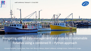
useR! conference, Toulouse 9 - 12 July 2019Navigating spatial data management and analysis in sustainablefisheries using a combined R – Python approachAnnette Scheffer, Francis Neat, Peter Hair, Marcus Nelson, Robert Lefebure, Ashleigh Arton, Catherine S. Longo
Marine Stewardship CouncilWorldwide sustainable fisheries certification since 1997Safeguard seafood for this & future generationsUse market demand for ecolabel to incentivise sustainable fishing2
Marine Stewardship Council – Data collectionCertification ReportAuditorMSC3
Marine Stewardship Council – Data collectionCertification ReportCertification dataData warehouseAuditorMSCSpatial dataSpatial database4
MSC spatial data – point locations5
MSC spatial data – fishing & stock areasCertificate holder locationswith species, gear andcatch amountFishing areas associated with certificatesStock distribution for target species6
User groups at MSCMSC organisation – multiple departments – different software / coding proficiencyScience &StandardsData & analysis teamR & Python codingChain of CustodyStrategic research teamR coding – beginner / intermed.LicencingOutreachOther teamsSoftware use7
Spatial database – data input1 – data inputMSC data warehouseSQL ServerRR - PythonPostgreSQL8
Spatial database – user interactions1 – data input2 – user interactionsMSC data warehouseSQL ServerRPython@ functionsR - PythonCustom Rscripts stored called in qGISRPostgreSQL9
Spatial database – user interactions1 – data input2 – user interactionsMSC data warehouseSQL ServerRPython@ functionsR - PythonCustom Rscripts stored called in qGISR or Pythoncalled through R@RQGIS packageRR scripting byusersPostgreSQL10
Spatial database - organisation1 – data inputMSC data warehouseSQL ServerRqGISR - PythonRQGIS packageAccess qGIS Pythongeoprocessingfunctionalities from RPostgreSQLPythonExecute R scripts in qGIS:Statistical analyses (withoutqGIS geoprocessingfunctionalities)R11
Spatial database - organisation1 – data input-qGIS Dissolve “Developing Word” layerMSC data warehouseSQL ServerRqGISqGISpluginbuilderR - PythonRQGIS packagePythonscripting inqGIS pluginbuilderPostgreSQLPythonAccess qGIS Pythongeoprocessingfunctionalities from RExecute R scripts in qGIS:Statistical analyses (withoutqGIS geoprocessingfunctionalities)R12
Spatial database – automated processes examples – qGIS pluginsthrough Python programmingUN FAO Major Fishing Areas Large Marine Ecosystemsmatch fishing areas attributes with external spatial layersfishing areas & companies per FAO area, per stock etccalculate stocks (number & areas) untouched by MSC fisheriesoverlay MSC developing countries layercreate buffers13
Thank you – sc.org@MSCecolabel14
Thank you – sc.org@MSCecolabel15
Certification data Data warehouse Spatial data Spatial database. MSC spatial data -point locations 5. MSC spatial data -fishing & stock areas 6 Certificate holder locations . PostgreSQL Python R RQGIS package Access qGIS Python geoprocessing functionalities from R Execute R scripts in qGIS: Statistical analyses (without