Transcription
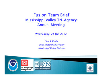
Fusion Team BriefMississippi Valley Tri-AgencyAnnual MeetingWednesday 24 Oct 2012Wednesday,Chuck ShadieChief Watershed DivisionChief,Mississippi Valley Division
The Fusion Team mission is toimprove the accuracy and utilityof river/rainfall observations andriver forecasts.The team works collaboratively toidentifyy needed improvementspand develop plans toimplement those improvementsgiven the current science,sciencemanpower, and level offunding.2 of 15
ChairmanChuck Shadie, USACE/MVDAdvisory CommitteeDave Busse, USACE/MVSNoreen Schwein,Schwein NWS/Central RegionBob Holmes, USGS Nat’l Flood CoordinatorTechnical MembersJoan Stemler, USACE/MVSJim Stiman, USACE/MVRKevin GrodeGrode, USACE/NWDBrian Astifan, USACE/LRDJeff Graschel, NWS/LMRFCShane Barks,Barks USGS/MO WSCBen Weiger, NWS/Sourthern RegionReggina Cabrerra, NWS/Eastern RegionPedro RestrepoRestrepo, NWS/NCRFCTom Adams, NWS/OHRFCKevin Low, NWS/MBRFCGeorge Arcement,Arcement USGS/LA WSCGerry Butch, USGS/NY WSC3 of 15
Increased emphasis on pre-coordination Unified federal message through intricate coordinationof NWS inflow forecasts, USACE reservoir outflowprojections, and USGS flow measurements Expanded prepre-floodflood season meteorological briefings andclimate outlook briefings to include more partnersGeographically expanded use of Chat Room technology USGS real time measurements sent to all at once Shared river gage issues Sent field reports (e.g.,g ice and snow)Expanded use of agency liaisons at EOCs and USACE JointInformation CenterDeveloped special websites4 of 15
pyImplementedUSACE-NWS collaborated hydraulicmodel, “Ohio River Community HEC-RAS Model” Included Birds Point-New Madrid Floodway opsCollaborated on model implementation for lowerMiss operation of Morganza and Bonnet Carre’SpillwaysCollaborated on hydraulic models incorporatinginundation mappingUSACE liaison at NCRFC assisted with hydraulicmodel update for Red River (North)5 of 12
Collaborated on best locations for flowmeasurements and rating curve extensionsUSGS installed temporary spillway gages/made flowmeasurements above/below structures Used for NWS/USACE backwater forecasts at nonforecastpoint locations Provided (first time ever) inflow forecasts andcontingenciestii ffor MissouriMii RiRiver reservoirsi andddetermined a 3-month projected range of stagesCollaborated with NWS Hurricane Center and USACEfor tropical storm surge scenarios for FEMA (lowerMiss and Atchafalaya Rivers)6 of 15
Post 2011 flood Per MVD request, in July 2012, the NWSimplemented a 28-day contingency forecast with16 days of QPF for the Mississippi and LowerMissouri and Ohio Rivers7 of 15
8 of 15
Data Developing common web portal à la IWRSS River gage map with agency metadata and links toforecasts, reservoir releases, etc. Communication and coordination Submitted requirements for NWS Chat filteringinteragency Developedpgy extranet (nonpublic)(p) site forforecast and observation specific information andissues9 of 15
Develop cross agency training Forecasters Workshops-NWS-USACE forecastersand USGS staff meet annually to review previousperformance and discuss improvementspp USGS methods of flow measurements USACE regulation operations NWS shorth t andd long-termltforecastsft anddcontingency methodologies, QPF, climate Technical forecast improvementsp Ratings action team10 of 15
Performance metrics indicate improvement incollaborated forecasts delivered to publicAction team developed a common set ofmetrics and process to review specific eventsand to provide annual performance metrics Annual review to cite trends and the impact ofcoordination/collaboration among the agencies11 of 15
Address interagency flood assessment recommendationsContinue cross-agency training (including coordination andcollaboration)Improve accuracy of data collection and analysis (e.g.,rating curve consistency between all three agencies)Continue to analyze forecast accuracy through metricsExpand use of Interagency internal web site containinginformation to support interagency operations.Share MRB Fusion Team Best Practices in other interagencyforums across the country (tri-agency, Silver Jackets, etc)Conduct real time simulation training exercises.12 of 15
Questions?13
of NWS inflow forecasts, USACE reservoir outflow projections, and USGS flow measurements Expanded preExpanded pre-flood season meteorological briefings andflood season meteorological briefings and climate outlook briefings to include more partners Geographically expanded use of Chat Room technology