Transcription
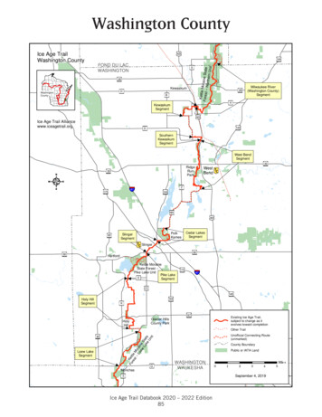
Washington CountyIce Age TrailWashington County45Kettle MForest oraine State-- Northern Unit144FOND DU kee River(Washington County)SegmentHKewaskumSegment45Ice Age Trail mentWest PolkKamesSlingerSegmentCedar LakesSegmentSlinger6060HartfordKettle MoraineState Forest -Pike Lake UnitPike LakeESegment17541CC145164Holy HillSegmentK167HolyHillExisting Ice Age Trail,subject to change as itevolves toward completionGlacier HillsCounty ParkOther TrailFo Ketre tlest M-- orLo ainew eLa Stake teUnit83Loew LakeSegmentQMonchesUnofficial Connecting Route(unmarked)County BoundaryPublic or IATA LandWASHINGTONWAUKESHAEIce Age Trail Databook 2020 – 2022 Edition8501234September 4, 20195Miles
02367CampbellsportDrumlins4Public or IATA LandCounty BoundarySeptember 4, 20191Other TrailMilesMilwaukee River(Fond du Lac County)SegmentCampbellsport45SDundee6723FOND DU cial Connecting eIce Age Trail Databook 2020 – 2022 lymouth5757LaBudde CreekSegmentA232832SheboyganFalls43KohlerIce Age Trail Alliancewww.iceagetrail.orgFond du LacandSheboyganCountiesIce Age TrailFond du Lac and Sheboygan CountiesLakeMichiganExisting Ice Age Trail,subject to change as itevolves toward completionFond du Lac & Sheboygan Counties
88 12'45BadgerRd.Connecting Route50.RidgeKewaskumP60Jackson83Hi-Mount Rd.Moraine1.3SlingerMilwaukeeRiver Segment(Washington County)6.9 N0.1bahnEisen41DCA1.043 30'PRd.FONDDU TATE odplain ForestState Natural AreaProspectDr.Other TrailKMSF–NUMilwaukee River Shelter 1geRidSunburstSki HillFuture Trail0.2Ice Age Trail45yndSa1 : 48,000 scaleNorthernerttle1 mileStateForest–0.2KewaskumSegment2.1 miverRi1/2aukeeNeRiv0ilwMIncludes Kettle Moraine State Forest–Northern Unit, Glacial Blue HillsRecreation Area, Otten Preserve,Ridge Run Park and West BendMoraineKeWashington County28KettleDr.HDr.t Branchuk eE asM il w aMap 86f88 10'1.588 14'KewaskumOak88 16'llHaSouthernKewaskumSegment1.1 miD0.60.3Rd.DWallace Lake451.0GlacialBlue HillsRec. AreaDam43 28'WA40.2Beaveraukee RiverMilwPFriendly Dr.0.6D.RdWildwood43 28'Smith Lake.RdLakeLenwoodAllis 33verSt.M ilw aukee.0.6Silver CreekPWashingtonDrP88 14'WheatDr. RidgeLn.1.3CedarLakeScenic88 16'0.70.3WA35University144PWest BendRidge RunParkZGilbertLake43 26'Ri33 14433Ave.SiAlbeckerNaturalArearkPa0.6r43 26'St.144Wildwood Rd.West BendSegment6.7 miRiversonLac LawrannConservancyWA5DrKohlsvilleJeffeWA6Lucas Lake4588 12'ICE AGE TRAIL ATLAS 2020 – 2022 EDITION www.iceagetrail.org11288 10'
88 14'88 12'88 10'88 7LakeSeven1.1FONDDUSHEBOYGANEden LACMORAINEWaldoParnellSegment13.9 ek4533ButtermilkLakechLakeBrMallardHole LakePSGGGForest–SHEBOYGANFOND DU LAC0.1NorthernSF7Unit KMSF–NUhutYoPGrossRd. 0.3Shelter 2pmCaMilwaS1.7.RdukeeMilwaukee River Segment(Fond du Lac County)4.3 miGCOUNTYCOUNTY43 34'Kettle HoleWoods StateNaturalAreaStateanEastAubu rnMauthe LakeRecreationAreaKettle MoraineSF1043 34'Stony0.2DDHaackLakeRiver0.6New Fane45Dr.43 36'0.40.433TowerCreek410.3PForestviewWASHINGTON43 River67Rd.CampbellsportMilwauk e rnah43 32'1.0MilwaukeeMoraineEastCounty Line Dr.MoraineState1.8Forest–MilwaukeeRiver Segment(WashingtonCounty)6.9 miMoraineDr.EastTrailDr.0281/21 mile1 : 48,000 scaleekeIce Age TrailConnecting RouteerFuture TrailOakRiv88 14'eekMap 87f1.54543 32'CrIncludes Kewaskum, Mauthe Lake,New Fane, and Kettle MoraineState Forest–Northern UnitDr.PMilwauDr.Sheboygan, Fond du Lacand Washington TYKettleeEisSNewFaneTrailsPFOND DU LAC COUNTYWASHINGTONVSF80.3erS88 12'Other Trail88 10'ICE AGE TRAIL ATLAS 2020 – 2022 EDITION www.iceagetrail.org113
88 10'88 08'67B88 06'UCreek1.1AUsseMoraineState 43 42'P0.3JohnsonHillKMSF–NUShelter 4UnitVDr.Scenic843 42'UKettle1.670.3SF4SHEBOYGANFOND DU LACer c rWatA1.3Rd.43 40'V5Butler0.2Lake4PAButler Lake andFlynn's SpringsState Natural Area0.90.ButlerSF5 darLakeVVPLongLakeRecreationArea43 40'ParnellSegment13.9 eFFONDDULAC0.6DivisionHenry S. ReussIce AgeVisitorCenterKettleSF6FORESTState Forest–Northern KMSF–NUUnitShelter 31.3R.Divi s i88 10'0N1/21 mile1 : 48,000 scaleIce Age TrailLakeSevenConnecting RouteFuture TrailOther TrailRd.MihBrancMautheLake43 38'Includes Henry Reuss Ice AgeCenter, Parnell Esker, Butler Lake,Long Lake, Dundee, and KettleMoraine State Forest–Northern UnitSS1.1GHaskellNoyesLittleMemorial Mud LakeWoodsState NaturalForestAreaLake57Sheboygan andFond du Lac countiesAPEast28Map StateNaturalAreaonKewaskumMaplelwaukee43 38'#3#1 Kellings#2 TE23PlymouthKETTLE45WMoraine67 572388 08'ICE AGE TRAIL ATLAS 2020 – 2022 EDITION www.iceagetrail.org11488 06'
88 06'88 04'88 02'PACrystal t570.28Kettle23RidgerMu llet1.2RiveOld ldAKettleMoraine RedOaks StateNatural AreaTSForest–PPlaGreenbushPlankRoad Trail43 46'231.143 46'Camp Evelyn 3 48'll e ulah23FONDDULAC KETTLECMu2343 48'1.3149Dr.GreenbushSegment8.7 neNorthern0.4State �NUShelter 5SF1643 44'N1.043 44'SF1ZZRd.SummitMap 89fPSheboygan CountyCree k67ssIncludes Old Wade House, KettleMoraine State Forest–Northern Unit,Greenbush, and Glenbeulah0.9Wateercr67ParnellSegment13.9 mi01/21 : 48,000 scaleAIce Age Trail1.1UConnecting RouteFuture TrailSU KMSF–NUShelter 4SF41 mileUU88 04'Other TrailSSICE AGE TRAIL ATLAS 2020 – 2022 EDITION www.iceagetrail.org11588 02'
Kewaskum Segment andMilwaukee River Segment(Washington County) (Atlas Map 86f, 87f; Databook page 89–90)SNAPSHOTKewaskum Segment—2.1 miles: Ridge Rd. to Eisenbahn State TrailMilwaukee River Segment (Washington County)—6.9 miles (6.8 IAT, 0.1 CR): Eisenbahn StateTrail to Kettle Moraine Dr.3 2overlooks.The Kewaskum Segment features the Otten Preserve and its scenicother usesNo reliable sources of water.At a Dispersed Camping Areathe Otten Preserve.onPortion overlaps Prospect Dr. andbriefly overlaps the multiuse Eisenbahn State Trail.Loop trails at the Otten Preserve. Ablue-blazed spur trail (WA32) to aDCA. The Eisenbahn State Trailextends north and south from thesegment.Portion of segment crossing privateland between Ridge Rd. and STH-45is closed during gun deer season.Dogs should be leashed (8-ft max)and under control at all times.The hilly Milwaukee River Segment (Washington County) highlightsforested woodlands and sunny meadows.4 3From a hand-pump water well(WA24) near Kettle Moraine StateForest—Northern Unit (KMSF-NU)Backpack Shelter 1 and at the nearbyKMSF-NU New Fane Trails parkingarea.At KMSF-NU Backpack Shelter 1(please respect those who have reserved the shelter) and nearby KMSFNew Fane Trails parking area.amenities NUand activitiesOne ColdCache site on segment.From the Milwaukee River.At KMSF-NU Backpack Shelter 1(reservations required).At nearby KMSF-NU New Fane Trailsparking area.other usesDogs should be leashed (8-ft max)and under control at all times.Segment includes a brief connectingroute roadwalk.Spur trail (WA1) to KMSF-NU Backpack Shelter 1.TRAIL ACCESS AND PARKINGRidge Rd.: From Kewaskum at the intersection of USH-45 and STH-28, take USH-45 south 1.8 mi.At the stoplight for Badger Rd. turn right and go west 0.3 mi. At Prospect Dr. turn left and go south1.0 mi. The road curves west and changes to Ridge Rd. Continue on Ridge Rd. west 0.6 mi to theparking area.Kettle Moraine Dr.: From Kewaskum at the intersection of STH-28 and USH-45, take STH-28 east2.5 mi. At Kettle Moraine Dr. turn left and go north 2.0 mi. No parking at the Trail access on KettleMoraine Dr. Instead, park at the Kettle Moraine State Forest—Northern Unit (KMSF-NU) New FaneTrails parking area 0.2 mi south on Kettle Moraine Dr. and 0.3 mi east on County Line Dr. A spur trailleads from the northwest corner of the parking area to the Ice Age Trail (SF8).Additional Parking: (i) Sunburst Ski Area parking area (WA2). (ii) CTH-H parking area on the southside of the road. (iii) KMSF-NU Backpack Shelter 1 parking area on the north side of CTH-H. (iv)STH-28 parking area. (v) East Moraine Dr. parking area.312 Ice Age Trail Guidebook 2020 – 2022 Edition
COUNTYCOUNTYGSF10THE HIKEIDDThe area traversed by the Kewaskum Segment has a rich Native American hisNew Fanetory. The word Kewaskum means “crooked river”in Algonquin, the languageof the Potawatomi who once inhabited the area. The Potawatomiclaim to theSF8Dr.MoraineSland ended with a treaty in 1833Kettleand the Nationwas resettledto Oklahoma. YearsPFOND DU LAC CO.WASHINGTONSMoraineEastCountyDr.COUNTY LineKettleMilwaukeeRiver Segment(Fond du –East Moraine t Rd.Town Hall Rd.KettleRd.WA2bahnEisenP2.2-mi CRto SouthernKewaskumSegment. Easton Ridge Rd.,south on TownHall Rd., southon Wildwood A1RidDr.SunburstSki HillRidgendSa45Rd.Milwaukee River Shelter 1Floodplain ForestState Natural ch Milw a e eukBranKewaskumDr.P280½1miles0½1milesWashington County 313
later, only a few returned.The Kewaskum Segment heads north from its starting point on Ridge Roadthrough the Ice Age Trail Alliance’s 125-acre Roman and Mercedes Otten Preserve, home to not only the main segment route but also an additional 2.5 milesof loop trails. The main segment route features light forests and upland fieldswith spectacular views of the Otten Preserve and the surrounding areas. Fromthe hilltops, hikers can look for Kewaskum and Campbellsport to the northand the Dundee Kame and Kettle Moraine State Forest to the northeast. Thisportion of the segment is a magnet for birds and hikers should keep an eye outfor meadowlarks, bobolinks, turkeys and several birds of prey. In spring, thewoods are filled with a gorgeous display of trillium and jack-in-the-pulpit, andin late summer, there are many areas of gooseberry and raspberry patches. Aspur trail (WA32) to a Dispersed Camping Area (DCA) for long-distance, multiday hikers is located 0.5 miles from the parking area on Ridge Road.After passing through the Otten Preserve, the segment continues east acrossthe Sunburst Winter Sports Park property (covering a prominent kame) on aneasement granted by the Summit Ski Corporation. The segment intersects (WA2)Prospect Drive, where hikers should turn left and follow the road 0.3 miles north.The segment departs Prospect Drive heading east along a field edge, crosses aseries of boardwalks, then skirts the southern edge of the “tank farm” beforearriving at USH-45. The segment crosses under USH-45 via an underpass builtspecifically for the Ice Age Trail. After periods of heavy rains, the underpass isoften swamped with water. Therefore, as conditions warrant, hikers should turnleft and hike north 0.1 miles along USH-45 to the intersection with CTH-H.Cross USH-45 at the stoplight, turn right onto the Eisenbahn State Trail and hikesouth 0.1 miles to where the Trail heads east.East of USH-45, the segment intersects the Eisenbahn State Trail, a stateowned multiuse recreation trail on the former C & NW Railroad right-of-way.Twelve of the 24.0 miles of the abandoned former rail corridor are maintained,extending from the city of West Bend to Eden in Fond du Lac County. “Eisenbahn” is German for “iron road,” harkening back to this rail line’s heritage andoriginal construction in 1871. The segment very briefly follows the EisenbahnState Trail north to the segment’s terminus where the Ice Age Trail heads off theEisenbahn State Trail to the east.From the Eisenbahn State Trail, the Milwaukee River Segment (WashingtonCounty) heads east then south, skirting a wetland mitigation site. The Trailcrosses a boardwalk, cuts through woods and along the edge of a field and thenenters a forested area. As the segment meanders through the forest it crosses awet area on a curving boardwalk and travels below and alongside a ridge, gradually climbing the ridge until the segment reaches an open field (WA23) just beforecrossing Sandy Ridge Road. The open field offers nice, long views of the surrounding fields and forested hills in the distance.After crossing the road, the Trail continues north through an open field and upthe side of a hill, then shortly drops down into the woods and courses through amore hummocky area passing grassy depressions and wetland openings. Alongthe way, the segment enters the Kettle Moraine State Forest—Northern Unit314 Ice Age Trail Guidebook 2020 – 2022 Edition
Milwaukee River Segment(Fond du Lac County) (Atlas Map 87f; Databook page 92)SNAPSHOT4.3 miles: Kettle Moraine Dr. to Kettle Moraine State Forest—Northern Unit (KMSF-NU) Mauthe LakeRecreation Area32This segment parallels the Milwaukee River through densely wooded hillsides.At KMSF-NU New Fane Trails, MautheLake Recreation Area and BackpackShelter 2 (please respect those whohave reserved the shelter).At the KMSF-NU New Fane Trails andMauthe Lake Recreation Area.At KMSF-NU Backpack Shelter 2( reservations required).At KMSF-NU Mauthe Lake Recreation.Areaother usesDogs should be leashed (8-ft max)and under control at all times.Portion briefly overlaps a snowmobiletrail.Spur trail to the KMSF-NU New FaneTrails parking area and spur trail (SF7)to KMSF-NU Backpack Shelter 2.TRAIL ACCESS AND PARKINGKettle Moraine Dr.: From Kewaskum at the intersection of STH-28 and USH-45, take STH-28 east2.5 mi. At Kettle Moraine Dr. turn left and go north 2.0 mi. No parking at the Trail access on KettleMoraine Dr. Instead, park at the Kettle Moraine State Forest—Northern Unit (KMSF-NU) New FaneTrails parking area 0.2 mi south on Kettle Moraine Dr. and 0.3 mi east on County Line Dr. A spur trailleads from the northwest corner of the parking area to the Ice Age Trail (SF8).Kettle Moraine State Forest—Northern Unit (KMSF-NU) Mauthe Lake Recreation Area: FromKewaskum at the intersection of STH-28 and STH-45, take STH-28 east 0.4 mi. At CTH-S turn leftand go north 6.1 mi. At CTH-GGG turn left (north) and go 1.0 mi to Mauthe Lake Rd. Turn left and goa short distance to a parking area at the entrance station. The Trail access is just west of the entrancestation.Additional Parking: KMSF-NU parking area just north of CTH-S on Gross Rd.THE HIKEIThis segment follows an irregular hummocky sand and gravel ridge for mostof its length, crossing through densely forested terrain with some open prairielike areas. The segment offers quiet passage through the forests, distant viewsfrom a ridge and opportunities to observe a variety of wildlife, including birds,plants and woodland flowers.The segment starts where the Ice Age Trail crosses Kettle Moraine Drive at apoint about a quarter mile north of the Fond du Lac/Washington county line.A short distance ( 0.3 miles) from the start, after passing over rolling hills andprairie grasses, the segment intersects (SF8) a spur trail that leads to the KettleMoraine State Forest—Northern Unit (KMSF-NU) New Fane Trails parkingarea. The segment continues through hardwood forests with some prairie clearings that contain an abundance of wildflowers like pinnate prairie coneflower,Queen Anne’s lace and more. Just before reaching CTH-DD, the segment parallels a well-worn bike path.320 Ice Age Trail Guidebook 2020 – 2022 Edition
COUNTYCOUNTY01milesSF10DDNew FaneKettleDr.MoraineSF8NewFaneTrailsRiverSCO. PCO. County Line Dr.FOND DU LACWASHINGTONeMilwau k eMoraineEastnahDr.stPch Dr.28PDr.MilwauGrossRd.Putnb45SF7Unit KMSF–NUYoeEis28SHEBOYGANFOND DU LACNorthernNorthernKewaskum: See Kewaskum Segment andMilwaukee River Segment (WashingtonCounty), p. 312. From Kettle Moraine Dr.KewaskumGGGForest–Shelter 2EaAREA SERVICESPStateanukeeVMallardHole LakeKettle MoraineMilwaRiver45Mauthe LakeRecreationAreaMilwauk e eCreekSpringLakePForestviewMautheLakeGKettleAfter crossing CTH-DD, thesegment climbs uphill and soonreaches a bench (SF10) in aclearing with views of kames tothe west. The Trail continues ona mostly forested, hummockyridge and crosses a snowmobiletrail twice; at the second crossing, the segment and the snowmobile trailAububriefly overlap forabout 50 feet.rnA short distancefarther, a path to the snowmobiletrail running parallel to the segment is visible. Hikers should payclose attention to blazes to avoidwandering off the Ice Age Trail.The segment crosses CTH-Sand soon reaches the southernend (SF7) of a loop trail that leadsto KMSF-NU Backpack Shelter 2.Before reaching the loop trail thereis a bench in a shady section wherehikers can enjoy a rest. As the TrailGcontinues, it coursesthroughhum mocky, forested topographyand intersects the northern end ofthe loop trail. Eventually, it dropsdown to cross over wetland areasthat can be muddy during rainyperiods. After crossing a bridgeover a small stream, the segment follows a wide, grassy treadbefore reaching its terminus atthe Mauthe Lake Recreation Areaentrance road, just west of theSRecreation Area entrancestation.Just before the terminus the segment passes a field of milkweed;be on the lookout for monarchbutterflies.akekeFond du Lac & Sheboygan Counties 321R
Trail access go south and west 4.5 mi or from Mauthe Lake Recreation Area go south and west 8mi. See Trail Access and Parking, above.Kettle Moraine State Forest—Northern Unit (KMSF-NU) Backpack Shelter 2: Camping. On Trail.Reservations required: (888-947-2757, wisconsin.goingtocamp.com). Only one group (up to 10) pershelter per night is allowed. No water.KMSF-NU Mauthe Lake Recreation Area: Camping. On Trail (262-626-4305; reservations:888-947-2757, wisconsin.goingtocamp.com).NATHAN ELLISKMSF-NU Long Lake Recreation Area: See Parnell Segment, p. 323. From the Mauthe LakeRecreation Area go north and west 8 mi.Late summer tread on the Greenbush Segment.322 Ice Age Trail Guidebook 2020 – 2022 Edition
Parnell Segment(Atlas Maps 87f, 88f, 89f; Databook pages 92–93)SNAPSHOT13.9 miles: Kettle Moraine State Forest—Northern Unit (KMSF-NU) Mauthe Lake Recreation Areato STH-67This long segment highlights remarkable glacial formations including theworld-famous Parnell Esker.4 3At the KMSF-NU Mauthe Lake Recreation Area, Butler Lake, the ParnellObservation Tower and nearby LongLake Recreational Area.From numerous lakes and streams.At KMSF-NU Backpack Shelters 3(reservations required).and 4At KMSF-NU Mauthe Lake RecreationArea and nearby Long Lake Recreational Area and private campground(see Areaon Crooked LakeServices).At KMSF-NU Mauthe Lake RecreationArea and nearby Long Lake Recreation Area.At KMSF-NU Mauthe Lake Recreation Area, Parnell Observation Towerparking area, KMSF-NU BackpackShelters 3 and 4 (please respect thosewho have reserved the she
KMSF–NU Shelter 4 KMSF–NU Shelter 3 Johnson Hill Conner Hill Parnell Observation Tower White Kame Dundee Kame Henry S. Reuss Ice Age Visitor Center Dundee R. Creek Milwaukee W a t e r c r e s s Mauthe Lake Forest East Branch Little Mud Lake Lake Seven Crooked Lake Cedar Lake #2 #1 Kellin