Transcription
Airborne Remote SensingComponent of Marine DebrisMonitoringDr. Thomas H MaceMace Geospatial, LLCWorkshop on Mission Concepts for Marine Debris SensingHonolulu, Hi, Jan 19‐21, 2016
Multistage Remote Sensing Concept1. Use model and satellite data to determine convergence zones andairborne flight target areas2. Use Airborne Radar and air‐ship telemetry to define fine features oflikely concentration of marine debris for ship search3. Use ship and small UAS to spot and retrieve debris.
MODIS and SST Satellite Interpretatons
Envisat – March 16 – March 18March 1820:54:01 UTCStd 1March 1608:14:38 UTCStd 1March 1620:27:27 UTCWide SwathAcquisitionBoxStd standard beams, 100 km wide swath, 25 m resolutionWide Swath 400 km wide swath, 150 m resolutionBen Holt ‐ JPL
Satellite SAR image showing eddy lines
UAVSAR polarimetric three‐color composite image of currents and eddies in theSanta Barbara Channel acquired on September 16, 2009, from the NASA G‐III aircraftoverlain on Google Earth image (Image courtesy B Holt & Y Lou – JPL).
Gulfstream IIIUAV Synthetic Aperture Radar (UAVSAR)Capabilities Ceiling 45,000 ft.Duration 6 hoursRange 3,400 nautical milesPayload 2,610 lbsMission Support Features Center-line pod/pylon supports UAVSARinstrument Precision flight path capability Shirtsleeve environment instrumentsupport World-wide deployment capability10 mUAVSAR Repeat-pass interferometry Ka-, P- and L-band capability (separatepods) Designed for UAV simulationPrecision FlightPath Control
April, 2011 Mission/Feasibility Study Satellite Imagery for planning USCG C‐130 for low altitude visual confirmation of debris G‐III interprets real time imagery onboard and sends coordinates to C‐130 via base station and satphone Mission cancelled due to instrument failure We returned to Hawaii in May, but it was too late for environmentalconditions
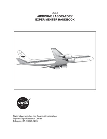
DC-8 Flying LaboratoryLarge Capacity, Long Range and EnduranceCapabilities Ceiling 42,000 ft.Duration 12 hoursRange 5,400 nautical milesPayload 30,000 lbsMission Support Features Shirtsleeve environment for up to30 researchersWorldwide deploymentexperienceExtensive modifications tosupport in-situ and remotesensing instruments–––– zenith and nadir viewportswing pylonsmodified power systems19 inch rack mountingAIRSAR Discontinued
NASA Global Hawks Two Advanced Concept Technology Demonstration (ACTD) aircrafttransferred to NASA in September, 2007(AV-1 and AV-6).AV‐6 Aircraft are based at the Armstrong FlightResearch Center on Edwards Air Force Base. Configuration andperformance similar tostandard ‘Block 10’.AV‐1
NASA Global Hawk Summaryand Capability NASA has been flying Global Hawk aircraft for airborne Earth scienceresearch since 2010. The autonomous aircraft are remotely operated from either NASAArmstrong Flight Research Center, NASA Wallops Flight Facility, or aportable Flight Control Station. A NASA/Northrop Grumman team is maintaining, modifying, and operatingthe 2 ACTD aircraft through a partnership that was established in 2008 andrenewed in 2013. Currently only AV6 is flying, and a Block 10 aircraft is being madeoperational using avionics and interfaces from AV1 (early FY17)HS3 ProfileATTREX Profile11Typical FlightProfiles
NASA Global Hawk Asset OverviewTN872TN871Global Hawk Operations Center – East (WFF)Operational AircraftPortable Ground Systems12Global Hawk Operations Center (AFRC)Spares Aircraft
Global Hawk Operations Center(GHOC) Room Layout at NASA rCo-PilotRangeSafetyOfficerFlight Operations Room (FOR)14 Customer WorkstationsPDUPayload Operations Room (POR)13
GHOC Fully Staffed During aHurricane Overflight14
Portable Ground Control Station Suite usedfor Deployed OperationsKuSatelliteGroundStationPayload Mobile Operations FacilityGlobal Hawk Mobile Operations Facility1515
Global Hawk time‐on‐station Based at EAFB
Global Hawk Science Flights (1 of 2)17
Global Hawk Science Flights (2 of 2)18
Airborne Tropical Tropopause ExperimentOverview(October‐November 2011, February‐March 2013, January‐March 2014) 11 instruments were flown on theNASA Global Hawk aircraft in 2011and 2013 and 12 instruments wereflown in 2014. 18 science missions, totaling 350flight hours were flown during the 3ATTREX campaigns. The flights in 2011 featured the firstscience demonstration in thetropics. The flights in 2014 featured the firstOCONUS deployment for NASAGlobal Hawk.19
ATTREX Flight Tracks2013 Flights2014 FlightsEAFBGuam20
IceHawk(December 2013) The UAV Synthetic Aperture Radar(UAVSAR) was integrated onto the aircraft. A single flight was conducted over thePacific Ocean and Canada. This flight marked the first UAVSAR flightoutside of the EAFB range and the firstNASA Global Hawk flight over a foreigncountry. Coordination with the Canadian Governmentwas straightforward. The IceHawk flight was funded by NorthropGrumman Co. as a platform capabilitydemonstration-no instrument data werecollected.21
Options G‐III/UAVSAR is operational but limited flight time gives only a fewpasses over the target areas DC‐8 has longer duration and ability to accommodate science teambut UAVSAR has not been integrated Global Hawk has all the components necessary, but needs somecomponent maturation as well as integration and testing of the full‐up system All three platforms have satellite telemetry capability andtelepresence, but large SAR files have not been demonstrated
Discussion
11 instruments were flown on the NASA Global Hawk aircraft in 2011 and 2013 and 12 instruments were flown in 2014. 18 science missions, totaling 350 flight hours were flown during the 3 ATTREX campaigns. The flights in 2011 featured the first science demonstration in the tropics. The flights in 2014 featured the first