Transcription
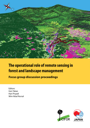
The operational role of remote sensing inforest and landscape managementFocus group discussion proceedingsEditorsGen TakaoHari PriyadiWim Ikbal Nursal
The operational role of remote sensingin forest and landscape managementFocus group discussion proceedingsEditorsGen TakaoHari PriyadiWim Ikbal Nursal
2010 Center for International Forestry Research. All rights reserved.Printed in IndonesiaISBN: 978-602-8693-16-5Takao, G., Priyadi, H. and Ikbal Nursal, W. (eds.) 2010 The operational role of remote sensing in forestand landscape management: focus group discussion proceedings. CIFOR, Bogor, Indonesia.Photo credits: Hari Priyadi (pages 13, 19), Gen Takao (pages 4, 25), Widya Prajanti (page 1)Cover map: Wim Ikbal NursalLayout: Rahadian DanilCIFORJl. CIFOR, Situ GedeBogor Barat 16115IndonesiaT 62 (251) 8622-622F 62 (251) 8622-100E cifor@cgiar.orgwww.cifor.cgiar.orgAny views expressed in this book are those of the authors. They do not necessarily represent the viewsof CIFOR, the authors’ institutions or the financial sponsors of this book.Center for International Forestry Research (CIFOR)CIFOR advances human wellbeing, environmental conservation and equity by conducting research toinform policies and practices that affect forests in developing countries. CIFOR is one of 15 centres withinthe Consultative Group on International Agricultural Research (CGIAR). CIFOR’s headquarters are in Bogor,Indonesia. It also has offices in Asia, Africa and South America.
tive summary1. About the focus group discussion2. Preliminary questionnaire on participants’ experiencesand expectations of remote sensing3. Presentations: Sharing experiencesForest/landscape management and remote sensingGen Takao, CIFORRemote sensing application for forestry and environmental managementLilik Budi Prasetyo, Faculty of Forestry, IPBApplying remote sensing to support better forest managementMr Indrawan Suryadi, TBIRemote sensing application in spatial planning at the micro levelMr Damsir Chaniago, KKI-WarsiRemote sensing for management of Gunung Halimun-Salak National ParkMr Werdi Septiana, Gunung Halimun Salak National ParkParticipatory mapping for conservation in MamberamoMr Michael Padmanaba, CIFORRemote sensing application for managing concession forest:Experience of the management unit of PT Suka Jaya MakmurMr Gusti Herdiansyah, PT Suka Jaya Makmur4. Plenary discussionIntroduction of discussion process (Dr Sonya Dewi)5. Focus group discussionsGroup 1 (Facilitated by Mr Hari Priyadi)Group 2 (Facilitated by Dr Lilik B. Prasetyo)Group 3 (Facilitated by Mr Wim Ikbal Nursal)6. Summary and recommendations7. Considerations and 71921232528
ivThe operational role of remote sensing in forest and landscape managementAnnexes1. List of participants292. Agenda303. Presentations311. Forest/landscape management and remote sensingGen Takao, CIFOR312. Remote sensing application for forestry and environmentalmanagementLilik Budi Prasetyo, Faculty of Forestry, Bogor Agricultural University493. Remote sensing application to support better forest managementIndrawan Suryadi, Tropenbos Indonesia614. Remote sensing for management Gunung Halimun-Salak National ParkWerdi Septiana, Gunung Halimun Salak National Park725. Participatory mapping for conservation in MamberamoMichael Padmanaba, CIFOR856. Remote sensing application for managing concession forest:Experience of the management unit of PT Suka Jaya MakmurGusti Herdiansyah, PT Suka Jaya Makmur91
TCJICAKKIMLANGORSRADARUNMULTBIBadan Perencana Pembangunan Daerah (Regional DevelopmentPlanning Agency)Conservation InternationalCenter for International Forestry ResearchDigital elevation modelFocus group discussionGunung Halimun Salak National ParkGeographic information systemWorld Agroforestry CentreInstitut Pertanian Bogor (Bogor Agricultural University)International Institute for Geo-Information Science and EarthObservationJapan International Cooperation AgencyKomunitas Konservasi IndonesiaMultidisciplinary landscape assessmentNongovernmental organisationRemote sensingRadio detection and rangingUniversitas MulawarmanTropenbos Indonesia
ForewordI welcome the participants to CIFOR in Bogor. I am particularly happy to see somany participants from organisations or groups that have actually been involvedin landscape or land use management. I am aware that some of the participantshave come from national parks and other organisations that already use remotesensing (RS).I feel that it is very important to share experiences so that participants couldprepare themselves to use RS as part of their landscape management activities. Ibelieve that in terms of the evolution of remote sensing, two important aspectsstand out.First, it appears that the concept of sustainable forest management is expandingto cover environmental services that are not traditionally taken into considerationwhen talking about sustainable forest management. Sustainable forest managementis very much about timber, or the sustainability of timber supply, but it is also verymuch about all the other environmental services and physical systems provided.Furthermore, I believe that everybody is going into this more with the expansionof sustainable forest management, for example through ecosystem services andother products such as non-timber forest products. There are challenges to befaced in planning, managing and monitoring success, and in this respect, the roleof RS is becoming increasingly important.The other aspect relates to negotiations and landscape management, which usuallyinvolve multiple stakeholders, with multiple land management objectives. It isimportant to have appropriate tools for the management and managers of theselandscapes. I believe that RS offers many opportunities to improve systems.I think that the objective of this meeting is very clear. CIFOR wants to learnfrom the participants and their experience with managing landscapes how toimprove the use of RS in landscape management to make it more cost efficientand, hopefully, user friendly.On behalf of CIFOR, I thank you again for your participation.Dr. Markku KanninenEnvironmental Services Programme Director, CIFOROctober 2007
AcknowledgementsWe acknowledge all the participating organisations (in alphabetical order):PT Alas Kusuma, Bappeda Kabupaten Bungo, Burung Indonesia, CIFOR, InstitutPertanian Bogor, JICA – Gunung Halimun Salak National Park ManagementProject, PT Inhutani II, PT Komatsu Marketing and Support Indonesia, TamanNasional Gunung Halimun Salak, Taman Nasional Gunung Palung, TropenbosIndonesia – Kalimantan Program, University of Mulawarman, WARSI and WorldAgroforestry Centre (ICRAF), and thank all the participating individuals. Thisstudy is supported by the CIFOR–Japan Project ‘Sustainable utilisation of diverseforest environmental services’ sponsored by the Government of Japan.We are grateful for comments on the text and editorial polish by Imogen BadgeryParker, Edith Johnson and Rosie Ounsted. We thank Hasantoha Adnan for hisdocumentation of the discussion and Atie Puntodewo for her support during theevent. Various people at CIFOR have helped and assisted at different points inthis exercise: Rahadian Danil, Eko Prianto, Yani Saloh and Gideon Suharyanto.
Executive summarySince it was first introduced, remote sensing (RS) has been assumed to contributeto forest and landscape management. The technology – sensors, processing andanalysis – has been the subject of a vast amount of research and development, andstudies using RS have improved understanding of the sites studied. At the strategiclevel of forest planning, or of general planning of forest resource allocation overa wide area, RS has often played an important role in estimating and monitoringthe forest cover. However, at the tactical level, for example during planningforest management activity assignments within a forested landscape, RS has notcontributed as much as expected. Successful research methods cannot always beapplied to operational management. It is recognised that there is a gap betweenthe scientific and the operational uses of RS.As part of the process to develop an operational RS framework for forestor land management, professional forest managers and RS experts wereinvited to a focus group discussion (FGD) to discuss their experiences andexpectations and the constraints that they have encountered in using RS in theirmanagement activities.The FGD, titled ‘The operational role of remote sensing in forest and landscapemanagement’, was held at CIFOR in Bogor, Indonesia, on 3 October 2007. Twentyseven participants were invited, on an arbitrary basis, from 13 organisations,including national parks, local government, private companies, conservationnon-governmental organisations (NGOs) and research institutions, all fromwithin Indonesia.Prior to the discussion, a preliminary questionnaire was distributed to all theorganisations invited in order to survey the range of their experiences with andexpectations of RS. As part of the event, after some participants gave presentations,all participants joined in plenary and smaller group discussions to discuss andprioritise the major expectations of and constraints on the use of RS in forestmanagement practices.The discussions revealed that, despite the wide range of experiences with andexpectations about the application of RS to forest and land management, anda shared view that RS was the only means for monitoring large areas, severalconstraints hinder the implementation of the technology. Many of these constraintswere institutional rather than technical and had already been identified by expertpractitioners; nevertheless, they remain unresolved.
ContentThe majority of the participants shared three concerns:1. the high costs of RS2. the need for capacity building3. the need for information sharing.Many participants mentioned that the costs of RS – especially the cost of images,software and ground truthing – could be reduced. Capacity building is necessaryto ensure the confident use of the technology.Information sharing arose as a key factor for addressing these constraints.Participants noted that data sharing could help avoid duplicate investment, andknowledge sharing could improve users’ capabilities. Sharing maps producedusing RS should be the first step, but this will be effective only when all the mapsapply the same land cover/use definitions. Sharing raw satellite images would be adirect means of reducing costs, and sharing ground-truthing data would not onlycontribute to reducing costs but also make cooperation among the institutionsmore flexible and interactive.Above all, sharing the value of RS and GIS is important, and one of our expectationsof RS experts is that they will facilitate such sharing. As a good example, oneparticipant described a local GIS/RS forum that called on local officials fromdifferent departments and sectors to share their information on RS and GIS andcoordinate a data platform.Managers are interested in image interpretation, particularly of high-resolutionimages, as this is something that they can do intuitively by projecting onto theimage their abundant empirical knowledge of the land that they manage. Suchempirical knowledge is exclusive to those who are familiar with the land, but it isnot accessible for outsiders. Consequently, such knowledge should be applied forimage analysis both proactively and repeatedly.The low accuracy of RS data was identified as a potential constraint for operationaluse by only two participants, both of who were from forestry companies thatwanted to replace some of their forest inventory with RS. As quantitative accuracyin a given compartment is very important for such companies, the monitoringsystem that they use should be carefully designed to meet their demands as faras possible. Some other participants seemed less interested in the accuracy of theproducts although the accuracy assessment was indispensable; it may be that alower level of accuracy is sufficient. For RS to be implemented reliably as an aspectof operational management, an objective and systematic assessment system withadequate ground truthing is required.ix
xThe operational role of remote sensing in forest and landscape managementCapacity building should be the most important process for disseminating RS foruse in operational management. Despite their limited resources, the participantspreferred to build their own capacity rather than outsource analyses because theyfelt that it was important to be able to monitor their own land. To respond touser requirements, RS experts should develop technology that is as simple andinexpensive as possible, and not only transfer the technology but also consult withusers to tailor an effective system through interactive learning.To conclude the FGD, the most important issues identified for implementing RSin forest management were summarised as follows:1. bridging the gap between RS users and RS experts2. promoting collaboration between institutions3. identifying/adjusting boundaries identified by authorities that do not matchthe reality on the ground4. sharing data, information and technology.The following recommendations arose from the group discussions.1. The use of high-resolution images for forest management should be encouragedbecause both RS experts and users can interpret them more easily.2. To build capacity, it is essential to train the users.3. Outsourcing of analyses should be the final option because outsourcing doesnothing to advance institutional capacity within the forest managementorganisations.4. In disseminating the technology, it is important to distribute materials via theInternet or CD rather than via printed media.5. To reduce costs, data sharing across institutional barriers and the use of opensource software should be promoted.
1About the focus group discussionBackgroundRemote sensing (RS) is both a technology and a science. It is used to observeobjects from a distance, especially from above, so as to measure and monitor themin a way that is quite different from taking direct measurements on the ground.The technology has been the subject of a vast amount of research and development,including work on sensors, processing and analysis. Since its introduction, RS hasbeen assumed to contribute to forest and landscape management, and studiesmade using RS have undoubtedly improved understanding and management ofthe study sites.However, RS has not contributed to operational forest and landscape managementas fully as expected. Successful research methods cannot always be applied tooperational management. It is recognised that there is a gap between the scientificand the operational uses of RS. Reasons scientific results have not been able to beused successfully in operational management include: the methods are expensiveand the user requires a certain level of skill; the images cannot always be taken in aregular or scheduled manner; and there is a lack of mutual understanding betweenmanagers and RS specialists, among others.‘Sustainable utilisation of diverse forest environmental benefits’ is a CIFORresearch project, funded by the Government of Japan, that aims to identify andfill gaps in the knowledge and practice of RS and provide a straightforward wayof applying RS technology in operational forest and landscape management. Anexpected output of the project is a set of guidelines for using RS technology inforest and landscape management.Participants of the focus group discussion
2The operational role of remote sensing in forest and landscape managementThe aims of the project are addressed under two main themes: ‘participatory andinteractive processes’ and ‘active manager involvement in image interpretation’.Under the first theme, it is intended to devise a flexible approach to addressing theproblems of using RS in practice, and identifying the criteria required to make thebest use of the technology and the outputs that are expected to be achievable inorder to satisfy managers. Under the second theme, the aim is to fully utilise theknowledge of managers in the image interpretation process so that outputs can bederived intuitively, thereby reducing costs.At an early stage of the project, a focus group discussion was used to determineproblems in forest and landscape management operations that could be resolvedby the use of RS.Purpose and outline of the focus group discussionThe purpose of the focus group discussion was to deepen understanding ofoperational forest and landscape management and RS techniques, and to determine‘meeting points’ between the operational demands and the possible solutionsoffered by RS in forest and landscape management. The discussion was designedas an arena for forest/landscape managers, RS specialists and other stakeholders toshare their knowledge and experience and to discuss potential common ground.The focus group discussion formed a one-day meeting. In the morning, informationabout the ‘Sustainable utilisation of diverse forest environmental benefits’ projectand its expected contribution to operational forest and landscape managementwas presented. This was followed by presentations by participants from differentbackgrounds on their experiences and expectations of management and RS. In theafternoon, the participants discussed ways in which RS can contribute to forestand landscape management.Before the focus group discussion, a questionnaire was sent to the participantsasking about their experiences and problems and/or their needs in terms ofmanagement and RS. The responses to these questionnaires, which were receivedbefore the meeting, were used to guide the discussions.Output and outcome of the focus group discussionThe output of the focus group discussion is a report that covers the process,conclusions and recommendations coming out of the meeting. The report will beused to guide the implementation of the ‘Sustainable utilisation of diverse forestenvironmental benefits’ project.The expected outcome of the focus group discussion is that the participants willincrease their knowledge of the importance of RS as a tool in forest and landscapemanagement. The participants will also be able identify the problems with usingRS and what might be expected of the technology in the future.
2Preliminary questionnaire on participants’experiences and expectations of remotesensingPrior to the focus group discussion, a preliminary questionnaire was sent to eachof the 13 participating organisations. It consisted of two questions: ‘What areyour experiences with remote sensing?’ and ‘What are your expectations of remotesensing?’.Q1. What are your experiences with remote sensing?YYHave you ever thoughtabout ‘remote sensing’in your management?Have you actually utilized‘remote sensing’ in yourmanagement?NN1a. What were your results,achievements, problems,surprises and/ordisappointments on‘remote sensing’?What were the differencesmade by ‘remote sensing’?1b. What were the reasons whyyou gave up using‘remote sensing’ in yourmanagements? What werethe alternative means thatyou finally adopted? Why& how?1c. What have you everthought about ‘remotesensing’ What are yourobservation/monitoringmeans for yourmanagements?
4The operational role of remote sensing in forest and landscape managementQ2. What are your expectations of remote sensing?What are your current interests or problems to which remote sensing might beapplied? What are your expectations or hopes for the future of remote sensing?What constraints do you anticipate in applying remote sensing in your operationalmanagement? Do you think remote sensing will be more useful to your managementin the future?Of the 13 organisations, seven had experience of using RS (Group 1a), and fivehad considered RS but did not yet have any experience with it (Group 1b). Theremaining organisation did not categorise itself into either group, but presumablyhad no experience (Group 1c). None of the organisations in Groups 1a or 1bhad experience using RS on a regular/operational basis. Some forestry companies(both private and state-owned) classified themselves in Group 1b despite theirconsiderable experimental experience, apparently because they had not used RS intheir regular activities. See Table 1 for a summary of the responses.Sharing experiences in using measurement equipment with project partner in Burgo, Jambi
Preliminary questionnaire on participants’ experiences and expectations of remote sensingTable 1. Summary of responses to the preliminary questionnaireQ1. What are yourexperiences withremote sensing?ExperiencesProblemsconfrontedQ2. What are yourexpectations ofremote on (roads, rivers, illegal logging,shifting cultivation, fires, high conservationvalue forest), land cover (LC)/land use(LU) classification/interpretation, LC/LUchange, assessment (erosion risk, habitat,land capability), regional spatial planning,planning aerial surveys1bDelineation (logging), LC/LU classification/interpretation, management planning(harvesting, replanting), making basic mapsfor participatory mapping1aCost, capacity, cloud cover, location accuracy,insufficient ground truthing, difficultyof comprehensive cover of large area,subjectivity of interpretation, image quality1bCost, capacity, low resolution, cloud cover1aMonitoring (deforestation, biomass,habitat, land suitability), LC/LU modelling,Digital Elevation Model (DEM) extraction,background images in GIS, database forregional planning1bInitial harvest planning, forest inventoryusing high-resolution images, immediateobservation and response, classification(forest type, succession stages)1cInitial forest assessment, updatinginformation, forest-type mapping, standparameters, monitoring (silviculture,damage)1aCost, capacity, long-term consistency,ground truthing, usable results on theground, insufficient information flowbetween RS experts and users1bCost, capacity, availability of high-resolutionimages, ground truthing, obtaining reliableinformation from lower resolution images,timely updatingNote: 1a, 1b and 1c represent classes of respondent experience: highly experienced, lessexperienced and no experience, respectively. Cost and capacity (in italics in Table 1) are the twoissues that almost all the respondents (12 and 11 of the 13, respectively) identified as eitherproblems or constraints in implementing RS. Other issues are listed in an arbitrary order.5
3Presentations: sharing experiencesThis chapter presents a summary of each presentation. See Annex 3 for the slidesfor each presentation.Forest/landscape management and remote sensingGen Takao, CIFORToday there is a great variety of remote sensing data, with a wide range ofresolutions and some new types of sensors. Nevertheless, the technology still hasnot successfully been applied to real forest management at the tactical level. Possiblereasons include cost, capacity and institutional problems. Application of RS forforest management should be based on operational knowledge and experience andbe embedded in regular management operations; also necessary is a functionalrelationship between managers and remote sensing experts to overcome the gapsbetween the technology and the demands.Comments and responsesComment 1: Satellite images are very expensive for non-commercial sectors suchas ours. We complemented satellite images with aerial patrols and photos fromour own ultralight planes for general monitoring. This has been very useful in theoperation and management of our national park.Takao: Using an ultralight plane is a very attractive option, especially if thephotographs can be taken in a systematic and statistical manner.Comment 2: Simpler RS and GIS programmes should be available for managersso that they can learn to work with this technology before more high-tech systemsare introduced.Takao: CIFOR has published guidelines and a textbook for practitioners, and isrevising them for free software. Cost reduction can be achieved by sharing the dataand the costs of data and equipment with the other interested institutions.Comment 3: There is a gap between the RS specialist and the user—the lack of sharedunderstanding—and the fact is that RS data are not yet used by decision-makers.
8The operational role of remote sensing in forest and landscape managementTakao: RS specialists and end-users need to clarify and agree together the requiredand possible outputs. We need to figure out what administrators or forest managersactually need.Remote sensing application for forestry andenvironmental managementLilik Budi Prasetyo, Faculty of Forestry, Bogor Agricultural UniversityRemote sensing is being used as an integral research component, for example indetermining the source of oil spills and contaminated areas, forest fire mapping,investigating deforestation by oil palm, identifying paddy fields accurately by usingRADAR, predicting erosion and landslides in Halimun Salak National Park, anddetermining Javan gibbon suitability habitat.Those experiences have shown that RS is very helpful in understanding processesoccurring in a landscape, in supporting investigations into environmental problemsand in supporting decision-making.The difficulties with using RS related mainly to data acquisition and the preclassification process. RS data can be easily used by the users.Applying remote sensing to support better forestmanagementIndrawan Suryadi, Tropenbos IndonesiaTropenbos International is a Dutch NGO. It has been active since 1988 in severalcountries, including Colombia, Guyana, Suriname, Bolivia, Netherlands, IvoryCoast, Ghana, Cameroon, Vietnam and Indonesia. Its mission in Indonesia is toimprove the use and management of forests for a healthy environment, sustainabledevelopment and prosperity for the people by generating relevant information;capacity building and training; and strengthening of institutions. Tropenbos hasactively used RS in implementing its programme. The first application of RS wasin dealing with design and developing a monitoring and certification system ofproduction forest in Indonesia. This programme was run in cooperation withITC Netherlands and Watershed Management Agency Solo in Berau and PasirDistrict (East Kalimantan Province). The second application was supporting andproviding technical assistance for the development of Spatial Data Infrastructure(GIS-RS Forum) in Pasir District. The third was dealing with a series of GISand RS training sessions for the GIS-RS Forum and local government agencies.The final activity was biodiversity assessment in Gunung Lumut and BetungKerihun National Park. The other relevant activity is doing land-cover analysisfor all provinces in Kalimantan, as well as erosion hazard analysis for all provincesin Kalimantan.
Presentations: sharing experiencesTropenbos has ongoing activities related to land cover interpretation for allprovinces in Kalimantan, which aim to define the actual land cover and determineremaining forest cover due to support of forest planning and management inKalimantan.There is another advanced analysis based on RS data and information, which wasto define the critical lands in Kalimantan as base data and information for futurerehabilitation activities.Problems encountered with RS analysis are lack of quality data and lack ofcoordination amongst institutions. The data do not reflect the reality in the field.The facts are inconsistent or there are unmatched data amongst institutions and lackof coordination in planning decision-making. The solution was the establishmentof the GIS-RS Forum for discussions to find solutions together.Some lessons learned based on Tropenbos’ involvement with several projects areas follows.1. An intensive approach to district governments is needed to have a real influenceon spatial planning decisions.2. Maintaining good personal relations with key persons in the district (particularlythe Development Planning Agency) is very important.3. Support from the heads of all agencies is required.4. A decree from the district head to formalise the GIS-RS Forum is needed tomake it function.5. The most effective training occurs when classroom training is alternated withfield exercises and is followed up by assistance with data analysis ‘on the job’after the formal course is over.6. Peer-to-peer extension is a powerful way of disseminating the concept.Remote sensing application in spatial planning at themicro levelDamsir Chaniago, KKI WarsiKomunitas Konservasi Indonesia Warsi or KKI Warsi is a local NGO based inJambi. In this workshop, I discuss KKI Warsi’s experience in remote sensing,especially its application in spatial planning at the community level. Through theparticipatory mapping approach, working with the community, we determinedland use types, such as conservation, agriculture, settlement, etc, as a basis fordesigning spatial planning on a wider scale.General issues for the application of RS include cost (data and software) andcapacity of human resources (technicians); collaboration, role distribution andcommitment between stakeholders could solve those problems.9
10The operational role of remote sensing in forest and landscape managementRemote sensing for management of Gunung HalimunSalak National ParkWerdi Septiana, Gunung Halimun Salak National ParkGunung Halimun Salak National Park (GHSNP), the largest national park in WestJava, is home to a rich biodiversity and a number of local communities. Managingthese harmoniously with limited human resources is a big challenge for the park.Remote sensing has been demonstrated to be one of the most useful tools forsustainable planning, zoning, monitoring and updating to support the decisionsof the GHSNP management. The park expects to apply the information gainedfor modelling forest cover chang
1. Forest/landscape management and remote sensing Gen Takao, CIFOR 31 2. Remote sensing application for forestry and environmental management Lilik Budi Prasetyo, Faculty of Forestry, Bogor Agricultural University 49 3. Remote sensing application to support better forest management Indrawan Suryadi, Tropenbos Indonesia 61 4. Remote sensing for .