Transcription
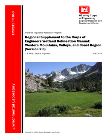
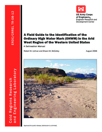
ERDC/CRREL TR-08-12A Field Guide to the Identification of theOrdinary High Water Mark (OHWM) in the AridWest Region of the Western United StatesA Delineation ManualCold Regions Researchand Engineering LaboratoryRobert W. Lichvar and Shawn M. McColleyApproved for public release; distribution is unlimited.August 2008
ERDC/CRREL TR-08-12August 2008A Field Guide to the Identification of theOrdinary High Water Mark (OHWM) in the AridWest Region of the Western United StatesA Delineation ManualRobert W. Lichvar and Shawn M. McColleyCold Regions Research and Engineering LaboratoryU.S. Army Engineer Research and Development Center72 Lyme RoadHanover, NH 03755-1290Approved for public release; distribution is unlimited.Prepared forU.S. Army Corps of EngineersWetland Regulatory Assistance Program
iiERDC/CRREL TR-08-12Abstract: The Ordinary High Water Mark (OHWM) is an approach foridentifying the lateral limits of non-wetland waters. However, determiningwhether any non-wetland water is a jurisdictional “Water of the UnitedStates” (WoUS) involves further assessment in accordance with theregulations, case law, and clarifying guidance. In the Arid West region ofthe U.S., the most problematic Ordinary High Water (OHW) delineationsare associated with the ephemeral/intermittent channel forms thatdominate the Arid West landscape. This report presents a method fordelineating the lateral extent of the non-wetland waters in the Arid Westusing stream geomorphology and vegetation response to the dominantstream discharge.DISCLAIMER: The contents of this report are not to be used for advertising, publication, or promotional purposes.Citation of trade names does not constitute an official endorsement or approval of the use of such commercial products.All product names and trademarks cited are the property of their respective owners. The findings of this report are not tobe construed as an official Department of the Army position unless so designated by other authorized documents.DESTROY THIS REPORT WHEN NO LONGER NEEDED. DO NOT RETURN IT TO THE ORIGINATOR.
ERDC/CRREL TR-08-12ContentsPreface . vi1Introduction .11.1 Ordinary High Water (OHW) in the Arid West Region .11.2 Scope of Manual .21.3 Stream Geomorphology .31.4 Hydrology .51.5 Arid West Channel Forms of Interest .61.5.1 Alluvial Fans . 71.5.2 Compound Channels. 81.5.3 Discontinuous Ephemeral Channels. 91.5.4 Single-Thread Channels with Adjacent Floodplains.101.5.5 Anastomosing Channels.101.6 Flood Cycles and Effective Discharge . 121.7 Human Disturbance . 182OHWM Delineation Background . 202.1 OHWM Indicators . 202.2 OHWM Indicator Distribution. 282.3 Identification of the Active Floodplain. 312.4 Arid West OHW – Active Floodplain . 333OHWM Identification Method. 353.1 Resources Needed . 353.1.1 Aerial Photography and Other Imagery .353.1.2 Topographic Maps .373.1.3 Other Maps.383.1.4 Rainfall Data.413.1.5 Stream Gage Data .423.1.6 Existing Delineations.433.2 Preliminary Delineation Procedure. 433.3 Field Verification of the Preliminary Delineation . 493.4 Problematic Boundaries . 603.5 Examples of Delineations by Channel Form. 613.5.1 Alluvial Fans .613.5.2 Compound Channels.623.5.3 Discontinuous Ephemeral Streams .633.5.4 Single-Thread Channels with Adjacent Floodplains.643.5.5 Anastomosing Rivers .64References . 66Report Documentation Page . 77iii
ivERDC/CRREL TR-08-12Figures and TablesFiguresFigure 1. Geographic extent of the Arid West region .2Figure 2. Representative cross sections depicting hydrogeomorphic floodplain units forperennial channel forms and intermittent/ephemeral channel forms .3Figure 3. Shift in the low-flow channel following a 5- to 10- year discharge event atMission Creek, CA .5Figure 4. Alluvial fan with distributary channels at the confluence of the Colorado Riverand Bright Angel Creek, Grand Canyon, AZ .7Figure 5. Compound channel with a low-flow feature in the foreground, Mojave River, CA .9Figure 6. Erosional reach (arroyo) along a discontinuous ephemeral channel, Susie Creek, NV .9Figure 7. Single-thread channel with adjacent floodplain, Alter Wash, NV . 10Figure 8. Anastomosing channels along Cooper Creek, Australia . 11Figure 9. Changes in channel form along an ephemeral stream channel . 12Figure 10. Model of changes within the active floodplain and low-flow channel associatedwith discharge events . 13Figure 11. Pre-effective discharge and post-effective discharge on the Mojave River atAfton Canyon . 14Figure 12. Aerial photo time-series acquired over a section of the San Carlos River, AZ,and their corresponding annual peak-flow hydrograph . 17Figure 13. Lateral and longitudinal variability of geomorphic indicator position along ahypothetical Arid West channel form . 22Figure 14. Hydrogeomorphic units and OHWM indicator positions within the MissionCreek study reach . 29Figure 15. Mean one standard deviation for each indicator type identified within theMission Creek study reach . 29Figure 16. Conceptual model showing the locations of OHW indicators . 30Figure 17. Active floodplain/low terrace boundary in an Arid West channel . 32Figure 18. Vegetative shift at the active floodplain/low terrace boundary in an Arid Westchannel . 32Figure 19. Examples of changes in vegetative cover and species between the activefloodplain and the low terrace . 34Figure 20. Aerial photograph acquired over Chinle Creek, AZ . 36Figure 21. Section of a topographic map of the Fried Liver Wash Quadrangle, CA . 38Figure 22. Section of a geologic/topographic map of the Frazier Creek Quadrangle, NV . 39Figure 23. General vegetation map of New Mexico . 40Figure 24. Section of a soils map of the Frasier Flat Quadrangle, NV . 41Figure 25. Distribution of precipitation over a portion of northern California . 42
ERDC/CRREL TR-08-12Figure 26. Flood frequency analysis results produced by HEC-SSP in accordance withBulletin 17B for the Puerco River, near Chambers, AZ, and for the Mojave River at AftonCanyon, CA . 45Figure 27. Discharge values associated with 2-, 5-, 10-, and 25-year events for gage09396100 on the Puerco River near, Chambers, AZ, and for gage 10263000 on theMojave River at Afton Canyon, CA . 46Figure 28. Discharge history for the Puerco River near Chambers, AZ, and for the MojaveRiver at Afton Canyon, CA . 47Figure 29. Shift-adjusted rating curve for gage 09396100 on the Puerco River, nearChambers, AZ, and for gage 10263000 on the Mojave River at Afton Canyon, CA . 48Figure 30. Step 1 of the field verification procedure . 49Figure 31. Step 2 of the field verification procedure . 50Figure 32. Step 3 of the field verification procedure . 51Figure 33. Step 4 of the field verification procedure . 52Figure 34. Step 5 of the field verification procedure . 53Figure 35. Step 6 of the field verification procedure . 54Figure 36. Step 7 of the field verification procedure . 55Figure 37. Step 8 of the field verification procedure . 55Figure 38. Staff used to determine stage height for Chinle Creek, AZ . 56Figure 39. Projection onto the landscape of the stage height associated with the mostrecent effective discharge that exceeded a 5-year event. 57Figure 40. Example geomorphic mapping of a compound channel showing a mosaic ofterraces within the active floodplain, Caruthers Creek, CA . 62Figure 41. Example geomorphic mapping of a discontinuous ephemeral stream in anerosional reach (arroyo), Susie Creek, NV . 63Figure 42. Example geomorphic mapping in a straight reach of a single-thread channelwith an adjacent floodplain, Alter Wash, AZ . 64TablesTable 1. Comparison by stream type of flood return interval and features associated withhydrogeomorphic position .4Table 2. Primary measurable alluvial fan characteristics .8Table 3. Natural controls on fluvial processes . 15Table 4. Human controls on fluvial processes . 19Table 5. Potential geomorphic OHWM indicators categorized by location below, at, andabove ordinary high water . 21Table 6. Potential vegetation OHWM indicators categorized by location below, at, andabove ordinary high water . 21Table 7. Select geomorphic OHWM indicators that may be present below, at, and abovethe OHW boundary . 23Table 8. Select vegetative OHWM indicators that may be present below, at, and above theOHW boundary . 27Table 9. Websites with access to digital imagery . 37v
viERDC/CRREL TR-08-12PrefaceThis manual was prepared by Robert W. Lichvar and Shawn M. McColley,both of the Remote Sensing/GIS and Water Resources Branch, ColdRegions Research and Engineering Laboratory (CRREL), U.S. ArmyEngineer Research and Development Center (ERDC), Hanover, NH.Support and funding for this manual was provided by the U.S. Army Corpsof Engineers (USACE), Headquarters (HQ) through the Wetland Regulatory Assistance Program (WRAP). Their support is acknowledged andappreciated. Dr. Mark Sudol and Katherine Trott (HQ) are acknowledgedfor their continued interest and support for this Arid West initiative, whichaddresses questions unique to this region of the country.Peer reviews, both external and internal, were provided by Dr. YongChung, USACE, Los Angeles District; Dr. Steven Daly, CRREL; Dr. JohnField, Field Geologic Services; Dr. Richard French, University of Texas atSan Antonio, San Antonio, TX; Dr. David Goldman, CRREL; and Dr. EricStein, Southern California Coastal Research Project, Westminster, CA.In addition, technical reviews of various drafts of this manual wereprovided by Dr. Aaron Allen, USACE, Los Angeles District; MarjorieBlaine, USACE, Los Angeles District; Ann Campbell, U.S. EnvironmentalProtection Agency (EPA); Donna Downing, EPA; Michael Finan, USACE,Sacramento District; Dan Martel, USACE, San Francisco District; JenniferMcCarthy, USACE HQ, Regulatory Community of Practice; Nita TallentHalsell, EPA; Brian Topping, EPA; Michael R Turaski, USACE, PortlandDistrict; R. Dan Smith, Environmental Laboratory (EL), ERDC; Dr. JamesWakeley, EL, ERDC; and James Wood, USACE, Albuquerque District.Technical support was provided by Michael Ericsson, Dave Finnegan, andWalter Ochs, all of the RS/GIS and Water Resources Branch, CRREL.The report was prepared under the general supervision of TimothyPangburn, Chief, RS/GIS and Water Resources Branch; Dr. Lance Hansen,Deputy Director; and Dr. Robert E. Davis, Director, CRREL.The Commander and Executive Director of ERDC is COL Gary E.Johnston. The Director is Dr. James R. Houston.
ERDC/CRREL TR-08-121Introduction1.1 Ordinary High Water (OHW) in the Arid West RegionThe Ordinary High Water Mark (OHWM) is a defining element foridentifying the lateral limits of non-wetland waters. However, determiningwhether any non-wetland water is a jurisdictional “Water of the UnitedStates” (WoUS) involves further assessment in accordance with theregulations, case law, and clarifying guidance. Federal jurisdiction over anon-wetland WoUS extends to the OHWM, defined in 33 CFR Part 328.3as the line on the shore established by fluctuations of water and indicatedby physical characteristics such as a clear, natural line impressed on thebank, shelving, changes in the character of the soil, destruction ofterrestrial vegetation, or the presence of litter and debris. In the Arid Westregion of the United States (Fig. 1), waters are variable and includeephemeral/intermittent and perennial channel forms. The mostproblematic ordinary high water (OHW) delineations are associated withthe commonly occurring ephemeral/intermittent channel forms thatdominate the Arid West landscape. The climate of the region drasticallyinfluences the hydrology, channel-forming processes, and distribution ofOHWM indicators such that delineations can be inconsistent (over spaceand time) and problematic. Based on recent research and testing, coupledwith years of observations and data gathering, we present here a methodfor delineating non-wetland waters in the Arid West. This method usesstream geomorphology and vegetation response to the dominant streamdischarge and represents the most consistent and repeating patternassociated with “ordinary” events representing OHW.The geographic extent of this manual is the Arid West region, as definedby Land Resource Regions (LRR) B, C, and D (USDA Natural ResourcesConservation Service 2006) (Fig. 1).1
2ERDC/CRREL TR-08-12Figure 1. Geogr aphic exten t of the Ari d We st region.(Mo difie d fro m U.S. Ar my Cor ps of Enginee rs 2006.)1.2 Scope of ManualThe methodology presented in this manual is limited to one element of thedelineation procedure for non-wetland waters in the Arid West region.Specifically, this manual addresses the identification of the OHWM in lowgradient, alluvial ephemeral/intermittent channel forms in the Arid Westfor use in the delineation of non-wetland waters. Although there may besome commonality in OHWM indicators observed in alluvial channelforms and other channel forms (e.g., bedrock) found in arid climates, theprocedures presented in this manual are not intended for use in thosesettings.
ERDC/CRREL TR-08-121.3 Stream GeomorphologyWatershed characteristics and the local hydrologic regime influence thegeometry of the channel and the surrounding floodplain by dictating theamount of sediment deposited and eroded in the channel. Whether inflashy (episodic) arid environments or humid regions with more evenlydistributed channel discharges, several common fluvial features areassociated with perennial channels. These features, typical of the channeland floodplain, include bankfull, active floodplain, and low terrace zones(Fig. 2). In perennial channels the bankfull zone is where the majority ofthe impact (via erosion and sedimentation) takes place owing to thepresence of the dominant channel-forming discharge. The activefloodplain zone receives frequent overbank flood flow. The terrace zoneranges from paleo surfaces that are completely abandoned to modernsurfaces that infrequently receive flood waters, typically referred to as the100-year floodplain.Figure 2. Repre sen ta tive cro ss sectio ns de pict ing hydrogeomo rphi cfloodpla in unit s for perenni al chann el form s (t op) an d i nter mitten t /ephem eral ch annel for ms (bot tom ).3
4ERDC/CRREL TR-08-12The geometry of ephemeral/intermittent channels differs from that ofperennial channels (Fig. 2). The bankfull zone in a perennial channel is aproduct of conveying the dominant channel-forming discharge. Inephemeral/intermittent channels, the bankfull zone is potentially a moretransient, less discernable feature, and the dominant channel-formingdischarge, which is similar in concept to the bankfull event of a perennialchannel form, is conveyed by one or more low-flow features in the activefloodplain zone. Although there are similarities (Table 1) between thebankfull zone of a perennial channel and the low-flow features ofephemeral/intermittent channels, two critical differences exist: 1) the lowflow features tend to be formed and may be relocated (Fig. 3) during lowto moderate-discharge events (5–10 yr), owing to the immature and poorlyformed/consolidated soils typically found in arid systems, and 2) the lowflow features are very dynamic due to a lack of stabilizing vegetation coverand flashy (episodic) discharge patterns.Ta ble 1. Com p ari son by stre am t ype of flo o d r eturn inte rval an d fe ature s a ssociate d withhydrogeo mor phic po siti on.Perennial Channel FormsEphemeral/IntermittentChannel FormsBankfull/Low flow channelReturn interval Low (1.4–1.6 yr) (Leopold et al. 1964, Rosgen 1996)2 yr (Lichvar et al. 2006)Features– Unstable over time– Well-defined to absent bed andbank– Shifts during low to moderateevents (Fig. 3)– Well-defined bed and bank– Stable over time– Where majority of the impact (erosion/deposition)occurs– Distinct vegetationActive floodplainReturn interval Moderate (2–10 yr) (Riggs 1985)5–10 yr (Lichvar et al. 2006)Features– Break in slope at margin common– Stable over time– Where majority of the impact(erosion/deposition) occurs– Distinct vegetation––––Overflow from bankfull channelHigh-flow channelsBreak in slope at margin commonDistinct vegetationLow terraceReturn interval Infrequent ( 10 yr) 10 yrFeatures– Isolated depressions– Overbank flow during extremeevents– Paleo-channels––––Isolated depressionsOverbank flow during extreme eventsPaleo-channelsDistinct vegetation
ERDC/CRREL TR-08-12Figure 3. Shif t in the low-flow ch annel foll owin g a 5- to 10yea r di sch arge even t at Mission Cre ek, C A.1.4 HydrologyChannel morphology is driven in large part by the discharge patternsassociated with the local hydrologic regime. In the Arid West, streamdischarges are driven by three large-scale weather patterns (Lichvar andWakeley 2004): winter North Pacific frontal storms, summer convectivethunderstorms, and late-summer eastern North Pacific tropical storms(Ely 1997). These weather patterns produce different types of precipitationevents: winter storms are typically of long duration (several days) and lowintensity, whereas summer storms are brief but potentially very intense.Precipitation produced by these weather patterns varies greatly on an5
6ERDC/CRREL TR-08-12annual and interannual basis for any given locality, but generally, theseason of peak precipitation shifts from winter in the north to summer inthe south. The variation of precipitation in time, coupled with theorographic effect of highly variable topography across the Arid West,results in spatially variable precipitation patterns (Reid and Frostick 1977,Graf 1988a).Typically, higher elevations tend to receive greater precipitation than lowlying areas (Lichvar and Wakeley 2004). Snowpack in mountainousregions may act as a buffer for mountain channel forms throughmoderating the release of runoff supplying more-consistent, lower-energyflow in the spring and early summer months. Alternatively, rainfall on adeep snowpack, which accumulated during a colder period, could result inhigh-energy flow and flooding of mountain channel forms while adjacentlower elevation channel forms remain dry (Lichvar and Wakeley 2004).Extreme weather events (e.g., summer thunderstorms) may producelocally intense precipitation over an entire watershed or perhaps just aportion of a watershed producing short-duration, potentially high-energy(depending on watershed size, relief, and soil conditions) flow in theseareas and a complete lack of flow in others. The spotty, episodicprecipitation patterns often lead to a lack of base flow (unless groundwaterinfluences are present) and, as a result, decreased incision of Arid Westchannel forms. The lack of consistent flow in conjunction with theimmature and poorly formed/consolidated soils typically found in aridsystems make both the channel morphology and the channel positionhighly variable and generally reduce the growth of channel-armoringvegetation (Reid and Laronne 1995, Millar 2000, Lichvar and Wakeley2004).1.5 Arid West Channel Forms of InterestFive major ephemeral/intermittent channel forms occur within the AridWest: (1) alluvial fans, (2) compound channels, (3) discontinuousephemeral channels, (4) single-thread channels with associatedfloodplains, and (5) anastomosing channels. Each channel form maytransition from one to another through space and time. At a delineationsite, the current channel type can be determined through the use of aformal channel classification scheme (e.g., Rosgen 1996); however,classification is not required to perform delineations because all fivechannel forms are delineated in the same manner. Thus, a brief,
ERDC/CRREL TR-08-12descriptive overview of each channel form is provided below forbackground purposes only.1.5.1 Alluvial FansAlluvial fans are widespread in the southwestern United States, where ithas been estimated that approximately 31% of the land surface is coveredby alluvial fan deposits (Antsey 1965). Alluvial fans have a generalgeomorphic form that is cone- or fan-shaped (Fig. 4) and are typicallycomposed of boulders, gravel, sand, and finer sediment. Definitions forthese features range from geological, which describe shape and locationand include a qualitative treatment of hydraulic processes that result inflood hazard, to the regulatory FEMA definition, which delineates the typeof alluvial fan that is most hazardous to public health and safety byitemizing the hydraulic processes expected to occur on a generic alluvialfan (French et al. 1993).Figure 4. Alluvi al fan with di stri bu tar y ch annel s at the conf luence ofthe Color a do River an d Brigh t Angel Cr eek, Gran d C an yon, AZ(Lichvar an d W akele y 2004).Measurable characteristics (Table 2) can be used to differentiate betweenthree types of alluvial fans: (1) active alluvial fans, (2) distributary flowsystems, and (3) inactive alluvial fans (French et al. 1993). Severalprocesses may be observed on an active alluvial fan, including channelmigration, debris flow, hyperconcentrated sediment transport, channelbank erosion, local bed scour, and flash flooding (French et al. 1993).Processes that occur in distributary flow areas include local scour and fill,7
8ERDC/CRREL TR-08-12divergent flow, stream capture, flash flooding, hyperconcentratedsediment transport, and shifting of runoff among existing channels due tovegetative and/or sediment debris dams (French et al. 1993). Inactivealluvial fans experience sheetflow, channel bank erosion, local depositionor scour, flash flooding, and hyperconcentrated sediment transport(French et al. 1993).Ta ble 2. Prim ar y m ea sur a ble alluvi al f an cha ra cteristics. (Mo difie d fro m the CH 2M Hill an dFrench 1992. )Active Alluvial Fan (1)Distributary Flow System (2)Inactive Alluvial Fan (3)Abandoned/discontinuouschannelsDiscontinuous channelsContinuous channelsChannel capacity decreasesdownstreamNo definite trend in channelcapacityChannel capacity increasesdownst
Walter Ochs, all of the RS/GIS and Water Resources Branch, CRREL. The report was prepared under the general supervision of Timothy Pangburn, Chief, RS/GIS and Water Resources Branch; Dr. Lance Hansen, Deputy Director; and Dr. Robert E. Davis, Director, CRREL. The Commander and Executive Director of ERDC is COL Gary E. Johnston. The Director is .
