Transcription
USDA/NASS Geospatial Products:The Cropland Data LayerRick Muellerrick mueller@nass.usda.govPresented at: LMV Geospatial ConferenceJune 17, 2008
NASS OverviewProvider of timely, accurate, and useful statistics in service to U.S. agriculture
Research and Development DivisionGeospatial Information BranchSpatial Analysis Research
MODISTerra 500m6/10/08
Cropland Data Layer (CDL) Discussion Legacy program– Issues: Budget/Satellites/Agency Support/Technology Operational Paradigm Deliver near real-time acreage estimates– Multiple times during growing season Increase program scope/coverage Public domain crop specific classification
CDL Program Objectives “Census by Satellite” Annually cover major producing corn and soybean regions Indications reflect actual location of the crops Not address on record via survey Provide timely, accurate, useful indications Measurable error Unbiased/independent estimator State, county and watershed level Operationalize indications delivery For June, August, and October Ag Statistics Board Output crop specific CDL Distribute to public at the cost of reproduction NRCS Geospatial Data Gateway Publish accuracy statistics/metadata
‟06 – „07„07„07‟05 & �99-‟07 7‟99-‟07‟04-07„04
CDL Program Inputs––––Resourcesat-1 AWiFS imageryFarm Service Agency – Common Land UnitAncillary dataCommercial software suite Outputs– Acreage Estimates– Cropland Data Layer
IRS Resourcesat-1 AWiFS Imagery340 km swath per head740 km combined5-day revisit4 spectral bands B2: 0.52 - 0.59 B3: 0.62 - 0.68 B4: 0.76 – 0.86 B5: 1.55 – 1.756 m nadir/70 m field edgesData provided by Arctic SlopeRegional Corporation13 Aug 2007
AWiFS Imagery Time SeriesMay 18June 21July 15Aug 27
USDA Satellite Image Archive
Image Timinghttp://www.nass.usda.gov/Charts and Maps/Crop Progress & Condition/
Ground Truth - Agriculture Farm Service Agency (FSA) Common Land Unit (CLU) 578 attributed reporting dataFSANASSNASS June Agricultural Survey (JAS) data stillused for acreage estimation
Matching CLU’s used forsampling (i.e., testing/training)CDL Classification
Ground Truth – Non Agricultural Proportional sampling 2001 National Land Cover Dataset from USGS Improve CDL program coverage of non-agclasses
Ancillary Data – USGS/NASA ProductsElevationNASA MODIS Terra(16-day NDVI composite)ImperviousnessForest Canopy
Commercial Software Suite Imagery Preparation ERDAS Imagine Image classification Decision tree software See5.0 www.rulequest.com Ground Truth Preparation ESRI ArcGIS Acreage Estimation SAS/IML workshop
CDL Publication
Non Ag NLCD Updates(urban sprawl)
Non Ag NLCD Updates(forest clearing)
Accuracy Statistics
Confidence MapLight HighDark Low
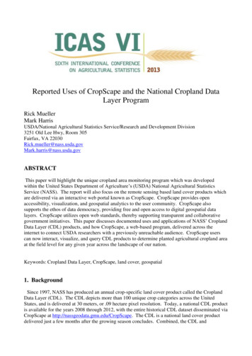
Cropland Data Layer Future Expand geographic scope Cotton, Winter, Durum andSpring Wheat Derivatives Change detection Crop rotation patternsPrimary Wheat States National program Leverage resource partnershipsPrimary Cotton States
Program Summary Cropland Data Layer Method––––AWiFS imageryFSA CLU datasetCommercial softwareAncillary data CDL Stakeholder Distribution:– Annually after county estimates published– Metadata/accuracies/confidence layer Access:– http://datagateway.nrcs.usda.gov
USDA/NASS Geospatial Products: The Cropland Data Layer Rick Mueller rick_mueller@nass.usda.gov Presented at: LMV Geospatial Conference June 17, 2008. . NRCS Geospatial Data Gateway Publish accuracy statistics/metadata ‟06 -„07 ‟05 & „07 ‟97-‟07 „04 ‟99-‟07‟00-‟07 ‟00-‟07 ‟04-07 ‟99-‟07


