Transcription
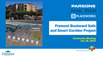
Fremont Boulevard Safeand Smart Corridor ProjectCommunity MeetingJuly 18, 2019
Agenda Introductions City Efforts Project Scope and Schedule Project Goals Existing Conditions Project Concepts Open House Stations Next StepsFunding for the work is granted fromMeasure BB, approved by AlamedaCounty voters in 2014 and administeredby the Alameda County TransportationCommission.2
Project Team Hans LarsenDirector of Public Works Sheila MarquisesSnr. Transportation Engineer City of Fremont Victoria WalkerTransportation EngineerCity of Fremont Daniel MillerTransportation EngineerCity of Fremont Derek PinesVice PresidentParsons Allen ChenSenior Project ManagerParsons Danny MurphySenior Engineer/PlannerFehr & Peers Charlie KnoxPrincipalPlaceWorks Janet ChangAssociatePlaceWorksCity of Fremont3
Current City Plans & Efforts General Plan Vision Zero Action Plan Mobility Action Plan Climate Action Plan Safe Routes to School Plans Systematic Safety Analysis Report Multimodal Arterial Plan (AlamedaCounty) Bicycle Master Plan Pedestrian Master Plan4
Project Scope and SchedulePreliminary EngineeringEnvironmental ClearanceDesignProcurement SupportCommunity & Industry OutreachCONTRUCTIONCONSTRUCTIONConstruction SupportProject Closeout11/18 12/18 1/19 2/19 3/19 4/19 5/19 6/19 7/19 8/19 9/19 10/19 11/19 12/19 1/20 2/20 3/20 4/20 5/20 6/20 7/20 8/205
Project Goals Improve safety and mobility for all modes Align with relevant safety and transportation plans and contribute tothe City’s sustainability goals Integrate project communication and management systems withsimilar City systems (e.g., FPD, IT) Provide accommodations for planned AC Transit and Alameda CTCprojects along the corridor Engage with the community and stakeholders Ensure operations and maintenance needs are a key considerationwhen developing projects Make Fremont Boulevard an innovative “testbed”6
Existing Conditions7
Existing ConditionsTraffic Traffic volume focused on thenorthern portion of Fremont Blvd. AM traffic southbound PM traffic northboundAMPMDecoto Road to Thornton AvenuePeralta Boulevard to Central AvenueCentral Avenue to Mowry AvenueMowry Avenue to Stevenson BoulevardStevenson Boulevard to Washington BoulevardWashington Boulevard to Auto Mall ParkwayAuto Mall Parkway to 8,7548
Existing ConditionsTransit / Rail Six AC Transit routes and “Flex” service toUnion City BART Stanford Marguerite shuttle Fremont Centerville Amtrak/ACE station9
Existing ConditionsPedestrians Significant pedestrianactivity (observed) Four large schools Many businesses Sidewalks (mostly) exist Crossings (mostly)controlled Many push buttons donot have AccessiblePedestrian Signals (APS)10
Existing ConditionsBicyclists Mostly Class II, someClass III bicyclefacilities Some of FremontBlvd. has bicycledetection 0.5% of trips citywide Planned for mostlyClass IV separatedbikewaysClass II Buffered Bike LaneClass IV Separated Bikeway11
Existing ConditionsCollisions 510 collisions from 2013-2018 Pedestrian Collisions (2009-2015)Highest number of pedestrian collisions citywide 7% resulted in fatal or severe injuries 20% involved a pedestrian or bicyclist 19% of bicyclist collisions were due to “Improper Turning or TrafficSignals and Signs” at a controlled intersection Primary collision factors for intersection collisions were: Traffic Signals and Signs (26%) Unsafe Speed (16%) Auto ROW Violation (10%) Pedestrian collisions occurred most at intersections Leading collision factors were “Pedestrian Violations” and“Pedestrian ROW Violations”12
Existing ConditionsData Communications Dept. of Information Technology Services manages hardware and software for traffic signal datacommunications City documents existing traffic signal communications equipment and interconnect13
Project Concepts14
Project Concepts 34 initial project concepts Meets one or more Vision Zero actions Meets one or more Project Objectives MobilitySafety InnovationSustainability Prioritized as high, medium, or low BenefitComplexityCost Prioritization of locations Areas of high speeds and collisionsSensitive groupsExisting infrastructure15
High Priority Project ConceptsProject Objectives:SafetyMobility Passive PedestrianDetection at TrafficSignals Bicycle Detection &Confirmation Speed Monitoring andFeedback Leading PedestrianIntervals Supplemental CrosswalkLighting Dynamic SpeedManagement Adaptive Traffic SignalSystem with AutomatedTraffic PerformanceMeasuresInnovation &Sustainability Automated Video Analysis Adaptive Street Lighting ArterialManagement/DecisionSupport Software Modernized DataCommunications Network Accessible PedestrianSignal Deployment16
Project ObjectivesSafetyMobility Incentivize safer autospeeds, give City toolsto monitor / addressspecific speed-relatedissues Deploy technologiesto assist mobilityimpaired users inthe corridor Enhance controlledand uncontrolledpedestrian crossingswith safety-focusedtechnologies Enable enhancedmonitoring ofpedestrian activity andbehavior, allowing theCity to targetenhancements asspecific locations Modernize the trafficsignal system toachieve efficiencygains, reduce signalrelated delay andenhance mobility forall modes on thecorridor Allow for transitreliabilityimprovements beingconsidered by ACTransit Expand CentervilleParking system withtechnology that willallow for dynamicpricing Provide dynamicwayfinding to availableparking supply atCenterville station, allowfor future possibility ofon-line reservation Consider dynamic curbspace managementsystem for the on-streetparking and loading thatexists on the corridor.Innovation &Sustainability Look into opportunitiesprovided by licenseagreements with wirelesscarriers Standardize datacommunications on thecorridor, allowing forcurrent and futurebandwidth needs Communicate signalsystem data in a formatconsistent with ITSstandards, and withexisting City protocols17
ActionsSafety / Vision Zero1 Provide incentives for safer auto speeds, provide the City with enhanced tools to monitor and address specific speedrelated issues on the corridorSafety / Vision Zero2 Enhance controlled and uncontrolled pedestrian crossings with safety-focused technologies, while considering lowcost traditional enhancements as well.Safety / Vision Zero3 Enable enhanced monitoring of pedestrian activity and behavior, allowing the City to target enhancements as specificlocations.Mobility4 Deploy technologies (traditional and innovative) to assist mobility-impaired users in the corridorMobility5 Modernize the traffic signal system (detection and control) to achieve efficiency gains, reduce signal-related delayand enhance mobility for all modes on the corridorMobility6 Allow for transit reliability improvements being considered by AC TransitParking7 Expand beyond the planned paid parking and monitoring system at Centerville Station with technology that willallow for dynamic pricingParking8 Provide dynamic wayfinding to available parking supply at Centerville station, allow for future possibility of on-linereservationParking9 Consider dynamic curb space management system for the on-street parking and loading that exists on the corridor.Data Communications 10 If possible, take advantage of license agreements with wireless carriersData Communications 11 Standardize data communications on the corridor, allowing for current and future bandwidth needsData Communications 12 Communicate signal system data in a format consistent with ITS standards, and with data communication standardsfor other City departments18
Next Steps Project concepts report More outreach DesignVisit project website at:www.fremontsmartcorridor.org19
Peralta Boulevard to Central Avenue 22,527 Central . Boulevard 31,780 Washington Boulevard to Auto Mall Parkway 18,883 Auto Mall Parkway to I-880 18,754 ADT Traffic volume focused on the northern portion of Fremont Blvd. . routes and "Flex" service to Union City BART Stanford Marguerite shuttle Fremont Centerville Amtrak/ACE .