Transcription
Grade 4Social StudiesUnit: 01Lesson: 01Suggested Duration: 3 daysGrade 04 Social Studies Unit 01 Exemplar Lesson 01: Regions of TexasThis lesson is one approach to teaching the State Standards associated with this unit. Districts are encouraged to customize this lesson bysupplementing with district-approved resources, materials, and activities to best meet the needs of learners. The duration for this lesson is only arecommendation, and districts may modify the time frame to meet students’ needs. To better understand how your district may be implementingCSCOPE lessons, please contact your child’s teacher. (For your convenience, please find linked the TEA Commissioner’s List of State Board ofEducation Approved Instructional Resources and Midcycle State Adopted Instructional Materials.)Lesson SynopsisStudents use geographic skills to identify, locate, and compare the geographic regions of Texas and the landforms, climate, and vegetation ofthose regions.TEKSThe Texas Essential Knowledge and Skills (TEKS) listed below are the standards adopted by the State Board of Education, which are required byTexas law. Any standard that has a strike-through (e.g. sample phrase) indicates that portion of the standard is taught in a previous or subsequentunit. The TEKS are available on the Texas Education Agency website at http://www.tea.state.tx.us/index2.aspx?id 6148.4.6Geography. The student uses geographic tools to collect, analyze, and interpret data. The student is expected to:4.6A Apply geographic tools, including grid systems, legends, symbols, scales, and compass roses, to construct andinterpret maps.4.7Geography. The student understands the concept of regions. The student is expected to:4.7B Identify, locate, and compare the geographic regions of Texas (Mountains and Basins, Great Plains, NorthCentral Plains, Coastal Plains), including their landforms, climate, and vegetation.4.7C Compare the geographic regions of Texas (Mountains and Basins, Great Plains, North Central Plains, CoastalPlains) with regions of the United States and other parts of the world.4.8Geography. The student understands the location and patterns of settlement and the geographic factors thatinfluence where people live. The student is expected to:4.8B Describe and explain the location and distribution of various towns and cities in Texas, past and present.4.8C Explain the geographic factors such as landforms and climate that influence patterns of settlement and thedistribution of population in Texas, past and present.Social Studies Skills TEKS4.21Social studies skills. The student applies critical-thinking skills to organize and use information acquired from avariety of valid sources, including electronic technology. The student is expected to:4.21C Organize and interpret information in outlines, reports, databases, and visuals, including graphs, charts,timelines, and maps.4.22Social studies skills. The student communicates in written, oral, and visual forms. The student is expected to:4.22D Create written and visual material such as journal entries, reports, graphic organizers, outlines, andbibliographies.GETTING READY FOR INSTRUCTIONPerformance IndicatorsGrade 04 Social Studies Unit 01 PI 01Draw and color code the geographic regions of Texas on a map. Use geographic tools to identify major landforms, cities, and information on climate for each region.Write a summary of the geographic regions and compare two of the regions on a graphic organizer.Standard(s): 4.6A , 4.7B , 4.8C , 4.21C , 4.22DELPS ELPS.c.1F , ELPS.c.4GKey UnderstandingsGeographic skills help people understand the physical and human characteristics of a region.—How do you use geographic tools to examine the geography of Texas?—What are the regions of Texas, and where are they located?Last Updated 05/16/13Print Date 06/20/2013 Printed By Karen Johnson, MIDLAND ISDpage 1 of 24
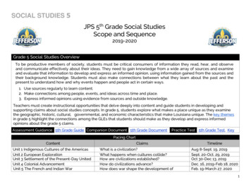
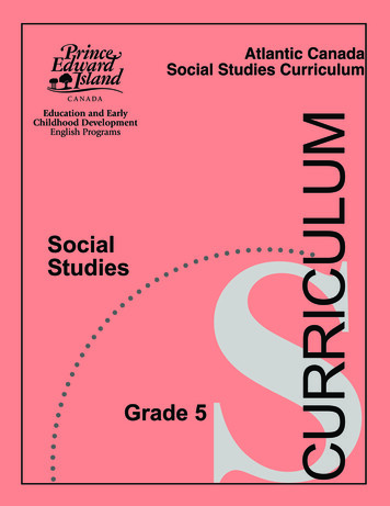
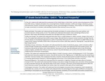
Grade 4Social StudiesUnit: 01Lesson: 01Suggested Duration: 3 days—What are physical and human characteristics of the regions of Texas?—How do regions of Texas compare to each other?—What geographic factors influence the patterns of settlement and the distribution of population in Texas?Vocabulary of Instructiongeographic factorgeographic regionlandformclimatesymbolscalevegetationpattern of settlementdesertplainscompass rosephysical characteristicsplateaugeographic toolgrid systemlegendhuman characteristicsMaterialsatlas and other maps of Texasmap pencilsoutline map of Texas (optional)AttachmentsAll attachments associated with this lesson are referenced in the body of the lesson. Due to considerations for grading or student assessment,attachments that are connected with Performance Indicators or serve as answer keys are available in the district site and are not accessible onthe public website.Teacher Resource: PowerPoint: Regions of TexasHandout: Regions of Texas Map (1 per student and 1 enlarged for classroom display)Handout: Region Cards (Cut apart. 1 card per student)Teacher Resource Lesson Activities KEYHandout: Texas Map – Map Skills (1 per student)Teacher Resource: Texas Map – Map Skills KEYHandout: Regions of Texas Note Cards (1 per student)Handout: Coastal Region – NASA (enough for ¼ of class)Handouts: North Central Region – Fort Worth (enough for ¼ of class)Handout: Great Plains – Palo Duro State Park (enough for ¼ of class)Handout: Mountains and Basins Big Bend National Park (enough for ¼ of class)Handout: Comparison Graphic Organizer (1 per student)ResourcesNone identifiedAdvance Preparation1.2.3.4.5.6.Become familiar with the content and procedures for this lesson.Refer to the Instructional Focus Document for specific information to include.Select appropriate sections of the textbook and other classroom and library materials to support the learning in this lesson.Preview materials and websites according to district guidelines.Display vocabulary words on a “word wall” to be used during the lesson.Prepare and print materials and handouts as needed.Background InformationIn previous years students have been introduced to the geography concepts of location, distance, and direction on maps and globes, and they have learned aboutphysical and human geographic characteristics. The concept of region is new – and very important. It will take time to help students understand what a region is.A region is an area identified by common characteristics. Geographic regions are defined by geographic characteristics. There are many types of regions, includingpolitical, social, economic, population, culture, and others.Regions of TexasThis lesson uses the four regions of Texas identified in the Social Studies TEKS (4.7B): Mountains and Basins, Great Plains, North Central Plains, Coastal Plains.Geographers use maps for many reasons. They may use them to study the earth, cities, states, landscape, population distribution, or cultural geography. Maps representthe time and space in which they were developed. In order to read maps, geographers use special tools to organize information. Some of these tools are the grid system,compass rose, map legend, symbols, and a scale indicator (4.6A). With these tools, geographers study the relationship between Texas geography and Texas history.Students have been working with these geographic tools and relative/absolute location since Kindergarten; however, they have not classified them using the termLast Updated 05/16/13Print Date 06/20/2013 Printed By Karen Johnson, MIDLAND ISDpage 2 of 24
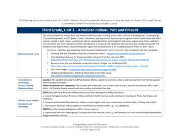
Grade 4Social StudiesUnit: 01Lesson: 01Suggested Duration: 3 days“geographic tools.” (See Grade 3, TEKS 5.) Physical and human characteristics of place have likewise been taught earlier, as have the concepts of adapting to andmodifying the environment. Fourth grade provides a larger context for applying those concepts.TODAL: T Title of map; O Orientation (compass rose); D Date of map creation; A Author’s name; L Labels and a LegendGETTING READY FOR INSTRUCTIONTeachers are encouraged to supplement and substitute resources, materials, and activities to meet the needs of learners. These lessons are oneapproach to teaching the TEKS/Specificity as well as addressing the Performance Indicators associated with each unit. District personnel maycreate original lessons using the Content Creator in the Tools Tab. All originally authored lessons can be saved in the “My CSCOPE” Tab withinthe “My Content” area.INSTRUCTIONAL PROCEDURESInstructional ProceduresNotes for TeacherENGAGE – Concept of RegionNOTE: 1 Day 50 minutesSuggested Day 1 – 15 minutes1. Display the word region and ask students what they know about the term. Scribethe responses under the term.2. Present the Teacher Resource: PowerPoint: Regions of Texas, which providesan opportunity to review vocabulary terms and prior learning from earlier grades. Italso provides an introduction to what a region is and reviews, through presentingexamples, the concepts of regions based on human characteristics and physicalcharacteristics.Attachments:Teacher Resource: PowerPoint: Regions ofTexasHandout: Regions of Texas MapPurpose:Students access prior knowledge about geography concepts andphysical and human characteristics of place. This can provide theteacher with pre-assessment information about studentunderstanding of regions of Texas.EXPLORE – Characteristics of RegionsSuggested Day 1 (cont’d) – 20 minutes1. Post a large map of Texas showing the four regions. (See Teacher Resource:PowerPoint: Regions of Texas or the Handout: Regions of Texas Map.)Materials:atlas and other maps of Texas2. Distribute to each student a Region Card from the Handout: Region Cards.3. In pairs, students match the characteristic on the card with a region and provide anexplanation for their reasoning. (Allow students access to the textbook and otherclassroom resources.)4. Teacher circulates, checking student understanding and gathering informationabout students’ prior knowledge of the regions of Texas and knowledge beinggained.Attachments:Handout: Region Cards (Cut cards apart, 1 cardper student.)Purpose:Students apply prior knowledge and gain new knowledge to helpbuild the concept of region.5. “Pair the pairs” to create groups of four. Members of the new group share theirlearning about the topic on their cards.6. Student volunteers report out, sharing their learning about characteristics of Texasregions. (Some student volunteers could come to the front of the room, affix theircard to the classroom map, and share their ideas.)7. See Teacher Resource: Lesson Activities KEYEXPLAIN – Use map skillsSuggested Day 1 (cont’d) – 15 minutes1. Distribute the Handout: Texas Map – Map Skills.Materials:2. Review with students map requirements for 4th grade social studies. IncludeTODAL requirements, and class-specific requirements. (TODAL: All maps shouldalways include the Title of the map, the Orientation of the map – often a compassrose, the Date the map was created, the Author of the map, and Labels and aLegend.)3. Working in pairs, students use their map skills and what they have learned aboutTexas to complete the map and answer the questions. (Also add the Author, Date,and Labels to the map.)map pencilsAttachments:Handout: Texas Map – Map Skills (1 perstudent)Teacher Resource: Texas Map – Map SkillsKEYEXPLORE – Explore maps and RegionsSuggested Day 2 – 25 minutes1. Distribute to each student, the Handout: Regions of Texas Note CardsMaterials:Last Updated 05/16/13Print Date 06/20/2013 Printed By Karen Johnson, MIDLAND ISDpage 3 of 24
Grade 4Social StudiesUnit: 01Lesson: 01Suggested Duration: 3 days2. In pairs or small groups (4 or fewer) students use their prior knowledge, textbooks,map pencilsand other classroom materials (including an atlas and other maps of Texas) toatlas and other maps of Texasgather information about the regions of Texas and complete the Handout: Regionsof Texas Note Cards.Attachments:3. Facilitate a class discussion allowing students to share their learning and practiceusing academic language. Probe with questions and provide additional informationas needed, especially related to the lesson’s Key Understanding and GuidingQuestions.Geographic skills help people understand the physical and humancharacteristics of a region.——How are geographic tools used to examine the geography of Texas?What are the regions of Texas and where are they located?——How do regions of Texas compare to each other?What are the geographic factors that influence the patterns of settlement and theHandout: Regions of Texas Note Cards (1 perstudent)Purpose:Provide students with an opportunity to interpret maps and identifythe characteristics of the regions of Texasdistribution of population in Texas?EXPLAIN – Characteristics of the regions of Texas.Suggested Day 2 (cont’d) – 10 minutes1. Students divide a piece of paper into fourths and label each section as one of theregions of Texas. In each section, students list characteristics (human andphysical) found in that region, and write a statement summarizing the region.ELABORATE – Deeper investigationSuggested Day 2 3 – 30 minutes1. Assign each student a region and provide the corresponding handout to completeindividually (approximately ¼ of the class should receive each region handout).(Handout: Coastal Region – NASA; Handout: North Central Region – FortWorth; Handout: Great Plains – Palo Duro State Park; Handout: Mountainsand Basins – Big Bend National Park)Attachments:2. Form expert groups of students who have completed the same handout. Expertgroup members briefly share their information about the attraction, includingpersonal experiences, additional knowledge, etc.3. Teacher circulates, probing with questions and ensuring correct information isbeing shared.4. Students then move to find a partner representing a different region. Allow about 3minutes for students to discuss/share.Handout: Coastal Region – NASAHandouts: North Central Region – Fort WorthHandout: Great Plains – Palo Duro State ParkHandout: Mountains and Basins – Big BendNational ParkPurpose:Allow more in-depth investigation of specific characteristics(physical/human) of the regions of Texas to provide opportunity tomake new connections to content information gained.5. Students again move to find a partner representing still another region. Allow about3 minutes for students to discuss/share.6. Repeat until all students have met with a partner from each of the four regions.7. Facilitate a discussion to summarize student learning in this lesson.8. Return to the classroom discussion from Day 1. Project (or write on the board) thelesson’s Key Understanding:Geographic skills help people understand the physical and humancharacteristics of a region.9. Students contribute to the discussion by providing answers to the questions below,using academic language and information learned about geography, geographictools, patterns of settlement, and the regions of Texas.—How do you use geographic tools to examine the geography of Texas?———What are the regions of Texas and where are they located?What are the physical and human characteristics of the regions of Texas?How do regions of Texas compare to each other?— What geographic factors influence the patterns of settlement and the distribution ofpopulation in Texas?EVALUATE – Map and comparison of regionsLast Updated 05/16/13Print Date 06/20/2013 Printed By Karen Johnson, MIDLAND ISDSuggested Day 3 (cont’d) – 35 minutespage 4 of 24
Grade 4Social StudiesUnit: 01Lesson: 01Suggested Duration: 3 daysGrade 04 Social Studies Unit 01 PI 01Draw and color code the geographic regions of Texas on a map. Use geographic tools to identifymajor landforms, cities, and information on climate for each region. Write a summary of thegeographic regions and compare two of the regions on a graphic organizer.Standard(s): 4.6A , 4.7B , 4.8C , 4.21C , 4.22DELPS ELPS.c.1F , ELPS.c.4GMaterials:outline map of Texas (optional)Attachments:Handout: Comparison Graphic OrganizerInstructional Note:1. Students need a blank sheet of 8-1/2 x 11 paper on which to draw their own map.They also need the Handout: Comparison Graphic Organizer2. Students sketch a map of Texas and then identify the regions of Texas on theirmap. They use the TODAL strategy and label major cities and landforms, addingthem to the map legend as appropriate. The legend or call-out boxes can be usedto identify information on climate.Students should draw their own maps.Teacher should set specific labeling requirements,especially in regard to local information.3. Students complete the Handout: Comparison Graphic Organizer to address thesummary requirement, using the Venn Diagram with attributes identified to comparetwo of the regions.4. Students and teacher use a rubric to evaluate the work.Last Updated 05/16/13Print Date 06/20/2013 Printed By Karen Johnson, MIDLAND ISDpage 5 of 24
Grade 4Social StudiesUnit: 01 Lesson: 01Regions of Texas Map 2012, TESCCC04/03/13page 1 of 1
Grade 4Social StudiesUnit: 01 Lesson: 01Region CardsMountainsCapital of TexasRegionRegionReason:Reason:Most RiversCaddo nRegionReason:Reason: 2012, TESCCC05/07/12page 1 of 5
Grade 4Social StudiesUnit: 01 Lesson: 01Big BendNational ParkGulf of MexicoRegionRegionReason:Reason:HoustonHot SummersRegionRegionReason:Reason:Pine TreesSan AntonioRegionRegionReason:Reason: 2012, TESCCC05/07/12page 2 of 5
Grade 4Social StudiesUnit: 01 Lesson: 01Rio Grande RiverHill CountryRegionRegionReason:Reason:HumidDry ClimateRegionRegionReason:Reason:Palo Duro CanyonWheatRegionRegionReason:Reason: 2012, TESCCC05/07/12page 3 of 5
Grade 4Social StudiesUnit: 01 Lesson: il and GasEl gionRegionReason:Reason: 2012, TESCCC05/07/12page 4 of 5
Grade 4Social StudiesUnit: 01 Lesson: 01RanchingTexas gestPopulationRegionReason:RegionReason:Rolling PrairiesSouth TexasRegionRegionReason:Reason: 2012, TESCCC05/07/12page 5 of 5
Grade 4Social StudiesUnit: 01 Lesson: 01Teacher Resource Lesson Activities KEYExplore – Characteristics of Regions: Day 1Regions Card KEY (Possible answers)Mountains/ Mountain & BasinHill Country/Coastal, North Central,Capital of Texas/ CoastalGreat PlainsMost Rivers /CoastalRio Grande River/ Mountain & Basin,Caddo Lake/ CoastalGreat, CoastalBlizzards/Great PlainsHumid/CoastalBayous/CoastalDry Climate/ Mountain & Basin,Big Bend National Park/ Mountain &Great Plains, North CentralBasinPalo Duro Canyon/ GreatGulf of Mexico/CoastalWheat/ Great Plains, North CentralHouston/CoastalWater Skiing/CoastalHot Summers/ All RegionsHiking /All regionsPine Trees /CoastalSan Antonio/ Great PlainsReason – Reasons should be students’ ideas. 2012, TESCCC04/04/13Oil & Gas/All regionsEl Paso/ Mountain & BasinHurricane/CoastalTornado/North Central but all regionsRanching/All regionsTexas Tech University/ Great PlainsDeserts/Mountain & Basin, GreatLargest population/ CoastalPlains/Coastal, North Central, GreatPlainsSouth Texas/Coastal, Great Plainspage 1 of 1
Grade 4Social StudiesUnit: 01 Lesson: 01Texas Map – Map SkillsABCDE123N4LEGENDCoastal Region – GreenNorth Central Region – BrownGreat Plains – YellowMountain & Basin – OrangeCapital of Texas - Austin1. Write your name in cell 1A.2. In which cell is the capital of Texaslocated?3. In which region do you live?4. How many cells cover Texas east towest?5. Which direction do you move going fromthe Great Plains to the Coastal Plains?6. Which region covers most of 2C?7. Which river is in 3B?8. Which cell is the most western part of Texas?9. In which cell is your home located? 2012, TESCCC05/07/12page 1 of 1
Grade 4Social StudiesUnit: 01 Lesson: 01Texas Map – Map Skills sinsOrangeCoastalGreen3N4LEGENDCoastal Region – GreenNorth Central Region – BrownGreat Plains – YellowMountain & Basin – OrangeCapital of Texas - Austin1. Write your name in cell 1A.2. Which cell is the capital of Texas located in? 3D3. Which region do you live in? (answer varies)4. How many cells cover Texas east to west? 35. Which direction do you move going from the Great Plains to the Coastal Plains? Southeast6. Which region covers most of 2C? North Central Plains7. Which river is in 3B? Rio Grande River8. Which cell is the most western part of Texas? 2B9. In which cell is your home located? (answer varies)10. What is located in 4D? (answers vary: Southern point of Texas or mouth of Rio Grande River) 2012, TESCCC05/07/12page 1 of 1
Grade 4Social StudiesUnit: 01 Lesson: 01Regions of Texas Note CardsName:COASTAL REGIONCOASTAL REGIONThe Coastal Region is in the southeast part of Texas. Thisregion is very diverse. There are forest, hills, plains, anddeserts. It extends from the Red River all the way to the RioGrande River and the Gulf of Mexico. The climate is verymild. It does not get too cold or too hot. Between June andDecember, there is always a chance of a hurricane, though,because of its location on the Gulf of Mexico. With a mildclimate and the region’s access to water, the vegetation isvery lush. That means a lot of vegetation can grow in thisregion like grasses, flowers, trees, and different crops. Overall,these characteristics have caused many people to move to this Shade and label the Coastal Region.area, making it the most populated region in Texas.What are the common characteristics of the CoastalRegion?Why is this region known as theCoastal Region?LandformsClimateVegetationREFLECTION – What are your thoughts about the CoastalRegion? 2012, TESCCC04/22/13Your picture describing this regionpage 1 of 4
Grade 4Social StudiesUnit: 01 Lesson: 01Regions of Texas Note CardsName:NORTH CENTRAL PLAINS REGIONNORTH CENTRAL PLAINS REGIONThe North Central Plains is located between theRed River and the Colorado River. It is coveredwith rolling plains, tall grasses, and some trees like pecan, postoak, and elm. This region is also surrounded by the Balconesand Cap Rock Escarpments. Escarpments are long, steep, rockwalls where the land changes from lower elevations to higherelevations. As a person moves from the east to the west in thisregion, the climate becomes drier and windier. This type ofclimate leads to the chance of tornados in the spring anddroughts in the summer.What are the common characteristics of the North CentralPlains Region?Shade and label theNorth Central RegionWhy is this region known as theNorth Central Plains Region?LandformsClimateVegetationREFLECTION – What are your thoughts about the NorthCentral Plains Region? 2012, TESCCC04/22/13Your picture describing thisregionpage 2 of 4
Grade 4Social StudiesUnit: 01 Lesson: 01Regions of Texas Note CardsName:GREAT PLAINS REGIONGREAT PLAINS REGIONThe Great Plains Region is located in the mostnorthern part of Texas and extends to the RioGrande. This region is made up of high plains,plateaus, canyons, and aquifers. The High Plains in this regionis one of the flattest places on earth. Palo Duro Canyon washome to prehistoric Indians, and the Edwards Aquifer supplieswater for San Antonio. The climate of this region is very hot in thesummer and very cold in the winter. During the winters, the mostnorthern part of this region is known to experience blizzards.There is little vegetation because the region is very dry, windy,and receives little precipitation. Traveling through this region, aperson would see mesquite and oak trees, short grasses, andtumble weeds rolling across the plains.Shade and label theGreat Plains RegionWhat are the common characteristics of the Great PlainsRegion?Why is this region known as theGreat Plains Region?LandformsClimateVegetationREFLECTION – What are your thoughts about the GreatPlains Region? 2012, TESCCC04/22/13Your picture describing thisregionpage 3 of 4
Grade 4Social StudiesUnit: 01 Lesson: 01Regions of Texas Note CardsName:MOUNTAINS AND BASINS REGIONMOUNTAIN AND BASIN REGIONThe Mountain and Basin Region is located in thewestern part of Texas. This region is made up oftall mountains separated by basins or closedvalleys. The southern border of this region is the Rio GrandeRiver, which flows into the Gulf of Mexico. The climate is dry anddesert like. There is little precipitation. Days are hot and nightsare cool. As people travel to the higher elevations of themountains, the climate gets even colder. Due to this climate, thevegetation includes forests of oak and ponderosa pine trees inthe mountains and cactus, shrubs, and short grasses in thebasins.What are the common characteristics of the Mountain andBasin Region?Shade and label theMountain and Basin RegionWhy is this region known as theMountain and Basin Region?LandformsClimateVegetationREFLECTION – What are your thoughts about the Mountainand Basin Region? 2012, TESCCC04/22/13Your picture describing thisregionpage 4 of 4
Grade 4Social StudiesUnit: 01 Lesson: 01Coastal RegionNASA – Johnson Space Stationhttp://www.nasa.gov/In 1961, the National Aeronautics and Space Administration (NASA) chose Clear Lake outside ofHouston as the location for its Manned Spacecraft Center. In 1973 the facility was renamed theJohnson Space Center in honor of former President Lyndon B. Johnson. President Johnson was the36th president of the United States and grew up in the Texas Hill Country. The Johnson Space Centertrains astronauts and directs the space missions after they are launched from Kennedy Space Centerin Florida.Imagine that you are one of three students that have been picked out of the crowd by an astronaut toblast off into space on the next space mission. The astronaut and his team can only take one studentand has decided whoever writes the most convincing letter will join them in space. Write the body of aletter persuading the astronauts to select you for the next space mission. The letter should includeyour reasons for traveling to space, what you will do when you are in space and why your spacemission will be important to Texas students. 2012, TESCCC05/07/12page 1 of 1
Grade 4Social StudiesUnit: 01 Lesson: 01North Central PlainsFt. WorthFort worth. (n.d.). Retrieved from http://www.traveltex.com/cities/fort-worth/Fort Worth began as a tiny outpost on the frontier in 1849. The outpost was named for Mexican Warhero Gen. William Worth. Many believe Ft. Worth is “where the west began.” They believe thisbecause military forts were built west of Ft. Worth to protect Texans from the Indians. After theremoval of Indians to reservations, Ft. Worth was given another name “Cowtown.” Ft. Worth islocated on the old Chisholm Trail cattle trail. This was a stop for cowboys herding cattle to northernmarkets. Later, the railroad will stop in Ft. Worth and become a market center for cattle in Texas.Today, the cowboy heritage of Ft. Worth is still there. Visitors can visit the The Stockyards, TheNational Cowgirl Museum, Texas Cowboy Hall of Fame, and Billy Bob’s of Texas.Poetry and songs were a way for cowboys to entertain themselves and get through the long lonelynights on the cattle trail. What did cowboys write about? Let’s see.TITLE:When the day is doneand the herd's at restand first watch is on the line,then the boys kick backto rest for a while,as the stars begin to shine.When their chow is ateand they've rolled their ownand the cards are all laid out,they begin to playand they fan the breezeto speak of tomorrow's route.When the game is doneand the fire burns lowand talk has faded away,the bedroll's laid outand quiet pervades,it's the endin' of the day.When the day is doneand all are at rest,a great sense of peace prevails,and the cowboy feelsas he drops to sleep,his love for these western trails.Crouch, C. (n.d.). Western & cowboy poetry by clarkcrouch. Retrieved fromhttp://poetry.crouchnet.com/western.html 2012, TESCCCDescribe two things that cowboys did after a long day on the trail.1.2.How does the poem describe a cowboy’s “love for these western trails?”Now that you have read and analyzed the poem, what would be a good titlefor this poem?04/09/13page 1 of 1
Grade 4Social StudiesUnit: 01 Lesson: 01Great Plains RegionPalo Duro Canyon State ParkPalo Duro Canyon State Park opened in 1934 outside of Amarillo. It is 120 miles long, 20 miles wide,and 800 feet deep. It claims to be the second largest canyon in the United States behind the GrandCanyon. The canyon was formed by wind and water erosion from the Red River which runs throughthe canyon.The name “Palo Duro” is Spanish for “hard wood.” It is believed that early Spanish explorers named itfor the trees that grow in the canyon. Humans have lived in the canyon for over 12,000 years. Earlysettlers were nomadic tribes that hunted mammoth and giant bison. Later, Apache, Comanche andKiowa Indians lived in the canyon. In 1874, the United States army removed the Comanche andforced them to live on reservations. In 1876, Charles Goodnight opened the JA Ranch in the canyon.The ranch supported more than 100,000 head of cattle and remains a working ranch.Today, visitors travel to Palo Duro Canyon State Park for its beautiful scenery and to hike, mountainbike, ride horses, and camp. One of the most unique attractions is the musical drama Texas,presented in the park during July and August.When is the best time of the year to visit the park? Let’s examine the climate and see when to go.1. The musical drama Texas opens in June. What is the high temperature in Amarillo in June?2. Which month receives the least amount of rainfall in Amarillo?3. Circle the term that best describes the park’s climate.A. Rainy and HotB. Dry and Cool4. Explain one reason why you would visit Palo Duro Canyon State Park.Image source (both):Climate for amarillo, texas. (2011). Retrieved from nformation source:Palo Duro Canyon State Park. (2013). Palo duro canyon state park. Retrieved
May 16, 2013 · 2. Review with students map requirements for 4th grade social studies. Include TODAL requirements, and class-specific requirements. (TODAL: All maps should always include the Title of the map, the Orientation of the map – often a compass rose, the Date the map was cre
