Transcription
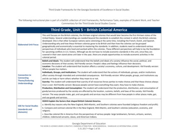
Third Grade Frameworks for the Georgia Standards of Excellence in Social StudiesThe following instructional plan is part of a GaDOE collection of Unit Frameworks, Performance Tasks, examples of Student Work, and TeacherCommentary for the Third Grade Social Studies Course.Third Grade, Unit 5 – British Colonial AmericaElaborated Unit FocusConnection toConnectingTheme/EnduringUnderstandingsThis unit focuses on the British colonies, the thirteen original colonies that would later become the first thirteen states of theUnited States. Several understandings are needed beyond the standards to establish the context in which the British coloniesdeveloped. One is that other European nations were colonizing at the same time, including the French, Dutch, and Spanish.Understanding why and how these thirteen colonies grew to be British and then how the colonies can be groupedgeographically and economically is essential to mastering the standards. In addition, students need to understand variousperspectives of individuals who lived and worked within the colonies. These different perspectives will help to lay the foundationfor upcoming conflicts in U.S. history. Although we do not have to include economic standards in this unit, since they arecovered in their own stand-alone unit later in the year, there are ample opportunities to include economic activities in thecolonial period.Beliefs and Ideals: The student will understand that the beliefs and ideals of a society influence the social, political, andeconomic decisions of that society. Kid-friendly version: People’s ideas and feelings influence their decisions.Location: The student will understand that location affects a society’s economy, culture, and development. Kid friendly version:Where people live matters.Individuals, Groups, and Institutions: The student will understand that the actions of individuals, groups, and/or institutionsaffect society through intended and unintended consequences. Kid-friendly version: What people, groups, and institutions sayand do can help or harm others whether they mean to or not.Scarcity: The student will understand that scarcity of all resources forces parties to make choices and that these choices alwaysincur a cost. Kid-friendly version: Because people cannot have everything they want, they have to make choices.Production, Distribution and Consumption: The student will understand that the production, distribution, and consumption ofgoods/services produced by the society are affected by the location, customs, beliefs, and laws of the society. Kid-friendlyversion: The ways people make, get, and use goods and services may be different from how people in other places make, get,and use goods and services.SS3H3 Explain the factors that shaped British Colonial America.GSE for Social Studies(standards andelements)a. Identify key reasons why the New England, Mid-Atlantic, and Southern colonies were founded (religious freedom and profit).b. Compare and contrast colonial life in the New England, Mid-Atlantic, and Southern colonies (education, economy, andreligion).c. Describe colonial life in America from the perspectives of various people: large landowners, farmers, artisans, women,children, indentured servants, slaves, and American Indians.Georgia Department of EducationTHIS WORK IS LICENSED UNDER A CREATIVE C OMMONS ATTRIBUTION - NONCOMMERCIAL - SHAREALIKE 4.0 INTERNATIONAL LICENSE5.31.2017 Page 1 of 35
Third Grade Frameworks for the Georgia Standards of Excellence in Social StudiesSS3G3 Describe how physical systems affect human systems.c. Explain how the physical geography of the New England, Mid-Atlantic, and Southern colonies helped determine economicactivities.ELAGSE3RI4: Determine the meaning of general academic and domain-specific words and phrases in a text relevant to a grade 3topic or subject area.ELAGSE3RI7: Use information gained from illustrations (e.g., maps, photographs) and the words in a text to demonstrateunderstanding of the text (e.g., where, when, why, and how key events occur).ELAGSE3RI9: Compare and contrast the most important points and key details presented in two texts on the same topic.ELAGSE3SL1: Engage effectively in a range of collaborative discussions (one-on-one, in groups, and teacher-led) with diversepartners on grade 3 topics and texts, building on others’ ideas and expressing their own clearly.c. Ask questions to check understanding of information presented, stay on topic, and link their comments to the remarks ofothers.d. Explain their own ideas and understanding in light of the discussion.Connection to K-5 GSEfor ELA/Science/MathELAGSE3W3: Write narratives to develop real or imagined experiences or events using effective technique, descriptive details,and clear event sequences.a. Establish a situation and introduce a narrator and/or characters; organize an event sequence that unfolds naturally.b. Use dialogue and descriptions of actions, thoughts, and feelings to develop experiences and events or show the response ofcharacters to situations. c. Use temporal words and phrases to signal event order.d. Provide a sense of closure.ELAGSE3W5: With guidance and support from peers and adults, develop and strengthen writing as needed by planning, revising,and editing.ELAGSE3RI9: Compare and contrast the most important points and key details.ELAGSE3W7: Conduct short research projects that build knowledge about a topic.ELAGSE3W8: Recall information from experience or gather information from print and digital sources; take brief notes onsources and sort evidence into provided categories.Connection to SocialStudies Matrices(informationprocessing and/or mapand globe skills)Map and Globe skills – 1 (cardinal directions), 2 (intermediate directions), 4 (compare/contrast categories of natural, cultural,and political features found on maps), 6 (use map key/legend to acquire information from historical, physical, political, resource,product, and economic maps), 7 (use a map to explain impact of geography on historical and current events), 8 (drawconclusions and make generalizations based on information from map)Information Processing Skills – 1 (compare similarities and differences), 2 (organize items chronologically), 3 (identify issuesand/or problems and alternative solutions), 6 (identify and use primary and secondary sources), 7 (interpret timelines), 8(identify social studies reference resources to use for a specific purpose), 9 (construct charts and tables), 10 (analyze artifacts),11 (draw conclusions and make generalizations)Georgia Department of EducationTHIS WORK IS LICENSED UNDER A CREATIVE C OMMONS ATTRIBUTION - NONCOMMERCIAL - SHAREALIKE 4.0 INTERNATIONAL LICENSE5.31.2017 Page 2 of 35
Third Grade Frameworks for the Georgia Standards of Excellence in Social StudiesEssential Questions and Related Supporting/Guiding QuestionsEnduringUnderstanding 1:1.How did the ideas and feelings of colonists help to shape their decisions to come to America?2.How does where we live shape how we live?Beliefs and IdealsEnduringUnderstanding 1:LocationEnduringUnderstanding 3:Individuals, Groups,and InstitutionsEnduringUnderstanding 4:a.How was the geography of the thirteen British colonies alike and different?a.How did the geography influence economic activity within the three groups of colonies?3.How did who you were affect your life as a colonist?4.How did scarcity help shape how colonists in each geographic region lived?5.In what ways did people in each group of colonies make, get, and use goods and services?ScarcityEnduringUnderstanding 5:Production,Distribution, andConsumptionGeorgia Department of EducationTHIS WORK IS LICENSED UNDER A CREATIVE C OMMONS ATTRIBUTION - NONCOMMERCIAL - SHAREALIKE 4.0 INTERNATIONAL LICENSE5.31.2017 Page 3 of 35
Third Grade Frameworks for the Georgia Standards of Excellence in Social StudiesSample Instructional Activities/AssessmentsActivity One – Making Predictions: Colonial Geography and Economics1923 map by William R. Shepherd, public domainEQ: How does where we live shape how we live?In this activity, we will explore the regions within the British colonies ofNorth America and make predictions about the effect of geography onthe economic activity of each region.1 – Show a physical map of North America and direct students’attention to the eastern coastline of the continent, where the EasternU.S. is today. Remind them that we have examined this area briefly inthe preceding units on American Indians and European Exploration.Today we want to focus particularly on the geography of the coastalarea, where the original colonies will develop. It would be ideal toprovide students with raised relief maps so that they can see what theland and water features look and feel like along the eastern coast ofNorth America.2 – Provide each student with a map of the eastern seaboard with nolabels. Ask them to research what the land and water, plants andnatural features are and to complete their map with symbols indicating the physical geography of this area. Save this map in interactive notebooks forlater reference.3 – Refer back to information about the American Indian tribes who lived in this area when Europeans began arriving. How did they use their environmentto meet their needs for food, shelter, and clothing? Have students discuss what they have found out about the geography and what they recall about thetribes who lived in this area and use this information to make predictions. Consider questions like: What types of jobs and ways of making a living do youthink new colonists might have to develop in this land that was new to them? How might those who settled in the northern area differ from those in themiddle and southern areas and why? What will they make and trade? What goods and services will they need? Record these predictions and any otherquestions students may have about the colonies that developed from 1607 to the 1770’s.4 – Have students write one of their predictions on an index card and turn them in; use this as a formative assessment to see where students’understanding of the geography/economics connection is. Keep the predictions for a later lesson when you can pull them out to see how many of themwere realized.Georgia Department of EducationTHIS WORK IS LICENSED UNDER A CREATIVE C OMMONS ATTRIBUTION - NONCOMMERCIAL - SHAREALIKE 4.0 INTERNATIONAL LICENSE5.31.2017 Page 4 of 35
Third Grade Frameworks for the Georgia Standards of Excellence in Social StudiesGSE Standards andElementsLiteracy StandardsSS3G3 Describe how physical systems affect human systems.c. Explain how the physical geography of the New England, Mid-Atlantic, and Southern colonies helped determine economicactivities.ELAGSE3RI7: Use information gained from illustrations (e.g., maps, photographs) and the words in a text to demonstrateunderstanding of the text (e.g., where, when, why, and how key events occur).ELAGSE3RI9: Compare and contrast the most important points and key details presented in two texts on the same topic.ELAGSE3W7: Conduct short research projects that build knowledge about a topic.ELAGSE3W8: Recall information from experience or gather information from print and digital sources; take brief notes onsources and sort evidence into provided categories.Social Studies MatricesMap and Globe skills – 1 (cardinal directions), 2 (intermediate directions), 4 (compare/contrast categories of natural, cultural,and political features found on maps), 8 (draw conclusions and make generalizations based on information from map)Information Processing Skills – 1 (compare similarities and differences), 8 (identify social studies reference resources to use fora specific purpose)EnduringUnderstanding(s)Location: The student will understand that location affects a society’s economy, culture, and development. Kid friendly version:Where people live matters.Georgia Department of EducationTHIS WORK IS LICENSED UNDER A CREATIVE C OMMONS ATTRIBUTION - NONCOMMERCIAL - SHAREALIKE 4.0 INTERNATIONAL LICENSE5.31.2017 Page 5 of 35
Third Grade Frameworks for the Georgia Standards of Excellence in Social StudiesNameGeorgia Department of EducationTHIS WORK IS LICENSED UNDER A CREATIVE C OMMONS ATTRIBUTION - NONCOMMERCIAL - SHAREALIKE 4.0 INTERNATIONAL LICENSE5.31.2017 Page 6 of 35
Third Grade Frameworks for the Georgia Standards of Excellence in Social StudiesActivity Two – A Human Timeline of the Colonial Period1 – Although students do not have to memorize specific dates tied to the colonial period, it is helpful for to have a timeline to refer to throughout the unit.One way to provide one is to construct a human timeline. Write one of the following colonial events on each sentence strips or piece of construction paperand distribute to students, but OMIT the dates. You may have them work individually or in pairs or small groups for this activity. Events include: (May 13, 1607) – The first permanent English colony is founded in Jamestown, Virginia. (July 30, 1619) – Virginia’s House of Burgesses meets the first legislative assembly in English North America. (May 21, 1620) – The Mayflower Compact, signed by 41 adult males in Provincetown Harbor, Massachusetts, is the first agreement on selfgovernment signed in English North America. (Dec. 26, 1620) – The Pilgrim Separatists land at Plymouth, Massachusetts. (1623) – New Hampshire colony is founded. (1624) – John Smith publishes his story of the history of the Virginia colony and tells about his rescue by Pocahontas. (1630) – the Massachusetts Bay Colony was founded. In 1652, Maine is included within the boundaries of this colony. (1634) – Charles I grants Lord Baltimore territory north of the Potomac River, which becomes the colony of Maryland. Catholics could settle herealong with Protestant groups. (1635) – The colony of Connecticut is established. ((1636) – After Roger Williams was expelled from Massachusetts Bay Colony, he founded Rhode Island. This was the first English colony to grantcomplete religious tolerance. (1638) – The first Swedish colonists settle in Delaware. (1653) – the North Carolina colony is founded by Virginians pushing south. (1663) – South Carolina is established with a royal charter from Charles II. (Sept. 7, 1664) – the Dutch surrender New Netherland to the English, who rename the colony New York. (1664) – The colony of New Jersey is founded. (1682) – Charles II grants William Penn a charter to what became the colony of Pennsylvania. (1700) - Population of the British colonies; approximately 275,000. Boston is the largest city, with about 7,000 people. (1733) – James Oglethorpe is granted a charter to start the colony of Georgia, the last of the 13 colonies, in 1732, and arrives the next year. (1740) – population of the British colonies is about 889,000. (1752) – Benjamin Franklin demonstrates that lightning is a form of electricity by flying a kite and a key during a thunderstorm. (1754) – Benjamin Banneker, an African American or Black man, constructs the first clock made entirely in the American colonies. (1760) – population of the British colonies is about 1,610,000.Georgia Department of EducationTHIS WORK IS LICENSED UNDER A CREATIVE C OMMONS ATTRIBUTION - NONCOMMERCIAL - SHAREALIKE 4.0 INTERNATIONAL LICENSE5.31.2017 Page 7 of 35
Third Grade Frameworks for the Georgia Standards of Excellence in Social StudiesGSE Standards andElementsSS3H3 Explain the factors that shaped British Colonial America.a. Identify key reasons why the New England, Mid-Atlantic, and Southern colonies were founded (religious freedom and profit).b. Compare and contrast colonial life in the New England, Mid-Atlantic, and Southern colonies (education, economy, andreligion).c. Describe colonial life in America from the perspectives of various people: large landowners, farmers, artisans, women,children, indentured servants, slaves, and American Indians.SS3G3 Describe how physical systems affect human systems.c. Explain how the physical geography of the New England, Mid-Atlantic, and Southern colonies helped determine economicactivities.Literacy StandardsELAGSE3SL1: Engage effectively in a range of collaborative discussions (one-on-one, in groups, and teacher-led) with diversepartners on grade 3 topics and texts, building on others’ ideas and expressing their own clearly.Social Studies Matricesc. Ask questions to check understanding of information presented, stay on topic, and link their comments to the remarks ofothers.d. Explain their own ideas and understanding in light of the discussion.ELAGSE3W8: Recall information from experience or gather information from print and digital sources; take brief notes onsources and sort evidence into provided categories.Information Processing Skills – 1 (compare similarities and differences), 8 (identify social studies reference resources to use fora specific purpose), 9 (construct charts and tables)Georgia Department of EducationTHIS WORK IS LICENSED UNDER A CREATIVE C OMMONS ATTRIBUTION - NONCOMMERCIAL - SHAREALIKE 4.0 INTERNATIONAL LICENSE5.31.2017 Page 8 of 35
Third Grade Frameworks for the Georgia Standards of Excellence in Social StudiesActivity Three – The Colonists: Why They Left and Why They CameEQ: How did the ideas and feelings of colonists help to shape their decisions to come to America?1 – In our European Exploration unit we talked about why some explorers from various countries began claiming areas of North America. Now we want tolook at that thirst to colonize more closely, by focusing on England in particular. Show students a map of the world and point out where England is andwhere the colonies are located. By the way, the term Great Britain did not develop until 1707. This terminology is important because colonists consideredthemselves English, and then later the term “British” was used by colonists to distinguish themselves (“English”) from the British soldiers controlling theiractions. In 1800, Britain became the United Kingdom, just to make things even more interesting.2 – Write PUSH and PULL on the board and/or have students make a t-chart in their interactive notebooks to record notes from this lesson. In order forstudents to understand what would make people want to leave where they live and settle in a distant, strange land, historians like to talk about PUSH andPULL factors. PUSH factors are reasons why people want to leave the country they already live in. Ask students to brainstorm what some push factorsmight be that would make people want to leave their home country to settle elsewhere. Record these. PULL factors are reasons why a new setting mightbe a good one that a person would find attractive. Brainstorm some pull factors that might appeal to colonists. Record these.3 – Many people came to what they called the New World for religious reasons. Explain that in this time period, England had established a state church andeveryone had to belong to it. People who had different religious beliefs from the Church of England were often discriminated against and went from placeto place, seeking freedom to have their own beliefs. Among these groups were Pilgrims and Puritans. Some of these people who had different beliefs hadmoved to Holland (show Holland, now The Netherlands, on the map of Europe.) When they heard of the chance to move to a new land they saw this as anopportunity to worship as they pleased. Ironically, many who had left England to worship as they pleased set up colonies that did not allow different typesof religions other than that of these founders. Ask students to keep a list of reasons why people left England and to include religious freedom as onereason. Encourage them to make their list a combination of words and images. (Example: religious freedom could be symbolized by a sketch of a church ora missionary.) possible responses: PUSH – lack of religious freedom, religion imposed by the King, discrimination; PULL – freedom to establish your ownreligion4 – Another reason that people left England was that it was very hard for many people to make a living in England. There was a lot of debt and a personwho was of middle or lower class status had a hard time obtaining land or finding a good job. The groups that sponsored the establishment of coloniesrecruited some of these people to start a new life where they could have free land and the chance to make a life for themselves. Many colonists came tofind work and land and the chance to raise their status. Others came to make a profit, find gold or other products (like fur, fish, and raw materials) thatthey could own and trade. Add this to the t-chart lists of reasons why people left England, using a combination of words and images. PUSH – limited workopportunities in England, debtors prisons, limited land, brutal working conditions in cities with lots of poverty; PULL – lots of free land and resources, lessrigid social classes so more chance to make something of yourself.Web resources on colonial life: Library of Congress - http://www.americaslibrary.gov/jb/colonial/jb colonial subj.htmlAlso from the Library of Congress, good background for teachers onial/ - background information and timelinelinked to primary sources.Scholastic – materials to accompany the Dear America series, colonial period: l.htmGeorgia Department of EducationTHIS WORK IS LICENSED UNDER A CREATIVE C OMMONS ATTRIBUTION - NONCOMMERCIAL - SHAREALIKE 4.0 INTERNATIONAL LICENSE5.31.2017 Page 9 of 35
Third Grade Frameworks for the Georgia Standards of Excellence in Social StudiesExtension Idea: Consider teaming with a 2nd grade teacher to have her/his students present a lesson to your third graders about the founding of theGeorgia colony, which is part of their standards. This will provide them an opportunity to share and reinforce what they know as well as review what yourstudents should recall from second grade. You could also team with an 8 th grade teacher or a high school U.S. History teacher to have their studentspresent a lesson on the colonies to your third graders. This kind of cross-grade experience can be mutually beneficial and fun!GSE Standards andElementsSS3H3 Explain the factors that shaped British Colonial America.a.Identify key reasons why the New England, Mid-Atlantic, and Southern colonies were founded (religious freedom andprofit).SS3G3 Describe how physical systems affect human systems.c. Explain how the physical geography of the New England, Mid-Atlantic, and Southern colonies helped determineeconomic activities.Literacy StandardsELAGSE3SL1: Engage effectively in a range of collaborative discussions (one-on-one, in groups, and teacher-led) with diversepartners on grade 3 topics and texts, building on others’ ideas and expressing their own clearly.Social Studies Matricesc. Ask questions to check understanding of information presented, stay on topic, and link their comments to the remarks ofothers.d. Explain their own ideas and understanding in light of the discussion.EnduringUnderstanding(s)ELAGSE3W8: Recall information from experience or gather information from print and digital sources; take brief notes onsources and sort evidence into provided categories.Map and Globe skills – 1 (cardinal directions), 2 (intermediate directions), 4 (compare/contrast categories of natural, cultural,and political features found on maps), 8 (draw conclusions and make generalizations based on information from map)Information Processing Skills – 1 (compare similarities and differences), 8 (identify social studies reference resources to use fora specific purpose), 9 (construct charts and tables)Beliefs and Ideals: The student will understand that the beliefs and ideals of a society influence the social, political, andeconomic decisions of that society. Kid-friendly version: People’s ideas and feelings influence their decisions.Georgia Department of EducationTHIS WORK IS LICENSED UNDER A CREATIVE C OMMONS ATTRIBUTION - NONCOMMERCIAL - SHAREALIKE 4.0 INTERNATIONAL LICENSE5.31.2017 Page 10 of 35
Third Grade Frameworks for the Georgia Standards of Excellence in Social StudiesActivity Four – Three Groups of ColoniesEQ: How does where we live shape how we live?How was the geography of the thirteen British colonies alike and different? How did the geography influence economic activity within the threegroups of colonies?1 – On a map of the colonies, color code the three main groups of colonies: New England, Mid-Atlantic, and Southern2 – Divide the class into three groups and have each group research one of the main colonies regions, using online resources and informational text. Try touse an assortment of resources – encyclopedia article(s), informational text, literary text, etc. They should record their findings on the Colonial RegionOrganizer found below.3 – Colonial Regions Postcard - Using the information on their completed table, students create a postcard for one of the three colonial regions. Thepostcard will include a small map, illustration, and summary of daily life in that region. Students will illustrate one side of the postcard with a scene fromthe colonial region, and craft a letter on the other side of the postcard. They will write the letter from the perspective of a newly arrived colonist, andaddress it to a friend or family member back home. Besides appropriate grammar and punctuation, the letter should include the following things:a) The name of the colonial region you are settlingb) Possible trades/occupations you might be able to adopt in that particular colonial regionc) Interaction with individuals in a different socio-economic class (i.e. slave, indentured servant, large landowner, or American Indian)To create their postcard electronically, see the ReadWriteThink Postcard Planning sheet and access to ReadWriteThink's interactive Postcard Creator.4 – Each group shares out main features of the colonies in their region. Students can complete an organizer for the two groups they are hearing about asgroups present.Georgia Department of EducationTHIS WORK IS LICENSED UNDER A CREATIVE C OMMONS ATTRIBUTION - NONCOMMERCIAL - SHAREALIKE 4.0 INTERNATIONAL LICENSE5.31.2017 Page 11 of 35
Third Grade Frameworks for the Georgia Standards of Excellence in Social StudiesGSE Standards andElementsSS3H3 Explain the factors that shaped British Colonial America.a.Identify key reasons why the New England, Mid-Atlantic, and Southern colonies were founded (religious freedom andprofit).b.Compare and contrast colonial life in the New England, Mid-Atlantic, and Southern colonies (education, economy, andreligion).SS3G3 Describe how physical systems affect human systems.c.Literacy StandardsExplain how the physical geography of the New England, Mid-Atlantic, and Southern colonies helped determine economicactivities.ELAGSE3RI7: Use information gained from illustrations (e.g., maps, photographs) and the words in a text to demonstrateunderstanding of the text (e.g., where, when, why, and how key events occur).ELAGSE3RI9: Compare and contrast the most important points and key details presented in two texts on the same topic.ELAGSE3W7: Conduct short research projects that build knowledge about a topic.ELAGSE3W8: Recall information from experience or gather information from print and digital sources; take brief notes onsources and sort evidence into provided categories.Social Studies MatricesEnduringUnderstanding(s)Map and Globe skills – 1 (cardinal directions), 2 (intermediate directions), 4 (compare/contrast categories of natural, cultural,and political features found on maps), 8 (draw conclusions and make generalizations based on information from map)Information Processing Skills – 1 (compare similarities and differences), 8 (identify social studies reference resources to use fora specific purpose), 9 (construct charts and tables)Beliefs and Ideals: The student will understand that the beliefs and ideals of a society influence the social, political, andeconomic decisions of that society. Kid-friendly version: People’s ideas and feelings influence their decisions.Location: The student will understand that location affects a society’s economy, culture, and development. Kid friendly version:Where people live matters.Individuals, Groups, and Institutions: The student will understand that the actions of individuals, groups, and/or institutionsaffect society through intended and unintended consequences. Kid-friendly version: What people, groups, and institutions sayand do can help or harm others whether they mean to or not.Scarcity: The student will understand that scarcity of all resources forces parties to make choices and that these choices alwaysincur a cost. Kid-friendly version: Because people cannot have everything they want, they have to make choices.Production, Distribution and Consumption: The student will understand that the production, distribution, and consumption ofgoods/services produced by the society are affected by the location, customs, beliefs, and laws of the society. Kid-friendlyversion: The ways people make, get, and use goods and services may be different from how people in other places make, get,and use goods and services.Georgia Department of EducationTHIS WORK IS LICENSED UNDER A CREATIVE C OMMONS ATTRIBUTION - NONCOMMERCIAL - SHAREALIKE 4.0 INTERNATIONAL LICENSE5.31.2017 Page 12 of 35
Third Grade Frameworks for the Georgia Standards of Excellence in Social StudiesName DateColonial RegionsNew ducationGeorgia Department of EducationTHIS WORK IS LICENSED UNDER A CREATIVE C OMMONS ATTRIBUTION - NONCOMMERCIAL - SHAREALIKE 4.0 INTERNATIONAL LICENSE5.31.2017 Page 13 of 35
Third Grade Frameworks for the Georgia Standards of Excellence in So
Commentary for the Third Grade Social Studies Course. Third Grade, Unit 5 – British Colonial America Elaborated Unit Focus This unit focuses on the British colonies, the thirteen original colonies that would later become the first thirteen states of the United States.