Transcription
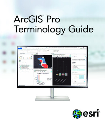
ArcGIS ProTerminology Guide
SharingTerminology and User Interface Cross-ReferenceArcGIS ProArcMap and Other ArcGIS Desktop ApplicationsShare contentUmbrella term referring to packaging, publishing, and sharingnew ArcGIS Pro itemsProject package (.ppkx)File type used to package an entire project (new in ArcGIS Pro)Map package (.mpkx)File type used to package a map; similar to an .mpk fileLayer package (.lpkx)File type used to package an individual layer; similar to an .lpk fileShare or publish a web layerPublish a serviceShare Web Layer panePublishing wizard and Service EditorMessages tabSimilar to the Prepare windowWeb layerServiceWeb feature layerFeature serviceWeb tile layerTile service/Cached map serviceProject template (.aptx)File type used to build a template for a new project (new inArcGIS Pro)Save As Map FileSimilar to File Save AsMap file (.mapx)Similar to an .mxd fileSave As Layer FileSimilar to Save As Layer FileLayer file (.lyrx)Similar to an .lyr fileExport MapSimilar to File Export MapTile package (.tpk)File type used to package web map or elevation tilesVector tile package (.vtpk)File type used to package vector tiles and stylesScene layer package (.slpk)File type used to package multipatch, point and point cloudfeaturesGeoprocessing package(.gpkx)File type used to share analysis servicesMobile map package (.mmpk)File type used to share maps, basemaps, locators, and networksto mobile apps
Essential Terminology or Functionality That’s New to ArcGIS ProSimilar Concepts in OtherArcGIS Desktop ApplicationsArcGIS ProUsageProjectA collection of related geographic datasets, maps,layouts, tools, settings, and resources, saved in an.aprx fileMapThe project item used to display and work withgeographic data in two dimensions (A map opensin a map view.)Data frameSceneThe project item used to display and work withgeographic data in three dimensionsGlobal scene: ArcGlobe document (.3dd)Local scene: ArcScene document (.sxd)RibbonThe rectangular area across the top of theapplication composed of tabs that containsoftware functionalityUser interface menus and toolbarsTab on theribbonA region on the ribbon that groups relatedsoftware commandsToolbarViewThe window representing the primary work area ofthe applicationSimilar to a map view or layout view, but therecan be other types in ArcGIS ProActive viewThe view that currently has keyboard focus (Theactive view controls the contents of the ribbon.)Active data framePaneA dockable window that contains a related set ofcommandsDockable windowGalleryA rectangular window or menu that presents anarray or grid of visual choicesTaskA set of preconfigured steps to guide usersthrough a workflow or business processQuick AccessToolbarA collection of icons located on the title bar thatprovides shortcuts to commonly used commandsPortalConnection to an ArcGIS Online or Portal forArcGIS organizationSimilar to ArcGIS Administrator Add PortalConnection. In ArcGIS Pro, connect to aportal on the Project tab Portals tabScreenTipsPop-up info tips that appear when you hover overthe ribbonHover over a button on a toolbarKeyTipsSmall tips that appear when you press the Alt keyand show keyboard shortcuts for the ribbonPress Alt and an underlined letterRangeOptional dynamic filter that can be applied to amap based on numeric valuesHas the similar concept in other Desktopapps of a Geoprocessing ServiceProject pane is renamed to Catalog paneWeb ToolAn analysis tool that runs through the web or ona serverArcPy.daPython module for data accessArcPy.naPython module for network analysisArcPy.saPython module for spatial analysisArcPy.wmxPython module for workflow managementSimilar to functionality in the Task AssistantManager extension
General ItemsTerminology and User Interface Cross-ReferenceArcGIS ProArcMap and Other ArcGIS Desktop ProductsContents paneTable of Contents windowCatalog pane andCatalog viewSimilar to the Catalog windowMap viewData viewLayout viewLayout view; layout of an ArcMap document (.mxd)Select item in Contentspane to open additionalribbon tabs and toolsRight-click item in Contents window to access the context menu(This is still available in ArcGIS Pro.)Explore toolContains functionality of Pan, Zoom, and other navigation tools, andHTML Pop-Up and Identify toolsClick with the Explore toolGet a pop-up window about what you clicked; similar to HTMLPop-Up and Identify toolsAttributes paneSimilar to the Attributes and Identify Results windows, alsoallows editingDefault project databaseDefault map (or scene or globe) document geodatabaseLocate paneFind toolAdd FolderCreate Folder ConnectionEdit tab on the ribbonEditor toolbarGeoprocessing pane(opened from the Analysistab)Search tools, show the system toolbox, and run geoprocessingtools; similar to ArcToolbox window and tool dialog boxesGeoprocessing HistoryResults windowFields, Subtypes, andDomains viewsFeature Class Properties and Geodatabase Propertiesdialog boxesProject tab OptionsContains settings for customizing ArcGIS ProData tab Export Features(opens Copy Features tool)Right-click a layer in the table of contents Data Export DataActive PortalDefault connection to the ArcGIS Online or Portal for ArcGISorganization where you share and search for content
Mapping and VisualizationTerminology and User Interface Cross-ReferenceArcGIS ProArcMap and Other ArcGIS Desktop ApplicationsSymbology paneSymbology tab on the Layer Properties dialog boxSymbology pane GallerySymbol SelectorSymbology pane PropertiesSymbol Property EditorPoint symbolMarker symbolPolygon symbolFill symbolColor schemeColor rampStyle FileStyle FileFavorites stylePersonal styleProject stylesReferenced stylesPreset layerA prebuilt layer embedded in ArcGIS Pro that only requires adata sourceRaster functionsSimilar to Image Analysis window Processing section, butexposes all functions and more functionalityAppearance tab for rastersSimilar to Image Analysis window Display sectionActivate map frame on a layoutSimilar to focus data frame on a layoutElement paneElement property dialog boxesSave As Layout FileSimilar to File Save AsLayout file (.pagx)Similar to templatesArcPy.mpSignificant update to the ArcPy.mapping module for Pythonscripting
EditingArcGIS ProSimilar Concepts in Other ArcGIS Desktop ApplicationsEditing is enabled at alltimesStart editingActive Select tool on theModify Features paneEdit toolCreate Features paneCreate Features windowModify Features paneContains tools for editing features, similar to those on editingtoolbarsManage Templates paneOrganize Feature Templates windowReposition toolbarContains Move, Scale, and Rotate tools, similar to those onediting toolbarsConstruction toolbarContains segment construction tools, similar to those onediting toolbarsVertices toolbarEdit Vertices toolbarAdditional ArcGIS ResourcesArcGIS Online: arcgis.comWhat’s New in ArcGIS: esri.com/whatsnewSupport: esri.com/supportTraining: esri.com/trainingBooks: esri.com/esripressCopyright 2017 Esri. All rights reserved. Esri, the Esri globe logo, ArcGIS, ArcMap, ArcGlobe, ArcScene, ArcToolbox, arcgis.com, and esri.com are trademarks,service marks, or registered marks of Esri in the United States, the European Community, or certain other jurisdictions. Other companies and products orservices mentioned herein may be trademarks, service marks, or registered marks of their respective mark owners.G78102
ArcGIS Pro Usage Similar Concepts in Other ArcGIS Desktop Applications Project A collection of related geographic datasets, m

