Transcription
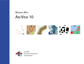
Working WithArcView 10Amy HillierUniversity of PennsylvaniaSchool of Design
Introduction to this ManualThis manual is intended for undergraduate and graduate studentslearning to use ArcGIS 10 in a classroom setting. It is meant to be acomplement, rather than substitute, for ArcGIS software manuals, Esritraining products, or the ArcGIS help options. It reflects the order andemphasis of topics that I have found most helpful while teaching introductory GIS classes in urban studies, social work, and city planning. Iexpect that it will be particularly helpful to people new to GIS who maybe intimidated by conventional software manuals. It may also be helpfulas a resource to those who have completed a course in ArcGIS but don’talways remember how to perform particular tasks. This manual does nottry to be comprehensive, focusing instead on the basic tools and functionsthat users new to GIS should know how to use. Those who master thesebasic functions should have the skills to learn about additional tools, usingthe ArcGIS help menus, or just exploring additional menu options, toolbards, and buttons.Each section in the manual introduces a general group of functions inArcGIS, providing step by step instructions for using a set of tools withscreen captures and a video showing those steps through screen captures.One of the most difficult parts of learning how to use GIS is matchingwhat you know you want to do in layman’s or conceptual terms to thespecific tool and technical language of ArcGIS. The table of contentsprovides an overview of the tools and functions covered, but you mayfind it just as helpful to use Adobe Acrobat’s “find” function.The other challenge is trouble-shooting. ArcGIS products include anenormous range of functionality which allows it to meet the needs of aH i l l ie r U si n gA r c v ie w1 0wide range of users. But this wide range also results in what can be anoverwhelming and sometimes temperamental product. Figuring outwhy things don’t work is key to getting ArcGIS to do what you want itto do and minimizing your frustration. The section on trouble-shootingat the end of this manual is intended to help identify common problemsand solutions.This manual is intended to be shared. You do not need my permissionto share this with a friend or even post it on a course website. BecauseI am continually updating it, I always appreciate feedback, whetheryou found a typo or spelling mistake or want to suggest a better way ofexplaining particular concepts and techniques. The best way to succeedwith GIS is to make learning how to use it a collective process, so pleasejoin me in making GIS work for us.Amy HillierUniversity of Pennsylvaniaahillier@design.upenn.eduGraphic Design by Caitlin Bowler, MCP ‘08
Table of Contents1 IntroductionIntroduction to ArcGIS4 Modifying Attributes2Working with Tables7 Creating New Geographic Files43Editing Shapefiles65Geoprocessing66Extensions for ArcGIS3Calculating Values45Introduction to ArcMap4Calculating Area, Perimeter & Length47Managing & Saving Files12Creating XY Coordinates47Data Formats152 Spatial DataGeorectifying ImagesWorking with Projections18213 Making MapsJoining Tables485 Creating & AggregatingPoint8 DigitizingCreating New Shapefiles69Digitizing w/Merge Tool70Creating a MaskGeocoding49Spatial Joins53709 Density Maps7110 Working With 3D6 Querying & MeasuringSymbolizing Points24Symbolizing Polygons27Querying by Attribute5632Querying by Location5711 Animating Time Series DataDesigning Map Layouts36Measuring Distances58Animation Toolbar76Multiple-Map Layouts40Buffers59Tracking Analyst78Exporting Maps42Labeling FeaturesCalculating Distance w/Spatial JoinsCalculating Network DistancesDistance between Matched Pairs3D Analyst7360616412 Cartograms7913 Trouble-Shooting80
1 Introduction to arcgisArcGIS is a collection of software products created by Environmental SystemsResearch Institute (Esri)--the Microsoft of GIS software--that includes desktop,server, mobile, hosted, and online GIS products. This introduction provides anArcViewArcView is the desktop version of ArcGIS meant for a general (non-professional)overview of all of the products, but this manual focuses on the desktop applica-audience. It is the most popular desktop GIS software program, but it is not thetions, only.only one. Even though it is the “baby” desktop GIS product within the Esri familyof products, it is still over-kill for most basic GIS projects. Some people will callthis “ArcGIS” rather than “ArcView.” They are one in the same; ArcView is part ofthe ArcGIS collection, so it is a more specific way to describe the software.ArcEditorMap made by Shimrit KeddemDesktop GIS ProductsArcEditor includes all the functionality of ArcGIS, adding the ability to editfeatures in a multiuser geodatabase so that multiuser editing and versioning arepossible. ArcEditor also adds the ability to edit topologically integrated featuresThe desktop GIS products allow users to integrate and edit data, create newin a geodatabase. The student version of ArcGIS that Esri provides is usuallymap layers, and author maps. ArcGIS desktop includes a series of scaleableArcEditor rather than ArcView.products. They are all based on the same architecture, but the more expensiveproducts have more functionality. A matrix describing what functionality isavailable for each product can be found at 0-functionality-matrix.pdf.system so that it uses the same structure as its more sophisticated GIS products.ArcGIS 3.x has similar functionality to ArcGIS 8, 9 and 10, but the products workin very different ways. That means that if you learned GIS using ArcGIS 3.x, youwill probably need to do some work to be able to use ArcGIS 10. ArcGIS 10 addssome functionality to ArcGIS 9, but those two versions work in a very similarway, so if you learned how to use ArcGIS 8 or ArcGIS 9, you should have notrouble switching to ArcGIS 10. U si n gA r c v ie wArcInfo is Esri’s professional GIS software. It includes all of the functionality inArcGIS and ArcEditor, adding some advanced geoprocessing and data conver-With the jump from ArcGIS 3.2 to ArcGIS 8, Esri brought ArcGIS into its ArcGISH i l l ie rArcInfo1 0sion capabilities. If you make a living as a GIS specialist, you’ll want access toArcInfo.ArcReaderArcReader is a free product for viewing maps. You can explore and query maplayers, but you cannot change symbology or create new data like you can inArcGIS. ArcReader is a good way to share the maps you created in ArcGIS withpeople who don’t have access to the software.2
Extensions for ArcGIS DesktopWhile the basic ArcGIS desktop products include an enormous amount offunctionality, extensions can also be purchased (some are free) that extend thisfunctionality. Many of these are specific to particular industries or data formats.The following are some of the more frequently used extensions.Spatial AnalystAllows for modeling and analysis with raster (cell-based) data. This includescreating density surfaces and conducting map algebra.3D AnalystMakes it possible to animate point data representing events at discrete timesand places. You can view events happening across time and space using the“playback” feature.Business AnalystDesigned to support business decisions through a series of advanced tools andextensive collection of industry data.CommunityVizDesigned for visualizing and analyzing land-use decisions. This product is distributed by Placeways rather than Esri.Includes ArcGlobe. Allows users to view visualize and analyze spatial data in 3D.This includes extruding polygons (such as parcels and building footprints) anddraping surfaces (such as orthophotos) on elevation models. You can also createvideo animations that simulate flying through your study area.Geostatistical AnalystThis sophisticated tool allows users to analyze raster (cell-based) and pointdata using advanced statistical methods. Methods include Kriging and inversedistance-weighting.Network AnalystAllows for network-based analysis such as routing, determining closest facility,and service areas. Unlike simple representations of street networks that can bemanipulated without this extension, networks can store information about trafficflow, one-way streets, and travel time.Tracking Analyst3Model made by Shimrit KeddemScripts for ArcGIS DesktopExtensions are simply bundles of scripts that are added together to ArcGIS.Individual scripts can also be added without purchasing whole extensions. Theseare generally written in Visual Basic, Python, or Avenue (the old programminglanguage for ESRI) by users or ESRI staff members. A large collection are available for free at http://arcscripts.esri.com/.I n t r odu c tio n
Introduction to ArcMapArcMap is where you create maps and access most of the ArcGIS functionality.You can add and edit data, query and symbolize map layers, and create maplayouts for printing.Starting ArcMapYou can launch ArcMap in more than one way. The most common way is toclick on the start menu and go to “All Programs,” then the ArcGIS folder, thenArcMap 10. If you don’t see ArcGIS in the list of programs, don’t worry, it mightstill be intstalled on your computer. Look in c:\\Program Files for a ArcGIS folder.Open the ArcGIS folder, then the Desktop 10.0 folder, then the Bin folder insidethat. Double-click on the ArcMap.exe file to start ArcMap. If it’s not there thenArcGIS is not installed on your computer.Adding DataUnless you open an ArcView .mxd file that someone else created, you will needto add data to get started. From the file menu, go to “Add data” or click onthe “Add data” button (yellow square with large black sign) on the Standardtoolbar. Navigate to the folder where you have your map layers. With ArcGIS10, you can use the “Add Data” button to access to other options: Add Basemapand Add Data From ArcGIS Online. From the “Add Basemep” option, youcan import Bing and Google aerial images, street and topo maps, and others.If you want to create a desktop icon for ArcMap (so you don’t have to gothrough all of that again), right click on the ArcMap.exe file and choose “createshortcut.” Then copy and paste the shortcut to your desktop.Through ArcGIS Online, you can import data many additional layers thatinclude data (such as zip codes with 2010 population estimates). The “Add Data”option allows you to navigate to a folder and add your own map layers.When ArcMap opens, it will ask if you want to open an blank map, use atemplate, or browse for an existing map document. When you are first creatinga map, you will probably start with a blank map so click “OK.” If the default isto add an existing project, click on “My Templates” and then “Blank Map.”H i l l ie r U si n gA r c v ie w1 04
Catalog WindowArcCatalog is a system for managing and organizing map files. One big difference with ArcGIS 10 is that a version of it (called “Catalog Window”) is integrated into ArcMap. You can still open ArcCatalog without opening ArcMap but itis much easier to use from inside ArcMap. To launch ArcCatalog within ArcMap,click on the Catalog Window. ArcCatalog will open on the far right.click on the folder named “Folder Connection” and choose “Connect Folder.”Navigate until you find the folder with your data and click “OK.” Your foldershould now be listed under “Catalog” next to a icon. One note of caution: Youdo not need to do this repeatedly. Once you have established a connection toyour folder, you will not need to do it again unless you change computers. Ifyou create a new connection to the folder each time you use ArcGIS, your pathoptions will become unmanageable. If you have one directory where you storeall your GIS files, consider connecting to that rather than each individual folderinside.You can add map layers from ArcCatalog, but you can also view and addtoolboxes, create geocoding services, edit and view metadata among other important “housekeeping” tasks. The tree within the Catalog Window will includea number of folders that are commonly used with ArcGIS. In order to add yourown map layers, you will need to “Connect to Folder” to show ArcMap wherethose other important folders reside. To create a connection to a new folder,click on the “Connect To Folder” icon at the top of the Catalog Window or rightWhen you view map layers within ArcCatalog, you see them the way ArcGISsees them. Some of the types of files used in ArcGIS, including shapefiles,coverages, and grids, are made up of multiple files that only together createa map layer. If you viewed them outside of ArcCatalog (in My Computer, forexample), you would see all of the files listed with extensions such as .dbf, .shp,5I n t r odu c tio n
.shx. Within ArcCatalog, you will see only a single file. This is especially helpfulwhen you are moving or copying data.View from Catalog WindowView from My ComputerYou can add data to ArcMap by dragging and dropping files from ArcWindow.The icons used to represent the data indicate the type of data. A light green iconwith lines (broad street line.shp) indicates a line shapefile; a light green iconwith three dots (highspeed stations.shp) indicates a point shapefile; a light greenicon with a square cut into three pieces is a polygon shapefile. An icon with awhite square and two columns of lines (BusStop TotalLines.dbf) is a table.You can view and edit the metadata for any of your files. Right click on a fileand go to “item description.” In most cases, the metadata will probably beempty. If you get into the habit of filling in at least a basic description aboutOther ArcCatalog Functionswhat the data are, who created them and when, you will make it much easierArcCatalog also has extensive search capabilities, making it possible to locateto keep track of and share your files. Click on the “Edit” button to add or changefiles based on name, location on your computer, geographic location, and date.the metadata.You can create new shapefiles in ArcCat
Scripts for ArcGIS Desktop Extensions are simply bundles of scripts that are added together to ArcGIS. Individual scripts can also be added without purchasing whole extensions. These are generally written in visual Basic, Python, or Avenue (the old programming language for ESrI) by users or ESrI staff members. A large collection are avail-
