Transcription
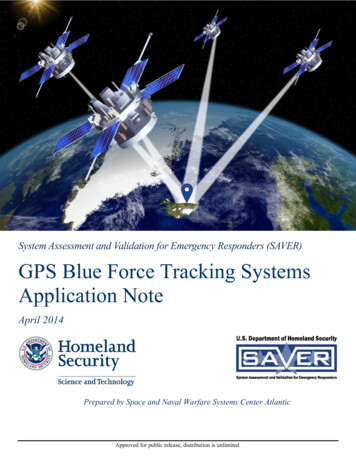
System Assessment and Validation for Emergency Responders (SAVER)GPS Blue Force Tracking SystemsApplication NoteApril 2014Prepared by Space and Naval Warfare Systems Center AtlanticApproved for public release, distribution is unlimited.
The GPS Blue Force Tracking Systems Application Note was funded under InteragencyAgreement No. HSHQPM-13-00024 from the U.S. Department of Homeland Security,Science and Technology Directorate.The views and opinions of authors expressed herein do not necessarily reflect those of theU.S. Government.Reference herein to any specific commercial products, processes, or services by tradename, trademark, manufacturer, or otherwise does not necessarily constitute or imply itsendorsement, recommendation, or favoring by the U.S. Government.The information and statements contained herein shall not be used for the purposes ofadvertising, nor to imply the endorsement or recommendation of the U.S. Government.With respect to documentation contained herein, neither the U.S. Government nor any ofits employees make any warranty, express or implied, including but not limited to thewarranties of merchantability and fitness for a particular purpose. Further, neither theU.S. Government nor any of its employees assume any legal liability or responsibility forthe accuracy, completeness, or usefulness of any information, apparatus, product, orprocess disclosed; nor do they represent that its use would not infringe privately ownedrights.The cover image was developed by Scientific Research Corporation using images providedby the National Aeronautics and Space Administration. Photographs and illustrationsincluded herein are provided by Chirange Technologies, Massachusetts Institute ofTechnology Lincoln Laboratories, Scientific Research Corporation, and WikimediaCommons.
FOREWORDThe U.S. Department of Homeland Security (DHS) established the System Assessment andValidation for Emergency Responders (SAVER) Program to assist emergency respondersmaking procurement decisions. Located within the Science and Technology Directorate (S&T)of DHS, the SAVER Program conducts objective assessments and validations on commerciallyavailable equipment and systems, and develops knowledge products that provide relevantequipment information to the emergency responder community. The SAVER Program missionincludes: Conducting impartial, practitioner-relevant, operationally oriented assessments andvalidations of emergency response equipment; and Providing information, in the form of knowledge products, that enablesdecision-makers and responders to better select, procure, use, and maintain emergencyresponse equipment.SAVER Program knowledge products provide information on equipment that falls under thecategories listed in the DHS Authorized Equipment List (AEL), focusing primarily on two mainquestions for the responder community: “What equipment is available?” and “How does itperform?” These knowledge products are shared nationally with the responder community,providing a life- and cost-saving asset to DHS, as well as to Federal, state, and local responders.The SAVER Program is supported by a network of Technical Agents who perform assessmentand validation activities. As a SAVER Program Technical Agent, the Space and Naval WarfareSystems Center (SPAWARSYSCEN) Atlantic has been tasked to provide expertise and analysison key subject areas, including communications, sensors, security, weapon detection, andsurveillance, among others. In support of this tasking, SPAWARSYSCEN Atlantic developedthis report to provide emergency responders with information on current GPS tracking systems,which fall under AEL reference number 04AP-02-OAPT Personnel Location Systems:Operations Area Personnel Tracking and Accountability, as well as AEL reference number04AP-02-DGPS Device: Global Positioning System.Visit the SAVER website on First Responder.gov (http://www.firstresponder.gov/SAVER) formore information on the SAVER Program or to view additional reports on GPS tracking systemsor other technologies.i
POINTS OF CONTACTSAVER ProgramU.S. Department of Homeland SecurityScience and Technology DirectorateFRG Stop 0203245 Murray LaneWashington, DC 20528-0215E-mail: saver@hq.dhs.govWebsite: http://www.firstresponder.gov/SAVERSpace and Naval Warfare Systems Center AtlanticAdvanced Technology and Assessments BranchP.O. Box 190022North Charleston, SC 29419-9022E-mail: ssc lant saver program.fcm@navy.milii
TABLE OF CONTENTSForeword . iPoints of Contact . ii1. Introduction .12. GPS Blue Force Tracking Systems Technology Overview .12.1 GPS Tracking Unit .22.1.1 GPS Receivers .32.1.2 Communications Modules.42.2 Tracking Software .42.3 Sensors .52.4 Mesh Nodes .63. Applications .63.1 Situational Awareness and Collaboration .63.1.1 GPS Position Location Information .73.1.2 Indoor Position Location Information .93.2 Health and Safety Monitoring .93.2.1 Personnel Biotelemetry .93.2.2 Alerts/Notifications . 104. Operational Considerations . 104.1 System Compatibility . 104.2 Component Functionality and Integration . 114.2.1 GPS Tracking Unit Accuracy and Function . 114.2.2 Data Transmission Options . 124.2.3 Transmission Intervals and Power Requirements . 124.2.4 Hosting Locations and Mapping Services. 124.2.5 Information Exchange Formats . 134.2.6 User Interfaces . 134.2.7 Secure Information Exchange . 144.2.8 Scalability and Interoperability . 144.3 Cost and Training . 155. GPS Blue Force Tracking Software . 156. Summary . 16iii
LIST OF TABLESTable 5-1. Blue Force Tracking Software . 16LIST OF FIGURESFigure 2-1. GPS Tracking Units .2Figure 2-2. Blue Force Tracking Illustration .4Figure 2-3. Mesh Network .6Figure 3-1. Position Location Information .8iv
GPS Blue Force Tracking Systems Application Note1.INTRODUCTIONThe Global Positioning System (GPS) is a constellation of more than 30 satellites orbiting theearth. These satellites broadcast radio signals that can be used to calculate and track thelocation information of people, vehicles and other assets equipped with GPS receivers. Aspecific application of this technology is blue force tracking, a term coined by the U.S. militarythat refers to monitoring the location of friendly forces’ personnel and resources in a particulararea of operation. GPS blue force tracking also includes civilian emergency responders, such asfirefighters, law enforcement, and emergency medical services (EMS) technicians. Blue forcetracking systems use GPS in combination with other technologies to increase the safety ofemergency responder personnel and offer dynamic situational awareness.Many emergency responder agencies have mutual aid agreements in place that significantlyexpand their potential areas of responsibility. GPS blue force tracking systems can help identifyfellow members of multidisciplinary and multijurisdictional teams operating together and lessenthe risk of friendly fire accidents. Real-time location information can also aid in finding injuredpersonnel and provide a common operating picture (COP) to help determine the best use ofassets. Large-scale incidents, such as the Boston Marathon bombing in April 2013 andrecurring wildfire disasters in the United States, pose complex challenges for coordinating theefforts of multiple agencies and responders across large areas.The following sections present information on GPS blue force tracking systems and theiroperational uses to assist emergency responders. This report is based on information gatheredfrom October 2013 to January 2014 from Internet searches, industry publications, andinterviews with subject matter experts.2.GPS BLUE FORCE TRACKING SYSTEMS TECHNOLOGYOVERVIEWGPS blue force tracking systems use a variety of technologies to track personnel and assets inreal time or at specified intervals. The minimum primary components include a GPS trackingunit carried by or attached to individual personnel and assets, and a software package thattypically includes a mapping application.The tracking unit consists of a GPS receiver that calculates location information and acommunications module that transmits the information. The software package collects anddisplays current personnel and asset location information in a graphical user interface (GUI)accessible to incident commanders and, in many cases, individual personnel. Increasingly, GPSblue force tracking systems incorporate a combination of GPS and other wirelesscommunications capabilities and devices. The following sections describe these components ofa blue force tracking system.Additionally, there are two technologies which enhance these systems: specialized sensors andmesh nodes. Specialized sensors monitor personnel safety. Mesh nodes are an emergingwireless technology intended to provide tracking communications in areas with traditionally poorsignal conditions (e.g., multi-story structures, underground).1
GPS Blue Force Tracking Systems Application Note2.1GPS Tracking UnitGPS tracking units (Figure 2-1) are oftencategorized according to how they log andretrieve location information, and are referredto as passive or active. Both passive andactive tracking units contain a GPS receiver todetermine the device’s current location.However, passive tracking units log and storethe data on the device for later download to acomputer, whereas active tracking units cancalculate and broadcast location informationin real time. Active tracking units transmittheir current location information to a centralFigure 2-1. GPS Tracking Unitslocation, such as a database server, using aImages Courtesy of Chirange Technologiesbuilt-in communications module. Activetracking units provide a real-time COP duringan event or incident, but passive tracking units are typically less expensive since they do notinclude a communications module suitable for real-time location reporting. Therefore, GPS blueforce tracking systems may incorporate both types of units, depending on the need to captureparticular personnel and asset movement in real time.GPS tracking units may be: Dedicated GPS devices: Standalone/autonomous devices whose primary function isGPS tracking and/or navigation; and GPS-enabled mobile devices: Devices such as smartphones, tablets, laptops, radios,and cameras that include GPS functionality.The chosen form of a tracking unit depends on agency mission requirements. A GUI may ormay not be a feature of the tracking unit. The following are types of tracking units available: Bracelets and wristwatches; Handheld and pocketable devices; Tablets; Mobile or permanently-mounted devices in vehicles (discussed in detail in theAutomatic Vehicle Locating Systems [AVLS] SAVER publications, available on theSAVER website [http://www.firstresponder.gov/SAVER]); Laptop computers; Portable satellite terminals; and Collars, harnesses, and chip implants for law enforcement animals (e.g., K-9s).GPS-enabled smartphones and tablets, as well as some newer models of dedicated GPS devices,are examples of tracking units that display maps and location information. These units provideincreased situational awareness.2
GPS Blue Force Tracking Systems Application Note2.1.1GPS ReceiversGPS receivers determine the location of the GPS tracking unit by utilizing high-frequency,low-power radio signals to obtain orbital and time stamp information from at least four GPSsatellites in line-of-sight. The receiver then uses this information to determine its position on theearth’s surface to within 20 meters or less, depending on receiver hardware and environmentalconditions. In most cases, the receiver translates location information into longitude, latitude,and elevation. However, some receivers use the Universal Transverse Mercator (UTM) instead.UTM is a system of global, grid-based maps that transform the earth’s three-dimensional (3-D)surface into a flat two-dimensional (2-D) surface using a mathematical formula.GPS receivers collect and store orbital information for all the GPS satellites in an almanac. Thealmanac is a general schedule of where every satellite should be at any given time. All GPSsatellites broadcast this almanac information. Additionally, each satellite transmits its ownephemeris data (i.e., precise corrections for any deviations/errors specific to that individualsatellite’s predicted orbit). The receiver combines this data to more accurately determinelocation information.Adverse signal conditions can slow or prevent the receiver from downloading the necessaryalmanac and ephemeris data. This process can take significant time and if the receiver loses thesignal, it must start over. Assisted GPS and differential GPS, as explained below, are techniquesthat can aid in acquiring more accurate location information. Assisted GPS (A-GPS): A-GPS offers an alternative to downloading data from thesatellites alone. A-GPS can lessen the time the receiver needs to determine its initialposition, referred to as time-to-first-fix (TTFF), by obtaining fresh almanac andephemeris data from wireless network resources instead. When GPS signals are weakor unavailable, A-GPS-equipped receivers can also calculate proximity to cellulartowers or Wi-Fi base stations with precisely known GPS coordinates to determineposition. Smartphones typically include A-GPS capability. Differential GPS (DGPS): DGPS is a technique that improves positional accuracy. Ithelps correct errors from radio signals bouncing off of large objects, such asskyscrapers, or when signals weaken from passing through walls, tree cover, orvariations in the atmosphere. A DGPS-equipped receiver uses fixed, ground-basedreference stations to determine the effect of local environmental conditions on satellitesignals. A fixed, ground-based station occupies a known position, and can thereforereadily calculate its own receiver’s current signal inaccuracy. The station thenbroadcasts to all DGPS-equipped receivers in the area, providing signal correctiondata. Within 10 seconds, the roving receiver can apply this position correction to itsown location information and be accurate within 10 meters.o Wide-Area Augmentation System (WAAS): WAAS is a DGPS systemoriginally developed to assist in aerial navigation. It consists of many groundreference stations positioned across the United States that monitor and correcterrors in GPS signals. Two master stations, one on each coast, then collect all thereference station data and create a GPS correction message. This message is thenuplinked to one of two fixed-orbit satellites, where it can then be broadcast toWAAS-enabled receivers. Accuracy is often within 3 meters.3
GPS Blue Force Tracking Systems Application Note2.1.2Communications ModulesOnce the GPS receiver determines the tracking unit’s current location, a communications modulewithin that tracking unit transmits this location information through a wireless communicationsservice, such as Wi-Fi, broadband, cellular network, or satellite Internet, depending on thespecific GPS product and service plan. Access to multiple transmission options helps ensurecommunications are not interrupted or lost in environments where a particular type of wirelessservice proves unreliable due to poor signal conditions.Many systems leverage the strengths of both GPS and wireless communications technology totrack personnel and assets. GPS is typically utilized for determining outdoor locationinformation, and wireless for improved indoor tracking.2.2Tracking SoftwareBlue force tracking software often utilizes a robust geographic information system (GIS)mapping application to track movement of personnel and assets in real time or at specifiedintervals. This process is illustrated in Figure 2-2. Blue force tracking software collects andinterprets dynamic location information from multiple tracking units and displays it in agraphical interface. In addition to the mapping application, software products are likely toinclude middleware invisible to the end user, but necessary for fulfilling important backbone andinfrastructure requirements.Figure 2-2. Blue Force Tracking IllustrationPhoto Courtesy of Massachusetts Institute of Technology (MIT) Lincoln LaboratoriesIt is not uncommon for blue force tracking systems to be incorporated into larger, morecomprehensive software packages that offer an extended range of tools for overall incidentcommand support. These systems may offer cross-platform solutions that function on more thanone type of operating system, such as Microsoft Windows and Apple Mac OS X , or morethan one mobile operating system like Google Android and Apple iOS. Cross-platform4
GPS Blue Force Tracking Systems Application Noteproducts often leverage common standards-based software to promote use on different operatingsystems.The kind of software package chosen may influenc
a blue force tracking system. Additionally, there are two technologies which enhance these systems: specialized sensors and mesh nodes. Specialized sensors monitor personnel safety. Mesh nodes are an emerging wireless technology intended