Transcription
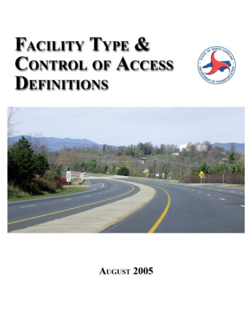
INTRODUCTIONThe NCDOT Facility Types and Control of Access Definitions document was prepared to create a set of easy tounderstand and consistent definitions for all roadways for NCDOT and its partners to use in the planning,design, and operations processes. The definitions are primarily based on the function of the roadway, level ofmobility and access, and whether the facility has traffic signals, driveways, and/or medians. These definitionswere developed from a committee comprised of members from the Federal Highway Administration and thefollowing NCDOT branches: Traffic Engineering, Highway Design, Project Development, and TransportationPlanning. The North Carolina Board of Transportation adopted these definitions on September 2, 2004 as a partof the Statewide Transportation Plan.The facility type definitions are identical to those used in a Comprehensive Transportation Plan (CTP), withthe exception of Thoroughfares. In a CTP, Thoroughfares are further broken down to Major Thoroughfares andMinor Thoroughfares. In this document, both Major and Minor Thoroughfares fall into the generalThoroughfares description.The first section this document provides descriptions of the different facility types with examples as they existat the time this document was created. The facility types are listed in order of the level of mobility provided(highest to lowest). This is followed by the definitions of the different types of control of access and acomparison chart. The second section of this document provides illustrative examples that show variouselements of each of the different facility types. These illustrations are not drawn to any particular scale.This document was revised in August 2005 in order to simplify the facility type definitions. The originalExpressway Type I and Type II definitions were consolidated into one Expressway definition. Similarily, theBoulevard Type I and Type II definitions were consolidated into one Boulevard definition.An electronic version of this document is available f/NCDOT Facility Types.pdf (Acrobat Reader required).Document Prepared by:NCDOT-Transportation Planning BranchSystems Planning UnitAttn: David S. Wasserman, P.E.1554 Mail Service CenterRaleigh, NC 27699-1554(919) 715-5482 ext. 380Illustrative Examples Prepared by:NCDOT-Highway Design BranchVisualization UnitRaleigh, NC 27699-1582(919) 250-4016
NORTH CAROLINA DEPARTMENT OF TRANSPORTATIONFACILITY TYPESListed in Order of Mobility FunctionAdopted by the North Carolina Board of TransportationSeptember 2, 2004FreewaysUS 74 in WaynesvilleUS 264 east of I-95 (Wilson Bypass)I-40/85 in Orange CountyUS 64 in Rocky Mount Functional Purpose: High Mobility, Low Access AASHTO Design Classification: Interstate orFreeway Posted Speed Limit: 55 mph or greater Control of Access: Full Traffic Signals: Not Allowed Driveways: Not Allowed Cross-Section: Minimum 4 Lanes with a Median Connections: Provided only at Interchanges; AllCross Streets are Grade-Separated Median Crossovers: Public-use Crossovers NotAllowed; U-turn Median Openings for Use byAuthorized Vehicles Only when Need is Justified Examples: I-40, I-95, US 64 between Rocky Mountand Williamston, US 52 between Lexington andMount Airy, US 70 between Kinston and New Bern,US 74 near Waynesville, US 264 east of I-95(Wilson Bypass), US 1 between Raleigh andSanford
NORTH CAROLINA DEPARTMENT OF TRANSPORTATIONFACILITY TYPESListed in Order of Mobility FunctionAdopted by the North Carolina Board of TransportationSeptember 2, 2004ExpresswaysUS 221 (Marion Bypass) Functional Purpose: High Mobility, Low toModerateAccess AASHTO Design Classification: Arterial Posted Speed Limit: 45 mph to 60 mph Control of Access: Limited or Partial Traffic Signals: Not Allowed Driveways:Limited Control of Access - Not AllowedPartial Control of Access - One DrivewayConnection per Parcel; Consolidate and/orShare Driveways and Limit Access toConnecting Streets or Service Roads; Restrict toRight-in/Right-out Cross-Section: Minimum 4 Lanes with a Median Connections: Provided only at Interchanges forMajor Cross Streets and At-Grade Intersections forMinor Cross Streets; Use of Acceleration andDeceleration Lanes for At-Grade Intersections Median Crossovers: Allowed; Alternatives to AllMovement Crossovers Encouraged; MinimumSpacing between All-Movement Crossovers is 2000feet (posted speed limit of greater than 45 mph) or1200 feet (posted speed limit of 45 mph or less) Examples: US 221 (Marion Bypass), US 220 inRockingham County, US 321 south of Lenoir, US117 north of I-40; US 74 (Independence Blvd) justeast of I-277 in Charlotte, US 74 west ofWaynesville, US 29 in Guilford County, US 301north of Wilson, US 64 in ApexUS 117 north of I-40US 74 west of WaynesvilleUS 64 in Apex
NORTH CAROLINA DEPARTMENT OF TRANSPORTATIONFACILITY TYPESListed in Order of Mobility FunctionAdopted by the North Carolina Board of TransportationSeptember 2, 2004BoulevardsUS 70 east of Clayton Functional Purpose: Moderate Mobility, Low toModerate Access AASHTO Design Classification: Arterial orCollector Posted Speed Limit: 30 mph to 55 mph Control of Access: Limited, Partial, or None Traffic Signals: Allowed Driveways:Limited Control of Access - Not AllowedPartial Control of Access - One DrivewayConnection per Parcel; Consolidate and/orShare Driveways and Limit Access toConnecting Streets or Service Roads; Restrict toRight-in/Right-out Cross-Section: Minimum 2 Lanes with a Median Connections: At-Grade Intersections for Majorand Minor Cross Streets (Occasional Interchange atMajor Crossing); Use of Acceleration andDeceleration Lanes Median Crossovers: Allowed; Minimum Spacingbetween All-Movement Crossovers is 2000 feet(posted speed limit of greater than 45 mph) or 1200feet (posted speed limit of 45 mph or less) Examples: US 70 between Clayton and Smithfield,NC 55 (Holly Springs Bypass), NC 11 (KenansvilleBypass), NC 87 (Elizabethtown Bypass), US 158(Murfreesboro Bypass), US 70 near Havelock, NC24 (Harris Boulevard) in Charlotte, US 1 (CapitalBlvd) in Raleigh, US 74 through Monroe, US 117south of Goldsboro, US 70 east of Goldsboro, CaryParkway, NC 132 (College Road) in Wilmington,Lochmere Drive in Cary, US 74 in RangerNC 24 (Harris Boulevard) in CharlotteUS 74 near RangerCary Parkway
NORTH CAROLINA DEPARTMENT OF TRANSPORTATIONFACILITY TYPESListed in Order of Mobility FunctionAdopted by the North Carolina Board of TransportationSeptember 2, 2004Thoroughfares Functional Purpose: Moderate to Low Mobility,High Access AASHTO Design Classification: Collector orLocal Posted Speed Limit: 25 mph to 55 mph Control of Access: None Traffic Signals: Allowed Driveways: Allowed with Full Movements;Consolidate or Share Connections, if possible Cross-Section: Minimum 2 Lanes; No Median;Includes All Facilities with a Two Way Left TurnLane Connections: Primarily At-Grade Intersections Median Crossovers: Not Applicable Examples: Old Concord Road in Charlotte,Hillsborough Street in Raleigh, Shamrock Road inCharlotte, Trinity Road in RaleighOld Concord Road in CharlotteHillsborough Street in RaleighShamrock Road in CharlotteTrinity Road in Raleigh
NORTH CAROLINA DEPARTMENT OF TRANSPORTATIONCONTROL OF ACCESS DEFINITIONSListed in Order of Mobility FunctionAdopted by the North Carolina Board of TransportationSeptember 2, 2004Full Control of AccessConnections to a facility provided only via ramps at interchanges. All cross-streets are grade-separated. Noprivate driveway connections allowed. A control of access fence is placed along the entire length of the facilityand at a minimum of 1000 feet beyond the ramp intersections on the Y lines (minor facility) at interchanges (ifpossible).Limited Control of AccessConnections to a facility provided only via ramps at interchanges (major crossings) and at-grade intersections(minor crossings and service roads). No private driveway connections allowed. A control of access fence isplaced along the entire length of the facility, except at intersections, and at a minimum of 1000 feet beyond theramp intersections on the Y lines (minor facility) at interchanges (if possible).Partial Control of AccessConnections to a facility provided via ramps at interchanges, at-grade intersections, and private driveways.Private driveway connections are normally defined as a maximum of one connection per parcel. Oneconnection is defined as one ingress and one egress point. The use of shared or consolidated connections ishighly encouraged. Connections may be restricted or prohibited if alternate access is available through otheradjacent public facilities. A control of access fence is placed along the entire length of the facility, except atintersections and driveways, and at a minimum of 1000 feet beyond the ramp terminals on the minor facility atinterchanges (if possible).No Control of AccessConnections to a facility provided via ramps at interchanges, at-grade intersections, and private driveways. Nophysical restrictions, i.e., a control of access fence, exist. Normally, private driveway connections are definedas one connection per parcel. Additional connections may be considered if they are justified and if suchconnections do not negatively impact traffic operations and public safety.
Public-use Crossovers NotAllowed; U-turn MedianMedian Crossovers Openings for Use by AuthorizedVehicles Only when Need isJustifiedConnectionsMinimum 2 Lanes; No Median;Minimum 4 Lanes with a Median Minimum 4 Lanes with a Median Minimum 2 Lanes with a Median Includes Facilities with Two WayLeft Turn LaneCross-SectionProvided only at Interchanges;All Cross Streets are GradeSeparatedNot AllowedAt-Grade Intersections for mostMajor and Minor Cross Streets(Occasional Interchange at MajorCrossing); Use of Accelerationand Deceleration Lanesbetween All-MovementCrossovers is 2000 feet (postedspeed limit of greater than 45mph) or 1200 feet (postedspeed limit of 45 mph or less)Primarily At-Grade IntersectionsCrossovers is 2000 feet (postedNot Applicablespeed limit of greater than 45mph) or 1200 feet (postedspeed limit of 45 mph or less)Allowed; Alternatives to AllMovement CrossoversAllowed; Minimum SpacingEncouraged; Minimum Spacing between All-MovementProvided only at Interchanges forMajor Cross Streets and At-GradeIntersections for Minor CrossStreets; Use of Acceleration andDeceleration Lanes for At-GradeIntersectionsPartial Control of Access - OneDriveway Connection per Parcel;Consolidate and/or ShareDriveways and Limit Access toConnecting Streets or ServiceRoads; Restrict to Right-in/RightoutDrivewaysPartial Control of Access - OneAllowed with Full Movements;Driveway Connection per Parcel;Consolidate or ShareConsolidate and/or ShareConnections, if possibleDriveways and Limit Access toConnecting Streets or ServiceRoads; Restrict to Right-in/RightoutLimited Control of Access - NotAllowedAllowedAllowedLimited Control of Access - NotAllowedNot AllowedNot AllowedNoneTraffic SignalsLimited or PartialLimited or Partial25mph to 55 mphCollector or LocalModerate to Low Mobility, HighAccessThoroughfaresFull30 mph to 55 mphArterial or CollectorModerate Mobility, Low toModerate AccessBoulevardsControl of AccessPosted Speed Limit 55 mph or greater45 mph to 60 mphArterialAASHTO DesignClassificationInterstate or FreewayHigh Mobility, Low to ModerateAccessExpresswaysFunctional Purpose High Mobility, Low AccessFreewaysNCDOT FACILITY TYPES COMPARISON CHART
REFERENCES1. American Association of State Highway and Transportation Officials (AASHTO), A Policy on GeometricDesign of Highways and Streets, 4th Edition, 20012. North Carolina Department of Transportation (NCDOT), Design Manual, 20023. North Carolina Department of Transportation (NCDOT), Policy on Street and Driveway Access to NorthCarolina Highways, 20034.North Carolina Department of Transportation (NCDOT), Median Crossover Guidelines, 2004
The NCDOT Facility Types and Control of Access Definitions document was prepared to create a set of easy to understand and consistent definitions for all roadways for NCDOT and its partners to use in the planning, design, and operations processes. The definitions are primarily based on the function of the roadway, level of