Transcription
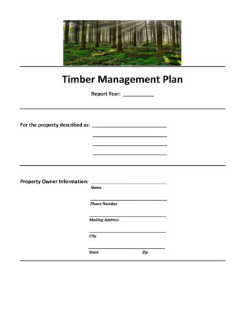
Timber Management PlanReport Year:For the property described as:Property Owner Information:NamePhone NumberMailing AddressCityStateZip
(This template is provided to assist Hardin County land owners who have adequate timber managementexperience prepare their own timber management plan. The use of this format is not mandatory. However, theelements listed herein are required to be in a valid plan. Submitting your plan in this format, or having a planprepared by other parties does not guarantee qualification of your tract. You should consult the District’spublication entitled “Hardin County Appraisal District Productivity Guidelines” or contact the District if you havequestions. Finally, while the use of a professional timber consultant is not required, you may wish to consultwith a professional in the planning of your timber operation.)PRODUCER INFORMATIONThe following land owner submits this document to outline a plan of management for the below described timbertract(s): (if more than one legal owner, attach additional pages)Owner Name:Mailing Address:City, State, Zip:Telephone No.DESCRIPTION OF THE OVERALL TRACT(S)The following information will define the overall tract of land that is used in the production of timber or timberproducts. Aerial or survey maps of the parcel(s) have been included in the appendix of this document. The mapsdenote the boundaries of the tract(s). They may be used to manage activities, inventory or as a confirmation ofproduction.The overall tract(s) of land is described on the appraisal roll of the local appraisal district as:(Attach additional pages as necessary)Tract 1Tract 2Tract 3Abstract Number(s)Abstract Name(s)Block Number(s)Tract Number(s)Parcel ID(s)Acreage(s)AcresAcresAcresTotal Combined Acreage in managed timber production: acres
DESCRIPTION OF INDIVIDUAL GROWING STANDSWithin the overall tract of managed land, there are the following Stands*. Aerial or survey maps are included inthe appendix of this plan that show the boundaries of each individual Stand and the reference name or number ofthe Stand is labeled on the map(s).(Attach additional pages as necessary)The following standards for Stand composition have been used:Pine – the Stand is more than 2/3 pine treesHardwood – the Stand is more than 2/3 hardwood treesMixed – the Stand is comprised of both pine and hardwood trees but do not meet the standard ofdominance above*(If there is only one Stand for the overall tract, complete the section for Stand 1 only)GROWING STAND 1Name and/or Reference Number of Stand:Size of Stand in acres:Composition of Stand: PineMixed HardwoodPrior History of Stand:The approximate year this Stand was established:The approximate year this Stand was last thinned:The approximate year this stand was last harvested:Type of harvest: Clear CutSelect CutFuture production of Stand:The anticipated year this Stand will be thinned:The anticipated year this Stand will be harvested:Regeneration of Stand:This Stand will be regeneratedAnticipated Means of Regeneration: Seedlings Seed Trees Coppice OtherAnticipated Species of Regeneration: Pine Hardwood MixedThis Stand will not be regenerated
GROWING STAND 2Name and/or Reference Number of Stand:Size of Stand in acres:Composition of Stand: PineMixed HardwoodPrior History of Stand:The approximate year this Stand was established:The approximate year this Stand was last thinned:The approximate year this stand was last harvested:Type of harvest: Clear CutSelect CutFuture production of Stand:The anticipated year this Stand will be thinned:The anticipated year this Stand will be harvested:Regeneration of Stand:This Stand will be regeneratedAnticipated Means of Regeneration: Seedlings Seed Trees Coppice OtherAnticipated Species of Regeneration: Pine Hardwood MixedThis Stand will not be regeneratedGROWING STAND 3Name and/or Reference Number of Stand:Size of Stand in acres:Composition of Stand: PineMixed HardwoodPrior History of Stand:The approximate year this Stand was established:The approximate year this Stand was last thinned:The approximate year this stand was last harvested:Type of harvest: Clear CutSelect CutFuture production of Stand:The anticipated year this Stand will be thinned:The anticipated year this Stand will be harvested:Regeneration of Stand:This Stand will be regeneratedAnticipated Means of Regeneration: Seedlings Seed Trees Coppice OtherAnticipated Species of Regeneration: Pine Hardwood MixedThis Stand will not be regenerated
DESCRIPTION OF INDIVIDUAL RESTRICTED STANDSState law provides for zones of timber where harvesting is restricted. These zones are specified under the law asbeing streamside managements zones, aesthetic management zones or zones set aside due to critical wildlifehabitat**. (You must submit the Comptroller’s Form 50-281 for restricted timber land)This plan, in compliance with the law, prohibits timber harvesting from the restricting zones described below*.Aerial or survey maps are included in the appendix of this plan that show the boundaries of each individualrestricted Stand and the reference name or number of the Stand is labeled on the map(s). (Attach additional pagesas necessary)The following standards for Stand composition have been used:Pine – the Stand is more than 2/3 pine treesHardwood – the Stand is more than 2/3 hardwood treesMixed – the Stand is comprised of both pine and hardwood trees but do not meet the standard ofdominance above*(If there is only one Stand for the overall tract, complete the section for Stand 1 only)**(Critical wildlife habitat is reserved for species listed as endangered or threatened under the Endangered Species Act of1973 or it subsequent amendments, or listed as endangered under Section 68.002 of the Parks and Wildlife Code.)RESTRICTED STAND 1Name and/ or Reference Number of Stand:Size of Stand in acres: Composition of Stand: Pine Mixed HardwoodType of Restricted Zone:This Stand has been established for streamside management.The zone is set by best management practices as being feet from each bank of the:RiverStream CreekLakeIntermittent watershedThis zone width has been determined based upon the slope of the surrounding terrain, quality of erodiblesoils and other factors. Sufficient trees and undergrowth have been left to assist in preventing sedimentsand timber debris from impacting the waterway.This Stand has been established for the following type of aesthetic management zone:The zone is set by best management practices as being feet alongside:HighwayCounty RoadF.M.This zone has been established by the director of the Texas Forest Service as being special or unique.(Attach designation from the director of TFS)This Stand has been established for a critical wildlife habitat for the following species of animaland/or plant: , , , that are listed underthe: Endangered Species Act of 197368.002 Parks & Wildlife Code.A written agreement with the following federal, state or private organization responsible for theprotection of the species listed is attached.
The zone has been established to provide the following benefits to protect these species:Providing Supplemental Supplies of: WaterFoodHabitat Control Erosion Control Predator ControlProviding Shelter Assisting in Population Census CountsRESTRICTED STAND 2Name and/ or Reference Number of Stand:Size of Stand in acres: Composition of Stand: Pine Mixed HardwoodType of Restricted Zone:This Stand has been established for streamside management.The zone is set by best management practices as being feet from each bank of the:RiverStream CreekLakeIntermittent watershedThis zone width has been determined based upon the slope of the surrounding terrain, quality of erodiblesoils and other factors. Sufficient trees and undergrowth have been left to assist in preventing sedimentsand timber debris from impacting the waterway.This Stand has been established for the following type of aesthetic management zone:The zone is set by best management practices as being feet alongside:HighwayCounty RoadF.M.This zone has been established by the director of the Texas Forest Service as being special or unique.(Attach designation from the director of TFS)This Stand has been established for a critical wildlife habitat for the following species of animaland/or plant: , , , that are listed underthe: Endangered Species Act of 197368.002 Parks & Wildlife Code.A written agreement with the following federal, state or private organization responsible for theprotection of the species listed is attached.The zone has been established to provide the following benefits to protect these species:Providing Supplemental Supplies of: WaterFoodHabitat Control Erosion Control Predator ControlProviding Shelter Assisting in Population Census Counts
RESTRICTED STAND 3Name and/ or Reference Number of Stand:Size of Stand in acres: Composition of Stand: Pine Mixed HardwoodType of Restricted Zone:This Stand has been established for streamside management.The zone is set by best management practices as being feet from each bank of the:RiverStream CreekLakeIntermittent watershedThis zone width has been determined based upon the slope of the surrounding terrain, quality of erodiblesoils and other factors. Sufficient trees and undergrowth have been left to assist in preventing sedimentsand timber debris from impacting the waterway.This Stand has been established for the following type of aesthetic management zone:The zone is set by best management practices as being feet alongside:HighwayCounty RoadF.M.This zone has been established by the director of the Texas Forest Service as being special or unique.(Attach designation from the director of TFS)This Stand has been established for a critical wildlife habitat for the following species of animaland/or plant: , , , that are listed underthe: Endangered Species Act of 197368.002 Parks & Wildlife Code.A written agreement with the following federal, state or private organization responsible for theprotection of the species listed is attached.The zone has been established to provide the following benefits to protect these species:Providing Supplemental Supplies of: WaterFoodHabitat Control Erosion Control Predator ControlProviding Shelter Assisting in Population Census Counts
LIST AND SCHEDULE OF MANAGEMENT ACTIVITIESThe following management activities will be performed over the course of production. These activities may beused to confirm active devotion to timber management.Control of undergrowthTimber management includes the control of growth under the forest canopy. These controls promote the healthof the timber stand and reduce available fuel for forest fires. As a means of controlling vegetation andunderbrush within and around these timber Stands, the following activities will be performed.Method(s) of vegetation control:MethodMechanical (mow/mulch)Control BurnHerbicide ApplicationOtherExpected DateStand(s)Maintenance of BoundariesState law recognizes the application of purple paint as an indication of no trespassing. In order to establish andmaintain the boundaries of this managed timber tract, this plan provides for maintaining clear boundary markersusing paint, signs or other appropriate methods.Method(s) of boundary maintenance:MethodPaintSignsFencingOtherExpected dateStand(s)
LIST AND SCHEDULE OF MANAGEMENT ACTIVITIES, CONTINUEDFire LanesIn the event of a fire threat, the plan provides that fire breaks be established around the perimeter of theproperty, Stands or other natural delineations of the property. The fire break is designed to deny fuel to a fire andallow access for firefighting equipment. Once established, these fire breaks shall be maintained as needed.ActivityFire Break EstablishedMaintenance Scheduled:DateStand(s)RoadsTo provide access to this tract(s), roads may have been constructed as a component of timber management. Theroads should be constructed in a manner to protect creeks, streams or other waterways from sediment runoff.Roads not required due to layout of tract(s)RoadDateRoad EstablishedType of Road: DirtMaintenance Scheduled:GravelStand(s)Other:LIST AND SCHEDULE OF MANAGEMENT ACTIVITIES, CONTINUED
Salvage and SanitationIn the event that the producer locates dead or diseased trees in the Stand(s), steps will be taken to remove thetrees from the Stand in a prudent manner. A salvage harvest may be performed to harvest and recoup dead ordying trees that can be sold as timber products. A sanitation harvest may be performed to remove diseased treesfrom the Stand in order to prevent the spread of infection.ActivitySalvage HarvestSanitation HarvestADDITIONAL NOTES:PLAN CERTIFICATIONDateStand(s)
The undersigned certify that the information provided by this plan is true and correct to the best of theirknowledge. Further, it is affirmed that the tract(s) specified herein constitute timber management for theproduction of timber or timber products as the primary use of the land.Signature of Owner(s) (Attach additional pages as necessary)SignatureDatePrint NameSignatureDatePrint NameSignatureDatePrint NameIf this plan has been prepared by a third party on behalf of the land owner(s), the following certification must besigned:The undersigned certify that the information provided by this plan is true and correct to the best of theirknowledge.Signature of Preparer:SignatureDatePrint NameTitleName of Firm or AgencyATTACHMENTSThere are pages of attachments such as maps and surveys, and other necessary documents includedwith this plan. A general list of those attachments:No Attachments have been added to this plan.
The overall tract(s) of land is described on the appraisal roll of the local appraisal district as: (Attach additional pages as necessary) Tract 1 Tract 2 Tract 3 . Timber management includes the control of growth under the forest canopy. These controls promote the health