Transcription
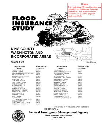
NoticeThis preliminary FIS report includes onlyrevised Flood Profiles and FloodwayData tables. See “Notice to FloodInsurance Study Users” page foradditional details.KING COUNTY,WASHINGTON ANDINCORPORATED AREASVolume 1 of 4King CountyCOMMUNITYNAMECOMMUNITYNUMBER*ALGONA, CITY OFAUBURN, CITY OF*BEAUX ARTS VILLAGE, TOWN OFBELLEVUE, CITY OFBLACK DIAMOND, CITY OFBOTHELL, CITY OFBURIEN, CITY OFCARNATION, CITY OF*CLYDE HILL, CITY OFCOVINGTON, CITY OFDES MOINES, CITY OFDUVALL, CITY OFENUMCLAW, CITY OFFEDERAL WAY, CITY OF*HUNTS POINT, TOWN OFISSAQUAH, CITY OFKENMORE, CITY OFKENT, CITY OFKING COUNTY,UNINCORPORATED AREASKIRKLAND, CITY OFLAKE FOREST PARK, CITY OF*MAPLE VALLEY, CITY 0336530080COMMUNITYNAME*MEDINA, CITY OF*MERCER ISLAND, CITY OFMUCKLESHOOT INDIANRESERVATIONNEWCASTLE, CITY OFNORMANDY PARK, CITY OFNORTH BEND, CITY OFPACIFIC, CITY OFREDMOND, CITY OFRENTON, CITY OFSAMMAMISH, CITY OFSEATAC, CITY OFSEATTLE, CITY OFSHORELINE, CITY OFSKYKOMISH, TOWN OFSNOQUALMIE, CITY OFTUKWILA, CITY OFWOODINVILLE, CITY OF*YARROW POINT, TOWN No Special Flood Hazard Areas IdentifiedPRELIMINARY:Federal Emergency Management AgencyFlood Insurance Study Number53033CV001B
NOTICE TOFLOOD INSURANCE STUDY USERSCommunities participating in the National Flood Insurance Program haveestablished repositories of flood hazard data for floodplain management andflood insurance purposes. This Flood Insurance Study (FIS) report may notcontain all data available within the Community Map Repository. Pleasecontact the Community Map Repository for any additional data.The Federal Emergency Management Agency (FEMA) may revise andrepublish part or all of this FIS report at any time. In addition, FEMA mayrevise part of this FIS report by the Letter of Map Revision process, which doesnot involve republication or redistribution of the FIS report. Therefore, usersshould consult with community officials and check the Community MapRepository to obtain the most current FIS report components.Selected Flood Insurance Rate Map panels for this community containinformation that was previously shown separately on the corresponding FloodBoundary and Floodway Map panels (e.g., floodways, cross sections). Inaddition, former flood hazard zone designations have been changed as follows:Old Zone(s)New ZoneAl through A30V1 through V30BCAEVEXXInitial Countywide FIS Effective Date: September 29, 1989Revised Countywide Date(s): May 16, 1995May 20, 1996March 30, 1998November 8, 1999December 6, 2001April 19, 2005To Be DeterminedThis preliminary FIS report does not include unrevised Floodway Data Tablesor unrevised Flood Profiles. These Floodway Data Tables and Flood Profileswill appear in the final FIS report.
TABLE OF CONTENTSVolume 1Page1.02.0INTRODUCTION . 11.1Purpose of Study . 11.2Authority and Acknowledgements . 11.3Coordination . 61.3.1 Revision 1 – Miller Creek. 161.3.2 Revision 2 – Snoqualmie River . 161.3.3 Revision 3 – Raging River . 161.3.4 Revision 4 – North Fork Issaquah Creek, Bear Creek, Evans Creek, MiddleFork Snoqualmie River, South Fork Skykomish River, UpperMiddle Fork Snoqualmie River, North Fork River, Tate Creek,South Fork Snoqualmie River . 161.3.5 Revision 5 – North Creek . 181.3.6 Revision 6 – Tolt River, Upper South Fork Snoqualmie River . 181.3.7 Revision 7 – Snoqualmie River, Issaquah Creek . 181.3.8 Revision 8 – Patterson Creek, Lower Snoqualmie River, Springbrook Creek,Cedar River, Green River . 191.3.9 Revision 9 – Puget Sound, Sammamish, White River . 20AREA STUDIED . 212.1Scope of Study . 212.1.1 Revision 1 – Miller Creek. 282.1.2 Revision 2 – Snoqualmie River . 292.1.3 Revision 3 – Raging River . 292.1.4 Revision 4 – North Fork Issaquah Creek, Bear Creek, Evans Creek, MiddleFork Snoqualmie River, South Fork Skykomish River, UpperMiddle Fork Snoqualmie River, North Fork River,Tate Creek . 292.1.5 Revision 5 – North Creek . 302.1.6 Revision 6 – Tolt River, Upper South Fork Snoqualmie River . 312.1.7 Revision 7 – Snoqualmie River, Issaquah Creek . 312.1.8 Revision 8 – Patterson Creek, Lower Snoqualmie River, Springbrook Creek,Cedar River, Green River, Kelsey Creek. 322.1.9 Revision 9 – Puget Sound, Sammamish River, White River . 332.2Community Description . 342.3Principal Flood Problems . 412.3.1 Revision 1 – Miller Creek. 542.3.2 Revision 2 – Snoqualmie River . 552.3.3 Revision 3 – Raging River . 55i
Table of Contents (continued)Volume 12.3.42.3.52.3.62.3.72.3.82.3.92.43.0Revision 4 – North Fork Issaquah Creek . 55Revision 5 – North Creek . 56Revision 6 – Tolt River, Upper South Fork Snoqualmie . 56Revision 7 – Snoqualmie River . 56Revision 8 – Patterson Creek, Lower Snoqualmie River, Springbrook Creek,Cedar River, Green River, Kelsey Creek . 57Revision 9 – Puget Sound, Sammamish River, White River . 59Flood Protection Measures . 602.4.1 Revision 1 – Miller Creek. 642.4.2 Revision 2 – Snoqualmie River . 642.4.3 Revision 3 – Raging River . 642.4.4 Revision 4 – North Fork Issaquah Creek . 652.4.5 Revision 5 – North Creek . 652.4.6 Revision 6 – Tolt River, Upper South Fork Snoqualmie . 652.4.7 Revision 7 – Snoqualmie River, Issaquah Creek . 652.4.8 Revision 8 – Patterson Creek, Cedar River, Green River, Kelsey Creek . 652.4.9 Revision 9 – Puget Sound, Sammamish River, White River . 66ENGINEERING METHODS . 673.1Hydrologic Analyses. 673.1.1 Revision 1 – Miller Creek. 733.1.2 Revision 2 – Snoqualmie River . 753.1.3 Revision 3 – Raging River . 753.1.4 Revision 4 – North Fork Issaquah Creek, Bear Creek, Middle ForkSnoqualmie River, South Fork Skykomish River, North ForkSnoqualmie River . 753.1.5 Revision 5 – North Creek . 783.1.6 Revision 6 – Tolt River, Upper South Fork Snoqualmie, Middle andSouth Fork Snoqualmie River . 793.1.7 Revision 7 – Snoqualmie River, Issaquah Creek . 803.1.8 Revision 8 – Patterson Creek, Lower Snoqualmie River, Springbrook Creek,Cedar River, Green River, Kelsey Creek. 833.1.9 Revision 9 – Sammamish River, White River . 863.2Hydraulic Analyses . 1003.2.1 Revision 1 – Miller Creek. 1053.2.2 Revision 2 – Snoqualmie River . 1073.2.3 Revision 3 – Raging River . 108ii
Table of Contents (continued)Volume 13.2.43.2.53.2.63.2.73.2.83.2.9Revision 4 – North Fork Issaquah Creek, Bear Creek, Evans Creek, CottageCreek, Middle Fork Snoqualmie River, South Fork SkykomishRiver, North Fork Snoqualmie River. 109Revision 5 – North Creek . 120Revision 6 – Tolt River, Upper South Fork Snoqualmie . 122Revision 7 – Snoqualmie River, Issaquah Creek . 123Revision 8 – Patterson Creek, Lower Snoqualmie River, Springbrook Creek,Cedar River, Green River, Kelsey Creek. 1283.2.8.1Springbrook Creek. 1413.2.8.2Green River . 144Revision 9 – Sammamish River, White River . 154Volume 23.33.44.0Wave Height Analysis . 161Vertical Datum . 162FLOODPLAIN MANAGEMENT APPLICATIONS . 1654.14.24.34.4Floodplain Boundaries . 166Floodways . 167Base Flood Elevations . 250Velocity Zones . 2505.06.0INSURANCE APPLICATION . 251FLOOD INSURANCE RATE MAP . 2527.0OTHER STUDIES . 2538.0LOCATION OF DATA . 2539.0BIBLIOGRAPHY AND REFERENCES . 25510.0REVISION DESCRIPTIONS . 27010.110.210.310.410.510.610.710.810.9First Revision . 270Second Revision . 271Third Revision . 272Fourth Revision. 272Fifth Revision . 273Sixth Revision . 273Seventh Revision . 274Eighth Revision. 275Ninth Revision . 282iii
Table of Contents (continued)FIGURESVolume 2Figure 1 – Transect Schematic . 162Figure 2 – Floodway Schematic . 250TABLESVolume 1Table 1 – USGS Gages . 68Table 2 – Summary of Discharge . 89Table 3 – Summary of Elevations . 100Table 4 – Manning's “n” values . 159Volume 2Table 5 – Datum Conversion Factors . 163Table 6 – Floodway Data . 169Table 7 – Community Map History . 254EXHIBITVolume 2Exhibit 1 – Flood ProfilesBear CreekNo ProfileBig Soos CreekBlack RiverCedar RiverCherry CreekCoal CreekDes Moines CreekEast Branch of West Tributary Kelsey CreekEast Fork Issaquah 40P41P-44P45P-47P
Table of Contents (continued)EXHIBIT (continued)Volume 2 (continued)Exhibit 1 – Flood Profiles (continued)Evans ume 3Forbes CreekGardiner CreekGilman Boulevard Overflow Issaquah CreekGreen RiverHolder CreekIssaquah CreekKelsey CreekLittle Bear CreekLongfellow CreekLower OverflowLyon CreekMaloney CreekMay CreekMay Creek TributaryMcAleer CreekMercer CreekMeydenbauer CreekMiddle Fork Snoqualmie RiverMiddle OverflowMill Creek-AuburnMill Creek-KentMiller CreekNorth Branch Mercer Creek (North Valley)North CreekNo ProfileNorth Fork Issaquah CreekNorth Fork Meydenbauer CreekNorth Fork Snoqualmie RiverNorth Fork Thornton CreekPatterson CreekPatterson Creek Overflow ReachRaging RiverRichards CreekVolume 4Richards Creek East TributaryRichards Creek West Tributaryv
Table of Contents (continued)EXHIBIT (continued)Volume 4 (continued)Exhibit 1 – Flood Profiles (continued)Right Channel Mercer CreekRolling Hills CreekSammamish RiverSnoqualmie RiverSnoqualmie River Overflow Reach 1Snoqualmie River Overflow Reach 2Snoqualmie River Overflow Reach 3Snoqualmie River Overflow Reach 4Snoqualmie River Overflow Reach 5Snoqualmie River Overflow Reach 6South Fork Skykomish RiverSouth Fork Snoqualmie River (Without Levee)South Fork Snoqualmie River (With Levee)South Fork Snoqualmie River (Without Left Levee)South Fork Snoqualmie River (Without Right Levee)South Fork Thornton CreekSpringbrook CreekSW 23rd Street Drainage ChannelSwamp CreekSwamp Creek OverbankThornton CreekTibbetts CreekTolt River (With Levee)Tolt River (Without Left Levee)Tolt River (Without Right Levee)Upper North OverflowUpper South OverflowVasa CreekWalker CreekWest Fork Issaquah CreekWest Tributary Kelsey CreekWhite RiverWhite River (Left Bank Overflow)Yarrow SHED SEPARATELYFlood Insurance Rate Map IndexFlood Insurance Rate 0P281P-282P283P-287P288P-293P294P295P-296P
FLOOD INSURANCE STUDYKING COUNTY, WASHINGTON AND INCORPORATED AREAS1.0INTRODUCTION1.1Purpose of StudyThis Flood Insurance Study (FIS) investigates the existence and severityof flood hazards in the geographic area of King County, Washington,including the Cities of Algona, Auburn, Bellevue, Black Diamond,Bothell, Burien, Carnation, Clyde Hill, Covington, Des Moines, Duvall,Enumclaw, Federal Way, Issaquah, Kenmore, Kent, Kirkland, Lake ForestPark, Maple Valley, Medina, Mercer Island, Newcastle, Normandy Park,North Bend, Pacific, Redmond, Renton, Sammamish, SeaTac, Seattle,Shoreline, Snoqualmie, Tukwila, Woodinville, the Towns of Beaux ArtsVillage, Hunts Point, Skykomish, Yarrow Point, the Muckleshoot IndianReservation, and the unincorporated areas of King County (hereinafterreferred to collectively as King County), and aids in the administration ofthe National Flood Insurance Act of 1968 and the Flood DisasterProtection Act of 1973. This study has developed flood risk data forvarious areas of the community that will be used to establish actuarialflood insurance rates and to assist the community in its efforts to promotesound floodplain management.Minimum floodplain managementrequirements for participation in the National Flood Insurance Program(NFIP) are set forth in the Code of Federal Regulations at 44 CFR, 60.3.Please note that the City of Milton is geographically located in King andPierce Counties. The flood-hazard information for the City of Milton isfor information purposes only. See Pierce County separately publishedFIS report and FIRM for City of Milton.Please note that the Cities of Algona, Clyde Hill, Maple Valley, Medina,and Mercer Island and the Towns of Beaux Arts Village, Hunts Point, andYarrow Point have No Special Flood Hazard Areas Identified.In some States or communities, floodplain management criteria orregulations may exist that are more restrictive or comprehensive than theminimum Federal requirement. In such cases, the more restrictive criteriatake precedence and the State (or other jurisdictional agency) will be ableto explain them.1.2Authority and AcknowledgmentsThe sources of authority for this FIS are the National Flood Insurance Actof 1968 and the Flood Disaster Protection Act of 1973.1
The hydrologic and hydraulic analyses for the original King County studywere performed by the U.S. Army Corps of Engineers (USACE), SeattleDistrict, for the Federal Emergency Management Agency (FEMA), underInter-Agency Agreement No. IAA-H-2-73, Project Order No. 14, andInter-Agency Agreement No. IAA-H-19-74, Project Order Nos. 1 and 15.This study was completed in August 1976. The Enplan Corporation,Consulting Engineers, Kirkland, Washington, assisted in the transfer ofmap data from photomosaic and topographic maps to the report workmaps for the Seattle District, USACE.The hydrologic and hydraulic analyses for the Tolt River were performedby the U.S. Soil Conservation Service (SCS) for Flood Hazard Analyses,Tolt River, and King County, Washington.Hydrologic and hydraulic analyses for the communities of King Countywere performed by study contractors and are summarized below:ContractNumberCompletionDateCH2M HillNorthwest, Inc.,for FEMACH2M HillNorthwest, Inc.,for FEMAEMW-85-C-1893June 1987EMW-85-C-1893June 1987Portion of UpperGreen River ValleyUSACE,Seattle District,February 1988upstream from Auburnfor FEMAInter-AgencyAgreement No.IAA-EMW-E1153Project Order No.1City of Auburn(original study)Tudor EngineeringCo., for FEMAH-4025,Amendment 4May 1978City of Auburn(revised study)CH2M HillNorthwest, Inc.,for FEMAEMW-85-C-1893June 1987CommunityContractorKing County(revised study)City of Seattle(revised study)2
y of BellevueUSGS, WaterResourcesDivision for FEMAInter-AgencyAgreement No.IAA-H-8-76,Project Order No.3May 1977City of CarnationCH2M Hill, Inc.,for FEMAHarper Houf Righeliis Inc.H-4600August 1978N/AMay 2002City of Des MoinesCH2M Hill, Inc.,for FEMAH-4600September 1978City of DuvallCH2M Hill, Inc.,for FEMANHC Inc.H-4600September 1978N/AN/ACity of IssaquahTudor EngineeringCo. for FEMAH-4025September 1977City of KentTudor EngineeringJune 1979(original study)Co. for FEMAH-4025Amendment No.13City of Kent(revised study)CH2M HillNorthwest, Inc.,for FEMAEMW-85-C-1893June 1988City of KirklandTudor EngineeringCo., for FEMAH-4025December 1977City of Lake Forest ParkCH2M Hill, Inc.,for FEMAH-4600August 1978City of Normandy ParkCH2M Hill, Inc.,for FEMAH-3815June 1976City of North BendCH2M Hill, Inc.,for FEMAH-4600October 2001City of PacificCH2M Hill, Inc.,for FEMAH-4600April 19793
ContractNumberN/ACompletionDateAugust 1977CommunityCity of RedmondContractorTudor EngineeringCo., for FEMACity of Redmond(additional hydrologic andhydraulic analyses)USACE, SeattleDistrict forFEMAN/AAugust 1976City of Renton(original study)Tudor EngineeringCo. for FEMAH-4025July 1979City of Renton(revised study)CH2M Hill,Northwest, Inc.,for FEMAEMW-85-C-1893June 1987Town of SkykomishCH2M Hill, Inc.,for FEMAH-4600July 1979Town of SnoqualmieCH2M Hill, Inc.,for FEMA(additional datafrom USACE)H-4810July 1981City of TukwilaTudor EngineeringApril 1979Co., for FEMAH-4025AmendmentNo.10King CountyUnincorporated AreasRevision 1NHC Inc.EMW-90-C-3134September 1991City of SeaTacRevision 1NHC Inc.EMW-90-C-3134September 1991City of BothellRevision 1NHC Inc.EMW-90-C-3134September 1991City of Normandy ParkRevision 1NHC Inc.EMW-90-C-3134September 1991City of SnoqualmieRevision 2NHC Inc.EMW-90-L-3134May 19954
CommunityContractorContractNumberKing CountyRevision 3Harper Righellis Inc, PortlandN/AMay 20, 1996King CountyUnincorporated AreasRevision 4Harper RighellisNHC Inc.EMW-93-C-4152December 2001Town of SkykomishRevision 4Harper RighellisCity of IssaquahRevision 4NHC Inc.EMW-93-C-4152September 1995City of RedmondRevision 4NHC Inc.EMW-93-C-4152September 1995City of BothellRevision 5NHC Inc.EMW-93-C-4152April 1994King CountyUnincorporated AreasRevision 6Harper HoufRighhellis Inc.December 2001King CountyUnincorporated AreasRevision 6Montgomery WaterGroup Inc.December 2001City of IssaquahRivision 6Montgomery WaterGroup Inc.N/AAugust 2001City of Snoqualmie/City ofNorth Bend/King CountyHarper Righellis Inc.N/AOctober 2001City of SnoqualmieRevision 7Harper Righellis Inc.N/AApril 2005City of Issquah/KingCountyRevision 7Montgomery Water GroupInc.N/AAugust 2001Revision 75CompletionDateDecember 2001
ContractorContractNumberCompletionDateConcept Engineering Inc.N/AN/AKing CountyRevision 8NHC Inc. and King CountyHarper Righellis Inc.N/AN/ACity of RentonRevision 8NHC Inc.N/AJune 2006City of DuvalRevision 8NHC Inc.N/AJune 2006NHC Inc.**NHC Inc.**NHC Inc.E00126E08*CommunityCity of Issaquah/KingCountyRevision 7City of Bothell/ City ofKenmore/ City ofRedmond/ City ofWoodinville/ King CountyRevision 9King CountyRevision 9City of Burien/ City of DesMoines/ City of FederalWay/ City of NormandyPark/ City of Seattle/ City ofShoreline/ King*Data Not AvailableBase map information shown on the FIRM for Revision 9 was derivedfrom multiple sources. Base map files were provided in digital format byKing County GIS, WA DNR, WSDOT, and Pierce County GIS. Thisinformation was compiled at scales of 1:12,000 to 24,000 during the timeperiod of 1994 – 2012.1.3CoordinationThe coordination for the original King County FIS was completed inmulti-agency conferences managed by the FEMA Consultation andCoordination Officer (CCO). The State of Washington Department ofEcology provided input to establish the study priority and the contractingagency. The King County Division of Hydraulics offered valuableassistance to the USACE and the study contractor, in establishing thescope of the original study, coordinating basic data, and defining6
approximate floodplain boundaries. Topographic maps at contourintervals of five feet, which served as part of the input for the hydraulicanalysis and the location of the floodplain boundary lines, were suppliedby the King County Department of Public Works. The county alsoprovided information on certain elevation reference marks.Contacts with the private engineering firms of Bush Roed and Hitchings,Inc., of Seattle, and Horton Dennis and Associates, Inc., of Seattle, weremade during the study to discuss field surveys they had conducted.Permission to enter restricted areas for field surveys was obtained from theCity of Seattle and the Chicago, Milwaukee, St. Paul, and PacificRailroad.The final CCO meeting was held at the offices of the King County PublicWorks Department on June 25, 1976. King County officials objected tothe ―equal conveyance‖ floodways that were developed in accordancewith FEMA guidelines, wanting to apply more stringent floodway criteria.They were especially concerned about the Snoqualmie River, fearing thatthe loss of valley storage would increase peak discharges if the fringe werefilled.The initial coordination meeting for the original City of Auburn study washeld on April 8, 1976. At this meeting, streams to be studied by detailedmethods were identified by representatives of the community, the studycontractor, and FEMA. During the course of the work, numerous informalcontacts were made by the study contractor with the community for thepurpose of obtaining data and base maps.On March 17, 1978, the results of the work were reviewed at anintermediate coordination meeting attended by representatives of the city,the study contractor, and FEMA.The results of the original study were reviewed at a final CCO meetingheld on December 6, 1978. Attending the meeting were representatives ofFEMA, the study contractor, and the city. This study incorporates allappropriate comments, and all problems have been resolved.The initial coordination meeting for the City of Bellevue study was held inApril 1975. This meeting was attended by personnel of the U.S.Geological Survey (USGS), FEMA, and officials of the Bellevue Planningand Storm Drainage Utility Departments. Community base maps wereselected and streams requiring detailed study were identified.A search for basic data was made at all levels of government.Topographic maps with a 5-foot contour interval were supplied by the7
Bellevue city engineer; these served as preliminary work maps ondetermining the location of floodplain boundary lines. Some locations andelevations of bench marks were provided by the city and verified byUSGS levels.During the course of the work by the USGS, flood elevations, floodplainboundaries, and floodway delineations were reviewed with communityofficials. On April 29, 1977, the results of the work by the USGS werereviewed at a final CCO meeting attended by personnel of the USGS,FEMA, and officials of the Bellevue Planning and Storm Drainage UtilityDepartments.The initial coordination meeting for the City of Carnation was held in theCarnation Town Hall on July 29, 1977. At the meeting, flooding sourcesfor the City of Carnation were defined and the areas to be studied wereidentified. Representatives from the City of Carnation, CH2M Hill, Inc.(the study contractor), and FEMA attended the meeting.Throughout the study, coordination was maintained with the USACE,King County hydraulics division, town officials, Sammamish Valleynewspaper, Carnation Planning Commission, and King County PlanningCommission. All were contacted to provide information pertinent to thisFIS.The results of the original study were reviewed at a final CCO meetingheld on December 19, 1978. Attending the meeting were representativesof FEMA, the study contractor, and the city. No problems were raised atthe meeting.The initial coordination meeting for the City of Des Moines was held onAugust 19, 197
Flood Insurance Study Number 53033CV001B King County. . 2.1.1 Revision 1 - Miller Creek.28 2.1.2 Revision 2 - Snoqualmie River .29 2.1.3 Revision 3 - Raging River.29 2.1.4 Revision 4 - North Fork Issaquah Creek, Bear Creek, Evans Creek, Middle .