Transcription
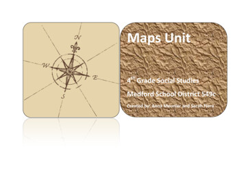
Maps Unit4th Grade Social StudiesMedford School District 549cCreated by: Anna Meunier and Sarah Flora
Maps Unit4th Grade Social StudiesMedford School District 549c
Table of ContentsMaps Unit Syllabus . 1Maps Unit Objectives . 2Maps Unit Lesson Plans . 3Print Shop Order . 4Maps Unit Lessons . 5Maps Daily Lessons . 12Lesson #1 .Lesson #2 .Lesson #3 .Lesson #4 .Lesson #5 .Lesson #6 .Lesson #7 .Lesson #8 .Lesson #9 .Lesson #10 .Lesson #11 .Lesson #12 .Lesson #13 .Lesson #14 .Print Shop Black Line Masters . 70
Oregon Content Standards Alignment Template—“Hitting the Mark”Name:Sarah Flora, Anna MeunierCurriculum Alignment Template forUnit Name:Social Studies(subject area)MapsUnit Objectives:Geography: 5. Apply skills, concepts, and technologies (e.g., maps, GIS, Google Earth)to gather, display, and analyze special information.Unit SyllabusDefine basic geography vocabulary andinterpret maps: Location Cardinal directions Intermediate directions Distance Scale Latitude Longitude Key/legend Hemispheres Continents Oceans Prime Meridian EquatorState Standards Covered4.8. Use geographical tools (e.g., maps,GPS, Google Earth) to identify absoluteand relative locations and physicalcharacteristics of places in Oregon.Lessons #1-#14Page 1
Oregon Content Standards Alignment Template- “Course Overview”Team Members: Sarah Flora, Anna MeunierCourse Title: MapsCourse Objective:GeographyThe learner will: Identify and use cardinal and intermediate directions on a compass rose. Locate and label the continents and oceans on a world map. Locate and label the four hemispheres on a world map. Locate and label the Prime Meridian and Equator on a world map. Apply the use of lines of latitude and longitude to determine a location on amap. Apply the use of a key/legend on a map. Apply scale by calculating distance on a map.Page 2
These lesson plans were written as a guideline to teach map skills. The resource used with this unit is MapSkills, Teaching a Variety of Map Skills. The lessons in this unit are directly tied to the fourth grade statestandards. The print shop order on the following page is for the worksheets needed to teach this unit aswritten.Each lesson should take from 30-45 minutes.The rest of the lessons and worksheets are also valuable map skills. You are encouraged to implement theother lessons and worksheets for homework, sponge activities or for “Weekly Map Skills” lessons. Thoseworksheets are not included on the print shop order form.The section marked “Teaching Tips” of the Lesson Plans was inserted to alert you to potential problemsthat could arise in each lesson. These are problems that were encountered while piloting this unit.These lessons are a work in progress. We would like to add and build upon them from year to year. If youfind a problem with any lesson, have another way to teach it, or would like to provide feedback, please feel freeto contact us: anna.meunier@medford.k12.or.us or sarah.flora@medford.k12.or.usAbbreviations KeyTETeachers Edition:Map Skills, Teaching a Variety of Map SkillsWSWorksheetMaps UnitPage 3
Publication Print Shop Order for worksheets needed to teach map unit.Number ofcopiesneededMaps UnitPage #3, 4 & 5789101121 & 23252730333738495255, 56 & 576662Chapter ReviewChapter TestColor/papertypeIndexHole punched Back to Back StapledOverheadNeeded Page 4
DayObjectives12Locate andlabel thecontinents andoceans on aworld map.Lesson PlanMaterials:Map SkillsReviewing map skillsTE Page #2Students complete WS 3, 4 & 5WS 3, 4, 5TE Page # 6Students complete blank map on WS 7 usingmap on WS 9.WS 7 & 9EXTENSION:WS 8 has added practice if time permits oruse for homework.Teaching TipUse when teachingclassroomprocedures the firstweek. IE How to passout papers, seatwork, raising hand,etc.Colored pencilsDo not copy back toback. Students needto look at both WS atthe same time. Also,make extra copies ofpage 7 for studentswho finish early forcutting out & makinga globe.Copy page 9 on indexpaper and havestudents keep. Theywill need this map tocomplete the reviewat the end of the unit.CurriculumIntegrationExplain to studentsthere are not two PacificOceans as implied onthe worksheet. Cut outmap on WS 7 and form itinto a globe using tape.Capitalization ofproper nounsMake oceans &continents spellingwords.Be sure to point out thatthe numbers on thecontinents & oceansmust match thenumbered blanks. (#1South America)Answers must be spelledcorrectly and capitalized.Colored pencilsWall MapGlobeWS 8 if timepermits or forhomework.Maps UnitPage 5
3Locate andlabel the fourhemisphereson a worldmap.TE Page #6 (“Teaching Suggestions” #5)Students complete WS 10 & 11WS 10 & 11 (Donot copy back to back.Students need to lookat both WS at thesame time.)Answers must be spelledcorrectly & capitalized.Capitalization ofproper nouns.The WS does not takevery long. Showstudents how to use acompass. Find north,south, east & west inyour classroom. Placethe direction signs in theproper place.WS 22 is very difficultfor students. Thewording of thequestions isawkward. This wouldbe a good lesson toreinforce classroommanagementstrategies on what todo when you arestumped and whenyou need to wait forhelp.Globe4Identify anduse cardinaldirections.TE Page #20Students complete WS 21 and WS 23EXTENSION:Use classroom direction signs to play“4 Corners” in the classroom. One student isblindfolded, everyone goes to a differentcorner (direction), the blindfolded studentmust call out the direction and point to it,and those students sit down. Play until onlyone player is left.“Simon Says” using the directions. Forexample, “Simon says point to the north.”5Identify anduseintermediatedirections on acompass rose.TE Page #24Students complete WS 25 & 27EXTENSION:See “Additional Activities” #2 on TE Page#24.WS 26 is very difficult for students. Thewording of the questions is awkward.Maps UnitWS 21 & 23Direction signs(North, South,East & West)TE #1CompassWS 25 & 27Explain to students thatthe top of the paper isalways north and thebottom is always south.The wording of thequestions on WS 25 isdifficult for the students.You may need to doseveral of them togetheras a class.Page 6
6TE Page #28 & #32Apply the useof a key/legend Students complete WS 30 & 33on a map.EXTENSION:See “Additional Activities” on TE 28 & 32.7Apply scale bycalculatingdistance on amap.TE Page #36Students complete WS 37 & 38EXTENSION:See “Additional Activities” #1 on TE 24WS 30 & 33Explain to students thatwhen a question asksabout what is north ofthe street, it means theentire street, not justthe section above thestreet name.Capitalization ofproper nouns.WS 37 & 38Most rulers do not startat the edge of the ruler.Students need to knowto start measuring fromthe line, not the end ofthe ruler.How to measureusing a ruler.Overhead rulerRuler for eachstudentDistance is not alwaysexact on copies.Students need to knowto go to the closestbenchmark whenmeasuring.How to measurefractions of an inch.Capitalization ofproper nouns.WS 38 will use a fractionof an inch whenmeasuring scale.Go over question #2together.8MathLessonMaps UnitWS 43 - 47These WS reinforcemath concept forcoordinate grids.Page 7
9Locate andlabel theequator on amap.Apply the useof lines oflatitude todeterminelocation on amap.Maps UnitTE Page #48Students complete WS 49WS 49Colored pencilsReinforce the unit ofmeasurement is indegrees. It is in thedirections at the top ofWS 49, but studentsoverlook this.Math: Use aprotractor to showhow the degrees aremeasured to createlines of latitude.Reinforce that thenumbers are the same,but it is the north andsouth of the equatorthat is important.Page 8
10Apply the useof lines oflatitude todeterminelocation on amap.More practiceStudents complete WS 52WS 52Reteach that theboundaries of the statesare the dashed lines. Itmay be helpful tooutline those in coloredpencil before beginning.Capitalization ofproper nouns.Reinforce that thestraight borders fall onlines of latitude; whilethe crooked borders arecreated by rivers or thePacific Ocean’scoastline.Reteach that the citynames are representedby dots, and the statenames are in bold.It is helpful to trace thelines of latitude with ahighlighter beforebeginning.Discuss where theunlabeled lines oflatitude would be placedon the map.Maps UnitPage 9
11Locate andlabel the primemeridian on amap.Apply the useof lines oflongitude todeterminelocation on amap.12Apply the useof lines oflatitude andlongitude todeterminelocation on amap.TE Page #54Students complete WS 55 & 57WS 55 & 57Be sure the students areconnecting themeridians of the map atthe bottom of WS 55 atthe two poles. Theywant to make themparallel like the lines oflatitude.Capitalization ofproper nouns.WS 66Point out to studentsthat not all states showa city and that the statesare abbreviated.Capitalization ofproper nouns.EXTENSION:WS 56 has added practice, if time permits, oruse for homework.TE Page #60Students complete WS 66EXTENSION:WS 62 has added practice and is challenging.Tell students to check off numbers as theydraw the lines on the map so they don’t getlost while doing the activity. Too difficult touse for homework.WS 62 if timepermits.Remind the studentsthat the dot representsthe closest city. (SeeSan Francisco & SanJosé.)Teach students how toestimate unlabeled linesof longitude andlatitude in between thelabeled lines.Use colored pencils todraw in unlabeled linesof latitude andlongitude.Maps UnitPage 10
13Maps ReviewMaps ReviewWS 1(NOT located inMaps SkillsWorkbook.Included in thedaily lessonplans.)World Map onWS 9RulersMaps ReviewAnswer KeyTE #214Maps TestMaps Test(NOT located inMaps SkillsWorkbook.Included in thedaily lessonplans.)Maps TestAnswer KeyTE #3RulersMaps UnitPage 11
Day1Maps UnitObjectivesLesson PlanReviewing map skillsTE Page #2Students complete WS 3, 4 & 5Materials:Map SkillsWS 3, 4, 5Colored pencilsTeaching TipCurriculumIntegrationUse when teachingclassroomprocedures the firstweek. IE How to passout papers, seatwork, raising hand,etc.
DayObjectivesLesson Plan2Locate andlabel thecontinents andoceans on aworld map.TE Page # 6Students complete blank map on WS 7 usingmap on WS 9.EXTENSION:WS 8 has added practice if time permits oruse for homework.Materials:Map SkillsWS 7 & 9Do not copy back toback. Students needto look at both WS atthe same time. Also,make extra copies ofpage 7 for studentswho finish early forcutting out & makinga globe.Copy page 9 on indexpaper and havestudents keep. Theywill need this map tocomplete the reviewat the end of the unit.Colored pencilsWall MapGlobeWS 8 if timepermits or forhomework.Maps UnitTeaching TipExplain to studentsthere are not two PacificOceans as implied onthe worksheet. Cut outmap on WS 7 and form itinto a globe using tape.Be sure to point out thatthe numbers on thecontinents & oceansmust match thenumbered blanks (#1South America).Answers must be spelledcorrectly and capitalized.CurriculumIntegrationCapitalization ofproper nounsMake oceans &continents spellingwords.
Day3ObjectivesLocate andlabel the fourhemisphereson a worldmap.Lesson PlanTE Page #6 (“Teaching Suggestions” #5)Students complete WS 10 & 11Materials:Map SkillsTeaching TipWS 10 & 11 (Donot copy back to back.Students need to lookat both WS at thesame time.)Answers must be spelledcorrectly & capitalized.GlobeMaps UnitCurriculumIntegrationCapitalization ofproper nouns.
Day4ObjectivesIdentify anduse cardinaldirections.Lesson PlanTE Page #20Students complete WS 21 and WS 23EXTENSION:Use classroom direction signs to play“4 Corners” in the classroom. One student isblindfolded, everyone goes to a differentcorner (direction), the blindfolded studentmust call out the direction and point to it,and those students sit down. Play until onlyone player is left.“Simon Says” using the directions. Forexample, “Simon says point to the north.”Maps UnitMaterials:Map SkillsWS 21 & 23Direction signs(North, South,East & West)TE #1CompassTeaching TipCurriculumIntegrationThe WS does not takevery long. Showstudents how to use acompass. Find north,south, east & west inyour classroom. Placethe direction signs in theproper place.WS 22 is very difficultfor students. Thewording of thequestions isawkward. This wouldbe a good lesson toreinforce classroommanagementstrategies on what todo when you arestumped and whenyou need to wait forhelp.
NorthSouthEastWestTE #1
DayObjectives5Identify anduseintermediatedirections on acompass rose.Lesson PlanTE Page #24Students complete WS 25 & 27EXTENSION:See “Additional Activities” #2 on TE Page#24.WS 26 is very difficult for students. Thewording of the questions is awkward.Maps UnitMaterials:Map SkillsWS 25 & 27Teaching TipExplain to students thatthe top of the paper isalways north and thebottom is always south.The wording of thequestions on WS 25 isdifficult for the students.You may need to doseveral of them togetheras a class.CurriculumIntegration
Day6ObjectivesLesson PlanApply the useTE Page #28 & #32of a key/legend Students complete WS 30 & 33on a map.EXTENSION:See “Additional Activities” on TE 28 & 32.Maps UnitMaterials:Map SkillsWS 30 & 33Teaching TipExplain to students thatwhen a question asksabout what is north ofthe street, it means theentire street, not justthe section above thestreet name.CurriculumIntegrationCapitalization ofproper nouns.
DayObjectives7Apply scale bycalculatingdistance on amap.Lesson PlanTE Page #36Students complete WS 37 & 38EXTENSION:See “Additional Activities” #1 on TE 24Materials:Map SkillsWS 37 & 38Overhead rulerRuler for eachstudentTeaching TipMost rulers do not startat the edge of the ruler.Students need to knowto start measuring fromthe line, not the end ofthe ruler.Distance is not alwaysexact on copies.Students need to knowto go to the closestbenchmark whenmeasuring.WS 38 will use a fractionof an inch whenmeasuring scale.Go over question #2together.Maps UnitCurriculumIntegrationHow to measureusing a ruler.How to measurefractions of an inch.Capitalization ofproper nouns.
Day8MathLessonMaps UnitObjectivesLesson PlanMaterials:Map SkillsWS 43 - 47Teaching TipCurriculumIntegrationThese WS reinforcemath concept forcoordinate grids.
Day9ObjectivesLocate andlabel theequator on amap.Apply the useof lines oflatitude todeterminelocation on amap.Maps UnitLesson PlanTE Page #48Students complete WS 49Materials:Map SkillsWS 49Colored pencilsTeaching TipReinforce the unit ofmeasurement is indegrees. It is in thedirections at the top ofWS 49, but studentsoverlook this.Reinforce that thenumbers are the same,but it is the north andsouth of the equatorthat is important.CurriculumIntegrationMath: Use aprotractor to showhow the degrees aremeasured to createlines of latitude.
DayObjectives10Apply the useof lines oflatitude todeterminelocation on amap.Lesson PlanMore practiceStudents complete WS 52Materials:Map SkillsWS 52Teaching TipReteach that theboundaries of the statesare the dashed lines. Itmay be helpful tooutline those in coloredpencil before beginning.Reinforce that thestraight borders fall onlines of latitude; whilethe crooked borders arecreated by rivers or thePacific Ocean’scoastline.Reteach that the citynames are representedby dots, and the statenames are in bold.It is helpful to trace thelines of latitude with ahighlighter beforebeginning.Discuss where theunlabeled lines oflatitude would be placedon the map.Maps UnitCurriculumIntegrationCapitalization ofproper nouns.
DayObjectives11Locate andlabel the primemeridian on amap.Apply the useof lines oflongitude todeterminelocation on amap.Maps UnitLesson PlanTE Page #54Students complete WS 55 & 57EXTENSION:WS 56 has added practice, if time permits,or use for homework.Materials:Map SkillsWS 55 & 57Teaching TipBe sure the students areconnecting themeridians of the map atthe bottom of WS 55 atthe two poles. Theywant to make themparallel like the lines oflatitude.CurriculumIntegrationCapitalization ofproper nouns.
DayObjectives12Apply the useof lines oflatitude andlongitude todeterminelocation on amap.Lesson PlanTE Page #60Students complete WS 66EXTENSION:WS 62 has added practice and is challenging.Tell students to check off numbers as theydraw the lines on the map so they don’t getlost while doing the activity. Too difficult touse for homework.Materials:Map SkillsWS 66WS 62 if timepermits.Teaching TipPoint out to studentsthat not all states showa city and that the statesare abbreviated.Remind the studentsthat the dot representsthe closest city. (SeeSan Francisco & SanJosé.)Teach students how toestimate unlabeled linesof longitude andlatitude in between thelabeled lines.Use colored pencils todraw in unlabeled linesof latitude andlongitude.Maps UnitCurriculumIntegrationCapitalization ofproper nouns.
Day13ObjectivesLesson PlanMaps ReviewMaterials:Map SkillsMaps ReviewWS 1(NOT located inMaps SkillsWorkbook.Included in thedaily lessonplans.)World Map onWS 9RulersMaps ReviewAnswer KeyTE #2Maps UnitTeaching TipCurriculumIntegration
Maps ReviewNameWrite the name of each continent in the correct blank. Make sure the number onthe map matches the number on the line. Capitalize and spell each namecorrectly.1.5.2. 6.3. 7.4.Write the name of each ocean in the correct blank. Make sure the letter on themap matches the letter on the line. Capitalize and spell each namecorrectly.A. C.B. D.1
Label Each Hemisphere with the Correct Name:Northern HemisphereSouthern HemisphereEastern HemisphereWestern Hemisphere2
Pretend you are an airline pilot for this activity. You will need a ruler tocalculate scale for this activity.1.2.3.4.5.3
Use the box to create the map using the symbols below:box.4
Use the coordinates below to locate each of the cities. Be sure to capitalize and spelleach city correctly.LatitudeLongitudeCity1.2.3.4.5.6.7.5
Maps Review KeyNameWrite the name of each continent in the correct blank. Make sure the number onthe map matches the number on the line. Capitalize and spell each namecorrectly.1. South America5. Antarctica2. Africa6. Australia3. Asia7. Europe4. North AmericaWrite the name of each ocean in the correct blank. Make sure the letter on themap matches the letter on the line. Capitalize and spell each namecorrectly.A. Arctic Ocean C. Atlantic OceanB. Pacific Ocean D. Indian Ocean1
Label Each Hemisphere with the Correct Name:Northern HemisphereSouthern HemisphereEastern HemisphereWestern HemisphereEastern HemisphereWestern HemisphereNorthern HemisphereSouthern Hemishere2
Pretend you are an airline pilot for this activity. You will need a ruler tocalculate scale for this activity.1.Yes2.3.4.5.NoAnswer: between 800-1,000 milesWestEast3
Use the box to create the map using the symbols below:box.4
Use the coordinates below to locate each of the cities. Be sure to capitalize and spelleach city ee3.Des Moines4.Albany5.Minneapolis6.Dallas7.Houston5
Day14ObjectivesLesson PlanMaps TestMaterials:Map SkillsMaps TestWS#2(NOT located inMaps SkillsWorkbook.Included in thedaily lessonplans.)Maps TestAnswer KeyTE #3RulersMaps UnitTeaching TipCurriculumIntegration
Maps TestChapter TestNameWrite the name of each continent in the correct blank. Make sure the number onthe map matches the number on the line.1.5.2. 6.3. 7.4.Write the name of each ocean in the correct blank. Make sure the letter on themap matches the letter on the line.A. C.B. D.1
Label Each Hemisphere with the Correct Name:Northern HemisphereSouthern HemisphereEastern HemisphereWestern Hemisphere2
Pretend you are an airline pilot for this activity. You will need a ruler tocalculate scale for this activity.3
Use the box to create the map using the symbols below:box.box.box.4
Use the coordinates below to locate each of the cities. Be sure to capitalize and spelleach city correctly.5
Maps TestChapterKeyTestNameWrite the name of each continent in the correct blank. Make sure the number onthe map matches the number on the line.1. South America5. Antarctica2. Africa6. Australia3. Asia7. Europe4. North AmericaWrite the name of each ocean in the correct blank. Make sure the letter on themap matches the letter on the line.A. Arctic Ocean C. Atlantic OceanB. Pacific Ocean D. Indian Ocean1
Label Each Hemisphere with the Correct Name:Northern HemisphereSouthern HemisphereEastern HemisphereWestern HemisphereEastern HemisphereWestern HemisphereSouthern HemisphereNorthern Hemisphere2
Pretend you are an airline pilot for this activity. You will need a ruler tocalculate scale for this activity.800 miles1,000 miles600 milesI to M3
Use the box to create the map using the symbols below:box.box.box.4
Use the coordinates below to locate each of the cities. Be sure to capitalize and spelleach city correctly.AtlantaMiamiPittsburghTulsaSan Jose or San FranciscoPhoenixSt. Louis5
The lessons in this unit are directly tied to the fourth grade state standards. The print shop order on the following page is for the worksheets needed to teach this unit as . the street, it means the entire street, not just the section above the street name. Capitalization of proper