Transcription
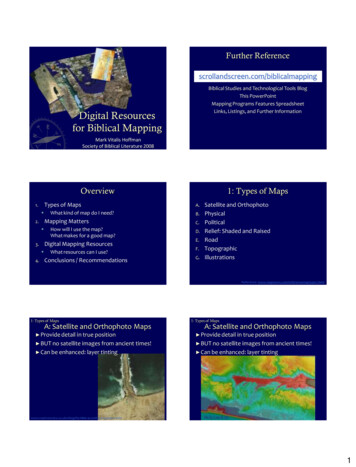
Further al Studies and Technological Tools BlogThis PowerPointMapping Programs Features SpreadsheetLinks, Listings, and Further InformationDigital Resourcesfor Biblical MappingMark Vitalis HoffmanSociety of Biblical Literature 2008OverviewTypes of Maps1. Mapping Matters2. How will I use the map?What makes for a good map?Digital Mapping Resources3. 4.What kind of map do I need?What resources can I use?Conclusions / Recommendations1: Types of MapsA.B.C.D.E.F.G.Satellite and OrthophotoPhysicalPoliticalRelief: Shaded and RaisedRoadTopographicIllustrationsReference: www.maptown.com/referencemaptypes.html1: Types of MapsA: Satellite and Orthophoto Maps1: Types of MapsA: Satellite and Orthophoto Maps Provide detail in true position Provide detail in true position BUT no satellite images from ancient times! BUT no satellite images from ancient times! Can be enhanced: layer tinting Can be enhanced: layer ccording-to-google-earth/Holy Land 3D1
1: Types of Maps1: Types of MapsB: Physical Maps Mainly used for landforms and bodies of water Provide helpful base terrainC: Political Maps Used to show boundaries of political entities Highlight key historical shiftsBibleMapperBible Atlas Onlineby Access FoundationLogos Bible AtlasBible Atlas Online by Access Foundation1: Types of Maps1: Types of MapsD: Relief Maps : Shaded and RaisedD: Relief Maps : Shaded and Raised Provide sense of the landBibleMapperBible Atlas Online by Access Foundation1: Types of MapsD: Relief Maps : Shaded and RaisedBibleWorks Map Module – Elevation Overlay1: Types of MapsD: Relief Maps : Shaded and RaisedHolyLand 3DAccordance BibleAtlas2
1: Types of Maps1: Types of MapsD: Relief Maps : Shaded and RaisedE: Road Maps Help explain historical developments Adjustable to periodExodus and JudgesRoad Map of Ancient PalestineBibleMapperGoogleEarth1: Types of MapsLogos Deluxe Map Set1: Types of MapsE: Road a Egnatia-en.jpgF: Topographic Maps Use contour linesGoogleEarthLogos Bible AtlasHoly Land 3D1: Types of Maps1: Types of MapsG: IllustrationsG: IllustrationsAccordanceBible Atlas Provide help invisualizing eventsBibleExplorer3
2: Mapping MattersA.B.C.D.E.F.G.Copyright and Fair Use ConsiderationsOrientation: N/S or E/WAccuracy, bias, coverage, appropriatenessLinked to modern locationsEdit-ability (i.e., mapping, not just maps)QualityUsing Maps2: Mapping Matters Basically okay if: Used for education or non-profit Not selling or diminishing value to owner Not making a permanent copy2: Mapping Matters Copyright and Fair Use (see web links)Section 107 of US Copyright Act contains a list ofthe various purposes for which the reproduction ofa particular work may be considered “fair,” such ascriticism, comment, news reporting, teaching,scholarship, and research. Four factors:1.purpose and character of the use, including whethersuch use is of commercial nature or is for nonprofiteducational purposes;2. nature of the copyrighted work;3. amount and substantiality of the portion used in relationto the copyrighted work as a whole; and4. effect of the use upon the potential market for or valueof the copyrighted work.http://www.copyright.gov/fls/fl102.htmlA: Copyright and Fair Use Considerations Programs and Permissions BibleMapper – no restrictions, even for commercialdistribution, with credit given GoogleEarth – maps not for commercialdistribution (?) World Wind – Open source earth viewer Creative Commons licenses (creativecommons.org)2: Mapping MattersB: OrientationorNorth /SouthA: Copyright and Fair Use Considerations2: Mapping MattersA: Copyright and Fair Use Considerations East / West2: Mapping MattersC: Accuracy, Bias, etc. Accuracy Jericho (OT or NT?) Troy / Troas Archaeology Ai (?) Beersheba Tradition Mount of Beatitudes / Mount of Transfiguration Golgotha and Jesus’ Tomb(Holy Sepulchre, Garden Tomb, or Talpiot?!) Route of Exodus4
2: Mapping MattersD: Links to modern locationsBibleMapperPalestinian Mapping ReferenceAccordance Bible AtlasBibleWorks72: Mapping Matters2: Mapping MattersE: Edit-ability How much do you want to have maps ready-made, or do you want to be able to edit them? Programs with editable/manipulable maps BibleWorks7/8Accordance Bible AtlasBibleMapperHolyLand 3DGoogleEarthLogos Bible Atlas ‘992: Mapping MattersWhat makes a good map? Usage Handout, Projection, Website Consider colors, backgrounds, sizing, copyrights2: Mapping MattersF: QualityBibleMapperF: QualityF: QualityWhat makes a good map? Clarity Sites appropriate to period orpurpose (BW, Acc., BibleMpr) Appropriate background Display compliments purpose5
2: Mapping Matters2: Mapping MattersF: Quality (or lack of)F: QualityThe Resurrection of Jesus and Subsequent EventsSample fromforthcomingLogosMap / AtlasThanks to VinceSetterholmLogos Deluxe Map SetIsrael’s Last Campaign West of the Jordan2: Mapping Matters2: Mapping MattersF: Quality3D Holy LandWhat makes a good map? Interactivity Ideally, links between Bible text / Map(s) /Reference Works / Online resources Maximizing technology:BiblicalText3D, animations, flyovers,links to ks2: Mapping MattersHazor2: Mapping MattersGoogleEarthGoogleEarthView from Hazor to Mt. thGoogleEarth view6
2: Mapping Matters2: Mapping MattersG: Using MapsG: Using MapsHoly Land 3D Overview and Perspective Illustration Biblical Events History and Geography Gerasa by Stephen egiddo3: Digital Mapping Resources3: Digital Mapping ResourcesBibleMapper 3 Maps Cf. online site for links Mapping Programs3: Digital Mapping ResourcesAccordance Bible Atlas3: Digital Mapping ResourcesBibleWorks 7 (8) Map Module7
3: Digital Mapping Resources3: Digital Mapping ResourcesLogos 3Parsons Bible Atlas in QuickVerse 20093: Digital Mapping Resources3: Digital Mapping ResourcesBibleMap.orgInteractive Satellite Map of the Holy Land3: Digital Mapping ResourcesManna Bible Mapse-Swordwww.biblemaps.com/Software.htmlManna Bible Maps also used inLaridianPocketBible8
3: Digital Mapping ResourcesBibleAtlas.orgConclusions / RecommendationsConclusions / RecommendationsNo single program does it all Overall: Integration and Features HolyLand3D / GoogleEarth AccordanceFree Mapping Resources BibleMapper Accordance BW7/8Interactivity Accordance HolyLand3D BW7/8 BibleAtlas.orgMap Creation 3: Digital Mapping ResourcesNET / neXt BibleGoogleEarth, BibleAtlas.org, NET/neXt BibleMaps: depends The future GoogleEarth High resolution with 3D data (but with a Terrainlayer were available)Navigation, flyovers, elevationsUse with overlays and KMZ files (OpenBible.info)Use in conjunction with existing mapsExtensive ability to link across the Cloud:reference works, photos, layersFree and able to be linked from Bibletexts/software9
Bible Atlas Online by Access Foundation 1: Types of Maps C: Political Maps Used to show boundaries of political entities Highlight key historical shifts Bible Atlas Online by Access Foundation BibleMapper Logos Bible Atlas 1: Types of Maps D: Relief Maps : Shaded and Raised Provide sense of the land