Transcription
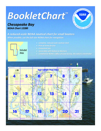
BookletChart Chesapeake BayNOAA Chart 12280A reduced-scale NOAA nautical chart for small boatersWhen possible, use the full-size NOAA chart for navigation.
Published by theNational Oceanic and Atmospheric AdministrationNational Ocean ServiceOffice of Coast Surveywww.NauticalCharts.NOAA.gov888-990-NOAAWhat are Nautical Charts?Nautical charts are a fundamental tool of marine navigation. They showwater depths, obstructions, buoys, other aids to navigation, and muchmore. The information is shown in a way that promotes safe andefficient navigation. Chart carriage is mandatory on the commercialships that carry America’s commerce. They are also used on every Navyand Coast Guard ship, fishing and passenger vessels, and are widelycarried by recreational boaters.What is a BookletChart ?This BookletChart is made to help recreational boaters locatethemselves on the water. It has been reduced in scale for convenience,but otherwise contains all the information of the full-scale nauticalchart. The bar scales have also been reduced, and are accurate whenused to measure distances in this BookletChart. See the Note at thebottom of page 5 for the reduction in scale applied to this chart.Whenever possible, use the official, full scale NOAA nautical chart fornavigation. Nautical chart sales agents are listed on the Internet athttp://www.NauticalCharts.NOAA.gov.This BookletChart does NOT fulfill chart carriage requirements forregulated commercial vessels under Titles 33 and 44 of the Code ofFederal Regulations.Notice to Mariners Correction StatusThis BookletChart has been updated for chart corrections published inthe U.S. Coast Guard Local Notice to Mariners, the National GeospatialIntelligence Agency Weekly Notice to Mariners, and, where applicable,the Canadian Coast Guard Notice to Mariners. Additional chartcorrections have been made by NOAA in advance of their publication ina Notice to Mariners. The last Notices to Mariners applied to this chartare listed in the Note at the bottom of page 7. Coast Pilot excerpts arenot being corrected.For latest Coast Pilot excerpt visit the Office of Coast Survey website t w.php?book 3.(Selected Excerpts from Coast Pilot)Chesapeake Bay, the largest inland body ofwater along the Atlantic coast of the UnitedStates, is 168 miles long with a greatestwidth of 23 miles. The bay is the approach toNorfolk, Newport News, Baltimore, andmany lesser ports. Deep-draft vessels usethe Atlantic entrance, which is about 10miles wide between Fishermans Island onthe north and Cape Henry on the south.Medium-draft vessels can enter fromDelaware Bay on the north via Chesapeake and Delaware Canal, andlightdraft vessels can enter from Albemarle Sound on the south via theIntracoastal Waterway.The waters surrounding a vessel that is carrying liquefied petroleum gasare a safety zone while the vessel transits the Chesapeake Bay andElizabeth River. (See 165.506, chapter 2, for limits and regulations.)North Atlantic Right Whales.–Endangered North Atlantic right whalesmay occur within 30 miles of the Virginia coasts in the approaches to theChesapeake Bay (peak season: November through April, although rightwhales have been sigted in the area year round). (See North AtlanticRight Whales, indexed as such in Chapter 3, for more information onright whales and recommend measures to avoid collisions.)All vessels 65 feet or greater in length overall (L.O.A.) and subject to thejurisdiction of the United States are restricted to speeds of 10 knots orless in a Seasonal Management Area existing around the entrance to theChesapeake Bay between November 1 and April 30. The area is definedas the waters within a 20-nm radius of 37 00'36.9"N., 75 57'50.5"W.(See 50 CFR 224.105 in Chapter 2 for regulations, limitations, andexceptions.)Chesapeake Light (36 54'17"N., 75 42'46"W.), 117 feet above the water,is shown from a blue tower on a white superstructure on four piles, 14miles eastward of Cape Henry. The name CHESAPEAKE is displayed on allsides. A sound signal and racon are at the light. A fish haven, consistingof sunken fishing-boat hulls and marked by private unlighted buoys, isabout 0.4 mile southwestward of the light.Cape Charles, on the north side of the entrance, is low and bare, but theland back of it is high and wooded. Wise Point is the most southerlymainland tip of the cape. Low Fishermans Island, a National WildlifeRefuge, is 1 mile south of Wise Point.The southwest end of Smith Island is 2.4 miles eastward of Wise Point;the island is 6 miles long, low and sparsely wooded, and awash at halftide midway along its length.Cape Charles Light (37 07'23"N., 75 54'23"W.), 180 feet above thewater, is shown from an octagonal, pyramidal skeleton tower, upperpart black and lower part white, on the southwestern part of SmithIsland.Smith Island Shoal, which breaks in heavy weather, has depths of 21feet 7.5 miles east-southeast of Cape Charles Light. Depths less than 40feet extend another 5 miles northeastward. Outer limits of the shoalarea are marked by a lighted buoy.Nautilus Shoal, which extends 4 miles southeastward from FishermansIsland, has patches with depths of 6 to 11 feet. The buoyed channelalong the southwest side of Nautilus Shoal, thence northward betweenFishermans Island and Inner Middle Ground, had a controlling depth ofabout 16 feet in 1977-1980. The channel is used by local vessels drawingup to 12 feet. This channel is not recommended for strangers because ofshifting shoals. In 1996, a 10-foot shoal was reported 1.5 miles S ofFishermans Island in about 37 03'31.2"N., 075 57'27.0"W.Breakers frequently occur along the axis of Inner Middle Ground,starting on the seaward side of the Chesapeake Bay Bridge-Tunnel andcontinuing the entire length of the shoal. This phenomenon appears tobe associated with large swells rolling in from sea from the southsoutheast to southeast.Cape Henry, on the south side of the entrance, has a range of sand hillsabout 80 feet high.Cape Henry Light (36 55'35"N., 76 00'26"W.), 164 feet above the water,is shown from an octagonal, pyramidal tower, upper and lower half ofeach face alternately black and white, on the beach near the turn of thecape.A naval restricted area extends northward and eastward from CapeHenry. (See 334.320, chapter 2, for limits and regulations.)U.S. Coast Guard Rescue Coordination Center24 hour Regional Contact for EmergenciesRCC Norfolk2Commander5th CG DistrictNorfolk, VA(575) 398-6231
Lateral System As Seen Entering From Seawardon navigable waters except Western RiversPORT SIDEODD NUMBERED AIDSGREEN LIGHT ONLYFLASHING (2)FLASHINGOCCULTINGQUICK FLASHINGISOPREFERRED CHANNELNO NUMBERS – MAY BE LETTEREDPREFERRED CHANNELNO NUMBERS – MAY BE LETTEREDPREFERRED CHANNEL TOSTARBOARDTOPMOST BAND GREENPREFERRED CHANNELTO PORTTOPMOST BAND REDGREEN LIGHT ONLYRED LIGHT ONLYFLASHING (2)FLASHINGOCCULTINGQUICK FLASHINGISORED LIGHT ONLYCOMPOSITE GROUP FLASHING (2 1)COMPOSITE GROUP FLASHING (2 1)812"1"Fl G 6sLIGHTGR "A"Fl (2 1) G 6sG "9"Fl G 4s5DAYBEACON"2"Fl R 6sRG "B"Fl (2 1) R 6sG"5"UCGR"U"RGN "C"GRC "S"CANG6RG"G"NUNFor more information on aids to navigation, including those on Western Rivers, please consult the latest USCG Light List for your area.These volumes are available online at http://www.navcen.uscg.govRN "6"NUNR "8"Fl R 4sLIGHTED BUOYLIGHTLIGHTED BUOYGC "1"CANSTARBOARD SIDEEVEN NUMBERED AIDS2DAYBEACONR"2"
VHF Marine Radio channels for use on thewaterways:Channel 6 – Inter-ship safety communications.Channel 9 – Communications between boats andship-to-coast.Channel 13 – Navigation purposes at bridges, locks, andharbors.EMERGENCY INFORMATIONChannel 16 – Emergency, distress and safety calls toCoast Guard and others, and to initiate calls to othervessels. Contact the other vessel, agree to another channel, and then switch.Channel 22A – Calls between the Coast Guard and the public. Severe weatherwarnings, hazards to navigation and safety warnings are broadcast here.Channels 68, 69, 71, 72 and 78A – Recreational boat channels.Distress Call Procedures Make sure radio is on. Select Channel 16. Press/Hold the transmit button. Clearly say: “MAYDAY, MAYDAY, MAYDAY.” Also give: Vessel Name and/or Description;Position and/or Location; Nature ofEmergency; Number of People on Board. Release transmit button. Wait for 10 seconds — If no responseRepeat MAYDAY call.Getting and Giving Help — Signal other boaters using visual distress signals (flares,orange flag, lights, arm signals); whistles; horns; and on your VHF radio. You arerequired by law to help boaters in trouble. Respond to distress signals, but do notendanger yourself.HAVE ALL PERSONS PUT ON LIFE JACKETS!NOAA Weather Radio All Hazards (NWR) is a nationwide network of radio stations broadcasting continuousweather information directly from the nearest National Weather Service office. NWR broadcasts official WeatherService warnings, watches, forecasts and other hazard information 24 hours a day, 7 days a week.http://www.nws.noaa.gov/nwr/Quick ReferencesNautical chart related products and information - http://www.nauticalcharts.noaa.govQRInteractive chart catalog - .shtmlReport a chart discrepancy - hart and chart related inquiries and comments - page ContactUsChart updates (LNM and NM corrections) - http://www.nauticalcharts.noaa.gov/mcd/updates/LNM NM.htmlCoast Pilot online - htmTides and Currents - http://tidesandcurrents.noaa.govMarine Forecasts - http://www.nws.noaa.gov/om/marine/home.htmNational Data Buoy Center - http://www.ndbc.noaa.gov/NowCoast web portal for coastal conditions - http://www.nowcoast.noaa.gov/National Weather Service - http://www.weather.gov/National Hurrican Center - http://www.nhc.noaa.gov/Pacific Tsunami Warning Center - http://ptwc.weather.gov/Contact Us - tmFor the latest news from Coast Survey, follow @NOAAchartsThis Booklet chart has been designed for duplex printing (printed on front and back of one sheet). If a duplex optionis not available on your printer, you may print each sheet and arrange them back-to-back to allow for the properlayout when viewing.NOAA’s Office of Coast SurveyThe Nation’s Chartmaker
Coast Pilot excerpts are not being corrected . . of sunken fishing -boat hulls and marked by private unlighted buoys, is about 0.4 mile southwestward of the light. Cape Charles , on the north side