Transcription
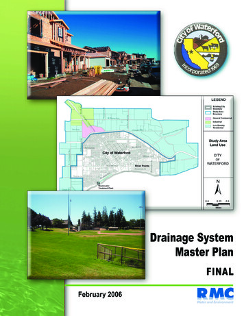
Drainage SystemMaster PlanFINALFebruary 2006
City of Waterford Storm DrainMaster PlanFinal ReportPrepared by:Water and EnvironmentFebruary 2006
Table of ContentsChapter 1 Introduction .1-11.1Background and Purpose.1-11.2Study Area .1-1Chapter 2 Study Area Characteristics .2-12.3Land Use.2-12.4Topography .2-22.5Soils .2-22.6Climate .2-3Chapter 3 Analysis Methodology .3-13.1Existing Conditions.3-13.1.1Existing Drainage and Irrigation Facilities .3-13.1.2Federal Emergency Management Agency Flood Insurance Rate Maps.3-23.2Watershed and Subsheds.3-23.2.1Overview of the Watershed and Subsheds.3-23.2.2Planned Development within the Subsheds.3-33.3Design Standards.3-43.4Model Development .3-53.4.1Modeling Software and Input Parameters.3-53.4.2Modeling Approach .3-7Chapter 4 Recommended Projects .4-14.5Subshed A.4-24.6Subsheds B and C .4-34.6.1Subshed B.4-54.6.2Subshed C .4-54.7Subshed D and E .4-54.7.1Subshed D .4-54.7.2Subshed E.4-6Chapter 5 Opinion of Probable Costs.5-1Chapter 6 Permitting Requirements & Future Regulations .6-16.1Storm Water Permitting.6-16.1.1Construction Permit.6-16.1.2Small MS4 General Permit.6-36.2Future Regulatory Direction .6-4Chapter 7 References.7-1Appendix A . A-1Appendix B . B-1List of TablesTable 1 - Proposed Land Uses.2-1Table 2 - Climate Data.2-3Table 3 - Design Criteria for Model.3-4Table 4 - Allowable Pipe Materials .3-5Table 5 - Design Storm Rainfall Totals .3-7Table 6 - Subshed A Proposed Facilities Description .4-2Table 7 – Proposed Detention Basins Descriptions .4-2Table 8 - Subshed B and C Proposed Facilities Description .4-5Table 9 - Subsheds D and E Proposed Facilities Description .4-6February 2006i
Table 10 - Cost Criteria for Recommended Projects .5-1Table 11 - Storm Drain System Cost Estimate .5-2List of FiguresFigure 1 - Study Area.1-2Figure 2 - Study Area Land Use.2-2Figure 3 - MID Irrigation Infrastructure .3-1Figure 4 - Watersheds and Subsheds.3-3Figure 5 – Proposed Storm Drain Layout .3-8Figure 6 - Detention Basins Schematic .3-10Figure 7 – Proposed Storm Drain Systems Identification.4-1Figure 8 - Profile for Subshed A Proposed Storm Drain System .4-3Figure 9 - Profile for Subshed B Proposed Storm Drain System .4-4Figure 10 - Profile for Subshed C Proposed Storm Drain System .4-4Figure 11 – Profile 1 for Subsheds D and E Proposed Storm Drain System.4-7Figure 12 - Profile 2 for Subsheds D Proposed Storm Drain System .4-7AppendicesAppendix AAppendix BFebruary 2006Storm Water Design and Maintenance ConsiderationsStormwater Management Plan BMPsii
AcknowledgementsThe 2006 Storm Drain Master Plan represents a collaborative effort between RMC and the City ofWaterford. We would like to thank the following key personnel from the City whose invaluableknowledge, experience, and contributions were instrumental in the preparation of this Master plan.Tony Marshall – Consulting City Engineer, City of WaterfordRobert Borchard – Consulting City Planner, City of WaterfordFebruary 2006iii
List of AbbreviationsAFAcre-feetBMPBest Management PracticeBODBiological Oxygen DemandCFSCubic Feet per SecondCIMISCalifornia Irrigation Management Information SystemCIPCapital Improvement Plan/ProgramCNCurve NumberDUDwelling UnitEOExecutive OfficerEPAEnvironmental Protection AgencyFIRMFlood Insurance Rate MapFISFlood Insurance StudyGISGeographic Information SystemGPDGallons per DayGPMGallons per MinuteHGLHydraulic Grade LineHSGHydrologic Soil GroupIDFIntensity Duration FrequencyMCMMinimum Control MeasureMEPMaximum Extent PracticableMGDMillion Gallons per DayMIDModesto Irrigation DistrictMS4Small Municipal Separate Storm SewerNPDESNational Pollution Discharge Elimination SystemNRCSNational Resource Conservation ServiceSCADASupervisory Control Data Acquisition SystemSCSSoil Conservation ServiceSWMPStorm Water Management PlanSWPPPStorm Water Pollution Prevention PlanSWRCBState Water Resources Control BoardTOCTime of ConcentrationTRTechnical ResourceRWQCBRegional Water Quality Control BoardFebruary 2006iv
City of Waterford Storm Drain Master PlanChapter 1Chapter 1 IntroductionIntroductionThis report presents the results of a study to develop a master plan for storm drains in the proposed areasof annexation (study area) to the City of Waterford (City). The report was prepared by RMC Water andEnvironment (RMC) under a contract with the City dated March 20, 2005.The storm drain system facilities presented in this master plan were developed using informationavailable at the time this report was drafted. This report shall act as the guiding document for design ofstorm drains in the study area; however, there may be circumstances in which it is necessary to deviatefrom the concepts presented in this master plan. Any deviations from the master plan shall only beallowed upon prior approval of the City Engineer.1.1 Background and PurposeThe City is planning to annex approximately 1,610 acres of agricultural land surrounding the existingCity boundary as shown in Figure 1. To help plan for the development of the study area, the Citycontracted with RMC to develop the following planning documents: Water Distribution Master Plan Sewer System Master Plan Storm Drainage Master Plan Urban Water Management Plan Wastewater Treatment Plant Master PlanThis Storm Drain Master Plan (Plan) provides information required for the City’s planning and financialefforts, and defines the storm drain system improvements necessary to accommodate the City’s futureland use development plans. The scope of this Plan includes the following major tasks:1. Create a computerized hydraulic model of the future storm drain system in the expansion areausing HEC-HMS;2. Create a Plan for the future storm drain system network for buildout expansion of the City withinthe study area boundary; and,3. Develop a Capital Improvement Program (CIP) for storm drain improvements needed to servethis area.1.2 Study AreaThe City is located in the eastern portion of Stanislaus County, approximately 13 miles east of Modestoand 11 miles northeast of Turlock. The City is bordered on the south by the Tuolumne River, on thenorth by the Modesto Irrigation District (MID) Modesto Main Canal, on the west by Eucalyptus Avenue,and on the east by a parcel boundary south of MID Lateral Connection No. 8.The study area for this Plan comprises approximately 1,610 acres of agricultural land surrounding theCity’s existing boundary to the north, east, and west. The study area forms a semicircular arc around theexisting City, and is bounded by the Tuolumne River on the south and Dry Creek on the north. Figure 1presents the geographical limits of the study area.February 20061-1
Chapter 1 IntroductionCity of Waterford Storm Drain Master PlanFigure 1 - Study AreaFebruary 20061-2
Chapter 2 Study Area CharacteristicsCity of Waterford Storm Drain Master PlanChapter 2Study Area CharacteristicsThis section provides a summary of the City’s study area’s characteristics including land use, terrain,climate and soils.2.3 Land UseThe City’s proposed annexation area consists primarily of agricultural lands surrounding the City’sexisting boundary. The study area’s boundary, service area boundaries, land use maps, and databaseswere developed by incorporating the following information: GIS Parcel Map – Downloaded from the Stanislaus County GIS Library1Annexation Area Map – Hard copy provided by MCR Engineering, Inc.River Pointe Development files – AutoCAD files provided by TKC EngineeringLand Use Map – Hard copy provided by MCR Engineering, Inc.A GIS (Geographic Information System) land use database was developed for each parcel by assigningthe land use category from the paper map provided by MCR Engineering to the downloaded GIS parcelmap. The proposed land uses associated with the study area are discussed and quantified below.Table 1 presents a summary of the proposed buildout land use categories, their associated densities, andgross acreage developed as part of the land use evaluation task for this Master Plan.Table 1 - Proposed Land UsesResidential Density(DU/acre)Gross Acreage 1Percentage ofAreaLow Density Residential4.51,31681%Industrialn/a1268%General Commercialn/a483%1,49092%1298%Land Use CategorySubtotalMajor roads and canals1.n/aTOTAL1,619100%Gross acreage includes future roadways, medians and sidewalks. Net acreage information is not availablesince the study area has not been subdivided into individual parcels and roadways. On average, net acreageis approximately 80 to 90 percent of the gross acreage.As shown in Table 1, and illustrated in Figure 2, the majority of existing vacant land is planned for futurelow density residential development. At this time, the location and number of schools and parks have notbeen identified. Schools, parks, an artificial lake, and storm water detention basins will be located withinthe low density residential area. The light industrial area may also have storm water detention basins.1http://regional.stangis.org/February 20062-1
City of Waterford Storm Drain Master PlanChapter 2 Study Area CharacteristicsFigure 2 - Study Area Land Use2.4 TopographyThe terrain in the western half of the study area is very flat, with the exception of the southwestern cornerof the study area that straddles the cliff north of the Tuolumne River. Terrain in the eastern half of thestudy area is more varied, rising from 160 feet above sea level to around 200 feet above sea level in theeastern and northeastern sections of the study area.2.5 SoilsThe Natural Resource Conservation Service classifies soils into four hydrologic soil groups based on thesoil’s runoff potential:Group A is sand, loamy sand or sandy loam types of soils. These soils have low runoff potential andhigh infiltration rates even when thoroughly wetted. They consist chiefly of deep, well to excessivelydrained sands or gravels and have a high rate of water transmission.Group B is silt loam or loam. These soils have a moderate infiltration rate when thoroughly wettedand primarily consist of moderately drained soils with moderately fine to moderately coarse textures.Group C soils are sandy clay loam. These soils have low infiltration rates when thoroughly wettedand primarily consist of soils with a layer that impedes downward movement of water and soils withmoderately fine to fine structure.February 20062-2
Chapter 2 Study Area CharacteristicsCity of Waterford Storm Drain Master PlanGroup D soils are clay loam, silty clay loam, sandy clay, silty clay or clay. These soils have thehighest runoff potential and very low infiltration rates when thoroughly wetted. They primarilyconsist of clay soils with a high swelling potential and/or soils with a permanent high water table.Soils within the study area range from B-D, with Type C soils accounting for approximately 56 percent ofthe soils, Type B soils accounting for 42 percent of the soils and Type D soils accounting forapproximately 4 percent of the soils2.2.6 ClimateClimate data including temperature and precipitation estimates used for the Waterford area were obtainedfrom the Western Regional Climate Center near Modesto, California. The period of record was January 1,1931 through December 31, 2004.In general Waterford’s climate is described as continental, characterized by moderate, wet winters andhot, dry summers. Table 2 shows the historic climate characteristics in the Waterford area. For this study,the more conservative mean annual precipitation of 12.7 inches presented in the Stanislaus CountyStandards and Specifications was used in the model development.Table 2 - Climate hly AverageETo(1) 50.78Average Total(2)Precipitation 12.42Average Max(2)Temperature 4.5Average MinTemperature(2) (F)37.7 40.9 43.4 46.8 51.7 56.4 59.8 58.7 56 49.7 41.7 37.848.41. Data from CIMIS Station #71. The period of record is June 1987 to present.2. Data from Western Regional Climate Center (http://www.wrcc.dri.edu/cgi-bin/cliMAIN.pl?camode nca) for Modesto, CA.Period of record is 1/1/1931 through 12/31/04.2Natural Resources Conservation Service website, http://soildatamart.nrcs.usda.gov/February 20062-3
City of Waterford Storm Drain Master PlanChapter 3Chapter 3 Analysis MethodologyAnalysis MethodologyThis section presents the analysis methodology used to develop the Storm Drain Master Plan for the Cityof Waterford. As discussed below, the methodology involved (1) analyzing the existing conditionsrelating to drainage facilities and flood plains; (2) establishing subsheds for runoff; (3) defining allpertinent design criteria and assumptions; and (4) developing a model in order to define storm drainfacility requirements and sizing.3.1 Existing ConditionsThe City’s study area consists primarily of agricultural lands surrounding the City’s existing boundary.The following sections describe the pertinent conditions in the area.3.1.1 Existing Drainage and Irrigation FacilitiesThere are a number of MID irrigation canals and drainage ditches in the annexed area and City as shownin Figure 3. These facilities have historically been used for irrigation and drainage purposes. The MIDModesto Main canal acts as a natural drainage boundary because water cannot flow from one side to theother without being intercepted by the canal.Figure 3 - MID Irrigation InfrastructureFebruary 20063-1
City of Waterford Storm Drain Master PlanChapter 3 Analysis MethodologyIt is anticipated that construction across the Modesto Main Canal will be accomplished by boring andjacking underneath the canal. With the exception of the Modesto Main Canal, all construction across theremainder of the MID canals and ditches will be completed using common construction methods. Thefollowing list provides some scenarios that may occur pending MID approval:1) The canals/ditches remain in place and construction across them can be accomplished usingopen cut trenching methods,2) The ditches may be replaced with pipe and covered, or3) The ditches may be filled in and abandoned.This study assumes that the MID irrigation canals will not be used to convey storm water for thefollowing reasons:1. Inadequate Sizing of Canals. Unlike storm water conveyance canals, irrigation canals tend to getsmaller towards the end of the line. At the end of the line the canal only needs to be big enoughto supply the end users. Some of the canals in the study area would need to be upsized to conveythe storm water.2. Pending Regulations for Use of Canals. The District is concerned that storm water wouldintroduce pollutants such as heavy metals into the system, and that it would consume capacityneeded for delivery of irrigation water. As such, the District is in the process of establishingcriteria for use of their canals to convey storm water. The following potential requirements foruse of their canals were identified during recent discussions:a. 48-hour 100-year storage prior to discharge into the canal to allow settling of heavymetals.b. Access to SCADA system for monitoringc. Assessment feesd. Sufficient notice, in the range of 48 hours, prior to each discharge into their canals3.1.2 Federal Emergency Management Agency Flood Insurance Rate MapsFEMA Flood Insurance Studies (FIS) and Flood Insurance Rate Maps (FIRM) for the area were analyzedto determine the 100-year floodplain elevations and flood categories for the area. The City and study areaare predominately categorized as Zone C, which is defined as “areas of minimal flooding”. The localvicinity of Dry Creek and the Tuolumne River are categorized as Zone A and Zone B flood zones. ZoneA is defined as “areas of 100-year flooding; base flood elevations and flood hazards not determined” andZone B is defined as “areas between limits of the 100-year flood and 500-year flood; or certain areassubject to 100-year flooding with average depths less than (1) one foot or where the contributing drainagearea is less than one square mile; or areas protected by levees from the base flood”.The Flood Insurance Study completed in 1979 for the City of Waterford presents the 100-year floodplainelevation for the Tuolumne River at Hickman Road Bridge as 86 feet above mean sea level based on theNorthern Geographic Vertical Datum. Dry Creek was not mapped as part of the City FIS or theStanislaus County Unincorporated Area FIS.3.2 Watershed and Subsheds3.2.1 Overview of the Watershed and SubshedsThe storm drains must convey runoff from the study area and any tributary areas. The study area ispredominately flat receiving little runoff from outside areas except for the eastern boundary. On theFebruary 20063-2
City of Waterford Storm Drain Master PlanChapter 3 Analysis Methodologyeastern boundary of the study area there is some varied terrain outside of the boundary that is tributary tothe study area.As shown in Figure 4, the watershed was divided into subsheds and subbasins based on topographicbarriers such as the Modesto Main Canal, planned development, parcel information and proximity to thetwo outlets, Tuolumne River and Dry Creek. Subshed boundaries are also based on regional topographicinformation collected from an aerial survey, aerial photography, and USGS maps. For the study area,there are 29 subsheds in total with an average area of 58 acres per subshed.Figure 4 - Watersheds and Subsheds3.2.2 Planned Development within the SubshedsThere is one planned residential development in the eastern study area. The development will occur inportions of subshed D, subbasins 1, 2, 3, 4, 5 and 8. There is a planned detention/retention basin locatedsubbasin 4 and shown schematically in Figure 4 that was initially designed to contain all the storm runofffrom the development. According to the developer, the total storage of the basin is approximately 129acre-feet. The basin also functions as a recreation pond for the surrounding homes and has aestheticbenefits.Operation of the basin shall be closely monitored throughout the year and especially during the wintermonths when there is a potential for flooding during heavier rainfall events. However, the basin still mustprovide recreational benefits as well as storm water storage.February 20063-3
City of Waterford Storm Drain Master PlanChapter 3 Analysis Methodology3.3 Design StandardsThe City of Waterford has not adopted storm drain facility design standards or specifications. This Planestablishes general design standards that shall be used in the design of future storm drains in the studyarea. Design standards presented in this Plan were compiled from a number of sources including: Stanislaus County Standards and Specifications City of Modesto Design Standards and Specifications Caltrans Standards and Specifications Modesto Irrigation District design criteria NPDES Phase II storm water permitting requirements Standard engineering practiceDesign standards not addressed in this Plan shall conform to the minimum standards established by theCity of Modesto. All designs failing to comply with the minimum standards established by the City ofModesto and this Plan shall be approved by the City Engineer prior to construction of said facilities. Inaddition, designs that deviate from the standards established in this Plan and the Modesto standards willbe required to be approved by the City Engineer prior to construction. For example, best managementpractices that are not addressed in either of the documents will need to be approved prior to construction.It is recommended that the City of Waterford adopt design standards specific to their storm drain systemso that the City will not have to rely on Modesto standards.This Plan establishes certain design criterion superseding the standards presented in the aforementioneddocuments. These criteria are presented below for clarity and shall be used in the design of all futureimprovements. Table 3 presents additional design standards that should be adhered to during design.1. The main trunk storm drain pipes presented and modeled as part of this master plan shall bedesigned to convey the 2-year 24- hour storm runoff without discharging to the detention basins.The main trunk storm drain pipes in conjunction with the operation of the detention basins shallbe designed to convey the 50-year 24-hour storm event below the top of grate of the drainageinlets.2. Laterals not presented in this master plan and connecting to the main trunk pipe shall be designedto meet the minimum standards presented in the City of Modesto Standards.3. Drainage detention/retention facilities shall store a minimum of the 100-year, 24-hour storm withone foot of freeboard.Table 3 - Design Criteria for ModelCriteriaRecommendationManning’s “n”0.013 for all materialsMinimum storm drain pipediameter12 inchesMinimum/maximum velocityConform to City of Modesto standardsFebruary 20063-4
Chapter 3 Analysis MethodologyCity of Waterford Storm Drain Master PlanCriteriaRecommendationMinimum pipe depthMaintain two feet of cover minimum from top of pipe tofinished grade. At least 3 feet of separation between flowline of creeks and crown of pipe. Deviations fromminimum requirements must be approved by CityEngineer.Increase in pipe sizeMatch crowns when increasing in pipe size.Headloss in manholesDeflections manholes with a deflection greater than 20degrees shall be assigned a 0.1 foot drop. Deflectionsgreater than 90 degrees are not allowed.Table 4 presents a list of allowable pipe materials to be used in the construction of storm drains.Deviations from this list must be approved by the City Engineer.Table 4 - Allowable Pipe MaterialsPipe MaterialDiameterStandard DesignationPrecast Reinforced Concrete PipeClass III minimum12” – 60”ASTM C76 (Pipe);Cast in Place Concrete Pipe12” – 60”Caltrans Standards Specifications Section 63and 90. Concrete to be a minimum of 4000 psi.Polyvinyl Chloride Pipe (PVC)12” – 42”ASTM D3034, SDR 35. All PVC pipe jointsshall be integral wall bell and spigotconfiguration factory formed, all rubber ringsshall conform to ASTM F477PVC48”AWWA C905 SDR 41Caltrans Standards Specifications Section 65(Bell and Spigot joints)3.4 Model Development3.4.1 Modeling Software and Input ParametersThe modeling software used to design the storm water facilities includes HEC-HMS and spreadsheetcalculations. A more sophisticated model such as EPA SWMM was not considered practical at this stageof the design. Although EPA SWMM has very powerful tools, those tools would be of little use at thispreliminary stage of this study. HEC-HMS was developed by the US Army Corps of Engineers and isused in standard practice for developing watershed routing models. HEC-HMS provides routing of therunoff, calculates a hydrograph for detention/retention basin sizing, and calculates the peak dischargeswhich are all applicable to this Plan. Many of the input parameters for the model can be calculated usingthe Natural Resources Conservation Service Urban Hydrology for Small Watersheds, TR-55.HEC-HMS has three components: Basin Model, Metrologic Model, and Control Specifications. In theBasin Model, the user enters information on the subshed area and characteristics, loss rate, transformmethod, baseflow characteristics, and reach type. The user enters meteorological information such as thedesign storm event in the Metrologic Model. In the Control Specifications component, the user enters thedate and duration of the storm event. The following characteristics were used in the model.February 20063-5
City of Waterford Storm Drain Master PlanChapter 3 Analysis MethodologyLoss RateFor this study, the loss rate was calculated using the SCS Curve Number method, an empirical curvenumber method developed by the NRCS to estimate total excess precipitation for a storm based oncumulative precipitation, soil cover, land use, and antecedent moisture. Required parameters include thecurve number (CN), which can range from 0 to 99, impervious area percentage, and initial loss.Curve Number. CNs are categorized by the type of land use, such as agricultural lands with row crops,and are dependent on the hydrologic soil group (HSG) (i.e., soils A, B, C and D), cover type, treatment,hydrologic condition, and antecedent runoff condition. The model is based on curve numbers developedas part of TR-55 and includes the following assumptions:o Land Use Type: This model assumes an open space land use category which is described aslawns, parks, golf courses, cemeteries, etc.o Cover Type: The model is dependent on the condition (or quantity) of the grass cover, whether itbe poor, fair, or good. For this model, the fair condition (grass cover 50% to 75%) category wasused.o Hydrologic Soil Group: As mentioned previously, fifty-six percent of the soils in the study areaare Type C and 42 percent are Type B soils. A CN value of 75 was extrapolated between the twoCNs for Type C and Type B soils based on the percentage of land of each soil.Impervious Area. To account for the area that is covered by streets, driveways, and homes animpervi
The 2006 Storm Drain Master Plan represents a collaborative effort between RMC and the City of Waterford. We would like to thank the following key personnel from the City whose invaluable knowledge, experience, and contributions were instrumental in the preparation of this Master plan. Tony Marshall - Consulting City Engineer, City of Waterford