Transcription
State Clearinghouse No. 2014071057ADDENDUM TO ENVIRONMENTAL IMPACT REPORTOWENS LAKE DUST MITIGATION PROGRAM –PHASE 9/10 PROJECTAugust 2016Prepared by:California State Lands Commission100 Howe Avenue, Suite 100 SouthSacramento, CA 95825CEQA Lead Agency:City of Los Angeles Department of Water and Power111 North Hope StreetLos Angeles, CA 90012
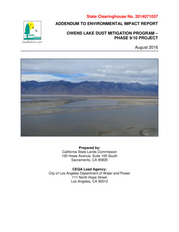
MISSION STATEMENTThe California State Lands Commission provides the people of Californiawith effective stewardship of the lands, waterways, and resources entrusted to itscare through preservation, restoration, enhancement, responsible economicdevelopment, and the promotion of public access.CEQA DOCUMENT WEBSITEwww.slc.ca.gov/Info/CEQA.htmlGeographic Location (State Lands Commission Lease):Latitude: N 36 26’12.80”Longitude: W 117 57’35.50”Cover Photo: Owens Lake, Inyo County California
OWENS LAKE DUST MITIGATION PROGRAM – PHASE 9/10 PROJECT1.11.21.3SUMMARY AND PROJECT OBJECTIVES . 1ADDENDUM PURPOSE . 1BACKGROUND . 43.13.23.3SUMMARY OF ENVIRONMENTAL ISSUE AREA ANALYSIS . 8AIR QUALITY . 8BIOLOGICAL RESOURCES . 95.15.2ADDENDUM PREPARERS . 16REFERENCES . 16APPENDICESAppendix A. HABITAT VALUE ASSESSMENT OWENS LAKE DUST MITIGATIONPROGRAM DYNAMIC WATER MANAGEMENT 2016LIST OF TABLESTable 1.Potential Habitat Value Lost . 11Table 2.Effective Multipliers for Summer Habitat Water . 12Table 3.Habitat Value Gained by Operation of Various DCAs as Part of DWM . 13LIST OF FIGURESFigure 1.Project Location . 3Figure 2.GBUAPCD Recommended Eligible DWM Areas . 7August 2016iAddendum to EIR: Owens Lake DustMitigation Program – Phase 9/10 Project
Table of ContentsLIST OF ABBREVIATIONS AND ACRONYMS USED IN THIS DOCUMENT# 2016 SIPB BACMC CEQAD DCADEPMDistrictDWME EIRG GBUAPCDH HSMHVAL LADWPO OLDMPP PM10S SHWSIP2016 Owens Valley Planning Area PM10 State Implementation PlanBest Available Control Method (Gravel Cover, Shallow Flooding andManaged Vegetation)California Environmental Quality ActDust Control AreaDivision of Environmental Planning and ManagementGreat Basin Unified Air Pollution Control DistrictDynamic Water ManagementEnvironmental Impact ReportGreat Basin Unified Air Pollution Control DistrictOwens Lake Habitat Suitability ModelHabitat Value AcreCity of Los Angeles Department of Water and PowerOwens Lake Dust Mitigation ProgramParticulate matter less than or equal to 10 microns in diameterSummer Habitat WaterState Implementation PlanAddendum to EIR: Owens Lake DustMitigation Program – Phase 9/10 ProjectiiAugust 2016
1.0 INTRODUCTION11.1SUMMARY AND PROJECT OBJECTIVES234567891011On June 14, 1999, the California State Lands Commission (Commission) authorized theissuance of Lease No. PRC 8079.9, a 20-year General Lease – Public Agency Use(Lease), to the City of Los Angeles Department of Water and Power (City or LADWP) forthe Owens Lake South Sand Sheet Air Quality and Sand Fence Effectiveness MonitoringSystem on Owens Lake, which is located in southwest Inyo County, approximately 200miles north of Los Angeles (Figure 1). Since that time, the Commission has authorized17 amendments to the Lease for the construction, operation, and maintenance ofadditional components of dust control, including the use of Best Available ControlMethods (BACM) to mitigate dust emissions on Owens Lake. Approved types of BACMinclude Shallow Flooding, Managed Vegetation, and Gravel Cover.121314151617181920212223242526On June 2, 2015, the City, as lead agency under the California Environmental Quality Act(CEQA), certified an Environmental Impact Report (EIR) for the Owens Lake DustMitigation Program (OLDMP)—Phase 9/10 Project (Project; State Clearinghouse No.2014071057). The City is proposing to implement the Phase 9/10 Project and expandand modify the existing system of dust control on the lake. As part of the OLDMP, theProject EIR contemplated implementation of Dynamic Water Management (DWM) tomodify the dust season on approximately 12.07 square miles of Shallow Flood dustcontrol areas (DCAs) on Owens Lake in order to conserve water. DWM uses delayedstart dates and earlier end dates for Shallow Flooding in specific areas that havehistorically had low dust emissions during the modified time periods. The truncated dustcontrol periods allow for water savings while achieving the required dust control. To helpoffset potential impacts to wildlife, LADWP would release water on the lake outside ofdust mitigation periods for the benefit of birds; this is called Summer Habitat Water (SHW).While DWM is referenced in the City’s certified EIR and included in the definition ofShallow Flooding BACM, this Addendum serves to clarify how DWM will be implemented.271.2282930313233The proposed DWM Plan requires Commission approval and therefore CEQAcompliance. Pursuant to the State CEQA Guidelines section 15164, the lead agency or aresponsible agency for a project shall prepare an addendum to a previously certified EIRif some changes or additions are necessary but no special conditions requiring asubsequent EIR (described in State CEQA Guidelines, § 15162) are present. Pursuant toState CEQA Guidelines section 15162, a subsequent EIR is not required unless:34353637(1) Substantial changes are proposed in the project which will require major revisionsof the previous EIR or negative declaration due to the involvement of newsignificant environmental effects or a substantial increase in the severity ofpreviously identified significant effects;ADDENDUM PURPOSEAugust 20161Addendum to EIR: Owens Lake DustMitigation Program – Phase 9/10 Project
Introduction12345(2) Substantial changes occur with respect to the circumstances under which theproject is undertaken which will require major revisions of the previous EIR ornegative declaration due to the involvement of new significant environmentaleffects or a substantial increase in the severity of previously identified significanteffects; or6789(3) New information of substantial importance, which was not known and could nothave been known with the exercise of reasonable diligence at the time the previousEIR was certified as complete or the negative declaration was adopted, shows anyof the following:1011A. The project will have one or more significant effects not discussed in theprevious EIR or negative declaration;1213B. Significant effects previously examined will be substantially more severethan shown in the previous EIR;14151617C. Mitigation measures or alternatives previously found not to be feasiblewould in fact be feasible and would substantially reduce one or moresignificant effects of the project, but the project proponents decline to adoptthe mitigation measure or alternative; or18192021D. Mitigation measures or alternatives which are considerably different fromthose analyzed in the previous EIR would substantially reduce one or moresignificant effects on the environment, but the project proponents decline toadopt the mitigation measure or alternative.222324252627282930The City has submitted an application to the Commission to modify the dust controlwatering season for approximately 12.07 square miles of the Lake. Before approving suchmodification, the Commission must apply the standards outlined above to ensure that asubsequent EIR is not required. In reviewing the DWM plan, Commission staff identifiedtwo areas where there could be a potential for environmental impacts from the proposedactions: air quality and biological resources. After reviewing the existing environmentaldocuments, application materials, and the DWM plan, and analyzing all relevant factsavailable, Commission staff has determined, on the basis of substantial evidence in lightof the whole record, that:3132 minor changes or additions to the previously certified EIR for the Owens Lake DustMitigation Program – Phase 9/10 Project are necessary;3334 none of the conditions described in State CEQA Guidelines section 15162 calls forthe preparation of a subsequent EIR; and3536 an addendum is the appropriate CEQA document for analysis and considerationof the portion of the Project on lands under the jurisdiction of the Commission.Addendum to EIR: Owens Lake DustMitigation Program – Phase 9/10 Project2August 2016
IntroductionFigure 1.August 2016Project Location3Addendum to EIR: Owens Lake DustMitigation Program – Phase 9/10 Project
Introduction1234Circulation of an addendum for public review is not required (State CEQA Guidelines, §15164, subd. (c)); however, the decision-making body must consider the addendum inconjunction with the previously adopted EIR for the project (State CEQA Guidelines, §15164, subd. (d)).51.3BACKGROUND678910111213141516Owens Lake was a natural and navigable waterway at the time of California’s statehoodand is thus sovereign land of the State. Wildlife, waterfowl, and the nearby residentsdepended on and benefited from Owens Lake, which covered approximately 110 squaremiles and was 50 feet deep in places. Early settlers diverted water from the Owens Riverto grow crops and irrigate pasture for livestock, and steamboats carried cargo across thelake. In 1908, the City began construction of an aqueduct to divert water from the OwensRiver north of Owens Lake. After completion of the Los Angeles Aqueduct in 1913, theCity began transporting river water to Los Angeles, causing Owens Lake water levels torapidly decline. By 1930, the Lake was virtually dry with only a small brine pool remaining.Since then, dust storms have carried away as much as four million tons of dust from thelakebed annually, causing respiratory problems for residents in the Owens Valley.171819202122232425262728The U.S. Environmental Protection Agency has designated the southern part of theOwens Valley as a Serious Non-Attainment Area for PM10 (suspended particulate matter[dust] less than or equal to 10 microns in mean aerodynamic diameter [about 1/10 thediameter of a human hair]). The Great Basin Unified Air Pollution Control District(GBUAPCD or District) subsequently designated the Non-Attainment area as the OwensValley PM10 Planning Area. The District determined that dust emissions from the drylakebed of Owens Lake cause air in the Owens Valley PM10 Planning Area to exceed thePM10 national ambient air quality standards, and that water diversions by the City causedOwens Lake to become dry and the lakebed to be in a condition that produces dust. TheDistrict has authority to issue Supplemental Control Requirements Determinations(Orders) to the City for dust control purposes and recently approved the 2016 OwensValley Planning Area PM10 State Implementation Plan (2016 SIP) (GBUAPCD 2016a).2930313233343536LADWP constructs and operates dust control measures (DCMs) on the lake incompliance with Orders from the District under the authority of California Health andSafety Code section 42316, legal settlement agreements with the District, leaseagreements for use of state lands (administered by the Commission), and other regulatoryapprovals. LADWP has also developed, in coordination with Commission staff and otherstakeholders, a Habitat Suitability Model (HSM) for the Lake that includes various physicalparameters that can be objectively measured as a means of predicting and monitoringhabitat suitability and ensuring maintenance of wildlife habitat and use on the Lake.Addendum to EIR: Owens Lake DustMitigation Program – Phase 9/10 Project4August 2016
2.0 DESCRIPTION OF PROJECT MODIFICATION123456As proposed by LADWP, DWM would modify the dust control season for some areas ofOwens Lake in order to conserve water. DWM is referenced in the EIR and included inthe definition of Shallow Flooding BACM defined by the GBUAPCD (2016a) in the 2016Owens Valley Planning Area PM10 State Implementation Plan (2016 SIP). LADWPcurrently manages approximately 31 square miles of Shallow Flood on the Lake; of this,approximately 12.07 square miles is eligible for DWM.17891011Shallow Flooding BACM consists of releasing fresh and/or recycled water into a DCA andallowing it to spread, wet the surface, and thereby suppress windborne dust. In order tomeet GBUAPCD’s goal of reducing dust emissions on the lake by 99 percent,2 generally72 percent of the surface must be wet or have saturated soil (75 percent wetnesscoverage is required for areas identified in the 2003 SIP).12131415161718Prior to the 2016 SIP, the coverage requirement for the 99 percent DCAs could bereduced progressively during the spring shoulder season (May 16 to June 30); 70 percentareal wetness cover from May 16 to May 31; 65 percent areal wetness cover from June1 to June 15; and 60 percent areal wetness cover from June 15 through June 30. The fallshoulder season was defined as October 1 to October 15; prior to the 2016 SIP, full levelsof dust control were not required until October 16. Under the 2016 SIP, DWM will modifythe dust season for certain areas on Owens Lake. This was described in the EIR as:19202122232425262728293031An analysis of Owens Lake ambient air quality, meteorological and sand flux dataalong with lake bed field observations during the past 15 years has revealed that theShallow Flood BACM dust season may be shortened for certain areas of the lake bedthat have historically shown little dust activity in the early and/or late portions of theOctober through June dust season. In addition, wetness cover requirements toachieve the required Minimum Dust Control Efficiency may also vary depending onseasonal conditions that may affect salinity of the surface water and the formation oferosion-resistant brine crusts. Modifications to the dust season for certain areas arecurrently being considered by GBUAPCD and LADWP to address the commitment inthe 2014 Stipulated Judgment to implement a Dynamic Water Management Plan inorder to reduce water use on the lake bed. Dynamic Water Management could includemodifications to the existing ramping schedules for flow operations and could apply toexisting Shallow Flooding dust control areas (DCAs) as well as new areas of Shallow12The District’s 2016 SIP and Board Order 160413-01 identify 44 DCAs or portions of DCAs totaling 13.15square miles; however, several of these areas are Gravel Cover rather than Shallow Flood, and wereremoved from consideration by LADWP and the Commission for this analysis.The GBUAPCD requires the City to continuously operate and maintain any mix of approved BACM PM10control measures to meet a 99 percent control efficiency level.August 20165Addendum to EIR: Owens Lake DustMitigation Program – Phase 9/10 Project
Description of Project Modification12Flooding proposed under the Phase 9/10 Project (T10-1-L1, T37-2-L1, T37-2-L2, T372-L3, and T37-2-L4).334567891011DWM is an operational modification to BACM Shallow Flooding that allows delayed startdates and/or earlier end dates required for Shallow Flooding in specific areas that havehistorically had low PM10 emissions with the modified time periods. The truncated dustcontrol periods allow for water savings while achieving the required control efficiencylevel. If a DWM area becomes susceptible to wind erosion outside of the modified dustcontrol period, the area will be flooded to meet the required control efficiency for that area.Following certification of the Phase 9/10 Project EIR and approval of the Project by theCity in June 2015, the GBUAPCD (2016b) prepared a DWM Plan to define DWM withgreater specificity.12131415161718Exhibit 4 of the DWM Plan (see Figure 2 below) depicts the recommended eligible DWMareas and notes the modified dust seasons for conventional pond and lateral ShallowFlooding areas. The dust season for DWM Plan areas irrigated with sprinklers would start2 weeks earlier and end 1 month later than shown on Exhibit 4 of the DWM Plan. Thestandard dust season defined in the 2008 SIP was October 16 to June 30, with rampingof 99 percent control areas after May 15. Modified DWM Plan dust seasons are as follows(noted by DCA on Figure 2): 1920213October 16 to April 30;December 1 to April 30; andJanuary 16 to April 30.Final EIR page 2-1, which expanded discussion of Draft EIR Section 3.1.8.4.Addendum to EIR: Owens Lake DustMitigation Program – Phase 9/10 Project6August 2016
Description of Project ModificationFigure 2.August 2016GBUAPCD Recommended Eligible DWM Areas7Addendum to EIR: Owens Lake DustMitigation Program – Phase 9/10 Project
3.0 ENVIRONMENTAL ASSESSMENT12345The following comparative analysis was undertaken to analyze whether DWM asproposed by the City would have any significant environmental impacts that were notaddressed in the EIR certified by the City in 2015. The comparative analysis (1) discusseswhether impacts are increased, decreased, or unchanged from the conclusions discussedin the EIR, and (2) addresses whether any changes to mitigation measures are required.63.1789101112SUMMARY OF ENVIRONMENTAL ISSUE AREA ANALYSISCompared to the Project analyzed in the City-certified EIR, the use of DWM would resultin minor modifications to the periods when water is applied to certain DCAs on OwensLake. As discussed in this Addendum, the Commission finds that the proposed changesin water application, which are temporal only, would have no impacts to the environmentalissue areas listed below; this determination is consistent with the analysis of the originalproject in the 2015 EIR. AestheticsAgriculture and Forestry ResourcesAir QualityBiological ResourcesCultural ResourcesGeology/SoilsGreenhouse Gas EmissionsHazards and Hazardous MaterialsHydrology and Water QualityLand Use/PlanningMineral ResourcesNoisePopulation/HousingPublic Service Systems131415161718192021222324For example, with respect to aesthetics, Project modifications would not change theappearance of Owens Lake. Similarly, the Owens lakebed is openly accessible to thepublic for recreation; however, implementation of DWM will not alter the recreationalamenities proposed as part of the Project or further impact public access to the lake duringProject construction and operation. Because the proposed changes would have no effecton the above-listed issue areas, they are not discussed further in this document. Projectchanges would have the potential to affect two issue areas, air quality and biologicalresources; these were determined to have impacts that were less than significant underthe EIR the City certified in 2015. As a result, Commission staff evaluated whether theseeffects would constitute a new significant impact, as required by CEQA (see generallyPub. Resources Code, § 21166; State CEQA Guidelines, § 15162). This evaluation andthe Commission staff’s conclusions are provided in detail below.253.22627Implementation of DWM will not result in additional construction activities and thereforewill not increase air pollutant emissions related to project construction. Construction-AIR QUALITYAddendum to EIR: Owens Lake DustMitigation Program – Phase 9/10 Project8August 2016
Environmental Assessment12345related emissions will remain less than significant. The specific change to the ProjectDWM contemplates is delaying the application of fall water and terminating early theapplication of water in the spring, thus shortening the time certain areas arewetted/flooded and potentially leading to dust emissions. Importantly, however, the DWMPlan incorporates the following conditions and restrictions:67 DWM will be implemented only in specific areas that have historically had low PM10emissions within the modified time periods.8910 DWM will be implemented in existing Shallow Flooding DCAs only if little dustactivity in the early and/or late portions of the October through June dust seasonis observed.111213141516 Re-flooding will be conducted when a DWM Plan area deteriorates such that theGBUAPCD determines it to be potentially emissive. When this determination hasbeen made and a written re-flood order has been made by the Air Pollution ControlOfficer, then LADWP shall re-flood the DWM Plan area so as to re-establish fullycompliant Shallow Flooding in accordance with the most current Shallow FloodingBACM requirements.17181920The above components of the DWM Plan ensure LADWP will continue to be compliantwith its dust control responsibilities and that air quality will not be compromised. As such,this Project change does not involve a new significant impact not previously identified inthe 2015 EIR and, therefore, a subsequent or supplemental EIR is not Implementation of DWM will not result in additional construction activities and thereforewill not increase the severity of impacts to biological resources related to construction,which the EIR identified as potentially significant and for which mitigation measures wereincorporated. DWM modifies the original Project by delaying the application of water inthe fall and terminating early the application of water in the spring in the Shallow FloodingDCAs identified in Figure 2, above (Exhibit 4 of the DWM Plan), thus shortening the timecertain areas are wetted/flooded and potentially resulting in a loss of habitat value for oneor more of the species guilds on the Lake. However, certain conditions andenhancements are also incorporated into the DWM Plan to ensure DWM will beimplemented such that existing Lake wide habitat values will be enhanced or maintainedoverall within the OLDMP Area. DCAs constructed as part of Phase 7a (T1A-2, T37-2),Tillage with BACM-back-up (T2-2, T16), and Phase9/10 (T10-1a, T37-2[a-d]) will havewater applied to meet habitat value goals in those projects (per Phase 7a FEIR, TWB2EIR Addenda, Phase 9/10 FEIR). Therefore while implementing DWM in these DCAshabitat value will be maintained across these projects in their entirety. Other DCAs willhave no impacts from DWM to habitat value in Spring due to the existing ponds remainingthrough the migration period in spring (e.g., T2-1) or currently being operated underTillage with BACM-back-up (e.g., T12-1).BIOLOGICAL RESOURCESAugust 20169Addendum to EIR: Owens Lake DustMitigation Program – Phase 9/10 Project
Environmental Assessment12345678Changes in habitat value for each species guild (which includes the diving waterbird,breeding waterfowl, migrating waterfowl, breeding shorebird, migrating shorebird, andalkali meadow bird guilds) on Owens Lake during DWM were estimated using the OwensLake HSM with draft recommendations from Point Blue Conservation Scienceincorporated. Habitat value was first estimated for 2016 assuming typical operations inDWM DCAs (Habitat Value Acre [HVA] ref). The most recently observed habitatparameter data available were for 2014 during normal operation. These were used forthis estimate of habitat value prior to DWM studies in 2015.910111213141516171819Habitat value was then projected for each DWM DCA, or portions of DCAs, by estimatinghabitat parameters for implementation of DWM through the fall period as described in the2016 SIP (HVA DWM). Most DCAs under DWM will have no water through the fallmigration time period with full operation planned between December 1 and January 16depending on the DCA. When possible, the habitat parameters observed duringimplementation of the DWM variance in 2015 were used to estimate habitat value throughfall for water depth and monthly water availability. DCAs outside of DWM were assumedto have similar habitat value during the reference period due to typical operations. Theresulting habitat value during DWM (HVA DWM) was then subtracted from habitat valueestimates without DWM in each DCA (HVA ref), for each DCA. This was performed forhabitat value for each guild (Table 1).20212223242526For spring DWM (turning off water supplied to DWM DCAs on April 30), most migratingbirds have left Owens Lake, therefore only breeding shorebirds and waterfowl arepotentially impacted. To maintain habitat value in that timeframe, DCAs with highnumbers of snowy plover and high habitat value for breeding shorebirds would have waterapplied to wet the surface through sprinklers along lateral water pipelines that have beeninstalled across each DCA (DCAs T17-1, T17-2, T13-1 and T10-1). These lateral sprinklerlines would operate as described in the EIR through the remainder of the dust season.2728293031323334353637383940For fall DWM, two primary options to increase habitat value were explored: (1) in DWMDCAs, operate the pond portion of the DCA, potentially at a lower level than normaloperations, while turning off lateral water pipelines through fall; and (2) in all DCAs,provide small amounts of water through the summer to provide perennial habitat forforage insects and shorebirds (referred to as Summer Habitat Water [SHW]). The formeroption provides habitat at a time when many migrating waterfowl and diving waterbirdsare using Owens Lake. However, it assumes habitat is limiting which is unlikely given theobserved variability in many DCAs. The latter option provides water at a time period whenwater is scarce and the amount of usable habitat during normal drydown is limited forshorebirds during their peak migration (August through September), but it also providesa refuge for forage insects to colonize the entire DCA once it is operational again in fall.This option helps to bolster the forage invertebrate population to make it through thenormally dry summer to provide a greater food source for later in fall when divingwaterbirds and waterfowl are most abundant on Owens Lake.Addendum to EIR: Owens Lake DustMitigation Program – Phase 9/10 Project10August 2016
Environmental Assessment1Table 1.DCAT10-1T10-2NT10-2ST10-3ET10-3WT1-1T13-1T13-1 AddT17-1T17-2T18-0T21WT25-3T5-3T5-3 2aT37-2bT37-2cT37-2dHVA 00.00.00.00.00.00.00.0975.1Potential Habitat Value LostHabitat Value Lost 7The presence of perennial water is second only to salinity in its importance to invertebrateabundance (Herbst 2001). Water persisting throughout the summer has historically beenquite rare on Owens Lake in DCAs due to high evaporation rates and no requirement toapply water for dust control operation. This refuge for invertebrates has been shown tohave a significant lag effect on habitat value where a little perennial water can producesignificant increases in bird use in subsequent months in those cells.891011This positive effect of SHW successfully demonstrated the increase in bird use duringimplementation of the DWM variance in 2015 (LADWP 2016) in DCAs T29-1, T29-2, T302, T36-2E. The effect was most obvious for the shorebird guild because they directlybenefit from the addition of water during the August portion of their migration. ForAugust 201611Addendum to EIR: Owens Lake DustMitigation Program – Phase 9/10 Project
Environmental Assessment12example, 1.7 times the number of shorebirds were recorded in August 2015 during DWMin 2015 than under normal operations per the reference averages.345678The diving waterbirds and waterfowl also responded to SHW. Bird counts in DCAs withSHW were higher than expected. Greater than expected bird numbers for both divingwaterbirds and migrating waterfowl were encountered in 2015 in DWM DCAs with SHWapplied compared to normally operated DCAs. In addition, many more birds were foundin these DCAs than predicted by the HSM in 2015. The information on increases in actualbird use was incorporated into the habitat value predictions for summer water.9Summer Habitat Water Value Adjustment1011121314151617To quantify the actual habitat value gained with application of SHW, the actual bird usedata and modeled habitat value from 2015 (HVA2015) were used. HVA2015 wasprojected from estimates of 2015 environmental parameters which reflected when DCAswere operational. From linear regression analysis, a best-fit equation was generated todescribe the relationship between habitat value in 2015 and observed bird counts in 2015.Using the linear equation, the habitat value needed to project the actual bird counts wascalculated (HVASHW). The Value Adjustment multiplier was calculated as:HVASHW/HVA2015.181920212223The effective multipliers are listed in Table 2 for each guild in DCAs that were shown tohave actual bird increases during 2015 DWM SHW application (DCAs T29-1, T29-2, T302, T36-2E). The multipliers were applied to the habitat value projected by adding SHW inthose four DCAs planned to have SHW in the future. For the remaining DCAs, theeffective multipliers were not used in the habitat value outputs from the HSM with themanagement operations included.24Table 2.Effective Multipliers for Summer Habitat WaterGuild
20 diameter of a human hair]). The Great Basin Unified Air Pollution Control District 21 (GBUAPCD or District) subsequently designated the Non-Attainment area as the Owens 22 Valley PM 10 Planning Area. The District determined that dust emissions from the dry 23 lakebed of Owens Lake cause air in the Owens Valley PM 10
