Transcription
sponsored bysponsored byissue 69 : April 2016. . . joining the geography jigsawGrand theft geospatialScottish AGI hits the high notesGround information modelling and BIMRethinking geospatial competitionsWhy we should not privatise the Land RegistryAGI Foresight 2020 Report updateEmergency HOT mapping uses OpenNews People Products & Services GiSPro’s columnists
Issue No 69 April 2016contentsour mission. . .to help grow the business for the wholeGIS community by providing an effective,reliable and timely medium for news,information and comment.p. 10We report from the Scottish AGI’s annual conference that attracted160 delegates for a day of lively presentations and debate.Publisher: Stephen BoothEditor: Robin WatersAdvertising & Subscriptions: Sharon Robsonp. 14Editorial advisory board:James KavanaghDr Muki HaklayAdena SchutzbergDr Suchith Anandp. 16Editorial and advertising:PV Publications Ltd2B North RoadStevenageHertfordshire SG1 4ATUnited KingdomTel: 44 (0) 1438 352617e-mail: editor@pvpubs.demon.co.ukweb: www.gisprofessional.co.ukMaterial to be Published: All submissions willbe handled with reasonable care, but thepublishers assume no responsibility for safety ofphotographs or manuscripts. Every precaution istaken to ensure accuracy, but publishers cannotaccept responsibility for the accuracy of information published or for any opinion expressed.AGI Scotland’s busy dayGIS training and the National TrustThe arrival of a new ArcGIS platform at the charity has been smoothed withdedicated training from GIS247.Why privatising the Land Registry is wrongPrivatisation of the Land Registry is back on the political agenda. Formerchief registrar John Manthorpe explains why this isn’t a good idea.p. 18Emergency mapping and the HOT responsePaul Stewart reports how the Humanitarian OpenStreetMap Team hasapplied their skills for disaster preparedness to economic development.p. 21Ground information modelling and BIMWith increasing demand for below ground data, Andrew Thompsonargues that a ground information model should be part of every BIM.p. 24Games and geospatial: how much crossover?Andy and James Coote work in different parts of the computer industry.We hear from each on how geospatial and video games intersect.Reprints: Reprints of all articles are available.Call 01438 352617 for details.Advertising: Information about advertisementrates, schedules etc. are available in a mediapack. Go to www.gisprofessional.co.ukor call 01438 352617Publishers: PV Publications LtdNo material may be reproduced in whole or inpart without the written permission of thepublishers. 2016 ISSN 1748-3646Printing: The Manson Group, St Albans GISPro’s COLUMNSp.27 AGI Column – AGI Foresight 2020: why it mattersp.09 Adena Schutzberg – GI competitions: solutions awaiting problems? GISPro’s .31GiSPro Products & ServicesGIS CalendarGiSPro ClassifiedFRONT COVER: Rockstar Games.The arrival of real-world games and theavailability of high-resolution 3D mapping hascreated perfect opportunities, or has it? We hearfrom a geospatial specialist and his son workingin the video games industry. Turn to page 24.to subscribe to GiSPro, go towww.pvpubs.com/GISProfessional/Homeor turn to page 20GiSProfessionalNext Issue: JUNE 2016Copy dates Editorial: 09 MayAdvertising: 23 May03
The ZenoCollectorReady to work when you areSimplifying high accuracy data collectionThe ZenoCollector combines the hardware excellenceof Leica Geosystems with the world’s leading GISsoftware from Esri to deliver high accuracy datacollection in ArcGIS.The solution delivers sub-metre or centimetresurvey grade position accuracy into Esri’s industryleading Collector for ArcGIS app. This uses the LeicaZeno 20, the world’s first handheld with Androidoperating system, enabling field data collection andediting in a simple, user-friendly interface on anultra-rugged device.Leica Geosystems LtdHexagon House, Michigan Drive, Tongwell,Milton Keynes, MK15 8HTTel:01908 stems.co.ukTo find out more information about theZenoCollector, please contact:uk.sales@leica-geosystems.comOr visit:www.esri.com/zenocollector
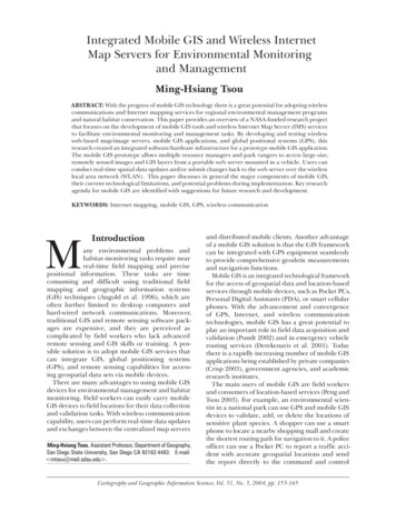
Issue No 69 April 2016from the editorwelcome. . .to the April 2016 issue ofGIS Professional. . .Geospatial: is it really just part of the techno stack?I attended the Scottish AGI conference last month in Edinburgh in a land where local government andother state agencies benefit from an organisation called the Improvement Service. Colin Mair of theservice painted a grim picture of local government finances north of the border though probably noworse than most of the rest of UK. Nevertheless, it was a particularly well attended, vibrant and busyday. Presentations ranged from the heritage sector, UAVs (aka drones), driverless vehicles, Big Dataand data islands, to Glasgow’s emerging space satellite industry where size is apparently measured inwhisky boxes (quite a change from those great ships that once began life on the Clyde whose sizecould be measured in football fields). The day wound up with one of those thought-provokingpresentations from Google’s geospatial evangelist Ed Parsons; we are moving from the desktop to “aworld in your pocket” (or handbag?) where the smartphone maps countries.While a number of pundits have tended to dismiss geospatial as nothing special including one at AGIScotland (“just another techno stack “) it is remarkable how many aspects of life today rely on it,including the all-important consumer sector. The still from Grand Theft Auto which graces our frontcover is typical of games whose compilation can be made a whole lot easier by basing the backgroundscenery on real-world 3D topography. Andy Coote and his son James discuss the influence and importance of geospatial in this context on page 24.“. . . when did theviews of thosewith knowledgeof a subjectever stopgovernment?Since at least last year the privatisation of the Land Registry has been on the Government’s agenda. Aprevious proposal three years ago under the coalition government was rejected by over 80% of thoseconsulted. But when did the views of those with knowledge of a subject ever stop government? Onlywhen you can get The Sun or The Daily Mail behind you, are you likely to make our Government thinkagain, and the Land Registry was never going to be an issue to exercise the mass media – too muchhard thinking. We report on the Government’s plans in this issue’s News columns and former chiefland registrar John Manthorpe sets out the arguments against this worrying move on page 16.One of the problems of conferences, unless you are an eminent keynoter, is that each speaker gets thesame amount of time to present. That can work well for those with a simple message; less so for thosewith a complex idea to get over. Last November at AGI GeoCom15 I was struck by an interestingpresentation from Andrew Thompson on ground information modelling. Alas, Andrew didn’t haveenough time to properly get his message across and was cut short. I am pleased to be able to give himspace in GiSPro to present his ideas in detail on this important topic (page 21).“Because mappers are an enthusiastic bunch and understand all too well the importance of up-to-datemapping in critical decision making, it is unsurprising that there is an increasing number of voluntaryinitiatives around crisis mapping. One such is HOT, the Humanitarian OpenStreetMap Team. HOT relieson open source and open data to provide up-to-date mapping for NGOs as well as local communitiesaround the world. Their work though is not just for crisis situations but also for economic development,as Paul Stewart explains (page 18).Towards the end of April we will be publishing the first issue of our twice-yearly EngineeringSurveying Showcase. This features lots of information, charts and tables on laser scanners, totalstations, GNSS and other data collection systems. To reserve your FREE copy go towww.pvpubs.com/Showcase/Home or call 01438 352617.joining the geography jigsawwww.gisprofessional.co.ukGiSProfessionalThis issue of GiSPro will be distributed at geospatial’s three big upcoming events: GEOBusiness (24-25May); the Esri UK Conference (17 May) and GeoPlace (28 April). All take place in London and areadvertised in this issue. I look forward to meeting readers there. In addition, we shall also have copiesavailable at the GeoDATA series of events (see News, page 08).05
Issue No 69 April 2016newsAGI Northern IrelandUKdigitalcropmap firstThe first digital map of the UK’s arable crops has been created througha collaboration between environmental researchers and RemoteSensing Applications Consultants Ltd using data from the CopernicusSentinel-1 Radar Satellite. Land Cover plus: Crops combines the Centrefor Ecology & Hydrology’s existing UK Land Cover Map with newanalysis of radar satellite data to map arable crops and grassland atthe field level. The map is the first operational product from theEuropean Copernicus Sentinel Mission, which provides a series ofsatellites for reliable, repeated monitoring of the earth’s surface.A time series of Sentinel-1 radar data has been used to producethe 2015 map, with more than 350 individual images of the UKprocessed to cover the whole crop growing season. Radar data is notaffected by cloud cover and can be acquired day or night under allweather conditions. Over the next three years, crop maps will beupdated annually, building up rotational cropping information for thewhole UK. From 2016 onwards crop mapping will also incorporate theuse of Sentinel-2 optical data. More precise knowledge of crop areasand field locations will provide policy-makers, regulatory agenciesand land managers with better evidence to inform planning anddecision-making.GiSProfessionalSTOP PRESS06GIS Professional was saddened to learn as we were going topress of the death of Lord Chorley. Roger Chorley wassomething of a polymath but he will be especially rememberedby the GI community for the Chorley Report of 1987 thattriggered the birth of the AGI and got people thinking seriouslyabout the importance of geospatial. A full appreciation willappear in the next issue of GiSPro.www.gisprofessional.co.ukCalling all GI users, specialistsand experts! The GeographicEconomy - the Benefits ofInvesting in GeospatialTechnology is the theme forthis year’s AGI Northern Irelandconference. The event is set for11th May 2016 in Riddel Hall,Belfast and the organisers arelooking for speakers withoriginal and thought-provokingpresentations in the use of GI,user testimonials, industrytrends and more. This yearthere is particular focus on thechallenges of AssetManagement and PositionalImprovement (PI) to calculatingand communicating the Returnon Investment (ROI) from GIStechnology. They are also veryinterested in local examples aswell as best practice across theindustry.Speaking slots will be 25minutes long, with 20 minutepapers and 5 minutes forquestions. Depending oninterest, they may also considerrunning a series of 10 minutelightning talks. Presentationsshould avoid being salespresentations, say theorganisers: “we have foundfrom experience that delegatesare not keen on any overtlycommercial presentations, sowe ask that you please keepany product and commercialreferences to an absoluteminimum”. More at:http://www.agi.org.uk/component/civicrm/?task civicrm/event/info&Itemid 238&reset 1&id 207Privatisation back on theagenda for Land RegistryThe government is planning toprivatise the Land Registryunder plans now out to aconsultation which closes on26th May. The plan is to sellthe agency as a going concernwith the core land registerremaining state owned butwith the agency run by aprivate company. Theannouncement is the secondattempt within two years totransfer the register to theprivate sector. A previousconsultation under thecoalition government proposedsplitting the agency into anOffice of the Chief LandRegistrar and a servicecompany. The plan was shelvedin 2014 after a wave of protestfrom users, trade unions andprofessional bodies.Under the new plan Crownownership of the registry’sdatabases, which include localland charges, bankruptcyrecords and agricultural creditsas well as the core register oftitle, will be retained, while thestaff and tangible assetstransfer to a private sectoroperator in which an investorwould buy shares.You can read more aboutwhy GiSPro thinks this is not agood idea in John Manthorpe’sarticle on page 16. Manthorpeis a former Chief Registrar ofthe Land Registry.Changes to Cadcorp’slicensingGIS and web mappingdeveloper, Cadcorp, has madea significant change to the wayit licenses software. Withimmediate effect, customersworldwide can benefit from anEnterprise Licence Agreement(ELA), which provides an optionfor small, medium and largeenterprises to licence CadcorpSIS Map Modeller desktopsoftware. The ELA is availableas an annual subscription andincludes full support andupgrade entitlement. CadcorpMD, Martin McGarry, said “Thenew ELA provides customerswith a cost effective andflexible way in which desktopGIS software can be deployed.”McGarry made theannouncement at the annualconference of the OrdnanceSurvey Public Sector MappingAgreement.
Issue No 69 April 2016newsThere is more news of companies and organisations on our website at www.location-source.comTo get your company featured on these pages call Sharon Robson on 44 (0)1438 352617The OGC has adopted astandard which defines asimplified profile of the OGCWeb Map Tile Service (WMTS)Interface Standard. WMTSSimple limits the flexibility ofthe original standard for thesake of interoperability withsome mass market tiledistributions that do not claimto be WMTS compliant but infact share elements of thestandard’s requirements. Theprofile enhancesinteroperability between clientsand servers and simplifies thetask of implementing clientapplications. It also proposes atile matrix pattern definitioncompatible with commonpractice in web map servicessuch as OpenStreetMap andanother pattern enunciated inthe European INSPIRE TechnicalGuidance for view services.Future City PilotOGC has also announced arequest for quotation and callfor participation in their Interoperability Program’s Future CityPilot Phase 1 (FCP1) initiative.The purpose is to solicitproposals in response to a set ofrequirements for the FCP1initiative. The sponsors areOrdnance Survey Great Britain,Institut National de l’InformationGéographique et Forestière (IGN)France, city of Sant Cugat delVallès (Barcelona), Spain andvirtualcitySYSTEMS GmbH Berlinand in collaboration withbuildingSMART International (bSI).The aim is to demonstrateand enhance the ability ofspatial data infrastructures tosupport quality of life, civicinitiatives and urban resilience.OGC, on behalf of the project’ssponsors, will provide costsharing funds to partially offsetexpenses uniquely associatedwith the initiative, thus therequest is for quotations frombidders wishing to receive cost-joining the geography jigsawsharing. However, not allproposals are expected to seekcost-share funding. OGCintends to involve as manyparticipants in the initiative aspossible, to the extent thateach participant can enhanceand/or contribute to theinitiative outcomes.The objective of the pilot isto demonstrate how use ofCityGML data and IFC datatogether can providestakeholders with information,knowledge and insight toenhance financial,environmental and socialoutcomes for citizens living incities. CityGML is an open datamodel and XML-based formatfor the storage and exchangeof virtual 3D city models.Industry Foundation Classes(IFC) are the open and neutraldata format for an open BIMenvironment.In the scenario, the use ofBIM models encoded in IFCs ismandatory for importantbuilding projects. The urbanplanning authorities check theconformance with urbanplanning rules using anautomated process. Forverification, an analyst easilyviews the building projectwithin the existing 3D model ofthe city. The BIM data is addedto the existing 3D city model’sdatabase, according to localcity rules, with mapping to thevarious levels of detail. The BIMdata is stored with links togeospatial data and BIM data.Agenda for Esri UKconferenceEsri UK has announced theagenda for their 2016 UKConference. An interetsing lineup of technical presentations,customer speakers and freehands-on training workshops,should not be missed. Key dateis 17th May in London at theQEII conference centre inWestminster.The day kicks off with aBluesky back water management in KenyaAerial mapping company Bluesky is aiding the expansion of aUNESCO Biosphere Reserve in Kenya. Working with CranfieldUniversity, the aerial survey company will provide financial andtechnical support for the project which will use remotely sensed data,such as aerial photography, satellite imagery and 3D height models,to improve water resource management. The project supportsreforestation and sustainable agriculture with a long-term integratedcatchment management approach that can be used in other regions.The Malindi-Watamu Biosphere Reserve is located on the coastapproximately 100 kilometres north of Mombasa, Kenya’s second city.The region is one of the main recreational centres with localcommunities benefiting from tourism. Originally established as aMAB (Man and the Biosphere programme) reserve in 1979, UNESCO isnow proposing to extend the mainly coastal and marine habitats toinclude the nearby Arabuko-Sokoke Forest as another core zone. Thenew areas have a variety of uses, including small scale agricultureand agro forestry.Bluesky will support a PhD project to study how sediment run-offfrom the forest catchment area can be controlled to reduce theimpact on ecologically important coral reefs and marine turtlehabitats. The project is backed by a new fund launched to mark thecontribution of a distinguished former Cranfield water specialist,Professor Sue White. The Sue White Fund for Africa, established withher generous bequest, provides funding to enable students to studyfor a PhD at Cranfield in topics related to her research, such as waterand sanitation, catchment process and water management.plenary: “GIS – Lighting up theEnterprise” and is followed by achoice of no less than ten tracksincluding subject areas likeTraining Workshops, Schools,Technical, Higher Education,Developers, etc. Individualsessions include Mapping theMarathon and KeepingLondoners Moving from TfL;Geographical InformationSystems in Location Planningfrom chartered surveyors KnightFrank; Utilising data tounderstand and manageNetwork Rail’s earthwork assetsand from Crossrail: Stand Backfrom the Platform Edge! –www.gisprofessional.co.ukGiSProfessionalOGC simplifies webmapping07
Issue No 69 April 2016newsSharing Geographic Informationon a Construction Project. Othersessions include, Situationalawareness any time, any place,anywhere (The UK HydrographicOffice); The landscape of GISteaching in Higher Education –where are we and where shouldwe be heading? With presentersfrom Ordnance Survey, UCL,University of Liverpool,University of Greenwich,University of Sheffield; and allbefore lunch!The afternoon also hasplenty to attract GISprofessionals. Planned is:Forensic remote search: GIS,UAVs and the search for themissing – presumed murdered;Understanding bird behaviourto progress wind farmdevelopment; from the RAF:Flying Low – How GIS is usedto manage and investigatepublic complaints;This promises to be a greatday of learning with 56individual sessions spread overten tracks. More informationand registration 16/agenda/2016-agendaBRIEFSGiSProfessionalThe call for contributions is nowopen for the 2016 BritishCartographic Society and Societyof Cartographers jointconference, ‘Mapping TogetherAgain’ which will take place atthe Cheltenham Park Hotel,Cheltenham on the 6-8thSeptember 2016.Those interested in making acontribution to the conferenceshould complete the Online Formby Tuesday 12th of April 2016 atwww.cartography.org.uk/08High resolution aerialphotography and 3D terrainmaps created from airborneLiDAR surveys are being used todesign new golf courses. Golfcourse architects Creative Golfwww.gisprofessional.co.ukDesign regularly downloadimages from Bluesky’s onlineMapShop to provide a mapaccurate base onto which coursedesign and improvement planscan be drawn. The Blueskyheight (LiDAR) data is alsohelping them to provide 3Dcontext for their designs,illustrating changes in terrain aswell as the location and extentof existing features such asboundaries, vegetation andwoodland areas.Los Angeles Mayor Eric Garcettiand Esri President JackDangermond have unveiled LA’snew GeoHub, a citywideapplication and data informationportal. The GeoHub is a first-ofits-kind technology infrastructurethat provides location as a service(LaaS) including real-timecollaborative and do-it-yourselfmapping tools.1Spatial has become a distribution partner of GeocomInformatik and will sell andimplement Geocom’s “Geonis” GISproduct suite for utilities andindustrial plants in the UK andIrish markets. Both companies areEsri worldwide partners. Geonis isalready in use by more than 225customers worldwide and is nowexpanding sales into the UK fromits traditional market area ofcentral Europe, the Middle Eastand Africa.Hexagon AB has acquiredSigmaSpace Corporation, a 3Dmapping company whoseclients include NASA and theUS Department of Defense(sic). Based near Washington,DC with approximately 110employees, SigmaSpace has aunique single photon LiDARtechnology, which enables 3Ddata collection at much higherspeeds and resolution thanconventional systems.Landmark’s 2016 UniversityLecture Programme has begun atHarper Adams University inShropshire, to provide studentsstudying Rural Estate, Propertyand Land Management withhands-on insight into the rangeof digital mapping datasets andtools used in today’s commercialworld. The programme is alsovisiting Oxford Brookes andNewcastle University.Members of the BritishCartographic Society canbenefit from a 25% discountfrom Ordnance Survey GB onpaper maps, custom made,historical and OS maps in theOS shop. When shoppingmembers should quote thecode BCS25LM.The 8bn Harris Corporation, aleading technology innovator,has raised its membership ofOGC from Technical to Principallevel. The move will enable it toparticipate in OGC’s PlanningCommittee which providesleadership through theexploration of market andtechnology trends relevant tothe organisation’s mission.Registrations are now open forthe complete GeoDATA 2016free seminar series. Dates andvenue include: Dublin, 19 April;Cork, 21 April; Liverpool, 28April; 6 October, Scotland; 19October, Brussels; 1 December,London.PEOPLECoast joins what3wordsSteve Coast, the founder ofOpenStreetMap, has beenappointed chief evangelist ofwhat3words, the grid-basedaddressing platform. Coast,who is based in Denver andfounded the OpenStreetMapproject in 2004 will capitalizeon expansion in the NorthAmerican market.“Addresses are the finalpiece of the puzzle” says Coast.“When it comes to realizing thepromises of the advances madein mapping and navigationwhat3words has hugemomentum and offers the onlyreal solution to this globalchallenge. It’s a really cleversystem to overcome the manycommunication, standardizationand accuracy challenges thathave stifled global addressinginitiatives in the past. Thebeauty of what3words is thatany mapping interface can reapthe benefits.”what3words is a locationreference platform based on aglobal grid of 57 trillion 3m 3msquares, where each square hasa unique pre-assigned 3 wordaddress. Used in over 170countries by logistics firms,navigation apps, travel guidesand NGOs, including the UNdisaster recovery app UN-ASIGNand Norway’s National Mappingwebsite Norgeskart. Esri alongwith other GIS softwareproviders including SafeSoftware and Boundless havemade what3words availableacross their platforms includingFME and the open source QGIS.Customer success officeOnline mapping softwarecompany eSpatial, hasappointed Peter Lyon as chiefcustomer success officer. Lyonbrings more than 25 years’experience in revenuegenerating roles in the B2Btechnology industry acrossEurope with extensiveknowledge and awareness ofemerging markets,technologies and trends. In July2015, he founded CustomerSuccess Associates whichadvises SaaS and Start-Upbusinesses with expansiontechniques and up-sellstrategies. With over 13 years’experience in the mappingsoftware industry, Lyon hasrecently held senior positions ascustomer success director ofEsri UK and managing directorof Esri Ireland.joining the geography jigsaw
Issue No 69 April 2016Adena Schutzberg hasworked in geospatialtechnologies for 25 yearsand is principal of ABSConsulting Group,www.abs-cg.com.adena@abs-cg.comcolumnist adenaI SEE REQUESTS FOR PARTICIPATION in geospatialcompetitions all the time. Professionals and students areinvited to produce maps and apps and win recognitionsand/or prizes. One type of contest features a geospatialtechnology company’s development platform.Participants have a time limit, hours to months, to buildan app or map. While sometimes there are guidelines onwhat kind of app or map is to be submitted, mostcontests are free-for-alls and competitors can buildwhatever they choose. Companies host such events togain users, generate marketing content and/or developproducts that result in revenue.There’s a second type of competition that I see lessoften. It asks participants to solve a very specificproblem. Here’s a current example. The government ofIndonesia is offering 1 million to find the mostefficient way to map Indonesia’s peat-lands. TheIndonesian Peat Prize was announced in February andregistration and qualification is open until May. Peat, adeposit of dead plant material, holds a substantialamount of carbon. Clearing, wildfires and climatechange cause peat-lands to release that carbon. TheschutzbergAbove: Forest fires in Indonesia.Source: uccessful projects, there’s a chance for positive change.I did not find a single problem-based competition inthe latest update of an online magazine’s GIS and mapcontests roundup. The listings did included two contestswhere specific data must be used, three that requiredmaking a map and one that required using a commercialmapping platform. That said, a variety of US governmentagencies, civic organizations and others host problembased tech challenges that can involve geospatialRethinking the Geospatial CompetitionToo often geospatial competitions invite solutions to hitherto undiscovered problems,argues Adena Schutzberg. Is there a better way of inspiring young GIS professionals tocome up with solutions to real world problems?solutions, but do not market them specifically in our space.I want to advocate for more problem-basedgeospatial competitions.Solution in search of a problem I was invited to bea judge for a location platform contest back in 2010. TheLocation Wild app competition challenged developers tobuild a location-based app in a week. Participants coulduse any location platform they chose. The winnerreceived 2,500 and an iPad. The handful of submissionswere rather weak. Nakd Reality, the sponsor, was tryingto promote its own LBS platform. I don’t think it workedout; I can no longer find Nakd Reality on the Web.“Solution in Search of a Problem” competitionscan involve quite a few decisions. The participants inLocation Wild had to choose a platform, a locationand a scenario before they even wrote any code!Further, the freedom in these contests can lead tosome unexpected winners. A winning app from 2015used geocoding and routing to automatically letsomeone know when they’re running late.A new vision I’m going to unapologetically steal anidea from Azavea, a well-regarded GIS consultancybased in Philadelphia. The company runs the Summerof Maps (www.summerofmaps.com) program.Selected college and graduate students are paired upwith local and national non-profits to tackle realworld geospatial problems. Azavea and otherprogram sponsors pay each student fellow a stipend.What if contest hosts started to think like Azavea?Organizations considering geospatial contestscould reach out to non-profit, humanitarian or othercommunity groups for spatial problems. Submissionswould need to be vetted and matched withcorporate goals, but I suspect that’s doable.While I can’t be sure these contests would resultin more entries, more long term users or put moremoney in corporate coffers, I hope they’d do at leastas well as “free for alls.” I do believe the marketingcontent would be more compelling!Problem in search of a solution The rational behinda “Problem in Search of Solution” contest is finding one ormore solutions. The focus puts the participants on a morelevel playing field than a “free-for-all” and, if there areCompetitions will remain I have no doubt app andmapping competitions will be with us for quite sometime. I do hope organizations will consider tweakingcompetition rules to serve others as well as lThe recent AT&T DeveloperSummit Hackathon in LasVegas saw the 10,000prize for best use of Esritechnology go to the teambehind the “I’m AlmostThere app”. Their Androidapp uses Esri’s geocodingand routing to help youautomatically let someoneknow when you’re runninglate. The app looks at yourphone’s Google calendar,and for events that containa location and an inviteewith a phone number inyour address book, the appwill pay attention to yourlocation and send a textmessage, automated call oremail with your locationand ETA if an event startsand you and your phonearen’t there yet.bottom line is that for Indonesia to manage its peat andits carbon emissions, it needs good peat maps.These two types of competitions might bethought of as “solutions in search of problems” and“problems in search of solutions,
AGI Foresight 2020 Report update Emergency HOT mapping uses Open Scottish AGI hits the high notes Ground information modelling and BIM Rethinking geospatial competitions News People Products & Services GiSPro's columnists sponsored by issue 69 : April 2016 sponsored by. . . joining the geography jigsaw Grand theft geospatial F
