Transcription
Semiannual Groundwater Monitoring ReportSecond Quarter 2012 and Third Quarter 2012Laborde Canyon (Lockheed Martin Beaumont Site 2)Beaumont, CaliforniaPrepared for:Prepared by:TETRA TECH301 E. Vanderbilt, Suite 450San Bernardino, California 92408TC# 28535-02.0303/ December 2012
Lockheed Martin Enterprise Business ServicesEnergy. Environment. Safety and Health2950 North Hollywood Way. Suite 125 Burbank. CA 91505Telephone RlR·847·0197 Facsimile 81R·847·0256LOCKHEED M A R T I N December 21, 2012Mr. Daniel ZogaibSouthern California Cleanup OperationsDepartment of Toxic Substances Control5796 Corporate AvenueCypress, CA 90630Subject: Submittal of the Semiannual Groundwater Monitoring Report, Second Quarter 2012and Third Quarter 2012, Laborde Canyon (Lockheed Martin Beaumont Site 2), Beaumont,CaliforniaDear Mr. Zogaib:Please find enclosed one hard copy of the body of the report and two compact disks with thereport body and appendices of the Semiannual Groundwater Monitoring Report, SecondQuarter 2012 and Third Quarter 2012, Laborde Canyon (Lockheed Martin Beaumont Site 2),Beaumont, California for your review and approval or comment.In the meantime, if you have any questions regarding this submittal, please contact me at 818847-9901 or brian.thorne@lmco.com.Sincerely,B '1. "1ABrian T. ThorneRemediation Project LeadEnclosure: Semiannual Groundwater Monitoring Report, Second Quarter 2012 and ThirdQuarter 2012, Laborde Canyon (Lockheed Martin Beaumont Site 2), Beaumont, CaliforniaCopy: Gene Matsushita, LMC (electronic and hard copy)Sally Drinkard, COM (electronic copy)Tom Villeneuve, Tetra Tech (electronic copy)Hans Kernkamp, Riverside County Waste Management (electronic copy)Brian Beck, Western Riverside County Regional Conservation Authority (electroniccopy)Alan Sick, Gibson Dunn (electronic copy)BUR294 Trans Bmt 2 GWM Rpt
TABLE OF CONTENTSSectionPageAcronyms and Abbreviations.vSection 1 Introduction .1-11.1Site Background .1-1Section 2 Summary of Monitoring Activities .2-12.1Groundwater Level Measurements.2-12.2Surface Water Flow and Sampling.2-12.3Groundwater Sampling.2-42.3.1Proposed and Actual Surface Water and Well Locations Sampled .2-42.3.2Field Sampling Procedures.2-72.4Analytical Data QA/QC .2-82.5Habitat Conservation .2-8Section 3 Groundwater Monitoring Results .3-13.1Groundwater Elevation and Flow.3-13.2Groundwater Gradients .3-93.3Surface Water Flow .3-113.4Analytical Data Summary .3-113.4.13.5Data Quality Review .3-13Chemicals of Potential Concern .3-143.5.1Organic Analytes .3-153.5.2Organic Chemicals of Potential Concern .3-163.5.3Inorganic Analytes.3-173.5.4Inorganic Chemicals of Potential Concern.3-173.6Private Production Wells and Springs .3-173.7Surface Water and Storm Water Sampling Results.3-17Tetra Tech Laborde Canyon Semiannual Groundwater Monitoring ReportSecond Quarter 2012 and Third Quarter 2012Page i
3.8Temporal Trends in Groundwater Chemical Concentrations.3-213.9Habitat Conservation .3-31Section 4 Summary and Conclusions .4-14.14.1.1Groundwater Elevation and Flow.4-1Groundwater Gradients .4-24.2Surface Water Flow .4-34.3Water Quality Monitoring .4-34.3.1Private Production Wells and Springs .4-34.3.2Surface Water and Storm Water.4-44.3.3Groundwater .4-44.4Temporal Trend Analysis .4-84.5Groundwater Monitoring Program and the Groundwater Quality Monitoring Network.4-124.5.1Groundwater Sampling Frequency.4-134.5.2Increasing Trend Wells.4-14Section 5 References .5-1Tetra Tech Laborde Canyon Semiannual Groundwater Monitoring ReportSecond Quarter 2012 and Third Quarter 2012Page ii
LIST OF FIGURESPageFigure 1-1 Regional Location of Laborde Canyon.1-2Figure 1-2 Historical Operational Areas and Site Features.1-4Figure 2-1 Surface and Storm Water Sampling Locations.2-3Figure 2-2 Second Quarter 2012 Sampling Locations .2-6Figure 3-1 Groundwater Contours for First Groundwater - Second Quarter 2012 .3-4Figure 3-2 Groundwater Contours for First Groundwater - Third Quarter 2012 .3-5Figure 3-3 Changes in Groundwater Elevation - Second Quarter 2012.3-7Figure 3-4 Changes in Groundwater Elevation - Third Quarter 2012.3-8Figure 3-5 1,4-Dioxane Isoconcentration Map (µg/L) – Second Quarter 2012.3-18Figure 3-6 Trichloroethene (TCE) Isoconcentration Map (µg/L) – Second Quarter 2012 .3-19Figure 3-7 Perchlorate Isoconcentration Map (µg/L) – Second Quarter 2012.3-20Figure 3-8 Perchlorate Statistical Analysis Summary Results .3-27Figure 3-9 TCE Statistical Analysis Summary Results.3-28Figure 3-10 1,4-Dioxane Statistical Analysis Summary Results .3-29Figure 3-11 RDX Statistical Analysis Summary Results.3-30Tetra Tech Laborde Canyon Semiannual Groundwater Monitoring ReportSecond Quarter 2012 and Third Quarter 2012Page iii
LIST OF TABLESPageTable 2-1 Sampling Schedule and Analysis Method - Second Quarter 2012 .2-5Table 3-1 Groundwater Elevation Data - Second Quarter 2012 and Third Quarter 2012 .3-2Table 3-2 Groundwater Elevation Change - Second Quarter 2012 and Third Quarter 2012.3-6Table 3-3 Summary of Horizontal and Vertical Groundwater Gradients .3-10Table 3-4 Summary of Validated Detected Organic and Inorganic Analytes - SecondQuarter 2012 .3-12Table 3-5 Summary Statistics for Validated Detected Organic and Inorganic Analytes Second Quarter 2012 .3-13Table 3-6 Groundwater Chemicals of Potential Concern.3-15Table 3-7 Mann-Kendall Concentration Trend Matrix .3-22Table 3-8 Summary of Mann-Kendall Trend Analysis of Chemicals of Potential Concernfor 2012 Sampled Monitoring Wells .3-23Table 3-9 Magnitude of Trends Detected for Chemicals of Potential Concern for 2012Sampled Monitoring Wells.3-25Table 3-10 Summary of Mann-Kendall Trend Analysis of Chemicals of Potential Concernfor 2012 Sampled Surface Water and Spring Locations .3-26Table 4-1 Historical Trichloroethene Trend Summary in Monitoring Wells.4-8Table 4-2 Historical Perchlorate Trend Summary in Monitoring Wells.4-9Table 4-3 Historical 1,4-Dioxane Trend Summary in Monitoring Wells .4-9Table 4-4 Historical Perchlorate Trend Summary in Surface Water .4-9Table 4-5 Summary of Increasing Chemicals of Potential Concern Trends – SecondQuarter 2012 .4-10Table 4-6 Current Sampling Frequencies.4-13Table 4-7 Proposed Sampling Frequencies .4-14Table 4-8 Monitoring Well Sampling Schedule and Frequency .4-16Tetra Tech Laborde Canyon Semiannual Groundwater Monitoring ReportSecond Quarter 2012 and Third Quarter 2012Page iv
APPENDICESAppendix A - Recent Environmental Activities and Conceptual Site ModelAppendix B - Copies of the Field Data SheetsAppendix C - Well Construction TableAppendix D - Water Level Hydrographs and Precipitation DataAppendix E - Summary of Calculated Horizontal and Vertical Groundwater GradientsAppendix F - Validated Sample Results by Analytical MethodAppendix G - Laboratory Analytical Data PackagesAppendix H - Consolidated Data Summary TableAppendix I - Chemicals of Potential Concern Time-Series GraphsAppendix J - Summary of the Mann-Kendall and Linear Regression AnalysesTetra Tech Laborde Canyon Semiannual Groundwater Monitoring ReportSecond Quarter 2012 and Third Quarter 2012Page v
Acronyms and Abbreviationsbgsbelow ground surfaceCOVcoefficient of variation1,2-DCA1,2-dichloroethane1,1 -DCE1,1-dichloroetheneDOdissolved oxygenDWNLCalifornia Department of Public Health drinking water notificationlevelECelectrical conductivityfThis data validation qualifier means the duplicate relative percentdifference was outside the control limit.ft/ftfeet per footGMPGroundwater Monitoring ProgramGPSglobal positioning systemHCPHabitat Conservation PlanJThis data validation qualifier means the analyte was positivelyidentified, but the concentration is an estimated value.LClower canyonMAROSMonitoring and Remediation Optimization SystemMWmonitoring wellMCLCalifornia Department of Public Health maximum contaminant levelMEFMt. Eden formationmg/Lmilligrams per literMSmatrix spikeTetra Tech Laborde Canyon Semiannual Groundwater Monitoring ReportSecond Quarter 2012 and Third Quarter 2012Page vi
MSDmatrix spike duplicatemslmean sea levelµg/Lmicrograms per literµg/L/yrmicrograms per liter per yearNAnot applicable/not availableNDnon-detectNTUsnephelometric turbidity unitsNWSNational Weather ServiceORPoxidation-reduction potentialPQLpractical quantitation limitqThis data validation qualifier means the analyte detected was belowthe PQL.QALQuaternary alluviumQA/QCquality assurance/quality PDrelative percent differenceRWQCBRegional Water Quality Control BoardSMann-Kendall statisticSTFSan Timoteo formationTCEtrichloroetheneTOCtotal organic carbonU.S.United StatesUSEPAUnited States Environmental Protection AgencyUSFWSUnited States Fish and Wildlife ServiceVOCvolatile organic compoundWDAwaste discharge areaTetra Tech Laborde Canyon Semiannual Groundwater Monitoring ReportSecond Quarter 2012 and Third Quarter 2012Page vii
wMEFweathered Mt. Eden formationWSformer Wolfskill propertywSTFweathered San Timoteo formationTetra Tech Laborde Canyon Semiannual Groundwater Monitoring ReportSecond Quarter 2012 and Third Quarter 2012Page viii
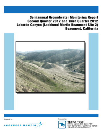
Section 1 IntroductionOn behalf of Lockheed Martin Corporation, Tetra Tech, Inc. has prepared this SemiannualGroundwater Monitoring Report, which presents the results of the Second Quarter 2012 and ThirdQuarter 2012 groundwater monitoring activities for the Laborde Canyon (Lockheed MartinBeaumont Site 2) Groundwater Monitoring Program. Laborde Canyon is southwest of the City ofBeaumont, Riverside County, California (Figure 1-1). Currently, the site is inactive except forongoing investigative activities performed under Consent Order HSA 88/89-034, amendedJanuary 1, 1991, with the California Department of Toxic Substances Control.The objectives of this report are to accomplish the following: Briefly summarize the site history Document the water quality monitoring procedures and results Analyze and evaluate the groundwater elevation and water quality monitoring datageneratedThis report is organized into the following sections: 1) Introduction, 2) Summary of MonitoringActivities, 3) Groundwater Monitoring Results, 4) Summary and Conclusions, and 5) References.Appendix A provides a brief description of the previous site environmental investigations and thecurrent conceptual site model.1.1Site BackgroundThe site is a 2,668-acre parcel southwest of Beaumont, California. The parcels that comprise thesite were owned by individuals and the United States government before 1958. Between 1958 and1960, portions of the site were purchased by the Grand Central Rocket Company and used as aremote test facility for early space and defense program efforts. In 1960, the Lockheed AircraftCorporation purchased one-half interest in the Grand Central Rocket Company. The Grand CentralRocket Company became a wholly-owned subsidiary of the Lockheed Aircraft Corporation in1961. The remaining parcels of land that comprise the site were purchased from the United Statesgovernment between 1961 and 1964. In 1963, the Lockheed Propulsion Company became anoperating division of the Lockheed Aircraft Corporation and was responsible for the operation ofTetra Tech Laborde Canyon Semiannual Groundwater Monitoring ReportSecond Quarter 2012 and Third Quarter 2012Page 1-1
P:\GIS\Lockheed S2 pted from:U.S. Census Bureau TIGER line data, ayMoreno ValleyState HighwayCounty BoundaryLaborde CanyonProperty Boundary(Lockheed Martin Beaumont Site 2)Laborde Canyon(Lockheed MartinBeaumont Site 2)City/MunicipalityLaborde Canyon(Lockheed Martin Beaumont Site 2)San JacintoFigure 1-1Regional Location ofLaborde Canyon
the site until its closure in 1974. The site was used by the Grand Central Rocket Company and theLockheed Propulsion Company from 1958 to 1974 for small rocket motor assembly, testingoperations, propellant incineration, and minor disposal activities. Ogden Labs is known to haveleased portions of the site during the 1970s (Radian Corporation, 1986).In 1989, the California Department of Health Services issued a Consent Order requiring LockheedMartin Corporation to clean up contamination at the site related to past testing activities(California Department of Health Services, 1989). After reviewing reports on investigative andcleanup activities performed at the site, the California Department of Toxic Substances Control, asa successor agency, issued a no further remedial action letter to Lockheed Martin Corporation in1993.Because of regulatory interest in perchlorate and 1,4-dioxane, a groundwater sample was collectedfrom an inactive groundwater production well (identified as W2-3) at the site in January 2003. Thesample was analyzed for volatile organic compounds, perchlorate, and 1,4-dioxane to determinethe potential presence and concentration of those chemicals in groundwater. The analytical resultsindicated that volatile organic compounds and 1,4-dioxane were not present at or above theirrespective method detection limits. However, perchlorate was reported at a concentration of 4,080micrograms per liter, which exceeded the then-current California Department of Public Healthdrinking water notification level of 4 micrograms per liter. In October 2007, the drinking waternotification level was replaced by the California Department of Public Health maximumcontaminant level of 6 micrograms per liter. Based on the detection of perchlorate in thegroundwater sample collected, the California Department of Toxic Substances Control reopenedthe site for further assessment in August 2004.Four primary historical operational areas have been identified at the site (Figure 1-2). Eachoperational area was used for various activities associated with rocket motor assembly, testing,and propellant incineration. In addition, a waste discharge area has been defined. A briefdescription of each area follows.Tetra Tech Laborde Canyon Semiannual Groundwater Monitoring ReportSecond Quarter 2012 and Third Quarter 2012Page 1-3
P:\GIS\Lockheed S2 Q2Q312\Op Areas.mxd0Parking AreaMarch 2007 aerial photograph.Concrete W2-18TT-MW2-1Destroyed MonitoringWell LocationDisposal SiteW S/DTT-MW2-10MW 2-2TT-MW2-28W -41ATT-MW2-41BRWQCB PermittedWaste Discharge AreaNote: Laborde Canyon property boundary(Lockheed Martin Beaumont Site 2)from Hillwig-Goodrow survey, May 2004.TT-PZ2-1TT-MW2-7Fault, Approximately LocatedLaborde Canyon Property Boundary(Lockheed Martin Beaumont Site 2)TT-MW2-6S/DTT-EW2-1Fault, Accurately Located Showing DipHistorical OperationalArea BoundaryTT-MW2-9DTT-MW2-5Reported ProductionWell LocationWaste Discharge AreaHistorical Operational Area LPropellant Burn AreaMW 2-4TT-MW2-231962 RWQCB PermittedWaste Discharge AreaDestroyed ProductionWell LocationHistorical Operational Area MGarbage Disposal AreaTT-MW2-31A/BTT-MW2-13PropellantBurn SiteSmallBunkerMW 2-5T-RevetmentConditioning ChambersInstrumentBuildingParking undwater MonitoringWell MW2-3Test BaysWaste Discharge AreaWater Tanksand Pump HouseTT-MW2-40A/B/CPrismConditioningChambersFaults from the Site 2 Lineament Study,Tetra Tech, 2009.W 2-2W 2-5CentrifugeHistorical Operational Area KTest Bays & Misc. Facilities2,000FeetAdapted from:Historical Operational Area JFinal AssemblyBuilding 250Rocket AssemblyBuilding1,000Disposal and Propellent Burn Siteperimeters are estimated (Radian, BTT-MW2-43Laborde Canyon(Lockheed Martin Beaumont Site 2)Figure 1-2Historical Operational Areasand Site Features
Historical Operational Area J (Area J) –Final AssemblyRocket motor casings with solid propellant were transported to Building 250, where finalassembly of the rocket hardware was conducted. The building was used from 1970 to 1974 forfinal assembly and shipment of short-range attack missile rocket motors. Rocket motor assemblyoperations included installation of the nozzle and headcap, pressure check of the motor,installation of electrical systems, and preparations for shipment. During plant closure in 1974, allusable parts of this facility were dismantled, taken off the site, and sold (Radian Corporation,1986).Historical Operational Area K (Area K) – Test Bays and Miscellaneous FacilitiesThe primary features included a large earthen structure known as the “Prism,” conditioningchambers, a centrifuge, and four test bays with two associated bunkers.The Prism was reportedly built between 1984 and 1990, and was used by General Dynamics totest radar (Tetra Tech, 2007b). Details concerning construction of the Prism are not available, butit appears to have been constructed with soils from near the test bays.The conditioning chambers were used to examine the effects of extreme temperatures on rocketmotors and to meet specification requirements (Radian Corporation, 1986). A centrifuge waslocated in the northwestern portion of Area K, where rocket motors were tested to determine if thesolid propellant would separate from its casing under increased gravitational forces.Four test bays were present at the site. Initially, only three test bays were known; however, aformer employee reported in an interview that a fourth test bay, north of the other three bays, wasalso used in Area K (Tetra Tech, 2009b). The initial testing activities had a history of explosionsthat destroyed complete test areas, especially during the period when the Grand Central RocketCompany operated at the site (Radian Corporation, 1986). Although vestiges from three test baysare currently visible at the site, the fourth was reportedly destroyed by such an explosion duringtesting. After a motor failure occurred, the area surrounding the test bay was reportedly inspectedto recover any unburned propellant.Historical Operational Area L (Area L) – Propellant Burn AreaSolid propellant was reportedly transported to the burn area and set directly on the ground surfacefor burning (Radian Corporation, 1986). No pits or trenches were dug as part of the burningTetra Tech Laborde Canyon Semiannual Groundwater Monitoring ReportSecond Quarter 2012 and Third Quarter 2012Page 1-5
process. The solid propellant was saturated with diesel fuel to initiate combustion. Reportedly, thesolid propellant would burn rapidly. No evidence or physical features identify the precise locationof burning activities, and previous site investigations (Tetra Tech, 2005 and 2010a) found noevidence of significant contamination in Area L, suggesting that propellant incineration may nothave been conducted in this area of the site.Historical Operational Area M (Area M) – Garbage Disposal AreaA garbage disposal area was located adjacent to a small creek at the site (Radian Corporation,1986). Scrap metal, paper, wood, and concrete materials were discarded at the disposal site by theLockheed Propulsion Company. Hazardous materials, including explosives and propellants, werenever disposed of at the disposal site by the Lockheed Propulsion Company, according toemployee interviews. However, Ogden Labs, a company that tested valves and explosive items,reportedly used this site for disposal of hazardous waste. In 1972, a Lockheed Safety Technicianwas exposed to toxic vapors of unsymmetrical dimethyl hydrazine from a pressurized gascontainer located in the disposal site. To avoid possible exposure risks to occupants, the LockheedPropulsion Companies safety group required Ogden Labs to take measures to remove anypotentially hazardous materials at the disposal site. Shortly thereafter, a disposal company wascontracted by Ogden Labs to clean up the disposal site (Radian Corporation, 1986).Waste Discharge AreaIn 2007, Lockheed Martin Corporation discovered the existence of Santa Ana River BasinRegional Water Pollution Control Board Resolution 62-24, dated September 14, 1962. Resolution62-24 prescribed requirements for the “discharge of industrial wastes (rocket fuel residuum) toexcavated pits.” The discharge area was described as two shallow basins protected by two-footberms, located in a small canyon on the western side of Laborde Canyon, in the SW quarter of theNW quarter of Section 19, Township 3 South, Range 1 West, San Bernardino Baseline andMeridian. Resolution 62-24 further described the wastes to be discharged as “residue remainingafter the manufacturing refuse is burned,” and indicated that the amount of material to bedischarged was “approximately 5,000 gallons per year.”The exact nature of the waste proposed for discharge is not clear from Resolution 62-24. Thedescription of the waste material suggests that the area may have been used for burning propellant;but the description of the quantity of material to be discharged suggests that the waste may haveTetra Tech Laborde Canyon Semiannual Groundwater Monitoring ReportSecond Quarter 2012 and Third Quarter 2012Page 1-6
been liquid rather than solid. A 1961 aerial photograph shows the waste discharge area as a largecleared area with roads leading to two circular structures, suggesting that the waste discharge areawas in use by 1961 (Tetra Tech, 2009b). Investigation of this area (Tetra Tech, 2007b and 2008)found evidence for perchlorate impacts in both soil and groundwater.Features remaining at the waste discharge area include two roughly circular depressionssurrounded by earthen berms, at the location of the circular structures identified in the 1961 aerialphotograph.Tetra Tech Laborde Canyon Semiannual Groundwater Monitoring ReportSecond Quarter 2012 and Third Quarter 2012Page 1-7
Section 2 Summary of Monitoring ActivitiesSection 2 summarizes the Second Quarter 2012 and Third Quarter 2012 groundwater monitoringactivities conducted at the site. The results of these monitoring events are discussed in Section 3.2.1Groundwater Level MeasurementsGroundwater level measurements are collected at the site on a quarterly basis from all availablewells. Water level measurements were proposed for 72 wells and four piezometers for SecondQuarter 2012 and Third Quarter 2012. During Second Quarter 2012, groundwater levelmeasurements were collected from 70 monitoring wells and four piezometers between 2 May2012 and 3 May 2012. During Third Quarter 2012, groundwater level measurements werecollected from 70 monitoring wells and four piezometers between 15 August 2012 and 16 August2012. Two monitoring wells, TT-MW2-29A and TT-MW2-43, were found to be dry during bothquarters. Copies of the field data sheets from the water quality monitoring events are presented inAppendix B. A summary of well construction details is presented in Appendix C.Precipitation data are collected from the local weather station in Beaumont to correlate observedchanges in groundwater levels with local precipitation. During Second Quarter 2012, theBeaumont National Weather Service (NWS) station reported approximately 1.64 inches ofprecipitation. During Third Quarter 2012, the Beaumont NWS station reported approximately 0.30inches of precipitation.2.2Surface Water Flow and SamplingThe site is bisected by Laborde Canyon, a major north-south oriented canyon that represents theprincipal drainage for the site. Ephemeral storm water drains to the south through Laborde Canyontoward the San Jacinto Valley. The 2,821-acre watershed for the site is dry when there is norainfall. Consequently, no permanent streams, creeks, or other major surface water bodies, otherthan a spring on the former Wolfskill property, occur at the site.Storm-water sampling locations SW-01 through SW-07 are located in ephemeral stream bedswithin Laborde Canyon and major side canyons. Storm water runoff drains to the stream bedsduring periods of heavy precipitation and flows south through the site and the former WolfskillTetra Tech Laborde Canyon Semiannual Groundwater Monitoring ReportSecond Quarter 2012 and Third Quarter 2012Page 2-1
property, eventually crossing beneath Gilman Hot Springs Road. Water is present in the streambeds only during periods of heavy, prolonged precipitation. Surface water sampling locations WS1, WS-2, and WS-3 are located at a spring approximately three quarters of a mile south of thesouthern site boundary on the former Wolfskill property. Surface water is generally present at oneor more of these sampling locations throughout the year. Figure 2-1 shows the surface and stormwater sampling locations.The areas within Laborde Canyon where surface water was observed were mapped during theSecond Quarter 2012 and Third Quarter 2012 groundwater monitoring events. If surface wa
Groundwater Monitoring Report, which presents the results of the Second Quarter 2012 and Third Quarter 2012 groundwater monitoring activities for the Laborde Canyon (Lockheed Martin Beaumont Site 2) Groundwater Monitoring Program. Laborde Canyon is southwest of the City of Beaumont, Riverside County, California (Figure 1-1).