Transcription
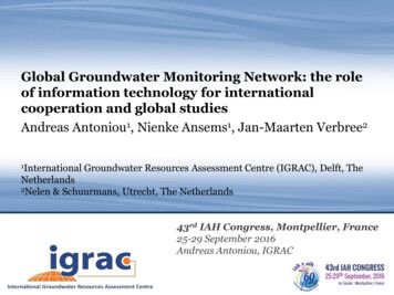
Global Groundwater Monitoring Network: the roleof information technology for internationalcooperation and global studiesAndreas Antoniou1, Nienke Ansems1, Jan-Maarten Verbree21InternationalGroundwater Resources Assessment Centre (IGRAC), Delft, TheNetherlands2Nelen & Schuurmans, Utrecht, The Netherlands43rd IAHMontpellier, FranceTitleCongress,of presentation25-29 September2016Subtitle of presentationAndreas Antoniou, IGRACDay month yearName of presenterGroundwater: Making the Invisible Visible
IGRAC - Global Groundwater CentreUNESCO and WMO groundwater centrefacilitates and promotes sharing of groundwater informationrequired for sustainable groundwater managementFocusing on transboundary aquifer assessment groundwater monitoring and information & knowledge management
Global Groundwater Monitoring ProgrammeGlobal Groundwater Monitoring Network (GGMN)Initiated to improve quality and accessibility of groundwatermonitoring information worldwide Need for groundwater data for informed decision-makingand management of groundwater– Global lack of available data– Limited accessibility and availability– Regional/transboundary groundwater management Data collection and storage at national level– Lack of funding/technology for own groundwater database Data as input for Sustainable Development Goals
GGMN ProgrammeGGMN People NetworkGGMN Portal
GGMN regional workshops Country representatives and regional hydrogeologists Knowledge sharing and best practices Initiate collecting and uploading groundwater data into the GGMN
Latest workshop outcomes (Southeast Asia &Pacific SIDS) Instrumental for cross-country collaboration and datasharing in transboundary settings (one database formultiple countries)– Level of accessibility from third parties is determined by theorganizations which own the data In pacific countries there is great need for ahomogeneous database to serve regional projects– Weak internet connections– Weak monitoring (accessibility, maintenance, equipment)
Global Groundwater Monitoring Network PortalQGIS –GGMN
GGMN.un-igrac.org
Additional layersDigital Elevation ModelLand coverHydrogeological MapTransboundary Aquifers
Select monitoring station for more information
Groundwater Station: an example Monitoring station information– Include image on well/boreholeinfo– Include information for each filter possible multiple filters for one station Time series available Download time series
Dashboard: combine and compare time series
Create, save and share favorite maps Note: only available after login
GGMN Regional: display groundwater levels
GGMN PortalWeb services allow groundwater data to be directly transferred from thenational online system to the GGMN
Public and protected environment– Protected environment– Access to private data– Import new dataData access rights- Open access (publically available)- Limited access (can be shared by IGRAC uponrequest)- Restricted access (only available for privateorganization)
GGMN and QGISExchange data betweenonline GGMN Portal and a GISsystem for offline processingUpload groundwater mapscreated in QGIS back intoGGMN PortalQGIS –GeographicInformation System
Groundwater level maps
Time series analysis Time series analysis can be performed for each pointmeasurement location to better understand temporalchanges of groundwater levels The time series analysis is a step-by-step procedure toidentify trends, periodic fluctuations,autoregressive model and additive model
How can the GGMN be useful for countries? Use GGMN tools for data analysis– create maps, time series analysis Use as national online groundwater database– Continuous development Use as a regional groundwater database– One system to cooperate with riparian countries Provide input for the sustainable development goals– Global SDG data collection by UN Agencies– “6.6 protect and restore water-related ecosystems, includingmountains, forests, wetlands, rivers, aquifers and lakes”
info@un-igrac.orgwww.un-igrac.orgDelft, The NetherlandsWorld MeteorologicalOrganizationGovernment ofThe Netherlands
Detection of Trends
Periodic Fluctuations
Autoregressive Model
Additive ModelAdditive Model Xtrend Xharmonics Xautoregressive
Global Groundwater Monitoring Network The GGMN is set up to improve quality and accessibilityof groundwater monitoring information worldwide. Member states are encouraged to contribute to theGGMN representative groundwater monitoring data. GGMN application offers additional services to analyzedata and generate regional groundwater mapsThe GGMN operates according to principles of theWorld Meteorological Organization (WMO) andUNESCO with the aim of encouraging thewidespread use of hydrological data for national,regional and global studiesWorldMeteorologicalOrganization
Global Groundwater Monitoring Network The GGMN is set up to improve quality and accessibility of groundwater monitoring information worldwide. Member states are encouraged to contribute to the GGMN representative groundwater monitoring data. GGMN application offers additional services to analyze data and generate regional .


