Transcription
2014 Colorado State University Bicycle Master PlanAcknowledgementsThis document was developed through a collaborative process involving University staff from numerous departments, faculty,students, and the City of Fort Collins.Steering Committee Aaron Fodge, Parking and Transportation Services Joy Childress, Police DepartmentFred Haberecht, FacilitiesDavid Hansen, FacilitiesJennifer Johnson, Parking and Transportation ServicesTim Broderick, Housing and Dining ServicesTessa Greegor, City of Fort CollinsSteve Hultin, FacilitiesKim Sharpe, Bicycle Pedestrian Education CoalitionSam Block, ASCSUConsultant Team Jessica Juriga, Project Manager, Toole Design Group Bill Schultheiss, Deputy Project Manager, Toole Design Group Jessica Zdeb, Transportation Planner, Toole Design Group Geneva Hooten, Transportation Planner, Toole Design Group Anthony Pratt, Landscape Architect, Toole Design Groupi
2014 Colorado State University Bicycle Master PlanTable of ContentsINTRODUCTION . 1Plan Purpose and Goals. 1Study Area . 3PLAN PROCESS. 4Steering Committee . 4Online Interactive Map . 5EXISTING PLANS AND PROGRAMS . 7Plans and Surveys . 7Existing Programs . 11Existing Support Facilities . 13Program Recommendations . 14EXISTING BICYCLE ENVIRONMENT. 15Bicycle Network . 15Bicyclist Safety . 23Existing Wayfinding . 24Bicycling and Transit. 25BICYCLE NETWORK RECOMMENDATIONS . 26Principles of Network Recommendations . 26Facility Toolbox . 26Main Campus Network Recommendations . 32Foothills Campus Network Recommendations . 34South Campus Network Recommendations . 35Wayfinding Recommendations . 35BICYCLE PARKING . 36Existing Bicycle Parking . 36Bicycle Parking Best Practices. 37Summary of Bicycle Parking Needs . 40Bicycle Parking Recommendations . 40IMPLEMENTATION AND EVALUATION . 44Infrastructure Implementation . 44Evaluation . 49Summary and Next Steps . 51ii
2014 Colorado State University Bicycle Master PlanFiguresFigure 1 Existing Bicycle Lane on Campus.2Figure 2 "Where I'd like to ride" Hand-Drawn Routes from WikiMap .5Figure 3 Stadium Site Plan .9Figure 4 Fort Collins Bike Plan Bicycle Demand Analysis .10Figure 5 Example of Fort Collins 2020 Low Stress Network .11Figure 6 BEEP Citation.11Figure 7 Bicycle Registration Sticker on Campus .11Figure 8 On-Campus Bicycle Thefts and Recovery Rates.12Figure 9 Existing CSU Bicycle Network .16Figure 10 A Bicyclist Walks his Bike in the Dismount Zone .17Figure 11 Vehicular Travel Routes on CSU's Main Campus .17Figure 12 Bicycle Dismount Zone near the Lory Student Center.18Figure 13 View of Braiden Drive.18Figure 14 Travel Routes through the CSU Campus Identified on the WikiMap .19Figure 15 “Routes I'd Like to Ride" Identified on the WikiMap .20Figure 16 Barriers to Bicycling as Identified on the WikiMap.21Figure 17 College Avenue and Elizabeth Street Intersection .21Figure 18 South Campus Existing Bicycle Network .22Figure 19 Foothills Campus Existing Bicycle Network .23Figure 20 Campus Crashes Between 2006 and 2013 .24Figure 21 Existing Mason Trail Wayfinding .24Figure 22 Display at Lory Student Center Teaching How to Transport Bicycles on Buses .25Figure 23 Existing Bike Lane on Campus .27Figure 24 Contra-flow Bike Lane Typical Section .27Figure 25 Buffered Bike Lane Typical Section.27Figure 26 Shared Path Typical Section .28Figure 27 Protected Bike Lane Typical Section .28Figure 28 Separated Path Typical Section .29Figure 29 Parking Lot Path in Lot 575 .29Figure 30 Two-way Sidepath Typical Section .29Figure 31 Dutch-style Intersection Depiction .30Figure 32 Bicycle Signal .32Figure 33 Main Campus Bicycle Network Recommendations .33Figure 34 Foothills Campus Bicycle Network Recommendations .34Figure 35 South Campus Network Recommendations.35Figure 36 Full bike racks at Corbett Hall residences .36Figure 37 Main Campus Bicycle Rack Inventory.36Figure 38 Cora-style bicycle racks on the South Campus.37Figure 39 Boulder County Secure Bicycle Parking Shelter .38Figure 40 Example of Covered Bicycle Parking .38Figure 41 Bicycle parking outside Student Recreation Center.39Figure 42 University Avenue East of the Dismount Zone .40Figure 43 Recommended Bicycle Count Locations .50iii
2014 Colorado State University Bicycle Master PlanTablesTable 1 Bicycle Parking per Building Typology .41Table 2 Recommended Quantities of Bicycle Parking .42Table 3 High Priority Projects .45Table 4 Medium Priority Projects .46Table 5 Low Priority Projects .47Table 6 High Priority Bicycle Counter Locations .51iv
2014 Colorado State University Bicycle Master Planimprove safety for all modes of travel even as the number ofIntroductionbicyclists increases.Colorado State Univeristy (CSU) has demonstrated acommitment to a sustainable transportation system bydeveloping separated bicycle facilities, closing streets foruse by bicycles and pedestrians, offering popular bicycleeducation programs, partnering with the City to build theMason Trail extension, and more. While these an Purpose and GoalsThis Plan is intended to help the University increasebicycling on campus as a way to enhance campussustainability and reduce demand for automobile travel andparking. The Plan provides clear vision and guidance toimprove the bicycle environment on campus while alsoaligning with the City of Fort Collins Bicycle Master Plan(Fort Collins Bike Plan). Specifically, this plan:transportation, there remains a need for an overall plan toorganize and guide the growth of the bicycling system at Prioritizes investments to the built environment;CSU. This Bicycle Master Plan (the Plan) was created to EquipsCSUtoapplyforNorthFrontfulfill that need. This Plan will guide CSU’s bikewayRange Metropolitandevelopment over the next decade as to become a morefunding in partnership with the City of Fortbicycle friendly campus and to achieve the goals ofCollins (City); improved safety, sustainability, and health. 25,600 on-campus students and 6,400 employees is directlyhealth,andRecommends data collection measures to supportCSU;resulting from crashes, ensuring efficiently and ease ofpublicGuides programmatic investments for education,ongoing investment in the bicycle environment atrelated to improving public safety, reducing injuriesimprovingOrganizationenforcement, and encouragement;Providing improved bicycle facilities for the University’smovement,Planning meetingInforms Master Plan updates and decisions aboutplacement of new buildings and open spaces onsustainability targets.1campus; and The Plan analyzes existing conditions, including currentProvides guidance for accommodating bicycles onpolicies, programs, and infrastructure, while providing bestcampus in new residences, office and educationalpractice examples of programs and facilities at peerbuildings, and parking garages.institutions. These recommendations aim to meet theproject’s goals while improving the user experience throughthe development of the bicycle network. This Plan alsorecognizes that improving existing bicycle facilities, addingnew facilities where needed, and providing moreeducational opportunities to the campus community willImprove SustainabilityIn 2008, CSU announced its intent to “seek environmentalsolutions that include making CSU carbon neutral in arapid timeframe.”2 Subsequently, CSU signed the AmericanCollege and University Presidents Climate Commitment,whereby the University agreed to set carbon neutrality as along-term climate goal. The original 2010 Climate ActionPlan began the process of defining a path for CSU to1CSU is the largest employer in Fort Collins with an estimated 6,400employees, of which 1,600 are faculty, 2,500 are administrative professionals,21,900 are state-classified personnel, and 400 are other salaried loads/Climate Action Plan es.aspxe-2-20-2013.pdfClimate Action Plan.1
2014 Coloraddo State Univeersity Bicycle Master Planachieeve climate neutrality and thhe most recennt update, TheeClimate Action Plaan Update in FebruaryF2013, offered goalssupdates to the original plan.and uThis Bicycle Plan advances Gooal 4.11 to reducersingle-occuppancy vehicle commuting byb 5 percent. anreduceegreennhouse gas emissions, immprove air quality, anddencouurage healthyy walking annd cycling haabits, therebyyadvanncing the Unniversity’s goal of becomiing a climateeneutrral campus.The SSustainability Tracking, Asssessment & Rating System (STAARS) is a selff-reporting framework for colleges anddFigure 1 Existing Bicyccle Lane on Cammpus3univeersities to meaasure their susttainability perrformance. Inn11.Februuary 2014, CSSU was granted a gold STARS rating, theeride and ppark a bicycle.higheest rating grannted to any UniversityU(pllatinum is thee22.higheest designatioon). Transportation factorss such as thee33.sharinng, bicycle and pedestrian plans,pfacilitiess for ionn: Give peoplee of all ages annd ability levellsthe skills aand confidencce to ride.Univversity’s camppus fleet, commmute mode split, bicycleecarEngineeriing: Create saafe and convennient places tooEncouraggement: Creatte a strong bbicycle culturethat welcoomes and celebbrates bicyclinng.otherrprogrrammatic elemments fit intoo the STARS scoring. CSUU44.Enforcemment: Ensure saafe roads for aall users.earneed 6.8 of 12 possibleppointss in the 2014 scoring. Theyy55.Evaluationn and Planniing: Plan for bicycling as alostpointsonnthecammpusfleetsafe and vviable transporrtation optionn.4andstudeent/employee commute modalmsplit, whichwcanbedirectlyyimprovedthroughEach of the Five “EE’s” calls for cchanges to thethempus bicycle environmennt to promotecamrecommmendations to the biicycle netwoorkhoolistic improveements. Theree are currentlyypropoosed in this Pllan.100 BFUs acrooss the counntry. A smalllnuumber of CSUU’s peer instiitutions in theAttaain Platinumm Bicycle--FriendlyDessignationMoountain Westt region havee attained theThe national Bicyycle Friendly University (BBFU)silveer or higher deesignation, inccluding:t League of Americanprogrram, created and run by the Ariizona State Unniversity (Goldd)Bicycclists, recogniizes applicantts for improvving bicyclinggconditions on cammpus. The proogram scores universitiesuinnthe ffollowing five areas, colloqquially knownn as the “FiveeE’s”:3 Universityy of Montana (Gold) Northern Arizona Univversity (Silver)) Universityy of Arizona, TTucson (Silverr) Boise Statte University ((Silver)Sustaainability Trackingg, Assessment & Raating System. Feb. 25, //www.bikeleague.oorg/content/5-esDefinnitions from The LLeague of Americaan Bicyclists,2
2014 Colorado State University Bicycle Master Plan University of Utah (Silver)The South and Foothill Campuses are an important part of Utah State University (Silver)the bicycling network, but improvements on thesecampuses will affect fewer riders than on Main Campus.In 2011, the League of American Bicyclists (LAB)designated CSU as a BFU at the silver level. Reviewersbased this designated on the University’s efforts andcommitment to support bicycling as well as the campus’potential growth. The application included an update onthe University’s bike trail to connect south and maincampus, investment in additional bike parking, policies andordinances for end of trip facilities, efforts of the BicycleAdvisory Committee, success of the Bicycle Education andEnforcement Program (BEEP), and the number of rides,races and fundraisers that take place on campus. CSUshould reapply for a new BFU designation in 2015 with thegoal of attaining a platinum designation. Only twoUniversities have attained that status: Stanford Universityand the University of California-Davis. The LAB states thatplatinum universities “usually show excellence across theboard. [They have] a comfortable and safe bike network,excellent bike parking, great bike education programs, asupportive police force and just people on bikeseverywhere.”5Study AreaThe study area for the Plan includes the Main Campus andtwo satellite campuses: South and Foothills. The MainCampus is located in central Fort Collins and is borderedby four major arterial streets: Laurel Street to the north,Lake Street to the south, College Avenue to the east, andShields Street to the west. This Plan focuses on how toimprove bicycling on the Main Campus due to the highconcentration of students, classrooms, and other academicfacilities. However, recommendations to improve bicyclingconditions on the satellite campuses are also included inthis Plan.5The League of American Bicyclists. http://bikeleague.org/content/process-0The Foothills Campus is located approximately 2.5 milesfrom CSU's Main Campus, on the west edge of the city. TheFoothills Campus is home to several research facilities andthe Centers for Disease Control Borne Infectious DiseaseLab. The South Campus is located just south of the MainCampus and is bordered by the Sherwood Lateral to thenorth, Drake Road to the south, Centre Avenue and GiletteDrive to the west, and Bay Road and the Mason Trail to theeast.3
2014 Colorado State University Bicycle Master PlanPlan ProcessWorkshop 3At the third workshop, committee members were presentedwith draft infrastructure recommendations for the MainThe development of the Plan was managed by CSU’sCampus and reviewed the City’s draft bicycle networkParking and Transportation Services Department andrecommendations. Valuable feedback was received aboutinvolved a steering committee, advisory committee, andthe following areas:robust public involvement conducted concurrent with theCity’s Plan.Steering CommitteeA steering committee of students, faculty, and staff wasformed to guide development of the Plan. The committeewas composed of City staff, Facilities staff, PoliceDepartment staff, Housing and Dining staff, Parking andTransportation staff, community members, and students (afull member list is provided in the acknowledgementssection of this document). The committee participated infour workshops. A description of each workshop follows. the West Laurel Street and South Mason Streetintersection; West Pitkin Street; a north-south route near the Oval; the South Meldrum Street and West Laurel Streetintersection; South Shields Street; West Plum Street; Remington Street; South Loomis Avenue; and Center Avenue.Workshop 1Workshop 4The first workshop focused on providing committeeCommitteemembers with an overview of roles, the current CSUrecommendations for bicycle parking, a recommendedbicycling context, the anticipated Plan focus and key topics,bicycle counting program, infrastructure recommendationsand the relationship of the Plan to other University andfor the Foothills and South Campuses, and initial costCity efforts.estimates for infrastructure mmittee helped clarify assumptions and gave feedbackWorkshop 2on recommendations. As a result, refinements were madeThe second workshop provided information on existingto the recommendations; these are reflected in this Plan.conditions, previous planning efforts, initial observationsabout bicycling on campus, and potential opportunities forimproving bicycling on campus. Additionally, informationgathered from the WikiMap (described below) waspresented. At the conclusion of the presentation, the groupdiscussed problem areas for bicycling including, but notlimited to South Drive, the West Elizabeth Street and SouthShields Street intersection, the East Elizabeth Street andSouth College Avenue intersection, the West Lake Streetand Centre Avenue intersection, and the Oval.4
2014 Coloraddo State Univeersity Bicycle Master PlanFigure 2 "WWhere I'd like too ride" Hand-Drrawn Routes froom WikiMapOnnline Inteeractive Mapbyyndicated that South CollegeAddiitionally, WikkiMap users inback from ann online interractive map, or WikiMap,,feedbAvennue (a north--south arteriall) and Laportte Avenue anddwhichh collected geeographically-sspecific feedback. The mappWestt Drake Roadd (east-west aarterials) are corridors thaatwas ccreated in connjunction withh the City Bikke Plan. Overrpeopple are interestted in rmedi400 rregistered useers were askeed to identifyy routes theyyalreaddy ride, routes they woulld like to ridde, barriers toobicyccling, locationns where bikke parking is needed, anddpotenntial bike shhare station locations. Thhe map wasspromminently featurred on the prooject website anda in the ForttCollinns Bike Plan’s documents annd website.The WWikiMap highhlighted that cyclistscuse thee Spring CreekkTrail and Mason TrailTas well asa Overland TrailTand Westtbeth Road. Thhe arterials thaat border camppus, includinggElizabSouthh Shields Street and South College Avennue, as well assinterssections suchh as South Shields Streeet and WesttProsppect Road, werre noted as barriers to bicyccling.Exammple CommeentWestt Lake and Ceenter Road: “WWith the mix of 4-way stopp,high vehicle trafficc, high pedestrrian traffic, hiigh bike trafficc,and ggeneral disreggard for followwing the rules of the road yundeesirable.”Pubblic Open HHousesTwo open houses were held as ppart of the Foort Collins BikePlan process. Bothh included foccused informaation about theU Bike Plan annd activities ddesigned to gaather posedd5
2014 Colorado State University Bicycle Master Planrecommendations. The first Open House sought inputabout existing conditions on and near campus while tions and travel corridors. There were 236 attendeesat the first open house and 114 at the second. Notablepreferences about preferred corridors for north-south andeast-west travel include: South Shields Street was noted as the most criticalnorth-south route that should be created first inthe City’s proposed 2020 Low Stress Network. West Pitkin Street was noted as the most criticaleast-west route that should be created first in theCity’s proposed 2020 Low Stress Network. South Shields Street was noted as the north-southprotected bike lane that should be created first inthe City’s Full Build Vision. West Drake Road was noted as the east-westprotected bike lane that should be created first inthe City’s Full Build Vision.The following four intersections were indicated as most inneed of improvement at the edge of CSU’s campus:1.West Elizabeth Street and South Shields Street (43percent)2.East Elizabeth Street and South College Avenue (19percent)3.West Lake Street and Center Avenue (16 percent)4.South Meldrum Street and West Laurel Street (15percent)6
2014 Colorado State University Bicycle Master PlanExisting Plans andProgramsCSU 2020 Plan (Campus Master Plan)The CSU 2020 Plan is the Campus Master Plan thatidentifies infrastructure needs for intended expansion ofthe student population. The Plan forecasts a significantincrease in bicycle mode share by 2024 with a target of 30This chapter includes a review of existing campuspercent of students and 9 percent of faculty and stafftransportation plans and policy documents, includingaccessing campus by bicycle. It is expected that 18,000summary of bicycle parking inventory and use and abicycle parking spaces will be needed on campus todescription of other bicycle-related programs and resourcesaccommodate future growth. This Plan will become anon campus. This information was used to understandappendix to the Master Plan (to later be approved by theaspects of bicycling on campus that are working well andMaster Plan Committee).challenges and barriers on campus to inform thedevelopment of recommendations.CSU Parking and Transportation MasterPlanPlans and SurveysA survey conducted as part of the Parking andThe following plans and studies that impact transportationand bicycle travel on campus were reviewed and aresummarized below:Transportation Master Plan showed that bicycling is thesecond most popular mode of travel to and from thecampus, though only 8 percent of trips are made by bicycle.While the mode split for bicyclists is much lower than for Student Housing Surveydriving, approximately 38 percent of respondents live CSU Parking and Transportation Master Planwithin three to five miles of campus meaning that a greater CSU 2020 Planbicycling mode split could be captured by improving the Stadium Construction Planbicycling environment on and around campus and by City of Fort Collins Bicycle Master Planproviding additional bicycle education and encouragementinitiatives.Student Housing SurveyCSU annually conducts the Student Housing Rental SurveyThe Master Plan supports increasing bicycle infrastructurewhich asks students about their housing preferences andand increasing travel options for non-auto modes oftravel behavior via an online questionnaire. The 2014transportation. The plan aims to reduce the amount ofsurvey had 758 respondents of which 65 percent listed theirparking space supplied to students and employees in thepersonal car as their primary mode of transportation forfuture, thereby encouraging students to bike or walk tocommuting to campus. Just under a quarter (24 percent) ofcampus instead of driving. Providing a safe, comfortable,all students surveyed listed biking as their primary mode ofand intuitive bicycling network is important to enable thistransportation to campus, followed by bus/transit at 20shift.percent, and walking at 19 percent. When asked howimportant bicycle storage and parking are when selectingstudent housing, nearly 25 percent said that is it extremelyimportant (up from 19 percent in 2013) with an additional22 percent stating that it is very important.Stadium Construction PlanHughes Stadium, built in 1968, is CSU’s outdated footballstadium located roughly three miles west of campus andadjacent to the Horsetooth Reservoir. The University isconsidering several options for the future of this stadiumwith the ultimate goal of relocating the stadium to MainCampus. If the stadium is relocated to the CSU campus, it7
2014 Colorado State University Bicycle Master Planwould be located at the southern edge of campus alongWest Lake Street and Meridian Avenue to the east.According to a Septemb
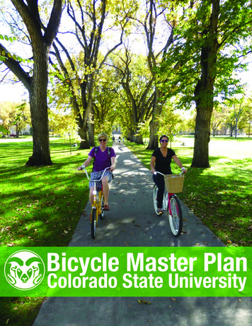
2014 Colorado State University Bicycle Master Plan 1 Introduction Colorado State Univeristy (CSU) has demonstrated a commitment to a sustainable transportation system by developing separated bicycle facilities, closing streets for use by bicycles and pedestrians, offering popular bicycle education programs, partnering with the City to build the