Transcription
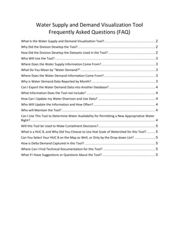
Water Supply and Demand Visualization ToolFrequently Asked Questions (FAQ)What Is the Water Supply and Demand Visualization Tool?. 2Why Did the Division Develop the Tool? . 2How Did the Division Develop the Datasets Used in the Tool? . 2Who Will Use the Tool? . 3Where Does the Water Supply Information Come From? . 3What Do You Mean by “Water Demand?” . 3Where Does the Water Demand Information Come From? . 3Why is Water Demand Data Reported by Month? . 3Can I Export the Water Demand Data into Another Database? . 4What Information Does the Tool not Include? . 4How Can I Update my Water Diversion and Use Data? . 4Who Will Update the Information and How Often? . 4Who will Maintain the Tool? . 4Can I Use This Tool to Determine Water Availability for Permitting a New Appropriative WaterRight? . 4Will this Tool be Used to Make Curtailment Decisions?. 5What is a HUC 8, and Why Did You Choose to Use that Scale of Watershed for this Tool? . 5Can You Select Your HUC 8 on the Map as Well, or Only by the Drop-down List? . 5How is Delta Demand Captured in this Tool? . 5Where Can I Find Technical Documentation for this Tool? . 5What if I Have Suggestions or Questions About the Tool? . 5
What Is the Water Supply and Demand Visualization Tool?The State Water Resources Control Board, Division of Water Rights (Division) developed anonline tool that shows basic monthly water balance data for past years in major watershedsthroughout California. The Water Supply and Demand Visualization Tool is a web-baseddashboard that allows users to select multiple water supply and water demand scenarios andcompare results side-by-side. The Division will add more watersheds and improve ease of use inthe coming months. The tool also includes an interactive map of diversion points and a detailedlist of all water rights within the user selected watershed. This tool is for informational purposesand will not be used to make water allocation or shortage decisions.Why Did the Division Develop the Tool?The Division believes it is important for all stakeholders interested in California’s wateraccounting to have a transparent, easy to use tool to see supply and demand information,locations of diversions, and water right types throughout the state. By seeing water quantitydata combined into one interactive space, we can collectively better identify and prioritizecritical watersheds.·Improved Reporting: Displaying publicly available data in one space can help allstakeholders identify potential water use reporting errors and areas that needadditional monitoring to better describe actual watershed conditions for use in makingfuture water management decisions.·Protecting Resources: Collecting and displaying best available data helps protect seniorwater rights, community and industry needs, and the environment.·Increased Resilience: The tool can help users identify and forecast watersheds that mayexperience water shortages, so communities and organizations can make better watermanagement decisions and increase drought resilience.How Did the Division Develop the Datasets Used in the Tool?Division staff researched and verified the best available water resource data sources andworked collaboratively with partner agencies like Department of Water Resources. The Divisionconducted an extensive peer review process with stakeholders from multiple sectors, includingTribal, academia, regulated community, and non-government organizations (NGOs), to identifydata gaps and integrate valuable user experience revisions. The Division also collaborated withother western states to discuss their current water management practices, tools, and availabletechnology.Water Supply and Demand Visualization Tool FAQPage 2
Who Will Use the Tool?The tool is available for all members of the public to better understand California’s waterbalance at a watershed scale. We anticipate water managers from all sectors as well asinterested members of the public and academia to use and provide feedback on this tool.Division Enforcement staff may use the tool to screen data while investigating complaints,potential cases of waste and unreasonable use, and other enforcement issues that are notnecessarily related to drought.Where Does the Water Supply Information Come From?The tool displays publicly available monthly supply data published by the Department of WaterResources, California Nevada River Forecast Center (CNRFC), and United States GeologicalSurvey (USGS). The Division takes the supply data from their websites and displays it as a curveon the tool’s water balance graph. We included multiple supply scenarios to choose from basedon data availability for example: supply for critically dry year, wet year, or average flow years.Users can select “unimpaired flow” scenarios as well. Unimpaired flow is the amount of waterthat would runoff into streams if there were no diversions or developed land in the watershed.What Do You Mean by “Water Demand?”When we use the term “Water Demand”, we mean the amount of water a water right holderreports on their water use reports. For the purposes of this tool, we use the terms “WaterDemand” and “Water Use” interchangeably.Where Does the Water Demand Information Come From?Currently, the tool displays reported monthly diversion amounts submitted by diverters in theirannual water diversion and use reports. The tool’s demand data preparation script pulls theinformation directly from the Electronic Water Rights Information Management System(eWRIMS) database. Because demand data is based on user-reported data, some demandestimates may not be accurate if the reported data contains errors such as incorrect units,double-reporting, or diversion not sourced from natural flow. The Division is aware that manydiverters have a challenging time reporting data in the necessary format. The Division plans touse data “cleaning” methods to improve accuracy as well as engage the regulated communityto improve data quality directly reported by diverters.Why is Water Demand Data Reported by Month?For the demand component of the visualization tool, diverters are required to report monthlywater use to the Division once each year in accordance with the California Water Code. Thisdata is then displayed for the user selected watershed in the tool.Water Supply and Demand Visualization Tool FAQPage 3
Can I Export the Water Demand Data into Another Database?The ability to export Water Demand information from eWRIMS for each watershed is notavailable at this time and is a planned enhancement that will be incorporated into the tool at alater date.What Information Does the Tool not Include?At this time, the tool does not include water quality data, minimum instream flowrequirements, face value of licensed, permitted, and pending appropriative water rights, orfuture water supply forecasts.How Can I Update my Water Diversion and Use Data?If you are a water right holder and want to update your reported water rights information,please visit the Division’s Report Management System (RMS) website. Find the reporting yearyou wish to update and click on ‘Amend’ in the ‘Action’ column then proceed with amendingyour information.Who Will Update the Information and How Often?This is truly an open-source application driven by public input and data. The Division plans tomake continuous improvements over time and will update the tool as additional data becomesavailable. We encourage stakeholders to provide feedback so we can better meet their needs.We will include a “Submit Comment” button in the tool and intend to check commentsregularly.Who will Maintain the Tool?Division of Water Rights staff will update the tool periodically as new supply and demand databecomes available. We intend to notify the public of major new releases through LYRIS emailmessages and social media.Can I Use This Tool to Determine Water Availability for Permitting a NewAppropriative Water Right?The tool is intended for informational purposes and can be helpful for exploring the supplyunder multiple scenarios. The tool does not display sufficient data and at a scale needed todemonstrate water is available for appropriation. Typically, to show that unappropriated wateris available to supply a project, applicants need to account for senior demand and instreamdemand along the downstream flow path. Although the tool includes information about seniorwater use, these data do not account for face value of licenses, permits and pending waterrights that are necessary to fully assess senior demand. Additionally, the tool does not includeminimum instream flow requirements.Water Supply and Demand Visualization Tool FAQPage 4
Will this Tool be Used to Make Curtailment Decisions?The Water Supply and Demand Visualization Tool is currently for informational purposes andwill not be used to make water allocation or shortage decisions at this time. This tool does notdisplay data at a scale or frequency such that curtailment decisions can be made. We intend toadd improved water use and supply data as it becomes available so that the public can use thistool to identify watersheds potentially experiencing shortages at certain times of the year.What is a HUC 8, and Why Did You Choose to Use that Scale of Watershed for thisTool?The Hydrologic Unit Code (HUC) are watershed boundaries defined by the U.S. GeologicalSurvey (USGS) Watershed Boundary Dataset (WBD). HUC level 8 (HUC8) has a unique 8-digitnumber that uniquely identify subbasins that drain to a waterbody. HUC8 was used because itis of sufficient size to offer meaningful holistic water balance information without needingadditional gage stations or higher frequency water use data. To illustrate the size of a HUC8watershed, the Sacramento Headwaters watershed is approximately 592 square miles andspans from Mount Shasta to Lake Shasta, in northern California.Can You Select Your HUC 8 on the Map as Well, or Only by the Drop-down List?Users can only choose watersheds from the “Select HUC-* Watershed” drop-down menu.How is Delta Demand Captured in this Tool?This tool does not include water supply or demand data for the “Legal Delta.” The Legal Delta ispart of the Sacramento-San Joaquin Delta. Its geographic boundaries are defined in Water Codesection 12220.Where Can I Find Technical Documentation for this Tool?This Visualization Tool uses a computer code called R script that can quickly read and processcomplicated data. Users can find technical documentation on R script in the “About/Help” dropdown tab and supply/demand data in the “Dataset Information” drop-down tab.What if I Have Suggestions or Questions About the Tool?Users can report bugs and make suggestions in the “About/Help” “Report Bugs/Data Issues”tab within the tool. We encourage members of the public to submit ideas to help us improvethis tool. We intend to make improvements as time allows and plan to release periodicupdates.Water Supply and Demand Visualization Tool FAQPage 5
What Is the Water Supply and Demand Visualization Tool? The State Water Resources Control Board, Division of Water Rights (Division) developed an online tool that shows basic monthly water balance data for past years in major watersheds throughout California. The Water Supply and Demand Visualization Tool is a web-based