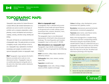
Transcription
TOPOGRAPHIC MAPS:The basicsTopographic maps produced by Natural ResourcesCanada (NRCan) offer detailed information on aparticular area and are used for several types ofactivities such as emergency preparedness, urbanplanning, resource development and surveying tocamping, canoeing, adventure racing, hunting andfishing.This guide will help the user understand the basicsof topographic maps. The guide provides an overviewof mapping concepts, along with tips on how touse a topographic map, explanations of technicalterminology and examples of symbols used torepresent topographic features on topographic maps.Why? Topographic maps represent the Earth’sfeatures accurately and to scale on a twodimensional surface. Topographic maps arean excellent planning tool and guide and, atthe same time, help make outdoor adventuresenjoyable and safe.What is a topographic map?A topographic map is a detailed and accurateillustration of man-made and natural featureson the ground such as roads, railways, powertransmission lines, contours, elevations, rivers,lakes and geographical names.The topographic map is a two-dimensionalrepresentation of the Earth’s three-dimensionallandscape. The most frequently used Canadiantopographic map is at the scale of 1:50 000.Culture: buildings, urban development, powertransmission line, pipelines, towersBoundaries: international, provincial/territorial,administrative, recreational, geographicalToponymy: place names, water feature names,landform names, boundary namesWhat information is on a topographic map?Topographic maps identify numerous groundfeatures, which can be grouped into the followingcategories:Refer to the map legend for a complete listingof all features and their corresponding symbols.Information along the map borders providesvaluable details to help you understand and use atopographic map. For example, here you will findthe map scale and other important informationabout the map such as the year, the edition andinformation pertaining to the map data.Relief: mountains, valleys, slopes, depressions asdefined by contoursTopo tip:Hydrography: lakes, rivers, streams, swamps,rapids, falls A legend explaining the symbols can be viewed atthe side of some maps nde/ or obtained fromyour map dealer. Symbol information can also be obtained b604e-3305-59a6-a77b-0f03b8cb963d.html. Review the map data and publication date locatedVegetation: wooded areasTransportation: roads, trails, railways, bridges,airports/airfield, seaplane anchorageson the bottom left corner of the map.
TOPOGRAPHIC MAPS: The basicsIs a topographic map similar to a road map?Both types of maps show roads, water features,cities and parks, but that’s where the similarityends.Topographic maps show contours, elevation,forest cover, marsh, pipelines, powertransmission lines, buildings and varioustypes of boundary lines such as international,provincial and administrative, and many others.Topographic maps show a universal transversemercator (UTM) grid, allowing the user todetermine precise positions. In basic terms,topographic maps allow the user to see a threedimensional landscape on a two-dimensionalsurface.Green indicates vegetation such as wooded areas,orchards and vineyards.2Topo tip: Use contour lines to determine elevations ofmountains and flat areas. The closer togetherthe lines are, the steeper the slope. Contour elevation numbers indicate thedirection of elevation by always reading(pointing) uphill.Some northern areas of Canada are mapped inblack and white (monochrome).What are contour lines?Contour lines connect a series of points of equalelevation and are used to illustrate relief on amap. They show the height of ground above meansea level (MSL) either in metres or feet, and canbe drawn at any desired interval. For example,numerous contour lines that are close to oneanother indicate hilly or mountainous terrain;when further apart they indicate a gentler slope;and when far apart they indicate flat terrain.What is scale?Maps are made to scale. In each case, the scalerepresents the ratio of a distance on the map tothe actual distance on the ground. A standardCanadian topographic map is produced at1:50 000, where 2 cm on the map represents1 km on the ground.What do the colours mean?A variety of colours can be found on a map,each relating to different types of features.Black shows cultural features such as buildings,railways and power transmission lines. It is alsoused to show geographical names (toponymy),certain symbols, geographic coordinates andprecise elevations.Blue represents water features, such as lakes,rivers, falls, rapids, swamps and marshes. Thenames of water bodies and water courses arealso shown in blue, as are magnetic declinationand UTM grid information.Medium-scale maps (e.g. 1:50 000) cover smallerareas in greater detail, whereas small-scale maps(e.g. 1:250 000) cover large areas in less detail.A 1:250 000 scale national topographic system(NTS) map covers the same area as sixteen1:50 000 scale NTS maps.
TOPOGRAPHIC MAPS: The basicsTopo tip: Know what map scale you’re using to measure distance. Refer to the scale bar at the bottom of the map.How do I measure distance on a map?Use the scale bar found at the bottom of every NRCan topographic map to determine distancesbetween points or along lines on the map sheet. Use the secondary division on the left of the scalebar for measuring fractions of a kilometre.What is a grid?A grid is a regular pattern of parallel lines intersecting at right angles and forming squares; it isused to identify precise positions. To help you locate your position accurately on the surface ofthe Earth (or map sheet), topographic maps have two kinds of referencing systems: universal transverse mercator (UTM) projection (easting/northing) geographic: degrees and minutes (longitude/latitude)The projection used for topographic maps is UTM.The UTM grid is a square grid system of lines depicted on maps and based on the transversemercator projection. It can be used to accurately locate the position of features on the map bydistance or direction. To express your location in grid coordinates or geographic coordinates,read the following section.3How can I find or express a location on a map?You can find or express a location on a map by usinggeographic coordinates (longitude, latitude) or byusing UTM grid coordinates (easting, northing).Geographic coordinates are expressed in degrees,minutes and seconds and can be determined on themap by using the longitude and latitude graticulesplaced along the edges of the map. Latitudegraticules are placed along the east and west edgesof the map and longitude graticules are placed alongthe north and south edges of the map. The longitudeand latitude of your location can be determined byprojecting your location to the map edges and thenby reading the corresponding latitude and longitudevalues.UTM grid coordinates are expressed in metres andcan be determined on the map by using the UTM gridlines. These grid lines are equally spaced horizontaland vertical lines superimposed over the entire map.The coordinate value for each grid line can be foundalong the edge of the map. Northing values canbe read along the east or west edges of the mapand easting values can be read along the north orsouth edges of the map. The easting and northing ofyour location can be determined by projecting yourlocation to the nearest horizontal and vertical gridlines and then reading the corresponding easting andnorthing values.
TOPOGRAPHIC MAPS: The basicsAs an example, the position of the sportsplexlocated in the top right corner of 92-G/3 Lulu Islandof British Columbia is located in UTM Zone 10 andthe coordinates are 498400m.E. and 5453100m.N.The same position can also be described usinggeographic coordinates 123 01'E longitude,49 14'N latitude.Topo tip: Determine your easting first, and then find yournorthing. (In the house, then up the stairs.)How do I find a grid reference?To find the map reference of a feature located at984531 on a 1:50 000 scale topographic map,Determine the easting: Read the grid line value left of the feature: 98. Estimate tenths of a square to the right (eastward)4Topo tip: Use a roamer to help locate features (see theillustation at left). Always measure over to the east and then up tothe north. In other words, find the easting, thenthe northing.How can I determine where I am on a mapusing a GPS receiver?If you have a GPS receiver, your location can bedetermined very quickly. This satellite receivingsystem displays a position in terms of latitude,longitude, and height, providing you with precisecoordinates for map reference. (Some receiversalso provide a direct conversion of position to aselected map grid such as UTM.) With this GPScoordinate, you can then use the geographicor UTM grid reference system on the map todetermine where you are.to feature: 4. Your easting is 984.Determine the northing: Read the grid line value below the feature: 53. Estimate tenths of a square up (northward) to thefeature: 1. Your northing is 531. The map reference for this feature is 984531.Topo tip: Users should ensure that the datum on theirGPS are the same as the datum on the map.The datum are typically located on the bottomof the map sheet.
TOPOGRAPHIC MAPS: The basicsHow can I determine where I am on a mapwithout using a GPS?If you do not have a GPS receiver, identify as manyfeatures around you as you can, man-made ornatural, and locate those same features on yourmap. Then orient the map, in relation to yourself,so that its orientation corresponds to the groundfeatures that you have identified. If this is difficultto do, use a compass to help you orient the map tonorth and try again to identify surrounding features.By estimation, or by using a compass, take bearingsto the known features and then from the knownfeatures, plot the bearing lines. The intersection ofthese lines should indicate your location.Topo tip: A map is oriented when it is made to correspondto the ground features it represents. If you knowyour location and can also identify the positionof a distant object, you can orient your map byturning it so it corresponds to the ground features.5Adjust the dial to read the value of the magneticbearing opposite the direction-of-travel arrow.Make certain to account for the differencebetween grid north and true north.How do I navigate with a compass and atopographic map?Navigating by compass requires determiningbearings with respect to true or grid northfrom a map sheet and converting them tomagnetic bearings for use with a compass.One way of doing this is described in thefollowing steps:1- Place the compass on the map with thedirection-of-travel arrow pointing along thedesired line of travel.2- Rotate the compass dial so that the parallellines within the capsule line up with thegrid lines on the map. Convert the gridbearing to a magnetic bearing by using theinformation given (as in the accompanyingdiagram) on the map sheet. If declinationis west, add it to the grid bearing; ifdeclination is east, subtract it from the gridbearing.3- Now pick up and rotate the whole compassuntil the red end of the needle points to thenorth marker on the dial. The direction-of-travelarrow on the compass card will point to yourdestination. Choose a landmark in that directionand walk toward it.Material provided courtesy of the NationalGeomagnetism Program, Geological Survey ofCanada.geomag.nrcan.gc.ca/mag fld/compass-eng.phpTopo tip: Using a compass along with a topographic mapensures obtaining an exact direction for locatingfeatures. An approximate but quick way to orientyour map is to align the compass needle (whenit is pointing north) with the top of the map.Remember that north is always at the top ofa topographic map.
TOPOGRAPHIC MAPS: The basicsHow do I know which map sheet I need?The most direct process to determine the mapyou require is to visit the topographic mapssection of the GeoGratis Website atgeogratis.ca.To order a Canadian topographic map, youmust know either the location (longitude/latitude) or the name of your area of interest(e.g. a major city, or a large body of water). Youmay also order by map sheet number.How are map sheet areas defined?Topographic maps produced by NRCanconform to the National Topographic Systemof Canada. They are available in two standardscales: 1:50 000 and 1:250 000. The areacovered by a given map sheet is determinedby its location in Canada. The 1:250 000scale maps are identified by a combinationof numbers and letters, from A through P(e.g. 13C). The 1:250 000 blocks are dividedinto 16 segments (1 to 16), forming blocksused for 1:50 000 scale mapping (e.g. 13C/9identifies Little Drunken River, Newfoundlandand Labrador).Paper index maps are available from local mapdealers and at map libraries across Canada.Index maps for each of the regions can alsobe downloaded from GeoGratis at formation/maps/9763.6Where can I obtain a topographic map?There are four sources for a topographic map: map dealers across Canada and worldwide a regional distribution centre a certified map printer the GeoGratis Web site, where high quality,print-ready copies of topographic maps can bedownloaded for free geogratis.caTo find a map dealer in your area, consult theYellow PagesTM under MAPS. If there are no localdealers accessible to you, or if your local dealerdoes not carry the maps you require, contactany of our regional distribution centres listedon our Web site at nformation/maps/9783?destination node/10580.A certification program to accredit map printersfor on-demand printing of NRCan topographicmaps is now implemented. All official NRCantopographic maps are available from certifiedmap printers, who ensure accessibility to highquality paper maps. Maps published by certifiedmap printers carry a special holographic sealof quality. Maps bearing this seal are authenticcopies of NRCan topographic maps and are easilyrecognized by map users.Map Index Regions
TOPOGRAPHIC MAPS: The basicsTopographic terminologyBearing: The horizontal angle at a given point,measured clockwise from magnetic north or truenorth to a second point.Classified roads: Roads for which surface type,width and use are identified.Contour lines: Lines on a map connecting pointsof equal elevation above mean sea level; usingcontour lines, relief features can be profiled intoa three-dimensional perspective.Elevation: Vertical distance from a datum(usually mean sea level) to a point or object onthe Earth’s surface.Horizontal datum: The positional reference orbasis for the geographic location of features ona map.Legend: A description, explanation table ofsymbols, or other information, on a map orchart to provide a better understanding andinterpretation of it.Magnetic north: Direction to which a compassneedle points.Mean sea level: The average height of thesurface of the sea for all stages of tide, used asa reference surface from which elevations aremeasured.National Topographic System: An orderly indexsystem suitable for a series of maps of differentscales for the coverage of Canada.Projection: Geometric representation of thecurved surface of the Earth on a flat sheet ofpaper.Relief: The physical configuration of the Earth’ssurface, depicted on a topographic map bycontour lines and spot heights.Spot elevation: A point on a map where heightabove mean sea level is noted, usually by adot and elevation value; it is shown whereverpractical (road intersections, summits, lakes,large flat areas and depressions).Symbols: A diagram, design, letter orabbreviations, placed on maps, that (byconvention, usage or reference to a legend) isunderstood to stand for or represent a specificfeature or object.Topography: Surface features both natural andman-made, collectively depicted on topographicmaps.Unclassified roads: Roads for which the surfaceis unidentified.7For more definitions and useful information ontopographic maps, visit the National TopographicSeries Polychrome Map Standards and Specificationspublication at -3305-59a6-a77b0f03b8cb963d.html. Her Majesty the Queen in Right of Canada, asrepresented by the Minister of Natural ResourcesCanada, 2014For information regarding reproduction rights, contactNatural Resources Canada at copyright.droitdauteur@nrcan-rncan.gc.ca.Cat. No. M114-35/2014E-PDF (Online)ISBN 978-1-100-23169-3Aussi disponible en français sous le titre :Cartes topographiques : Les éléments de base
Boundaries: international, provincial/territorial, administrative, recreational, geographical. Toponymy: place names, water feature names, landform names, boundary names. Refer to the map legend for a complete listing . of all features and their corresponding symbols. Information along the map borders provides