Transcription
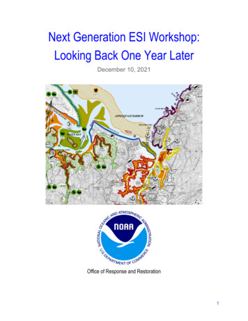
Next Generation ESI Workshop:Looking Back One Year LaterDecember 10, 2021Office of Response and Restoration1
Table of ContentsExecutive Summary2Background4Workshop Overview and Objectives6Workshop SummaryDay 1: State PerspectivesTake-aways from Day 1 presentations and breakouts:Presentations:Breakouts:Day 2: Federal and Tribal PerspectivesTakeaways from Day 2:Day 3: Contractor PerspectivesCommon Observations and Takeaways from Day 3:Day 4: Overview, Recap, and Next StepsOverview DiscussionBreakout GroupsShorelineLayer and Extent Changes (Biology and Human-Use)Updates and DistributionFunding OpportunitiesAdditional Funding and Cost-Related Content from NOAA Q & A on Day 1778889910101111111111121213Overall Workshop Recommendations13AppendicesRecording LinksParticipantsAcronyms14141415Workshop Organizers:Nicolle Rutherford, Biologist & ESI Program Manager, NOAA/NOS/OR&R/ERDKate Wheelock, Chief, Disaster Preparedness Program, NOAA/NOS/OR&R/DPPRobb Wright, Geographer, Spatial Data Branch, NOAA/NOS/OR&R/ARDOther Report Authors:Shane O’Neal, Outreach and Policy Specialist (contractor w/ Lynker), NOAA/NOS/OR&R/ERDDonna Roberts, Web Support Specialist (contractor w/ Lynker), NOAA/NOS/OR&R/ERD2
Executive SummaryThe National Oceanic and Atmospheric Administration’s (NOAA) Office of Response andRestoration (OR&R) hosted a virtual workshop over four days in the fall of 2020 focused on thenext generation of the Environmental Sensitivity Index (ESI) program. The workshop wasattended by a mix of users and stakeholders from the federal, state, tribal, and private sectors,averaging eighty attendees per day.The primary objective of the workshopwas to explore the future of ESImapping in a constrained budgetenvironment. With no funding for ESIsfrom NOAA’s base budget in recentyears, the program must eitherdrastically cut costs or identify newfunding sources in order to continueproducing up-to-date products thatmeet the critical response and planningneeds of users across the country. Theworkshop covered what data is mostimportant, how the data is used, andwhat OR&R might do moving forwardto keep the ESI product as useful aspossible.This report, issued a year after the conclusion of the workshop, aims to capture the keytakeaways and next steps and set a course of action to continue to develop the next generationof ESIs. Top recommendations include: Establish a working group on biological and human-use data layers.Establish a working group on the development and production of shoreline layers.Develop a crosswalk document to map equivalent or similar information between theCUSP, CMECS, and ShoreZone products.Explore the hurdles to using NRDA funds towards ESI updates.Engage in further conversations about funding with a wider set of partners.Convene a meeting of developers to discuss technological efficiencies and innovations.Begin research on additional indices to enhance support for coastal planners.Conduct additional outreach regarding the ESI product and its uses.These recommendations are explored in more detail in the report. The organizers thank thosewho participated in the workshop, and welcome any feedback.3
BackgroundEnvironmental Sensitivity Index (ESI) maps and data provide concise summaries of coastalresources that could be at risk in the event of an oil or chemical spill: biological resources (suchas birds and shellfish beds), sensitive shorelines (such as marshes and tidal flats), and humanuse resources (such as public beaches, marinas, and parks). When a spill occurs, ESI mapscan help responders meet one of the main response objectives: reducing the environmentalconsequences of the spill and the cleanup efforts. Additionally, ESI maps can be used byresponse planners—before a spill happens—to identify vulnerable locations, establishprotection priorities, and identify cleanup strategies. ESI maps have been produced for coastalwaters of all U.S. states and territories.ESIs are unique in that they are a comprehensive regional product that compiles a snapshot ofresources in one place. NOAA ESIs are the only source for the numbered index that is thefederal standard for ranking shorelines based on their sensitivity to oil spills. In addition, noother available dataset contains information related to the seasonality of species occurrence ina given area. Responders rely on this nationally consistent information to quickly andconsistently assess threats as they engage in incidents across the country.ESI maps are an integral part of preparedness,response, and recovery planning, as well as areal time decision-making tool for responseoperations. They are crucial to assisting decisionmakers, like the U.S. Coast Guard (USCG), byproviding information about sensitive habitatsand species in the area that could be at risk.They often drive prioritization of responseoptions during an emergency or disaster.Additionally, the information provided by ESImaps helps responders understand when certainresponse options—like burning, dispersantapplication, or intensive manual cleanupefforts—may be inappropriate.ESIs bring a wealth of information to yourfingertips for quick and relatively easy access,including contact information for the resourceexperts. The cadence of response is unforgiving,and taking time to assemble the data in the midstof a response is difficult. One of the manystrengths of ESIs is having information ready togo before an incident, contact information for theresource experts at your fingertips, and critical4
information available quickly in an accessible, easy to read format. ESI maps also provide abasis for establishing baseline conditions for the assessment of damage to natural resources asthe result of a spill.The National Contingency Plan (40 CFR 300) specifically states that “DOC, through NOAA,provides scientific support for response and contingency planning in coastal and marine areas,including information on the sensitivity of coastal oil and hazardous substances andassociated clean-up and mitigation methods (40 CFR 300.175(b(7)).” ESI maps are a criticalcomponent of this support. They have been produced by NOAA’s Office of Response andRestoration (OR&R) for more than four decades, with important contributions of data andresources from other federal, state, local, and tribal agencies.Unfortunately, many ESI maps are outdated; some have not been updated since the 1980s (i.e.,Great Lakes, some portions of Alaska). In addition to adversely impacting response decisionmaking, out-of-date ESI information could make Endangered Species Act (ESA) and otherconsultations less effective, potentially leading to legal challenges, and may also call intoquestion preauthorization determinations.Updates to ESI maps involve compiling a wide range of data about shoreline type, biology, andsocioeconomic resources that are sensitive to oil. While the increase in digital data has reducedsome costs in development, the production of robust maps still requires substantial engagementwith resource providers and classification based on ESI criteria.OR&R recognizes that habitat, species, shoreline, and built infrastructure shifts over time makethese older maps harder to rely on for decision-making. However, the resources required tokeep pace with updates across the country are substantial, and OR&R makes difficult choicesevery year with appropriated funding to best uphold its mandates.5
Workshop Overview and ObjectivesThis workshop was jointly organized and hosted by the Emergency Response Division (ERD),Assessment and Restoration Division (ARD), and the Disaster Preparedness Program (DPP)within NOAA’s Office of Response and Restoration (OR&R).The primary objective of the workshop was to explore the future of ESI mapping in aconstrained budget environment. Understanding end-user needs is critical when consideringwhere and how to reduce production costs. Therefore, we asked avid end-users and subjectmatter experts to convene to discuss and identify the most critical layers and aspects of thecurrent tool. The results of this workshop will guide ESI developers in decision-making regardingthe “next generation” of ESIs.This workshop was postponed from March 2020 due to COVID-19 concerns, and instead tookplace virtually over four days from October to December 2020 as follows: Wednesday, Oct. 28 – State Perspective. We heard from states who have built similarproducts and about their experiences and lessons learned in doing so. Tuesday, Nov. 10 – Federal and Tribal Perspective. We heard how Federal and Tribalentities are using NOAA’s ESI tool. Wednesday, Nov. 18 – Contractor Perspective. We heard from contract companieswho have engaged in and supported OR&R with ESI development over the years. Wednesday, Dec. 2 – Summary and Path Forward. We summarized the previousinformation and discussions to better understand efficiencies and the path forward forESIs.Each day is discussed in more detail in this report. There are video and audio recordingsavailable for each day through the Adobe Connect platform (links available in Appendix). Eachday’s schedule roughly followed this format: Two hours in the morning, beginning at 11:00 am ET/8:00 am PT.Two hours in the afternoon, beginning again around 2:30 pm ET/11:30 am PT.6
Workshop SummaryThe workshop took place over four days in late 2020, and each day is summarized in thissection. The first two days of the workshop kicked off with a welcome from OR&R Director,Scott Lundgren, and an overview of ESIs from Dave Wesley, Chief of the Technical andScientific Services Branch of ERD. Each day, participants asked questions pertaining to ESIfunding history and mechanisms. These are captured in more detail in the Day 4 fundingdiscussion.Day 1: State PerspectivesThe first day of the workshop, conducted on October 28, 2020, provided a platform for severalstates (Texas, Maine, California and Florida) and the Environmental Protection Agency (EPA)Region 5 to discuss similar tools they have built. We asked four main questions to guide thepresentations: How did they create their own tool? How does it differ from NOAA’s ESI tool? Why did they create their own tool? What data do they prioritize?7
There were 89 participants on this first day, including representatives from: Federal agencies NOAA, USCG (Headquarters and Districts 5, 8, and 9), EPA, and DOI (BSEE,NPS, FWS). State agencies Florida, California, Texas, Alaska, Michigan, Washington, and Maine. Other organizations Great Lakes Commission, OSRI, and Gulf Coast Ecosystem Restoration Council(established by the RESTORE Act).External contract companies involved with ESI development were not invited to attend thissession.Take-aways from Day 1 presentations and breakouts:Presentations: Manipulating data to fit ESI data standards is time consuming.All agree that printed maps can be useful, and 11” x 17” is preferred to 8.5” x 11”.Not all current ESI data layers are needed, but each state/region has differing layerpriorities/uses.A web-based tool is preferred.A NOAA map template would be well-received.Breakouts: Data: Consensus: T&E species are a high priority and must be included. Potential to reduce other species data shown/collected? Consensus: Shoreline classifications and index are a priority. Maps are cluttered, could reduce data displayed (e.g., fewer bird groupings andshoreline classifications, reduce human-use layers).Format: Consensus: Scale at 24000 is fine, most reasonable. Paper is generally liked. Important for power outages, remote locations, etc. Ability to map on the fly, download data (offline capability), and generation ofpaper products by an online tool is important.8
Day 2: Federal and Tribal PerspectivesThe second day of the workshop was held on November 10, 2020, and featured presentationsfrom federal and tribal partners that are end users of ESI maps and data. The day started withan introduction from Scott Lundgren, Director of OR&R, and an overview of the ESI programand its current state from Dave Wesley, Chief of the Technical and Scientific Services Branch ofERD. The presentations focused on how each agency or tribe uses ESIs, and their thoughts onwhat can be improved, removed, or otherwise updated.The afternoon session consisted of a panel discussion with a mix of pre-planned topics andother questions from the audience. This led to a robust conversation and lots of excellent ideas.There were 75 participants for day two, including representatives from many federal agencies,state governments, and outside contract companies.Takeaways from Day 2: ESIs are an information-rich snapshot of the area of concern.They are a critical tool used for: Response plan development (ACPs, GRS/GRPs) Resources at risk and identifying protection priorities Drills and assessments Consultations Responding to spillsWilling to reduce some human-use and biological information (but need to keep T&E andcommercially important species).Users rely on electronic access, need better query and report tools.Many data sources and tools exist, but they are not centralized and it can be difficult tolocate and sort through them all. Should this available data feed into ESIs? Would be nice for a one-stop shop.Paper maps are still needed for now, but could be eliminated if data is easily available todownload and use offline.Interest in developing a data template, but difficult to obtain all needed data.Decouple data layers for ease of updates.9
Day 3: Contractor PerspectivesThe third day of the workshop was held on November 18, 2020. This session was anopportunity to hear from external contract companies and others who have worked with OR&Rto develop ESI maps and data in recent years. Presenters walked through their organization’sproposals for how to reduce costs and improve efficiency in the ESI process, includingreductions in data layers and improvements in data collection and processing.The third day of the workshop had 82 participants. Due to the proprietary nature of thecontractor presentations, their slides are not available for viewing and the recommendationshave been generalized.Common Observations and Takeaways from Day 3: Shared desire to bring ESI scope closer to original oil spill focus. Some maps are bloated, can cut unneeded data or simplify formats. Should reduce the area of analysis.Currently too many data layers to maintain cost-effectively, and not all are relevant. Shoreline: simplify collection/data, use existing data if possible (e.g., CUSP). Biology: reduce data, focus on T&E species, reduce attribute collection. Human-use: reduce the amount of data collected, simplify classification types.The GIS structure is outdated. ESI production needs to be more rapid and flexible.Desire to move away from state boundaries for atlases and adopt a national scale orgeographic regions instead.Map outputs and data delivery can be improved. Should add tools and features.Want a standardized data upload template set by NOAA, ideally an enterprise database.10
Day 4: Overview, Recap, and Next StepsThe final session of the workshop took place on December 2, 2020. The day opened with arecap of the previous three sessions by the OR&R team, and ended with concluding remarksfrom Scott Lundgren. In between, attendees were split up into four breakout groups to discusssome of the key topics that emerged over the course of the sessions. The groups then reportedback, and those summary reports are captured here. Final recommendations are presented atthe end of the report.There were 79 participants in the breakout sessions on day four, divided up roughly evenlyamong the breakout groups based on participants’ general interests and expertise.Overview DiscussionA survey of attendees taken during an earlier session showed that most participants use ESIsthrough ERMA and their own GIS installations. Many may access PDFs through ERMAthough, and front line responders are likely the ones using printed/PDF maps. Although fewer,they are a critical group of users.Breakout GroupsShorelineThere was general agreement that shorelineclassifications can be collapsed into fewertypes, along with a discussion about aligningESI categories with other pre-existingproducts and systems. This includes NOAA’sContinually Updated Shoreline Product(CUSP), ShoreZone data in the PacificNorthwest, and the Coastal and MarineEcological Classification Standard (CMECS)maintained by NOAA. Issues exist with eachapproach or product, but the amount ofexisting data was a point of emphasis.Layer and Extent Changes (Biology andHuman-Use)The discussion of biological and human-use data layers covered many potential changes, butneeds and priorities turned out to be highly variable across states and regions. Biological data isvery regionally specific, as some types are more important to one region and less useful inanother. Even a preference for point or polygon data appears regionally divergent. There wasagreement to maintain a focus on threatened and endangered species, commercially valuablespecies, and those in high concentrations. There was discussion of focusing human-use layerson publicly managed areas and other special sites, or data that is not widely available.11
The objectives of the ESI product were also raised, as the elimination or addition of data layerswould depend on the intended use of the data. If other hazards are considered beyond oil spills,this would influence what data is needed by responders and resource managers. Any finaldecisions on these data layers will require another set of discussions or a working group. Therewas, however, a general recommendation to reduce or eliminate most mapping qualifiers.Updates and DistributionThe group agreed on the goal to eventually have a nationwide ESI enterprise database in asingle symbology and data format. This could serve as a baseline or database for data gatheredthrough other means, but the template and data schema need to be agreed upon before settlingon a platform. This would ideally have an improved printing tool to produce output that looksmore like a traditional ESI map. There was general consensus that ERMA fills this need for now.Another discussion topic was the desire for automatic or incremental updates to the data. Manyexpressed hope that data from other sources (NMFS, FWS, EPA, FEMA, states, etc.) could betied directly to ERMA to keep ESI data up to date, and that layers could be updated one at atime. There remain many issues of compatibility between these data sources, and data is notalways in a format that is usable for operational decision-making. The compiled nature of ESIscomplicates this process.A point of discussion about distribution was whether sensitive data, including endangeredspecies and cultural resources, could be presented to responders and field users only, insteadof being publicly available.Funding OpportunitiesThere was a long discussion with many creative ideas about funding solutions for the ESIprogram. Below is a non-exhaustive list of some of the suggestions and questions: Could funding come from OSLTF? OSLTF authorization for ESIs might take away from other OR&R appropriations. It may be worth looking into rewriting this statute. Consider NRT as well, as they are related.Including additional hazards, such as climate resilience, would be more appealing on theHill than the current focus on oil spills and NRDA.The program can’t count on post-disaster supplemental funding moving forward.We could expand the user base by making other partners aware of ESIs and their utility. Could “market” them to nonprofits that could provide funding. Also work with more federal agencies, as they are used by DOI, DOT, EPA, etc.Is it possible to require data updates as part of activity from NRDA settlements, or aspart of certain permitting and management uses? Are there legal issues with this?When asking for funding, NOAA should emphasize recent changes implemented tomake the process more cost-efficient.Could the GRP/GRS task force use some OSLTF funds to support ESIs?12
Additional Funding and Cost-Related Content from NOAA Q & A on Day 1 What is the relative cost of ESI printing? Printing costs are minimal, but creating the PDFs is fairly expensive becauseeach PDF is manually “crafted” to provide a good view of the data. Automatedtools exist, but there's still a manual art to the map creation.Is ESI funding specifically requested in annual budget requests? In a decreasing budgetclimate, NOS has notprioritized ESIs whenstrategically seeking fundingincreases.NOAA has not assessed wherechanges in the data have occurredto predict where updates will bemost needed in the future (“heatmaps”). However, as updatesoccurred so infrequently in recentdecades, all maps need a refreshby now.Other comments on cost: Work for updating an ESI is primarily contracted. Primary costs are for data collection, synthesis, processing, and organization. Merging all the information into a single data layer/polygon set is costly, but it isworth it to have a stable compiled data layer, rather than have individual links tooriginal sources.Overall Workshop Recommendations1. Establish a working group on biological and human-use data layers. This should coverwhat layers to keep, what to let go, regional differences, points vs. polygons, etc.2. Establish a working group on the development and production of shoreline layers.3. Develop a crosswalk document to map equivalent or similar information between theCUSP, CMECS, and ShoreZone products.4. Explore the hurdles to using NRDA funds towards ESI updates.5. Further conversations about funding with a wider set of partners. In particular, adiscussion with the NRT about how to generate support for ESI updates.6. Convene a meeting of ESI, ERMA, and NCCOS developers to discuss technologicalefficiencies and innovations.7. Begin research on additional indices to enhance support for coastal planners.8. Conduct additional outreach regarding the ESI product and its uses.13
AppendicesRecording Links2020 ESI Next Generation WorkshopAdobe Connect RecordingsPasscode to view the recordings is: Knowledge (case sensitive)Day 1 Recording (Oct. Day 2 Recording - Morning Session (Nov. Day 2 Recording - Afternoon Session (Nov. Day 3 Recording (Nov. 18):Not available due to sensitivity of contractor proposals.Day 4 Recording (Dec. articipants14
MA &ROSLTFOSRIRESTORE ActT&EUSCGArea Contingency PlanOR&R’s Assessment and Restoration DivisionBureau of Safety and Environmental EnforcementCode of Federal RegulationsCoastal and Marine Ecological Classification StandardContinually Updated Shoreline ProductDepartment of CommerceDepartment of the InteriorDepartment of TransportationOR&R’s Disaster Preparedness ProgramEnvironmental Protection AgencyOR&R’s Emergency Response DivisionEnvironmental Response Management ApplicationEndangered Species ActEnvironmental Sensitivity IndexFederal Emergency Management AgencyFish and Wildlife ServiceGeographic Information SystemGeographic Response Plan (part of an ACP)Geographic Response StrategiesNational Centers for Coastal Ocean Science (NOAA)National Marine Fisheries Service (NOAA)National Oceanic and Atmospheric AdministrationNational Ocean Service (NOAA)National Park ServiceNatural Resource Damage AssessmentNational Response TeamOffice of Response and Restoration, within NOAA’s National Ocean ServiceOil Spill Liability Trust FundOil Spill Recovery InstituteResources and Ecosystems Sustainability, Tourist Opportunities, andRevived Economies of the Gulf Coast States Act (2012)Threatened and Endangered Species, as designated by the ESAU.S. Coast Guard15
next generation of the Environmental Sensitivity Index (ESI) program. The workshop was attended by a mix of users and stakeholders from the federal, state, tribal, and private sectors, averaging eighty attendees per day. The primary objective of the workshop was to explore the future of
