Transcription
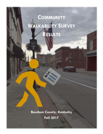
COMMUNITYWALKABILITY SURVEYRESULTSBourbon County, KentuckyFall 2017
ContentsAcknowledgements . 3Summary . 4City of Paris . 5City of Millersburg . 6City of North Middletown . 7SURVEY AREAS26. West 8th St (North). 825. North Middletown . 924. Millersburg (North). 1023. Downtown Paris (north) . 1122. South Main St. from 16th St. to 20th St. . 1221. Claysville Neighborhood, Link Ave., Vine St. . 1320. Lexington Rd., Reinhold to Bourbon Square . 1419. Garrard Park and West of 2nd st. 1518. Stoner Ave. and Scott Ave. . 1617. West 8th St. (South) . 1716. Bethlehem Rd. (North) . 1815. Bypass at Lexington Rd. to Arlington Dr. . 1914. South Main St. and Cypress St. from 12th – 16th St. . 2013. Downtown Paris (South) . 2112. Cypress St., Creekview Dr., and Springhill Dr. 2211. Hume Bedford Pike and Bedford Acres Subdivision . 2310. Lexington Rd and Hume Bedford Pike. 249. Millersburg (Central) . 258. East Main St. (South) . 267. Millersburg (South) . 276. Clintonville rd. (East) Idlewind Dr. to Effrain St. . 285. Clintonville rd. (East) Wings Nolk Dr. and Clinton Dr. . 294. Bethlehem Rd. (West) Windham Hill Dr., Redbud Ln., Park Place Ct . 303. East Main St. (North) . 312. Houston Oaks and Old Post Rd. . 321. Clintonville (West) Castle Blvd. . 33Conclusion . 34
ACKNOWLEDGEMENTSPartnerships and community participationare vital to the success of any planninginitiative; especially those of a smallcommunity like Bourbon County. Whilethe organization of the walkability surveywas spearheaded by the Bourbon CountyHealth Department and the BourbonCounty Joint Planning Office, it wouldhave fallen flat without the 35 volunteerswho took time to walk 120 milesthroughout the Cities of NorthMiddletown, Millersburg, and Paris.Thank you to our citizen surveyors forconducting the legwork that is the bodyof this report! The information derivedfrom this survey will influence futurepolicy decisions about how to improvewalkability in our community.Photo: ASPLacySurvey Organizers:Drew BeckettExecutive DirectorBourbon County Health DepartmentAndrewb.beckett@ky.gov(859) 987-1915http://www.bourboncohd.orgAbove: A small group of volunteers braved the cold and rainy weatherconditions on the second Saturday of surveying (October 28, 2017). Below:Drew Beckett, Director of the Bourbon County Health Department lays out theground-rules for Citizen Surveyors on October 21, 2017 in the Community Roomof the Library. Volunteers broke off into pairs and hit the streets to survey thesidewalks.Shelby SipesPublic Health InternBourbon County Health DepartmentAndrea S. Pompei Lacy, AICPPublic AdministratorBourbon County Joint Planning Officealacy@paris.ky.gov(859) 987-2150www.bourboncountyplanning.comCathy BooneExecutive DirectorParis-Bourbon County YMCAhttps://www.parisbourbonymca.org/Mark AdlerExecutive DirectorParis-Bourbon County Public Libraryhttps://www.bourbonlibrary.org/Photo: ASPLacy
SUMMARYThe 2012 Paris-Bourbon County Bike and Pedestrian Planwas adopted by the Fiscal Court and the Paris CityCommission as a guiding document for improving bike andpedestrian safety in our community. As such, the BourbonCounty Joint Planning Office has been tasked with the plan’simplementation (Action Item 8.4). Five years later in 2017, amajor effort has been undertaken by the Bourbon CountyHealth Department, the Bourbon County Joint PlanningOffice, and the YMCA to both implement and update thisplan for adoption in 2018. One key aspect of this updatewas to conduct a walkability survey.The purpose of conducting a community-widewalkability survey is as follows: Generally, to inventory the current state ofpedestrian infrastructure in Bourbon County.To conduct a cursory review of sidewalks toidentify areas for prioritization.To inform a major rehabilitation effort forsidewalks (Action Item 7.10).In the Fall of 2017, 35 “Citizen Surveyors” covered over120 miles of the Cities of Millersburg, North Middletown,and Paris to rate the walkability in 26 designated areas.The benefits of walkable areas are improved fitness, cleanerair, reduced risks of certain health problems, and a greatersense of community.1 However, whether one is walking fortransportation or recreation, it should be safe andconvenient.Over two Saturdays in October, Citizen Surveyors werepaired up and provided with maps and a survey (AppendixA) for each designated area. Upon completion of the walk,they were tasked with completing the Walkability Checklistfor each area. General questions included: Did you have room to walk?Was it easy to cross the streets?Did drivers behave well?Was it easy to follow safety rules?Was your walk pleasant?Once the checklist was completed, surveyors ranked theirresponses to each question based on the severity of theissues they observed. The below chart and the following 26profiles group the results (Appendix B) into three categoriesbased on the following scores: Poor (0-10), Fair (11-20),Good (21-30).Photo: ASPLacyWalkability in the Urban Areas of Bourbon CountyPhoto: ASPLacyNational Center for Safe Routes to School. Walkability Checklist: How Walkable is Your Community? Accessed: February 7, 2018 fact-sheet/walkability-checklist.1
WALKABILITY SURVEY RESULTSFALL 2017CITY OF PARIS26823171314125101612042LEGENDPoor Condition (0-10 points)Fair Condition (11-20 points)Good Condition (21-30 points)18212215113196Walkability Rankings (Highest to Lowest)Location DescriptionPoints1Clintonville (West), Castle Blvd.292Houston Oaks and Old Post Rd.293East Main St. (North)284Bethlehem Rd. (West), Windham Hill Dr.285Clintonville Rd. (East), Wings Nolk Dr.256Clintonville Rd. (East), Idlewind Dr.257Millersburg (South)238East Main St. (South)239Millersburg (Central)2210Lexington Rd. and Hume Bedford Pike2011Hume Bedford Pike and Bedford Acres2012Cypress St., Creekview Dr., Springhill Dr.2013Downtown Paris (South)2014S. Main St. and Cypress (12th-16th St.)2015Bypass and Lexington Rd.1916Bethlehem Rd. (North)1717West 8th St. (South)1718Stoner Ave. and Scott Ave.1719Garrard Park and W. of 2nd St.1720Lexington Rd (South)1621Claysville, Link Ave., Vine St.1622South Main (16th-20th St.)1423Downtown Paris (North)1224Millersburg (North)1125North Middletown1026West 8th St. (North)10
WALKABILITY SURVEY RESULTSFALL 2017CITY OF MILLERSBURG9Walkability Rankings (Highest to Lowest)Location Description7LEGENDPoor Condition (0-10 points)Fair Condition (11-20 points)Good Condition (21-30 points)Points1Clintonville (West), Castle Blvd.292Houston Oaks and Old Post Rd.293East Main St. (North)284Bethlehem Rd. (West), Windham Hill Dr.285Clintonville Rd. (East), Wings Nolk Dr.256Clintonville Rd. (East), Idlewind Dr.257Millersburg (South)238East Main St. (South)239Millersburg (Central)2210Lexington Rd. and Hume Bedford Pike2011Hume Bedford Pike and Bedford Acres2012Cypress St., Creekview Dr., Springhill Dr.2013Downtown Paris (South)2014S. Main St. and Cypress (12th-16th St.)2015Bypass and Lexington Rd.1916Bethlehem Rd. (North)1717West 8th St. (South)1718Stoner Ave. and Scott Ave.1719Garrard Park and W. of 2nd St.1720Lexington Rd (South)1621Claysville, Link Ave., Vine St.1622South Main (16th-20th St.)1423Downtown Paris (North)1224Millersburg (North)1125North Middletown1026West 8th St. (North)10
WALKABILITY SURVEY RESULTSFALL 2017CITY OF NORTH MIDDLETOWN25Walkability Rankings (Highest to Lowest)Location DescriptionLEGENDPoor Condition (0-10 points)Fair Condition (11-20 points)Good Condition (21-30 points)Points1Clintonville (West), Castle Blvd.292Houston Oaks and Old Post Rd.293East Main St. (North)284Bethlehem Rd. (West), Windham Hill Dr.285Clintonville Rd. (East), Wings Nolk Dr.256Clintonville Rd. (East), Idlewind Dr.257Millersburg (South)238East Main St. (South)239Millersburg (Central)2210Lexington Rd. and Hume Bedford Pike2011Hume Bedford Pike and Bedford Acres2012Cypress St., Creekview Dr., Springhill Dr.2013Downtown Paris (South)2014S. Main St. and Cypress (12th-16th St.)2015Bypass and Lexington Rd.1916Bethlehem Rd. (North)1717West 8th St. (South)1718Stoner Ave. and Scott Ave.1719Garrard Park and W. of 2nd St.1720Lexington Rd (South)1621Claysville, Link Ave., Vine St.1622South Main (16th-20th St.)1423Downtown Paris (North)1224Millersburg (North)1125North Middletown1026West 8th St. (North)10
26. WEST 8TH ST (NORTH)1234MANYSOMEGOOD56RATINGS:WAS THERE ROOM TO WALK?1EASY TO CROSS STREETS?2DID DRIVERS BEHAVE WELL?3AWFULVERY GOOD EXCELLENTPROBLEMS PROBLEMSEASY TO FOLLOW SAFETY RULES? 3WAS WALK PLEASANT?1TOTAL SCORE:10Comments: No access to Chief Reed Park pastPatterson street.Utility poles blocking sidewalks.Missing sidewalk sections through area.Most available sidewalks are uneven,cracked, and spalling.Overgrown brush, litter, and carsparking on sidewalks.Road Names in this Area:Atlas St.Chrisholm St.Curtis St.Fields St.Gano St.Hanson HeightsHanson St.Henderson St.Higgins Ave.Lilleston Ave.Marshall St.Patterson St.Sterns Ave.Thomas Ave.W. 7th St.Walker Ave.Williams St.Windsor WayDisconnected sidewalk network on Hanson St.Photo: Google Maps
25. NORTH MIDDLETOWN1234MANYSOMEGOOD56RATINGS:WAS THERE ROOM TO WALK?1EASY TO CROSS STREETS?1DID DRIVERS BEHAVE WELL?3AWFULVERY GOOD EXCELLENTPROBLEMS PROBLEMSEASY TO FOLLOW SAFETY RULES? 1WAS WALK PLEASANT?4TOTAL SCORE:10Comments: Only sidewalks are on Main andCollege Rd.Most need repair or replacementexcept section near Family Dollar.College Rd. section only goes toElementary School and is broken,cracked and missing sections.Intersection at Prescott Rd., Main St., and Levy Rd. lackssidewalks and designated pedestrian crossing.Road Names in this Area:Caywood St.Church St.College St.Cook St.Levy Rd.Liberty Ave.Main St.Mt. Sterling Rd.Prescott Rd.See St.Sledd St.Thatcher's Mill Rd.Wilson Ave.Photo: Google MapsPhoto: Google MapsNo sidewalks at intersection of Main St. and Mt. Sterling Rd.
24. MILLERSBURG (NORTH)1234MANYSOMEGOOD56RATINGS:WAS THERE ROOM TO WALK?1EASY TO CROSS STREETS?2DID DRIVERS BEHAVE WELL?3AWFULVERY GOOD EXCELLENTPROBLEMS PROBLEMSEASY TO FOLLOW SAFETY RULES? 2WAS WALK PLEASANT?2TOTAL SCORE:11Comments: Overgrown sidewalk next to formerMillersburg Military Institute (MMI).Sidewalk stops after MMI.No other sidewalks.Road Names in this Area:Banks St.Butler St.Coal Dr.College Ave.Judy Dr.Lee St.Leer St.Main St.Millersburg-Cynthiana Rd.Ritchie St.Short St.Switch St.Thomason St.No sidewalks at intersection of Main St. and Leer St.Photo: Google Maps
23. DOWNTOWN PARIS (NORTH)1234MANYSOMEGOOD56RATINGS:WAS THERE ROOM TO WALK?1EASY TO CROSS STREETS?2DID DRIVERS BEHAVE WELL?4AWFULVERY GOOD EXCELLENTPROBLEMS PROBLEMSEASY TO FOLLOW SAFETY RULES? 3WAS WALK PLEASANT?2TOTAL SCORE:12Comments: Cracks, spalling, crumbling, curbs, andsteep driveways throughout.7th St. - Utility poles obstructingsidewalks. No sidewalk on south sidebetween Main St. and Pleasant St.Pleasant St. - No ramps at 4th, 5th, and6th St. No sidewalks at Pleasant St. and2nd St.Duncan Ave. - No crosswalks to cross atPleasant St. No curb at intersection withVine St.2nd St. - No ramps on several cornersand no sidewalk on one side.High St. - Many corners without ramps,lots of stairs, no crosswalk paint,spalling and cracks.Main St. - Some crosswalks not painted.Road Names in this Area:2nd St.Davis Ct.Duncan Ave.E. 4th St.E. 5th St.E. 6th St.E. 7th St.Ferguson St.High St.Main St.Pleasant St.Stoner Ave.W. 7th St.Photo: Google MapsPoor sidewalk conditions at 2nd St. and Main St.Photo: Google MapsDangerous unmarked pedestrian crossing at CourthouseSquare.
22. SOUTH MAIN ST. FROM 16TH ST. TO 20TH ST.1234MANYSOMEGOOD56RATINGS:WAS THERE ROOM TO WALK?2EASY TO CROSS STREETS?2DID DRIVERS BEHAVE WELL?4AWFULVERY GOOD EXCELLENTPROBLEMS PROBLEMSEASY TO FOLLOW SAFETY RULES? 3WAS WALK PLEASANT?3TOTAL SCORE:14Comments: Drainage issues. No sidewalk on Brent St., BaldwinAve., or Wayne Ave.Many difficult areas to cross.Cracked and uneven pavement.Road Names in this Area:17th St.19th St.Baldwin Ave.Brent St.Clifton Ave.Clintonville Rd. (20th St.)S. Main St.Wayne Ave.Photo: Google MapsMain St. near Baldwin Ave lack sidewalks.Photo: Google MapsNarrow sidewalks, fast traffic and utility poles block sidewalkmake pedestrian experience stressful.
21. CLAYSVILLE NEIGHBORHOOD, LINK AVE., VINE ST.1234MANYSOMEGOOD56RATINGS:WAS THERE ROOM TO WALK?2EASY TO CROSS STREETS?3DID DRIVERS BEHAVE WELL?4AWFULVERY GOOD EXCELLENTPROBLEMS PROBLEMSEASY TO FOLLOW SAFETY RULES? 3WAS WALK PLEASANT?4TOTAL SCORE:16Comments: No curb ramps available.Sections of sidewalk on Vine St. arecrumbling.No sidewalk on one side of Vine St.Kingsley Ct. has no sidewalks.Underpass on 14th St. that leads to Claysville neighborhoodhas little visibility and is dangerous for pedestrian use.Road Names in this Area:14th St.Harmon St.Kingsley Ct.Link Ave.Parrish Ave.Vine St.Winchester St.Photo: Google MapsPhoto: Google MapsNo sidewalks at KU substation on either side of Vine St.
20. LEXINGTON RD., REINHOLD TO BOURBON SQUARE1234MANYSOMEGOOD56RATINGS:WAS THERE ROOM TO WALK?3EASY TO CROSS STREETS?3DID DRIVERS BEHAVE WELL?4AWFULVERY GOOD EXCELLENTPROBLEMS PROBLEMSEASY TO FOLLOW SAFETY RULES? 2WAS WALK PLEASANT?4TOTAL SCORE:16Comments: No sidewalks on Bourbon Hills Drive.Overgrown bushes on Lexington Rd.makes walking difficult.Stones falling from retaining wall onLexington Rd.Sidewalks present on Lexington Rd. andin good condition.Road Names in this Area:Bourbon Hills Dr.Houston Creek Dr.Lexington Rd.Photo: Google MapsNo pedestrian crossing at Lexington Rd. and Reinhold St.Photo: Google MapsStone façade is missing from several sections along retainingwall on Lexington Rd.
19. GARRARD PARK AND WEST OF 2ND ST.1234MANYSOMEGOOD56RATINGS:WAS THERE ROOM TO WALK?2EASY TO CROSS STREETS?4DID DRIVERS BEHAVE WELL?4AWFULVERY GOOD EXCELLENTPROBLEMS PROBLEMSEASY TO FOLLOW SAFETY RULES? 3WAS WALK PLEASANT?4TOTAL SCORE:17Comments: Missing sidewalk sections across area.Cracks causing uneven sections.Needs crosswalks.Missing curb ramps throughout.Road Names in this Area:2nd St.Brooks St.Cameron St.Catherine St.Chaplin St.Elizabeth St.Fithian St.Garrard City Park Dr.George St.Houston Ave.Kelly St.Lilleston Ave.Mt. Airy Ave.Park Ave.Spears St.Turner St.Photo: Google MapsUnsafe pedestrian access beneath rail overpass.Photo: Google MapsLack of pedestrian crossing and sidewalk connectivity at Mt.Airy and Fithian split.
18. STONER AVE. AND SCOTT AVE.1234MANYSOMEGOOD56RATINGS:WAS THERE ROOM TO WALK?2EASY TO CROSS STREETS?2DID DRIVERS BEHAVE WELL?6AWFULVERY GOOD EXCELLENTPROBLEMS PROBLEMSEASY TO FOLLOW SAFETY RULES? 4WAS WALK PLEASANT?3TOTAL SCORE:17Comments: Vine street has sidewalks in poorcondition and water meters in way.Corner of Vine St., Duncan and ScottAve. does not have a ramp cuts.Utility poles blocking sidewalks.No sidewalks on one side of Vine St. upto 560.Scott Ave. sidewalks are narrow andcracked with pole issues, no
Millersburg Military Institute (MMI). Sidewalk stops after MMI. No other sidewalks. Road Names in this Area: Banks St. Butler St. Coal Dr. College Ave. Judy Dr. Lee St. No sidewalks at intersection of Main St. and Leer St. Leer St. Main St. Millersburg-Cynthiana Rd. Ritchi