Transcription
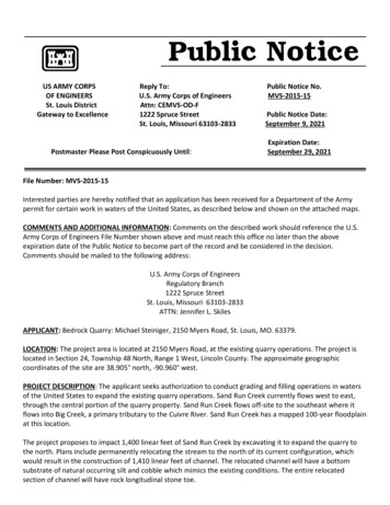
US ARMY CORPSOF ENGINEERSSt. Louis DistrictGateway to ExcellenceReply To:U.S. Army Corps of EngineersAttn: CEMVS-OD-F1222 Spruce StreetSt. Louis, Missouri 63103-2833Postmaster Please Post Conspicuously Until:Public Notice No.MVS-2015-15Public Notice Date:September 9, 2021Expiration Date:September 29, 2021File Number: MVS-2015-15Interested parties are hereby notified that an application has been received for a Department of the Armypermit for certain work in waters of the United States, as described below and shown on the attached maps.COMMENTS AND ADDITIONAL INFORMATION: Comments on the described work should reference the U.S.Army Corps of Engineers File Number shown above and must reach this office no later than the aboveexpiration date of the Public Notice to become part of the record and be considered in the decision.Comments should be mailed to the following address:U.S. Army Corps of EngineersRegulatory Branch1222 Spruce StreetSt. Louis, Missouri 63103-2833ATTN: Jennifer L. SkilesAPPLICANT: Bedrock Quarry: Michael Steiniger, 2150 Myers Road, St. Louis, MO. 63379.LOCATION: The project area is located at 2150 Myers Road, at the existing quarry operations. The project islocated in Section 24, Township 48 North, Range 1 West, Lincoln County. The approximate geographiccoordinates of the site are 38.905 north, -90.960 west.PROJECT DESCRIPTION: The applicant seeks authorization to conduct grading and filling operations in watersof the United States to expand the existing quarry operations. Sand Run Creek currently flows west to east,through the central portion of the quarry property. Sand Run Creek flows off-site to the southeast where itflows into Big Creek, a primary tributary to the Cuivre River. Sand Run Creek has a mapped 100-year floodplainat this location.The project proposes to impact 1,400 linear feet of Sand Run Creek by excavating it to expand the quarry tothe north. Plans include permanently relocating the stream to the north of its current configuration, whichwould result in the construction of 1,410 linear feet of channel. The relocated channel will have a bottomsubstrate of natural occurring silt and cobble which mimics the existing conditions. The entire relocatedsection of channel will have rock longitudinal stone toe.
Willow stakes are also planned to be incorporated within the relocation to help establish vegetation.Bedrock Quarry has researched alternatives and has attempted to minimize impacts to the stream. However,the applicant stated that the impacts are unavoidable due to the desire to utilize the site for quarryoperations.The applicant is proposing to mitigate impacts to Sand Run Creek by creation and enhancement of therelocated section of channel.LOCATION MAPS AND DRAWINGS: See attached. In addition, the project plans may be viewed in color and inmore detail by visiting the Public Notice section of our website ry/PublicNotices/OpenNotices.aspxADDITIONAL INFORMATION: Additional information may be obtained by contacting Jennifer L. Skiles, ProjectManager, U.S. Army Corps of Engineers, at (314) 331-8579. Your inquiries may also be sent by electronicfacsimile to (314) 331-8741 or by e-mail to Jennifer.L.Skiles@usace.army.mil.AUTHORITY: This permit will be processed under Section 404 of the Clean Water Act (33 U.S.C. 1344).WATER QUALITY CERTIFICATION: The Clean Water Act (CWA) Section 401 Certification Rule (CertificationRule, 40 CFR 121), effective September 11, 2020, requires certification for any license or permit thatauthorizes an activity that may result in a discharge. The scope of a CWA Section 401 certification is limited toassuring that a discharge from a Federally licensed or permitted activity will comply with water qualityrequirements. The applicant is responsible for requesting certification and providing required information tothe certifying agency. As of the date of this public notice, the applicant has not submitted a certificationrequest to the MDNR (certifying authority). In accordance with Certification Rule part 121.6, once theapplicant submits a certification request the Corps will determine the reasonable period of time for thecertifying agency to act upon the certification and provide written notification. In accordance withCertification Rule part 121.12, the Corps will notify the U.S. Environmental Protection Agency Administratorwhen it has received a Department of the Army (DA) permit application and the related certification. TheAdministrator is responsible for determining if the discharge may affect water quality in a neighboringjurisdiction. The DA permit may not be issued pending the conclusion of the Administrator’s determination ofeffects on neighboring jurisdictions.SECTION 404 (b)(1) EVALUATION: The impact of the activity on the public interest will be evaluated inaccordance with the Environmental Protection Agency guidelines pursuant to Section 404 (b)(1) of the CleanWater Act.PUBLIC HEARING: Any person may request, in writing, within the comment period specified in this notice, thata public hearing be held to consider the applicant’s proposal. Any request for a public hearing shall state, withparticularity, the reason for the hearing, and must be based on issues that would warrant additional publicreview.ENDANGERED SPECIES: The proposed project is within the range of the federally endangered Indiana bat(Myotis sodalis) and the northern long-eared bat (Myotis septentrionalis) that currently a threatened speciesand is a proposed candidate for endangered status. Approximately 7,500 square feet of forested habitat is
planned to be removed per the channel relocation. A preliminary determination, in compliance with theEndangered Species Act as amended, has been made that this activity may affect the habitat of these listedand candidate species. The Corps is coordinating with the U.S. Fish and Wildlife Service and the applicant istaking measures to minimize potential effects of the project during construction. In order to further completeour evaluation, written comments are solicited by this public notice from the U.S. Fish and Wildlife Service andother interested agencies and individuals.CULTURAL RESOURCES: The St. Louis District will evaluate information provided by the State HistoricPreservation Officer and the public in response to this public notice and we may conduct or require areconnaissance survey of the project area. The Corps will continue to coordinate with SHPO and NativeAmerican Tribes as appropriate.EVALUATION: The decision whether to issue a permit will be based on an evaluation of the probable impactincluding cumulative impacts of the described activity on the public interest. That decision will reflect thenational concern for both protection and utilization of important resources. The benefit that may reasonablybe expected to accrue from the described activity must be balanced against its reasonably foreseeabledetriments. All factors, which may be relevant to the activity described, will be considered including thecumulative effects. Among factors considered are: conservation; economics; aesthetics; generalenvironmental concerns; wetlands; historic properties; fish and wildlife values; flood hazards; flood plainvalues; land use; navigation; shoreline erosion and accretion; recreation; water supply and conservation;water quality; energy needs; safety; food and fiber production; mineral needs; consideration of propertyownership; and in general the needs and welfare of the people. Many of the concerns listed above includingAir Quality are reviewed, evaluated, and permitted by the Missouri Department of Natural Resources throughthe State Land Reclamation Permitting Process.SOLICITATION OF COMMENTS: The U.S. Army Corps of Engineers is soliciting comments from the public;Federal, state, and local agencies and officials; Indian Tribes; and other interested parties in order to considerand evaluate the impacts of the proposed activity. Any comments received will be considered by the U.S.Army Corps of Engineers to determine whether to issue, modify, condition or deny a permit for this proposal.To make this decision, comments are used to assess impacts on endangered species, historic properties, waterquality, general environmental effects, and other public interest factors listed above. Comments are used inthe preparation of an Environmental Assessment and/or an Environmental Impact Statement pursuant to theNational Environmental Policy Act. Comments are also used to determine the need for a public hearing and todetermine the overall public interest of the proposed activity.AttachmentsRobert S. GramkeChief, Regulatory BranchNOTICE TO POSTMASTERS:It is requested that this notice be conspicuously and continually placed for 21 days from the date of thisissuance of this notice.
*** 2021/08/19 ***BEDROCK QUARRYSITE PLANWESLOCATION MAP01Michael SteinigerN854 Lone Star DriveO'Fallon, Missouri 63366636-978-3478Phone (636) 397-1211Fax (636) 397-1104www.prs3.com22 Richmond Center CourtSt. Peters, MO 63376St. PetersBEDROCK QUARRYSAND RUN CREEKRELOCATIONPrepared For:DIGNE CA LL SYSTRI OESAND RUN CREEK RELOCATION PLANP-OLL BE FO RE YU348ST OWI NC.M,4-7-3400STREAM CROSS SECTIONCA1-8MISSOUUTILITIES NOTENESSCALE: 1" 100'01
you dig! 1-800-dig-rite little mo" says. underground facilities, utilities and structures have been plotted from available information and therefore, their location mu\ t be considered approximate only. there may be others, the existence of which is presently not known. it is the responsibility對 of the contractor to have all utilities .
