Transcription
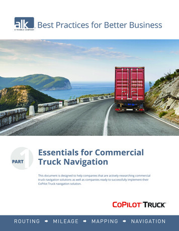
Best Practices for Better BusinessEssentials for CommercialTruck NavigationThis document is designed to help companies that are actively researching commercialtruck navigation solutions as well as companies ready to successfully implement theirCoPilot Truck navigation solution.
Executive SummaryEnsuring a Successful Commercial Truck Navigation ImplementationDid you know? On average, a single truck wastes over 1,190 per year on Out-of-Route (OoR) costs1Fines typically cost companies 1,000 to 40,000 per incidentThe average cost of a crash is 265,000, if a fatality is involved 11M2Commercial truck navigation solutions can help to avoid these staggering costs. Proper navigationcan save thousands per truck, per year, by efficiently routing drivers on safe, truck legal routes andreducing out-of-route (OoR) costs. In addition, the company saves potentially hundreds of thousandsin fines by avoiding restricted roads, bridges and tunnels. Finally, although all accidents cannotbe prevented, commercial truck navigation can route a driver on a safer route, helping to avoidpotentially millions in insurance and legal expenses.Correct implementation and proper configuration of truck and routing profiles with precisedestinations is the key to driver acceptance and positive results for a company using a commercialtruck navigation solution. Accurate profiles are critical. Sending a driver with a 24-foot straight truckon a 53-foot trailer route (which is much longer and circuitous) will damage the credibility of a newnavigation solution and spread like wildfire among the rest of the drivers. By providing accurate truckdimensions and load information, profiles can be established to provide safe and efficient navigationfor the best driver experience.The Challenges a Driver FacesEnforced Road Restrictions Traffic, MUTCD/DOT SignsTrailer length and widthWeight (GVWR)HeightHazardous materialThe number of vehicles on the road today is increasing as are the number of distractions for adriver, including in-cab technology.Driver distraction has remained a huge concern among motor carriers and commercialdrivers as evidenced by its 2014 breakthrough in the Top 10 Industry Issue Rankings.31 An Analysis of the Operational Costs of Trucking, a 2013 Update; American Transportation Research Institute2 2015 Pocket Guide to Large Truck and Bus Statistics; USDOT FMCSA; April 20153 American Transportation Research Institute. (2016, October). Critical Issues in the Trucking Industry 2016. Arlington, VABest Practices for Better Business Part I – Essentials for Commercial Truck Navigation2
The risk of missing important road signs for enforced restrictions has also increased, resultingin even an experienced driver going past the point of no return. Accurate profiles in yournavigation solution are critical to ensuring the success of the driver. Map data, like road signs,can have almost all the necessary information to route a driver, but if the navigation softwaredoes not have the right parameters for the truck and its load, then the driver with a 53-footstraight trailer, for example, is at risk of being instructed to follow a car’s prescribed route. Thiscan result in the driver and company facing costly fines and delays.Enforced restrictions come in the form of weight, height, length, width, and hazardous materials. Someregulations are federal and others are local, but all are factored into building an optimal and saferoute.This essential restriction data is available through ALK’s proprietary map data and serves as the basefor ALK’s CoPilot Truck commercial truck routing and turn-by-turn navigation solution. CoPilotTruck offers the key profile settings and selections to provide the right guidance.In addition to enforced restrictions, traffic speeds, stop signs, stop lights, and safe turns need to betaken into consideration. Providing a driver with this accurate guidance enables them to stay focusedon the road, improving both their efficiency and satisfaction.The Essentials for Accurate Commercial Truck NavigationMap Data Enhanced Daily Hundreds of data points per road segmentMillions of miles updated monthlyQuarterly releasesALK is continuously updating map data to adjust to the constantly changing public infrastructureand laws.ALK Map Data includes over 4.2 million commercial truck restrictions in NorthAmerica and hundreds of attributes per road segment.ALK’s map of North America features over 6.7 million miles, over 100 million addresses, and 7.8million Points of Interest (POIs). Globally, millions of miles are updated monthly and made availablefor ALK’s web-based solutions (PC*MILER Web Services and ALK Maps). ALK’s CoPilot Truck andCoPilot Professional solutions offer quarterly map data releases that are available via USB stickupdates or over-the-air through a high speed connection (e.g. LTE or WiFi) due to the file size.Updates to the application software itself can be performed over-the-air, eliminating the need totouch the truck or take vehicles out of service.Best Practices for Better Business Part I – Essentials for Commercial Truck Navigation3
Sub-Second, Turn-by-Turn Navigation Local/Offline storageAccessible in remote or out of coverage areasGreat navigation starts with great routes but also requires sub-second response time fordriver safety.Did you know?If a vehicle is traveling at 65 mph, it will have traveled 953 feet in 10 seconds,which Is the distance of almost three football fields!A company cannot count on a connection to a cellular network to provide urgent navigationupdates that will leave their drivers in trouble. Data has to be immediately available in localstorage to provide the constant feedback the drivers need. Supplemental real-time informationcan help but cannot always be depended upon for proper and safe navigation.Driver-friendly User Interface In-cab warnings for speed limits and significant traffic delaysAlternate routing optionsClearTurn view and lane assist guidanceEasily recognizable icons displayed on map screen to identify restrictionsHow often have you missed a speed limit transition on a road you are traveling? CoPilot Truckprovides real-time audible and visual notification to the driver when they are exceeding the speedlimit so they can make quick corrections, helping to avoid a ticket.There are many decisions a driver has to make, so assistance before and during navigation must becarefully considered. If the driver has local knowledge of road problems, CoPilot Truck can calculateup to three alternative routes along with the cost and time impact for each that will not violate theprofile but can give the driver choices.More and more ramps and intersections are being modified to have multiple lanes for turningmaking it critical to be in the proper lane when exiting. CoPilot Truck provides a ClearTurn view thatdisplays the available lanes and provides audio/visual guidance as to whichlane the driver needs to be in, thus improving the safety for the driver and other vehicles on the road.Best Practices for Better Business Part I – Essentials for Commercial Truck Navigation4
Best PracticesGeocode Cleansing with PC*MILER Six digits of precision beyond the decimal placeValidated address and geocode dataAddresses and the associated geocodes for most companies have evolved overtime going from hand written instructions, or a partial address, to three digits ofprecision (365 ft. radius), to four digits (36 ft. radius) and finally to six digits (fourin. radius). Often there will be errors in the address and the geocode puts themhundreds or thousands of miles apart. Additionally, the address is probably forthe physical office location and not necessarily the proper point of entry for atruck.TIP:A geocode needs to bethe entry point for thetruck to have properand accurate navigation.PC*MILER has the capability to take a spreadsheet with addresses and geocodes,process it and generate a workbook with four different confidence levels anderror messages to highlight the problem addresses/geocodes. Typically, 80%are good (about 20% of those need some cleanup) and 20% require furtherinvestigation.Components of Truck Profiles Data rich mapsAccurate Length, Height, Width, and GVWRSpecify load typeALK map data has dozens of data points for each road segment to provide the bestnavigation. The customer’s responsibility is to feed CoPilot Truck the right truck/routing profile for planning the optimal route. CoPilot Truck starts off with Heavy Duty,Medium Duty and Light Duty vehicle profiles. To customize, start with Heavy Dutyand select custom to create your specific configuration.Heavy Duty is for tractor/trailer set-ups and focuses on the trailer for the dimensionsand the weight which is the GVWR from the truck. There is a designated National Network and State Extensions for trailers that exceed 48 feet but not more than 53 feetlong, exceeding 96 inches but not more than 102 inches wide and 13 feet 6 inchestall that drivers must follow or they will be ticketed. Selecting this category will alsoautomatically check the box for National Network State Extensions.TIP:When naming profiles,it is best to be very clearon the critical routingaspects that are easilyrecognizable by the driveras they will be selectingprofiles based on thename (e.g. 48 ft, Flam, 60Klbs, 12 ft; 28 ft Twins, nonhaz, 80K lbs, 12 ft 6 in).Best Practices for Better Business Part I – Essentials for Commercial Truck Navigation5
Non-Standard Routing NeedsFor custom dimensions and weights over 26,000 pounds, the Heavy Duty category needsto be selected first and then customized. Heavy Duty is the default setting and provides thesafest route; however, it will be the longest route. If a fleet includes smaller trailers, then werecommend configuring additional profiles for the smaller trailers (even if they are 48 feetlong) as routing will change dramatically to shorter routes.There are options for pups, twin trailers, and custom lengths, widths, and heights. The moreaccurate the better; however, close common heights and widths can be grouped.Height variances of 6 inches should merit another grouping. Likewise, road/bridge weightrestrictions can vary by individual tons so every 2,000 pounds (GVWR) can yield anothergroup.Anything longer than 53 inches or twin 28-foot trailers, or taller than 13 feet 6 inches,requires permits and are not supported by ALK software and map data.Routing Profiles Practical vs. ShortestNational Network State ExtensionsHazmat class restrictionsPractical routing takes into consideration all the legal road constraints, geometries,traffic, road speeds, tolls and other factors.Shortest routing determines the shortest truck-legal route but will invariably use routes thathave more traffic, more stops, and more turns, which creates more driver stress and increasesthe probability for an accident.ALK only recommends shortest routing for local delivery operations. Shortest routing is neverrecommended for trucks conveying hazardous materials. Practical should yield the best resultson an ongoing basis.By selecting Heavy Duty for a truck configuration, CoPilot Truck automatically checks the box forNational Network State Extensions. This is a double check for legal routing on 53- feet long,102 inches wide, and 13-feet 6 inches tall trailers. Some customers will also choose NationalNetwork State Extensions for safety reasons, fully realizing the routes will be longer.Hazardous material (Hazmat) transport has many restrictions; however, restricted routing hasbeen broken down into 6 categories: Corrosive, Explosive, Flammable, Inhalants, Radioactive,and Other/General. All the U.S. DOT Hazmat Classes can fit into each of these routing categories.It is critical to make the right selection here and if there are any questions, consult with yoursafety group.Best Practices for Better Business Part I – Essentials for Commercial Truck Navigation6
Management Options International Borders OpenToll or secondary road preferencesInternational Borders Open allows a route to be created that will send a driver acrossinternational borders when deemed more practical than a route using domesticroads (e.g. going from Detroit, MI to Buffalo, NY). Most companies uncheck this boxbecause they don’t want to deal with the delays and paperwork needed for crossingan international border.Note: By leaving this unchecked it will not affect cross border deliveries, onlydomestic deliveries.TIP:Tolls can representa significant hiddenexpense when youconsider the availabilityof non-toll roads.ALK offers the ability to Use, Avoid If Possible (reasonable incremental distance),or Always Avoid. The "Avoid If Possible" setting to use that provides a compromisebetween time and money. The "Always Avoid" setting can prove troubling with theextra distance and time, so it merits deeper analysis for your situation.Route or Trip Creation Manual entry or select POIs (Points of Interest) that are customer locationsWork flow with navigation and RouteSync integration (discussed in BestPractices Part III)Once the foundational elements for creating legal, safe, fast, managementapproved routes are established, the next step is to create a trip. There are 3 easyways to create a trip:1.Manually entering/selecting stops2.“Work flow” from a telematics service provider (TSP) or your transportationmanagement system (TMS) that contains geocoded3.RouteSync utilizing your TMS to generate the complete route and thensending a BLOB (Binary Large Object) to CoPilot Truck for execution.Manual entry does not require integration so it is the easiest to get started, but hasthe most potential for errors. However, ALK has enhanced the process by allowingthe driver to select from a wide range of options for automatic address input. Theyare “My Places” (frequented stops), contacts listings, selecting a spot on the map, andeven entering exact coordinates. From there the driver can create the stops for atrip in any sequence, select a “Routing Profile” (based on the equipment and hazmatproducts), and select “Optimize Stops” in “Trip Options”. CoPilot Truck will thencalculate the options and re-sequence the stops for optimal routing.Best Practices for Better Business Part I – Essentials for Commercial Truck Navigation7
Note: The “Advanced Optimization” option for CoPilot Truck can take into consideration ServiceLevel Agreements (SLAs), delivery time windows, and other inputs to sequence a route thatis optimal while maintaining the maximum number of commitments.For more information about #2 and #3, see Part III of this Best Practices series.The Road AheadThe future is exciting for map data, data sources, and navigation enhancements. More sources foraccuracy in weather predictions and forecasting ground conditions, traffic cameras, more traffichistory, and vehicle cameras will allow companies to keep their drivers safer and make deliveriesmore predictable. ALK has built a strong foundation on which it will continue to grow as technologyevolves.Your Next Steps Know your fleet, your customers, and your cargoSelect a commercial navigation solution that offers a comprehensive set of commercial truck .restrictions, reliable offline access and a driver centric user interfaceGreat navigation requires the input of great details. By gathering the data customized specifically to afleet and hauling criteria, the time spent on the road will be compliant and cost-effective. Utilize ALKto analyze your customer addresses and geocodes easily, helping to maintain the health and integrityof your address database and safely guide your fleet.Take the extra steps to customize your navigation solution to suit yourcompany’s needs. Contact us at bestpractices@alk.com to use ouractionable checklist to get you started.Additional Resources1 Contact your ALK Sales Representative for the actionable checklist specific to this whitepaper2 Navigation Best Practices Part II – Advanced Commercial Truck Navigation3 Navigation Best Practices Part III – TMS Integration for Customization and Tight ControlTo learn more about ALK’s advanced transportation technology visit www.alk.comALK Technologies is a transportation technology company dedicated to defining the optimal route to success through innovativerouting, mileage, mapping, and navigation solutions. 2016 ALK Technologies Inc. · All Rights ReservedALK, CoPilot, PC*MILER, RouteSync, and other ALK graphics, logos, and service names are trademarks of ALK Technologies, Inc.1 Independence Way, Princeton, NJ 08540alk.com
be prevented, commercial truck navigation can route a driver on a safer route, helping to avoid potentially millions in insurance and legal expenses. Correct implementation and proper configuration of truck and routing profiles with precise destinations is the key to driver acceptance and positive results for a company using a commercial truck .