Transcription
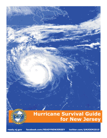
HURRICANEGUIDEWe’re ready for hurricane season Are you?Today, Southwest Florida is more vulnerableto the dangers of a hurricane. You musthave an emergency plan of action beforethe next storm threatens.This guide will help you get started!
WATCHVS WARNINGHurricane warnings indicate that hurricaneA hurricane watch means that hurricane conditions (sustained winds of 74 mph or higher) conditions (sustained winds of 74 mph or higher)are possible within the specified area. A hurricaneare expected somewhere within the specifiedwatch is issued 48 hours in advance of thearea. Because hurricane preparedness activitiesanticipated onset of tropical-storm-force winds inbecome difficult once winds reach tropical storman area.force (sustained winds of 39 to 73 mph), the hurricane warning is issued 36 hours in advanceof the anticipated onset of tropical-storm-forcewinds to allow for important preparation.HURRICANE DEVELOPMENTTROPICALDEPRESSIONAn organized system of clouds and thunderstorms with adefined, closed surface circulation and maximum sustainedwinds of less than 39 mph. It has no eye and does nottypically have the organization of the spiral shape of morepowerful storms. However, it is already a low-pressuresystem, hence the name depression.Tropical Depression Irma over the SoutheasternUnited States (Sep. 12, 2017)TROPICAL STORMAn organized system of strong thunderstorms with a definedsurface of circulation and maximum sustained winds between39 mph and 7 4 mph. At this point, the distinctive cyclonicshape starts to develop, although an eye is not usuallypresent.Tropical Storm Irma in the Atlantic Ocean (Aug.30, 2017)HURRICANEA system with sustained winds of at least 74 mph. A cycloneof this i ntensity tends to develop an eye, an area of relativecalm (and lowest atmospheric pressure) at the center ofcirculation. The eye is often visible in satellite images as asmall circular cloud-free spot. S urrounding the eye is theeyewall, an area about 9.9 mi to 50 mi wide in which thestrongest thunderstorms and winds circulate around thestorm’s center.Hurricane Irma in the Caribbean (Sep. 8, 2017)
PREPARATION TIMELINEASAPHurricane season starts June 1st, but the earlieryou can prepare, the better. Prepare your hurricane kit Know your evacuation zone Know your evacuation route Check supplies from previous seasons to makesure nothing has expired. Establish a plan with your family for stayinghome or evacuating. Check your home’s hurricane insurance policy.48 HOURSPrepare your home Secure the outside of your home, includinglawn furniture and other loose items. Don’t forgetto prep your pool or protect your boat. Board up or shutter windows to preventshattering. Secure and wedge sliding doors toprevent them from lifting from their tracks Check your survival kit. Make sure all items arepresent and in working order. Review your evacuation plan in case a warningis issued Pay extra attention to the forecast Follow instructions from local officials Fuel motor vehicles and obtain a supply ofcash. Banks and ATMs may not be open afterthe storm.36 HOURSUnless you have been advised to evacuate, stay home. It is a better place to ride out a storm thanstuck i n traffic, or in a crowded public shelter. Complete final storm preparations immediately andevacuate, if directed by local officials. And tune in to NBC2 for First Alert Coverage.STAYING HOME Be sure your home and your family is prepared and supplied.EVACUATINGFlorida law states that you MUST go whentold to evacuate. Here are some options: Board up or brace garage and porch doors A friend or relative’s home in a safer area Bring in pets A safer location outside of Southwest Fill bathtubs and containers with fresh water Run refrigerator at maximum and do notopen unless necessary Unplug small appliances Turn off propane tanks and utilities if toldto do so by authoritiesFlorida A designated public shelterShelters will not allow alcohol, firearms, or animals(other than service animals) Notify family and friends of your evacuationplans Take a survival kit of essential items Turn off the utilities and seal your home asIf you live in a mobile home, manufacturedhome, recreational vehicle or low lying areaprone to flooding, you may need to evacuate.tightly as possible Pack small valuables and shelter itemslisted on safety checklist Secure your home and take recommended evacuation routes to the nearest designatedshelter or safe area Do not leave your pets behind!If you plan to evacuate, leave 2 to 3 daysearly. During the height of an evacuation,travel time to your destination could triple!
HURRICANE SAFETY KIT 1 gallon of water per person per day for 3-7 days.1 gal 4 family members 3 days 12 gallons of water Non-perishable food and a manual can opener Medications Flashlight with extra batteries Other light sources such as a storm lantern with extrafuel or candles with matches Portable battery bank for cell phones Waterproof case for electronics & important documents Gloves for removing debris after storm Hand sanitizer and disinfecting wipes Whistle in the event of an emergency First aid kit Think about getting a generator Fill gas cans & label them with the date they were filled Camping stove or gas grill with propane Cash if ATMs and card readers are out with the power Battery powered radio Important documents such as a list of family contactsand physicians, insurance documents, and passportsDon’t forget extra items for children in your family. Non-perishable snacks Favorite stuffed animal, doll, or blanket Cards, games, books Vitamins and medications Diapers or pull-upsMake sure you have supplies for your pets in your family. Food and water for 3-7 days Sturdy crate Medical records and county tags Leash and collar Current photo of you with your pet in the event you areseparated Comfort items like a bed, blanket, or favorite toyPRINT THIS PAGE
EMERGENCY NUMBERSCOUNTYEMERGENCYMANAGEMENTAMERICANRED CROSSCharlotte(941) 833-4000(941) 629-4345Collier(239) 252-3600(239) 596-6868Desoto(863) 993-4831(863) 494-2348Glades(863) 946-6020(239) 278-3401Hendry(863) 674-5400(239) 278-3401Lee(239) 533-0622(239) 278-3401Dial 211 for information and referralFIRST ALERT WEATHER APPStay informed about the latest tropical systems inthe Atlantic and Caribbean. Get the most recentmaps and forecast details about active storms.Search NBC2 WxSouthwest Florida’s most powerful only livedoppler radarThe power to track storms live, right in the palmof your hand. Customize alerts for you!First Alert detailed storm analysisDetailed reports that break down the data, andgive you everything you need to know!Up to date hurricane trackerLive updates with the latest storm coordinates,and the p rojected paths.HURRICANE TRACKERInteractivePrint105 W100 W95 WAtlantic Basin Hurricane Tracking ChartNational Hurricane Center, Miami, Florida90 W85 W80 W75 W70 W65 W60 W55 W50 W45 W40 W35 W30 W25 W20 W15 W50 N10 W50 NNLQC45 NMEONNYPAOH40 NPEINB45 NNSVTNHMA ! BostonCTRI!New York CityPhiladelphia !NJ!MDWVVA40 NAzores! VA BeachNC35 NSCTX30 NLAHouston !MSALGANew Orleans!!35 NCharlestonBermuda! Jacksonville30 NFL! Miami25 N25 NThe BahamasMexico20 NCayman Is.CubaHaitiJamaicaDom.RepublicGuatemala10 NNicaraguaCostaRicaAnguillaSt. MartinLeeward IslandsMauritaniaAntiguaGuadeloupeand NevisDominicaMartiniqueSt. LuciaBarbadosHondurasElSalvador20 NB.V.I.Puerto U.S.V.I.St. KittsRicoBelize15 NWesternSaharaGrenadaCape Verde IslandsSenegalWindward IslandsTrinidad10 NPanamaColombia15 NThe GambiaVenezuela5 N5 N105 W100 W95 W90 W85 W80 W75 W70 W65 W60 W55 W50 W45 W40 W35 W30 W25 W20 W15 W10 W
Charlotte (941) 833-4000 (941) 629-4345 Collier (239) 252-3600 (239) 596-6868 Desoto (863) 993-4831 (863) 494-2348 Glades (863) 946-6020 (239) 278-3401 Hendry (863) 674-5400 (239) 278-3401 Lee.
