Transcription
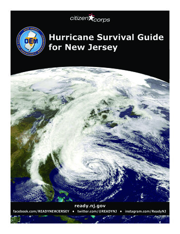
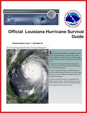
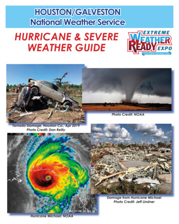
HOUSTON/GALVESTONNational Weather ServiceHURRICANE & SEVEREWEATHER GUIDEPhoto Credit: NOAATornado Damage, Houston Co., Apr 2019Photo Credit: Dan ReillyDamage from Hurricane MichaelPhoto Credit: Jeff LindnerHurricane Michael: NOAA
INTRODUCTIONABOUT THE HURRICANEIndex of PagesAbout the HurricaneSevere thunderstorms can bring tornadoes, large hail,damaging winds, flooding rains and lightning. HurricanesPage 3and tropical storms can bring many of the same hazardsFlooding from Heavy RainPage 4as well as storm surge flooding. This guide will cover howZip Zone EvacuationPage 5 - 6to prepare for different weather hazards and how to stayDamaging Winds andsafe when facing them. There are numerous checklists onTornadoesPage 7what to do before, during and after the storm. The guideContacts and Disaster Supply KitPage 8contains contact information for your local emergencyPlanning and Preparingmanagers and numerous resources/links where to findPage 9 - 10information. In this years guide you’ll also find an article onFor Those Who NeedAssistancethe dangers of rapidly intensifying Gulf hurricanes whichPage 11can impact the area with relatively little notice. In recentPreparing Pets and LivestockPage 12years Michael (2018) and Harvey (2017) made landfallInsurance TipsPage 13along the Gulf Coast as category-4 storms after a periodFinal Checklistof rapid intensification over just a few days time. ThesePage 14hurricanes make the point that the time for preparation isHurricane Tracking ChartPage 15 - 16now. Don’t wait until there is a storm in the Gulf. We hopeHurricane Forecast ResourcesPage 17you find this guide useful and will share the information withReview of 2019 Hurricane Seasonyour family, friends and coworkers. An electronic version ofPage 18Rapidly Intensifying Gulfthis guide will be found on the National Weather ServiceHurricanesHouston/Galveston Forecast Office web site weather.Page 19 - 20After the Stormgov/houston and also at the Extreme Weather Expo pagePage 21 - 22Flood Safetyextremeweatherexpo.com. You are encouraged to placePages 23the link to the guide on your web site and/or share it outTornado SafetyPage 24through email and social media.Page 2Storm Surge FloodingHurricanes Matthew and Nicole, 2016 Photo credit: NASADefinitionsLTROPICAL DEPRESSION:HURRICANE WATCH/WARNING:A tropical cyclone with maximum sustained Hurricane force winds are possible/winds of 38 mph or less.expected within the watch/warning areawithin 48/36 hours.TROPICAL STORM:A tropical cyclone with maximum sustained STORM SURGE WATCH:The possibility of life-threatening inundationwinds between 39 and 73 mph.from rising water moving inland from theshoreline (storm surge flooding) somewhereHURRICANE:An intense tropical cyclone with sustained within the specified area, generally within48 hours.winds of 74 mph or higher.TROPICAL STORM WATCH/WARNING:Tropical Storm force winds are possible/expected in the watch/warning areagenerally within 48/36 hours.Other Thunderstorm HazardsPage 25Weather Alerts to Cell PhonePage 26Regional NWS OfficesPage 27EMC Contacts, Phone numbersPage 28 - 301Daniel ReillyWarning Coordination MeteorologistNational Weather Service Houston/GalvestonA hurricane is the strongest type of tropicalcyclone, a weather system that derives its energyfrom warm ocean waters and is characterizedby a closed counterclockwise circulation in theNorthern Hemisphere. It typically has a cluster ofthunderstorms around the center of circulationand bands of thunderstorms spiraling outward. Thetropical cyclone is called a tropical depression,tropical storm or hurricane depending on thestrength of the maximum winds in the storm. Thehurricane often has an eye, a rain free area inthe center of the storm where the winds are verylight. Every storm is different and contains somecombination of the following hazards: damagingwinds, storm surge flooding, tornadoes andflooding from heavy rainfall. The greatest chanceof a hurricane landfall for Texas is during Augustand September although hurricanes have struckthe Upper Texas coast during every month fromJune to October.Saffir SimpsonHurricane Wind ScaleCategory 1- Winds 74 to 95 mphCategory 2 - Winds 96 to 110 mphCategory 3 - Winds 111 to 129 mphCategory 4 - Winds 130 to 156 mphCategory 5 - Winds 157 mph or higherSTORM SURGE WARNING:The danger of life-threatening inundationfrom rising water moving inland from theshoreline (storm surge flooding) somewherewithin the specified area, generally within36 utsshws.php2
Storm Surge FloodingFlooding from Heavy RainStorm surge is the abnormal rise of water generated by a storm, over and above the predictedastronomical tides. The storm tide is the height of water relative to a reference level or datum thatincludes storm surge and astronomical tide. The combination of storm surge flooding and batteringwaves can be very destructive as seen with Hurricanes Ike (2008), Carla (1961), the 1900 GalvestonHurricane and many others.There are numerous examples of significant flooding caused by slow moving hurricanes and tropicalFlooding from Heavy Rainstorms in Texas. Harvey in 2017 and Allison in 2001 are two recent examples. Extreme rainfall totalsand rain rates in some cases over 4,5 or even 6 inches per hour produced devastating flooding inthese cases. The figure below shows the amount of rainfall from Harvey and it’s slow looping track.While the rainfall and associated flooding with Allison was extreme, the maximum rainfall and areacovered was much greater with Harvey leading to even more catastrophic and widespread flooding.When a hurricane or strong tropical storm approaches, the National Weather Service (NWS) will producetwo maps to convey the storm surge flood threat. The first is the storm surge watch and warning mapshowing areas at risk for life threatening surge (see page 2 for watch/warning definitions). The other typeof map, referred to shows the reasonable worst case scenario for depth of water above ground dueto storm surge flooding for a given storm. Thefollowing are examples from Harvey in 2017.Tips to Prepare for Flooding Protect Your Personal Documents and Special Items 3For more information on these storm surge related maps refer to the following arninghttps://www.nhc.noaa.gov/surge/inundation Store in plastic tubs with lockable tops on high shelves or in the attic Consider storing critical documents in a safe deposit box if in a flood prone areaBuy flood insurance even if not in the 100 year flood plain! Your homeowners policy will notcover your flood loss. A separate policy is needed through the National Flood Insurance Program(NFIP). For more information go to www.floodsmart.govKnow your risk. Is your home, business or school in a flood plain? Where is water likely to collect onthe roadways you most often travel? What is the fastest way to get to higher ground?Most of the time it is safer to stay put than get on the roads. Is that true where you live?Knowing the answers to these questions ahead of time can save your life. Flood plainmaps can be accessed here: https://msc.fema.gov/portalNever attempt to drive on flooded roads. If you encounter flood waters when driving,Turn Around, Don’t Drown! Most flash flood fatalities occur in vehicles.http://www.weather.gov/taddAdditional flood safety information can be found on page 234
Zip Zone EvacuationDifferent colors/zones roughly correspond to surge flooding for differenthurricane categories (J1 corresponds to cat 1, etc). However becausesurge depends on more than category, this is not always the case.5ZipZone evacuation zones roughly correspond to the following hurricane categories. However because surgedepends on more than category, this is not always the case. Hurricane Ike was a category 2 but had a surgemore like a typical 3 or a 4: Coastal-cat 1; Zone A-cat 1 or 2; Zone B-cat 3; Zone C-cat 4,5.6
Damaging Winds and TornadoesHurricane force winds of 74 mph or more candestroy buildings, mobile homes, trees andpower poles. Debris such as signs, roofingmaterial, siding, and small items left outsidebecome flying missiles in a hurricane. Thestrongest winds occur in a region of thehurricane called the eyewall. Wind gustsin the right side of the eyewall are the mostdestructive.Hurricane force wind gustscan be felt well inland, far from the coast,especially for stronger fast moving hurricanes.Above: Wind damgage to home fromHurricane Alicia in August 1983.! It is imperative to ensure your home orbusiness is well constructed to minimize thedamage from the wind. See the Planning andPreparing section in this guide for cost effectivehome improvement tips that can help youreduce your damage from a hurricane.MOBILE HOME RESIDENTS MUST EVACUATE!No mobile home or manufacturedhome - no matter how new it is - canprovide safe shelter from hurricaneforce winds. Straps or other tie-downs will notprotect a mobile home from the highwinds associated with a hurricane.Mobile home residents must evacuatewhen told to do so by local authorities.TornadoesTropical cyclones can also produce tornadoes which most oftenoccur in thunderstorms embedded in outer rain bands on the righthand side of the track, away from the center of the hurricane. Theycan also occur in the eyewall. Tornadoes produced by tropicalcyclones are usually relatively weak and short-lived but not always.A tornado that developed in Hurricane Carla’s outer bands killed 6in Galveston in 1961. Twenty-three tornadoes were confirmed withHarvey, all forming in the outer rainbands on the right side of the storm.7More information on tornado safety can be found on page 24Contacts and Disaster Supply KitThe Greater Houston Area Chapter of the American RedCross recommends that you have the following items in yourHurricane Supply Kit. Do not forget to have a family meetingbefore hurricane season and review your communicationinformation and evacuation plan. Make sure the contactinformation such as home, work, school, cell phone numbers,and your “Out of Town” contact person’s information is current.Emergency Contact InformationOut of Town Contact Address:Out of Town Contact Phone Number:Work Telephone Number:Cell Number/Spouse Cell Number:Children Cell Number:School Telephone Number:Doctor Telephone Number:Bank/Credit Card Telephone Number:Insurance Company Information: !HURRICANE SUPPLY KITAt least a 7-day supply of non-perishablefood and a manual can opener At least a 7-day supply of water. One gallonper person per day is recommended Battery powered portable television or radiowith extra batteries Flashlight with extra batteriesFirst Aid kit and manualSanitation and hygiene items such as instanthand sanitizing gel, moist towelettes, toiletpaper, and feminine hygiene productsMatches in a waterproof containerWhistleKitchen accessories and cooking utensilsCashExtra clothing, blankets, and sleeping bags !Photocopies of identification, insurance,prescriptions, household inventory, creditcards, and your latest utility billCD or photocopies of important documentssuch as birth/marriage certificates and titlesPrescriptionmedications,eyeglasses,contact lens solution, and hearing aidbatteriesFormula, baby food, diapers, and pacifiersPet carriers, leashes, shot records, and foodfor each animal evacuating with youA good map showing county roads andhighwaysTire repair kit, booster cables, pump, and flaresWhite distress flagToys and games for childrenList of family phone numbers and addressesoutside the area8
Planning and PreparingPlanning and PreparingBusiness and Employee PreparationPreparing Your Home Before the StormProper hurricane preparations made ahead of time will notcompletely protect your property from damage. However,following a few simple tips may greatly reduce the damage toyour home and property.!Important Home Preparation Tips!Tips for Businesses Identify and protect vital records. Backup andstore key files off site. Protect electronic equipment from possible waterdamage. Have extra cash and blank checks in case extramoney is needed after the storm.Elevation Matters Establish a temporary location for businessoperations in case your facility is damaged. Identify a safe room for employees who mustremain in the building.Mobile Homes Give employees enough time to securetheir homes and families. Develop a 24-hour emergency contact list withphone numbers of key employees. Consider paying employees before theyleave to prepare their homes. Set up telephone numbers for employees tocheck in and receive company information. Know the elevation of your home! Are you in a surge, flood and/or evacuation zone?Check tie-downs for rust or breakage.Residents of mobile homes must evacuate when told to do so!Landscaping Trim trees, shrubbery and dead limbs, especially ones close to your home.Repair or replace broken or damaged fences.Shredded bark is preferred instead of small gravel or stone bedding.Protecting Your Boat - Marine PreparationsRoofing Inspect the roof for loose tiles, shingles or debris. Consider replacing old or damaged shingles with newones rated for hurricane force winds.Check for and/or install hurricane clips to secure roof trusses to side walls.Clear loose and clogged rain gutters and downspouts. Doors Reinforce garage doors and tracks or replace with a hurricane tested door. (See above image)Reinforce double entry doors with heavy duty foot and head bolts.Use a security dead bolt with a one inch minimum bolt length.Doors may be shuttered, but one entry must be left easily accessible.Windows 9If possible, install tested/manufactured hurricane shutters.Inspect existing shutters to ensure they are in good working order.Alternative: Use 5/8” or greater exterior grade plywood secured by 2 1/2” screws and/or special clips.Obtain wood and fasteners, cut wood to size, pre-drill holes and place anchors on homes.Store shutters or plywood lying flat to avoid warping when not in use.For more information on how to prepare your home visit www.flash.org!Tips for Boat OwnersCheck your marina contract for policies andprocedures for hurricanes.Check with the manufacturer for proper waysto secure your boat during a storm. Considermovingarrangementsadvance of an approaching storm. Trailer boats should be removed from the waterand securely stored at least 48 hours beforea hurricane is expected to make landfall.wellin Purchase necessary hurricane materials such as additional mooring lines, crew anchors,fenders, fender boards, chafing gear, and anchors. Safe storm moorings should consist of good condition ropes of sufficient diameter andlength, with at least three or four substantial anchor points. Do not moor parallel to bank. Receding tides often capsize boats in this type of iness-or-farm-was-damaged10
Preparing Pets and LivestockFor Those Needing AssistancePreparations for People with Medical, Functional or Access NeedsIf you or someone you know have medical, functional or accessneeds, such as impaired vision, hearing loss, or limited mobility, itis important to make sure there is a support structure in place tohelp that person respond to a hurricane threat. Such individuals canoften benefit from a caretaker or “hurricane helper,” someone whocan look out for that individual and ensure they have the necessaryresources to evacuate and/or shelter when the storm threatens.For more information: www.togetheragainsttheweather.comFEMA News Photo !Important TipsIdentify things you need every day such as food, medicines, water and other items you may rely on suchas a walker, oxygen tanks or medical equipment. Start building up a supply before the hurricane season ofnon-perishable food items, bottled water, medicines, etc. that can be used in the event you lose power and/or water supply. Have at least two weeks’ supply of food and water, and 1 month supply of medications. Ifyou have vital medical equipment that you rely on that requires power, be sure to have a back-up source ofpower such as a battery or generator. Store important documents in a plastic bag such as prescriptions, emergency contact information for familyand doctor, insurance cards, identification etc. If evacuation is necessary, identify where you will evacuate to, who you will stay with and how you will getthere. If you cannot drive, make sure you have someone designated who will drive you where you need togo in advance of the hurricane. Make sure your transportation can accommodate any equipment or othersupplies that need to be taken with you.Preparing for Your Pet’s SafetyYour pet should be part of your overall hurricane preparationplans. Below are a few important things to help you prepare: Make sure your pet’s vaccinations are current and haveproof they are current. DO NOT assume that a publicshelter or hotel will accept your pet. Be sure to have a current photo of your pet. Make sure your pet has a proper ID collar. Be sure to pack all medications your pet may need along with a muzzle, collar, leash, paper towels,and trash bags.The City of Galveston has a separate “need a ride” number for their residents which is 409-797-3701. Once youregister contact your emergency management office (pp.28-30) for more information on what type of assistancewill be offered in your ed-A-Ride-Program11Pack enough food and bottled water for the duration of your evacuation. DO NOT let your pet eatfood or drink water from outside that may have become contaminated. State of TexasEmergency Assistance Registry (STEAR) - Dial 211If you will need help evacuating from a hurricane or any other hazard, dial 2-1-1 to register in advance. You willbe asked a series of questions which will allow emergency managers to identify those who need extra assistanceevacuating. It is necessary to do this each calendar year. There is also an option to register online.Each animal should have a properly sized pet carrier. Thecarrier should be large enough for the animal to stand upand turn around. Preparations for LivestockEnsure all animals have some form of visibleidentification. Evacuateanimalswheneverpossible.Arrangements for evacuation, including routes andhost sites, should be made in advance. The evacuation sites should have or be ableto readily obtain food, water, veterinary care,handling equipment and facilities. Obtain vehicles and trailers needed fortransporting each type of animal. Also makeavailable experienced handlers and drivers.If evacuation is not possible, a decision must be made whether to move large animals to availableshelter or turn them outside. This decision should be determined based on soundness andlocation of the shelter (structure).When necessary, move livestock to higher ground and deny access to flood prone pastures,barns, and other structures.It is important that livestock have plenty of food and clean mals12
Insurance TipsFinal ChecklistInsurance Tips - Before the Storm Keep a written inventory of your possessions. Take photos or videotape of each room and the exterior of yourhome to keep with your inventory.Gather important documents and insurance cards and policies. Unless they are stored in a safe place, takethem with you if you evacuate along with an inventory of your possessions, including receipts and photos orvideos.Know what your policy covers. Check your auto policy to see if you have comprehensive coverage “otherthan collision.” Comprehensive coverage pays if a storm, fire, or flood damages your car. Find out how muchcoverage you have for “additional living expenses” to cover lodging, food, and other expenses if you’reforced to vacate your residence after suffering a covered loss.Know your policy limits. Your limits may be too low if replacement costs have risen because of new additions,improvements, or inflation.Review your health coverage. Find out if you’ll be able to receive non-emergency care from out-of-networkproviders, if needed, without accruing additional out-of-pocket costs.Consider renters insurance if you don’t have it. If you rent an apartment, duplex, house, or townhouse, youmay need renters insurance to protect your belongings.Consider purchasing flood, wind and hail coverage. You may have to buy separate policies to cover wind,hail, and flood damage. Homeowners, farm and ranch, renters, windstorm, and condominium policies do notcover damage from rising waters.National Flood Insurance Program (NFIP)Actions to Take When a Storm is in the Gulf Listen frequently to radio, TV, or NOAA weather radio for bulletins and forecasts of the storm’s progress.Double check items in your emergency supply kit.Fuel and service your vehicles. Store lawn furniture and other loose, light weight objects, such as garbage cans and garden tools.Get plenty of extra cash in case power goes out and ATMs do not work.Garage or store vehicles that are not being used.Inspect and secure mobile home tie-downs.Make sure you have supplies to survive on your own for at least one week if you plan on staying.Board up windows (if shutters do not exist) in case storm moves quickly and you have to leave.TAPE PROVIDES NO PROTECTION!Follow instructions issued by local officials. EVACUATE IMMEDIATELY IF ORDERED TO DO SO!Final Actions to Take if LeavingIf your property is located in one of Texas' 14 coastal counties, or parts of southeastern Harris County, you willlikely only be able to obtain insurance coverage for windstorm or hail damage from a special insurance poolcalled the Texas Windstorm Insurance Association (TWIA.) To qualify for TWIA coverage, your property mustpass a windstorm inspection and must meet certain windstorm-resistant building standards. You cannot buy orchange TWIA coverage once a hurricane has entered the Gulf of Mexico. For more information about windstorm coverage call TWIA or visit its website 1-800-788-8247. www.twia.org Contact your insurance agent or company promptly. Keep a record of all contacts you have with your company. Be prepared to answer questions about the extent and severity of the damage.Final Actions to Take if StayingHomeowners and commercial property policies specifically exclude coverage for damage from flooding fromrising waters. To protect yourself from losses caused by most flooding, you'll need to purchase a separate floodinsurance policy from the National Flood Insurance Program (NFIP)For more information about flood insurance,contact the NFIP 1-800-427-4661. www.floodsmart.govTexas Windstorm Insurance Association (TWIA)Insurance Tips - After the StormIf your home is not insured, contact your local Red Cross or FEMA Disaster Recovery Center for assistance. CallFEMA at 1-800-621-FEMA (3362).Make a list of your damaged property. Photograph or videotape the damage if possible. Don't throw awaydamaged items until your insurance adjuster has had a chance to view them.If there is partial damage to your home, take reasonable and necessary repairs to protect your home andproperty from further damage. Cover broken windows and holes to keep rain out. Don't make permanent repairs until instructed by your insurance company. Keep a record of your repair expenses and save all receipts.13Texas Department of InsuranceTexas Windstorm Insurance Associationwww.tdi.texas.govwww.twia.orgConsumer help line 1-800-252-3439Consumer help line 1-800-788-8247 Turn off propane tanks.Unplug small appliances.Turn refrigerator and freezer to lowest setting.Turn off utilities if ordered to do so.Notify family members of your evacuation plans.Lower water level in swimming pool by at least one foot.Lock home securely.Board up remaining doors and brace garage door.Take pets with you.Close storm shutters, if available.Turn refrigerator or freezer to coldest setting and open only if necessary.(25 pounds of dry ice will keep a 10-cubic foot freezer below freezing for 3-4 days.)Follow instructions from emergency managers and be prepared to turn off utilities if ordered to do so.Board up remaining doors, brace garage door, and remain inside. Stay away from boardedup windows.Beware of the calm winds in the eye of the storm and do not venture outside. Some of thestrongest winds may occur shortly after the eye passes.DO NOT EXPECT EMERGENCY RESPONDERS TO BE OF ANY ASSISTANCE DURING A LANDFALLINGHURRICANE!14
2019 Hurricane Names toImeldaJerryKaren Lorenzo Melissa Nestor Olga Pablo Rebekah Sebastien Tanya Van Wendy2020 Hurricane Names aiasJosephineKyle ed2021 Hurricane Names inKate nda16
Hurricane Forecast ResourcesThe National Hurricane Center (NHC) inMiami, FL is the official source for tropicalcyclone advisories and forecasts and isresponsible for issuing tropical cyclonewatches and warnings for the United States.Review of 2018 Hurricane SeasonWeather InformationNational Weather Servicewww.weather.gov/houstonNational Hurricane Centerwww.hurricanes.govGraphical Tropical Weather OutlookProvides an overview of all tropical cyclone activity.Indicates areas of interest where tropical cyclones could developover next 5 days. A percent chance that it will develop is assigned.Moving the cursor over the highlighted areas will provide a moredetailed text description.NHC Forecast AdvisoryMost recent position for a storm along with all coastline watchesand warnings. Includes a 3 or 5 day track with error cone.Error cone represents a 5 year average error. The center of thestorms only stays within the error cone 67% of the time.DO NOT focus too closely on the exact track forecast - the littleblack line. If you are in or near the cone, the center of the stormcould head your way. Impacts are often felt well outside the cone.Tropical Storm Wind Time of Arrival GraphicGraphic shows estimated time of arrival of tropical storm forcewinds, both most likely time and earliest reasonable time.Designed to account for forecast uncertainty.May be useful for evacuation planning.Potential Surge Inundation GraphicIssued by National Hurricane Center about 48 hours prior toimpacts being felt at the coast.Shows reasonable worst case for the amount of flooding from oceanwater surging over land. Data is plotted as depth of water aboveground.Storm Surge watch/warning also may be issued.17The 2018 Atlantic hurricane season was active with 15 named storms including 8 hurricanesof which 2 were major (category 3 or greater). This compares to the long term averages of12 named storms, 6 hurricanes and 3 major. The most significant impacts to the United Stateswere from Hurricanes Florence and Michael. Florence was a slow moving hurricane whichdropped torrential rains and produced catastrophic flooding over the Carolinas. HurricaneMichael made landfall as a category 5 hurricane along the Florida Panhandle, the strongesthurricane on record to strike that region. Hurricane Michael is described in more detail onpages ve-2018-atlantic-hurricane-season-draws-to-end18
Rapidly Intensifying Gulf Hurricanes:Need to Prepare Before the SeasonRapidly Intensifying Gulf Hurricanes:Need to Prepare Before the SeasonIn October 2018 Hurricane Michael struck the coast of the Florida Panhandle with 160 mph sustainedwinds making it just the 4th hurricane on record to make a U.S. landfall as a category 5 storm. Itranks only behind the Labor Day Hurricane of 1935, Camille in 1969 and Andrew in 1992 for maximumsustained winds at landfall. The destruction was devastating, especially in the Mexico Beach areawhich received the most intense winds in the eyewall region of the storm (figure 1). A combinationof winds and surge produced mass devastation accounting for 49 deaths and 5.5 billion dollars indamage. Severe wind damage extended well inland following the track of the storm.Figure 2. Maximum sustained wind speed for Harvey versus time. Note rapid intensification from 8/24to 8/26. Source: National Hurricane Center.Figure 1. Base reflectivity and velocity as measured from EVX radar. Oct. 10th, 2018, 1254 pm EDT.In 1932 another rapidly intensifying Gulf storm struck Freeport area as a Category 4 within just a fewdays of formation. Hurricane Alicia in 1983 intensified from a tropical storm to a major category 3 stormhurricane in less than 48 hours before making landfall on the West End of Galveston Island. These pasthurricanes show the need to prepare ahead of the hurricane season. By the time something starts toform in the Gulf it may be too late. Have a hurricane plan that includes where you would evacuate to(if necessary) and what you would take with you. Build your hurricane supply kit whether you plan toride out the storm or leave. Detailed checklists on what to consider in your plan and what to include inyour kit are found elsewhere in this guide.Michael reminds us that hurricanes which form and intensify over the Gulf of Mexico can strike coastalregions with devastating impacts as high-category, major hurricanes with only a few days notice.Michael strengthened rapidly as it lifted north across the eastern Gulf. It intensified from a 40-mphtropical storm to a 160-mph category 5 hurricane at landfall in just 3 days. Hurricane Harvey in 2017strengthened even more rapidly from a minimal tropical storm to a category 4 hurricane at landfallin less than 48 hours (see figure 2). The main wind and surge impacts were felt along the Mid-TexasCoast close to where the center came ashore. The Ho
information and evacuation plan. Make sure the contact information such as home, work, school, cell phone numbers, and your "Out of Town" contact person's information is current. Emergency Contact Information! HURRICANE SUPPLY KIT! At least a 7-day supply of non-perishable food and a manual can opener At least a 7-day supply of water. One .
