Transcription
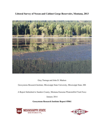
Littoral Survey of Noxon and Cabinet Gorge Reservoirs, Montana, 2013Gray Turnage and John D. MadsenGeosystems Research Institute, Mississippi State University, Mississippi State, MSA Report Submitted to Sanders County, Montana Eurasian Watermilfoil Task ForceJanuary 2014Geosystems Research Institute Report #5061
Littoral Survey of Noxon and Cabinet Gorge Reservoirs, Montana, 2013PrefaceThis report presents data collected by the Geosystems Research Institute, Mississippi StateUniversity in 2013 on Noxon and Cabinet Gorge Reservoirs. Funding was provided by SandersCounty, Montana through the Eurasian Watermilfoil Task Force.Cite as:Turnage, G. and J. D. Madsen. 2014. Littoral Survey of Noxon and Cabinet Gorge Reservoirs,Montana, 2013. GRI Report #5061, Geosystems Research Institute, Mississippi StateUniversity. January 2014.Author contact information:Gray Turnage, gturnage@gri.msstate.eduJohn Madsen, jmadsen@gri.msstate.eduMississippi State University, Geosystems Research InstitutePage 2
Littoral Survey of Noxon and Cabinet Gorge Reservoirs, Montana, 2013Littoral Surveys of Noxon and Cabinet Gorge Reservoirs, Montana, 2013Gray Turnage and John D. MadsenGeosystems Research Institute, Mississippi State University, Mississippi State, MSIntroductionAquatic plants are important to lake ecosystems (Madsen et al. 1996, Wetzel 2001) and areessential in promoting the diversity and function of an aquatic system (Carpenter and Lodge1986). Littoral zone habitat and associated plants may be responsible for a significantproportion of primary production for the entire lake (Ozimek et al. 1990, Wetzel 2001). Littoralzone habitats are prime areas for the spawning of most fish species, including many speciesimportant to sport fisheries (Savino and Stein 1989). Furthermore, aquatic plants anchor softsediments, stabilize underwater slopes, remove suspended particles, and remove nutrients fromoverlying waters (Barko et al. 1986, Doyle 2000, Madsen et al. 2001). The introduction of nonnative plants into littoral zone habitats often alters the complex interactions occurring in theseareas (Madsen 1998). Dense stands of non-native plants are often responsible for reduction inoxygen exchange, depletion of dissolved oxygen, increases in water temperatures, increasedsedimentation, and internal nutrient loading (Madsen 1998).Eurasian watermilfoil (Myriophyllum spicatum L.), curlyleaf pondweed (Potamogeton crispusL.), and flowering rush (Butomus umbellatus L.) are non-native invasive species that, whenpresent, have been associated with declines in native plant species richness and diversity(Madsen et al. 1991, 2008, 2012, 2013). These species also pose nuisance problems to humansin the form of increasing flood frequency and intensity, impeding navigation, and limitingrecreation opportunities (Madsen et al. 1991, 2012, 2013). The establishment of Eurasianwatermilfoil and subsequent spread is likely perpetuated by the ease of fragmentation (bothphysical and physiological) of this plant. Establishment of curlyleaf pondweed is primarilydriven by turion production; while flowering rush primarily establishes by rhizome budproduction. Water movement within the reservoir and high watercraft traffic moves Eurasianwatermilfoil fragments, curlyleaf pondweed turions, and flowering rush buds to new areas.Although the impacts from Eurasian watermilfoil, curlyleaf pondweed, and flowering rush arenumerous, controlling these species is often difficult and unpredictable. Flowing water, such asthe Lower Clark Fork River, further complicates the use of herbicides as water flow will increasethe dilution and dissipation of the herbicides. Herbicide applications in run of the riverreservoirs are often subject to more extreme perturbations than those of natural lakes. Run of theriver reservoirs have variable water-exchange patterns, typically tied to dam operations, whichwill impact aqueous distribution of herbicides resulting in reduced chemical exposure timesagainst target plants and unacceptable effectiveness (Getsinger et al. 1997).By systematically surveying an infested reservoir, locations and intensities of infestations willbecome evident. This will give reservoir managers starting criteria to narrow down managementoptions until a suitable control method is found.Mississippi State University, Geosystems Research InstitutePage 3
Littoral Survey of Noxon and Cabinet Gorge Reservoirs, Montana, 2013Materials and MethodsPoint Intercept Assessments. Point intercept surveys were conducted on August 29 throughSeptember 2, 2013 to assess the aquatic plant community in the Noxon and Cabinet GorgeReservoirs littoral zones. A 150 m grid was used for the Noxon assessment (Figure 1) and a 125m grid was used for the Cabinet Gorge assessment. Survey methods were similar to thoseutilized during recent projects in the Pacific Northwest (Madsen and Wersal 2008, Madsen andWersal 2009, Wersal et al. 2010a, Wersal et al. 2010b, Wersal & Madsen 2011a, Wersal &Madsen 2011b, Turnage et al. 2012).Additionally, we mapped dense beds of Eurasian watermilfoil. This was done by marking theedge of a bed and then running transects across the bed until the other edge of the bed wasencountered. Next, the ends of transects were joined thereby outlining an entire bed. This methoddid not include areas with scattered or sparse occurrences of Eurasian watermilfoil, thus actualarea inhabited by this species is greater than the area of the beds that were mapped.Surveys and bed mapping were conducted by boat using Global Positioning System (GPS)technology to navigate to each point. Survey accuracy was 1-3 m (3-10 ft) depending on satellitereception. At each survey point, a weighted thatch rake was deployed to determine the presenceof plant species. Spatial data were recorded electronically using FarmWorks Site Mate software (Hamilton, IN). The software allowed for in-field geographic and attribute datacollection. Data were recorded in database templates using specific pick lists constructedexclusively for this project. Site Mate provided an environment for displaying geographic andattribute data and enabled navigation to specific locations on the lake.Statistical Analyses. Plant species presence was averaged over all points sampled andmultiplied by 100 to calculate percent frequency. Acreages of Eurasian watermilfoil bed areaswere calculated using the X-tools function in ArcGIS 10.0 (ESRI 2011). Changes in theoccurrence of non-native plant species between annual littoral surveys for each reservoir weredetermined using the Chi-square test (Statistix 9.0, Analytical Software, Tallahassee, FL). TheChi-square test was also used to analyze changes in total vegetated cover within the littoral zoneof each reservoir.Results and DiscussionNoxon ReservoirNoxon Reservoir had an aquatic plant species richness of 19 (Table 1). The non-native speciesEurasian watermilfoil, curlyleaf pondweed, and flowering rush were found at 14.3, 14.7, and 0.7percent of surveyed points, respectively, within the littoral zone of the reservoir (Table 1, Figs 57 and 17-21). Observed curlyleaf pondweed frequency is likely lower than actual frequencybecause the survey time fell within this species dormancy period. The most common speciesobserved were Elodea canadensis (23.7%) Ceratophyllum demersum (22.8%), andMississippi State University, Geosystems Research InstitutePage 4
Littoral Survey of Noxon and Cabinet Gorge Reservoirs, Montana, 2013Myriophyllum sibiricum (19.6%), all of which are native species (Table 1). Locations of nativespecies that covered more than 10% of the littoral survey sites in Noxon reservoir and non-nativespecies are shown in Figures 1 – 24.There are 1,942 acres of littoral habitat in Noxon Reservoir covering 25% of the reservoir(Wersal et al. 2010a). In 2008, initial estimates of dense Eurasian watermilfoil beds were 247acres (Table 2, Figs 25-30, Wersal et al. 2010a). In 2009, the estimate had increased to 323 acres(Table 2, Wersal et al. 2010a). Beds were not mapped in 2010, 2011, or 2012. In 2013, therewere 11 dense beds of Eurasian watermilfoil found in Noxon reservoir totaling 96.6 acres oflittoral habitat (Table 3). This accounts for approximately 5% and 1.3% of littoral and totalreservoir acreages, respectively (Table 2). This has decreased from the highest acreage reported,323 acres in 2009 (Wersal et al. 2010a), by 70.1%. This represents a decrease of 60.7% inEurasian watermilfoil bed acreage from the initial 2008 estimate.Secchi readings were taken at 10 sites within Noxon Reservoir starting at Noxon dam and endingnear the Flat Iron access (Table 4, Fig 31). Secchi readings were shallowest in the upstreamreaches of Noxon Reservoir, especially Secchi points 7, 8, and 9 in the vicinity of Finley Flatsboat access (Table 4, Fig 31). Finley Flats is a widening in the riverine section of the reservoirthat has a dense plant bed over much of the area (Fig 32). This would slow down water currentsallowing much of the suspended sediment to drop out of the water column and be deposited inthis area. Furthermore Finley Flats is surrounded by high cliff faces, many of which are exposedsediments that wash into the reservoir during rain events further increasing the sediment load inthis portion of the river (Fig 33 and 34). The deepest Secchi readings came from sites 5 and 6 inthe riverine reaches of the reservoir (Table 4). Secchi sites 1 through 4 tended to have shallowerreadings (Table 4). These sites were in the more lacustrine section of the reservoir (Fig 31).Chi-square analysis shows an increase in the percentage of vegetated littoral zone points inNoxon Reservoir over time (Table 5 and 6). Of these points, Eurasian watermilfoil pointssignificantly increased from 2009 to 2010 and then decreased due to herbicide application in thereservoir (Table 6). Presence of curlyleaf pondweed in the reservoir decreased from 2008-2009but has since remained fairly constant (Table 6). However, surveys in 2013 were later in thesummer which coincides with this species dormant period. More than likely curlyleaf pondweedis present at more sites than we observed and thus should be monitored closely. Presence offlowering rush has significantly increased from 2008-2013 to the point where monitoring andmanagement goals need to be implemented for this species as well (Table 6). Future surveysshould occur earlier in the year so as to not coincide with dormant periods for curlyleafpondweed.Cabinet Gorge ReservoirCabinet Gorge Reservoir had an aquatic plant species richness of 17 (Table 7). The non-nativespecies Eurasian watermilfoil, curlyleaf pondweed, and flowering rush were found at 1.8, 31.3,and 10.7 percent of surveyed points, respectively, within the littoral zone of the reservoir (Table7, Figs 38, 39, and 44-46). Observed curlyleaf pondweed frequency is likely lower than actualfrequency because the survey time fell within this species dormancy period. The most commonspecies observed were elodea (35.2%), Eurasian watermilfoil (31.3%), and coontail (25.1%)(Table 7). All of these except Eurasian watermilfoil are native species. Figures 35-52 showMississippi State University, Geosystems Research InstitutePage 5
Littoral Survey of Noxon and Cabinet Gorge Reservoirs, Montana, 2013frequency of non-native species and each native species found at more than 10% of the surveysites in Cabinet Gorge Reservoir.There are 1,121 acres of littoral habitat in Cabinet Gorge Reservoir covering 38% of thereservoir (Wersal et al. 2010a). In 2008, initial estimates of dense Eurasian watermilfoil bedswere 78 acres (Table 8, Fig 53, Wersal et al. 2010a). In 2010, the estimate had increased to 328acres (Table 8, Wersal et al. 2010a). Beds were not mapped in 2009, 2011, or 2012. In 2013,there were seven dense beds of Eurasian watermilfoil found in Cabinet Gorge Reservoir totaling205.2 acres of littoral habitat (Table 9, Fig 53). This accounts for approximately 18.3% and 7%of littoral and total reservoir acreages, respectively (Table 8). This has decreased from thehighest acreage reported, 328 acres in 2009, by 37.4% (Wersal et al. 2010a). This represents anincrease of 62% in Eurasian watermilfoil bed acreage from the initial 2008 estimate. The waterlevel was lower in while we surveyed in 2013, thus exposing some of the littoral habitat that hadbeen mapped in 2010. This probably accounts for some of the decline in acreage covered byEurasian watermilfoil from 2010 to 2013. To our knowledge, no Eurasian watermilfoil controlefforts have been implemented on Cabinet Gorge Reservoir.Secchi readings were taken at five sites within Cabinet Gorge Reservoir starting at downstreamend and ending below Noxon dam (Table 10, Fig 54). Secchi readings were shallowest in theupstream reaches of Cabinet Gorge Reservoir (Table 10, Fig 54). The largest Eurasianwatermilfoil beds were located in the upstream portion of the reservoir which are also some ofthe widest reaches of reservoir (Fig 54). These two factors combined most likely slowed thewater current allowing the suspended sediment to drop out of the water column. This wouldexplain the deeper Secchi readings in the downstream end of the reservoir (Table 10).Chi-square analysis shows an increase in the percentage of vegetated littoral zone points inCabinet Gorge Reservoir over time (Table 11 and 12). Of these points, Eurasian watermilfoilpoints significantly increased from 2008 to 2013 (Table 12). Presence of curlyleaf pondweed inthe reservoir decreased from 2008 to 2013 (Table 12). However, surveys in 2013 were later inthe summer which coincides with this species dormant period. More than likely curlyleafpondweed is present at more sites than we observed and thus should be monitored closely.Presence of flowering rush has significantly increased from 2008-2013 (Table 12). Monitoringand management goals need to be implemented for this species. Future surveys should occurearlier in the year so as to not coincide with dormant periods for curlyleaf pondweed.Conclusions. Management efforts should focus on controlling Eurasian watermilfoil, curlyleafpondweed, and flowering rush in both reservoirs. Herbicide applications that were effective atreducing the presence of Eurasian watermilfoil in Noxon Reservoir should be considered for usein Cabinet Gorge Reservoir as well. Future studies should also note whether these treatments areeffective at controlling curlyleaf pondweed and flowering rush. Water exchange times should bestudied in areas of infestation in Cabinet Gorge Reservoir. This will allow us to see if herbicidetreatments previously used in Noxon will be effective in new areas of infestation in CabinetGorge Reservoir. Control of nuisance aquatic plants is achievable in flowing water systems ifthere is an understanding of water exchange characteristics at a given site. Water exchange islikely to be site specific within Cabinet Gorge Reservoir (as it was in Noxon Reservoir) soadditional studies are needed, especially upstream of infestations, to develop a water exchangedata set for portions of the reservoir to base management decisions on.Mississippi State University, Geosystems Research InstitutePage 6
Littoral Survey of Noxon and Cabinet Gorge Reservoirs, Montana, 2013Previous studies indicate that Eurasian watermilfoil was selectively removed from areas ofNoxon, and that native species will rapidly re-colonize areas once inhabited by Eurasianwatermilfoil (Wersal & Madsen 2011a, 2011b). Furthermore, these studies suggested thatEurasian watermilfoil control can be maintained for at least two growing seasons with a singleherbicide application (Wersal & Madsen 2011b). Achieving multiple year control would allowfor the treatment of additional areas without having to continually re-treat in the same plots.Though this will depend upon site location, water flow, and distance from other infestations thatwould re-colonize an already treated area.The potential short term impacts of herbicide applications on the native plant community shouldnot overshadow the long-term effects that Eurasian watermilfoil, curlyleaf pondweed, andflowering rush will have if left unmanaged. Species such as leafy pondweed (Potamogetonfoliosus) and elodea (Elodea canadensis) which are widespread in Noxon Reservoir recoveredtwo years later to levels similar or greater than what was observed during pretreatment surveys(Wersal & Madsen 2011b). There is a native propagule bank present in both Cabinet Gorge andNoxon that will allow the native plant communities to recover following management efforts.Mississippi State University, Geosystems Research InstitutePage 7
Littoral Survey of Noxon and Cabinet Gorge Reservoirs, Montana, 2013Literature CitedBarko, J.W., M.S. Adams, & N.S. Clesceri. 1986. Environmental factors and their considerationin the management of submersed aquatic vegetation: A review. Journal of Aquatic PlantManagement 24:1-10.Carpenter, S.R. and D.M. Lodge. 1986. Effects of submersed macrophytes on ecosystemprocesses. Aquatic Botany 26:341-370.Doyle, R.D. 2000. Effects of navigation on aquatic plants: effects of sediment resuspension anddeposition on plant growth and reproduction. Upper Mississippi River – IllinoisWaterway System Navigation Study, ENV Rep. 28. U.S. Army Corps of Engineers, RockIsland District, St. Louis District, St. Paul District. 64 pp.ESRI 2011. ArcGIS Desktop: Release 10. Redlands, CA: Environmental Systems ResearchInstitute.Getsinger, K.D., E.G. Turner, J.D. Madsen, & M.D. Netherland. 1997. Restoring nativevegetation in a Eurasian watermilfoil dominated plant community using the herbicidetriclopyr. Regulated Rivers: Research and Management 13:357-375.Madsen, J.D. 1998. Predicting invasion success of Eurasian watermilfoil. Journal of AquaticPlant Management 36:28-32.Madsen, J.D., J.A. Bloomfield, J.W. Sutherland, L.W. Eichler, & C.W. Boylen. 1996. Theaquatic macrophyte community of Onondaga Lake: Field survey and plant growthbioassays of lake sediments. Lake and Reservoir Management 12:73-79.Madsen, J.D., P.A. Chambers, W.F. James, E.W. Koch, & D.F. Westlake. 2001. The interactionsbetween water movement, sediment dynamics and submersed macrophytes.Hydrobiologia 444:71-84.Madsen, J. D., B. T. Sartain, G. Turnage, & M. D. Marko. 2013. Herbicide Trials forManagement of Flowering Rush in Detroit Lakes, Minnesota for 2012. GeosystemsResearch Institute Report # 5059. Mississippi State University: Geosystems ResearchInstitute.Madsen, J. D., Stewart, R. M., Getsinger, K., Johnson, R. L., & Wersal, R. M. 2008. Aquaticplant communities in Waneta Lake and Lamoka Lake, New York. NortheasternNaturalist. 15, 97-110.Madsen, J.D., J.W. Sutherland, J.A. Bloomfield, L.W. Eichler, & C.W. Boylen. 1991. Thedecline of native vegetation under dense Eurasian watermilfoil canopies. Journal ofAquatic Plant Management 29:94-99.Mississippi State University, Geosystems Research InstitutePage 8
Littoral Survey of Noxon and Cabinet Gorge Reservoirs, Montana, 2013Madsen, J.D. & R.M. Wersal. 2008. Assessment of Eurasian watermilfoil (Myriophyllumspicatum L.) populations in Lake Pend Oreille, Idaho for 2007. GeoResources InstituteReport # 5028, 116p.Madsen, J.D. & R.M. Wersal. 2009. Aquatic plant community and Eurasian watermilfoil(Myriophyllum spicatum L.) management assessment in Lake Pend Oreille, Idaho for2008. Geosystems Research Institute Report # 5032, 65p.Madsen, J. D., R. M. Wersal, M. D. Marko, & J. G. Skogerboe. 2012. Ecology and Managementof Flowering Rush (Butomus Umbellatus) in the Detroit Lakes, Minnesota. GRI Report#5054. Mississippi State University: Geosystems Research Institute.Ozimek, T., R.D. Gulati, & E. van Donk. 1990. Can macrophytes be useful in biomanipulation oflakes? The Lake Zwemlust example. Hydrobiologia 200/201:399-407.Savino, J.F. & R.A. Stein. 1989. Behavior of fish predators and their prey: habitat choicebetween open water and dense vegetation. Environmental Biology of Fishes 24:287-293.Turnage, G., Duncan, C., & Madsen, J. D. 2012. Aquatic Invasive Plant Survey of SelectedMontana Waters for 2012. GRI Report #5055. Mississippi State University: GeosystemsResearch Institute, 80p.Wersal, R.M., J.D. Madsen, & J.C. Cheshier. 2010a. Aquatic plant monitoring in NoxonRapids Reservoir and Cabinet Gorge Reservoir for 2010. Geosystems Research Institute Report# 5042, 18p.Wersal, R.M., J.D. Madsen, T.E. Woolf, & N. Eckberg. 2010b. Assessment of herbicide efficacyon Eurasian watermilfoil and impacts to the native submersed plant community inHayden Lake, Idaho, USA. Journal of Aquatic Plant Management 48:5-11.Wersal, R.M. & J.D. Madsen. 2011a. Evaluating plant response to triclopyr applied alone and incombination with endothall in Noxon Rapids Reservoir for 2010: Phase 2. GeosystemsResearch Institute Report # 5046, 64p.Wersal, R. M., & Madsen, J. D. 2011b. Plant Community Response in Small Plots One Yearafter Treatment with Triclopyr and Endothall in Noxon Rapids Reservoir, MT, 2011. GRIReport # 5049. Mississippi State University: Geosystems Research Institute. 21p.Wetzel, R.G. 2001. Limnology: Lake and River Ecosystems, Third Edition. Academic Press, SanDiego, CA, USA. 1006 pp.Mississippi State University, Geosystems Research InstitutePage 9
Littoral Survey of Noxon and Cabinet Gorge Reservoirs, Montana, 2013Table 1. Percent frequency of aquatic plant species in the Noxon Reservoir littoral zone in 2013.There were 448 littoral zone points located 150 meters apart. Of these points, 317(70.7%) were vegetated.Scientific NameCommon NamePoints% OccurrenceButomus umbellatusFlowering rush6414.3Ceratophyllum demersumCoontail10222.8Chara spp.Chara429.4Elodea canadensisElodea10623.7Heteranthera dubiaWater stargrass327.1Lemna minorLesser duckweed20.4Myriophyllum sibiricumNorthern watermilfoil8819.6Myriophyllum spicatumEurasian watermilfoil6614.7Najas flexilisSlender naiad10.1Potamogeton crispusCurlyleaf pondweed30.7Potamogeton foliosusLeafy pondweed337.4Potamogeton illinoensisIllinois pondweed92.0Potamogeton praelongisWhite-stem pondweed20.4Potamogeton richardsoniiClasping-leaf pondweed368.0Potamogeton zosterformisFlat-stem pondweed61.3Ranunculus aquatilisWhite watercrowfoot449.8Sagittaria cuneataArum-leaf arrowhead30.7Stuckenia pectinataSago pondweed5111.4Vallisneria americanaWater celery10.1Mississippi State University, Geosystems Research InstitutePage 10
Littoral Survey of Noxon and Cabinet Gorge Reservoirs, Montana, 2013Table 2. Estimates of littoral zone and total reservoir covered in dense Eurasian watermilfoilbeds in Noxon Reservoir from 2008 to 2013. Noxon Reservoir littoral zone is 1,942 acres in sizeand covers 25% of the reservoir (Wersal et al. 2010). No mapping was done by us in 2011 or2012. A graph of these values is presented in Figure 6% LITTORAL12.716.67.85Mississippi State University, Geosystems Research Institute% TOTAL RES3.24.21.91.3Page 11
Littoral Survey of Noxon and Cabinet Gorge Reservoirs, Montana, 2013Table 3. Acreage covered by Eurasian watermilfoil beds in Noxon Reservoir in 2013. A total of96.6 acres was covered in Eurasian watermilfoil beds. Total littoral zone in Noxon Reservoir is1,942 acres. Maps shown in Figure 25-30.Eurasian watermilfoil Bed #1234567891011Acreage ppi State University, Geosystems Research Institute% Littoral Zone3.90.090.60.10.010.120.060.030.060.030.005Page 12
Littoral Survey of Noxon and Cabinet Gorge Reservoirs, Montana, 2013Table 4. Secchi disk readings (in feet) in Noxon Reservoir. Measurements were recorded in feet.A map of these locations is presented in Figure 31.Site12345678910Secchi Down (ft)20.219.821.019.226.525.111.514.915.516.0Secchi Up ippi State University, Geosystems Research InstituteAverage (ft)19.618.920.418.825.724.110.714.014.715.0Page 13
Littoral Survey of Noxon and Cabinet Gorge Reservoirs, Montana, 2013Table 5. Percentage of Noxon Reservoir littoral zone vegetated by all species (ALL), Eurasianwatermilfoil, curlyleaf pondweed, and flowering rush during littoral surveys. A graph of thesevalues is presented in Figure 020132008200920102013SpeciesALLALLALLALLEurasian watermilfoilEurasian watermilfoilEurasian watermilfoilEurasian watermilfoilCurlyleaf pondweedCurlyleaf pondweedCurlyleaf pondweedCurlyleaf pondweedFlowering rushFlowering rushFlowering rushFlowering rushMississippi State University, Geosystems Research Institute% Littoral 5.412.32.31.30.418.5Page 14
Littoral Survey of Noxon and Cabinet Gorge Reservoirs, Montana, 2013Table 6. Change in the percentage of Noxon Reservoir littoral zone covered by all species(ALL), Eurasian water milfoil (Eurasian watermilfoil), Curlyleaf pondweed (curlyleafpondweed), and Flowering rush (flowering rush) between littoral surveys. Percentages in boldare statistically significant changes.SpeciesALLALLALLEurasian watermilfoilEurasian watermilfoilEurasian watermilfoilCurlyleaf pondweedCurlyleaf pondweedCurlyleaf pondweedFlowering rushFlowering rushFlowering rushYear ear ississippi State University, Geosystems Research Institutep-valuep 0.1489p 0.4828p 0.05p 0.6065p 0.05p 0.05p 0.05p 0.1498p 0.1718p 0.5951p 0.2101p .918.1Page 15
Littoral Survey of Noxon and Cabinet Gorge Reservoirs, Montana, 2013Table 7. Percent frequency of aquatic plant species in the Cabinet Gorge Reservoir littoral zonein 2013. There were 335 Littoral Zone points located 125 meters apart. Of these points, 182(54.3%) were vegetated.Scientific NameCommon NameButomus umbellatusCeratophyllum demersumChara spp.Elodea canadensisHeteranthera dubiaMyriophyllum hippuroidesMyriophyllum sibiricumMyriophyllum spicatumPotamogeton crispusPotamogeton foliosusPotamogeton illinoensisPotamogeton nodosusPotamogeton praelongisPotamogeton richardsoniiPotamogeton zosterformisRanunculus aquatilisStuckenia pectinataFlowering rushCoontailCharaElodeaWater stargrassWestern watermilfoilNorthern watermilfoilEurasian watermilfoilCurlyleaf pondweedLeafy pondweedIllinois pondweedLongleaf pondweedWhite-stem pondweedClasping-leaf pondweedFlat-stem pondweedWhite watercrowfootSago pondweedMississippi State University, Geosystems Research 16.711.08.14.8Page 16
Littoral Survey of Noxon and Cabinet Gorge Reservoirs, Montana, 2013Table 8. Estimates of littoral zone and total reservoir covered in dense Myriophyllum spicatumbeds in Cabinet Gorge Reservoir from 2008 to 2013. Cabinet Gorge Reservoir littoral zone is1,121 acres in size an covers 38% of the reservoir (Wersal et al. 2010). No mapping was done in2009, 2011, or 2012. A graph of this data is found in Figure 57.YEAR200820092010201120122013ACREAGE (Acres)78328205.2% LITTORAL729.318.3Mississippi State University, Geosystems Research Institute% TOTAL RES2.611.17Page 17
Littoral Survey of Noxon and Cabinet Gorge Reservoirs, Montana, 2013Table 9. Acreage covered by Myriophyllum spicatum beds in Cabinet Gorge Reservoir in 2013.A total of 205.2 acres were covered by M. spicatum beds. Total littoral zone in Cabinet GorgeReservoir is 1,121 acres. Maps of these beds are found in Figure 53.Myriophyllum spicatum Bed #1234567Acreage (acres)72.560.621.719.48.911.410.7Mississippi State University, Geosystems Research Institute% Littoral Zone6.55.41.91.70.81.00.9Page 18
Littoral Survey of Noxon and Cabinet Gorge Reservoirs, Montana, 2013Table 10. Secchi disk readings (in feet) in Cabinet Gorge Reservoir. Measurements wererecorded in feet. A map of these sites is found in Figure 54.Site12345Secchi Down (ft)22.320.717.416.015.0Secchi Up (ft)20.019.714.513.913.9Mississippi State University, Geosystems Research InstituteAverage (ft)21.220.216.015.014.5Page 19
Littoral Survey of Noxon and Cabinet Gorge Reservoirs, Montana, 2013Table 11. Percentage of Cabinet Gorge Reservoir littoral zone vegetated by all species (ALL),Eurasian watermilfoil, curlyleaf pondweed, and flowering rush during littoral surveys. A graphof these results is found in Figure 02013SpeciesALLALLALLEurasian watermilfoilEurasian watermilfoilEurasian watermilfoilcurlyleaf pondweedcurlyleaf pondweedcurlyleaf pondweedflowering rushflowering rushflowering rushMississippi State University, Geosystems Research Institute% Littoral 4Page 20
Littoral Survey of Noxon and Cabinet Gorge Reservoirs, Montana, 2013Table 12. Change in the percentage of Cabinet Gorge Reservoir littoral zone covered by allspecies (ALL), Eurasian water milfoil (Eurasian watermilfoil), Curlyleaf pondweed (curlyleafpondweed), and Flowering rush (flowering rush) between littoral surveys. Percentages in boldare significant changes.SpeciesALLALLEurasian watermilfoilEurasian watermilfoilCurlyleaf pondweedCurlyleaf pondweedFlowering rushFlowering rushYear 120082010200820102008201020082010Year 220102013201020132010201320102013Mississippi State University, Geosystems Research Institutep-valuep 0.0931p 0.05p 0.7680p 0.05p 0.9105p 0.05p 0.4897p 0.05%-Change-8.619.9-1.125.80.5-16.90.37.1Page 21
Littoral Survey of Noxon and Cabinet Gorge Reservoirs, Montana, 2013Table 13. Comparison of Eurasian watermilfoil bed depths between depth at time of survey timeand depth at full pool in Noxon Reservoir.BED #SURVEYTIME12345678910119/2/2013 7:009/2/2013 8:009/2/2013 9:009/2/2013 10:009/2/2013 11:009/2/2013 12:009/2/2013 13:009/2/2013 14:009/2/2013 15:009/2/2013 16:009/2/2013 17:00MEANSURVEY BEDDEPTH (FT)1.55.532.21.57.85.49.17.394.7GAUGEFULL POOL
University in 2013 on Noxon and Cabinet Gorge Reservoirs. Funding was provided by Sanders County, Montana through the Eurasian Watermilfoil Task Force. Cite as: Turnage, G. and J. D. Madsen. 2014. Littoral Survey of Noxon and Cabinet Gorge Reservoirs, Montana, 2013. GRI Report #5061, Geosystems Research Institute, Mississippi State University.