Transcription
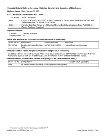
Colorado Historic Highway Inventory - Historical Summary and Evaluation of SignificanceHighway Name: State Highway (SH) 88CDOT Route Nos. and Milepost (MP) Limits:CDOT RouteRoute Description088AFrom U.S. 40-C and U.S. 287-C at West Colfax Ave in Denver south via Federal Blvd and eastvia Belleview Ave To I 25-A in South Denver088BFrom the East Side Ramps at I-25 South of Denver East Along Arapahoe Road To SH 83-A(Parker Road and Arapahoe)Highway Location:Counties:Length (Miles):Denver, Arapahoe19.171OAHP Site Numbers (for previously recorded segments, if applicable)*:OAHP Site No. Assessment5DV.10746Assessment DateEligible - Officially Eligible - 9/17/2010 8/24/2010FieldSite NameFederal Boulevard OverpassDiscussion of Site Forms (for previously recorded segments, if applicable):SH 88 has not been previously surveyed. The Federal Boulevard overpass (5DV.10746), which bridges W. ColfaxAvenue and is part of both SH 88 and US 287, was documented in 2010 and determined to be eligible.Historic Districts located within 250 feet of highway (OAHP Site Number and Name)*:OAHP Site No. District NameNoneAssessment (If Applicable)No historic districts are found on or adjacent to this highway*Information based on data from Compass provided by OAHPMead & Hunt, Inc./Dill Historians LLCState Highway (SH) 88 - Page 1
Colorado Historic Highway Inventory - Historical Summary and Evaluation of SignificanceHighway Name: State Highway (SH) 88Historical Data:SH 88 is 19.67 miles in length and begins at its northern point at the cloverleaf intersection of Federal Boulevard andW. Colfax Avenue. It continues south as Federal Boulevard and South Federal Boulevard to Belleview, where it turnseast and is continuous with Belleview Avenue until the intersection with Interstate(I)-25, where it ends on the eastside of the intersection at MM 14.77.The highway runs through a cross-section of urban landscapes, with the northern part of the Federal Boulevardsegments traversing a commercial corridor associated with older (1920s) neighborhoods, becoming more suburban,with post-World War II era shopping centers and tract housing, as the highway extends south. The segment of SH 88that comprises Belleview Avenue from Federal to I-25 is generally a late twentieth century commercial corridor fromFederal to Broadway, with chain stores dominating the otherwise residential landscape. East of Broadway, Belleviewruns through a changing landscape of post-World War II suburban housing and much newer suburban housing. FromUniversity Blvd east to I-25 the landscape is one of newer, upscale residential development, interspersed with parksand open space as the highway defines the border between Greenwood Village and Cherry Hills Village. A separatesegment of SH 88 (88B) extends east along Arapahoe Road from the intersection of Arapahoe Road and I-25 to theintersection of Arapahoe Road and Parker Road.Over time, SH 88 has been repeatedly re-engineered to facilitate increased traffic. Federal Boulevard was paved anda traffic light installed at the intersection with West Colfax Avenue after a 1927 report by the Colorado HighwayDepartment reported it to be one of the most traveled arterial streets in the west half of the city. As the city grew in the1940s and 1950s, traffic congestion increased, and the city widened Federal in the mid-1950s. The cloverleafinterchange at West Colfax and Federal was completed in 1960. At the other end of the highway, a fly-over overpassat Arapahoe Road and Parker Road was completed in 2012, to alleviate traffic congestion at the intersection (Salek2014).SH 88 is an original 1920s highway. Belleview from Broadway east to Parker Road was the original SH 88. In 1939the highway was extended east along Quincy into the Lowry Field Bombing Range, although this extension was nolonger in place by 1954, after the bombing range was decommissioned. SH 88 extended west to Santa Fe by 1956,and with the “purge” of 1968, SH 88 came to include Belleview to Federal and Federal (formerly SH 75) fromBelleview north to W. Colfax. The segment (88B) that follows Arapahoe Road from I-25 to Parker was designated in1959, although at that time it was only a stretch of graveled road. It was paved by 1961, however, and re-engineeredas an expressway in the late 1970s and early 1990s.The earliest development on what is now SH 88 is the portion of Federal Boulevard from West Colfax to Alameda.Beginning in the 1870s, what is now Federal Boulevard was an unpaved road that served to connect scatteredhomesteads. Later, it bordered the platted subdivisions annexed to the city in the 1890s, running north to the eastwest arteries that reached the core of Denver and the more established residential neighborhoods and industrialareas along Federal to the north of W. Colfax. The city annexed lands south of Alameda in the 1940s and later in thepost-World War II period, and increased automobile traffic was generated by the large postwar housingdevelopments built in the 1950s, leading to re-engineering along Federal and Belleview, as well as a high rate ofcommercial development and ongoing redevelopment (City and County of Denver, 1947). The highway segments ofthe route were enhanced to help facilitate increased automobile traffic related to post-World War II housingdevelopments.Unless otherwise indicated, sources used in the preparation of this section included state highway maps, theHighways of Colorado, Highways to the Sky: A Context and History of Colorado's Highway System, Colorado StateRoads and Highways, National Register of Historic Places Multiple Property Submission, plans in the OnlineTransportation Information System (OTIS) and site forms for previously surveyed resources in Compass whenavailable.*Information based on data from Compass provided by OAHPMead & Hunt, Inc./Dill Historians LLCState Highway (SH) 88 - Page 2
Colorado Historic Highway Inventory - Historical Summary and Evaluation of SignificanceHighway Name: State Highway (SH) 88Not Significant - No historical significance identifiedSignificant - Historical significance identified (see details below)Property Type and Areas of Significance:A detailed explanation why this highway possesses historical significance is provided in the Significance Statement below.Cultural:Criterion A specific requirementsEarly and/or prominent project of the Colorado Highway Department (Transportation)Association with a significant event (If applicable, the Area of Significance is indicated in the statement ofsignificance below)Association with federal work relief programs (Politics/Government)Criterion C specific requirementsRepresentative example (Transportation)Engineering:SubtypesFarm-to-Market RoadLimited Access, Multiple-Lane, Divided Highway/FreewayHighway BypassCriterion A specific requirementsEarly and/or prominent project of the Colorado Highway Department (Transportation)Association with a significant event (If applicable, the Area of Significance is indicated in the statement ofsignificance below)Association with federal work relief programs (Politics/Government)Criterion C specific requirementsRepresentative example (Transportation)Engineering achievement (Engineering)Aesthetic:Criterion A specific requirementsEarly and/or prominent project of the Colorado Highway Department (Transportation)Association with a significant event (If applicable, the Area of Significance is indicated in the statement ofsignificance below)Association with federal work relief programs (Politics/Government)Criterion C specific requirementsRepresentative example (Transportation)Engineering achievement (Engineering)Landscape architecture (Landscape Architecture)*Information based on data from Compass provided by OAHPMead & Hunt, Inc./Dill Historians LLCState Highway (SH) 88 - Page 3
Colorado Historic Highway Inventory - Historical Summary and Evaluation of SignificanceHighway Name: State Highway (SH) 88Historic periods of highway construction:Pre-territorial (pre-1861)Territorial and pre-automobile state roads (1861-1890)Automobile age (1890-1930)Depression and World War II (1930-1945)Postwar Interstate Era (1945-1973)Completion and Augmentation of Interstate System (1973-2000)Level of Significance:LocalStateNationalSignificance Statement:SH 88 is classified as an Engineered Route under the classification system in the MPS.Criterion ASH 88 is classified as an Engineered Route and possesses significance under Criterion A. The northern part of thehighway (Federal Boulevard between Belleview and Colfax) has historically been one of the major north-southarteries in the west part of Denver. SH 88 south of Denver facilitated development of the post World War II housingdevelopments. As such, SH 88 possesses significance under Criterion A in the areas of Transportation andCommunity Planning and Development for its role in post-World War II suburban development at the local level.Criterion BResearch did not reveal SH 88 to be directly associated with the events or work of a person important in history,nor does research indicate the highway represents the efforts of a specific individual to secure construction of thishighway for the economic development of a community or area of the state. Therefore, this highway does notpossess significance under Criterion B.Criterion CThis highway is not considered to be an early or prominent project of the Colorado Highway Department.Research and literature review yielded no evidence to indicate the use of innovative or important engineeringdesign or construction techniques that serve to distinguish this highway from other roads and does not appear toexhibit important engineering innovations or important later modifications. The highway’s design and constructionappear to fall within the established standard practices of state highway design and construction of the time and thehighway does not possess significance under Criterion C.Criterion DFor a property to possess significance for information potential, the information yielded by the property mustanswer specific important research questions that cannot be otherwise answered. The technology of highwayconstruction is well understood and documented. As such, this highway is unlikely to yield important informationthat cannot be discerned from archived plans and other records. Therefore, this highway does not possesssignificance under Criterion D.*Information based on data from Compass provided by OAHPMead & Hunt, Inc./Dill Historians LLCState Highway (SH) 88 - Page 4
Colorado Historic Highway Inventory - Historical Summary and Evaluation of SignificanceHighway Name: State Highway (SH) 88088.jpg*Information based on data from Compass provided by OAHPMead & Hunt, Inc./Dill Historians LLCState Highway (SH) 88 - Page 5
at Arapahoe Road and Parker Road was completed in 2012, to alleviate traffic congestion at the intersection (Salek 2014). SH 88 is an original 1920s highway. Belleview from Broadway east to Parker Road was the original SH 88. In 1939 the highway was extended east along Quincy into the Lowry Field Bombing Range, although this extension was no