Transcription
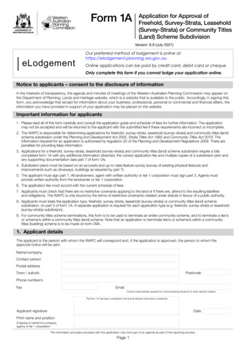
Form 1AApplication for Approval ofFreehold, Survey-Strata, Leasehold(Survey-Strata) or Community Titles(Land) Scheme SubdivisionVersion: 9.9 (July 2021)eLodgementOur preferred method of lodgement is online athttps://elodgement.planning.wa.gov.auOnline applications can be paid by credit card, debit card or cheque.Only complete this form if you cannot lodge your application online.Notice to applicants – consent to the disclosure of informationIn the interests of transparency, the agenda and minutes of meetings of the Western Australian Planning Commission may appear onthe Department of Planning, Lands and Heritage website, which is a website that is available to the public. Accordingly, in signing thisform, you acknowledge that except for information about your business, professional, personal or commercial and financial affairs, theinformation you have provided in support of your application may be placed on the website.Important information for applicants1. Please read all of this form carefully and consult the application guide and schedule of fees for further information. The applicationmay not be accepted and will be returned to the applicant with the submitted fee if these requirements are incorrect or incomplete.2. The WAPC is responsible for determining applications for freehold, survey-strata, leasehold (survey-strata) and community titles (land)scheme subdivision under the Planning and Development Act 2005, Strata Titles Act 1985 and Community Titles Act 2018. Theinformation required for an application is authorised by regulation 20 of the Planning and Development Regulations 2009. There arepenalties for providing false information.3. Applications for a freehold, survey-strata, leasehold (survey-strata) and community titles (land) scheme subdivision require a fullycompleted form 1A with any additional information attached, the correct application fee and multiple copies of a subdivision plan andany supporting documentation (see part 7 of form 1A).4. Subdivision plans must be based on an accurate and up-to-date feature survey (survey of existing physical features andimprovements such as driveways, buildings as required by part 7).5. The applicant must sign part 1. All landowners, agent with written authority or tier 1 corporation must sign part 3. Agents mustprovide written authority from the landowner or tier 1 corporation.6. The application fee must accord with the current schedule of fees.7. Applicants must check that there are no restrictive covenants applying to the land or if there are, attend to the resulting liabilitiesand obligations. The WAPC is only bound by the terms of restrictive covenants created under statute in favour of a public authority.8. Applicants must state the application type, freehold, survey-strata, leasehold (survey-strata) or community titles (land) schemesubdivision, on part 5 of form 1A. A separate application is required for each application type (e.g. freehold, survey-strata or leasehold(survey-strata) subdivision).9. For community titles scheme terminations, this form is to be used to terminate an entire community scheme, and to terminate a tier/sor scheme/s within a community titles (land) scheme. Note that an application to terminate tier/s or scheme/s within a communitytitles (building) scheme is to be made on form 29A.1. Applicant detailsThe applicant is the person with whom the WAPC will correspond and, if the application is approved, the person to whom theapproval notice will be sent.Name/companyContact personPostal addressTown / suburbPostcodePhone number/sFaxEmailCurrent email address required for communicating decisions or other relevant mattersThe form 1A has been completed in full and all relevant information is attachedApplicant signatureDatePrint name and position(if signing on behalf of a company,agency or tier 1 corporation)The information and plans provided with this application may form part of an agenda as part of the reporting process.Page 1
Form 1AVersion: 9.9 (July 2021)Application for Approval ofFreehold, Survey-Strata, Leasehold(Survey-Strata) or Community Titles(Land) Scheme Subdivision2. Landowners (applicable where a community scheme has not been registered)All the registered proprietors (landowners) as shown on the record of certificate/s of title for the subject lot/s must be provided. A changeof name must be supported by relevant documentation such as a transfer of land document that incorporates a lodgement receipt,a company search from the Australian Securities and Investment Commission, a marriage certificate or a change of name certificate.If there are more than two landowners please provide the additional information on a separate page.Full nameOrganisation/company (if applicable)ACN/ABN (if applicable)Postal addressTown/suburbPostcodeFull nameOrganisation/company (if applicable)ACN/ABN (if applicable)Postal addressTown/suburbPostcode3a. Consent to apply (applicable where a community scheme has not been registered)Registered proprietor/s (landowner/s) or the authorised agent’s details must be provided in this section. If there are more than twolandowners please provide all relevant information on a separate page. Signature/s must be provided by all registered proprietorsor by an authorised agent.Alternatively, a letter of consent, which is signed by all registered proprietors or by the authorised agent, can be provided.Full nameOrganisation/company (if applicable)ACN/ABN (if applicable)Postal addressTown/suburbPostcodeThe landowner/s or authorised agent consents to the applicant submitting this applicationSignatureDatePrint name and position(if signing on behalf of a company or agency)Full nameOrganisation/company (if applicable)ACN/ABN (if applicable)Postal addressTown/suburbPostcodeThe landowner/s or authorised agent consents to the applicant submitting this applicationSignatureDatePrint name and position(if signing on behalf of a company or agency)The information and plans provided with this application may form part of an agenda as part of the reporting process.Page 2
Form 1AVersion: 9.9 (July 2021)Application for Approval ofFreehold, Survey-Strata, Leasehold(Survey-Strata) or Community Titles(Land) Scheme Subdivision3b. Consent to apply (applicable where a community scheme has been registered)For community titles (land) scheme subdivision where a community scheme has been registered, upload or attach copy of the tier 1corporation special resolution approving the subdivision application. Where the applicant is not the tier 1 corporation, evidence that thetier 1 corporation authorises the applicant to submit the application must be attached.Tier 1 scheme numberTier 1 corporation namePostal addressTown/suburbPostcodeThe tier 1 corporation consents to the applicant submitting this applicationSignatureDatePrint name and position(if signing on behalf of a tier 1 corporation)Please tick ‘yes’ or ‘no’ for each statement.Yes1. Current copies of all records of title are attached.2. All registered proprietors (landowners) listed on the certificate/s of title have signed the application or an attachedletter of consent. This includes landowners specified on a certificate of title for a leasehold lot.3. Consent to apply is given on behalf of landowners or tier 1 corporation.If you indicate ‘yes’, a letter of consent that is signed by the registered proprietor/s as shown on the certificate/s oftitle and/or an endorsed power of attorney or other evidence must be provided.If the subject land is owned by a company, the appropriate signatories include:for dual proprietorship - two directors or one director and one secretary, and for sole proprietorship - one director.Proprietors are required to print their full name/s, position title/s, company name and ACN/ABN on the form 1A.If the company is sole proprietorship, you must state “Sole Director”.If the subject land is owned by owners in a survey-strata scheme, part 3 or a letter of consent can be signed byan elected person of the company providing proof of authority either by letter of delegated authority, signed by allstrata owners or minutes showing delegated authority.4. The application is by or on behalf of a prospective purchaser/s under contract of sale or offer and acceptance.If you indicate ‘yes’, evidence of landowner’s consent must be provided. Relevant evidence may include anexpress provision of consent by the vendor on the contract of sale or offer and acceptance, a letter of consentfrom the registered proprietor/s giving prospective purchaser/s consent to lodge the application or copy of thetransfer of land document that incorporates a lodgement receipt. Lodgement does not guarantee registrationof the document and prospective purchaser/s must notify the WAPC in writing if the document is withdrawn orrejected from registration.5. Consent to apply is given by or on behalf of joint tenant survivors.If you indicate ‘yes’, a copy of the death certificate of the deceased landowner must be provided.6. Consent to apply is given by or on behalf of an executor of a deceased estate.If you indicate ‘yes’, a copy of the grant of probate or endorsed power of attorney must be provided.7. This application includes land that is owned by or vested in or held by management order by a governmentagency or local government.If you indicate ‘yes’, you must ensure that part 3 or a letter of consent is signed by an authorised officer of therelevant agency or authority, stating the name and position of the signatory/ies.8. This application includes Crown land.If you indicate ‘yes’, you must ensure that part 3 or a letter of consent is signed by an authorised officer,Department of Planning, Lands and Heritage (Lands Division), stating the name and position of the signatory/ies.The information and plans provided with this application may form part of an agenda as part of the reporting process.Page 3No
Form 1AVersion: 9.9 (July 2021)Application for Approval ofFreehold, Survey-Strata, Leasehold(Survey-Strata) or Community Titles(Land) Scheme Subdivision4. Certificate/s of titleCurrent copies (issued within the last 6 months) of a record of certificate/s of title for all subject lot/s must be attached to the form.If there are more than two records of title please provide the additional information on a separate page.Duplicate certificate/s of title will not be accepted.Certificate of titleVolumeFolioLot number and locationof subject lotLot no (whole/part)Diagram/plan/deposit plan noLocationReserve no (if applicable)Street number and nameTown/suburbPostcodeNearest road intersectionCertificate of titleVolumeFolioLot number and locationof subject lotLot no (whole/part)Diagram/plan/deposit plan noLocationReserve no (if applicable)Street number and nameTown/suburbPostcodeNearest road intersectionCurrent copies of all records of title are attachedYesTotal number of current lot/s subject of this application5. Summary of the proposalPlease print clearly and tick the appropriate boxes.1. Application typeAmalgamation for the purpose of termination of a strataor community scheme*Subdivision* Select if terminating an entire community scheme* If termination proposed the ‘tenure proposed’ can only be freeholdAmendment to an existing community titles (land) schemeAmalgamation2. Proposed TenureFreeholdSurvey-strata3. Is common property proposed?YesNo* includes termination of a community titles (land) scheme/s or tier/s, but not anentire community scheme.Community (land) scheme subdivision4. Does the subject lot/s contain existing dwellings(i.e. buildings for residential purposes), outbuildings and/or structures?Yes (go to 5)5. Please provide details of dwellings, outbuildings and/or structuresDwellingsNumber of dwellingsAll to be retainedOutbuilding/s and/or structuresNumber of outbuildings and/or structuresAll to be retainedPartially retained/removed (please specify)and/orAll to be removedNo (go to 6)All to be removedPartially retained/removed (please specify)and/orOthers (please specify)6. Number of proposed lot/s7. Current land useThe information and plans provided with this application may form part of an agenda as part of the reporting process.Page 4
Form 1AVersion: 9.9 (July 2021)8.Application for Approval ofFreehold, Survey-Strata, Leasehold(Survey-Strata) or Community Titles(Land) Scheme SubdivisionPlease specify the proposed zone, lot size and the number of lots. If there are more than six records, please provide the additionalinformation on a separate page.Zone: Commercial, Common property, Industrial, Mixed use, Residential, Rural, Rural living, Special rural, Special residential, Other.Lot size:0 – 99 m2100 – 119 m2120 – 159 m2160 – 179 m2180 – 234 m2235 – 319 m2320 – 449 m2450 – 499 m2500 – 549 m2550 – 599 m2600 – 699 m2700 – 799 m2800 – 899 m2900 – 999 m21,000 – 1,499 m21,500 – 1999 m22,000 – 2999 m23,000 – 3999 m24,000 – 4999 m25,000 – 9999 m2Zone9.Lot size1 HA – 2 HA2 HA – 5 HA5 HA – 10 HA10 HA – 25 HAOver 25 HANumber of lotsLocal government where the subject land is located City/Town/Shire ofLeasehold (Survey-Strata) (If not applicable leave blank)10. Proposed Leasehold scheme term:11. Is an option for postponement of the leasehold scheme expiry day proposed?YesNo12. If yes to above question, what is the proposed postponement timeframe?Termination (If not applicable leave blank)13. Has a copy of the strata company or tier 1 corporation resolutionin support of the termination proposal been attached?YesNo14. Has a copy of the outline of termination proposal been attached?YesNoCommunity Titles (Land) Scheme Subdivision (if not applicable leave blank)15. What tier subdivision is this subdivision application for (choose 1):Tier 1Tier 2Tier 316a. Community development statement (or as amended) WAPC reference number that this form 1A application relates to a:16b. WAPC approval date of community development statement:17. Has the applicable community development statement been registered with a tier 1 subdivision?YesNoIf ‘yes’ enter the date the Registrar of Titles gave notice of registration:18. Where a valid development approval exists for the subject land, a copy of the approved development approval must be attached.6. Application feeThe application fees are listed in the schedule of fees which is reviewed annually. Please ensure the fees submitted accordwith the current fee schedule. Cheques should be made out to the Western Australian Planning Commission.The correct application fee determined in accordance with the current schedule of fees is attached.Yes Required information about the proposal check list - page 7The information and plans provided with this application may form part of an agenda as part of the reporting process.Page 5
Form 1AVersion: 9.9 (July 2021)Application for Approval ofFreehold, Survey-Strata, Leasehold(Survey-Strata) or Community Titles(Land) Scheme SubdivisionSubmission of application to WAPC through Department of Planning, Lands and Heritage officesOnly required if you cannot complete and lodge your application ations):(Lodgements inperson):Locked Bag 2506Perth WA 6001Level 2140 William StreetPerth WA 6000178 Stirling TerracePO Box 1108Albany WA 6331Level 1 - Suite 9416 Dolphin DriveMandurah WA 6210telephone: 9892 7333telephone: 9586 46806th FloorBunbury Tower61 Victoria StreetBunbury WA 6230telephone: 9791 0577telephone: 6551 8002facsimile: 6551 9001NRS: 13 36 77Hours that walk-in (hand delivered) applications will be accepted may change. Please check our website for updates.eLodgementOur preferred method of lodgement is online atwww.dplh.wa.gov.au/eplanOnline applications can be paid by credit card, debit card or cheque.Only complete this form if you cannot lodge your application onlineThe information and plans provided with this application may form part of an agenda as part of the reporting process.Page 6
7. Required information about the proposalAn application may not be accepted and will be returned tothe applicant with the submitted fee if the requirements areincorrect or incomplete.General information required for all applicationsTransport impactsTransport Impact Statements and Transport Impact Assessments are required todetermine the likely transport impact of a proposal. Information to assist proponentsis available on the DPLH website at es/transport-impactassessment-guidelines1. Are there 10 - 100 vehicle trips in the subdivision’s peak hour?If yes, a transport impact statement is to be provided2. Are there more than 100 vehicle trips in the subdivision’s peak hour?If yes, a transport impact assessment is to be provided.1. Subdivision plans are based on an accurateand up-to-date feature survey that includesexisting ground levels relative to AHD ortopography of the subject lot/s. A featuresurvey is not required for amalgamationapproval.Yes2. Relevant copies of the subdivision plans andsupporting documentation or accompanyinginformation are attached.Yes3. The subdivision plan is capable of beingreproduced in black and white format.Yes4. The subdivision plan is drawn to a standardscale (ie 1:100, 1:200, 1:500, 1:1000) at A3or A4.YesAccess to/from right-of-way or private roadAccess is to be provided from an existing right of way or private road.If you indicate ‘yes’, you must provide a copy of the plan or diagram of survey on which thesubject right-of-way was created to confirm its exact width and whether a right of accessexists. Right of access may be an easement under section 167A of the Transfer of LandAct 1893, an implied easement for access or other arrangement.5. All dimensions on the subdivision plan are inmetric standard.YesRoad and rail noiseIs the proposal within the trigger distance of a strategic transport route as defined byState Planning Policy 5.4?6. The north point is shown clearly on thesubdivision plan.Yes7. The subdivision plan shows all lots or thewhole strata or community titles (land)scheme plan (whichever is applicable).Yes8. The subdivision plan shows all existing andproposed lot boundaries.Yes9. The subdivision plan shows all existing andproposed lot dimensions (including lot areas).Yes10. The subdivision plan shows the lot numbersand boundaries of all adjoining lots.Yes11. For battleaxe lots, the subdivision plan showsthe width and length of the access leg, thearea of the access leg and the total area of thelot.Yes12. The subdivision plan shows the name/s ofexisting road/s.Yes13. The subdivision plan shows the width ofproposed road/s.Yes14. The subdivision plan shows all buildings and/or improvements, including driveways andcrossovers (including setbacks) which are tobe retained, or removed.YesN/A15. The subdivision plan shows all physicalfeatures such as watercourses, wetlands,significant vegetation, flood plains and dams.YesN/A16. The subdivision plan shows all electrical, sewerand water infrastructure. For on-site sewagedisposal, the indicative disposal areas forwastewater distribution are to be shown.YesN/A(battleaxe lotnot proposed)N/A(no roadproposed)(land is vacant)(land does notcontain suchfeatures)17. Additional information required in the case of applications forresidential infill subdivision within existing residential zoned areasApplications which propose to create two or more residential lots inexisting residential areas must show all existing features (in addition toitem 16 above) located in the road reserve/s adjoining the subject landand all existing improvements on the subject land and including: drivewaysand crossovers kerb lines manholes bus stops gully pits boundary setbacksfor dwelling/s to beretained fencingstreet treeswater supplyswimming poolspedestrian pathsretaining wallstelecommunicationpillars electricitytransmission linesand poles sewer, waterand electricityconnections on-site sewagedisposal systems,including treatmentand wastewaterdisposal areas18. Additional information required in the case of an applicationfor terminationHas a copy of the outline of terminationproposal been attached?YesHas a copy of the strata or tier 1 corporationresolution in support of this proposalbeen attached?YesThe WAPC has published a guide to applications and fees to assistapplicants preparing to submit applications. The guide and otherinformation about the planning system is available YesNoYesNoIf you indicated ‘yes’ to question 2 or 3 you must provide a Basic Summary ofRecords (BSR). Where a BSR is not available from the public Contaminated SitesDatabase, the form requesting a BSR from DWER is available online sites/57-formsor by calling DWER on 1300 762 982.If a BSR is not available, a copy of the letter from DWER notifying the applicant that the siteor the sites are under assessment must be provided, followed by the BSR when available.Is a BSR or letter from DWER attached?YesNoInformation requirements for Liveable NeighbourhoodsSubdivision applications proposing to create 20 or more lots on greenfield and urban infillsites will be assessed against the requirements of Liveable Neighbourhoods.Such applications should be supported by documentation addressing the relevant criteriaof Liveable Neighbourhoods, as identified in the application guidelines within the policydocument.Is this application to be assessed under the Liveable Neighbourhoods policyand is supporting documentation attached?YesNoAcid sulfate soilsIs the land located in an area where site characteristics or local knowledge lead you to formthe view that there is a significant risk of disturbing acid sulfate soils at this location?YesNoYesNoYesNoContaminated sitesInformation to assist applicants to respond to the following questions is on the Departmentof Water and Environmental Regulation (DWER) website sites.1. Has the land ever been used for a potentially contaminating activity?Appendix B of Assessment and Management of Contaminated Sites(DWER Contaminated sites guidelines) lists potentially contaminating industries,activities and land uses. The list is not exhaustive.If yes, please attach details of the activities/uses.2. Does the land contain any site or sites that have beenclassified under the Contaminated Sites Act 2003?3. Does the land contain any site or sites that have been reported or are required to bereported under the Contaminated Sites Act 2003?Bushfire Prone AreasIs all, or a section of the subdivision in a designated bushfire prone area?If ‘yes’, has a BAL Contour Map been prepared; andIf the BAL Contour Map indicates areas of the subject site as BAL-12.5 or above, has aBushfire Management Plan been provided with the application?If N/A is selected and the proposal is in a designated bushfire prone area thena statement advising why SPP 3.7 does not apply should be included.On-site sewage disposalIs on-site sewage disposal proposed?If yes, proposals for on-site sewage disposal should be accompanied by a site and soilevaluation as per the Government Sewerage Policy.Has a site and soil evaluation been provided? If no, then a statement is to be providedas to why an evaluation has not been provided.Information on preparing site and soil evaluations may be found on the Department ofHealth’s website https://ww2.health.wa.gov.au/ astewater/Site-Soil-Evaluation.pdfSurvey Strata Title lotsIs strata title subdivision proposed?If yes, either the plan of subdivision or accompanying servicing plan is to show theindicative internal sewer and water connections to each lot.If applicable, easements are to be shown.Information on the water and sewer detail for survey-strata lots to be shown can be foundon the Department of Mines, Industry Regulation and Safety website: ical-note-services-survey-strata-lots-0Community titles (land) scheme lotsIs community titles (land) scheme subdivision proposed?Page 7N/AYesNoN/A(Greater than 4ha)YesNoYesNo
3. The subdivision plan is capable of being reproduced in black and white format. 4. The subdivision plan is drawn to a standard scale (ie 1:100, 1:200, 1:500, 1:1000) at A3 or A4. 5. All dimensions on the subdivision plan are in metric standard. 6. The north point is shown clearly on the subdivision plan. 7. The subdivision plan shows all lots .


