Transcription
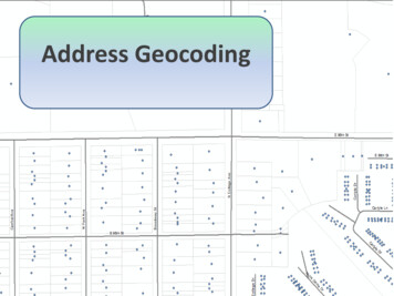
Address Geocoding
Outline DefinitionsDataAddress LocatorsGeocodingDemonstration
What is an address?(from a GIS perspective)An address is simply a methodused to describe and reference alocation A location is based on anexisting feature in a GIS database. A location can be a streetaddress (9609 College Ave) Place-name (Indianapolis) A specific location that has beenidentified and/or defined (9609College Ave, Indianapolis, IN46280)
What is Geocoding?Geocoding is the process of transforming a description —such as a pairof coordinates, an address, or a name of a place—to a location on theearth's surface. (ESRI)AddressesAddress LocatorFind LocationsCreates PointsAddress LocatorAn ESRI tool used to execute thegeocoding process within theArcGIS environment. Can be built by any user Built using location data Standardized addresssearch
Understanding Data SourcesUsed for creating locators (geocoding)
Point DataRepresents the address location May be a point near to an exact location(Option A) Roof-top accuracy Driveway/entrance Parcel Centroid May be approximate (Option B) Interpolated from a street segment Zip Code or Place centroid (Option C)200201250 W College AveW College AveTown of Yorktown298299
Where does point data come from?OriginalCounty DataStateHarvestedDataGIO SDELibrary Collaboration between countygovernments and the state Data originates at the county The state regularly harvests county datafor integration into a single dataset. Currently over 3 million address points in theGIO dataset GIO is not complete TIGER Data is used where county data missing
“Cleaning up” Data(AKA: Locator) Locator updated last fall https://gis.in.gov/arcgis/services(State) Currently being updated again Location data has multiple errorsErrors: No data Incomplete Data Unusable Data Varied standardization
Improving Point DataThe Standardization Process Addresses are reformatted Use an in house algorithm(ISDH) developed for ourGeoRunner web service Not all addresses standardize well Addresses with ½ Streets with odd names Reformatted data is checked foraccuracyStandardized data better address locator19544 Lake Site DriveImproves addressmatching rate
Enhancing Point DataFinding missing Data Spatial join with the county parcels (property address) Spatial join with census ZCTA (Zip Code Tabulated Area) data(2010) When ZCTA data is used the USPS preferred city is assigned Time management: Unusable data is deleted Usable data goes through the reformatting process Additional InformationAlternate city names (Speedway)Alternate zip code names (Town of Yorktown)47304(Muncie)47396(Yorktown)
Understanding Street Data(Option B)
What is Street Data?Street segments Split at each intersection. Contain and address range Locator interpolates the point Comes from current TIGERdata Can have direction (to or from)Some required fields From Left To Left From Right To Right Street Name200201250 W College AveW College Ave298299
Creating an Address Locator Have a primary reference table with x,y data. Created in ArcCatalog from a variety of styles. Style depends on the attributes in theprimary reference table. Reference fields are set using the field map. Made from a variety of data types Accuracy depends on the primary tableAddress locators also containprojection information!
Address Locators
Composite Locator Contains multiple locators Allows for more addressmatching types. Order is important the locatorsare searched from the top down. Once an address is matchedsearching stops for that address.No match found addresspassed to next locatorNo match found addresspassed to next locatorMatch foundNo match found addresspassed to next locatorMatch foundMatch foundMatch foundFind tool can show allpossible candidatesNo match found
Why all the work?Geocoding Addresses Current cost for batch geocoding (ArcGISonline) is 40/10,000 In House unlimited batch geocoding The ISDH geocodes 5 million addresses inone year! Savings of 20,000 based on current rates ISDH is one agency Multiple agencies & users you do the math Can make custom locator (ISDH Facilities) https://gis.in.gov/arcgis/services (State)
Now for geocoding
Parts needed for PointFeatureClass
Address Matching ProcessAdd theaddress table tothe mapChoose theAddress LocatorSet the geocodingparametersMatch theAddressesAdjustgeocodingparametersGeocoding can be done fromArcCatalog or ArcMap.
Geocoding ToolbarCustomize Toolbars Geocoding Shows available address locators Use ArcGIS Online or local locators https://gis.in.gov/arcgis/services (State) Can use the Map Extent to limit search Quick way to search and view singleaddress
Table of AddressesCan be anydatabase tableCommonformats are:.xls, .xlsx,.dbf,.txt, .csv.mdb tablesOracle tables
Start GeocodingRight-click Geocode AddressesChoose Address Locator State (https://gis.in.gov/arcgis/services) Local Custom ArcGIS On LineCheckParameters
Select the address table Choose Address Input Fields Defaults parameters will beset they can be changed Advanced Geometry: Setsprojection Geocoding Options: Offsets set at 0 Check ( ) X and Ycoordinates Check ( ) Referencedata ID if needed Composite: Parametersset for each locator Match ties only neededfor street segmentsParametersGeocoded feature class willhave points only for matchesand tiesSome records will not havecorresponding points becauseof errors in the data
Unmatched AddressesUnmatched addresses canbe matched manuallySome records may not be matcheddue to data entry errors !!!
Address GeocodingContact GIO OfficeQuestions?
geocoding process within the ArcGIS environment. Can be built by any user Built using location data Standardized address search What is Geocoding? Geocoding is the process of transforming a description —such as a pair of coordinates, an address, or a name of a place—to a location on the earth's surface. (ESRI) Address Locator