Transcription
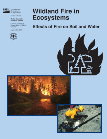
Bren School of Environmental Science & ManagementUniversity of California, Santa BarbaraPost-Fire Sedimentation and Flood Risk Potentialin the Mission Creek Watershed of Santa BarbaraA Group Project submitted in partial satisfaction of the requirements for the degree ofMaster’s in Environmental Science and ManagementByLeslie AbramsonMilli ChennellErica EischAlicia GlasscoThomas HolleyFaculty Advisor:Thomas Dunne
Post-Fire Sedimentation and Flood Risk Potentialin the Mission Creek Watershed of Santa BarbaraAs the authors of this Group Project report, we are proud to archive this report on theBren School’s website such that the results of our research are available for all to read.Our signatures on the document signify our joint responsibility to fulfill the archivingstandards set by the Bren School of Environmental Science & Management.Leslie AbramsonMilli ChennellErica EischAlicia GlasscoThomas HolleyThe mission of the Bren School of Environmental Science & Management is to produceprofessionals with unrivaled training in environmental science and management who willdevote their unique skills to the diagnosis, assessment, mitigation, prevention, andremedy of the environmental problems of today and the future. A guiding principal of theSchool is that the analysis of environmental problems requires quantitative training inmore than one discipline and an awareness of the physical, biological, social, political,and economic consequences that arise from scientific or technological decisions.The Group Project is required of all students in the Master’s of Environmental Scienceand Management (MESM) Program. It is a four-quarter activity in which small groups ofstudents conduct focused, interdisciplinary research on the scientific, management, andpolicy dimensions of a specific environmental issue. This Final Group Project Report isauthored by MESM students and has been reviewed and approved by:Thomas Dunne, AdvisorJohn Melack, Acting DeanMarch 2009
ABSTRACTRunoff and erosion rates rise dramatically in the rainy seasons followingwildfire, increasing the risk of destructive floods, sediment accumulation,and debris flows. Watershed assessments are typically performed post-fire,but risk quantification and determination of mitigation treatments arelimited when a fire occurs immediately before the rainy season. In highlyvulnerable areas, such as Mission Creek watershed in California, pre-fireanalysis of post-fire risk is warranted. This study examined potential postfire runoff and erosion risk by simulating the effects of fire on upperMission Creek watershed. The project utilized field observations of ananalogous burned watershed, spatially explicit data on watershedcharacteristics, historic rainfall and runoff measurements, and acceptedmodeling techniques to estimate post-fire changes in hydrologic andsedimentary processes in Mission Creek watershed. Results estimate flooddischarge associated with the 100-year storm is four times more likelyafter fire, and even small storms will flood areas of downtown SantaBarbara. Sediment yield from the upper watershed may increase byseveral orders of magnitude, depending on precipitation, increasing floodrisk through channel aggradation. These estimates were used to assessvarious pre- and post-fire mitigation projects that reduce risk fordownstream communities in Santa Barbara.iii
AcknowledgementsWe would like to extend sincere thanks to the people who helped make this projectpossible. In particular, we thank our advisor, Tom Dunne, whose expertise and guidancewas invaluable to the creation and development of the project.We would also like to thank our external advisors for their guidance and feedback duringthe course of project development and execution:Arturo Keller Bren School of Environmental Science and ManagementEdward Keller Dept of Geography, U.C. Santa BarbaraRaymond Smith Mission Canyon AssociationIn addition, thanks to those organizations and individuals who provided data and supportduring project development and analysis:Santa Barbara County Flood Control DistrictCandice ConstantineMaureen SpencerShawn JohnsonMatt GriffinU.S. Forest ServiceWilliam ElliotCindy ChojnackyMary MooreSlippery Rock Ranch Madars OzonlinsS.B. Office of Emergency Services Yolanda McGlincheyS.B. County Office of Emergency Services Jay McAmisSanta Barbara County Fire David NeelsNational Weather Service Eric Boldtiv
TABLE OF CONTENTSAbstract . iii1. Executive Summary . 12. Introduction. 32.1 Project Significance . 42.2 Research Questions. 42.3 Research Objectives. 43. Background . 53.1 Regional California Climate . 53.2 Fire Regime. 63.3 Effects of Fire on Hydrology and Sedimentation . 73.4 Study Area . 83.5 Current Post-Fire Management Policies in Santa Barbara . 144. Approach. 174.1 Conceptual Approach. 174.2 Scenario Development . 195. Methodology & Results: Hydrology (HEC-HMS) . 216. Methodology and Results: Sedimentation . 296.1 Surface Erosion Model (ERMiT). 296.2 Shallow Landslide/Debris Flow Model (SHALSTAB). 377. Analysis of Post-Fire Risk . 427.1 Flood Risk. 427.2 Effects of Sedimentation on Flooding . 448. Recommendations. 498.1 Emergency Post-Fire Actions . 498.2 Long Term Planning Actions. 529. References. 55Appendix 10.1: HEC-HMS. 62Appendix 10.2: ERMiT . 71Appendix 10.3: SHALSTAB . 78
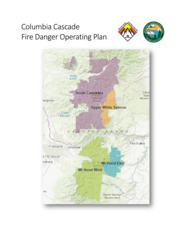
1. EXECUTIVE SUMMARYWildfires pose a complex management problem, especially in fire-prone areas such assouthern California. Flood, sedimentation, and debris flow hazards increase in theyears following fire when precipitation falls on bare hillslopes and unprotected,sometimes hydrophobic soils. Communities downstream of burned areas are at higherrisk when storm runoff and erosion are intensified.Mission Creek watershed, a small coastal watershed in southern California, has highwildfire potential indicated by regional fire history and current fuel accumulation.Mission Creek begins in steep, chaparral-covered mountain slopes and flows to thePacific Ocean after winding through flood-prone downtown Santa Barbara. Fire in theupper watershed would greatly increase water and sediment supplies to the channel,increasing flood risk to downstream urban areas.This project uses spatially and temporally explicit data and watershed modelingprograms to quantify increases in runoff, sedimentation, and risk of debris flows inMission Creek watershed following a potential wildfire. Current observations of postfire hydrologic and sedimentary response in the nearby Gap Fire burn areacontributed to the analysis. Fine-scale analysis allows for early planning and preemptive mitigation, which can supplement the typical post-fire response planned inemergency circumstances.ApproachThree modeling programs were used to calculate post-fire changes in hydrology,erosion, and debris flow risk:1. The Hydrologic Modeling System (HEC-HMS, U.S Army Corps of Engineers)was used to estimate post-fire storm runoff to Mission Creek.2. The Erosion Risk Management Tool (ERMiT, U.S. Forest Service) was used topredict post-fire sediment delivery rates from surface erosion.3. The Shallow Landslide Stability Model (SHALSTAB, UC Berkeley) was used toidentify areas of the watershed where sediment supply from landsliding couldincrease, enhancing the risk of debris flows.Increased flood risk from sediment accumulation in lower Mission Creek wasanalyzed by combining estimates of post-fire sediment delivery (from ERMiT) anddischarge predictions (from HEC-HMS) with calculated sediment transport capacitiesfor the creek.ScenariosSmall and large fire scenarios were developed, simulating a fire in 25 and 50 percentof the upper watershed. Precipitation scenarios were developed for rainstorms with 25-, 10-, 25-, 50-, and 100-year recurrence intervals to represent a range of storm sizes.The effect of dry and wet antecedent soil moisture conditions on runoff was alsoexamined.1
Results Flooding is predicted to occur in some portion of the lower Mission Creekwatershed in all fire and storm scenarios considered. Discharge equal to the 100-year flood, as predicted by FEMA, is four to twentytimes more likely after a fire. Erosion rates increase by up to 385 percent for a 2-year storm and three orders ofmagnitude for a 100-year storm. Areas of chronically unstable soils increase by 53 percent in the upper and middlewatershed after a large fire. 1 foot of sediment accumulation in lower Mission Creek decreases dischargecapacity by approximately 10 percent.RecommendationsPrioritizing post-fire risk mitigation actions improves emergency response plans andallows for pre-emptive mitigation to supplement emergency post-fire response.Recommendations focus on both specific actions to reduce runoff and sedimentdelivery and on coordinated emergency and long-range planning.Emergency Post-Fire Actions:1. Clear sediment basins: Clear the two sediment basins in the upper watershed tofull capacity after a fire to reduce delivery of sediment to lower Mission Creek.2. Increase channel capacity: Clear the creek channel of debris and vegetation toincrease flow velocity and prevent blockage from large debris.3. Stabilize hillslopes: Apply hydromulch to areas of upper Mission Creekwatershed to reduce sediment delivery by up to 90%.Immediate Actions:1. Incorporate post-fire risk into Long Range Development Plans: Create LRDPsthrough the cooperative efforts of both local agencies and communityorganizations, with special attention given to the unique hazards created by postfire storm management.2. Incorporate post-fire risk into Winter Storm Emergency Response Plan:Incorporate post-fire flooding and sedimentation risks into management plans thatdetail emergency response actions during storm events.3. Improve information systems: Improve public services by providing easilyaccessible and centralized information to citizens.4. Increase channel capacity: Improve infrastructure in downtown Santa Barbara toincrease capacity in the lower channel and decrease risk of flooding.2
2. INTRODUCTIONFlooding and debris flows in urban areas damage property and endanger human lives.Wildfires increase the magnitude of runoff and erosion, creating a risk to downstreamcommunities that lasts for 1-3 years after a fire (DeBano 2000, Loaiciga 2001). Asdevelopment in southern California encroaches upon wildland areas, the threat of fireand post-fire impacts to lives and property continues to increase. Post-wildfire debrisflows killed 16 people and caused tens of millions of dollars of property damage inSouthern California in 2003 (Cannon et al. 2007). To aid in the management of theserisks, it is imperative to understand the controlling factors behind post-fire changes inhydrologic and sedimentary processes, as well as the magnitude of change.Predictions of runoff and sedimentation after fires are important both for long-termplanning of risks to infrastructure and for short-term emergency planning for publicsafety and hazard mitigation. It is standard procedure for local and federal agencies toconduct rapid assessments of potential hydrologic and sedimentary changes inresponse to a wildfire. However, making advance predictions of these phenomena inhigh-risk areas aids disaster planning and mitigation, flood control infrastructureupgrades (which can require decades to complete), and public awareness of possibleenvironmental hazards.Mission Creek watershed has a high wildfire potential based on regional fire historyand fuel accumulation since the last major fire in 1964. Mission Creek floodsoverbank in the low-gradient reaches sporadically, with recurrence periods rangingfrom two to forty years, but the risks of floods and debris flows increase significantlyafter fire in the upper watershed (FEMA 2005a). Since the magnitude of increase inrisk depends on local factors and watershed characteristics, studies of recently burnedanalogous watersheds can be used to inform estimations of local post-fire erosion andflooding risk.The July 2008 Gap Fire burned approximately 9,500 acres of vegetation on steephillslopes above Goleta, California, nine miles west of the Mission Creek watershed.Areas of the Los Padres National Forest and private lands were affected by the fire(BAER, 2008). The Burnt Area Emergency Response (BAER) Team responded byconducting a rapid assessment of the burn area and suggesting management actions tomitigate risks to the City of Goleta. As many of the burned watersheds empty throughthe city to the subjacent Goleta Slough near the Santa Barbara Airport, city andcounty implemented mitigation programs to deal with the increased sedimentationand flood risk in winter of 2008-9. The City removed debris from the channel andsediment basins, constructed racks to catch debris, and treated the land surface ofburnt areas to reduce potential hazards. Early estimation of the magnitude and spatialextent of post-fire effects can improve the efficiency and timing of managementdecisions. These predictions can be aided by watershed analysis, field observations,and calculations of the hydrologic and sedimentary changes in the basins.3
San Pedro Creek watershed was 63 percent burned in the Gap Fire and is comparablein topography, geology, hydrology and climate. These similarities provide anopportunity to refine predictions of post-fire response in Mission Creek watershed byobserving the response of San Pedro watershed to the Gap Fire. Investigation ofrunoff and sedimentation in San Pedro Creek during the winter of 2009 supportspredictions of the increases in these processes after a fire for similar watersheds suchas Mission Creek watershed. This process validates predictions and provides the Cityof Santa Barbara and stakeholders in Mission Creek watershed with an early estimateof potential flood and sedimentation risk after a future wildfire.2.1 Project SignificanceWildfire increases the risk of debris flows and floods in the following rainy season,threatening life and property. The upper slopes of Mission Creek watershed lastburned in the Coyote Fire of 1964, after which flooding and debris flow events wererecorded (FEMA 2005a). Forty-five years of vegetation recovery and fuelaccumulation have increased the likelihood of wildfire in the basin.Conceptualizing and quantifying the post-fire consequences of such a burn providesthe foundation for risk analysis and mitigation planning. First, this project utilizeshistorical and current data about Mission Creek and San Pedro Creek watersheds topredict the potential increase in hydrologic and sedimentation processes in MissionCreek. The analysis uses field observations and hydrologic and sedimentationmodeling programs to accomplish this goal. Second, the project investigates andquantifies increased risk created by these processes while integrating predictions intopost-fire management and hazard mitigation plans.2.2 Research Questions1. How would a fire in upper Mission Creek watershed affect hydrologic andsedimentation processes in the succeeding rainy seasons?2. What risks must be addressed to prepare downstream communities and what arethe magnitudes of those risks?3. How can early predictions of potential post-fire flood and sedimentation riskinform mitigation strategies?2.3 Research Objectives1. Identify the physical changes to the sedimentation and hydrologic properties ofSan Pedro and Mission watersheds after a fire.2. Calculate the response of Mission Creek watershed to wildfire based on thecharacteristics of the watershed, and taking advantage of observations of theresponses of San Pedro watershed to the 2008 Gap wildfire.3. Assess and communicate risks to downstream communities as well as policy andmanagement implications of the analysis.4
3. BACKGROUND3.1 Regional California ClimateSouthern California has a Mediterranean climate, characterized by winterprecipitation from October to May and summer drought (Goldstein et al. 2000).Annual average rainfall varies strongly with elevation, and between years, with someyears receiving over twice the average rainfall while other years experience winterdrought (Figure 3-A). This interannual precipitation variation has a significant impacton the hydrology of the region (Inman and Jenkins 1999).Figure 3-A: Downtown SB Rainfall Totals Compared with Average (red line).(Santa Barbara County Water Resources Division, 2002)There is also high precipitation variability within any given year. Variability inprecipitation increases in El Niño years. Often, southern California will receive themajority of annual winter precipitation from one or two storm events. These eventsvary widely in duration and intensity, as well as the time interval betweenoccurrences (Lavee et al. 1997). Time intervals between storm events determineantecedent moisture in soils and vegetation, which in turn, alters hydrology, erosionrates and fire regimes.Additionally, from late fall into winter, dry, hot Santa Ana winds from easternCalifornia are common (Callaway and Davis 1992). Santa Ana winds occur betweenSeptember and April, with a peak occurrence in December. The winds are driven bythe co-occurrence of a high pressure system onshore and a low pressure system off5
the coast. The pressure differential leads to strong winds (30 knots or 35 miles perhour or more) pushing down the coastal ranges to the sea (Raphael 2003). Thisphenomenon can impact the size and intensity of fires in the region.Scientific consensus is that local Southern California climate will be altered by globalclimate change, but the magnitudes of change are not well defined. Most predictionsare for a longer-duration fire season and rainfall events of lower frequency, but higherduration (Miller et al. 2003; Inman and Jenkins 1999).3.2 Fire RegimeIn Southern California, thousands of fires burn through massive tracts of wildlandevery year (Haston and Michaelsen 1994). The coast of south and central California isdominated by dense chaparral scrublands, one of the most fire-susceptible ecosystemsin the world. Winds, as well as soil and vegetation moisture content, are importantfactors in the ignition of chaparral wildland fires (Zhou, Weise and Mahalingam2005). Lightning is the only natural source of wildfire ignition, yet the most commonignition sources today are anthropogenic (Keeley et al. 2003). Chaparral fires tend tobe active crown fires: rapidly moving fires that jump from canopy to canopy, burningthrough the vegetative column to the ground surface and often scorching the soil.Historic fire frequency and intensity regimes remain a topic for academic debate.Many scholars provide a fire recurrence interval of 20 to 40 years (Keeley and Davis2006; Conard and Weise 1998). Mensing et al. (1999) used a 560 year record ofcharcoal deposits in the Santa Barbara basin to determine that the fire regime has notchanged dramatically since the 1400s.There is clear consensus that wildfires have always played a role in chaparralecosystems, with many plant species requiring fire for seed dispersal and re-growth(Keeley 2001). It is only the risk to humans in these chaparral-covered watershedsthat poses a significant “environmental” problem. As such, this paper will notexamine the ecosystem impacts of fire, flooding or erosion processes. Rather, it willfocus solely on the threat these processes have to human life and property.“The general public refuses to accept that catastrophic wildfires are inevitable andthat where shrublands meet human development, disaster is a likely result.” (Zedler1995)6
3.3 Effects of Fire on Hydrology and SedimentationWildfire Effects on HydrologyFires increase the runoff potential of a watershed by reducing vegetation cover androot structures and lowering the infiltration capacity of the soils. These hydrologiceffects of wildfire are well-documented and increase both overall streamflow volumesand the peak flows (Meixner and Wohlgemuth 2003). Post-fire hydrograph responsesare more flashy than normal runoff with more frequent flood events, especially in thefirst year following a fire. Annual runoff yield can be increased as much as 30% inthe first year after a fire (Lavabre 1993).The processes by which wildfires alter runoff mechanisms fall into two categories.First, removing vegetation decreases evapotranspiration of water that has infiltratedthe soil, making more water available for runoff (Lavabre 1993). The result isincreased streamflow volumes in the weeks and months after rainfall. Second, firelowers infiltration capacity of soils to varying degrees by exposing bare soil toraindrop impacts that compact and seal the surface and by creating a hydrophobiclayer that prevents water from entering the soil or penetrating more than severalcentimeters below the surface (Robichaud 2000). Particularly hot fires can alter soilchemistry, creating a layer virtually impenetrable by water (DeBano 2000). Thehydrophobic layer usually occurs at depths between 2 – 8 inches (5-20 cm) (DeBano2000, Onda et al. 2008, Gabet and Dunne 2003), and is maximized when firetemperatures reach 175 - 200 C (DeBano 2000).During a post-fire rainfall event, moisture moves through the soil until it encountersthe hydrophobic layer, at which point infiltration capacity drops significantly andoverland flow increases. This overland flow rapidly drains to the channel network andcontributes to flashy hydrograph responses with a short lag to peak (Onda et al.2008). The hydrophobic layer also decreases the water-holding capacity of soils by upto 20 times its pre-fire volume (DeBano 2000, Wells 1981), increasing the quantity ofwater in drainage networks and contributing to increased flood peaks seen after postfire rainstorms.Wildfire Effects on Erosion and SedimentationFire accelerates erosion and sedimentation processes, particularly in areas with steepslopes and easily eroded soils, such as those found in coastal California (Wells 1981).After wildfires, bare hillslopes have little protection from precipitation, whichincreases erosion from rainsplash and overland flow (Wohlgemuth 2002). Rills orsmall channels may form on scorched slopes as water accumulates on thehydrophobic layer, saturating soils and decreasing friction between soil particles. Thiscreates a risk of thin debris flows which continues until the hydrophobic layer hasbeen weathered or eroded and infiltration increases (Gabet and Dunne 2003). Debris7
flows are rapidly moving mixtures of mud and water that can also be initiated by thecollapse of saturated soils. Larger debris flows can gather momentum and beparticularly destructive when they exceed the capacity of existing channels (Wells1981).Rainsplash, rill erosion, slope collapse, and erosion from overland flow increasesediment yields, which may be up to 35 times higher than average during the firstyear after a fire (Wells 1981). Studies conducted in the San Dimas experimentalforest in Southern California indicate a 2-3-fold increase in sediment production inchaparral and 7-fold increase in grassland the year after a fire occurs (Wohlgemuth2002). Published estimates of sediment production after fires in chaparral ecosystemsrange between 12 and 88 tons/ acre (Keller 1997, Tyrell 1981) compared with abaseline rate of 3.9 tons/ acre (Rowe et al. 1949). (See Appendix 10.2.4)3.4 Study AreaA small coastal watershed of 11.5 mi2 (30 km2), Mission Creek watershed runs fromthe undeveloped mountainous terrain of Los Padres National Forest in the Santa YnezMountains through residential Mission Canyon to the city center of Santa Barbara(Figure 3-B). The Mission Creek watershed was chosen for this study for itsimportance to stakeholders, the availability of data, and its position as a highly visiblewatershed likely to burn in the next decade. The topography of the watershed, a resultof active tectonics, consists of a basin that rises from sea level to nearly 3,900 feet(1,200 meters) (Gurrola 2006). Thin soils and large areas of bedrock outcrop, with adense cover of chaparral vegetation characterize the steep, upper portion of thewatershed (Bean 2007). Low- to mid- density urbanization begins in the middleportion of the watershed, which is moderately steep (Vogelmann 2001). Historically,fires and debris flows have occurred in the upper and middle watershed areas (EdKeller, pers. comm.). Lower Mission Creek passes near the historic Santa BarbaraMission and continues through the heart of downtown Santa Barbara to the PacificOcean. This urban area has experienced some flooding in twelve of the past 100 years(FEMA 2005b).Nearby San Pedro watershed (Figure 3-B), studied for comparison and as an exampleof a burned watershed, is 7.1 mi2 (18.5 km2), rises 2,900 feet (880 meters) above sealevel and has similar pre-fire vegetation, hydrology and geology to Mission Creek.San Pedro differs from Mission in size and land use, as the mid-watershed area isagricultural, rather than residential, and in that it empties into Goleta Slough beforeentering the Pacific Ocean (Vogelmann 2001). The Gap Fire of July 2008 burned 63percent of the San Pedro watershed, with the burned area located in the upper andmiddle watershed (BAER 2008). This burn is similar to a scenario that could occur inupper Mission Creek watershed (David Neels, pers. comm.). Additionally, San Pedrois a useful study area because of concurrent research by USGS and the installation ofa stream gauge in the lower reach.8
Figure 3-B: Location and extent of study area, including the Mission Creek and San Pedrowatersheds. (Source Data: County of Santa Barbara, USGS, ESRI Data and Maps)9
Geology and SoilsWatershed geology can determine the types of erosion to expect after a fire. TheSanta Ynez Mountains, part of the rapidly uplifting Transverse Ranges (Gurrola2006), consist of sandstone and shale (indurated clay and silt). The sandstone is moreresistant than the shale and forms east-west trending ridges with shale units formingdepressions and less steep portions of hillside. Both watersheds contain sevengeologic units which are, from oldest to youngest: weak Juncal (shale) Formation,hard Matilija Sandstone, weak Cozy Dell Shale, hard Coldwater Sandstone, weakSespe Formation, very weak Rincon Shale, and weakly consolidated Quaternarydeposits from landslides, debris flows and the streams (Dibblee 1986). As bothwatersheds exhibit extensive bedrock outcroppings in areas of low rock strength, therate of bedrock weathering to loose debris is high. The upper basins of the Santa Ynezrange have considerable areas of exposed bedrock, especially on their steeper slopes.The proportion of bare rock in these watersheds has not been mapped, but usingdigital image processing, the area of bedrock outcropping was estimated to bebetween 2 percent and 9 percent in each of the upper sub-basins of the Mission Creekwatershed. Mission Creek watershed has higher proportions of weaker rocks andgreater volumes of runoff from the higher terrain, making it likely that rates ofsediment production and erosion will be higher there than in San Pedro Creekwatershed.Understanding watershed soil characteristics elucidates the reaction of the basin toprecipitation. As shown in Figure 3-C, soils depths in both watersheds are below onefoot (0.3 m) in depth at the headwaters, one to two feet (0.3-0.6 m) deep in the middlewatershed and two to five feet (0.6-1.6 m) deep on the historical flood pl
Mission Creek watershed, a small coastal watershed in southern California, has high wildfire potential indicated by regional fire history and current fuel accumulation. Mission Creek begins in steep, chaparral-covered mountain slopes and flows to the Pacific Ocean after winding through flood-prone downtown Santa Barbara. Fire in the
