Transcription
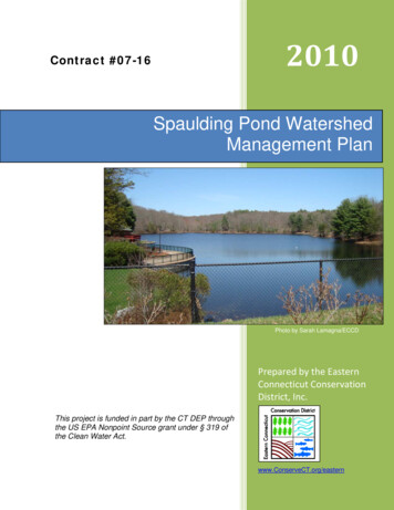
2010Contract #07-16Spaulding Pond WatershedManagement PlanPhoto by Sarah Lamagna/ECCDPrepared by the EasternConnecticut ConservationDistrict, Inc.This project is funded in part by the CT DEP throughthe US EPA Nonpoint Source grant under § 319 ofthe Clean Water Act.www.ConserveCT.org/eastern
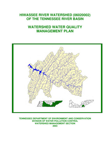
AcknowledgementsThe Eastern Connecticut Conservation District would like to thank the following fortheir contribution of time and effort to the development of this plan:Joseph Loyacano, Director (retired), City of Norwich Department of Public WorksBarry Ellison, Director, City of Norwich Department of Public WorksLuis DePina, Director, City of Norwich Recreation DepartmentThomas Doherty, City of Norwich Recreation DepartmentMichelle Kellough, Norwich Animal Control OfficialChristopher LaRose, Assistant General Manager, Norwich Public UtilitiesDavid Coughlin, Uncas Health DistrictStan Zaremba, CT Department of Environmental ProtectionEric Thomas, CT Department of Environmental ProtectionAristea Kinney, CT Department of Public HealthPeter Popinchalk, Kelly Middle School2009 Kelly Middle School Eighth Grade Science StudentsPark visitors and volunteers who participated in outreach activities.Eastern Connecticut Conservation District StaffScott Gravatt, Executive DirectorKate Johnson, Office AdministratorJudy Rondeau, Natural Resource SpecialistJean Pillo, Watershed Conservation CoordinatorSarah Lamagna, Natural Resource SpecialistPat Young, Natural Resource Specialisti
Table of ContentsI. Executive SummaryII. IntroductionIII. Watershed Management Plan Purpose and ProcedureIV. Watershed DescriptionV. Nine Element Watershed Based PlanA. Identification of Pollutant Causes and SourcesB. Pollutant Load Reduction EstimatesC. Watershed Best Management PracticesD. Financial and Technical Assistance NeededE. Education/Outreach ComponentF. Implementation ScheduleG. Interim MilestonesH. Monitoring and Assessment ComponentI. Implementation EffectivenessAPPENDICESAppendix A – Geese Counting Data SheetAppendix B – Results of Waterfowl TalliesAppendix C – Results of Bacteria Sampling by Uncas Health DistrictAppendix D – Stream Bacteria Test ResultsAppendix E – Rainfall Data from Norwich Public UtilitiesAppendix F – Comparison of Bacteria Data to Rainfall DataAppendix G – Location Map of Animal Control FacilityAppendix H – Location Map of Optical Brightener Pad and Drainage Pipeson Ox Hill Rdii
I. Executive SummaryThe Eastern Connecticut Conservation District (ECCD) conducted a thoroughinvestigation and evaluation of the Spaulding Pond watershed in Norwich,Connecticut. Spaulding Pond, a city-owned waterbody located in Mohegan Park,does not meet the water quality standards for its designated use of recreation dueto periodic bacterial exceedances. Although there has been a considerableinvestment of funding and energies by several government agencies and otherparties over the years, water quality problems have persisted.The project included an in-depth review of all available existing water quality dataand information. Water sampling data from several sources was obtained andevaluated with the goal of finding indicators that would help identify or confirmsources of NPS pollution. Land uses were examined, and detailed field surveyswere conducted, including an inspection of storm drains and outfalls,documentation of resident waterfowl populations and an evaluation of park use bypark visitors.This project was pursued with the intent of developing a Watershed Based Plan forthe Spaulding Pond watershed. Therefore, it is by design that ECCD’s evaluationcontains information that addresses the nine elements required by the USEnvironmental Protection Agency (US EPA) for a Watershed Based Plan. TheWatershed Based Plan identifies specific management measures that arenecessary for water quality assessment and improvement, enabling SpauldingPond to meet the standards for its designated use, and be eligible for delisting.One of the most valuable products contained in this evaluation is a comprehensivelist of recommended implementation actions for improving the water qualitythroughout the watershed. The recommendations are consolidated and organizedin one of the latter sections of the report.Figure 1: Postcard of Spaulding Pond at Mohegan Parkdated 1912. The view is south towards the dam.1
II. IntroductionSpaulding Pond (Water body Segment ID CT3800-00-6 L3 01), is a 14-acreimpoundment of an unnamed stream located within the City of Norwich-ownedMohegan Park, and is a popular destination for recreational activities such asswimming and fishing. However, Spaulding Pond is listed as impaired by the Stateof Connecticut for one of its designated uses, which is water contact recreation.The cause of the impairment is elevated Escherichia coli (E. coli) levels, suspectedby the CT DEP to be attributed to the presence of waterfowl. E. coli originates inthe intestinal tracts of warm-blooded animals (including humans). When found in awater body, E. coli is indicative of the presence of human or animal waste. WhileE. coli itself is not generally considered harmful, it is an indicator that other diseasecausing organisms, which may present a health risk, may be present in thewaterbody. A public swimming area located on the eastern shore of SpauldingPond must be closed when E. coli levels exceed the established ConnecticutDepartment of Public Health (CT DPH) water quality standard for recreationalcontact of 235 colony forming units (cfu) per 100 milliliters of water for a singlesample. A geometric mean of 126 cfus/100 milliliters of water for any set ofsamples will also trigger designation of a water body as impaired for recreation.The Eastern Connecticut Conservation District, in partnership with the City ofNorwich, the Uncas Health District and the CT DEP, has conducted a watershedinvestigation that identifies the causes of the impairment and makesrecommendations to address this periodic bacterial contamination. The projectalso supports State efforts to develop a TMDL (total maximum daily load) forindicator bacteria (E. coli) for Spaulding Pond. The information gathered as part ofthe Spaulding Pond water quality improvement project has been used to developan abbreviated form of the US EPA nine-element watershed-based plan, whichidentifies the sources of impairments and provides non-point source pollution bestmanagement practices (BMPs) to address them.Figure 2: Similar view of Spaulding Pond, 98 years later.2
Figure 3: Spaulding Pond Watershed and City of Norwich within the Shetucketand Thames Basins.3
III. Watershed Management Plan Purpose and ProcedureA. PurposeThe purpose of the Spaulding Pond Watershed Management Plan is to identify thesources of bacterial contamination in Spaulding Pond and to recommend non-pointsource (NPS) pollution management measures to address those sources. Theprimary objective of this watershed management plan is provide decision-makerswith a list of specific actions which, when implemented, will reduce bacteria loadingin Spaulding Pond to levels that meet State standards. The most visible benefit ofsuch a reduction will be the elimination of beach closures at Mohegan Park due tohigh levels of E. coli, through the implementation of the management strategiesidentified in Section 5C of this document.B. ProcedureThe following headings provide a summary of topics that were investigated. Resultsof the investigation are provided in Section V, Part A of this report.1. Watershed TeamThe success of a watershed based plan depends on implementation. Therefore itis essential for the plan to be accepted by those who will be implementing therecommendations. This is best done by including those who will be responsible forimplementation in the creation of the plan. To that end, a watershed managementteam was assembled, comprised of ECCD, the City of Norwich Department ofPublic Works, the Norwich Recreation Department, the Uncas Health District, andthe CT DEP. ECCD met with representatives from these key stakeholder entities todiscuss the water quality problem and to gather information regarding possiblesources of bacterial contamination, and also to solicit information regardingmeasures currently being taken to mitigate the problem.ECCD also discussed potential waterfowl management issues with CT DEP wildlifedivision staff, and provided water testing data to CT DEP TMDL staff for use in thedevelopment of a bacteria total maximum daily load (TMDL) for Spaulding Pond.Table 1: Watershed Management TeamTeam MemberResponsibility/Area of ExpertiseCT DEPTMDL, Flock EvaluationECCDWater Quality InvestigationNorwich DPWPark MaintenanceNorwich Public UtilitiesSewer Line Installation, Rainfall DataNorwich Recreation DeptSwim Beach MaintenanceUncas Health DepartmentWater Testing4
2. Management Activities Already Undertaken By Team MembersManagement activities already undertaken by the City of Norwich includeimplementation of swimming beach maintenance strategies by RecreationDepartment employees, posting of signs to ban dog walking in the park, and theinstallation of aerator units in Spaulding Pond to increase water oxygenation andcirculation.Over a several year period, the Norwich Department of Public Works installed threeaerating fountains in Spaulding Pond. Although there is no scientific data toconfirm that these aerators can help reduce the levels of bacteria, there areindications that the aerators may help. It is possible the aerators help reduce levelsof bacteria as a result of increased water circulation. Therefore, ECCD has includedaerators and/or circulators at Spaulding Pond as a BMP recommendation.3. Information Collection and ReviewOver the course of ECCD’s investigation, data was gathered from the City ofNorwich, Uncas Health District and Mohegan Park visitors, and through fieldstudies conducted by ECCD. Other available resource data utilized includes landcover/land use data from the University of Connecticut’s Center for LanduseEducation and Research (CLEAR), and generally available GIS data layers fromCT DEP, USDA, USGS and others. This data was used to develop the abbreviatedwatershed-based plan for the Spaulding Pond watershed. The plan identifies themost likely sources of the bacterial contamination, and provides NPS managementrecommendations which will be implemented by local stakeholders.4. Land Use and Land CoverECCD evaluated land use and land cover in the Spaulding Pond watershed,particularly in the highly developed northern portion of the watershed, whichcontains the headwaters of the intermittent stream that flows to Spaulding Pond. Ofparticular importance was the possibility of inputs to the stream from developedareas that could be causing or contributing to bacteria loads, including failing septicsystems or illicit discharges. In addition to land use/land cover data, NaturalResources Conservation Services (NRCS) soils data was reviewed to determinesuitability of local soils for subsurface sewage disposal.5. Septic System Failures/Illicit DischargesIn order to determine if septic system effluent or contamination from illicitdischarges was present in the stream flowing to Spaulding Pond, optical brightenerpads (untreated cotton pads which fluoresce under ultraviolet light if they absorboptical brighteners - a common laundry detergent additive) were placed in thestream just upstream of Ox Hill Road (see location map in Appendix G). In additionto utilizing the optical brightener pad method, Uncas Health District sampled thewater for bacteria at both Ox Hill Road and downstream at the pond inlet on thedays the optical brightener pad was placed and removed, to provide additionalbacterial data.6. Water Quality SamplingData from water quality sampling conducted by Uncas Health District, whichsampled bi-weekly at the swimming beach from Memorial Day through Labor Day5
in 2010, was obtained and analyzed. Rainfall data for the same time period wasobtained from Norwich Public Utilities, and compared to the water quality data todetermine if a relationship between rainfall and elevated bacteria levels inSpaulding Pond was apparent.OpticalBrightener PadFigure 4: Optical brightener pad in stream north of Ox Hill Roadculvert.An analysis of graphs depicting rainfall and bacteria levels for each monitoring yearfrom 2007 to 2010 (Appendix E) indicates that there may be an associationbetween rainfall and elevated bacteria levels in Spaulding Pond. However, sincewater sampling is conducted on a bi-weekly schedule independent of rain events, adirect causal relationship cannot be established.7. Storm Drain SystemThe storm drain system located in Mohegan Park was evaluated for potentialbacteria contributions from the adjacent upland areas, with special focus on thestorm pipes that outlet directly into Spaulding Pond. The evaluation includedconsideration of possible bacteria contributions from such sources as latrine areasestablished by animals frequenting trash bins and other food sources.8. Waterfowl InformationStudents from a nearby middle school gathered information regarding geese andduck populations in the spring of 2010, including information on the number ofnesting pairs and goslings observed. They also documented activities such as thenumber of park visitors observed fishing, swimming, walking dogs or feeding thewaterfowl.6
9. Park Use InformationECCD staff and volunteers visitedMohegan Park on several occasions toelicit information from park visitors. Bothweekday and weekend park visitors weresurveyed to determine when and howthey use the park, and what activities theytypically enjoy. The survey includedquestions regarding park visitor’s attitudestoward feeding the resident waterfowl.The results of the survey are summarizedin Table 2. Public participation will becritical in the implementation of the WBP,since it is a change in public behavior thatwill drive many of the water qualityimprovements at Spaulding Pond.Activities such dog walking and thefeeding of ducks and geese at the Park(as well as other types of wildlife) havebeen traditional park activities, so publiceducation, acceptance and support will beneeded in order to create the behavioralchanges necessary to discontinue thesepractices.Table 2: Park Visitor Survey Results Roughly as many visitors live inNorwich as come from out of town(54% vs. 46%)54% visit at least once a week89% like to walk and 43% enjoywildlife81% say park is an important link tonature24% say the swim area is importantto them37% feed the waterfowl. Of those:o 75% would not feed if theyknew feeding could increasebacteriao 100% would not feed if theyknew feeding was unhealthy forbirdsIV. Watershed DescriptionThe Spaulding Pond watershed is part of theShetucket River regional drainage basin andthe Thames River major drainage basin (seeFigure 3). The local watershed contributing toSpaulding Pond is 275 acres (0.43 squaremiles) and is located entirely within the City ofNorwich. The Spaulding Pond watershed istypical of eastern Connecticut with rolling hillsand stream valleys as depicted in the USGStopographic map in Figure 5. The maximumelevation is approximately 290 feet and theminimum elevation is approximately 244 feetat Spaulding Pond, an elevation differential of146 feet. The Norwich area is underlain byglacial soils, including lodgment and melt-outtills, deposited by the Laurentide ice sheetapproximately 18,000 years ago. These soilsare overlain by more recent soils as depictedin Figure 6.7Figure 5: Topography of SpauldingPond Watershed (USGS).
Spaulding Pond is a 14.3 acre waterbody located in Mohegan Park. The pond is animpoundment of an unnamed intermittent stream that originates in a forestedwetland in the northern portion of the watershed. The impoundment is formed by a30.5 foot high earthen embankment located at the south end of the pond. Anemergency spillway is located at the right end of the dam. The pond has amaximum storage capacity of approximately 235 acre-feet, or roughly 10.2 millioncubic feet of water. Peak inflow to the pond, as determined by the Army Corps ofEngineers, is 780 cubic feet per second (cfs). Peak outflow through the principlespillway, a drop inlet structure, is 490 cfs. Combined spillway capacity (via the dropinlet and emergency spillway) is 1142 cfs.Figure 6: Soil types in the Spaulding Pond Watershed (from NRCSsoils data).Approximately 54% of the watershed is forested, comprised primarily of deciduoustree species. Suburban development occurs primarily in the north portion of thewatershed (see Figure 7). Impervious cover (roadways, driveways, sidewalks)accounts for 22% of the watershed. Approximately 12% of the watershed is turf orgrass, 10% is forested wetland or water (including Spaulding Pond), and 2% isdesignated other grasses (see Figures 8 and 9).8
Figure 8: Land Use and Land Cover inthe Spaulding Pond Watershed.Figure 7: Aerial image of theSpaulding Pond Watershed.Land Cover in Spaulding PondWatershedWater5%Coniferous Forest1%Forested Wetland5%Barren0%Developed22%DevelopedTurf & GrassesOther GrassesDeciduous ForestTurf & Grasses12%Coniferous ForestWaterForested WetlandBarrenOther Grasses2%Deciduous Forest53%Figure 9: Percentages of Land Cover in Spaulding Pond Watershed9
V. Nine Element Watershed Based PlanA. Identification of Pollutant Causes and SourcesAs part of the Spaulding Pond water quality investigation, ECCD investigatedpotential non-point sources of bacterial contamination including waterfowl,residential septic systems, swimming “accidents” at the public swim area, and dogwaste.1. WaterfowlThe 2008 Connecticut Integrated Water Quality Report lists waterfowl as thesuspected source of bacterial contamination to Spaulding Pond. Spaulding Pond isseasonally inhabited by a large population of waterfowl. The primary speciesinclude Canada geese and mallard ducks, although other (unidentified) ducksspecies were observed. Students from a nearby middle school were recruited todocument bird populations, including breeding/nesting pairs of Canada geese, andoffspring, from April to June 2010. The largest number of Canada geese counted,14, was documented on April 29th. On the same day students observed 6 possiblenesting pairs of geese and one gosling. The largest number of Mallard ducks, 58,was counted on June 10th. Unofficial counts by ECCD staff over the course of theinvestigation indicated the Mallard duck population was maintained atapproximately that level throughout the summer.Waterfowl CountsNumber Fowl605040Canada GeeseMallard 15/1320105/6/4/29/20100Counting DatesFigure 10: Results of Spring 2010 Waterfowl Counts by Kelly Middle School students.10
2. Septic SystemsMuch of the Spaulding Pond watershedis undeveloped. The areas at thenortherly extent of the watershed andbeyond are developed as residentialneighborhoods (R-40 zone). NorwichPublic Utilities has been installing sewerservice in the developed residentialarea to the north of Harland Road,which intersects the upper watershedarea west to east, in the Flyers Driveand Lambert Drive neighborhoods, inresponse to documented septicsystems problems related to poor soils,high water table, small lot size andaging septic systems. Neighborhoodssouth of Harland Road, includingHarland Road, Larry Street, HarvardTerrace, Ox Hill Road, and Tower HillRoad remain on individual septicsystems. Although a review of septicsuitability of the soils in the area southof Harland Road indicates they havelow septic potential, the Uncas HealthDistrict has no record of septic systemfailures for that area.Figure 11: Suitability of soils for subsurfacesewage disposal in the Spaulding PondWatershed.To test for the presence of septic leachate or other contaminants in the streamflowing to Spaulding Pond, ECCD staff placed an optical brightener pad (OBP) inthe stream north of the Ox Hill Road stream crossing for a one week period, fromAugust 16 – 23, 2010. On August 16th and 23rd, the days the OBP was placed andremoved, Uncas Health District staff took water samples in two locations, south ofthe stream crossing at Ox Hill Road and at the stream inlet to Spaulding Pond, totest for bacteria. The OBP tested negative for optical brightener agents. However,the results are considered inconclusive, rather than indicative that no contribution ofseptic system effluent was present, since a number of variables, includingextremely low stream flow related to below average rainfall in the summer of 2010,and whether the seven day sampling period coincided with the laundry schedule ofthe nearby residences, can affect the results.The water samples taken at the stream crossing and at the pond inlet on the daysthe optical brightener pad was placed in the stream and removed tested in excessof the upper testing range of 2000 cfu/100 ml (see Appendix D for results). Thissample set of four data points indicates that additional bacteria testing in the streammay be warranted.11
A reconnaissance survey of thestream identified a property onOx Hill Road from which threedrainage pipes discharged nearthe stream. One of the pipeshad fungal growth associatedwith the area of discharge.The site was reported to andfield inspected by Uncas HealthDistrict personnel in dryweather when no dischargewas being emitted by any of thepipes. We recommend thatUncas Health District check thepipes periodically, especiallyafter a significant rain, to ensurethat the drains are dischargingclean water.Figure 12: Fungal growth associated with the6” PVC pipe discharging near the unnamedstream.ECCD also reviewed City records for the location of the on-site subsurface sewagetreatment system for the public restroom at Mohegan Park, which is located at thesouth end of Spaulding Pond, near the pavilion (see Appendix G for buildinglocations). The subsurface sewage treatment system is located south of the dam,down gradient of the pond, and thus was ruled out as a potential source of bacterialcontamination.3. Swim BeachThe effects of swim “accidents” by diaper-wearing swimmers were considered as apotential source of bacterial contamination. Although not quantifiable, the potentialfor bacterial contamination via direct contact with soiled diapers exists. The City ofNorwich has posted signage at the swim area informing beach-goers that diapersare not allowed in the water. In conversation with Norwich Recreation Departmentstaff, it was learned that the main reason for the ban was that regular disposablediapers tend to disintegrate when saturated. In recent years, special swim diapers("swimmies") have been promoted for the diaper-wearing population. However, arecent study conducted by James Aubrey, PhD, of University of North CarolinaCharlotte and his colleagues, found that swim diapers, plastic pants, and swimtrunks do not protect against the spread of recreational water illness (RWI),diseases spread by water-borne germs, especially and including diarrhea.The City of Norwich has provided “porta-potties” for the sanitary needs of beachgoers. The portapotties are owned and maintained by a private waste service, andare located at the entrance to the beach area by Mohegan Park Road. Theportapotties are installed in mid-June to coincide with the opening of the beach, andare removed at the end of August, when the beach closes. They are pumped twiceweekly by the waste management company. All indications are that the portapottiesdo not contribute to the bacteria loading of Spaulding Pond.12
4. Dog WasteThe Norwich Animal Control Facility islocated at Mohegan Park, near the southwestshore of Spaulding Pond, behind themaintenance garage (see Appendix F forbuilding locations). A drainage system wasobserved at the kennel that channels run-offfrom the concrete dog runs into a drain pipethat is connected to an on-site septic systemwhich will be abandoned when the newfacility is completed. Communication with theanimal control officer, Norwich DPW andRecreation staff indicate that solid dog wasteis removed and disposed of in a wastereceptacle. A new animal control facility isunder construction near the existing facility,which has its own newly installed on-siteseptic system, which is located south of anddown gradient to Spaulding Pond.Figure 13: Overland Flow from theAnimal Control Facility to a StormDrain at the Maintenance Garage.Storm run-off from the existing animal controlfacility has been observed flowing to a stormdrain located behind the park maintenance/public restroom building (Figure 12). Investigation indicates this storm drain doesnot outlet to Spaulding Pond, but rather has its discharge point south of the pond.Visitors are regularly observed walking dogs in Mohegan Park even though “no dogwalking” signs are clearly posted throughout the park. If spotted, park employeespolitely inform dog walkers that dogs are not permitted in the park, but the Citydoes not have a policy in place to enforce the prohibition.Waste from dogs walked by park visitors, especially along the paved paths circlingSpaulding Pond, has the potential to contribute to bacteria loading to the pond viasurface runoff. However, based on numerous informal inspections by ECCD staff, itis apparent that the quantity of dog feces in the vicinity of the pond is minute incomparison to the amount of waterfowl feces.5. Storm Drain SystemThe storm drain system located in Mohegan Park was evaluated for potentialbacteria contributions from the adjacent upland areas, park roads and parking lots.With one exception described below, runoff from park roads and parking areas viathe storm drain system was ruled out as a significant source of bacteria. TheMohegan Park Road parking lot (on the east side of Spaulding Pond, see Figure 13for location) does not discharge to Spaulding Pond. The Park Center parking lot (tothe southwest of Spaulding Pond near the animal control facility, see Appendix G13
for location) discharges north to a small forested wetland before draining via apoorly defined intermittent stream to Spaulding Pond.ECCD staff did not observe animal feces in the parking areas or along the roadsthat would indicate that either area contributed bacteria in any significant amount tothe pond. City operations such as maintenance, sanding and snow plowing wouldnot contribute to bacteria loading and were therefore not evaluated as potentialsources.The one area where storm flow may contribute to bacteria loading is a storm drainnear Wilderness Road (on the north side of Spaulding Pond) that outlets onto thegrassy area north of the swimming beach (see Figures 13 and 14). After heavyrain events, water discharging from this outlet may flow across the land surfacenear the grassy area where waterfowl forage and goose feces have beenobserved, transporting bacteria into the pond. Establishment of a vegetative bufferalong the lake shore, which is one of this Plan’s recommendations, would interceptmuch of the runoff and reduce the contamination potential.Storm Drain OutletWilderness RoadMohegan Park RoadFlowDirectionSwim AreaFigure 14: Location of storm drain outlet from Mohegan Park Road relative to theswimming area.14
Storm DrainOutletFlowDirectionFlowDirectionFigure 15a: Storm drain outlet acrossfrom the beach area.Figure 15b: Bread left from waterfowlfeeding activity.B. Pollutant Load Reduction EstimatesTo estimate loads and load reductions, EPA recommends the use of models whichhave been developed for these purposes. ECCD has found that there are fewmodels that provide quantitative estimates of loading or load reductions forbacteria. Therefore, ECCD emulated previously approved Watershed BasedPlans, which utilize qualitative estimates to predict load reductions.Resident and migratory waterfowl, septic systems, swimming “accidents,” andTable 4: Estimated E. coli Load Reduction for Existing and Potential Management StrategiesSourceManagement StrategyLoad Reduction Potential¾ Flock Reduction¾ Vegetative Buffer Installation¾ Installation of Reractable Fencingalong BeachWaterfowl¾ Beach BMPs & Maintenance¾ Prohibit Feeding¾ Installation of Pond Circulator¾ Use of AeratorsSeptic¾ Homeowner BMPs includingSystems/Regular Tank Pump-outSewers¾ Installation of Sewer Lines¾ Sanitary Facilities at Swim AreaSwimming ¾ Enforcement of "No Diapers in“Accidents”Water" PolicyDogs¾ Enforcement of Dog Ban¾ Implementation of BMPs at AnimalControl FacilityAmount ofImpactModerate to HighModerateModerateModerateModerateLow to ModerateLowLow *Low *Low to ModerateEight E. coliexceedancesfrom 2007 to2010 thatresulted inclosure ofswim areaLow to ModerateLowLow* Pending the results of additional testing in the stream and at the drain pipes near the stream onOx Hill Road, the load reduction potential of these strategies may increase.15
waste from dogs that are either brought to the Park or kept at the animal controlfacility were identified in previous section of this report as potential sources of E.coli. Since no quantitative data for bacteria loading was obtained as part of thisproject, qualitative estimates for bacteria load reduction from these sources for thevarious recommended management measures are listed in Table 4.C. Watershed Best Management PracticesDescriptions of existing and recommended management strategies necessary toachieve the estimated load reductions are provided below.1. Existing NPS Management Strategies to Achieve Load Reduction Goalsa. Structural Controls: Three (3) Aquamaster Master Series 5hp aerators. In recent years, theNorwich Department of Public Works has installed three aerators inSpaulding Pond to increase oxygenation and promote water movement. Beach maintenance BMPs to remove waste left by waterfowl. During thesummer months, the swimming beach is raked several times during theday by Recreation Department staff to remove waterfowl droppings fromthe beach and shoreline. Waste is deposited in nearby waste containers. Installation of municipal sewer lines in
the Spaulding Pond water quality improvement project has been used to develop an abbreviated form of the US EPA nine-element watershed-based plan, which identifies the sources of impairments and provides non-point source pollution best management practices (BMPs) to address them. Figure 2: Similar view of Spaulding Pond, 98 years later. 2

