Transcription
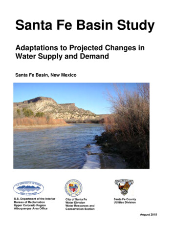
Santa Fe Basin StudyAdaptations to Projected Changes inWater Supply and DemandSanta Fe Basin, New MexicoU.S. Department of the InteriorBureau of ReclamationUpper Colorado RegionAlbuquerque Area OfficeCity of Santa FeWater DivisionWater Resources andConservation SectionSanta Fe CountyUtilities DivisionAugust 2015
Mission StatementsDepartment of InteriorProtecting America’s Great Outdoors and Powering our Future.The U.S. Department of the Interior protects America’s natural resources andheritage, honors our cultures and tribal communities, and supplies the energy topower our future.Bureau of ReclamationThe mission of the Bureau of Reclamation is to manage, develop, and protectwater and related resources in an environmentally and economically soundmanner in the interest of the American public.City of Santa Fe, Water DivisionOur mission is to provide a reliable, safe and sustainable water supply to meet theneeds of our customers and our community.Santa Fe County UtilitiesThe mission of Santa Fe County Utilities is to provide fully sustainable, reliablewater services, in compliance with applicable regulatory requirements andindustry standards, for a full spectrum of use by all residents of Santa Fe County.
Santa Fe Basin Study:Adaptations to Projected Changes in Water Supply and DemandReport partnersBureau of ReclamationCity of Santa FeSanta Fe CountyReport prepared by:Dagmar Llewellyn, HydrologistProgram Management Group, Water Management DivisionAlbuquerque Area Office, Upper Colorado RegionWilliam Schneider, Water Resources CoordinatorP. Andrew Erdmann, Water Resources CoordinatorRick Carpenter, Water Resources and Conservation ManagerCity of Santa FeClaudia Borchert, Director, Santa Fe County Utilities DivisionSanta Fe CountyKelly Collins, PG, BCES, PrincipalLauren Starosta, P.E., Water Resources EngineerCDM SmithJesse Roach, PhD, Hydrologist, Earth Systems AnalysisSandia National LaboratoriesAugust 2015
Acronyms and AbbreviationsAcronyms and AbbreviationsAAOAFAlbuquerque Area Officeacre-feetAFYacre-feet per yearamslabove mean sea levelASRBCSDaquifer storage and recoveryCIPCapital Improvement PlanCityCity of Santa FeCountySanta Fe CountyCMIP3Coupled Model Inter-comparison Project Phase 3DOIUnited States Department of InteriorETevapotranspirationGCMGeneral Circulation ModelsGDDgrowing degree daysGHGgreenhouse gasgpcdgallons per capita per dayHD(e)Hybrid-Delta Ensemble UnitIPCCIntergovernmental Panel on Climate ChangeMOAMemorandum of AgreementMRGCDMiddle Rio Grande Conservancy DistrictNMEDNew Mexico Environment DepartmentO&Moperation and maintenanceOSENew Mexico Office of the State EngineerReclamationRWRPBureau of ReclamationSTELLASURFSSystems Thinking Experimental Learning Laboratory with AnimationStream Unit Response Function SolverTSCTechnical Services CenterURGWOMURGSiMUpper Rio Grande Water Operations ModelUpper Rio Grande Simulation ModelVICVariable Infiltration CapacityWCRPWorld Climate Research ProgrammeWaterMAPSWater Management and Planning SimulationBias Correction and Spatial DisaggregationCity of Santa Fe Reclaimed Wastewater Resource PlanWaterSMART Sustain and Manage America’s Resources for Tomorrow
ContentsTable of ContentsExecutive Summary . ES-1Chapter 1. Introduction. 11.1. Study Purpose, Authorization, and Funding . 11.3. Location and Description of the Study Area . 31.4. Coordination and Participants . 51.5. Collaboration and Outreach. 61.6. Summary of Previous and Current Studies . 81.7. Identification of Interrelated Activities . 12Chapter 2. Problems and Needs. 132.1. Future Challenges and Considerations . 142.2. Characterization of Future Conditions . 152.3. Present Water Supply. 212.4. Approach to Overall Water Supply Analysis. 282.5. Water Availability . 302.6. Water Demands. 362.7. System Reliability and Impact Assessment. 42Chapter 3. Adaptive Strategies . 493.1. Formulation of Adaptive Strategies . 503.2. Evaluation and Comparison of Adaptive Strategies . 68Chapter 4. Findings. 714.1. Scoring and Ranking of Water Supply Portfolios . 714.2. Current and Ongoing Activities . 744.3. Next Steps and Future Considerations. 75Chapter 5. Disclaimers. 75Chapter 6. References Cited . 76AppendicesAppendix A: Climate Change and the Santa Fe Basin: A PreliminaryAssessment of Vulnerabilities and Adaptation AlternativesAppendix B: Technical Memo on Development of Climate ChangeHydrographs for WaterMAPSAppendix C: ModelingC1. Temperature and Precipitation Data for Santa Fe Basin StudyC2. Evapotranspiration Calculations in the Upper Rio GrandeSimulation Model (URGSiM)Appendix D: Projected Water Supply for Reclamation’s San Juan-ChamaProjecti
Santa Fe Basin StudyAppendix E: Technical Memorandum Summarizing Task 3: Update andEnhance WaterMAPSAppendix F: Technical Memorandum Summarizing Task 4: Assessment ofAdequacy of Current Water Supplies in Meeting Future Demand andProjected Climate-change-induced ConditionsAppendix G: Technical Memorandum Summarizing Task 5a: Develop andAnalyze Adaptation StrategiesTablesTable 1-1: Adaptation Strategies from the Preliminary AssessmentIncorporated in Adaptation Portfolios . 7Table 2-1: Management Targets for Santa Fe Area Water Supply . 21Table 3-1. Adaptation Strategies for the Santa Fe Basin study area . 51Table 3-2. Santa Fe Basin Projected 2055 Water Supply Gap . 52Table 3-3. Santa Fe Basin Study Portfolios and Simulated Supply. 56Table 3-4. Performance of Portfolio 1 Relative to Reliability Criteria. 58Table 3-5 Performance of Portfolio 2 Relative to Reliability Criteria. 60Table 3-6 Performance of Portfolio 3 Relative to Reliability Criteria. 62Table 3-7 Performance of Portfolios 4 and 5 Relative to ReliabilityCriteria . 64Table 3-8. Performance of Portfolio 6 Relative to Reliability Criteria. 65Table 3-9. Performance of Portfolios 7 and 8 Relative to ReliabilityCriteria . 67Table 3-10. Performance Criteria, Performance Measures, andCriteria Weigh. 71Table 4-1. Scoring of Adaptation Portfolios . 73FiguresFigure E-1. Map of Santa Fe County . E-1Figure E-2 The Santa Fe watershed. E-5Figure E-3. Ranking of Santa Fe Portfolios . E-16Figure 1-1. Location of Santa Fe City and Sante Fe County, NewMexico. . 1Figure 1-2. The Santa Fe watershed . 4Figure 1-3 Map of the Jemez y Sangre Region . 10Figure 2-1. Carbon dioxide emissions and atmospheric concentrationsfor some emission scenarios. . 17Figure 2-2. Climate change scenarios. . 19Figure 2-3. Population projections . 20Figure 2-4. Santa Fe water supply system. . 22Figure 2-5 Map of the San Juan- Chama Project . 24Figure 2-6. Location and capacities in cfs of San Juan-Chama Projectdiversions and tunnels. 26ii
ContentsFigure 2-7. Santa Fe River target flow allocation as a function ofannual yield . . 31Figure 2-8. Hydrographs used to model Santa Fe River target flows. 31Figure 2-9. Future availability of water predicted by WaterMAPS . 32Figure 2-10. Santa Fe River projected average annual yield as apercent of normal (4,909 afy) by climate changescenario. . 34Figure 2-11. Frequency of years below and above normal (4,909AFY) Santa Fe River flow conditions, for each climatechange scenario. . 34Figure 2-12. San Juan-Chama Project water loss by evaporation inthe Abiquiu Reservoir under different climate changescenarios. . 35Figure 2-13. Monthly observed gpcd and average maximum dailytemperatures for the City of Santa Fe. . 39Figure 2-14. Monthly observed gpcd and precipitation for the City ofSanta Fe. . 39Figure 2-15. Comparison of predicted water use to observed wateruse for the City of Santa Fe. 40Figure 2-16. Average and maximum monthly gpcd simulated. 41Figure 2-17. Cumulative probability curves for the annual deficit foreach climate change scenario. . 43Figure 2-18. Probability curves for the monthly deficit for each climatechange scenario . 44Figure 2-19. Probability curves for the summer monthly deficit foreach climate change scenario. . 45Figure 2-20. Probability curves for the winter monthly deficit for eachclimate change scenario. 46Figure 3-1. Santa Fe Basin Portfolio 1 annual deficit probability curveunder central tendency climate scenario. 58Figure 3-2. Santa Fe Basin Portfolio 2: Direct Reuse Only annualdeficit probability curve under central tendency climatescenario. . 60Figure 3-3. Santa Fe Portfolio 3: Additional Water Rights Only annualdeficit probability curve under central tendency climatescenario. . 61Figure 3-4. Santa Fe Portfolios 4 and 5: More Conservation andWater Rights (Reuse to Potable) annual deficit probabilitycurve under central tendency climate scenario. . 63Figure 3-5 Santa Fe Basin Portfolio 6: More ASR annual deficitprobability curve . 65Figure 3-6. Santa Fe Basin Portfolios 7 and 8: More Direct Reuseannual deficit probability curve . 67Figure 4-1. Ranking of Santa Fe Basin Study portfolios. 72iii
Executive SummaryExecutive SummaryStudy PurposeClimate change, in concert with human development and other changes, promisesto alter many aspects of life in the Santa Fe basin, including the availability ofwater to the City of Santa Fe (City) and Santa Fe County (County), and theresources that depend on the Santa Fe watershed (Figure E-1). The health offorests, fish and wildlife, and other ecosystems as well as human development,food security, and quality of life are likely to be affected. This Basin Study hasbeen undertaken by the City and County along with the United States Departmentof Interior (DOI) Bureau of Reclamation (Reclamation), to evaluate theseprojected changes and to develop potential strategies for adaptation that can beused for planning.Figure E-1. Map of Santa Fe County.WaterSMART: Authorization and ProgramThis Basin Study was performed under the U.S. Department of the Interior’sWaterSMART (Sustain and Manage America’s Resources for Tomorrow) BasinStudy Program. The Federal SECURE Water Act of 2009 and Secretarial Order3297 established the WaterSMART Program, which authorizes Federal water andscience agencies to work with State and local water managers to pursue andprotect sustainable water supplies and plan for future climate change by providingleadership and technical assistance on the efficient use of water. WaterSMARTallows all bureaus of the Department to collaboratively work with States, Tribes,local governments, and non-governmental organizations to pursue a sustainablewater supply for the Nation, and integrate water and energy policies to support thesustainable use of all natural resources.ES-1
Santa Fe Basin StudyBasin studies, one of WaterSMART’s tools, are basin-wide efforts to evaluate andaddress the impacts of increased competition for limited water supplies, climatechange, and other stressors, and to define options for meeting future waterdemands in river basins in the Western United States where imbalances in watersupply and demand exist or are projected. This Basin Study is consistent withReclamation’s Basin Study Framework and Section 9503 of the SECURE WaterAct (Subtitle F of Title IX of P.L. 111-11, the Omnibus Public Land ManagementAct of 2009).Cost Share and FundingThe cost-share partners for this study are the City, County, and Reclamation,which performed the study in partnership under a Memorandum of Agreement(Reclamation et al., 2011 [MOA]). The Santa Fe Basin Study analyses, modeling,evaluations, and reporting have been developed through the combined efforts ofthe City and County working in consultation with Reclamation’s AlbuquerqueArea Office (AAO), with technical support from Reclamation’s Technical ServiceCenter (TSC), Sandia National Laboratories, and CDM Smith, an engineeringfirm.Scope and ObjectivesThe opportunities for adaptation to future water supply shortages identifiedthrough this Basin Study are based on a better understanding of the future effectsof, and associated risks from, climate change and population growth on the Cityand County’s combined water supply portfolio. Through the Santa Fe BasinStudy, the study partners seek to improve the resilience of the Santa Fe watershedand the communities the watershed supports, as well as the municipal watersystems for the City and County, in the face of projected changes in population,human development, and climate. This Basin Study consisted of the followingactions: Identify the vulnerabilities of systems in the Santa Fe watershed to climatechange. A preliminary assessment qualitatively evaluated climate-changeimpacts on water supply sources, ecosystems, quality of life, agricultureand local food production, landscapes, land use, and water demand. Thisassessment was based on input obtained during a March 6, 2012 workshopand from research conducted by the authors and is summarized in thisreport and presented in full in Appendix A. Assess Santa Fe’s changing water supply and demand, including nativesurface-water supplies from the Santa Fe Watershed, the Upper RioGrande, and the San Juan Basin (imported water of the San Juan-ChamaProject), as well as groundwater supplies to the city and county’s wellfields. This portion of the study includes an assessment of the likely watersupply and demand conditions in 2050 for the City and County’scombined water supply. There is a small amount of agricultural land (as of2005, OSE estimated 590 acres irrigated with surface water and 130 acresES-2
Executive Summaryirrigated with groundwater) in the Santa Fe Watershed. However, thequantitative analyses in this study focused on municipal supply, demand,and adaptation measures, since municipal use represents the largestportion of water use within the basin, and is the primary area of interest ofReclamation's study partners. This assessment included:o Developing climate and hydrology projections for use in this BasinStudy. This work by Reclamation and Sandia National Laboratories isdescribed in Appendices B, C1, and C2.o Developing an independent transient analysis of the projected changesover the course of the 21st century of the reliability of Reclamation’sSan Juan-Chama Project. This work by Reclamation and SandiaNational Laboratories is presented in full in Appendix D.o Updating the City’s Water Management and Planning Simulation(WaterMAPS) model to include the County as a partnering entity andto enhance the model to include functionality to assess projectedclimate impacts. This work by CDM-Smith is discussed in detail inAppendix E.o Using the updated WaterMAPS model, running simulations todetermine the impacts to the City and County’s combined water supplyunder future demand and projected climate conditions. Thesesimulations by CDM-Smith are described in detail in Appendix F. Identify and analyze potential adaptation strategies for the combined Cityand County water supply. This portion of the study included:o Assessing the vulnerability and possible shortcomings of the currentlong-range water supply strategies.o Identifying management or infrastructure changes that mightstrengthen the entire basin, its component systems, and its inhabitantsto provide more flexibility in the face of an uncertain future.o Combining these adaptation strategies into portfolios that wouldprovide adequate water supply in the 2050s, considering projectedpopulation growth and climatic changes. Since it is likely that nosingle adaptation strategy will suffice to fill the gap between supplyand demand, these combined portfolios helped the City and Countyselect adaptive strategies that best meet the regional water supplyneeds. Appendix G describes the adaptation strategies and alternativeclimate mitigation portfolios evaluated.Location and Description of the Study AreaThis Basin study focuses on the Santa Fe River watershed, a sub-basin to the RioGrande watershed. The Santa Fe watershed is in the high-elevation desert ofnorthern New Mexico (Figure E-1). It spans the Sangre de Cristo Mountains onthe east and the Rio Grande on the west. The City of Santa Fe is the mainmunicipality in the watershed and within the northern portion of Santa Fe CountyES-3
Santa Fe Basin Study(Figure E-2). The Santa Fe Basin includes the City and the portion of the Countythat has the highest population density and the highest growth rate, as well as thepart that has historically depended on the City of Santa Fe for its water supply.For water-supply assessment purposes, the study area also encompasses: The upper Rio Grande watershed (upstream of Otowi stream gage) Tributaries within the San Juan River watershed, a portion of which aredelivered to Santa Fe through Reclamation’s San Juan-Chama Project Groundwater from the aquifers of the Santa Fe GroupEach of these sub-basins is a source of surface-water for the combined municipalwater supply for the City and County. The first two sub-basins are within the RioGrande basin; the third lies within the Upper Colorado River Basin (Figure E-2).Santa Fe averages over 300 days of sunshine a year, with a temperate climate andfour distinct seasons. The summer months in Santa Fe, from May to September,feature typically hot, sunny weather, with fairly low humidity and coolerevenings. Daily summer temperatures in Santa Fe peak at around 93 F duringJuly and August. Thunderstorms typically occur in the early evening during thisseason. Rainfall in the Santa Fe area is spread throughout the year, although thehighest frequency and intensity of rain occurs as part of the summer monsoons,which occur primarily during the months of July and August. The average annualprecipitation in Santa Fe is about 14 inches.Problems, Needs, and OpportunitiesThe City and County water supply systems are interconnected, with the Countysystem surrounding the City system to the north, south, and east of the Cityboundary and service area. The two water utilities also co-own one of the region’ssources of supply (Figure E-2). The City and County water utilities have a diversewater supply portfolio, providing water to their customers with surface water fromthe three sub-basins and groundwater from two well fields. Because of this sharedresource and infrastructure, cooperation between the City and County is essentialfor planning. The City and County are concerned about potential decreases in theavailability and reliability of their joint surface water supply, as well as the qualityof the water. The water utilities recognized the need for long-range planningefforts to identify future water supply deficiencies, identify strategies for meetingthose shortfalls, and implement those strategies.ES-4
Executive SummaryFigure ES-2. The Santa Fe watershed (shaded green) receives water supply from the Santa Fe sub-basin, the upperRio Grande sub-basin (green stipple) and the San Juan-Chama River sub-basin (all green stipple).ES-5
Santa Fe Basin StudyThe population continues to grow and the needs of the community continue toexpand. Like many surface waters in the arid Southwest, however, supplies fromthe Santa Fe River, the Upper Rio Grande and the tributaries to the San JuanRiver are all limited, highly variable, and. dependent on seasonal snowpack andrunoff conditions, They are also all vulnerable to climate-change-inducedimpacts. The groundwater is pumped from aquifers that are slow to recharge. Inresponse to these conditions, the City and the County have been working for amore resilient, sustainable, diverse, and innovative water supply system for manyyears. To increase the sustainability of their water supply, the City and Countywater utilities have developed new surface-water sources. However, they alsorecognize that additional increases in supply and/or decreases in demand will berequired to meet the challenges ahead. This Basin Study is the latest in a series ofefforts to understand and strengthen water supply management in the Santa Fearea.Characterization of Future ConditionsFuture water supply conditions, water availability, and water demands wereprojected based on climate scenarios and population increases. The climateprojections used for this study were developed from The World Climate ResearchProgramme (WCRP) Coupled Model Inter-comparison Project Phase 3 (CMIP3)(Meehl et al. 2007), and Reclamation’s Bias-Corrected and Spatially DownscaledSurface Water Projections (Reclamation 2011[BCSD]).Imported San Juan-Chama Project Reliability AnalysisTo assess the reliability of Reclamation’s San Juan-Chama Project. Reclamationand Sandia National Laboratories provided an independent, separate transientanalysis of the projected changes over the course of the 21st century. The methodsused for this analysis are described in Llewellyn, et. al. (2013) and results aremore fully described in Appendix D. Projected changes to the water supply andproject operations are:. Flows would decrease by one-quarter overall Flows would decrease in summer and increase in spring. Storage in Heron Reservoir would be reduced. Sufficient water for a full allocation to contractors will be available lessfrequently.Even if sufficient water is available in tributaries to the San Juan River fordiversions to the San Juan-Chama Project, shortages within the Colorado RiverBasin could lead to priority calls or shortage sharing agreements that would resultin decreased supply to New Mexico under the Colorado River Compact. SuchES-6
Executive Summaryshortages could result in decreases in Reclamation’s authorization to divert waterto the San Juan-Chama Project, even if sufficient water is available locally.Santa Fe Municipal Supply Analysis (WaterMAPS)As the 2050s are the period consistent with the study’s 40-year planning cycle, themodel generated five climate scenarios representing the range of variabilityexpected in basin hydrology in the 2050s (Reclamation 2010).Three of these five climate scenarios were deemed to represent the range oftemperature and precipitation changes that are expected due to climate change:Warm-Wet, Hot-Dry, and Central Tendency groups. Therefore, these threescenarios were simulated by Sandia National Laboratories in the monthly timestep operations model, Upper Rio Grande Simulation Model (URGSiM).Analysis is in Llewellyn et. al. 2013 and results are discussed in Appendix E. Theoutput from these URGSiM simulations were used as input to Santa Fe’smunicipal supply operations model, Water Management and Planning Simulation(WaterMAPS), to generate the projections and alternatives evaluated in this BasinStudy. A baseline scenario, referred to as “simulated historic” was used forcomparison to climate-change impacted hydrologies. The simulated historicscenario combines current infrastructure and operations with synthetic, spatiallydistributed historic climate and inflows (Maurer et. al. 2002). The components oftotal demand, as modeled in WaterMAPS, are: Population. Population projections for the 2055 populations used fordeveloping water demand are 125,019 and 44,673 persons for the City andCounty water service areas, respectively. The City’s Long-Range WaterSupply Plan completed in 2008 did not directly include the adjacentCounty population. The combined population leads to much greaterdemand without a commensurate increase in supply, so the gap betweensupply and demand reported in this study is not similar to previous City orCounty documents. Per-capita water demand. The current average annual per-capita waterdemand of 114 gallons per capita per day (gpcd) was derived frommonthly water production data provided by the City and the Citypopulation data from 2002 to 2010. For the demand projections, the unitdemand representing the annual average is assumed to be fixed at 114gpcd (e.g., no conservation efforts assumed for future conditions). Thisaverage annual unit demand represents the baseline demand that iscompared to the projected 2055 demands to identify the potential watersupply gap. Demand values for reclaimed water used in this analysis wereobtained from the City of Santa Fe Reclaimed Wastewater Resource Plan(Borchert, 2013), which outlines specific allocations for reclaimed wateruse. Demand for reclaimed water was based on the allocations and was notmodified to account for climate change.ES-7
Santa Fe Basin Study Seasonal variations. In the water supply assessment portion of this study,projected changes to temperature and precipitation were input into a localdynamic systems water operations model (WaterMAPS) to assesspotential changes to water supply. The simulated supply conditions werethen compared with demand projections to evaluate deficits and needs inthe future water supply for the Santa Fe area. Seasonal variability ofdemand and impacts on that variability due to climate change are alsopredicted as part of this study and included in the analysis. Other waterdemands include court ordered provision of water for irrigation systems(i.e., Acequia Madre, Acequia Cerro Gordo).Water Supply and DemandThe analysis of water supply in the Santa Fe Basin uses the City’s WaterMAPSmodel. WaterMAPS is a multi-criteria dynamic systems simulation model thatwas
to alter many aspects of life in the Santa Fe basin, including the availability of water to the City of Santa Fe (City) and Santa Fe County (County), and the resources that depend on the Santa Fe watershed (Figure E-1). The health of forests, fish and wildlife, and other ecosystems as well as human development,