Transcription
Assessment Methods for Aquatic Habitat andInstream Flow Characteristics in Support ofApplications to Dam, Divert, or Extract Water fromStreams in British ColumbiaFinal VersionPrepared for:Ministry of Water, Land & Air Protection andMinistry of Sustainable Resource ManagementPrepared by:Adam LewisEcofish Research, Denman Island, BCTodd HatfieldSolander Ecological Research, Victoria, BCBarry ChilibeckNorthwest Hydraulic Consultants, North Vancouver, BCCedric RobertsCBR and Associates, Nanaimo, BCMarch 2004
Table of Contents1.02.03.0SUMMARY. 1BACKGROUND . 2SCREENING DATA REQUIREMENTS . 53.1.1 Description of the Proposed Project. 53.1.2 Hydrology . 93.1.3 Biology. 143.1.4 Habitat . 164.0DETAILED DATA REQUIREMENTS. 184.1.1 Approach . 184.1.2 Geomorphology. 254.1.3 Water Quality . 284.1.4 Fish Biology . 334.1.5 Fish Habitat . 354.1.6 Lower Trophic Levels . 414.1.7 Stream and Riparian Ecology. 424.1.8 Cumulative Effects. 454.1.9 Other Studies. 464.1.10Data Analysis and Interpretation . 465.0REFERENCES . 596.0APPENDICES . 63Appendix A: The BC Instream Flow Methodology . 636.1.1 Study Design . 646.1.2 Transect Site Selection. 666.1.3 Transect Setup. 676.1.4 Marking Transects and Locations . 686.1.5 High Flow Considerations. 696.1.6 Hydrometric Survey Equipment . 696.1.7 Habitat Data Collection. 706.1.8 Collecting Depth and Velocity Data . 726.1.9 Calculating Weighted Usable Area . 776.1.10Collecting Elevation Data. 786.1.11Photodocumentation . 796.1.12Field Safety Considerations . 846.1.13Data Collection Forms . 866.1.14User Notes for the IFS Field Data Card. 88Appendix B: Background Information . 99Assessment Methods in Support of Water Licence Applicationsii
List of TablesTable 1. Watershed level information by variable, with units, locations, andrecommended data sources and methods. . 9Table 2. List of potential impacts to aquatic habitat from water withdrawal, organized byissue. Operational changes affect physical habitat which in turn may affect specifichabitat biological attributes. 23Table 3. Basic water quality parameters to be monitored at water use projects in BritishColumbia. The minimum frequency of sampling is specified, however, morefrequent sampling may be required for some projects. . 30Table 4. An example of a species periodicity chart, detailing life stage timing by activityfor each species of interest. . 34Table 5. Ecological considerations to be addressed in detailed studies. . 44Table 6. Hydrologic characteristics for ‘Falls Creek’ showing a) key hydrologic statisticsand b) median monthly flows and flow thresholds as per Hatfield et al. (2003). . 51Table 7. Hydrologic parameters on ‘Falls Creek’ showing the hydrologic effects of aproject meeting the Guideline monthly flow thresholds provided in Hatfield et al.(2003). 51Table 8. Hydrologic parameters for ‘Falls Creek’ showing the hydrologic effects of aproject meeting the Guideline monthly flow thresholds provided in Hatfield et al.(2003). 54Table 9. Summary of substrate classification. . 72Assessment Methods in Support of Water Licence Applicationsiii
List of FiguresFigure 1. General decision schematic for a two-tiered review process to determineinstream flow requirements to support aquatic ecosystem values. . 2Figure 2. Examples of upstream, diversion, and downstream sections for threehypothetical hydroelectric projects. . 8Figure 3. a) Natural surface flows from Englishman River, Vancouver Island based on 29years (solid grey lines) of data collected between 1913 and 2000 (MAD 13.1 cms).The Y axis maximum has been set at 50 cms to clearly show low flows. b)Simulated power flows (pink columns) during 1995 with a run-of-river hydropowerproject on the Englishman River, assuming a maximum diversion capacity of the80th %tile annual flow and a minimum operating threshold of 0.66 cms (5% MAD),with an instream flow guideline as per the Flow Thresholds for fish-bearing streams(solid green line). . 13Figure 4. Example of a linkage diagram identifying operation effects on stream flow,physical habitat effects, direct effects on fish and habitat, key components of streamecology, and affected attributes of fish population ecology. Factors other than streamflow can affect fish population ecology. 21Figure 5. Diagram of the key information used in an instream flow analysis: flow, waterquality, geomorphology, ecosystem, useable habitat area, and aquatic ecology.Processes linking information can be characterized by correlating informationsources. Other factors that can affect fish population ecology should also beconsidered. . 47Figure 6. Hydrograph of ‘Falls Creek’ showing daily flows averaged over the period ofrecord for a project scenario that meets the Guidelines. The blue solid line shows thebaseline flow, the solid red line the post-project scenario (flows calculated based onflow thresholds in Hatfield et al. 2003). Pink columns indicate flows diverted downthe penstock (powerflows) and the solid green line shows the monthly flowthresholds. . 52Figure 7. Hydrograph of ‘Falls Creek’ showing daily flows averaged over the period ofrecord under the proposed operating scenario (10% MAD minimum instream flowrelease). The blue solid line shows the baseline flow, the solid red line the postproject flow (scenario follows flow thresholds in Hatfield et al. 2003). Pink columnsindicate flows diverted down the penstock (powerflows) and the solid green lineshows the minimum flow release. 53Figure 8. A habitat-flow relationship calculated for steelhead trout juveniles in thediversion section of ‘Falls Creek’, showing the individual transect values for eachtransect across all mesohabitats. A curve is fitted to the data, following a log-normalform that is typically found in habitat-flow relationships. 56Assessment Methods in Support of Water Licence Applicationsiv
List of Figures continuedFigure 9. Example of appropriate vertical positioning to capture changes in streambedtopography. . 73Figure 10. Example of appropriate rod positioning when encountering large embeddedboulders and protruding bedrock outcrops. 74Figure 11. Example of procedures involved in the collection of depth and velocity data atundercut banks. Similar procedures apply when encountering LWD at water edges. 75Figure 12. Example site drawing including all data requirements. 77Figure 13. Example photo looking upstream. . 81Figure 14. Example photo looking downstream. . 81Figure 15. Example photo looking at the left bank from the right bank. . 82Figure 16. Example photo looking at the right bank from the left bank. . 82Figure 17. Example photo looking at the right bank pin (rebar). 83Figure 18. Example photo looking at the left bank pin (spike). 83Assessment Methods in Support of Water Licence Applicationsv
List of BC Instream Flow Guidelines for FishBC Instream Flow Methodologybenthic index of biological integritycritical flow stream periodDepartment of Fisheries and Oceans.environmental assessmentFisheries Data Information SystemFish Habitat Assessment ProcedureFisheries Information Summary Systemharmful alteration, disruption or destructionhabitat suitability indexLand and Water BCmean annual dischargeMinistry of Water, Land and Air Protectionnaturalized mean annual dischargephysical habitat simulationpoint of diversionriver two-dimensional modelResource Information Standards CommitteeTerrain Resource Information Mappingweighted usable areaweighted usable widthAssessment Methods in Support of Water Licence Applicationsvi
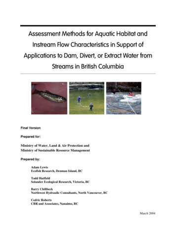
AcknowledgementsThis project was spearheaded by Kevin Conlin and Ted Down, who both providedsupport to the study team. Gary Robinson provided support in the second half of theproject. Alan Caverly collated Provincial review comments and provided guidancethroughout the project. We received useful review comments from Ron Ptolemy, TonyCheong, George Butcher, Bruce Letvak, Bruce McFarlane, Scott Babakaiff, JohnPatterson, Mike Bradford, Debra Hughes, and Alan Cowan. Cover photos by DaveGordon and David Burt.Note to ReaderEarly in 2003 the Province made available a set of “Working Guidelines”,” datacollection standards that should be followed when presenting relevant information tofisheries agency staff as part of an application for a water licence. Applicants were askedto adhere to those data collection and presentation formats until release of this document.This Assessment Methods document supersedes the “Working Guidelines”. TheAssessment Methods build on the “Working Guidelines” by including revisions fromMWLAP and DFO agency personnel, and by providing additional methods for detailedassessment. Projects already under review are covered under the specific requirementsidentified by regulatory review personnel: these requirements may vary from the“Working Guidelines” and the methods presented here.Assessment Methods in Support of Water Licence Applicationsvii
1.0 SUMMARYThe British Columbia Instream Flow Guidelines for Aquatic Habitat are made up of twocomponents: Instream Flow Thresholds and Instream Flow Assessment Methods. The InstreamFlow Thresholds are guidelines designed to protect aquatic habitat in British Columbia streamsfrom excessive water withdrawal. The Assessment Methods are methodology guidelines designedto identify impacts from water withdrawal. This document defines the Assessment Methods foraquatic habitat: Flow Thresholds are defined in a companion document (Hatfield et al. 2003).Although these Assessment Methods were designed for small hydro water licence applications, theAssessment Methods are also appropriate for other applications, such as some large hydro projectsand applications for consumptive water uses.Applications to dam, divert, or extract water from streams in British Columbia must be supportedby high quality information on hydrology, biology, and habitat from the stream of interest. TheAssessment Methods defined in this document are structured into two tiers: those applied at apreliminary ‘coarse’ screening level and those applied at a detailed level. Applications for water usehoping to meet the Guidelines’ Flow Thresholds must provide preliminary level data consisting of aproject description, daily hydrological data estimated from regional stations or collected from thestream of interest, biological data including fish presence determined through existing records ordirect sampling, and reconnaissance- level fish habitat information. Applications that move to thedetailed level will have to provide information at both the screening and detailed levels. Detailedinformation needs must include: geomorphology, water quality, fish biology, fish habitat, lowertrophic levels, ecological function, and cumulative effects.The two-step process is designed to identify projects that pose a low risk to fish and habitat.Projects that do not meet the ‘Guidelines’ Flow Thresholds represent a higher risk to theenvironment and will be subject to greater scrutiny through a requirement for detailed studies. TheAssessment Methods identified here are intended to meet the requirements of the Fisheries Act.Specifically, information is required to assess a harmful alteration, disruption, or destruction ofhabitat (HADD) and to develop appropriate mitigation and compensation of project impacts.Although the methods identified here are detailed, proponents have ultimate responsibility inmeeting the information requirements of DFO. Accordingly, all detailed studies should be carefullyplanned and documented to allow external review, should that be requested during or following thestudy.The Assessment Methods provide data collection and analysis procedures that should be followedwhen presenting relevant information to fisheries agency staff as part of an application for a waterlicence. It is important to note that these methods only address fish and fish habitat concerns. Insome cases, additional detailed studies on other resources (e.g., wildlife, recreation) will berequired, but these are not described here. Data must be collected and summarized using themethods described and referenced in this document. All studies should be certified by a qualifiedprofessional in the appropriate field (e.g., R. P. Bio., P. Geo., P. Eng., etc.) with demonstratedexperience on instream flow issues.Assessment Methods in Support of Water Licence Applications1
2.0 BACKGROUNDThe British Columbia Instream Flow Guidelines for Fish (referred to here as “the Guidelines,”Hatfield et al. 2003) were developed by MWLAP, MSRM, LWBC, and DFO to aid in the processof setting instream flows in British Columbia streams. The Guidelines are comprised of twocomponents: Instream Flow Thresholds and Instream Flow Assessment Methods. This documentpresents the Assessment Methods, and water licence applicants are advised to adhere to thesemethods for data collection and presentation. By following the Assessment Methods water licenceapplicants will allow regulators to accurately assess projects in a timely manner.The Guidelines direct reviewers and applicants through a two-tiered assessment of fisheriesconcerns related to instream flows (Figure 1). The “coarse filter” (i.e., a set of flow thresholdsdescribed in the Guidelines) is first applied to a proposed water use. If the coarse filter indicates thatfish-flow issues are not a concern, then fisheries regulators would approve the application subject toreview of other fisheries concerns (e.g., intake screening, footprint issues, etc.). If the coarse filterindicates a potential fish-flow concern, then the applicant has three options: abandon the project,redesign it to meet the flow thresholds (e.g., alter diversion rates or timing), or collect and presentadditional information to demonstrate that aquatic habitat concerns are adequately addressed withinthe proposed flow regime.Figure 1. General decision schematic for a two-tiered review process to determine instreamflow requirements to support aquatic ecosystem values.Water LicenceApplicationConduct screeningassessmentRedesignAbandonReject“Coarse Filter”PassProject meets flow thresholds;HADD authorization not required forstreamflow component of projectConduct detailedassessmentRedesignAbandonRejectReview ofDetailedAssessmentPassAssessment Methods in Support of Water Licence ApplicationsHADD authorization not requiredfor streamflow component of projectorHADD authorized withappropriate compensation2
In the first tier, the coarse filter is applied using basic project description, hydrological, andbiological information specific to the project site. The biological information most critical to thisstep is fish presence, because the thresholds for adjustment to natural stream flows in the Guidelineschange between fish-bearing and fishless streams. Quality hydrological data is also critical, since itquantifies the availability of stream flow for fish and for water extraction. In the second tier,projects are evaluated in greater detail using multiple biological, hydrological andgeomorphological parameters.Information requirements in the preliminary and detailed assessment are additive. Projects thatpropose to extract flow beyond the Guidelines’ flow thresholds require a detailed assessment, butwill nonetheless be required to collect all information necessary for the coarse filter. Theinformation needs for both tiers can be summarized as:1. Description of the proposed project;2. Description of the natural hydrology, geomorphology, and biology in the watershed;3. Assessment of how the hydrology, geomorphology, and biology will be affected by theproposed project; and4. Description of other land and water uses in the area that may interact with the project.Prior to submitting data and analyses, they should be certified by a professional in the appropriatefield (e.g., R. P. Bio., P. Geo., P. Eng., etc.).The two-tiered review process and data requirements are based on existing environmentallegislation, and the information presented from proponents1 to regulators must be relevant in thecontext of these existing regulations. The methods identified here are intended to meet therequirements of the Fisheries Act, specifically the assessment of harmful alteration, disruption, ordestruction of habitat (HADD). The Assessment Methods are detailed, but proponents have ultimateresponsibility for meeting information requirements of DFO and other agencies. Accordingly, alldetailed studies should be carefully planned and written study proposals should be submitted toregulatory agencies prior to undertaking the studies. DFO has guidelines for determination andauthorization of HADD (DFO 1998a), and determination of mitigation and compensation (DFO1998b). The Assessment Methods are meant to complement these and other existing guidelines.Biological and hydrological data essential to the screening assessment are identified and describedin full in this document. Also, preliminary information on habitat is requested. Although thissecondary information is not essential to the screening assessment, it can be collected at littleadditional cost and provides a context for the interpretation of the fish presence and hydrologicaldata, and will benefit proponents.1In this document the term ‘proponent’ includes consultants retained for representation and to conductstudies, or any other agent of the proponent.Assessment Methods in Support of Water Licence Applications3
Information essential to the detailed assessments is only partly described in this document, becausethe “best” method will vary, particularly among complex projects. The methods identified here areconsidered adequate for most, but not all, projects. Where exceptional aquatic habitat values arepresent, regulators in MWLAP and DFO may require studies different to those described here, inorder to characterize habitat values and potential impacts. Streams with greater fisheries values andsensitivity to development can expect more rigorous analysis and are likely to require even moredetailed assessment than that identified here.It is important to note that the methods provided here address fish and fish habitat only. Additionalinformation may be required for other purposes during the application review (e.g., to assess theeffects of the proposed project on wildlife, recreation, agriculture, or other industries) andproponents should consult with regulators to obtain those information needs and the methods toassess them. Proponents and regulators may wish to use these methods to direct data collection forassessing other resources or project types (e.g., large water withdrawals for industrial or municipaluse).Assessment Methods in Support of Water Licence Applications4
3.0SCREENING DATA REQUIREMENTS3.1.1 Description of the Proposed ProjectA reliable and sufficiently detailed description of a proposed project is required to conduct ascreening of a water licence application. The purpose of the project description is to define theproject and to put geographical bounds on the area of influence. The project description should beconcise yet include:1.2.3.4.Project location;Physical facilities;Proposed operating regime; andArea of impact.3.1.1.1 Project LocationBoth preliminary and detailed agency reviews require watershed level information to identify thelocation of the project and its facilities, as well as the environment affected by the project. Thelocations of all proposed project infrastructure must be properly geo-referenced, and mapped out onthe existing TRIM base (1:20,000). Mapping should show detail of the immediate project area, aswell as place the project location in the context of the surrounding watersheds. Mapping andengineering drawings completed at more than one scale may be necessary to do this. Whereapplicable, mapping should follow RISC mapping standards (e.g., symbology) (see ResourceInformation Standards Committee Website).3.1.1.2 Physical FacilitiesThe project description should include sufficient detail on the physical infrastructure required forthe construction, operation, and maintenance of the project. Details include:1. Dam structures, diversion weir, etc.;2. Powerhouse structures; and3. Project lifespan.Assessment Methods in Support of Water Licence Applications5
3.1.1.3 Proposed Operating RegimeThe project description should include sufficient detail on the proposed operating regime. The effectof project operation on flow and sediment transport is critical to the assessment of impacts.Operational details include:1. General and daily operations;2. Operations during maintenance; and3. Emergency procedures.3.1.1.4 Area of ImpactWater withdrawals have areas of direct and indirect impact. Direct impacts occur in the diversionsection. Indirect impacts occur in the upstream and downstream aquatic habitats that could beaffected by the project operations. Downstream sections are typically difficult to delimit becausethey have no obvious downstream boundary (i.e., for any Fraser River tributary they logicallyextend to the estuary at Steveston, though in practise the extent is far smaller). The downstreamimpact limit is ideally the point downstream of the project where tributary inflows dilute anysignificant effect of project operations. In practise this is difficult to define. For the purposes ofassessing impacts from hydroelectric projects, the downstream impact limit has been defined as thatpoint downstream where the watershed area is five times that at the powerhouse site. The same ratioapplies to consumptive uses; however, the measurement should be relative to the point of waterwithdrawal. Even in those cases where project flows have important effects on areas below thedownstream limit; assessments within the downstream section will likely be adequate tocharacterize impacts further downstream, since impacts within the downstream section will be moresevere than those further downstream. Exceptions to this may exist and the downstream limit mayhave to be adjusted accordingly.The upstream section is defined in non-fish bearing streams as the upstream limit of backwateringeffects from the headpond or reservoir. In fish-bearing streams, the same definition holds, providingthat the instream works do not impede upstream migration. If the instream works do impedeupstream migration, the upper boundary of the upstream section is defined as the upstream limit ofmigration of fish that occupy the diversion section at any life stage, provided that this upperboundary extends past the upstream limit of backwatering effects. Migration limits are usually notwell known and vary among streams and species. Migration limits are usually determined by aninteraction between biological (e.g., species, life stage, etc.) and physical factors (e.g., flowpatterns, barriers, etc.). In practice, the upstream sections will likely need to be defined qualitativelybased on site-specific information and inferences from either the nearby watersheds or the literature.Assessment Methods in Support of Water Licence Applications6
In Figure 2 the layout of three hypothetical hydroelectric projects is shown. In project A, the projectstream runs directly into an inlet of a lake or ocean. The upstream section is the main stream and itstributaries upstream of the intake; the diversion section extends from the intake to the powerhouse;the downstream section is short, running from the powerhouse to the inlet. In project B, the projectstream runs into a major river. The upstream section includes the main stream and its tributariesupstream of the intake; the diversion section extends from the intake to the powerhouse; thedownstream section extends from the powerhouse, past the confluence with the major river, to thepoint where a tributary enters that increases the downstream watershed area to five times the area atthe powerhouse site. In project C, water is diverted from a sub-basin into the main basin. Theupstream section is bounded by an impassable barrier above which there are no fish; the diversionsection extends from the intake to the inlet and includes all tributaries in that section; thedownstream section extends from the powerhouse to the inlet. Note that between-basin diversionsare not usually approved because of multiple impacts, typically of large magnitude, to hydrology,water quality, and ecology.When the areas of influence have been defined they should be mapped on the 1:20,000 TRIM baseor other suitable scales as part of the project description. When the proposed project is properlygeo-referenced, existing information on topography, terrain, and infrastructure can be assembledand compared to the project location. Basic information requirements for mapping are laid out inTable 1.Assessment Methods in Support of Water Licence Applications7
Figure 2. Examples of upstream, diversion, and downstream sections for three hypotheticalhydroelectric projects.Assessment Methods in Support of Water Licence Applications8
Table 1. Watershed level information by variable, with units, locations, and recommendeddata sources and methods.VariableUnitsLocationsData Sources and MethodsWatershed areakm2Point of diversionPoint of dischargeDownstream impact limitfish migration barriersDigital Watershed Atl
The British Columbia Instream Flow Guidelines for Aquatic Habitat are made up of two components: Instream Flow Thresholds and Instream Flow Assessment Methods. The Instream Flow Thresholds are guidelines designed to protect aquatic habitat in British Columbia streams from excessive water withdrawal.


