Transcription
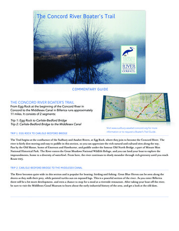
The Concord River Boater’s TrailÑSUDBURYASSABET& CONCORDWILD & SCENICRIVERSTEWARDSHIPCOUNCILCOMMENTARY GUIDETHE CONCORD RIVER BOATER’S TRAILFrom Egg Rock at the beginning of the Concord River inConcord to the Middlesex Canal in Billerica runs approximately11 miles. It consists of 2 segments:Trip 1: Egg Rock to Carlisle-Bedford BridgeTrip 2: Carlisle-Bedford Bridge to the Middlesex CanalVisit www.sudbury-assabet-concord.org for moreTRIP 1: EGG ROCK TO CARLISLE-BEDFORD BRIDGEinformation or to request a Boater’s Trail Guide.The Trail begins at the confluence of the Sudbury and Assabet Rivers, at Egg Rock, where they join to become the Concord River. Theriver is fairly slow moving and easy to paddle in this section, so you can appreciate the rich natural and cultural sites along the way.Pass by the Old Manse, home of Emerson and Hawthorne, and paddle under the famous Old North Bridge, a part of Minute ManNational Historical Park. The River enters the Great Meadows National Wildlife Refuge, and you can land your boat to explore theimpoundments, home to a diversity of waterfowl. From here, the river continues to slowly meander through rich greenery until you reachRoute 225.TRIP 2: CARLISLE-BEDFORD BRIDGE TO THE MIDDLESEX CANALThe River becomes quite wide in this section and is popular for boating, birding and fishing. Great Blue Heron can be seen along theshores as they stalk their prey, while painted turtles sun on exposed logs. This is a peaceful section of the river. As you enter Billericathere will be a bit more development, and even a chance to stop for a meal at a riverside restaurant. After taking your boat off the river,be sure to visit the Middlesex Canal Museum to learn about the early industrial history of the area, and get a look at the old dam.
CONCORD RIVER BOATER’S TRAIL COMMENTARY GUIDEPAGE 2TRIP 1. EGG ROCK TO CARLISLE-BEDFORD BRIDGE1. EGG ROCKThe Concord River begins at Egg Rock where the Sudbury andAssabet Rivers join to become the Concord River. If the currentpermits, be sure to paddle your way up to Egg Rock to read itsinscription. This is also the beginning of the Wild and Scenicsection of the Concord. A wealth of history as well as noteworthycurrent events take place on this river.This river junction provided perfect conditions for NativeAmericans to thrive off the influx of shad, eels, and alewives (alsoknown as river herring). In the late 19th century it providedthe ideal location for large holiday breakfasts, daily picnics, andcamping parties for European settlers. If you carefully observethe natural beauty around this junction, you may be lucky enoughto spot an osprey nest. In the words of Henry David Thoreau:“Concord River is remarkable for the gentleness of its current,which is scarcely perceptible it appears to have been properlynamed Musketaquid, or Meadow River, by the Indians.”2. OLD CALF PASTURE AT LOWELL ROAD BRIDGEAccess point: There is a boat ramp and parking at the Old CalfPasture Conservation Area off Lowell Road just upstream of theLowell Road Bridge.As your boat swiftly glides under the Lowell Road Bridge, try toimagine the cave made of thick stone slabs that once stood erectunder this very bridge. As George Bartlett tells us, just inside thestone cave walls resided pigs owned by some of the oldest Europeansettlers on the river.3. THE OLD MANSEThere is a dock at the boathouse of the Old Manse on the rightside of the river where you can tie up your boat if you want todisembark for a short visit.When Ralph Waldo Emerson’s grandfather, the Reverend WilliamEmerson, built this home with his own hands in 1770, he had noidea how many historically significant events would happen here.Ralph Waldo Emerson conceived his famous 1836 work Natureat the Old Manse. Nathaniel Hawthorne and Sophia Peabodybegan their marriage here in 1842, and George Bartlett initiatedhis “floats,” water sports, and river outings and wrote variousguidebooks and articles about the Concord River. Even WilliamBrewster, the first president of the Massachusetts Audubon Society(the first Audubon Society of the United States) called a portion ofthe Old Manse his home when he first arrived in Concord.If you visit the home, be sure to notice the poems that Hawthorneand Peabody inscribed on the window panes for each other, as wellas the vegetable garden that Henry David Thoreau planted for thenewlyweds. From there it is a short walk to the Old North Bridge.4. OLD NORTH BRIDGEThe Old North Bridge marks the first battle fought in theRevolutionary War, the Battle of Concord. On April 19, 1775,the first bullets were shot, and the Revolutionary War began.Dock your boat and visit the Minute Man Historical Park Visitor’sCenter to learn more.According to legend, there once existed a stone wall barrier builtbelow the waterline under the Old North Bridge. John Buttrick,Ralph Waldo Emerson, and Edmund Hosmer were said to haveconstructed the wall in order to inhibit large boats from damagingthe natural beauty of the river. Just as we hope today to keepour rivers clean and free of oil contaminants, unsafe speeds andconservation destruction, so did many others two hundred yearsago.5. THE MINUTE MAN NATIONAL HISTORICAL PARKPeople come from all over the world to visit this very place. Ifyou have time to explore the park, be sure to start at the MinuteMan National Historical Park Visitor’s Center. You will alsonotice Hawthorne’s inscription on the Daniel Chester FrenchMinuteman Statue:By the rude bridge that arched the floor,Their flag to April’s breeze unfurled,Here once the embattled farmers stood,And fired the shot heard around the world.The Park Service’s North Bridge Visitor’s Center, which was builtin 1911, is on the left of the river, past the bridge.6. FLINT’S BRIDGE (MONUMENT STREET)People come from all over the world to visit this historic place. Ifyou have time to explore the park, be sure to start at the MinuteMan National Historical Park Visitor’s Center. The Center, builtin 1911, is on the left of the river, past the bridge.ÑSUDTHE SUDBURY, ASSABET, AND CONCORD WILD AND SCENIC RIVER STEWARDSHIP COUNCILSUDBURY-ASSABET-CONCORD.ORGBURYASSABNC ET& COW ILD & ORDSC ENICRIVERSTEWAR DSCOUHIPNCIL
CONCORD RIVER BOATER’S TRAIL COMMENTARY GUIDEPAGE 37. BOUNDARY OF GREAT MEADOWS NATIONAL WILDLIFE REFUGE10. BALL’S HILLJust 1.2 miles from Egg Rock, your boat will enter the largeconservation land known as the Great Meadows National WildlifeRefuge. This land has been carefully protected since it was firstpurchased in 1928 by Samuel Hoar and later generously donatedto the U.S. Fish and Wildlife Service in 1944. Hoar workedextensively to preserve the natural habitat. He constructed dikesthroughout the marshes to protect the waterfowl’s habitat, a goalthat we are still working on today. Thanks to Hoar’s and the U.S.Fish and Wildlife’s work, you may spot or hear several waterfowlspecies throughout the Great Meadows portion of the ConcordRiver. These native birds are especially prevalent throughout thespring and fall.Ball’s Hill will soon approach on your left, half a mile downstreamfrom the Great Meadows landing. William Brewster purchasedthis land in 1891 and built a cabin on the southeast slope. WhenBenjamin Ball left this hill to fight in the Battle of Bunker Hill, helost his life in the battle and never returned.Additionally, this hill held importance for the Nipmuck NativeAmericans. Thousands of the Nipmuck’s stone weapons werediscovered here, as well as at other sites along the river banks. Thehigh elevation of the hill allowed the Nipmucks to avoid much ofthe spring flooding.11. BEAVER DAM8. GREAT MEADOWS NATIONAL WILDLIFE REFUGE LANDINGHalf a mile from the boundary of the Great Meadows NationalWildlife Refuge, you will spy a landing next to a small beach witha Great Meadows National Wildlife Refuge sign. Hidden on theother side of dense vegetation is a breathtaking view of the GreatMeadows. There are 2.5 miles of trails through the meadows andwoods which can be a nice addition to paddling the river.Thoreau took advantage of the wonder of the Great Meadows,where he enjoyed picking the pickerelweed and cardinal flowers.9. CONCORD IMPOUNDMENTSThe Concord Impoundments are home to many species of wildlife,including river otters, mink, muskrats, and white tailed deer. Thetwo impoundments are each enclosed with a man-made dike inorder to control the water level. The impoundments are similar tolakes, but are drained into the Concord River in the summertimeto allow the growth of vegetation that will provide food in the fallfor migrating waterfowl. The drawdown of the impoundmentsprovides ideal feeding grounds for shorebirds. These speciesmake the impoundments a popular spot for bird watchers. TheNorthern Harrier uses the impoundments as hunting ground.Blanding’s turtles live most of the year in the impoundmentsand nest in nearby landsWaterfowl, including mallards andwoodducks, nest here. Several species of marshbirds, including rails andbitterns, are found in the cattails within the impoundments. Manyspecies of amphibians and reptiles are active during the warmermonths.As your boat continues to gently glide through the calm currentof this river portion, be sure to look for beaver dams. If you arelucky, you may see a heron perched atop the dam or Painted turtlesresting around the sides. Beavers live all along the river, but theyare spotted more frequently closer to the Great Meadows Lake.12. CARLISLE-BEDFORD BRIDGE (END)Access Point: The Bedford Boat Ramp is just downstream of thebridge on the right bank, with ample parking and vehicle accessto Rte. 225. The Carlisle Road Bridge (Route 225) has beenreconstructed many times since Thoreau’s era when the bridgewas held up by wooden piers. The bridge marks the boundarybetween Carlisle and Bedford — the original bridge was built fromthe left by the Town of Carlisle and from the right by the Town ofBedford.Just beyond the Carlisle-Bedford Bridge, the Concord Riveropens out to what seems like a whole new river. This part of theriver is very popular for boating and fishing. Because the river isa bit wider, motorized boats and sometimes jet skis use the river.Speed limit for all boats is 10 miles per hour so they should not bedisruptive to any wildlife or paddlers.Waterfowl hunting is allowed within Great Meadows NationalWildlife Refuge from this point north to the Carlisle–Billericatown line during certain weeks in the fall. Buoys in the river markthe boundaries for hunting.Visitors to the impoundments in July might see the invasive purpleloosestrife plant or water chestnut. These plants are detrimentalto the river’s wildlife habitat. The U.S. Fish and Wildlife Service isworking to decrease the growth of these plants.ÑSUDTHE SUDBURY, ASSABET, AND CONCORD WILD AND SCENIC RIVER STEWARDSHIP COUNCILSUDBURY-ASSABET-CONCORD.ORGBURYASSABNC ET& COW ILD & ORDSC ENICRIVERSTEWAR DSCOUHIPNCIL
CONCORD RIVER BOATER’S TRAIL COMMENTARY GUIDEPAGE 4TRIP 2. ROUTE 225 TO FAULKNER DAM IN BILLERICAThe River becomes quite wide in this section and is popular for boating, birding and fishing. Great Blue Heron can be seen along theshores as they stalk their prey, while painted turtles sun on exposed logs. This is a peaceful section of the river. As you enter Billericathere will be a bit more development, and even a chance to stop for a meal at a riverside restaurant. After taking your boat off the river,be sure to visit the Middlesex canal Museum to leanr about the early industrial history of the area, and get a look at the old dam.12. CARLISLE-BEDFORD BRIDGE (START)15. RESIDENTIAL BEACHESAccess Point: The Bedford Boat Ramp is just downstream of thebridge on the right bank, with ample parking and vehicle access to Rte.225. The Carlisle Road Bridge (Route 225) has been reconstructedmany times since Thoreau’s era when the bridge was held up bywooden piers. The bridge marks the boundary between Carlisle andBedford — the original bridge was built from the left by the Town ofCarlisle and from the right by the Town of Bedford.This portion of the Concord River is characterized by residentialhomes and many man-made beaches on both banks. Between theRoute 4 and Route 3 bridges is a small island of Andover granitebedrock, which was once the northernmost part of a ancient lakeformed by glacial ice that dammed the valley.Just beyond the Carlisle-Bedford Bridge, the Concord Riveropens out to what seems like a whole new river. This part of theriver is very popular for boating and fishing. Because the river isa bit wider, motorized boats and sometimes jet skis use the river.Speed limit for all boats is 10 miles per hour so they should not bedisruptive to any wildlife or paddlers.The Route 3 Bridge ends the portion of the Concord, Assabet andSudbury rivers protected under the Wild and Scenic Rivers Act.This Act protects designated segments of the three rivers and their“outstanding resources.” The Route 3 Bridge was built near theOld Middlesex Turnpike Bridge, which has since been demolished.You’ll notice the old stone bridge abutments just after the Route 3Bridge.Waterfowl hunting is allowed within Great Meadows NationalWildlife Refuge from this point north to the Carlisle–Billericatown line during certain weeks in the fall. Buoys in the river markthe boundaries for hunting.13. TWO BROTHERS ROCKJust after the bridge, you can paddle up to the famous TwoBrothers Rock on the right shore. Governor John Winthrop andDeputy Governor Thomas Dudley used these stones to mark theirproperty boundaries in 1638. The men had many differing viewsbut always worked hard to find a common ground. Thus, to many,the rocks represent a place of genuine collaboration betweenadversaries. Two Brothers Rock is located on the Great MeadowsNWR and is now part of an historic district.14. ROUTE 4 NASHUA ROAD BILLERICAAccess Point: On the left side just upstream of the bridge, you’llfind the Billerica Motorsports and Marine’s boat ramp and dock.It is possible to launch a boat here for a small fee. Just next dooris a restaurant which is a fun spot for a quick meal along the way.On the opposite (east) side of the river, Great Meadows NWR hasa small parking area. Plans are underway to create another smallaccess area at the sewer pump station just across the street.16. ROUTE 3 BRIDGEThere is also a small trail into the woods near the bridge, whichprovides a relaxing walk.17. JUG ISLANDThoreau named this island “Jug Island” and also “Grape Island”at one point because of its abundant grapes vines. He documentedthe island in his journals and characterized it as a “fine denselywooded island surrounded by deep water and overrun by grapevines, which looked like a mass of verdure and of flowers cast uponthe waves.” The island is now owned by Sudbury Valley Trusteesand is permanently protected.18. RIVER STREET BRIDGEThe reconstruction of the River Street Bridge was completed inAugust of 2006. You may spot some bur-reed or bulrush reedshere, although these plants are often out competed by the invasivepurple loosestrife. Thoreau wrote, “Now we coasted along someshallow shore by the edge of a dense palisade of bulrushes, whichstraightly bounded the water as if a clipt by art ”The Route 4 Bridge marks a slightly more urbanized section of theConcord River.ÑSUDTHE SUDBURY, ASSABET, AND CONCORD WILD AND SCENIC RIVER STEWARDSHIP COUNCILSUDBURY-ASSABET-CONCORD.ORGBURYASSABNC ET& COW ILD & ORDSC ENICRIVERSTEWAR DSCOUHIPNCIL
CONCORD RIVER BOATER’S TRAIL COMMENTARY GUIDEPAGE 519. ROUTES 3A AND 129 BILLERICA22. FORDWAY BARAccess Point: The Route 3A Bridge in Billerica has a convenientboat access on the right bank downstream of the bridge atContribution Park, a popular spot for fishing.As your boat cruises around the rocks, you’ll soon come to a largerisland in the middle of the river called Fordway Bar.With only 1.3 miles left before the Middlesex Canal and FaulknerDam, make sure to take advantage of your time on the river andnotice the power that the gentle flow of the Concord has inbringing a sense of relaxation. If you have at least one more boatnext to you, you can recreate Bartlett’s “floats.” Simply store yourpaddles inside your boats, tie or hold your boats together, and lieback as you let the water drift your canoes and let your mind driftyour thoughts.20. BILLERICA HIGHWAY DEPARTMENTJust before a bend in the river, you’ll notice a structure left overfrom the Billerica Water Filtration Plant, now owned by theHighway and Recreation departments. A new plant has been builtacross from the Billerica Prison. The town of Billerica draws itspublic drinking water supply from the Concord River.21. POLLARD STREET BRIDGEYou’ll notice the water gaining speed as you move under thePollard Street Bridge. Enjoy this unusual current, but be careful asyou carve through the granodiorite igneous rocks scattered aboutjust beyond the bridge.Back in 1902 the State legislature voted down a bill to authorize theHarbor and Land Commissioners to spend 25,000 to cut out andremove the Fordway Bar. As you can see, the bar is still intact today.23. MIDDLESEX CANAL (END)Access Point: There are commercial parking lots bordering theriver on both sides off Faulkner Street, just before the MiddlesexCanal. The lots on your left are the easier place to take your boatout of the river. As your boat nears the Canal you will see a bayto your right blanketed with water chestnut plants. These invasiveaquatic weeds degrade the ecology of the river and efforts areunderway to control them.The 27-mile Middlesex Canal connecting the Merrimack Riverwith Boston crossed the Concord River in Billerica. It openedto barges in 1802and closed completely in 1860. The MiddlesexCanal Museum Visitor’s Center is just across the street from thecanal, open every Saturday and Sunday from 12:00 to 4:00pm(www.middlesexcanal.org). This is the last stop on the Boater’sTrail!ÑSUDTHE SUDBURY, ASSABET, AND CONCORD WILD AND SCENIC RIVER STEWARDSHIP COUNCILSUDBURY-ASSABET-CONCORD.ORGBURYASSABNC ET& COW ILD & ORDSC ENICRIVERSTEWAR DSCOUHIPNCIL
9. CONCORD IMPOUNDMENTS The Concord Impoundments are home to many species of wildlife, including river otters, mink, muskrats, and white tailed deer. The two impoundments are each enclosed with a man-made dike in order to control the water level. The impoundments are similar to lakes, but are drained into the Concord River in the summertime