Transcription
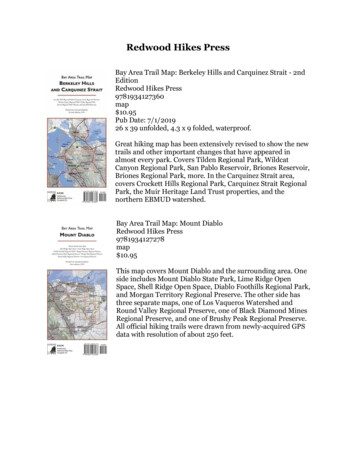
Redwood Hikes PressBay Area Trail Map: Berkeley Hills and Carquinez Strait - 2ndEditionRedwood Hikes Press9781934127360map 10.95Pub Date: 7/1/201926 x 39 unfolded, 4.3 x 9 folded, waterproof.Great hiking map has been extensively revised to show the newtrails and other important changes that have appeared inalmost every park. Covers Tilden Regional Park, WildcatCanyon Regional Park, San Pablo Reservoir, Briones Reservoir,Briones Regional Park, more. In the Carquinez Strait area,covers Crockett Hills Regional Park, Carquinez Strait RegionalPark, the Muir Heritage Land Trust properties, and thenorthern EBMUD watershed.Bay Area Trail Map: Mount DiabloRedwood Hikes Press9781934127278map 10.95This map covers Mount Diablo and the surrounding area. Oneside includes Mount Diablo State Park, Lime Ridge OpenSpace, Shell Ridge Open Space, Diablo Foothills Regional Park,and Morgan Territory Regional Preserve. The other side hasthree separate maps, one of Los Vaqueros Watershed andRound Valley Regional Preserve, one of Black Diamond MinesRegional Preserve, and one of Brushy Peak Regional Preserve.All official hiking trails were drawn from newly-acquired GPSdata with resolution of about 250 feet.
Bay Area Trail Map: Mount TamalpaisRedwood Hikes Press97819341273392 pagesmap 10.95This map covers all of Marin County's parks except for the PointReyes and Novato areas. One side shows the Marin Headlands,Mount Tamalpais, and Muir Woods, with an inset of China CampState Park; the other side shows the Marin Municipal WaterDistrict's Mount Tamalpais Watershed, Pine Mountain, the SanGeronimo Valley, Samuel P. Taylor State Park, and Lucas Valley.All official hiking trails were drawn from newly-acquired GPSdata with a resolution of about 100 feet.Bay Area Trail Map: Oakland Hills and Pleasanton Ridge - 2ndEditionRedwood Hikes Press9781934127377map 10.95Pub Date: 7/1/201926 x 39 unfolded, 4.3 x 9 folded, waterproof.Great hiking map has been extensively revised to show the newtrails and other important changes that have appeared in almostevery park. Covers the central section of the East Bay Hills,currently the only comprehensive trail map of this region. Oneside includes Redwood Regional Park, Anthony ChabotRegional Park, Lake Chabot Regional Park, Las TrampasRegional Wilderness, and the southern EBMUD watershed. Theother side has Garin and Dry Creek Pioneer Regional Parks, theHayward Greenbelt, Dublin Hills Regional Park, and PleasantonRidge Regional Park.
Bay Area Trail Map: Point ReyesRedwood Hikes Press9781934127346map 10.95This detailed trail map of Point Reyes is drawn at asignificantly larger scale than other printed trail maps ofthe area. One side shows the southern half of the park fromBolinas to Inverness; the other side shows the northernhalf from the Laguna Trailhead to Tomales Point.Bay Area Trail Map: Skyline Ridge - 3rd editionRedwood Hikes Press97819341273151 pagesmap 10.95This map covers in detail the many regional parks in thehills above Woodside, Palo Alto, Portola Valley, Los Altos,and Cupertino. Besides full coverage of hiking trails, nearlyall local roads are shown so that hikers can find their way toall available trailheads. For example, the map shows backentrances to Rancho San Antonio County Park that aren’tshown on the official map. It also shows how the trails ofneighboring parks connect to each other, making it mucheasier to plan longer hikes. All official hiking trails weredrawn from newly-acquired GPS data with a resolution ofabout 250 feet.
Henry Cowell, Wilder Ranch and Nisene Marks Map - 2ndEditionRedwood Hikes Press9781934127049map 7.95Map scale is 1:25,000. This map covers the trails of the SantaCruz area. One side includes Henry Cowell Redwoods StatePark, Wilder Ranch State Park, Pogonip, and the Universityof California at Santa Cruz. The other side has the Forest ofNisene Marks State Park and Soquel Demonstration StateForest. Most roads are shown and labeled. Wooded areas areindicated in green, old growth redwoods in dark green, anddeveloped areas in grey. Forty foot contour lines are shownand trail distances are marked. (This map is an enlarged andrevised version of San Lorenzo Valley, first edition).Humboldt Redwoods State Park - 3rd editionRedwood Hikes Press97819341273531 pagemap 10.95Humboldt Redwoods includes some of the world's mostimpressive redwood groves. This map covers the entire park,including the Rockefeller Forest, which is the largestremaining stand of old-growth redwoods and has beencalled the world's tallest forest; the Avenue of the Giants, a30-mile road through the Eel River valley and one of thebest-known redwood attractions; and the extensivebackcountry. Three smaller neighboring parks are alsoincluded. Printed on waterproof plastic. 1:25,000 scale, 26 x39, full color on both sides. Third edition, 2017.
Muir Woods National Monument Annotated Trail MapRedwood Hikes Press97819341270321 pagesmap 6.95Because it s only a few minutes drive from the Golden Gate,Muir Woods is the world s most-visited redwood park and is afavorite destination for visitors to San Francisco. Includesphotos, brief descriptions, and elevation profiles of eight hikes.Full color on both sides.Portola Redwoods and Pescadero Creek - 4th editionRedwood Hikes Press9781934127056map 7.95Pub Date: 2016Full-color map printed both sides, 2 1 mile, 40-foot contourlines,4 x 9 folded, 28 x 18 unfolded. Fourth edition, Waterproofstock.This is the only trail map that shows the interconnected trailsystems of Portola and Pescadero parks on a single sheet. Thefront of the map shows Portola Redwoods State Park, PescaderoCreek County Park, Sam McDonald County Park, MemorialCounty Park, and Heritage Grove. Three Skyline Ridge parks arealso included: Long Ridge, Upper Stevens Creek, and SkylineRidge. The back of the map has enlargements of central PortolaRedwoods, Sam McDonald, and Memorial parks, as well as amap of the coastline around the town of Pescadero, includingSan Gregorio, Pomponio, Pescadero, and Bean Hollow StateBeaches. Most roads are shown and labeled. Wooded areas are indicated in green, oldgrowth redwoods in dark green, and developed areas in grey. Trail distances are clearlymarked on the map.
Redwood National and State Parks: North 5TH EDITIONRedwood Hikes Press978193412738484 pagesmap 10.95Pub Date:Folded size: 9 x 4.3. Unfolded size: 26 x 39 Scale: 1:25,000.Approximately 2.5 represent one mile. Printed both sides infull color.With its vast stands of lush old-growth redwoods, miles ofpristine beaches, and glittering redwood-lined creeks,Redwood National and State Parks is the world’s best redwoodhiking destination. Half of a two map set that covers theentire park, this map covers all of Jedediah Smith RedwoodsState Park, Del Norte Redwoods State Park, and Prairie CreekRedwoods State Park. It is the only commercially-available map to include theapproximately 50 miles of new multi-use trails in the Mill Creek Watershed of DelNorte Redwoods State Park.Redwood National and State Parks: South 5TH EDITIONRedwood Hikes Press978193412739184 pagesmap 10.95Folded size: 9 x 4.3. Unfolded size: 26 x 39 Scale: 1:25,000.Approximately 2.5 represent one mile. Printed both sides infull color.Redwood National and State Parks is the world’s bestredwood hiking destination. Half of a two-map set that coversthe entire park, this map covers the the main body ofRedwood National Park and Humboldt Lagoons State Park.Elevation profiles for many trails throughout RedwoodNational and State Parks are also included. This is the largestscale and most detailed map of Redwood National Parkcurrently available for purchase. Now printed on waterproofplastic stock for strength and durability.
Sequoia and Kings Canyon National Parks: Generals HighwayRedwood Hikes Press9781934127223map 7.95Pub Date: 2013Bored Feet Maps. 9.2 x 4.3 folded, 27 x 39 unfolded, scale1:25,000 or 2.5 inches represents one mile, 40-foot contours,70 lb. matte coated paper, full color on both sides.This topographic trail map covers the most popular day hikingareas of Sequoia and Kings Canyon National Parks. It isorganized around the Generals Highway, the main connectorbetween the two sister parks. A key feature of the map is that itshows and names all the Sequoia groves of the area, both thepopular groves with road and trail access and the remotegroves with no trail accessOlaf Palm: A Life in ArtThomas, Irene D.Redwood Hikes Press9780972569514144 pagespaperback 35Pub Date: 200510 x 10, full-color cover, 188 full-color reproductions ofpaintings, 10 black & white photographs, 9 pen & inksketches by the artist, index of paintings.Lavishly illustrated biography of West Coast artist Olaf Palm (1935-2000) collects abroad sample of his diverse works, with excerpts from his journals and letters, plusreminiscences of some who knew and loved him. While Palm chose the Mendocinocoast as home, his canvas was far larger, chronicling his roots in the sixtiescounterculture and the preoccupations of the rural West and the back-to-the-landmovement. Palm’s influences were Old Masters such as Rembrandt and Vermeer,successfully merged with American Realism and European Impressionism. Includes averbal portrait of the artist as he painted, written by his lifelong friend, novelist JamesD. Houston.Irene D. Thomas taught English, Linguistics and Education at several California StateUniversity campuses, then made a second career in educational publishing.
favorite destination for visitors to San Francisco. Includes photos, brief descriptions, and elevation profiles of eight hikes. Full color on both sides. Portola Redwoods and Pescadero Creek - 4th edition Redwood Hikes Press 9781934127056 map 7.95 Pub Date: 2016 Full-color map printed both sides, 2 1 mile, 40-foot contour


![[1] - nonoise](/img/32/redwood-20city-20california.jpg)
