Transcription
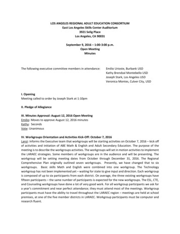
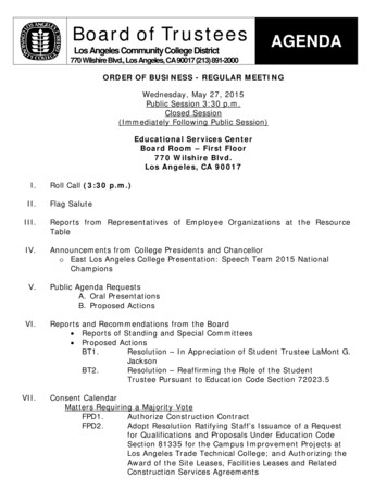
VENICECommunity PlanTABLE OF CONTENTSACTIVITY LOGCOMMUNITY MAPSCOMMUNITY PLANI.IntroductionII.Function of the Community PlanIII.Land Use Policies and ProgramsIV.Coordination Opportunities for Public AgenciesV.Urban DesignLand Use DiagramAppendix A - Landmarks per Venice Historic Sites Survey Report of 1990Appendix B - Programmed ArterialImprovementswww.lacity.org/PLN (General Plans)A Part of the General Plans - City of Los Angeles
VENICEACTIVITY LOGADOPTION DATESept. 29, 2000ADOPTIONSept. 7, 2016PLANVenice Community Plan UpdateAMENDMENTMobility Plan 2035 UpdateCPC FILE NO.97-0047 CPUCPC FILE NO.CPC-2013-910-GPA-SPCA-MSCCOUNCIL FILE NO.2000-1505COUNCIL FILE NO.15-0719
VENICECommunity PlanChapter IINTRODUCTIONCOMMUNITY BACKGROUNDPLAN AREAThe Venice Community Plan Area contains approximately 2.061 acres,representing 0.7 percent of the land in the City of Los Angeles. Located inthe western portion of Los Angeles, it contains the world famous VeniceBeach and Boardwalk that stretch from Marina Court on the north to YawlStreet on the south. The Plan Area is bounded to the north by Marine Courtand Dewey Street, adjoining the City of Santa Monica. It extends in anirregular fashion from the Pacific Ocean eastward to Walgrove Avenue,Beethoven Street and Del Rey Avenue bordering the Palms-Mar Vista-DelRey Community Plan Area, parts of Culver City and Los Angeles CountyMarina Del Rey.The majority of the Venice Community Plan Area, approximately 85 percent,that extends from the Pacific Ocean to Lincoln Boulevard, lies within theCalifornia Coastal Zone and is thus subject to the provisions of the CoastalAct of 1976. The Venice Coastal Zone has been divided into eight subareasfor planning purposes, including: Oakwood-Millwood-Southeast Venice, NorthVenice, Venice Canals, Marina Peninsular, Ballona Lagoon East and West,Silver Strand, and Oxford Triangle subareas.The predominant land use in the community is residential. Most of the lowdensity residential development is located east of Lincoln Boulevard, in theOxford Triangle and in the western portion of the Southeast Venice subarea.The majority of the multi-family development of medium and high mediumdensity is located west of Lincoln Boulevard to the coastline and south ofWashington Boulevard within the Marina Peninsula.Approximately 7 percent of the land is designated for commercial uses. Themajority of commercial facilities are small-scale in character and serve thelocal population. A more intense commercial area is located on the westernedge of the community adjoining Lincoln Boulevard and within the OxfordTriangle area. It contains movie theaters, a large hotel, and a variety ofrestaurants and other retail uses. The remainder of the commercial uses aregenerally located at street intersections as in around the Windward Circleand along boulevardslike Lincoln Boulevard which is an auto-orientedcommercial strip.VENICEI-1
Of the Community’s total area, approximately 3 percent is designated formanufacturing and industrial uses. The majority of this land is concentratedon both sides of Venice Boulevard, and extends one block east of AbbotKinney Boulevard. Other concentrations of industrial and light manufacturingdesignated land uses are found along Main Street, from Abbot KinneyBoulevard to Dewey and Navy Streets.COMMUNITYPARTICIPATIONThe State of California requires citizen participation in the preparation of theGeneral Plan. Government Code Section 65351 reads, "During thepreparation or amendment of the General Plan, the planning agency shallprovide opportunities for the involvement of citizens, public agencies, publicutility companies, civic education, and other community groups throughpublic hearings and any other means the city or county deems appropriate."Community participation occurred through an open house and the publichearing process. Community members assisted in identifying major issuesand formulating land use policies and objectives to be contained in the VeniceCommunity Plan.COMMUNITY ISSUESANDOPPORTUNITIESThe following planning and land use issues and opportunities have beenidentified in the Venice Community plan area and form the basis for thepolicies and programs listed in Chapter III.RESIDENTIALIssuesCNeed to maintain the low-density character of single-familyneighborhoods and protect them from incompatible uses.CPreservation of residential neighborhoods and provision of more affordablehousing.CLack of transition in scale, density and character of multiple-familyhousing and commercial uses adjacent to single-family homes.CLack of adequate parking, usable open space and recreational areas inmultiple-family housing.CNeed to improve the visual environment of multiple-family dwellingsthrough the development of appropriate design criteria and landscaping.CNeed to promote rehabilitation of residential areas and improve qualityof housing in some parts of the plan area.CCoordination of new development with the availability of publicinfrastructure.CProliferation of illegal additions of dwelling units to areas zoned for singlefamily use.VENICEI-2
Private residential encroachments into the public rights-of-way. Illegal conversion of residential uses to commercial uses.OpportunitiesCOMMERCIALCModerately priced housing on the westside and relatively smog free, mildclimate.CProximity to ocean amenities, airports and major universities.CPotential for residential and mixed use development along commercialcorridors.CA diverse community that is socially and economically vibrant withunique architectural and historical characteristics.IssuesCLack of cohesiveness and continuity of complementary uses alongcommercial frontages.CUnsightly strip commercial development such as Lincoln Boulevard withpoor visual identity, lack of adequate parking and convenient access andoriented to pass-through traffic rather than to neighborhood andpedestrian traffic.CProliferation of out-of-scale signs including billboards, roof and wall signsand sandwich board signs on sidewalks.CUnsightliness of new construction such as mini-malls due to the lackof landscaping, architectural character and parking.CInadequate transition between commercial and residential uses.OpportunitiesCDevelop a distinctive character and cohesive visual identity for thecommunity through the upgrade of commercial areas, especially at theentry points on major streets of Venice and Washington Boulevards,Rose Avenue and around Windward Circle. Establish street identity and character on Venice and WashingtonBoulevards adjoining Culver City, through the provision of pedestrianoriented amenities and street scape improvements that would unify thestreet and attract pedestrian and business patronage. Physical improvement of commercial buildings by incorporatingappropriate design criteria and landscaping to promote a healthy retailenvironment.VENICEI-3
INDUSTRIAL Potential for mixed-use on Venice and Washington Boulevards and RoseAvenue to encourage pedestrian activity, reduce traffic circulation andcongestion, invigorate commercial areas and increase their viability. Promote existing commercial areas on Abbot Kinney Boulevard betweenVenice Boulevard and Main Street as an artcraft center. Encourage abroad range of community serving commercial uses and services. Promote beach-oriented and visitor-serving commercial activities andother coastal-dependent uses.IssuesCNeed to maintain the industrial employment base. Need to protect residential areas from possible detrimental effects ofindustrial activities. Inadequate buffering and landscaping in industrial areas.OpportunitiesTRANSPORTATIONCClose proximity of artists to small industrial uses can facilitate creativitybetween the two users. Proximity to the new Playa Vista project may attract additionalmedia/entertainment and high-tech firms to the area. Proximity to Marina Del Rey may attract recreational boat building andother marine related industries.IssuesCInadequate transportation linkages between residential areas andcommercial, retail and recreation facilities within Venice. Inadequate transit feeder services from residential neighborhoods tomajor transportation corridors. Inadequate automobile alternatives such as rail, bus service and streetsor paths which encourage biking and walking. Congestion caused by through traffic from outside the community. Inadequate parking for beach visitors during the peak tourism season. Unsightly and generally outdated infrastructure such as above groundutility poles and lines along Lincoln Boulevard.VENICEI-4
OpportunitiesRECREATION, PARKS,AND OPEN SPACECFuture study of a minibus or circulation system which links residentialareas with employment, commercial, retail, institutional and recreationalareas. Improved and expanded bicycle lanes coordinated with systems inadjacent communities and with special attractions such as the beachand shopping centers. Neighborhood shopping centers and mixed-use developments whichwould encourage walking and reduce traffic congestion and air pollution. Existing walk streets within the Venice Coastal Zone Community shouldbe protected and adequately maintained. Properties designated for Low-Medium II Residential uses lying westerlyof Speedway and northerly of Washington Boulevard may also be usedfor parking as an alternative use when authorized by the ZoningAdministrator under the Conditional Use provisions of the Planning andZoning Code. Funds collected in the Beach Impact Parking Trust Fund may be usedto build parking structures at strategic locations. Developer fees collected under the Coastal Corridor TransportationSpecific Plan may be expanded to improve signalization and other streetimprovements to ameliorate circulation within Venice. The Lincoln Corridor Task Force is preparing a comprehensive study oftraffic and streetscape improvements for Lincoln Boulevard.IssuesCPublic facilities within the community such as parks, libraries andcommunity centers are generally inadequate to address the needs of thecommunity residents. Protection of existing natural and recreational resources, includingVenice Beach, Ballona Lagoon, and Grand and Venice Canals.OpportunitiesCAcquisition, expansion and improvement of local parks within thecommunity should be facilitated by the availability of additional fundingsources. Possibility of multi-purpose use of existing public facilities. Improvement to the Beach recreation area following the demolition of theVenice Pavilion.VENICEI-5
MAJOROPPORTUNITY SITESRestoration of the Venice Canals and improvement of the lagoon andcanals banks and bridges would preserve this unique communityresource.Except for the Metropolitan Transportation Authority (MTA) bus maintenanceyard located at Main Street and Sunset Avenue, there is a lack of large andvacant parcels in the community with significant development potential.Many changes are likely to occur from modification or adaptive reuse ofbuildings. The majority of new development is expected to be small scalesince existing regulations prohibit land assembly of more than two parcels,particularly in the Coastal Zone.COMMUNITY PROFILEThe community profile provides an overview of population, housing, and sociodemographic characteristics of the Venice Community Plan Area andcompares it to the rest of the City. The following tables contain the statisticaldata for previous census dates and rates of growth.VENICEI-6
Chapter IIFUNCTION OF THE COMMUNITY PLANSTATUTORY REQUIREMENTSCalifornia State law (Government Code Section 65300) and the City of LosAngeles City Charter (Section 96.5) require that the City prepare and adopta comprehensive, long-term general plan for its development. It must containseven mandatory elements including land use, circulation, housing,conservation, open space, noise and safety. California State law requiresthat the Land Use Element be prepared as part of a city’s general plan andthat it correlate with the Circulation Element. In the City of Los Angeles, thethirty-five Community Plans comprise the Land Use Element and containpolicy and standards for each geographically distinct area.The Land Use Element has the broadest scope of the General Plan Elementsrequired by the State, since it regulates how land is to be utilized. Many ofthe issues and policies contained in all other plan elements are impactedor have an impact on this element.Government Code Section 65302(a) requires that land use elementsdesignate the proposed general distribution and general location and extentof the land uses for housing, business, industry, open space (includingagriculture, natural resources, recreation and enjoyment of scenic beauty),education, public buildings and grounds, solid waste disposal facilities andother categories of public and private land uses. The land use element isalso required to include a statement of the standards of population densityand building intensity recommended for the various communities and otherterritory covered by the plan.The Venice Community Plan is a part of the General Plan of the City of LosAngeles. It consists of this text and the accompanying map. TheCommunity Plan text states goals, objectives, policies, and programs. TheCommunity Plan map outlines an arrangement and intensities of land uses,the street system and the locations and characteristics of public servicefacilities.ROLEOF THECOMMUNITY PLANThe General Plan is the fundamental policy document of the City of LosAngeles. It defines the framework by which the City’s physical and economicresources are to be managed and utilized over time. The plan guides the Cityin the use of its land, design and character of buildings and open spaces,conservation of existing and provision of new housing, provision of supportinginfrastructure and public services, protection of environmental resources andprotection of residents from natural and other known hazards.Community Plans are intended to promote an arrangement of land uses,streets and services which will encourage and contribute to the economic,VeniceII-1
social and physical health, safety, welfare and convenience of the people wholive and work in the community. The Plans also guide development byinforming the general public of the City’s goals, policies and developmentstandards with the objective of creating a healthy and pleasant environment.Goals, objectives, policies and programs are created to meet the existingand future needs of the community through the year 2010. The Plans areintended to coordinate development among the various parts of the City ofLos Angeles and adjacent municipalities in a fashion both beneficial anddesirable to the residents of their communities and compatible withinfrastructure and public services.The General Plan expresses the City’s intentions with respect to the rightsand expectations of the general public, property owners, and prospectiveinvestors, business interests, and community-based organizations. Throughthe Community Plan, the City can inform these groups of its goals, policiesand development standards, thereby communicating what is expected of theCity government and private sector to meet its objectives.The Community Plan allocates sufficient land in the community for housing,commercial, employment, educational, recreational, cultural and social uses.The Plan identifies and provides for the maintenance of any significantenvironmental resources within the community. It also seeks to enhancethe distinctive community identity and recognizes its unique neighborhoods.PURPOSEOF THECOMMUNITY PLANThe last comprehensive review of the Venice Community Plan was completedMarch 22, 1976, and has been subsequently revised through the General PlanConsistency Program and Periodic Plan Review and other Plan amendments.Since that time, considerable growth has occurred, new issues haveemerged, and new community objectives regarding the management of newdevelopment and community preservation have evolved. Consequently, it isnecessary to update the Community Plan not only to reflect currentconditions, but to accurately reflect the prevailing visions and objectives ofthe area’s residents and property and business owners.The Venice Community Plan is consistent with the Venice Local CoastalProgram, complements it and integrates its policies and implementationprograms as they apply to the Venice Coastal Zone in compliance with theprovisions and requirements of the California Coastal Act of 1976.The Community Plan sets forth goals and objectives to maintain thecommunity's distinctive character by: Providing a guide for the orderly and balanced development of Venice,designating and generally locating land uses and public facilities in thequantities and at the densities which will accommodate population andactivities projected to the year 2010. Coordinating the planning of Venice with that of other parts of the Cityof Los Angeles, with the adjacent Cities of Santa Monica and Culver City,and with the County of Los Angeles Marina Del Rey.VeniceII-2
ORGANIZATIONAND Preserving and enhancing the low-density character of residential areasto maintain the variety of the residents’ lifestyles. Preserving and promoting existing uses, particularly small businessesand artisan which characterize Venice various neighborhoods. Promoting the economic health, convenience and general welfare of thecommunity. Preserving open space, particularly the coastal zone, giving dueconsideration to private property rights, and develop recreational facilitiesfor the enjoyment of both local residents and persons living throughoutthe Los Angeles region. Supporting the development of an integrated and balanced transportationsystem, utilizing all appropriate public and private modes, to meet thetransportation and recreation needs of the community and of thesurrounding area. Where possible, this should be accomplished bymeans that do not require the widening and realigning of streets, suchas the short-term improvement of public transportation and improvedsignalization. Guiding the location and programming of public services and utilities toadequately meet the future needs of the community. Guiding development and use of lands and waters located within theCoastal Zone consistent with the provisions of the California Coastal Actof 1976.CONTENTOF THECOMMUNITY PLANThis Plan sets forth goals, objectives, policies, and programs that pertain tothe Venice Community. Broader issues, goals, objectives, and policies areprovided by the Citywide General Plan Framework Element and otherapplicable citywide Elements.The Plan is organized and formatted to facilitate periodic updates. The Staterecommends that a plan be comprehensively reviewed every five years toreflect new conditions, local attitudes, and technological advances.The principal method for the implementation of the Land Use Map is theZoning Ordinance. The City's Zoning Map must be updated to remainconsistent with the adopted Land Use Map. Together, the Zoning Ordinanceand the Zoning Map identify specific types of land use and developmentstandards applicable to specific areas and parcels of land within thecommunity. The Venice Coastal Zone area is further regulated by the LocalCoastal Program Land Use Plan adopted by City Council on October 29,1999, and other applicable specific plans.VeniceII-3
RELATIONSHIP TO OTHER GENERAL PLAN ELEMENTSThe Community Plan includes appropriate policies and implementationmeasures generated from the mitigation measures listed in the environmentalclearance. In many instances these measures encompass the policiescontained in the General Plan Framework Element.The City of Los Angeles is responsible for revising and implementing itsGeneral Plan. State law requires that the General Plan an internalconsistency. The Venice Community Plan, a portion of the City’s Land UseElement, must be consistent with other elements and components of theGeneral Plan.The General Plan Framework is a long range, citywide, comprehensive growthstrategy. It is a special element of the General Plan which plans for the futureas required by law and replaces Concept Los Angles and the Citywide Plan(adopted in 1974). Therefore, the Framework Element looks at the City asa whole and provides a citywide context within which local planning takesplace. It discusses both the benefits and challenges of growth.Because it takes a citywide perspective, the Framework Element cannotanticipate every detail. The Community Plans must be looked to for finaldeterminations as to boundaries, land use categories, intensities, and heightthat fall within the ranges described by the Framework. The FrameworkElement neither overrides nor supersedes the Community Plans. It guidesthe city’s long range growth and development policy, establishing citywidestandards, goals, policies, and objectives for citywide elements andCommunity Plans. The Framework Element is flexible, suggesting a rangefor uses within its land use definitions. Precise determinations are made inthe Community Plans.The General Plan Framework Element projects the following population,housing and employment levels for the Venice Plan area for the year 2010:Population (2010) ProjectionEmployment (2010) Projection:Housing (2010) Projection46,19816,57524,632These numbers are provided as reference during the Community Plan Updateprocess and are best estimates that are derived from regional data which aredisaggregated to the city and then to the community level. Population,employment and housing could grow more quickly or slowly than anticipateddepending on economic trends.Regional forecasts do not generally reflect the adopted Community Plan landuse capacity or build-out estimate from planned land use. Plan capacity orbuild-out is also an imprecise estimate and depends on specific assumptionsabout future development density and household size, which may vary fromwhat actually occurs. Community Plan capacity does not include housinglocated within commercial districts nor the current residential vacancy rate.VeniceII-4
In addition to the seven State mandated elements, the City's General Planincludes a Service System Element, a Cultural Element, a Major PublicFacilities Element and an Air Quality Element. All the provisions andrequirements of these elements apply to the Venice Community Plan.There are also other types of plans such as specific plans or neighborhoodplans which set detailed policy and development regulations for uniqueneighborhoods within a community. In addition to these specific plans, thereare overlay zones which combine policy and implementation functions toaddress issues specific to a neighborhood.PLAN CONSISTENCYEach plan land use category within a Community Plan indicates thecorresponding zones permitted, unless it is restricted by the plan text,footnotes, adopted specific plans or other specific limitations set bydiscretionary approvals. The residential densities, commercial and industrialintensities depicted on the Community Plan Map are theoretical and will notoccur due to Plan and zone restrictions, economic conditions, and designlimitations.The Community Plan permits all corresponding zones designated with eachplan category and also zones which are more restrictive, as referenced inSection 12.23 of the Los Angeles Municipal Code (LAMC). Any subsequentaction or monitoring review that modifies the Plan must be accompanied bynew consistency findings.City actions on most discretionary approval projects require a finding that theaction is consistent or in conformance with the General Plan. Discretionaryapproval on projects in the Venice Community Plan area will require thedecision-maker to refer to the additional programs, policies or objectivescontained in Chapter III of the Plan Text. To further substantiate theconsistency findings, decision-makers may cite other programs, policies,or objectives which would be furthered by the proposed project. In addition,Chapter V of the Plan requires a decision-maker to make a finding ofconformance with applicable design standards for discretionary projects.PLAN MONITORINGThe Plan has a land use capacity greater than the projected developmentlikely to occur during the Plan period. During the life of the plan, growth willbe monitored and reported in the City’s Annual Report on Growth andInfrastructure, regularly submitted to the City Planning Commission, Mayor,and City Council. In the fifth year following Plan adoption (and every fiveyears thereafter), the Director shall report to the Commission on therelationship between population, employment, and housing growth and plancapacities. If growth has occurred faster than projected, a revisedenvironmental analysis will be prepared and appropriate changesrecommended to the Community Plan and zoning. These Plan and zoningchanges and any related moratoria or interim control ordinances, shall besubmitted to the Planning Commission, Mayor, and City Council as specifiedin the Los Angeles Municipal Code (L.A.M.C.).VeniceII-5
Chapter IIILAND USE POLICIES AND PROGRAMSChapter III of the Plan Text Contains goals, objectives, policies, and programsfor appropriate land use issues, such as residential, commercial, industrial,public and institutional service system categories. The Planning Departmenthas authority over the goals, objectives, policies, and the initiation and directimplementation of the programs contained in Chapter III.RESIDENTIALThe quality of life and stability of neighborhoods throughout the VeniceCommunity Plan Area critically depends on providing infrastructure resources(i.e., police, fire, water, sewage, parks, traffic circulation, etc.) commensuratewith the needs of its population. If population growth occurs faster thanprojected and without needed infrastructure improvements to keep pace withthat growth, the consequences for livability within Venice could beproblematic.Accordingly, the proposed Plan has three fundamental premises. First, islimiting residential densities in various neighborhoods to their prevailingdensity. Second is the monitoring of population growth and infrastructureimprovements through the City’s Annual Report on Growth and Infrastructurewith a report to the City Planning Commission every five years on the VeniceCommunity following Plan adoption. Third, if this monitoring finds thatpopulation in the Plan area is occurring faster than projected; and thatinfrastructure resource capacities are threatened, particularly criticalresources such as water and sewage; and that there is not a clearcommitment to at least begin the necessary improvements within twelvemonths; then building controls should be put into effect, for all or portionsof Venice Community, until land use designations for the Venice CommunityPlan and corresponding zoning are revised to limit development.The Community Plan includes appropriate policies and implementationmeasures generated from mitigation measures listed in the environmentalclearance. In many instances, these measures encompass the policiescontained in the General Plan Framework Element.According to the 1990 Census, the Plan area’s population amounts toapproximately 40,040 persons. This population ethnic mix consists of 64percent Caucasian (non-Hispanic), 24 percent Hispanic, eight percentAfrican-American, three percent Asian, and less than one percent NativeAmerican.The 1990 Census indicates that the Plan area contains a total of 21,844housing units. About a third, or 7,222 units, consists of single-familydwellings, and 14,622 units are multi-family dwellings. Most of the housingstock is well maintained, but relatively old with approximately 41 percent ofthe housing in the community over fifty years old. Due to the lack of availablevacant land for new construction, most new housing is created bydemolishing older units and building new ones. As reported in the AnnualReport on Growth and Infrastructure, about 200 housing units, mostly inVENICEIII-1
multi-family structures, were added to the housing stock between the 1990-96years.Less than half of the Venice Community Plan area, or 918 acres isdesignated for residential use. Residential land use consists of 335 acresdesignated as Low Density Residential, or approximately 36 percent of thetotal residential land use; 133 acres as Low Medium I Density Residential,or approximately 15 percent; 332 acres of Low Medium II Density Residential,or approximately 36 percent; 111 acres of Medium Density Residential, orapproximately 12 percent; and 7 acres of High Medium Residential, or lessthan one percent. The average net density for all housing types isapproximately 20 units per acre.Areas designated for Low Density Residential land use are concentrated inthe eastern portion of the community plan area, east of Lincoln Boulevardin the Oxford Triangle subarea; in part of Southeast Venice, west of AbbotKinney Boulevard; and in the Silver Strand subarea. Other single-familyresidential development is found in areas designated as Low Medium IDensity, mostly along the canals in the Coastal Zone. Multi-family residentialdevelopment characterizes most of the residentially designated land in theLow Medium I and II categories in the North Venice, Oakwood-MilwoodSoutheast Venice, and Ballona Lagoon Subareas.Higher densityresidentially designated land uses are concentrated along b o u l e v a r d s ,such as Washington and Venice Boulevards and in the eastern portion ofthe Silver Strand Subarea. Higher density residentially designated land usesare also found east of Lincoln Boulevard, in the Lincoln Place residentialneighborhood bounded by Lake Street and Palms Boulevard, as well asalong Penmar Avenue.As a result of prior development and changes in land use, there has emergeda blend of residential uses of various intensities, commercial uses and someminor industrial uses. Housing is located in single-family homes, multi-familydwellings, and mixed use structures. Some areas that include live/work artiststudios and workshops are desig
VENICE ACTIVITY LOG ADOPTION DATE Se pt. 29, 000 ADOPTION PLAN Venic eCommunity Plan Udat AMENDMENT CPC F LE NO. 2 9 7-004 CP CPC F LE NO. COUNCIL ILE NO. 000-1505 COUNCIL ILE NO. I F F I Sept. 7, 2016 Mobility Plan 2035 Update CPC-2013-910-GPA-SPCA-MSC 15-0719
