Transcription
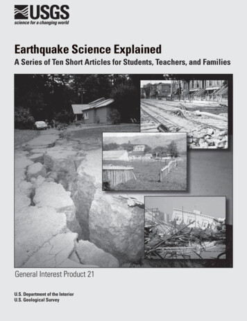
Earthquake Science ExplainedA Series of Ten Short Articles for Students, Teachers, and FamiliesGeneral Interest Product 21U.S. Department of the InteriorU.S. Geological Survey
Earthquake Science ExplainedA Series of Ten Short Articles for Students,Teachers, and FamiliesCompiled by Matthew A. d’AlessioThe features in this booklet originally appeared in the San Francisco Chronicle from September 12 to November 14, 2005, as part of that newspaper’s Chronicle in Education program—aprogram to distribute newspapers free to classroom teachers and encourage their use as acurriculum resource. For information go Edulndex.aspor call 1-800-499-5700 extension 6828Contributions by:Matthew d’Alessio, Mehmet Çelebi, Eric Geist, Russell Graymer, Jeanne Hardebeck,Thomas Holzer, Jessica Murray, Ann Rosenthal, John Solum, Heidi StennerNewspaper activities by:Elizabeth Coleman (San Francisco Chronicle)Edited by:Matthew d’Alessio, Mary Lou Zoback, and nearly two dozen members of the U.S. GeologicalSurvey’s Earthquake Hazards TeamGeneral Interest Product 21U.S. Department of the InteriorU.S. Geological Survey
U.S. Department of the InteriorGale A. Norton, SecretaryU.S. Geological SurveyP. Patrick Leahy, Acting DirectorU.S. Geological Survey, Reston, Virginia: 2006Available from U.S. Geological Survey Information ServicesBox 25286, Denver Federal CenterDenver, CO 80225This report and any updates to it are available online at:http://pubs.usgs.gov/gip/2006/21/For additional information write to:U.S. Geological SurveyBox 25046, Mail Stop 421, Denver Federal CenterDenver, CO 80225–0046Additional USGS publications can be found at:http://geology.usgs.gov/products.htmlFor more information about the USGS and its products:Telephone: 1–888–ASK–USGS (1–888–275–8747)World Wide Web: http://www.usgs.gov/Any use of trade, product, or firm names in this publication is for descriptive purposes only and does not implyendorsement of the U.S. Government.Cataloging-in-publication data are on file with the Library of Congress (URL http://www.loc.gov/).Produced in the Western Region, Menlo Park, CaliforniaManuscript approved for publication, January 4, 2006Text edited by Peter StaufferLayout and design by Susan Mayfield and Matthew A. d’Alessio
iiiA Message from the Director,U.S. Geological SurveyRecent images of massive earthquake-inducedwaves washing away entire towns or buildings reducedto rubble by the violent shaking of Earth’s crustal plateshave underlined, all too painfully, the importance ofunderstanding our dynamic and ever-changing Earth.These natural earthquake hazards will always be withus, but the consequences are not inevitable—if we prepare for them. An essential part of that preparation iseducation. Education is the key to ensuring that peopletake appropriate actions when living in earthquakeprone areas and for supporting policies and decisionsthat will save lives and property.Director Leahy with instruments at USGSheadquarters that record seismic wavesfrom earthquakes around the globe.Earthquake Science Explained is a series of short articles for students, teachers, and parentsoriginally published as weekly features in The San Francisco Chronicle. This U.S. GeologicalSurvey General Information Product presents some of the new understanding gained and scientific advances made in the century since the Great 1906 San Francisco Earthquake. Conceptsintroduced in each feature are designed to address State and national science-education standards. Written by our scientists, the articles go beyond traditional textbook information to discussstate-of-the-art thinking and technology that we use today.I encourage you to explore this informative publication as well as the U.S. Geological Survey’sscience education Web site at http://education.usgs.gov/, and I further invite you to become ourlong-term partners exploring the full range of our science for a changing world.P. Patrick Leahy
ivContents[The articles in the series correlate with the State of CaliforniaScience Content Standards, as noted in brackets]Articles*Feature 1 The Earthquake Machine: What 1906 taught us about how earthquakes work .1By Matthew d’Alessio[Grade 6, Sc. 1—Major geologic events, such as earthquakes, volcaniceruptions, and mountain building, result from plate motions.]Feature 2Seismograms: Earthquake Fingerprints .2By Jeanne Hardebeck[Grade 6, Sc. 1g—How to determine the epicenter of an earthquake and theeffects of an earthquake on any region vary, depending on the size of the earthquake, the distance of the region from the epicenter, and the local geology.]Feature 3Find the Fault: Recognizing active faults .3By John Solum and Russell Graymer[Grade 4, Sc. 5c—Some changes in the earth are due to rapid processes,such as earthquakes.Grade 6, Sc. 2d—Students know earthquakes change human andwildlife habitats.]Feature 4Looking into the past with earthquake trenches .4By Heidi Stenner[Grade 6, Sc. 7g—Interpret events by sequence and time fromnatural phenomena.]Feature 5When will the next big one hit? How do we know? .5By Matthew d’Alessio[Grade 6, Sc. 1—Major geologic events, such as earthquakes, volcaniceruptions, and mountain building, result from plate motions.]Feature 6Liquefaction—When the ground flows .6By Thomas Holzer[Grade 6, Sc. 1g—The effects of an earthquake on any region vary,depending on the size of the earthquake, the distance of the regionfrom the epicenter, and the local geology.]
vFeature 7 Bay Area tsunamis: Are we at risk? .7By Eric Geist and Anne Rosenthal[Grade 4, Sc. 5a—Waves, wind, water, and ice shape and reshape Earth’sland surface.Grade 6, Sc. 2c—Beaches are dynamic systems in which the sand ismoved along the coast by the action of waves.]Feature 8An earthquake scientist in action .8By Jessica Murray[Grade 6, Sc. 7—Scientific progress is made by asking meaningfulquestions and conducting careful investigations.]Feature 9How do we make buildings and roads safer? .9By Mehmet Çelebi[Grade 8, Sc. 2d—Identify separately the two or more forces that areacting on a single static object, including gravity, elastic forces due totension or compression in matter, and friction.]Feature 10 Putting down roots in earthquake country.10By Matthew d’Alessio[Grade 6, Sc. 1f—Explain major features of California geology (includingmountains and faults) in terms of plate tectonics.Grade 6, Sc. 2d—Earthquakes change human habitats.]*All articles are written by scientists and focus on the evidence we collect during our work. They therefore directlyaddress the important “Investigation and Experiment” California State Science Content Standard for all grade levels:Grade 4, Sc. 6, Grade 5, Sc. 6, Grade 6, Sc. 7, Grade 7, Sc. 7, Grade 8, Sc. 9, Grades 9 – 12, Science Investigation:Scientific progress is made by asking meaningful questions and conducting careful investigations. As abasis for understanding this concept and addressing the content in the other three strands, students shoulddevelop their own questions and perform investigations.
vi
A Series of Ten Short Articles for Students, Teachers, and FamiliesEarthquake Science—Feature 1 of 10The Earthquake Machine:What 1906 taught us about howearthquakes workOn April 18, 1906, theearth moved. Not only didthe ground shake on the dayof the Great San Franciscoearthquake, but land on bothsides of the San Andreasfault permanently shifted.Precise measurements of theamount of motion ledscientists to discover whyearthquakes happen.Fences across the SanAndreas fault ripped apart,and it was no longer clearwho owned the land nearby.Surveyors went to mountainpeaks to relocate the propertyboundaries. While the fencesshowed that ground hadFence after 1906 earthquake.moved near the fault, thesurveyors also discoveredthat much of northernCalifornia had moved anddistorted during the earthquake. The movementfollowed a pattern with mostof the motion near the faultand less motion far away.At the time, nobody knewwhat caused earthquakes.The survey measurementsled a scientist named H. F.Reid to propose one possibleexplanation. He hypothesized that strain built up inthe earth’s crust like thestretching of a rubber band.At some point, the earthwould have to snap in anearthquake. The problemwas that Reid didn’t knowwhat caused the strain tobuild up.Scientists continued tosurvey after the earthquakeand saw that motion continued throughout California,providing an important pieceof evidence that the Earth’stectonic plates are inconstant motion. This platemotion is Reid’s missingcause of strain.Two plates can get stucktogether where they meet (atfaults), but forces deepwithin the earth drag andpull the plates in differentdirections. Faults remainstuck together for manyyears as the nearby crustdeforms and stretches, buteventually the strain is toomuch and the two platesshift suddenly in an earthquake.Today, scientists monitorthe buildup of strain nearlocked faults using satelliteobservations, and the patternis much like Reid hypothesized 100 years ago.By Dr. Matthew d’AlessioU.S. Geological SurveyEarthquake Hazards TeamPlate tectonics: The cycle of earthquakes continues because plates motions continue.FaultA new fence is builtstraight across the faultat the boundary betweentwo plates.Over many years, platemotions cause strain tobuild up and deform theearth (and fence).An earthquake is a suddenburst of motion that relievesthe strain and causesshaking.Resources: Demonstrate the earthquake cycle in your classroom (animations & “The EarthquakeMachine”): g/teaching/Putting Down Roots in Earthquake Country, a special insert in The Sunday Chronicle, Sept. 18, 2005,contains information about making your family safer in the next quake. Also online at:http://pubs.usgs.gov/gip/2005/15/Newspaper Activity: Land features can changenaturally over time, or more rapidly during anevent such as an earthquake. Read and summarize an article in today's Chronicle that discussesnatural or man-made changes in the land.1
Earthquake Science ExplainedEarthquake Science—Feature 2 of 10Seismograms:Earthquake FingerprintsWhen a fault slipssuddenly in an earthquake, it releases energyin the form of seismicwaves. Captured by sensitive instruments, a seismogram is a recording of theshakes and jolts of thesepassing seismic waves.Seismograms are like thefingerprints of earthquakeswith patterns that can bematched and decoded tolearn about how earthquakes affect our world.We know theearthquake’s magnitudefrom the height of thewaves, and we can figureout when and where theearthquake happened fromthe times the waves arriveat different places. Theexact pattern of the wigglesis shaped by the individualearthquake: how deep itwas, which direction thefault moved, and whatkinds of rocks the wavespassed through.PasoRoblesMost earthquakes haveunique seismograms, likepeople have uniquefingerprints. Some groupsof small earthquakes havealmost identical seismograms, which means thatthese earthquakes arerepeats of exactly the samemotion in exactly the samedirection in exactly thesame place.We can find out evenmore about big earthquakes by breaking themdown into smaller parts.For example, a magnitude6.5 earthquake that hitPaso Robles in December2003 released built-upstrain over a fault area 20miles long and 8 milesfrom top to bottom. Youcan think of this area asbeing like a quilt dividedinto individual patches.The movement of eachpatch has its own uniquefingerprint. The seismogram of a large earthquakefaultilesView intoSanthe EarthSimeonalong thefault of theDecember 200320 milesearthquake. Arrowsshow how much each patch offault moved. The largest movementwhite patcheswas 9 feet. [Chen Ji, UC Santa Barbara]did not slip8m2Jan 1, 1998Aug 10, 2000Oct 20, 2003Mar 17, 20012 secondsSeismograms frommagnitude 2 earthquakeson the San Andreas fault.The same patch of faultslipped 3 separate times,producing nearly identicalseismograms (top 3). Adifferent patch slipped andhas a different fingerprint(bottom). [R. Nadeau, UC Berkeley]is then the combinedfingerprints of all thepatches. We use acomputer to match patternsin the large earthquake’sseismogram to figure outwhich patches of the faultmoved and by how much.Some patches of thefault did not slip much, sowe can expect futureearthquakes sooner there.Patches that slipped a lotalready won’t move againuntil plate tectonics causesthe strain to build back up.By Dr. Jeanne HardebeckU.S. Geological SurveyEarthquake Hazards TeamResources: Recent earthquake locations: http://quake.usgs.gov/recenteqs/latest.htm Listening to Seismic Waves (activity to introduce seismic waves):http://quake.usgs.gov/info/listen/ Virtual Earthquake (online activity to locateearthquakes using seismic waves): per Activity: Advances in technologyhave helped scientists better understandearthquakes. Read today's Chronicle to find anarticle about other advances in technology. Howcould these advances change your life?
A Series of Ten Short Articles for Students, Teachers, and FamiliesEarthquake Science—Feature 3 of 10Find the Fault:Recognizing Active FaultsFaults are where largeblocks of the Earth’scrust move past eachother. At plate boundaries,they are most often stucktight, but at times theylurch several feet in a greatearthquake. Living nearfaults is a fact of life formany Californians, buthow do you recognize anactive fault?Some faults, calledcreeping faults, move veryslowly all the time.Structures like bridges,sidewalks, and buildingsbuilt astride these faultswill be offset as the faultsslowly move (up to a halfinch each year). You canfind these faults bylooking for bent or offsetcurbs and sidewalks (Photo1). Not every offset curbis a fault, but if you findseveral features that allline up, you may haveThis curb is offset by aboutone foot due to creep on theCalaveras Fault. The whitetriangles point along the fault.found a fault.However, most faultsdon’t creep, so geologistslook for effects faults haveon the landscape. Naturalfeatures like streams,valleys, and ridges can beoffset from repeatedearthquakes if they crossthe fault (Photo 2).Crystal Springs Reservoirlies within the long, straightvalley broken up by the SanAndreas Fault.The stream in this photo isoffset by movement alongthe San Andreas Fault. Asthe fault continues to move,the two parts of the streamwill get farther apart. Also,a straight ridge, or “scarp”runs along the fault.Active faults also maketheir own landscapefeatures. If one side of thefault moves up or down, itcreates a long, straightridge called a “scarp.” Asfaults move along inrepeated earthquakes, therock along the fault isbroken and ground down.This shattered zone ismore easily eroded thanthe surrounding rocks, solong valleys can formalong the fault (Photo 3).So faults can cause bothResources: Visit the San Andreas Fault:A Geology Fieldtrip Guidebook ToSelected Stops On Public Lands,http://pubs.usgs.gov/of/2005/1127/ridges and valleys to form.Faults also can disrupt themovement of undergroundwater, forcing it to thesurface to form springsand ponds.A lot of these featuresare easiest to spot from theair. Our newest tool to findfaults is Laser ImagingDetection And Ranging(LIDAR), which uses laserlight from an airplane tomake a detailed image ofthe ground surface that caneven see through trees in aforest. Being able to readthe landscape allows us topinpoint the exact locationof dangerous faults.By Dr. John Solum andDr. Russell GraymerU.S. Geological SurveyEarthquake Hazards TeamNewspaper Activity: Using the Bay Areamap on today's Weather Page, look forfeatures that could indicate a fault. Whichcities are closest to these features? Whichbodies of water?Want to know more? Visithttp://education.usgs.gov3
Earthquake Science ExplainedEarthquake Science—Feature 4 of 10Looking into the PastWith Earthquake TrenchesDo earthquakes tendto repeat at regularintervals? If so, that maytell us when to expect thenext one. Manyearthquakes happened longbefore recorded history;how can we discover whathappened so long ago?Geologists look forevidence in the groundbelow us. Layers of earthget added, one on top ofthe other, over time. Likethe pages of a history book,each layer records whatwas happening at that time.A layer of round rocks canindicate an ancient river,while a layer of mud canbe from an ancient flood.Layers also recordearthquakes. The groundcan shift several feet ormore during an earthquake,disrupting the layers (and"tearing" the pages ofEarth's history book). InScientists dig trenchesacross active faults tolook for evidence ofancient earthquakes.the years after anearthquake, new layers ofrock and soil may blanketthe area and bury thebroken layers below.To go back in time,geologists dig trenches upto 20 feet deep and 10 feetwide and then walk in toobserve the layers. If therehas been a large quake, thesediment will be disruptedat the fault. Any layers thatare not disturbed and thatWhite arrowsindicate directionblocks movedin earthquake.SEDIMENTLAYERSOldrecent earthquakecuts all layersFaultRecentSEDIMENTLAYERS4past earthquakescut only old layersrest on top of the faultedlayers were laid down afterthe earthquake.Then, if we can figureout when the layersformed, we can figure outwhen the earthquake hit.Geologists look for plant oranimal remains, like sticksor bones, in the buriedlayers and date them usingthe same tools used byarcheologists.With the informationgathered in the trenches,geologists can tell howoften earthquakes occurand even how large pastquakes were. The morescientists know about afault's past, the better theyare able to suggest whatmay happen in the future.By Heidi StennerU.S. Geological SurveyEarthquake Hazards TeamNewspaper Activity:Look through today'snewspaper for pictures ofitems that you thinkshould be included in anearthquake preparednesskit. Write a paragraphdescribing how you madeyour choices. What is thetotal price of the items?In April 2006, visitors will walk below ground level toexperience an active fault in downtown Fremont. They’ll seeevidence of an earthquake in 1868 — known as "The GreatSan Francisco Earthquake" until the even larger and moredamaging 1906 seis/Classroom Activity about html
A Series of Ten Short Articles for Students, Teachers, and FamiliesEarthquake Science—Feature 5 of 10When will the next big one hit?How do we know?Plate tectonics causesstress to build up in theBay Area, which willeventually be released byan earthquake. By measuring the rate of stress buildupand the largest stress thatthe Earth can sustain, wecan predict how manyearthquakes will occurduring a decade. If we couldpredict exactly when onewill occur, people could bebetter prepared for thedisaster. But does the earthgive any warning signs thatan earthquake is coming? Ifit does, we could recordthose signals on scientificinstruments.Map fromSept. 30, 2005Scientists have madehypotheses about severalways faults might signalthat they are about torupture. For example, faultsmight start moving veryslowly before they lurchviolently in a big earthquake– a lot like a car starting upat a stoplight. This slowstart could take place over awhole year or a fraction of asecond. So far, it looks likethe earth starts slipping tooquickly to give us anywarning, but it's possiblethat our instruments aren'tsensitive enough to detectthis motion.Scientists have successfully observed one type ofwarning sign that helpsthem predict earthquakes –other earthquakes. Sometimes, one earthquake cantrigger another one.Imagine that an earthquakeWhat's the probabilityof an earthquakehappeningtoday?An earthquakeis more likely tohappen in thedark areas.is like having one leg of atable break – if the objectson the table are too heavyfor the remaining three legsto support, another leg willeventually snap under thestress. This is whyaftershocks occur after alarge earthquake. Scientistshave detected patterns inaftershocks and can nowpredict how many largeaftershocks there will be.This information helpedSan Francisco decide howmany firefighters to keepon duty during the daysafter the 1989 earthquake.Sometimes an aftershockcan even be bigger than thefirst earthquake. When asmall earthquake occurs,scientists predict the oddsthat the earthquake is awarning sign that a largerearthquake will hit soon.These odds are based onthe earthquake's magnitudeand the seismic history ofthe fault on which itoccurred. If the chance islarge enough, the government issues a warning.There are lots of unanswered questions, and weare always looking for new,creative ways to measurewhat the Earth is doing.Probability of Exceeding MMI VI ShakingBy Dr. Matthew d’AlessioSee today’s map at: http://pasadena.wr.usgs.gov/stepU.S. Geological SurveyEarthquake Hazards TeamNewspaper Activity: Earthquake scientistshave tried to use Earth's clues to predictearthquakes. Using today's Chronicle, readthe headlines of a few articles to try topredict what the articles are about. Wereyour predictions correct?5
6Earthquake Science ExplainedEarthquake Science—Feature 6 of 10Liquefaction—When the ground flowsAfter the 1989 LomaPrieta earthquake, afireman on Treasure Island(in the middle of SanFrancisco Bay) told me hisearthquake experience. Hesaw water spurting out ofthe ground from manyplaces, and his greatest fearduring the earthquake wasthat he might drown.As I listened, I was thinking how ironic this was.Only a few miles away inSan Francisco, the samenatural phenomenon thattriggered the spurting waterin the 1989 earthquakecontributed to the fire thatburned about 500 cityblocks in San Franciscoafter the 1906 earthquake.In both 1989 and 1906,buildings and streets hadlots of damage where theywere built on wet sandlayers. This sand had beendeposited not long agoeither by rivers and creeksor by humans making newland by dumping sand intowater bodies. Normallysuch sandy soil providesexcellent support forbuildings, but earthquakeshaking jiggles the sandand squeezes the watertrapped between the grainsso much that the layerbegins to act like a muddyliquid. We call this processliquefaction.In 1989, the fireman onTreasure Island witnessedone effect of liquefaction,as muddy water spurtedfrom the ground like theviolent squeezing of asponge. In 1906, theliquefied sandy soilsflowed down hill slopesand snapped buried waterpipes. With so many waterpipes broken, firefightersin San Francisco did nothave enough water todouse the fire. It raged outof control for three days.Firefighters even blastedbuildings with dynamite totry to form fire breaks.Today, many neighborhoods around San FranciscoBay are built on sandy soils.Geologists are busymapping soil types toidentify areas that might beat risk for liquefaction.They push probes morethan 100 feet down into thesoil, measuring how theprobes slide into the earth.This tells them how muchsand is present and howfirmly it is packed together.Engineers and planners canuse this information tomake our community saferfor the next time an earthquake shakes the Bay Area.By Dr. Thomas HolzerThe fire that destroyed 500 city blocks after the 1906 quakeraged out of control because liquefaction broke water pipesthat were needed by firemen to fight the fire.Newspaper Activity:This feature recounts afireman's observations ofliquefaction. Read today'sChronicle to find an articlein which a personalexperience was used todiscuss a fact or theory.Write a summary of thearticle you chose.Liquefaction in yourclassroom: Take a largerubber dish pan and fill itabout one-quarter full withtap water. Then add sandwith the texture of table saltuntil the sand surfacereaches the water level. Stirthe sand as you pour it intothe water to remove bubblesU.S. Geological SurveyEarthquake Hazards Teamand level the sand surface.Gently place a brick onthe sand so that it standsup on its end like askyscraper. Tap the side ofthe pan with a mallet witha series of quick taps.What happens to thebrick?Related activities: See Lesson 6 ofhttp://teachingboxes.org/earthquakesfor an explanation and liquefaction maps.
A Series of Ten Short Articles for Students, Teachers, and FamiliesEarthquake Science—Feature 7 of 10Bay Area Tsunamis:Are we at risk?The infamous 1906 SanFrancisco Earthquakebegan when a tiny section ofthe 1300 km-long SanAndreas fault began torupture. That initial breakknown as the hypocenteroccurred just offshore of SanFrancisco. Although mostof the movement wasstrike-slip (with blocks ofcrust moving horizontally)there was a small amount ofBefore earthquakeOceanSeafloorVertical movementof seafloor InitialwaveseafloorFaultWaves travelInundationTsunamis occur when theocean floor movesvertically.Newspaper Activity:Tsunami is a word ofJapanese origin meaningharbor wave. AmericanEnglish has adopted manywords of non-Englishorigin. How manynon-English words canyou find in today'sChronicle?vertical movement. Whenthe ocean floor moveddown, it created a tsunami.Luckily for San Franciscans already suffering theeffects of a major earthquake, the 1906 tsunamiwasn’t a large one. In fact, itmeasured only 10 centimeters high when it arrived atthe San Francisco tide gaugestation near Crissy Field.Does that mean there’s notsunami danger in the BayArea? Not exactly! Ourgreatest tsunami dangercomes from subductionzones similar to the one thatgenerated the 2004 IndianOcean tsunami, where onetectonic plate dives beneathanother. When an offshoreearthquake occurs along asubduction zone, a largesection of ocean floor movesvertically, generating atsunami. Tsunamis fromsubduction zone earthquakesas far away as Alaska orJapan, for example, can hitBay Area shores. In 1964, alarge earthquake in Alaskacaused waves 6 meters highin northern California,killing 11 people. Today, theWest Coast/Alaska TsunamiWarning Center would alertauthorities in time toevacuate coastal regions.Although San FranciscoBay is sheltered by itsnarrow entrance at theGolden Gate, tsunamis canstill enter the bay and resultin strong currents.We have tsunami dangerfrom another source as well:a local earthquake couldtrigger coastal or underwater landslides, potentiallyleading to dangerous waves.If you feel shaking, be sureto leave the beach, even ifno official alerts you!What about that 10centimeter 1906 tsunami?To scientists it was important; that single tide gaugerecord helped them todecipher how the offshoreportion of the San Andreasfault moved during theGreat 1906 Earthquake.Tsunamis in your classroom: Take a glass bakingdish (9” x 13” or larger) orclear rubber tub and fillwith enough water to atleast cover the bottom. Tipone end up and gently letthe dish down to rest on thecounter to generate waves.Use a ruler and stop-watchto calculate the speed atwhich waves move. Addmore water and make newwaves. How does thespeed of the waves varywith the depth of water inthe dish? The same is truefor tsunamis! Tsunamistravel at different speeds inthe deep Pacific Oceanthan they do in the shallowSan Francisco Bay.Eric Geist andAnne RosenthalU.S. Geological SurveyCoastal and Marine GeologyProgramFind out more: 1906 tsunami html7
8Earthquake Science ExplainedEarthquake Science—Feature 8 of 10An Earthquake Scientist inAction: Jessica MurrayI’m a geophysicistworking with the Earthquake Hazards Team at theU.S. Geological Survey inMenlo Park. Although myfather is a geologist, Ididn’t know I wanted tobecome an earth scientistuntil I took an introductorygeology course in college.I was fascinated withunderstanding how different types of rocks areformed and change throughvarious processes,especially the tectonicforces that cause earthquakes.As an earth sciencemajor in college I tookcourses in many differentaspects of geology. When Igraduated I knew I wantedto pursue a career in thefield, but wasn’t sure inwhat to specialize. I didknow that my favoritecourses had been about“structural geology” whichis the way in which rocksare slowly folded to formmountains or broken byfaults like the San Andreas.I also knew that I wanted todo scientific investigationsthat were important forsociety in general – not justother geologists.For those reasons I choseto attend graduate school tostudy a branch of geophysics called “crustal deformation.” I learned to makeand use measurements thattell us how the Earth’s crustis distorted, or deformed,around faults and volcanoes. With this information we can determinewhere strain is building thatmay be released in anearthquake, or recognizethat a volcano is inflatingand may erupt soon.One of the ways wemonitor the slow movement of the Earth’s surfaceis with Global PositioningSystem (GPS) instruments.These instruments aresimilar to what people usewhile camping or boating,Precise measurements using thisGPS instrument helpDr. Jessica Murraymonitor the motionof active faults.but are specialized forscientific applications. Wecan tell exactly where alocation on Earth is towithin about half thediameter of a dime.A great thing about beingan earth scientist is theopportunity to travel allover the world to investigateunique geological features. Iget to work in a wide rangeof environments. Many ofus do “field work” at leastpart of the year. Th
Fences across the San Andreas fault ripped apart, and it was no longer clear who owned the land nearby. Surveyors went to mountain peaks to relocate the property boundaries. While the fences showed that ground had moved near the fault, the surveyors also discovered that much of northern California had moved and distorted during the earth-quake .
