Transcription
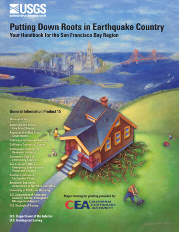
Putting Down Roots in Earthquake CountryYour Handbook for the San Francisco Bay RegionGeneral Information Product 15Developed by:American Red Cross,Bay Area ChapterAssociation of Bay AreaGovernmentsCalifornia Earthquake AuthorityCalifornia Geological SurveyEarthquake EngineeringResearch InstituteGovernor’s Office ofEmergency ServicesSan Francisco Office ofEmergency Services andHomeland SecuritySouthern CaliforniaEarthquake CenterStructural EngineersAssociation of Northern CaliforniaUniversity of California BerkeleyU.S. Department of HomelandSecurity, Federal EmergencyManagement AgencyU.S. Geological SurveyU.S. Department of the InteriorU.S. Geological SurveyMajor funding for printing provided by:
U.S. Department of the InteriorGale A. Norton, SecretaryU.S. Geological SurveyP. Patrick Leahy, Acting DirectorAny use of trade, product, or firm names in this publication is fordescriptive purposes only and does not imply endorsement ofthe U.S. Government.United States Government Printing Office: 2005Revised and reprinted, March 2006Reprinted, June 2006Revised and reprinted, May 2007For additional copies please contact:USGS Information ServicesBox 25286Denver, CO 80225This report and any updates to it are available at:http://pubs.usgs.gov/gip/2005/15/For more information about the USGS and its products:Telephone: 1–888–ASK–USGS (1–888–275–8747)World Wide Web: http://www.usgs.gov/Manuscript approved for publication, July 19, 2005Cataloging-in-publication data are on file with theLibrary of Congress (URL http://www.loc.gov/).This document is adapted from editions of “Putting Down Rootsin Earthquake Country,” written by Lucy Jones (U.S. GeologicalSurvey) and Mark Benthien (Southern California EarthquakeCenter), published by the Southern California Earthquake Center(SCEC) in 1995, 2004, 2005 (see er: The suggestions and illustrations included in thisdocument are intended to improve earthquake awareness andpreparedness; however, they do not guarantee the safety of anindividual or a structure. The contributors and sponsors of thishandbook do not assume liability for any injury, death, propertydamage, or other effects of an earthquake.CONTRIBUTORS: U.S. Geological Survey: Mary Lou Zoback,Steve Walter, Susan Garcia, Luke Blair, Marco Ticci, HowardBundock, and Bob Simpson; American Red Cross: HaroldBrooks, Helen Knudson, and Chris Kramer; Association of BayArea Governments: Jeanne Perkins; California EarthquakeAuthority: Nancy Kincaid and Rolf Erickson; California Geological Survey: Keith Knudsen and Chris Wills; EarthquakeEngineering Research Institute, Northern CaliforniaChapter: Fred Turner; Governor’s Office of Emergency Services: Richard Eisner and Kathleen Bailey; QuakeHold!: DeanReese and Jeff Primes; San Francisco Office of EmergencyServices and Homeland Security: Doug Sandy; SouthernCalifornia Earthquake Center: Mark Benthien and Robertde Groot; Structural Engineers Association of NorthernCalifornia: Patricia Coate and Reinhard Ludke; Universityof California, Berkeley Seismological Laboratory: LindGee; U.S. Department of Homeland Security, FederalEmergency Management Agency: Jeffrey Lusk.Text edited by James W. Hendley II and Peter H. Stauffer, USGS.Production, design, and illustration by Susan Mayfield, USGS.Other illustrators: Jere Smith (front cover), Hans Bennewitz(FUEL Creative Group) (p. 19), Stephanie Langley (p. 4, 10, 25,26), Todd Connor (p. 20, 21, 27), and Judy Weathers (USGS)(p. 9, 23, 24).2ContentsWhy Should I Care?—The Bay Area Is Your HomeAll Bay Area residents live on an active plate boundary whereearthquakes are frequent events! 4History shows that damaging earthquakes have occurred throughout theBay Area. 6Most earthquake damage is caused by shaking. 8Earthquakes also cause damage in other ways. 10Why Should I Prepare?—Big Quakes Will Affect YouThe disastrous 1989 Loma Prieta earthquake was not the “Big One”! 12Many likely earthquake scenarios for the Bay Area will causemore damage than the Loma Prieta earthquake. 13Your life could change unexpectedly in the next quake. Consider. 14Where will your family be?Will you have medical services?Will you be able to get home?Will you be able to stay in your home?Can you live without the services you rely on?How will your job be affected?How will the American Red Cross help?Your financial situation could be affected by a quake. 16Will you have money, food, and medicine?Will you be able to recover financially?Will your insurance cover your losses?Does your small business have a recovery plan?What will the Government do for you?What Should I Do?—Follow the Seven Steps to Earthquake SafetyThe seven steps to earthquake safety. 18STEP 1—Identify potential hazards in your home and begin to fix them 20STEP 2—Create a disaster-preparedness plan 22STEP 3—Prepare disaster kits 23STEP 4—Identify your building’s potential weaknesses and begin to fix them 24STEP 5—Protect yourself during earthquake shaking—DROP, COVER, AND HOLD ON 26STEP 6—After the quake, check for injuries and damage 27STEP 7—When safe, continue to follow your disaster-preparedness plan 28A review of money matters 29What Else Should I Know?Earthquake information on the Web 30Glossary31
IntroductionThe Bay Area Is “Earthquake Country”This handbook provides information about the threat posedby earthquakes in the San FranciscoBay region and explains how youcan prepare for, survive, and recoverfrom these inevitable events. If youlive or work in the region, you needto know why you should be concerned with earthquakes, what youcan expect during and after a quake,and what you need to do beforehandto be safe and reduce damage.Since the Great earthquake of 1906, much has beenlearned about earthquake hazards and vulnerabilities in the Bay Area: We know why earthquakes occur here—The BayArea straddles the boundary where two of theEarth’s largest tectonic plates meet and slowlymove past one another. When boundary faultsbreak and the North American and PacificPlates lurch past each other, quakes occur. We know large and damaging earthquakes arecertain to occur in the future—At least eightfaults in the Bay Area are capable of producingearthquakes of magnitude 6.7 or larger. Suchquakes can kill and injure many people andcause substantial damage to buildings, roads,bridges, and utilities. We know how to reduce losses in future largeearthquakes—Building codes have beenimproved, some older buildings strengthened,and bond measures approved to upgrade criticalfacilities. Some Bay Area residents have securedtheir homes to better withstand shaking, createdemergency plans and disaster supply kits, andheld home earthquake drills.BUT we have not done enough to be prepared for thenext large earthquake: Fewer than 10% of households have disaster plans—If an earthquake occurred right now, wherewould you go to be safe? If you are at work andyour children are at school when the earthquakeoccurs, how will you get back together? Fewer than 10% of homeowners have taken steps toretrofit their homes—Is your home bolted to itsfoundation? If you live in an older building, has itbeen retrofitted? Is your water heater strapped?Could unsecured furniture or objects fall andcause injury or damage? Fewer than 50% of households have disaster supplykits—You will likely be on your own in the hoursand days following an earthquake. Are youprepared with water, food, first aid supplies, andmedications?3
Why Should I Care?All Bay Area Residents Live on an Active Plate BoundaryWhere Earthquakes Are Frequent Events!We know that the San Andreas Faultproduces large earthquakes and thatmany other Bay Area faults are also hazardous.However, even knowing this, it can be difficult tounderstand how to use this information to make ussafer in our daily lives. Should we care only if welive near the San Andreas Fault, or is every placein the Bay Area just as dangerous?This eight-page section describes whereearthquakes occur in northern California. It alsoexplains how earthquakes will shake the groundand cause damage in other ways, such as liquefaction and landslides (see pages 8 through 11).Technical terms used throughout this book areexplained in the Glossary (see page 31).Myth number 1ADAPlate boundary faultsEarthquake rupturetle h i n g t o ntaSe a sWCascadiJan. 1700M9a Subduce FucadnauJPlatetionZoPlate Motions Load the FaultsDeep beneath California, the Pacific and North American Plates relentlessly grind past one another, straining or “loading” faults in the Earth’s rigid crust above.The horizontal (“strike slip”) movement between theseplates along the San Andreas Fault Zone is about1.7 inches per year (40 mm/yr), about as fast as yourfingernails grow. At this rate, Los Angeles will be westof San Francisco in about 12 million years.Don’t be fooled!—4CAN“BEACHFRONT PROPERTY”?JANUARY 1700 M 9The idea or myth of Californiasliding into the Pacific Oceanin an earthquake and creatingnew beachfront property to theeast appeals to those having abit of fun at the Golden State’sexpense. Although part of theState west of the San AndreasFault system is very slowlymoving northward and in millions of years could becomean island, earthquakes causedby this horizontal motion of theEarth’s tectonic plates will notmake California disappear intothe sea, like fabled Atlantis.In this computer simulation,tsunami waves are radiatingoutward after a magnitude (M)9 earthquake that occurred onthe Cascadia Subduction Zoneoffshore of northern California,Oregon, and Washington onJanuary 26, 1700. This viewshows the waves 4 hours afterthe quake. Colors indicate waveheights—red is highest. Alongparts of the coast of the PacificNorthwest, 30-foot-high (9 m)waves rushed inland. Within 20 hours the tsunami did damage throughout the Pacific, and it iswell documented in written records from Japan. (For more information go to http://pubs.usgs.gov/circ/c1187/. ”Orphan tsunami” Web address: http://pubs.usgs.gov/pp/pp1707/.)ne
The Bay Area Is Your HomeWyomingMontanaD SakotaD NakotaJANUARY 1857 M 7.9hoUtahnNorth AmerOct. 1989M 6.9coSanrancisFzoJan. 1857M 7.9OApr. 1906M 7.8naican PlateICliadaMCaniforvaEXNerigoAOreSan Andreas Fault ZonePacific PlaAn Loge slesIdaThe magnitude (M) 7.9 FortTejon earthquake in 1857 causeda horizontal shift of about 30feet (9 m) on this stretch of thesouthern San Andreas Fault (redarrows indicate this “strikeslip” movement). Although thequake ruptured nearly 200 miles(300 km) of the fault, it did littledamage because southernCalifornia’s population was smallat that time. (USGS photo)teAPRIL 1906 M 7.8In the Great 1906 magnitude (M) 7.8 earthquake, nearly 300 miles (480 km)of the San Andreas Fault ruptured, producing strong shaking along all ofcoastal northern California. Shaking was most intense in Santa Rosa andSan Francisco. In San Francisco, broken water mains kept firefightersfrom battling the fires that swept through the city and contributed to thedevastation shown in this photograph (looking south) taken from a tetheredballoon 5 weeks after the earthquake.San FranciscoCity HallFor more information go to:http://neic.usgs.gov/neis/plate tectonics/rift man.htmlhttp://pubs.usgs.gov/gip/earthq3/5
Why Should I Care?History Shows That Damaging Earthquakes HaveOccurred Throughout the Bay Area.In the last half of the 1800s, damagingearthquakes (magnitude 6 or greater)occurred in the San Francisco Bay regionon average every 4 years. However, thischanged in 1906:Fault Rupture Lengths for Historical Quakes in the Bay Area On April 18, 1906, the San Andreas Faultruptured violently over a length of 300 miles,causing damage from San Juan Bautistanorth as far as Eureka. This magnitude 7.8earthquake—the “Great San Franciscoearthquake”—relieved stresses on faultsthroughout the bay region. Because fault stresses were reduced, therate of large quakes in the San FranciscoBay region dropped abruptly after the1906 earthquake. The three-quarters of a century following the 1906 quake was a golden age forthe bay region, in which urban areas andpopulation expanded rapidly during a timeof minimal quake activity. Although the level of seismic activity hasnot yet reached that of the late 1800s, since1906 stresses on Bay Area faults havebeen building up once again. The area canexpect more frequent and stronger earthquakes in the future.)NCOBEMF PLETORE E R ECOR D 'REATER THAN ILIITTUYDEBAOB AGN KE PRST ONEATMER QU A T LEA GRE RATOFOR O TO )NCREASING QUAKE PROBABILITY TO %!24(15! % -!'.)45 %31906 epicenter4HEFUTUREThe Past and Future of Significant Bay Area Quakes6
The Bay Area Is Your HomeQuakes can cause damagefar from the fault rupture.3ACRAMENTO3%2 '2/.3!3ANTA2OSA3%! 2!.0ETALUMA6ALLEJO3AN2AFAEL FIC45,&!4( -425 34 )!"&! ,/5,4 (AYWARDEAN(ALF -OON"AY"AY 3AN*OSE 3!.45,&! -),%3 /2%''21868—Damage in Hayward)/5RBAN AREAS IN 4&!5,)NCREASING PROBABILITYALONG FAULT SEGMENTS32!6%,!#!0ALO!LTO. ),/-%4%234RACY45,&!3AN-ATEO O/C0ACIFICA3TOCKTON,IVERMORE0LEASANTON !NTIOCH,%),.6%%'2 ANVILLE/AKLANDSCNCI&RACI !297(!3AN0A3AN &RANCISCO7ALNUT#REEK PROBABILITY FOR ONE OR MOREMAGNITUDE OR GREATEREARTHQUAKES FROM TO 45,&!1969—Damage in Santa Rosa .OVATO.OV1906—Damage in Healdsburg.APA45,&!3ONOMA3!. &2!.#)3#/ "!9 2%')/.%!24(15! % 02/"!"),)4945,&!%9,,%%. 6!2 n'2#/.#/ %%#2 ). %84'ILROY,/ %.- 4! /02 & 3ANTA #RUZ)% 257ATSONVILLE 4! 0451 25! % %-ONTEREY"AY3ALINAS-ONTEREYThe threat of future quakes extends across the Bay Area 1865—Damage in San Francisco(Historical photos of shakingdamage courtesy National Information Service for EarthquakeEngineering (NISEE), UniversityThere is a 62% probability that at least one earthquake of magnitude 6.7or greater will occur on a known or unknown San Francisco Bay region faultbefore 2032. After a century of study by geologists, many faults have beenmapped in the region, but not all faults are apparent at the surface—somequakes occur on previously unknown faults.An example of a damaging quake on a previously unknown fault is theSeptember 3, 2000, Yountville (Napa) earthquake. This magnitude 5.2 quakestruck at 1:36 a.m., 10 miles northwest of Napa, rudely awakening manyresidents of the Bay Area. It injured 25 people, caused at least 10 million indamage, and forced 70 people to seek shelter at Red Cross facilities.of California, Berkeley.)7
Why Should I Care?Most Earthquake Damage Is Caused by Shaking.Damage in earthquakes ismainly from shaking. Theintensity of shaking that a structure will experience during anearthquake is a function of threemain factors:Expected Levels of Shaking from Future Earthquakes(1) The magnitude of theearthquake—the largerthe quake, the stronger theshaking.(2) The distance from the faultthat ruptured—the neareryou are to the fault, thegreater the shaking.FranciscoicBayOcea,) %,)(// /& ).4%.3% 3(! ).',OW(IGHn8ncifBuildings in the Marina District of SanFrancisco were badly damaged in the 1989Loma Prieta earthquake. “Soft story” buildings, typically with parking on ground floor,like the one pictured here, are commonthroughout the Bay Area and are particularly at risk when exposed to strong shaking. (USGS photo)SaPa(3) The type of ground materials beneath the structure—soft soils amplifythe shaking; hard bedrockdoes not.SANFRANCISCO -),%3 ),/-%4%23For more /index.htm On this map, bands of highest expected shaking generally follow major faults. Shaking levels are also influenced by the type of materials underlying an area—soft soilstend to amplify and prolong shaking, even at great distances from a quake. The worst soft soils in the Bay Area are the loose clays and filled areas bordering SanFrancisco Bay and the Sacramento-San Joaquin Delta. Deep soils in valleys shake more than bedrock in the hills—most urban developmentis in the valleys. Intense shaking can damage even strong, modern buildings and their contents.
The Bay Area Is Your Home4/ "%2 %,%9 42%!352%)3,!. "% 2/# '%"2) "!9 #902%333425#452% 9%2"!"5%.!)3,!. 3/&4 -5 4/3!. &2!.#)3#//! ,!. 3!. !. '2!6%, -),%3 ),/-%4%23 3%#/. 3Soft Soils Amplify Earthquake ShakingNiccif anPa OceThe Cypress freeway structure in Oakland was3!./! ,!. &2!.#)3#/built in the 1950s, before the use of modern!REA OF MAPseismic-safety standards. Part of the structure%!24(15! %standing on soft mud (dashed red line) col%0)#%.4%2lapsed in the 1989 magnitude 6.9 Loma Prietaearthquake, whose epicenter was nearly 60miles (100 km) to the south. Adjacent parts of the structure (solid red)that were built on firmer ground remained standing. Seismograms(upper right) show that the shaking was especially severe in the softmud. (Photo by Lloyd S. Cluff, Pacific Gas & Electric)The Exposure of the Bay Area’s Built Environment to Violent Earthquake Shaking—Many criticalfacilities in the Bay Area will likely experience damaging earthquake shaking in the next 30 years.4YPES OF FACILITIES(OSPITALS&IRE 0OLICE AND ,OCAL 'OVERNMENT%LEMENTARY 3CHOOLS)NTERMEDIATE OR -IDDLE 3CHOOLS(IGH 3CHOOLS.UMBER OR EXTENT OF "AY !REA0ERCENTAGE OF TOTAL NUMBER OF FACILITIESFACILITIES WITH A HIGH LIKELIHOODIN THE NINE COUNTY "AY !REAOF EXPERIENCING DAMAGING SHAKING IN THE NEXT YEARS #OLLEGES OR 5NIVERSITIES "RIDGES AND )NTERCHANGES "AY !REA 2APID 4RANSIT "!24 TRACKS2OADS MILES KM MILES KM3OURCE !SSOCIATION OF "AY !REA 'OVERNMENTS HTTP QUAKE ABAG CA GOV MITIGATION PICKCRIT HTML 9
Why Should I Care?Earthquakes Also Cause Damage in Other Ways.Although most earthquake damage is caused byshaking, other damaging effects of quakes can bejust as devastating. For example, in the Great 1906 earthquake, the shaking damage in San Francisco was followed byfires that raged through the city almost uncontrolled, in partbecause water mains had broken in the quake. These andother destructive effects of quakes are discussed below.Fires—Earthquakesin urban areas areoften followed bydestructive firesbecause (1) gas linesbreak, (2) electricalshorts ignite fires, (3)damaged water tanksand broken pipes limitwater for firefighting,and (4) clogged roadsand collapsed bridges prevent firefighter access. These factorscan lead to fires spreading, causing extensive additional damageand burning entire neighborhoods. This photo shows fires inSan Francisco’s Marina District following the 1989 magnitude 6.9Loma Prieta earthquake (photo courtesy of CBS 5).Damaged bridges, pipelines, powerlines,and roads—Earthquakes often damageroads, hindering rescue and recoveryefforts and causing accidents. Water andsewer pipeline breaks result in waterloss and can cause “sinkholes” thatundermine roads and buildings. Damageto natural gas and electrical distributionsystems can cause fires, as well as majorservice outages. This car crashed whena section of the eastern span of the SanFrancisco-Oakland Bay Bridge collapsedin the 1989 magnitude 6.9 Loma Prietaearthquake (Earthquake EngineeringResearch Institute photo).Don’t be fooled!—Myth number 2“AND THE EARTH OPENED ”A popular literary device isa fault that opens during anearthquake and then closes toswallow up an inconvenientcharacter. Unfortunately forprincipled writers, such “carnivorous” faults exist only innovels and B-movies.10Dam failures—Earthquake shaking cancause dams to fail, potentially causingcatastrophic downstream flooding andreduced water supplies. In addition,many dams provide hydroelectric power,which could be critically needed following a quake. Cracks in the top of this damwere caused by the 1989 magnitude 6.9Loma Prieta earthquake (USGS photo).Hazardous material releases—Earthquake damage can cause releases ofhazardous materials from refineries andother chemical storage and distribution systems, research and industriallaboratories, manufacturing plants, andrailroad tank cars. Oil was released andcaught fire when this storage facility wasdamaged by the 1999 magnitude 7.4 Izmit,Turkey, earthquake (photo by KandilliObservatory and Earthquake Institute).
Care?The BayWhyAreaShouldIs YourI HomeFaultLandslides—Earthquakes can triggerlandslides that damage roads, buildings, pipelines, and other infrastructure. Steeply sloping areas underlainby loose or soft rock are mostsusceptible to earthquake-inducedlandslides. This home was destroyedwhen the hillside beneath it gaveway following the 1994 magnitude 6.7Northridge earthquake (FEMA photo).Liquefaction—Earthquake shaking cancause soils to behave like a liquid and losetheir ability to support structures. Liquefaction often causes buried gas and waterlines to break. The highest hazard is in lowlying areas where there are loose, sandysoils or poorly compacted artificial fill. Thisphoto shows liquefaction-related damagein the Marina District of San Francisco following the 1989 magnitude 6.9 Loma Prietaearthquake (USGS photo).Surface rupture—Fault movementscan break the ground surface, damaging buildings and other structures.This fence near Point Reyes wasoffset 8 feet ( 2.5 m) when the SanAndreas Fault moved in the Great(magnitude 7.8) 1906 earthquake(USGS photo).3EISMIC (AZARD :ONES:ONE OF 2EQUIRED )NVESTIGATION FOR%ARTHQUAKE )NDUCED ,ANDSLIDES:ONE OF 2EQUIRED )NVESTIGATION FOR,IQUEFACTION%ARTHQUAKE &AULT :ONE4RACE OF (AYWARD &AULT AS SHOWN ON%ARTHQUAKE &AULT :ONE -APTsunamis—Great earthquakes occurringanywhere in the Pacific Ocean may displace the ocean floor, generating tsunamisthat could affect the California coast.Some coastal communities are designatingTsunami Hazard Zones and planning evacuation routes. Although the tsunami hazardin most of the Bay Area is low, coastalareas are still at risk. For example, this baitshop (Hazel’s Fish Stand) in Half Moon Baywas ruined when it was hit by debris in thetsunami generatedby the 1946 (magnitude 8) Alaskaearthquake (photocopyright by MS &SB Collection).Map Showing Seismic Hazard Zones—This map of part of the Oakland area showsregulatory zones defined by the California Geological Survey (CGS) for three seismichazards—earthquake-induced landsliding, liquefaction, and surface rupture. These zonesindicate where the hazard may exist. Sites of proposed construction (new or remodel)within a zone must be investigated for the hazard. These maps are also used in real-estatetransactions—disclosure is required if a property is within any of these hazard zones. CGSseismic hazard zone maps for the Bay Area are available at http://www.consrv.ca.gov/cgs/geologic hazards/regulatory hazard zones/index.htm.11
Why Should I Prepare?The Disastrous 1989 Loma Prieta EarthquakeWas Not the “Big One”!The Loma Prieta earthquake releasedonly 3% of the energy of the Great1906 quake. Although it occurred in theSanta Cruz Mountains, far from the BayArea’s urban centers, it caused destructionnot only in nearby Santa Cruz and Watsonville but also in San Francisco and Oakland:ShakeMap of the 1989 M 6.9 Loma Prieta EarthquakeThis “ShakeMap” shows levels ofshaking in the San Francisco Bayregion during the1989 magnitude(M) 6.9 Loma Prieta earthquake.Shaking intensities are shownby colors corresponding to the“Modified Mercalli Intensity Scale,”which uses Roman numerals and isbased on actual reports of shaking and damage in earthquakes.ShakeMaps are now automaticallygenerated from shaking measurements recorded by an extensivenetwork of seismographic instruments operated by the partnershiporganizations in the California Integrated Seismic Network (CISN) (seepage 30). CISN ShakeMaps are nowavailable online within minutes aftera significant earthquake at http://earthquake.usgs.gov/shakemap/ orhttp://www.cisn.org/shakemap/. More than 60 people died, most in the collapseof the Cypress freeway structure in Oakland. About 16,000 homes and apartment units wereso badly damaged that they could no longer belived in. The American Red Cross operated 45shelters housing more than 6,000 people, manyof them for several months. The San Francisco-Oakland Bay Bridge wasclosed for more than a month because a portion of its eastern span collapsed. This closureand the collapse of the Cypress Freeway werethe most dramatic of 142 road closures in theBay Area./AKLAND3AN &RANCISCO 3ANTA #RUZ Direct physical damage to buildings and structures totaled 6 billion; other related losses werean additional 4 billion (losses in 1989 dollars).!"!' %ARTHQUAKE 3HAKING 3CENARIO 3AN !NDREAS &AULT 0ENINSULA 3EGMENT -AGNITUDE ( !6' 2 !0 ),/-%4%234% , %%4 34 !9 7/!"2/! ,!. 6,/ ! 4Modified Mercalli IntensityShaking Severity Level( 34 X-Very Violent4(3 4(4 364!2344%.!/4)IX-Violent ).!",6VIII-VeryStrong, 12 -),%30!"Some words of caution: Because these hazard maps are based on general information, they are reasonably accurate for a neighborhood, but much less accurate for a particular address. The maps in this booklet or on ABAG’s Web site arebased on probabilities, so actual earthquakes couldproduce different damage patterns. 3!.The Association of Bay Area Governments (ABAG) operates a Web sitedesigned to provide this information in the form of earthquake-shaking hazardmaps at http://quake.abag.ca.gov/. These maps show expected shakingintensities in the Bay Area for various earthquake scenarios, such as a quakeon the Peninsula segment of the San Andreas Fault or the northern HaywardFault. These maps can be “zoomed in” to display your neighborhood.Other ABAG earthquake hazard maps show areas of liquefaction susceptibility, landslide hazards, potential fault ruptures, and tsunami inundation.ABAG even has maps for other natural hazards such as wildfires and flooding.-! 2 How Do I Find Out the Expected Shaking in My Neighborhood?VII-StrongVI-ModerateV-Light
Big Quakes Will Affect YouMany Likely Earthquake Scenarios for the Bay Area WillCause More Damage Than the Loma Prieta Earthquake.What if the Hayward Fault in the EastBay ruptured from San Pablo Bay toFremont in an earthquake of magnitude 6.9,like Loma Prieta?If this scenario earthquake for the Hayward Fault occurs, areas of soft soils alongthe margins of San Francisco Bay, particularly in the East Bay, are likely to experienceintense shaking and liquefaction. These areasare heavily urbanized and may have devastation similar to or greater than that of the areaaround the Cypress freeway structure inOakland in 1989, shown below.“Scenario” ShakeMap for a Possible M 6.9 Earthquakeon the Hayward Fault /AKLAND&REMONT This “scenario” ShakeMap shows predictedlevels of shaking in theSan Francisco Bay regionfor a possible magnitude (M) 6.9 earthquakeon the Hayward Fault.Such scenario maps arecomputer generatedusing information aboutthe projected quake magnitude, distances fromthe rupturing fault, andlocal geologic conditions.Scenario ShakeMapsare available online cts/shake/archive/scenario.html. (USGS photo)Projected Consequences and Implications for the Bay Area from a Magnitude 6.9 Earthquake on the Hayward FaultFacilitiesProjected LossesWho Is Taking Action?What Can I Do To Prepare?Housing 80,000 to 160,000 homes andapartment units becomeuninhabitable (10 times thenumber in the Loma Prietaquake). As many as 300,000 people areforced from their homes. As many as 150,000 peoplerequire public shelter. The American Red Cross,cities, and countiesare planning for publicshelters. Bay Area city and countybuilding departmentshave developed retrofitstandards. Retrofit your home, if needed(see pages 24 and 25). Secure the contents of yourhome. BART, Caltrans, and localpublic works departments are retrofitting theBay Area’s transportationinfrastructure. Make a family plan for whatto do if you are separatedin a disaster (see pages 22and 23). Have earthquake disaster kitsat home, at work, AND inyour car (see page 23).Transportation As many as 1,700 road closures (12 times the number inthe Loma Prieta quake) willsnarl commutes. Only parts of the Bay AreaRapid Transit System (BART)will remain in operation.Source: Association of Bay Area Governments.13
Why Should I Prepare?Your Life Could Change Unexpectedly in theNext Quake. Consider Where will your family be? Your children may be at school,day care, or other activities. Family members may be at workor commuting. Pets may run away or be injured.After the 2001 magnitude 6.8 Nisquallyearthquake, thisschool in the Puget Sound area of Washington was closedfor repair (Earthquake Engineering Research Institute photo).Pets are not allowed inmost emergency shelters.Do you have a plan to feedand care for your animalsafter an earthquake? (Photos courtesy of EmergencyAnimal Rescue Service)Will you have medical services? The 911 emergency system willlikely be overloaded. Hospitals and other medical facilities may be damaged. Emergency rooms and traumacenters may be overwhelmed.This hospital in Sylmar, California,had to be demolished after the1971 magnitude 6.7 San Fernandoearthquake. Inset shows anambulance that was crushed during the quake. (USGS photos) Assisted living, critical care, andother health services such asdialysis may not be operational.Will you be able to get home? Road damage and closures mayrestrict your ability to travel by car. Public transportation, includingbuses, Bay Area Rapid Transit(BART), ferries, and airports mayexperience closures or interruptions in service. Commute times may be dramatically increased.14The 1989 magnitude6.9 Loma Prietaearthquake causedthis section of the SanFrancisco-OaklandBay Bridge
handbook do not assume liability for any injury, death, property damage, or other effects of an earthquake. CONTRIBUTORS: U.S. Geological Survey: Mary Lou Zoback, Steve Walter, Susan Garcia, Luke Blair, Marco Ticci, Howard Bundock, and Bob Simpson; American Red Cross: Harold Br