Transcription
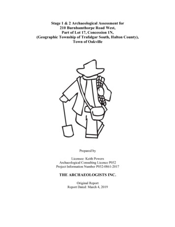
Stage 1 & 2 Archaeological Assessment for210 Burnhamthorpe Road West,Part of Lot 17, Concession 1N,(Geographic Township of Trafalgar South, Halton County),Town of OakvillePrepared byLicensee: Keith PowersArchaeological Consulting Licence P052Project Information Number P052-0861-2017THE ARCHAEOLOGISTS INC.Original ReportReport Dated: March 4, 2019
EXECUTIVE SUMMARYThe Archaeologists Inc. was contracted to conduct a Stage 1 & 2 ArchaeologicalAssessment for 210 Burnhamthorpe Road West, Part of Lot 17, Concession 1N,(Geographic Township of Trafalgar South, Halton County), Town of Oakville. Thedevelopment project was triggered by the Planning Act and the archaeologicalassessment report was conducted in advance of a submission of a proposed draft plan ofdevelopment approval by the Town of Oakville.A Stage 1 background study of the subject property was conducted to provideinformation about the property’s geography, history, previous archaeological fieldworkand current land condition in order to evaluate and document in detail the property’sarchaeological potential and to recommend appropriate strategies for Stage 2 survey. AStage 2 property assessment was conducted to document all archaeological resources onthe property, to determine whether the property contains archaeological resourcesrequiring further assessment, and to recommend next steps. The characteristics of theproperty dictated that the Stage 2 survey be conducted by test pit survey.The Stage 1 background study found that the subject property exhibits potential for therecovery of archaeological resources of cultural heritage value and concluded that theproperty requires a Stage 2 assessment. The Stage 2 property assessment, which consistedof a systematic pedestrian survey, did not result in the identification of archaeologicalresources.The Stage 1 background study concluded that the property exhibits archaeologicalpotential. The Stage 2 property assessment did not identify any archaeological resourceswithin the subject property. The report recommends that no further archaeologicalassessment of the property is required.
TABLE OF CONTENTSExecutive SummaryTable of ContentsProject Personnel1.0 Project Context1.1 Development Context1.2 Historical Context1.3 Archaeological Context2.0 Field Methods3.0 Record of Finds4.0 Analysis and Conclusions5.0 Recommendations6.0 Advice on Compliance with Legislation7.0 Bibliography and Sources8.0 Images9.0 Mapsiiiiii111368889101115
PROJECT PERSONNELProject/Field Director:Mr. T. Keith Powers (P052)Field ArchaeologistsMr. T. Keith PowersMr. John EllisMr. Sam FelipeMr. Misha StecykReport Preparation:Mrs. Susan DyerGraphicsMrs. Karen PowersMr. T. Keith Powers
Stage 1 & 2 Archaeological Assessment for 210 Burnhamthorpe Road West, Part of Lot 17, Concession 1N,(Geographic Township of Trafalgar South, Halton County), Town of OakvilleINTRODUCTIONThe Ontario Heritage Act, R.S.O. 1990 c. O.18, requires anyone wishing to carry outarchaeological fieldwork in Ontario to have a license from the Ministry of Tourism,Culture & Sport (MTCS). All licensees are to file a report with the MTCS containingdetails of the fieldwork that has been done for each project. Following standards andguidelines set out by the MTCS is a condition of a licence to conduct archaeologicalfieldwork in Ontario. The Archaeologists Inc. confirms that this report meets ministryreport requirements as set out in the 2011 Standards and Guidelines for ConsultantArchaeologists, and is filed in fulfillment of the terms and conditions an archaeologicallicense.1.0PROJECT CONTEXT (Section 7.5.5)This section of the report will provide the context for the archaeological fieldwork,including the development context, the historical context, and the archaeological context.1.1 Development Context (Section 7.5.6, Standards 1-3)Section 7.5.6, Standard 1The Archaeologists Inc. was contracted to conduct a Stage 1 & 2 ArchaeologicalAssessment for 210 Burnhamthorpe Road West, Part of Lot 17, Concession 1N,(Geographic Township of Trafalgar South, Halton County), Town of Oakville. Thedevelopment project was triggered by the Planning Act and the archaeologicalassessment report was conducted in advance of a submission of a proposed draft plan ofdevelopment approval by the Town of Oakville.Section 7.5.6, Standard 2There is no additional development-related information relevant to understanding thechoice of fieldwork strategy or recommendations made in the report.Section 7.5.6, Standard 3Permission to access the study area to conduct all required archaeological fieldworkactivities, including the recovery of artifacts was given by the landowner and theirrepresentative.1.2 Historical Context (Section 7.5.7, Standards 1-2)Section 7.5.7, Standard 1In advance of the Stage 2 assessment, a Stage 1 background study of the subject propertywas conducted in order to document the property archaeological and land use history andpresent condition. Several sources were referenced to determine if features orcharacteristics indicating archaeological potential for pre-contact and post-contactresources exist.1
Stage 1 & 2 Archaeological Assessment for 210 Burnhamthorpe Road West, Part of Lot 17, Concession 1N,(Geographic Township of Trafalgar South, Halton County), Town of OakvilleCharacteristics indicating archaeological potential include the near-by presence ofpreviously identified archaeological sites, primary and secondary water sources, featuresindicating past water sources, accessible or inaccessible shoreline, pockets of welldrained sandy soil, distinctive land formations that might have been special or spiritualplaces, such as waterfalls, rock outcrops, caverns, mounds, and promontories and theirbases, resource areas, (including food or medicinal plants, scarce raw materials, earlyEuro-Canadian industry), areas of early Euro-Canadian settlement, early historicaltransportation routes, property listed on a municipal register or designated under theOntario Heritage Act or that is a federal, provincial or municipal historic landmark orsite, and property that local histories or informants have identified with possiblearchaeological sites, historical events, activities, or occupations.Archaeological potential can be determined not to be present for either the entire propertyor a part of it when the area under consideration has been subject to extensive and deepland alterations that have severely damaged the integrity of any archaeological resources.This is commonly referred to as ‘disturbed’ or ‘disturbance’, and may include: quarrying,major landscaping involving grading below topsoil, building footprints, and sewage andinfrastructure development. Archaeological potential is not removed where there isdocumented potential for deeply buried intact archaeological resources beneath landalterations, or where it cannot be clearly demonstrated through background research andproperty inspection that there has been complete and intensive disturbance of an area.Where complete disturbance cannot be demonstrated in Stage 1, it will be necessary toundertake Stage 2 assessment.The background study determined that the following features or characteristics indicatearchaeological potential for the subject property; ! The near-by presence of 44 known archaeological sites within a 1- kilometreradius of the subject property. ! The 1877 Atlas illustrates a structure and orchard on the Lot, east of the subjectproperty. ! The subject property is located on an historic transportation route (i.e. modern dayBurnhamthorpe Road East).Lot 17, Concession 1NThe subject property is located within part of Lot 17, Concession 1N, Township ofTrafalgar South. According to the 1877 Historical Atlas of Trafalgar South, the Lot hasthree owners. The owners of the south 100 acres if William McWilliams. A structureand orchard are illustrated on his portion of the Lot. The northern 100 acres is divided inhalf; the southern 50 acres belongs to James Applebee, and the northern 50 acres, whereour subject property is located, belongs to William Dent. A structure and orchard areillustrated within the north 50 acres, and are located to the east of our subject property.The subject property is located along a main concession road (i.e. modern dayBurnhamthorpe Road East).2
Stage 1 & 2 Archaeological Assessment for 210 Burnhamthorpe Road West, Part of Lot 17, Concession 1N,(Geographic Township of Trafalgar South, Halton County), Town of OakvilleThe Stage 1 background study indicates, that there is potential for the recovery of precontact and post-contact Euro-Canadian archaeological resources within the subjectproperty. As it cannot be clearly demonstrated through the background study that therehas been complete and intensive disturbance of the area, archaeological potential is notremoved. There are areas within the subject property that have the potential for therecovery of archaeological resources.Section 7.5.7, Standard 2The Stage 2 property assessment of the subject property will employ the strategy of testpit survey, following the standards listed in Section 2.1.2 of the 2011 Standards andGuidelines for Consultant Archaeologists. This is the appropriate strategy based on Stage1 background study and current field conditions. To our knowledge there are no otherreports containing relevant background information related to this development project.1.3 Archaeological Context (Section 7.5.8, Standards 1-7)Section 7.5.8, Standard 1In order that an inventory of archaeological resources could be compiled for the studyarea, three sources of information were consulted: the site forms for registered siteshoused at the Ministry of Tourism and Culture; published and unpublished documentarysources; and the files of The Archaeologists Inc.In Ontario, information concerning archaeological sites is stored in the OntarioArchaeological Sites Database (O.A.S.D.), an inventory of the documentedarchaeological record in Ontario.Information on the known archaeological sites in the vicinity of the study area wasobtained form the Ministry of Tourism, Culture & Sport site database (Table 1). Thereare no known archaeological sites located within the study area limits. A total of 44 siteswere registered within a one-kilometre radius of the subject property.TABLE 1: Archaeological Sites Within 1-kilometre of the Study AreaBorden w-326AiGw-415Site 81-403-4281-403-4381-403-45SamosShagbarkCultural AffiliationArchaic, odland, LatePre-ContactPre-ContactWoodland, EarlyPre-ContactSite FindspotFindspotFindspotFindspotResearcherPihl 1980Pihl 1981Pihl 1981Pihl 1981Pihl 1981Pihl 1981Pihl 1981Pihl 19811986Woodley 1998Sutton 1998Murray 1998Sutton 1998Austin, 20063
Stage 1 & 2 Archaeological Assessment for 210 Burnhamthorpe Road West, Part of Lot 17, Concession 1N,(Geographic Township of Trafalgar South, Halton County), Town of ndentPhillipsBourbeeMosely Farm HouseMorrison CreekWesterkirkBowbeerBowbeer IILocation 1AskinBiggerMcDuffe SitePre-ContactArchaic, MiddleArchaic, re-ContactPre-ContactArchaic, ctPost-Contact, t-ContactPost-ContactPre-Contact, in, 2005Austin, 2005Austin, 2005Austin, 2005Austin, 2005Austin, 2006Austin 2006Austin 2007Austin 2007Austin 2007Austin 2007Austin 2007Austin ost-ContactArchaic, EarlyHomesteadHomestead2007Sutton, 1985Woodley, 2013Sutton, 2014Dickson, 2014Sutton, 2016Powers, 2012Powers, 2012Steiss, 2008FindspotSection 7.5.8, Standard 2The subject property is located at municipal address 210 Burnhamthorpe Road West. Itis bound on the northwest by Burnhamthorpe Road West, on the northeast by aresidential property and on the other sides by agricultural fields. The subject propertycurrently consists of an existing standing residential structure, an area of tarmacdriveway, an small pond, and grassed and treed areas.The subject property is in the Peel Plain physiographic region of southern Ontario(Chapman and Putnam 1984). This physiographic region covers a large area across thecentral portions of the Regional Municipalities of Peel, York and Halton. The surface ofthe plain is characterized by level to gently rolling topography, with a consistent, gradualslope toward Lake Ontario. The physiography of the Peel Plain is best described asbevelled till plains that have originated from silty clay glacial till deposits derivedprincipally from local-occurring brown shales, sandstones and fossiliferous limestone.The predominant soil types found within the subject properties are Brady sandy loam andFox sandy loam. Both are stone-free and classed in the Grey-Brown Luvisol soil group.The former soil type is imperfectly drained and the latter is well-drained.4
Stage 1 & 2 Archaeological Assessment for 210 Burnhamthorpe Road West, Part of Lot 17, Concession 1N,(Geographic Township of Trafalgar South, Halton County), Town of OakvilleSection 7.5.8, Standard 3The Stage 2 archaeological fieldwork of the subject property was undertaken onDecember 6th, 2017 under favorable conditions for the assessment.Section 7.5.8, Standard 4No previous archaeological fieldwork has taken place within the limits of the projectarea. The Archaeologists Inc. is unaware of archaeological fieldwork conductedimmediately adjacent (i.e. within 50m) of the subject property.Section 7.5.8, Standard 5We are unaware of previous findings and recommendations relevant to the current stageof work.Section 7.5.8, Standard 6There are no unusual physical features that may have affected fieldwork strategydecisions or the identification of artifacts or cultural features.Section 7.5.8, Standard 7There is no additional archaeological information that may be relevant to understandingthe choice of fieldwork techniques or the recommendations of this report.5
Stage 1 & 2 Archaeological Assessment for 210 Burnhamthorpe Road West, Part of Lot 17, Concession 1N,(Geographic Township of Trafalgar South, Halton County), Town of Oakville2.0 FIELD METHODS (Section 7.8.1, Standards 1-3)This section of the report addresses Section 7.8.1 of the 2011 Standards and Guidelinesfor Consultant Archaeologists. It does not address Section 7.7.2 because no propertyinspection was done as a separate Stage 1.Section 7.8.1, Standard 1The entire project area was surveyed, although certain areas were not subject to asystematic survey due to disturbance noted above.Section 7.8.1, Standard 2As relevant, we provide detailed and explicit descriptions addressing Standards 2a, b andc. Standard 2d is not relevant.Section 7.8.1, Standard 2a - The general standards for property survey under Section 2.1of the 2011 Standards and Guidelines for Consultant Archaeologists were addressed asfollows: ! Section 2.1, S1 – A portion of the property was not surveyed due to previousdisturbances. These include the existing structure and tarmac drive. ! Section 2.1, S2a (land of no or low potential due to physical features such aspermanently wet areas, exposed bedrock, and steep slopes) – There is a smallpond of water on the property that was assessed as having no or low potential andwas not subject to survey. ! Section 2.1, S2b (no or low potential due to extensive and deep land alterations) –A section of the property was not surveyed due to disturbance associated with theexisting structure and tarmac driveway. ! Section 2.1, S2c (lands recommended not to require Stage 2 assessment by aprevious Stage 1 report where the ministry has accepted that Stage 1 into theregister) - n/a ! Section 2.1, S2d (lands designated for forest management activity w/o potentialfor impacts to archaeological sites, as determined through Stage 1 forestmanagement plans process) - n/a ! Section 2.1, S2e (lands formally prohibited from alterations) - n/a ! Section 2.1, S2f (lands confirmed to be transferred to a public land holding body,etc) - n/a ! Section 2.1, S3 - The Stage 2 survey was conducted when weather and lightingconditions permitted excellent visibility of features. ! Section 2.1, S4 - No GPS recordings were taken as no artifacts were found duringthe Stage 2 assessment. ! Section 2.1, S5 - All field activities were mapped in reference to either fixedlandmarks, survey stakes and development markers as appropriate. See reportsection 9.0 Maps. ! Section 2.1, S6 - See report section 8.0 Images for photo documentation ofexamples of field conditions encountered.6
Stage 1 & 2 Archaeological Assessment for 210 Burnhamthorpe Road West, Part of Lot 17, Concession 1N,(Geographic Township of Trafalgar South, Halton County), Town of Oakville ! Section 2.1, S7 - n/aSection 7.8.1, Standard 2b -The subject property was subject to a systematic test pitsurvey appropriate to the characteristics of the property.The test pit survey of the property followed the standards within Section 2.1.2 of the2011 Standards and Guidelines for Consultant Archaeologists. Test pit survey was onlyconducted where ploughing was not possible or viable, as per Standard 1. Test pits werespaced at maximum intervals of five metres and to within one metre of built structures,when present, or until test pits show evidence of recent ground disturbance. All test pitswere at least 30 cm in diameter. Each test pit was excavated by hand, into the first fivecm of subsoil and examined for stratigraphy, cultural features, or evidence of fill. Nostratigraphy or cultural features were noted. Soils were screened through 6mm mesh. Alltest pits were backfilled.Section 7.8.1, Standard 2c - All areas of the subject property were surveyed at five metreintervals except for those areas identified as previously disturbed.Section 7.8.1, Standard 3Approximately 75% of the subject property was test pit surveyed at five metre intervals.The remaining approximately 25% was assessed as disturbed by an existing structure,area of tarmac driveway, and an area of standing water.7
Stage 1 & 2 Archaeological Assessment for 210 Burnhamthorpe Road West, Part of Lot 17, Concession 1N,(Geographic Township of Trafalgar South, Halton County), Town of Oakville3.0 RECORD OF FINDS (Section 7.8.2, Standards 1-3)This section documents all finds discovered as a result of the Stage 1 and 2archaeological assessment of the subject property.Section 7.8.2, Standard 1No archaeological resources or sites were identified in the Stage 2.Section 7.8.2, Standard 2An inventory of the documentary record generated in the field is provided in Table 2.Document TypeField NotesPhotographsMapsTable 2: Inventory of Documentary RecordDescription ! This report constitutes the field notes for thisproject ! 12 digital photographs ! Figures in this report represent all of the mapsgenerated in the field.Section 7.8.2, Standard 3Information detailing exact site locations on the property is not submitted because nosites or archaeological resources were identified in the Stage 2 assessment.4.0 ANALYSIS AND CONCLUSIONS (Section 7.8.3, Standards 1-2)Section 7.8.3, Standard 1No archaeological sites were identified. Standard 2 is not addressed because no sites wereidentified.5.0 RECOMMENDATIONS (Section 7.8.4, Standards 1-3)Section 7.8.4, Standard 1This standard is not applicable as no sites were identified.Section 7.8.4, Standard 2The report makes recommendations only regarding archaeological matters.Section 7.8.4, Standard 3The Stage 2 survey did not identify any archaeological sites requiring further assessmentor mitigation of impacts and it is recommended that no further archaeological assessmentof the property be required.8
Stage 1 & 2 Archaeological Assessment for 210 Burnhamthorpe Road West, Part of Lot 17, Concession 1N,(Geographic Township of Trafalgar South, Halton County), Town of Oakville6.0 ADVICE ON COMPLIANCE WITH LEGISLATION (Section 7.5.9, Standards1-2)Section 7.5.9, Standard 1aThis report is submitted to the Minister of Tourism and Culture as a condition oflicensing in accordance with Part VI of the Ontario Heritage Act, R.S.O. 1990, c 0.18.The report is reviewed to ensure that it complies with the standards and guidelines thatare issued by the Minister, and that the archaeological fieldwork and reportrecommendations ensure the conservation, protection and preservation of the culturalheritage of Ontario. When all matters relating to archaeological sites within the projectarea of a development proposal have been addressed to the satisfaction of the Ministry ofTourism and Culture, a letter will be issued by the ministry stating that there are nofurther concerns with regard to alterations to archaeological sites by the proposeddevelopment.Section 7.5.9, Standard 1bIt is an offence under Sections 48 and 69 of the Ontario Heritage Act for any party otherthan a licensed archaeologist to make any alteration to a known archaeological site or toremove any artifact or other physical evidence of past human use or activity from the site,until such time as a licensed archaeologist has completed archaeological fieldwork on thesite, submitted a report to the Minister stating that the site has no further cultural heritagevalue or interest, and the report has been filed in the Ontario Public Register ofArchaeological Reports referred to in Section 65.1 of the Ontario Heritage Act.Section 7.5.9, Standard 1cShould previously undocumented archaeological resources be discovered, they may be anew archaeological site and therefore subject to Section 48 (1) of the Ontario HeritageAct. The proponent or person discovering the archaeological resources must ceasealteration of the site immediately and engage a licensed consultant archaeologist to carryout archaeological fieldwork, in compliance with Section 48 (1) of the Ontario HeritageAct.Section 7.5.9, Standard 1dThe Cemeteries Act, R.S.O, 1990 c. C.4 and the Funeral, Burial and Cremation ServicesAct, 2002, S.O. 2002, c.33 (when proclaimed in force) require that any persondiscovering human remains must notify the police or coroner and the Registrar ofCemeteries at the Ministry of Consumer Services.Section 7.5.9, Standard 2Not applicable9
Stage 1 & 2 Archaeological Assessment for 210 Burnhamthorpe Road West, Part of Lot 17, Concession 1N,(Geographic Township of Trafalgar South, Halton County), Town of Oakville7.0 BIBLIOGRAPHY AND SOURCES (Section 7.5.10, Standards 1)Chapman, L.J. and F. Putnam1984 The Physiography of Southern Ontario, Ontario Geological SurveySpecial Volume 2. Toronto: Government of Ontario, Ministry of NaturalResources.Illustrated Historical Atlas of Peel County, Ontario.1877 Toronto: Miles & Co.Ministry of Tourism and Culture2011 Standards and Guidelines for Consultant Archaeologists.10
Stage 1 & 2 Archaeological Assessment for 210 Burnhamthorpe Road West, Part of Lot 17, Concession 1N,(Geographic Township of Trafalgar South, Halton County), Town of Oakville8.0 IMAGES (Sections 7.5.11, 7.7.5, 7.8.6)Plate 1 Shows conditions of subject property.Plate 2 Shows conditions of subject property.11
Stage 1 & 2 Archaeological Assessment for 210 Burnhamthorpe Road West, Part of Lot 17, Concession 1N,(Geographic Township of Trafalgar South, Halton County), Town of OakvillePlate 3 Shows area of tarmac driveway and existing standing structure.Plate 4 Shows conditions for test pit survey.12
Stage 1 & 2 Archaeological Assessment for 210 Burnhamthorpe Road West, Part of Lot 17, Concession 1N,(Geographic Township of Trafalgar South, Halton County), Town of OakvillePlate 5 Shows conditions for test pit survey.Plate 6 Shows conditions for test pit survey.13
Stage 1 & 2 Archaeological Assessment for 210 Burnhamthorpe Road West, Part of Lot 17, Concession 1N,(Geographic Township of Trafalgar South, Halton County), Town of OakvillePlate 7 Shows conditions of subject property for test pit survey.Plate 8 Shows conditions for test pit survey.14
Stage 1 & 2 Archaeological Assessment for 210 Burnhamthorpe Road West, Part of Lot 17, Concession 1N,(Geographic Township of Trafalgar South, Halton County), Town of Oakville9.0 MAPS (Section 7.5.12, 7.7.6, 7.8.7)Map 1 General location of subject property on Google map imagery.15
Stage 1 & 2 Archaeological Assessment for 210 Burnhamthorpe Road West, Part of Lot 17, Concession 1N,(Geographic Township of Trafalgar South, Halton County), Town of OakvilleMap 2 Approximate location of subject property, overlaid in red, on1877 Atlas.16
Stage 1 & 2 Archaeological Assessment for 210 Burnhamthorpe Road West, Part of Lot 17, Concession 1N, (Geographic Township of Trafalgar South, HaltonCounty), Town of OakvilleMap 3 Clear copy of mapping provided by proponent.17
Stage 1 & 2 Archaeological Assessment for 210 Burnhamthorpe Road West, Part of Lot 17, Concession 1N, (Geographic Township of Trafalgar South, HaltonCounty), Town of OakvilleMap 4 Results of Stage 2 archaeological assessment.18
Stage 1&2 Archaeological Assessment for 374 Burnhamthorpe RoadWest, Part of Lots 18 & 19, Concession 1, North of Dundas Street(Geographic Township of Trafalgar) Town of Oakville, RegionalMunicipality of Halton, OntarioSubmitted toThe Remington Group7501 Keele Street, Suite 100Vaughan, Ontario L4K 1Y2T: 905.761.8200F: 905.761-8201Prepared byTHE ARCHAEOLOGISTS INC.790 Exceller CircleNewmarket, OntarioL3X 1P6Tel:(416) 991-6848Fax:(905) :www.thearchaeologists.comArchaeological Consulting Licence # P052MCL CIF # P052-149-2006April 2009
PROJECT PERSONNELProject/Field Director:Mr. T. Keith PowersField ArchaeologistsMr. T. Keith PowersMs. Karen PowersMr. Etienne JacobsonMr. Barclay PowersMr. George ClarkMr. Jimmson BowlerMs. Janice SedgwickReport Preparation:Ms. Karen PowersGraphicsMrs. Karen Powers
Stage 1&2 Archaeological Assessment for 374 Burnhamthorpe Road West, Part of Lots 18 & 19,Concession 1North of Dundas Street, Town of Oakville, Regional Municipality of Halton, OntarioStage 1&2 Archaeological Assessment for 374 Burnhamthorpe Road West, Part ofLots 18 & 19, Concession 1, North of Dundas Street (Geographic Township ofTrafalgar) Town of Oakville, Regional Municipality of Halton, Ontario1INTRODUCTIONThe Archaeologists Inc. wascontracted by The RemmingtonGroup Inc., to conduct a Stage 1 and2 Archaeological Assessment for 374Burnhamthorpe road West, Part ofLots 18 & 19, Concession 1, Northof Dundas Street (GeographicTownship of Trafalgar) Town ofOakville, Regional Municipality ofHalton, Ontario (Figure 1). Thesubject property, which comprisedapproximately 38 hectares, is locatedat 374 Burnhamthorpe Road W.,which is located between 6th line tothe east and Neyagawa Blvd. to thewest.Figure 1: The location of the study area as depicted on 1:50,000The Stage 1 and 2NTS map 30M/5 1983 Edition 10Archaeological Assessment wasconducted under the project direction of Mr. T. Keith Powers. Fieldwork was performedin accordance with the Ontario Heritage Act (1990) under an archaeological consultinglicense (P052-149-2006) issued to Mr. Powers of The Archaeologists Inc. Permission toaccess the study area, and undertake all activities required to complete this archaeologicalassessment, was granted to The Archaeologists Inc. by The Remmington Group Inc. Mr.Powers conducted fieldwork of the subject property December 17th, 2006.2BACKGROUND RESEARCH2.1Previous Archaeological ResearchIn order that an inventory of archaeological resources could be compiled for the studyarea, three sources of information were consulted: the site record forms for registeredsites housed at the Ministry of Culture; published and unpublished documentary sources;and the files of The Archaeologists Inc.In Ontario, information concerning archaeological sites is stored in the OntarioArchaeological Sites Database (O.A.S.D.), a database maintained by the Ministry ofCulture. This database contains archaeological sites registered within the Borden system.The Borden system was first proposed by Dr. Charles E. Borden, and is based on a block1
Stage 1&2 Archaeological Assessment for 374 Burnhamthorpe Road West, Part of Lots 18 & 19,Concession 1North of Dundas Street, Town of Oakville, Regional Municipality of Halton, Ontarioof latitude and longitude. A Borden block is approximately 13 kilometers east west by18.5 kilometers north south. Sites within each block are numbered sequentially as theyare found. The study area under review is located within borden block AjGw.Information on the known archaeological sites in the vicinity of the study area wasobtained form the Ministry of Culture sites database (Table 1). Regional sites can beexpected to relate to the cultural/temporal categories outlined in Table 2. While nopreviously registered archaeological site were listed within the study area limits, 16archaeological sites were registered within a 2- kilometre radius of the subject property.TABLE 1: Registered Archaeological Sites Within 2 kilometres of the Study AreaBorden -427AjGw-433AjGw-434AjGw-28Site NameLernanLandingPeriodCultural AffiliationUndetermine
archaeological fieldwork in Ontario to have a license from the Ministry of Tourism, Culture & Sport (MTCS). All licensees are to file a report with the MTCS containing details of the fieldwork that has been done for each project. Following standards and guidelines set out by the MTCS is a condition of a licence to conduct archaeological