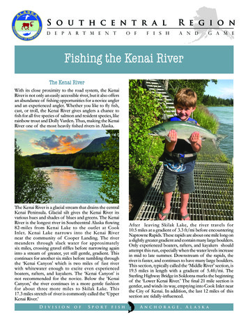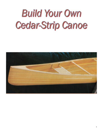
Transcription
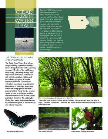
CEDARRIVERSince the 1800’s, Iowa rivershave been designated aseither meandered or nonmeandered. Much of the CedarRiver Water Trail is lined withpublic lands and classified asmeandered, meaning thatpaddlers may access not onlythe river itself but also theriver bottom and banks alongits course. However, north ofWashington Park, the river isclassified as non-meandered,meaning that the river bed andsurrounding land are owned bythe adjacent landowners andpaddlers should respect theirproperty rights.BLACK HAWKCOUNTYBLACK HAWKCOUNTYBLACK HAWKCOUNTYTHE CEDAR RIVER - WILDNESSAND CIVILIZATIONThe Cedar River Water Trail offers aunique paddling experience amongstIowa’s designated water trails. A journeydown the 47 miles of the trail featuresdramatically contrasting settings, withthe wildness of forested bottomlandsrich with diverse plant, wildlife, andbird species giving way to historicurban environments. Paddlers areoffered an opportunity to explore thedowntowns of two major Iowa citiesbefore returning again to the river’spastoral setting. Traversing the county’swidest stream, its landscape, and loremay feel like time travel at times. Fromprehistoric times into the present, theCedar River valley continues to beckonto paddlers to explore its natural beautyand cultural treasures.Red-spotted purple butterflySilver maples shade a peaceful backwater of the Cedar RiverThese trees, typical of bottomland hardwood forest, often grow right up to the water’sedge. Quiet back channels are “nurseries” for aquatic wildlife and isolated nesting areas forbirds and wildlife.Bank swallow nest holesCedar waxwing gathering nest material
CEDAR RIVER WATER TR AILThe Cedar River bisects Black Hawk County diagonally as it continues to erode thelandform region called the Iowan Surface. This relatively recently-formed landscape isprimarily composed of glacial drift deposited during the retreat of the Des Moines Lobe ofthe Wisconsinan glacier about 14,000 years ago.The river was originally named the Red Cedar River by the Meskwaki and Sauk due to thevast quantity of red cedar trees growing along it. Indigenous peoples used the lower reachesof falls and rapids formed by the river flowing over bedrock ledges on the river bottom asprime places for a safe crossing. Two of these fords were first known in historical times asPrairie Rapids (Waterloo) and Sturgis Falls (Cedar Falls).Prior to the cultivation of the landscape along the river banks, the Cedar River was crystalclear through much of the year. Fish in the river abounded, and the woodland river bankswere heavily vegetated and provided habitat and food for animals and humans.Turkey Foot ForksPhoto: Library of CongressNamed “Turkey Foot Forks” by NativeAmericans due to its resemblance to thefootprint of a wild turkey, the confluencearea of the Cedar, West Fork Cedar, andShell Rock Rivers has long attracted humansto its rich resources. An 1887 map of BlackHawk County shows the many claims madeto the area by later Euro-American settlers.After the region opened to Euro-American explorers in the 1830s, the Meskwaki andFox lost their hold on the area following the Black Hawk War of 1832. Settlements wereestablished in the mid-1840s along waterways, including the Cedar River and Black HawkCreek, attractive for their timber and other natural resources. In December 1845, the firstnewspaper was published – the Iowa State Register and Waterloo Herald.The first bridge over the Cedar River was built in Waterloo at Fourth Street in 1859. Priorto that, settlers crossed the river by fording it and, later in the 1850s, by ferry. The first damin Black Hawk County, built of brush and logs, was built at Cedar Falls in 1848. The seconddam was completed in 1854 in Waterloo. A sawmill was constructed at the same time.These developments on the river launched the progressive growth of two of Iowa’s mainurban centers, seven miles apart on the Cedar.Photo: Hartman Reserve Digital ArchiveJohn C. HartmanJohn C. Hartman succeeded his fatheras editor of the Waterloo Daily Courierin 1895. In his spare time, he was anavocational archaeologist and documenteda number of prehistoric sites in the CedarFalls/Waterloo area, many before theyvanished. Hartman Reserve Nature Centeris named in his honor.Birdseye view of Waterloo, Iowa in 1907Artifacts excavated at the Black Medicine Site at Hartman Reserve Nature CenterPhoto: Claudia GaffProjectile points and pottery fragments recovered from recent excavations at the BlackMedicine site on the bluff at Hartman Reserve; this prehistoric campsite is over 1,000 yearsold and one of several known to be located along the river in the Cedar Falls/Waterloometro area.Photo: Library of Congress
CEDAR RIVER WATER TR AILKEY0There are notable hazards to be awareof along the Cedar River Water Trail.Two dams, one each in the downtownareas of Cedar Falls and Waterloo, andthe portages around them, require thepaddlers’ attention. Follow the signageon the river and on shore that direct trailusers to the portages and safe passage.There are also two wing dams – which,unlike a conventional dam, extend onlypartway into the river: one immediatelydownstream of the Park Avenue Dam inWaterloo, and one approximately 2.4miles upstream near Sans Souci Island.The wing dam near Sans Souci Islandshould be avoided altogether. The damcreates narrow rapids that collectsdebris, and while it may not create thedangerous recirculating currents of alow-head dam, the unpredictable currentsand trapped woody debris can be quitehazardous. River users can bypass thisdam easily by keeping left and paddlingor tubing around the other side of SansSouci Island.Traversing the wing dam downstream ofthe Waterloo Dam is not recommendedfor any user.Beginner LevelBoat RampIntermediate LevelCarry Down AccessAdvanced LevelRestroomsCity/TownWaterPublic LandShelterPaved RoadwaysCampingGravel RoadwaysDamPortage TrailRapids/Rock Dam4 MilesWing DamAside from the dams, reported hazardsalong the Cedar River Water Trail areminimal. Riffles which could impactpaddlers at low water levels were notedjust downstream of the Janesville accessand rapids at a breached dam below theCedar Falls Dam. The rapids in CedarFalls are occasionally used for whitewateractivities when the river reaches an idealheight. For most users, however, avoidingthis area entirely is recommended.
CEDAR RIVER WATER TR AILStream Reach: Janesville City Park Access to Washington Union Access (4 miles)The Cedar River Water Trail begins at the Janesville City Park access. Just below the put-in,a small riffle may be challenging for beginning paddlers, especially at lower water levels. Twobridges, a railroad and a highway, are also downstream from there in Janesville. Paddlers areadvised to avoid the bridge abutments. If paddlers wish to avoid these hazards altogether,they may put in at a small city park on the south end of Janesville.There are several beaches along this stretch of the river and mussel shells are common onthem, as are turtles, killdeer, and other beach birds. Some tree and bank swallows may befound foraging over the river.The middle ½ mile of this reach is nicely wooded with bottomland hardwoods. Bald eagles,herons, red-tailed hawks, turkey vultures, barred owls and even a few wood pewees areseen along the entire four mile stretch.Vegetation varies widely in this section. In much of the upper half of the stretch, there istypical lowland hardwood woodland, with silver maple, cottonwoods, willow and someboxelder, with elms next to the water and walnut, some ash, hackberry, and oaks onbenches farther above the water.Plain pocketbook musselThe number and types of mussels in a riverare an important indicator of its health.Recent Cedar River surveys have identifiedfourteen species of living mussels and theshells of two others.The lower half of this section has been and still is grazed heavily by cattle. While a few largeswamp white oaks, silver maple, hackberry, and cottonwoods tell what the forest along hereused to look like, it is now dominated by small and large honey locust trees, thistles andother inedible species in the understory.The Shell Rock River joins the West Fork Cedar River about 1.5 miles above WashingtonUnion Access, increasing the river’s water volume and vitality as it proceeds. As travel onthis stretch concludes, the paddler approaches Washington Union Access, located at theconfluence of the Cedar River and the West Fork Cedar River.Recommended Experience Classification: BeginnerStream Reach: Washington Union Access to Black Hawk Park Access (5.1 miles)After passing the Washington Union Access, the river passes beneath the W. Cedar WapsiRoad bridge and the landscape changes dramatically. The vast majority of this stretchof river is surrounded by public land, owned and operated by the Black Hawk CountyConservation Board. It has a wildness that is rivaled only by the stretch from North CedarPark to Cedar Bend in Bremer County to the north of the water trail proper. It contains abroad floodplain of bottomland hardwood forest, beaches on the insides of numerous rivermeanders, and abundant wildlife.An alternate channel along the CedarPeriodic flooding and allowing the river tomake its own way have led to the creationof alternate channels in several locations,leaving islands both large and small.Turtles, great blue and green herons, deer,raccoons, and other wildlife make use ofthese small backwaters, making explorationexciting.A wide variety of songbirds make use of the woodlands along this stretch, includingwarblers, vireos, grosbeaks, orioles, wrens, catbirds, flycatchers, and many other species.Similarly, beaches occur on the inside bends of turns in the river and mussel shells,shorebirds and an abundance of turtles—especially soft shelled—make use of them.Be aware that a shooting range is near the access at Black Hawk Park. It can be heard up toone mile upriver. Be assured it is a safe and well-maintained range isolated from the river.This entire stretch of river is typical bottomland hardwood forest, with silver mapledominating near the water, allowing some cottonwoods, box elder, elms, and willows topop through. It is vegetated to the water’s edge and, where sunlight is sufficient, riverbankgrapes and poison ivy vines drape nearly into the water. On shoreline benches 4-6 feetabove the water, walnuts, hackberry, ash, swamp white oaks, and a few Kentucky coffeetrees are found. Elderberry and gray dogwood are common in openings. While a few honeylocusts can also be found in this location, they are common only in small areas.Recommended Experience Classification: Beginner
CEDAR RIVER WATER TR AILStream Reach: Black Hawk Park Access to Island Park Access (4.8 miles)This section is one of transition, changing from the wildness of the river in Black Hawk Parkto the urban river of Cedar Falls and Waterloo. Approximately half of this section is in eachof the two zones.The access at Black Hawk Park offers water, picnic tables, a picnic shelter, vault toilets,and garbage cans. The camping area of the park is not far from this access. There isample parking. Around the first bend of the river, paddlers will find the Black Hawk Parkcampground on the left side of the river. It is possible, with some careful footwork, to put inor take out there as well. Many quiet backwaters, alternate channels, and islands continue tobe features of this portion of the river.Blue flag irisBlue flag iris flowers from May through Juneand favor wetlands and waterways.Cabins appear as soon as the park land ends along the left side of the river soon followed byhomes as paddlers approach closer to Cedar Falls. This section of the river is popular withanglers—in johnboats and on the shoreline—and with other water recreationists on jet-skis,pontoon boats, and speedboats in the mile just above the dam. If paddlers stay close to theright shore, they can avoid much of the traffic and still see wildlife and wild land on that sideof the river. In fact, about ¼ mile above the Island Park Access, paddlers can duck into theshallow backwaters of an island on river right and share it with geese, bachelor mallards,cedar waxwings, orioles, blue flag iris, blooming dogwoods, butterflies, dragonflies, beesand turtles. It is a fitting end to an exploration of a beautiful stretch of river.However, paddlers must be certain to get out of the river at Island Park on river left toavoid the dangerous dam at Cedar Falls just below that point. Take out and portage at IslandPark are necessary. There are two boat ramps, but if they are busy, paddlers can take out atthe beach just below the ramps.Vegetation along the first half of this stretch is the same bottomland hardwood forest foundin the previous stretch. When cabins and private land occurs along the river, of course,it changes to rip-rapped shoreline—some of it using rock rather than cement waste—withscattered trees and mowed lawns.Recommended Experience Classification: BeginnerStream Reach: Island Park portage to Gateway Park Access to Washington ParkAccess to George Wyth Park Access to Sherwood Park (.5 to 1 mile portage, then4 miles to Sherwood Park)While it is possible to put in at Tourist Park, which is closer to Island Park, the put-in belowthe dam requires portaging a boat through a narrow woodland trail, lined with poison ivy,that leads to a small sand inlet. Tourist Park does have parking and a small picnic shelter, butis also the site of a disk golf course and appeals to a lively, younger crowd.The dam at Cedar FallsPhoto: Library of CongressThe Cedar River drops about six feet duringits half-mile course from Center Street tothe Iowa Highway 57 Bridge in Cedar Falls.This geological fact gives that city the “falls”of its name. Built in 1886, this dam is oneof a succession of dams that contributedgreatly to economic development in themetro area.An alternative portage for paddlers who have access to a vehicle to transport paddlecraftis to put in at Gateway Park, a bit farther downstream. Gateway has parking, restrooms,and a ramp to enable put-in. However, the hazards in the water below the Gateway ParkAccess are considerable and should only be undertaken by experienced paddlers. Thedisadvantage here is that immediately below the put-in, there is a breached dam thatcreates some challenging rapids, and the dam wall on the left makes it difficult to exit theriver. Whitewater paddlers use this area to hone their skills, so it’s pretty common tosee them surfing and performing maneuvers in the standing waves. A section off to theright of this breached dam creates recirculating currents that can be deadly. If your skillsare not advanced, or you are unfamiliar with this area, it’s best to avoid it. (Note: puttingin at Tourist Park would not avoid these rapids, either, but rather would add some moreupstream.)River travelers wishing to bypass this area altogether could put in farther downstream atWashington Park on river right. Since most will not portage on foot anyway, this option isrecommended as a better access for most paddlers. There is an existing boat ramp there
CEDAR RIVER WATER TR AILN
CEDAR RIVER WATER TR AILand the park is owned and managed by the City of Cedar Falls and the slopes are gentleproviding a safer and more usable option. If an expedition into downtown Cedar Falls is onyour itinerary, this may not be a bad staging area.A snapping turtle basks on a logOther turtle species found in the CedarRiver include softshell turtles, painted, andmap turtles.Once the paddler departs Washington Park Access and passes under the busy Hwy 58bridge and the bike/pedestrian bridge just below it, the city is quickly left behind. Cliffswallow nests decorate the undersides of both bridges. The wooded slopes of Cedar Fallsand the expanded woodlands of George Wyth State Park and Hartman Reserve NatureCenter quickly turn this urban paddle into a pleasant paddle through Iowa wildness. Thebottomland hardwood forest holds a variety of birds and other wildlife. Spotted sandpipersand killdeer occupy the beaches, while turtles bask on the logs. Orioles, wrens, woodpewees, and other woodland birds call from the woods along the shoreline. The public landmeans that the riparian zone is wide, allowing deep woodland birds like scarlet tanagers andred-eyed vireos and other wildlife to be common, despite the urban location. Deer, foxes,squirrels and woodchucks are all common.Bike trails are found along both sides of the river. Interpretive signage may be found nearHartman Reserve. At George Wyth State Park look for an old, now abandoned, boat rampalong the bike trail at the “Pickles Place” gazebo.The inside bend of the river is Hartman Reserve with a beach area used by both humansand wildlife. Mussel shells on the beach reveal their presence in the river, and crows, geese,mallards, blackbirds, killdeer and sandpipers make use of the sand area. Spiny softshells,snappers, and other turtles enjoy this beach, too. Typical bottomland forest of silver maple,cottonwoods, and willow dominates near the water, while on upland slopes walnuts,basswoods, and oaks punctuate the canopy.Recommended Experience Classification: Advanced to Washington Park, Beginneras the trail continues to Sherwood Park.Stream Reach: Sherwood Park to Cedar Bend Park (BH Co.) to WaterlooBoathouse - last take-out in downtown Waterloo) (3.7 miles)The access at Sherwood Park is in an urban setting, right next to busy Hwy 218. This shortstretch is an interesting urban/rural combination. However, the noise of the highway quicklyfades as trees absorb the din as paddlers move downriver and into the bend of Cedar Bend.Much of the shoreline is rip-rapped with concrete. Remnant stairs, private ramps, etc. areall that remain of cabins and houses that once stood along the river, destroyed in floodingof recent years. The Waterloo levee system begins about .4 mile southeast of the HartmanReserve access, directly south of where the river takes the large horseshoe bend to thenorth.A wing dam juts northeast into the river at that point also, seemingly directing the river—and paddlers—to take the bend north. Keep left!The Cedar Bend area of the river is heavily forested with bottomland forest. Deer, greatblue herons, green herons, belted kingfishers, great crested flycatchers, woodpeckers,swallows, and other river fauna are all seen easily in this area.Cedar Bend Park AccessAs paddlers approach the northernmost bend in the river, the Waterloo levee on thenorthwest side of the city is visible from the river. At first just appearing as a rip-rappedarea beyond the bottomland trees, the trees disappear and the levee (with the bike trail ontop) comes into full view along the eastern side of Cedar Bend. Cedar Bend Park and itsaccess are evident on the east (left) side of the river. On the Cedar Bend island, a sloughreaches back into the center of the island, beginning about halfway down the eastern sideof the island. A paddle back into this quiet backwater may yield a rewarding experience indiscovering the wildlife of this area.As the river turns back to the east and into downtown Waterloo, on river right is an areawith stone docks and steps and patios that once serviced several expensive riverfronthomes on Sans Souci Island. They are gone now but for the stone waterfront remains.Opposite, on river left, is an active neighborhood of modest homes on the river side of the
CEDAR RIVER WATER TR AILJohn C. Hartmanlevee, most with boat docks in front along the river. Evidence of the flooding of recent yearsis not hard to find.As the river bends to the east and towards downtown Waterloo, it becomes fully an urbanriver. The noise from industry to the south is constant, traffic over the nearby roads andbridges is constant, and the flood walls that line the river through downtown Waterloo arevisible in the distance. Yet the land along the river is still wild on the left, the non-manicuredportion of Exchange Park. Scan the dense willows along the river for beaver homes.Kingfishers also rattle along the river here, finding fish to eat and apparently oblivious to theclamor of the city.The treed portions of this stretch are silver maple dominated bottomland hardwoods. Somecottonwoods, willow, boxelder and elms are included in this mix. Because most of the landis only 1-3 feet above the water level, only trees capable of having wet roots survive here.A patch of healthy swamp white oak graces a backwater on the eastern side of the CedarBend island. A few walnuts and basswoods on higher benches are also found. Reeds canarygrass, sedges, curly dock, dogwoods, and riverbank grapes are common throughout thestretch.The Waterloo Boat HouseThe last access in Waterloo before the downtown is on river left at Exchange Park, just afterthe red-roofed Waterloo Boat House on the waterfront. (Black Hawk Creek enters theCedar River just across from Exchange Park on river right.) The access is a boat ramp andhas docks to which to tie up if so desired. The parking lot is ample and there are restroomsnearby.Paddlers that continue down the river may only go a short distance and must exit thewater on river left to portage around the Park Avenue and Sixth Street dams in downtownWaterloo. This short stretch of river is classifed Advanced for this reason. Be aware there isa steep staircase at the end of the portage.After completing the portage and putting back in, another short distance of river travelbrings paddlers to the Riverview Recreation Area Access on river right.Recommended Experience Classification: Beginner, Advanced from Waterloo BoatHouse to portage take-outStream Reach: Riverview Recreation Area Access to Deerwood Park to CedarTerrace Park Access to Gilbertville Park Access (10.5 miles)The Riverview Recreation Area Access has a parking area and a vault toilet at the ORVgrounds. However, it is isolated and may not be the best place to leave a car overnight. Analternate access downriver is Deerwood Park with a campgrounds, restroom, parking, andpicnic area.Take-out by Park Avenue BridgeExit on river left before the bridge to begina portage around the dams in downtownWaterloo.The left side of the river in the first part of this section has a large levee that stretches downto Hwy 20/I-380 approximately 3 miles downriver. It protects the southeast Waterloo area(and Evansdale) from flooding. Accordingly, the levee is covered with rip-rap, not providingthe paddler with much to look at. The right side of the river is partially leveed down to Hwy20/I-380 and also contains old cement rip-rap along some of the shoreline. However, partof the right shoreline is treed with bottomland hardwood forest, dominated by silver maple.This is typical along most of this whole length to Gilbertville, with walnut, swamp whiteoaks, and some cottonwoods, hackberry, honey locust, and box elder.Demonstrating how tolerant of humans they have become, a bald eagle nest has beenobserved in the first mile on the first and most heavily wooded bend in the river, despitethe industrial area behind it. Song sparrows, orioles, robins, Canada geese, turkey vultures,mallards, great blue herons, red-winged blackbirds, cardinals, rough-winged swallows,barred owls, and turtles are also common along this stretch. True to an urban area, freshrains sometimes flush out the contents of storm sewers into the river.Frequent flooding in recent decades has created alternate channels and islands in the Cedar,including some throughout the Deerwood Park area and below. The isolated back channels,
CEDAR RIVER WATER TR AILNKEYBeginner Level0Boat RampIntermediate LevelCarry Down AccessAdvanced LevelRestroomsCity/TownWaterPublic LandShelterPaved RoadwaysCampingGravel RoadwaysDamPortage TrailRapids/Rock Dam4 MilesWing Dam
CEDAR RIVER WATER TR AILas in the rest of the river, create valuable nursery areas for aquatic wildlife and isolatednesting areas for birds and wildlife. Though floods occasionally tear through them, thesenow quiet backwaters are critical for wildlife, especially in these urban areas.Adult bald eagle near GilbertvilleFrom Deerwood Park to Gilbertville, the river bends several times in its current floodplainand it is evident that it spills out onto its floodplain frequently. Some rip-rapping is presentbut most of the remaining six miles is wooded along the riparian area and wildlife is easyto find. Rock and sand beaches are common in the inside bends and softshelled turtlesare found in abundance. Painted turtles, map, and snapping turtles make use of baskinglogs along the way and a wide variety of birds use the forests along the shoreline. Wherehigher land is found on the outside bends, upland oak forests are found. Portions of theriver floodplain are labeled as part of a WRP easement: the Wetland Reserve Program inthe Federal Farm Bill that has made permanent easements of much bottomland along Iowarivers.The Cedar Valley Nature Trail and the Cedar River Water Trail meet at a bend in the riverabout a mile above Gilbertville. Paddlers may want to consider a unique bike shuttle optionthat this intersection suggests--leaving a bicycle somewhere downstream to ride back up thetrail to retrieve a vehicle at a float’s starting point.Below that area, the land on the west side of the river is grazed. Honey locusts dominatethe trees in this area. Homes line the bluff on the east above the river as it rounds the bendtowards Gilbertville.Gilbertville Park AccessAfter passing under the East WashburnRoad Bridge at Gilbertville, find the accessat a small park on the left, on the southwestend of Gilbertville. This access features aboat ramp, picnic tables, and a parking area.Bottomland forest is most common along this stretch, dominated by silver maple, withcottonwoods interspersed and mulberry and boxelder in the understory. Willows dominateon the inside bends where sand and gravel beaches are found, grading back into largewillows and cottonwoods. On benches above the bottomland forest find walnuts, ash,elm, and some swamp white oaks and white oaks. Basswoods and some sugar maples arefound in uplands well above the floodplain. Where enough light exists, Reeds canary grass,elderberry, and dogwood grow along the shoreline, with overhanging vines of riverbankgrape and poison ivy common. Nettles, jewelweed and dock are herbaceous plantscommonly found in the understory and river edge, as well.Recommended Experience Classification: BeginnerStream Reach: Gilbertville Park Access to Cedar River Natural Resource AreaAccess to McFarlane/Cedar River Accesses (9 miles)This section of river is a highly channelized portion of the Cedar. But because ofpublic ownership along much of its length, it makes for an interesting paddle. Prior tochannelization, the river meandered over a broad floodplain. Today, much of that floodplainis farmed, obvious by the scarcity of trees on the west, and cattle grazing degrading thebank in the first mile below Gilbertville. However, the east side is dominated by bottomlandhardwoods in that same mile.The Cedar River Natural Resource Area (CRNRA) is public land, owned and managed forhunting and wildlife by Black Hawk County Conservation. In the second mile of this stretch,paddlers should be aware that the CRNRA has a shooting range so they are not caught offguard by the sound of nearby gunfire.Cedar River Natural Resource Area AccessA gravel road runs along a drainage ditch that drains farmland to the west and ends on thenorth side of where that ditch enters the river. During sufficient water levels, a paddle upthat ditch a few hundred yards reveals the interior of the silver maple bottomland forest andits inhabitants to the paddler.The remaining six miles of this section is more meandering than the initial two miles,although it does not occupy all of the twists and turns it once did. The inside bends of turnsin the river are usually sand and gravel bars and are used by killdeer and spotted sandpipersfor nesting, by bachelor mallards and Canada geese for loafing, and by turtles for basking.Dense willows that inhabit the inner parts of these bars hide deer, beaver, coyotes, andothers coming to the river for a drink or a snack. Outside bends, if steep, hold colonies of
CEDAR RIVER WATER TR AILbank swallows and the more hidden nest holes of rough-winged swallows. Belted kingfishernest holes may be found there, as well. In wooded stretches, oriole nests overhang thewater from silver maple branches; wrens, wood ducks, and woodpeckers use tree cavitiesfor nesting; while bluejays, great crested flycatchers, and great blue herons perch in treetops.A mile-long island is found in the river about halfway between the CRNRA and the BrandonRoad Bridge. Its island status and dense bottomland forest make it ideal wildlife habitat.Elderberry in bloomIn June, elderberry shrubs are bloomingin the understory along sunny banks. Theyattract a number of pollinators to theirfragrant flowers, and the berries they formwill treat August paddlers to snacks and toviews of many fruit-eating bird species.Silver maples dominate the hardwoods along this stretch, with mulberry, boxelder, and elmin the understory and some willows and cottonwoods. Riverbank grape and poison ivy vinesare common along the bank. So too is Siberian elm, a woody invasive that can quickly ruin anative woodland. A good stand of it is growing along the shoreline on the northeast end ofthe Cedar River Natural Resource Area.Also along this stretch are notable Kentucky coffee trees, a tree with a seed that must bescarified to sprout. Scarification is defined as the weakening, opening, or altering the coatof a seed to encourage germination. It is not common along any of the Cedar but, rather, isfound here and there. Paddlers should look for its huge doubly pinnately compound leavesand curved exterior bark.On the interior of the few bends on this stretch, sand and rock bars are found and areusually grown up with a “willow wedge” -- that is, young,
The river was originally named the Red Cedar River by the Meskwaki and Sauk due to the . vast quantity of red cedar trees growing along it. Indigenous peoples used the lower reaches . of falls and rapids formed by the river flowing over bedrock ledges on the river bottom as prime places for a safe crossing.