Transcription
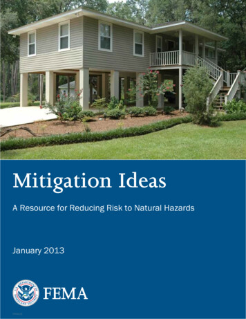
Mitigation IdeasA Resource for Reducing Risk to Natural HazardsJanuary 201301024.13
AcknowledgementsFEMA’s Risk Analysis Division funded the development of this document, which updates Mitigation Ideas: PossibleMitigation Measures by Hazards Type created by FEMA Region V in 2002. The primary authors and project managerswere Julie Baxter and Karen Helbrecht from FEMA and Stacy Franklin Robinson, Sara Reynolds, Adam Reeder, andHilary Kendro from the Strategic Alliance for Risk Reduction (STARR). Laura Coventry (STARR) provided layout and designsupport. Special thanks to the following FEMA program areas for their contributions to this project: Hazard MitigationPlanning, Building Sciences, Environmental and Historic Preservation, Flood Mitigation and Insurance, and HazardMitigation Assistance.2Mitigation Ideas: A Resource for Reducing Risk to Natural Hazards
Table of ContentsTable of ContentsIntroduction . 4Drought. 5Earthquake. 9Erosion . 15Extreme Temperatures .19Flood . 21Hail .33Landslide .35Lightning . 39Sea Level Rise. 41Severe Wind . 45Severe Winter Weather . 51Storm Surge. 55Subsidence. 59Tornado. 63Tsunami . 65Wildfire .69Multiple Hazards .75FEMA Resources/Publications . 83FEMA Contacts .883
IntroductionIntroductionThe purpose of this document is to provide a resource that communities can use to identifyand evaluate a range of potential mitigation actions for reducing risk to natural hazardsand disasters.The focus of this document is mitigation, which is action taken to reduce or eliminatelong-term risk to hazards. Mitigation is different from preparedness, which is action taken toimprove emergency response or operational preparedness.Ideas for mitigation actions are presented for the following natural hazards: DroughtEarthquakeErosionExtreme temperaturesFloodHailLandslideLightningSea level riseSevere windSevere winter weatherStorm surgeSubsidenceTornadoTsunamiWildfireExamples of mitigation actions areplanning and zoning, floodplainprotection, property acquisition andrelocation, or public outreach projects.Examples of preparedness actions areinstalling disaster warning systems,purchasing radio communicationsequipment, or conducting emergencyresponse training.Actions that may mitigate multiple hazards are presented in the last section, entitled“Multiple Hazards.”The suggested mitigation actions are summarized into four types: (1) Local Planning andRegulations, (2) Structure and Infrastructure Projects, (3) Natural Systems Protection, and (4)Education and Awareness Programs. Examples of activities that can be used to accomplisheach mitigation goal are identified, as well as the relevant FEMA publications or resources,if applicable.This document is intended to be a starting point for gathering ideas and should not be usedas the only source for identifying actions. Communities should seek innovative and differentideas for reducing risk that meet their unique needs. The actions listed are not necessarilyeligible for Federal assistance programs. Users should review specific program guidanceand contact their State Hazard Mitigation Officer (SHMO) or regional FEMA office for moreinformation.4Mitigation Ideas: A Resource for Reducing Risk to Natural Hazards
DroughtA drought is a period of unusually constant dry weatherthat persists long enough to cause deficiencies in watersupply (surface or underground). Droughts are slow-onsethazards, but, over time, they can severely affect crops,municipal water supplies, recreational resources, and wildlife.If drought conditions extend over a number of years, thedirect and indirect economic impacts can be significant. Hightemperatures, high winds, and low humidity can worsendrought conditions and also make areas more susceptible towildfire. In addition, human actions and demands for waterresources can accelerate drought-related impacts.
Local Planning and RegulationsD-1 Assess Vulnerability toDrought RiskTo better understand and assess local vulnerability to drought,consider actions such as:D-2 Monitor DroughtConditionsMonitoring drought conditions can provide early warning forpolicymakers and planners to make decisions throughactions including: Gathering and analyzing water and climate data to gain a betterunderstanding of local climate and drought history. Identifying factors that affect the severity of a drought. Identifying available water supplies. Determining how the community and its water sources have beenimpacted by droughts in the past. D-3 Monitor Water SupplyIdentifying local drought indicators, such as precipitation,temperature, surface water levels, soil moisture, etc.Establishing a regular schedule to monitor and report conditionson at least a monthly basis.Monitoring the water supply and its functions can save water in thelong run through actions such as: Regularly checking for leaks to minimize water supply losses. Improving water supply monitoring.D-4 Plan for Drought6Plan for future drought events in your area through actions such as: Developing a drought emergency plan. Developing criteria or triggers for drought-related actions. Developing a drought communication plan and early warningsystem to facilitate timely communication of relevant informationto officials, decision makers, emergency managers, and the generalpublic. Developing agreements for secondary water sources that may beused during drought conditions. Establishing an irrigation time/scheduling program or process sothat all agricultural land gets the required amount of water.Through incremental timing, each area is irrigated at differenttimes so that all water is not consumed at the same time. Spacingusage may also help with recharge of groundwater.Mitigation Ideas: A Resource for Reducing Risk to Natural Hazards
D-5 Require Water ConservationDuring Drought ConditionsRequire mandatory water conservation measures during droughtemergencies, including:D-6 Prevent OvergrazingPrevent overgrazing, which has been linked to drought vulnerability,through actions such as: Developing an ordinance to restrict the use of public waterresources for non-essential usage, such as landscaping, washingcars, filling swimming pools, etc. Adopting ordinances to prioritize or control water use, particularlyfor emergency situations like fire fighting. Establishing a grazing policy or permitting program toprevent overgrazing. Reducing the number of animals and improvingrange management.Structure and Infrastructure ProjectsD-7 Retrofit Water SupplySystemsImprove water supply and delivery systems to save water throughactions such as: Designing water delivery systems to accommodate drought events. Developing new or upgrading existing water delivery systems toeliminate breaks and leaks.Natural Systems ProtectionD-8 Enhance Landscaping andDesign MeasuresEncourage drought-tolerant landscape design through measuressuch as: Incorporating drought tolerant or xeriscape practices into landscapeordinances to reduce dependence on irrigation. Providing incentives for xeriscaping. Using permeable driveways and surfaces to reduce runoff andpromote groundwater recharge.DroughtMitigation Ideas: A Resource for Reducing Risk to Natural Hazards7
Education and Awareness ProgramsD-9 Educate Residents onWater Saving TechniquesEncourage citizens to take water-saving measures, such asthe following:D-10 Educate Farmers onSoil and Water ConservationPracticesEncourage farmers to implement soil and water conservationpractices that foster soil health and improve soil quality to helpincrease resiliency and mitigate the impacts of droughts. Potentialconservation practices include the following: Installing low-flow water saving showerheads and toilets. Turning water flow off while brushing teeth or during othercleaning activities. Adjusting sprinklers to water the lawn and not the sidewalkor street. Running the dishwasher and washing machine only when theyare full. Checking for leaks in plumping or dripping faucets. Installing rain-capturing devices for irrigation. Encouraging the installation of graywater systems in homes toencourage water reuse. Rotating crops by growing a series of different types of crops onthe same fields every season to reduce soil erosion. Practicing contour farming by farming along elevation contourlines to slow water runoff during rainstorms and prevent soilerosion, allowing the water time to absorb into the soil. Using terracing on hilly or mountainous terrain to decrease soilerosion and surface runoff. Planting “cover crops,” such as oats, wheat, and buckwheat, toprevent soil erosion. Using zero and reduced tillage to minimize soil disturbance andleave crop residue on the ground to prevent soil erosion. Constructing windbreaks to prevent evaporation from reclaimingsalt-affected soil. Collecting rainwater and using natural runoff to water plants.D-11 Purchase Crop InsuranceFEMA Resources/PublicationsFEMA 20, P-85, 361, 453Preserve economic stability during a drought by encouragingagricultural interests to obtain crop insurance to cover potentiallosses due to drought.Other drought-related mitigation actions may also apply to other hazards. See the sections entitled“Extreme Temperatures” and “Multiple Hazards” for other possible ideas.8Mitigation Ideas: A Resource for Reducing Risk to Natural Hazards
EarthquakeAn earthquake is a sudden release of energy that createsa movement in the earth’s crust. Most earthquake-relatedproperty damage and deaths are caused by the failureand collapse of structures due to ground shaking. Thelevel of damage depends upon the extent and duration ofthe shaking. Other damaging earthquake effects includelandslides, the down-slope movement of soil and rock (inmountain regions and along hillsides), and liquefaction.
Local Planning and RegulationsEQ-1 Adopt and EnforceBuilding CodesFEMA Resources/PublicationsFEMA 83, 224, 232, 254, 266,313, 349, P-749, P-750EQ-2 Incorporate EarthquakeMitigation into Local PlanningFEMA Resources/PublicationsFEMA 83, 224, 254, 266, 313, 349EQ-3 Map and Assess CommunityVulnerability to Seismic HazardsFEMA Resources/PublicationsFEMA 83, 154, 366, ROVER10Building codes reduce earthquake damage to structures. Consideractions such as: Adopting and enforcing updated building code provisions toreduce earthquake damage risk. Adopting the International Building Code (IBC) and InternationalResidential Code (IRC).Earthquake risk can be reduced through local planning, codes, andordinances, including: Creating a seismic safety committee to provide policyrecommendations, evaluate and recommend changes in seismicsafety standards, and give an annual assessment of local andstatewide implementation of seismic safety improvements. Developing and distributing guidelines or passing ordinances thatrequire developers and building owners to locate lifelines,buildings, critical facilities, and hazardous materials out of areassubject to significant seismic hazards. Incorporating structural and non-structural seismic strengtheningactions into ongoing building plans and activities in the capitalimprovement plan to ensure that facilities remain operational foryears to come. Supporting financial incentives, such as low interest loans or taxbreaks, for home and business owners who seismically retrofittheir structures.To better understand and assess local vulnerability to earthquakes,consider actions such as: Developing an inventory of public and commercial buildings thatmay be particularly vulnerable to earthquake damage, includingpre-1940s homes and homes with cripple wall foundations. Collecting geologic information on seismic sources, soil conditions,and related potential hazards. Creating an earthquake scenario to estimate potential loss of lifeand injuries, the types of potential damage, and existingvulnerabilities within a community to develop earthquakemitigation priorities. Using Hazus to quantitatively estimate potential losses froman earthquake. Maintaining a database to track community vulnerability toearthquake risk. Using GIS to map hazard areas, at-risk structures, and associatedhazards (e.g., liquefaction and landslides) to assess high-risk areas.Mitigation Ideas: A Resource for Reducing Risk to Natural Hazards
Local Planning and RegulationsEQ-4 Conduct Inspections ofBuilding SafetyFEMA Resources/PublicationsFEMA 154, 155, 202, 221, 224, 225,226, 233, 306, 307, 395, ROVERInspections can be used to assess earthquake risk, such as: Establishing a school survey procedure and guidance document toinventory structural and non-structural hazards in and aroundschool buildings. Using rapid visual screening to quickly inspect a building andidentify disaster damage or potential seismic structural andnon-structural weaknesses to prioritize retrofit efforts, inventoryhigh-risk structures and critical facilities, or assess post-disaster riskto determine if buildings are safe to re-occupy. Consulting industry standard publications such as AmericanSociety of Civil Engineers (ASCE) 31 - Seismic Evaluation of ExistingBuildings, ASCE 41 - Seismic Rehabilitation of Existing Buildings,and Applied Technology Council (ATC) 20 - Procedures forPostearthquake Safety Evaluation of Buildings.EarthquakeMitigation Ideas: A Resource for Reducing Risk to Natural Hazards11
Structure and Infrastructure ProjectsEQ-5 Protect Critical Facilitiesand InfrastructureReduce potential damage to critical facilities and infrastructure fromfuture seismic events through actions such as:EQ-6 Implement StructuralMitigation TechniquesUse structural mitigation measures to reduce damage from futureseismic events, such as:FEMA Resources/PublicationsFEMA 307, 320, 345, 356, 361,395, 396, 412, 453, 547, P-77412 Conducting seismic retrofitting for critical public facilities most atrisk to earthquakes. Requiring bracing of generators, elevators, and other vitalequipment in hospitals. Identifying and hardening critical lifeline systems (i.e., critical publicservices such as utilities and roads) to meet “Seismic DesignGuidelines and Standards for Lifelines” or equivalent standardssuch as American Lifelines Alliance (ALA) guidance. This maydistinguish a manageable earthquake from a social andeconomic catastrophe. Reviewing construction plans for all bridges to determine theirsusceptibility to collapse and retrofitting problem bridges. Using flexible piping when extending water, sewer, or naturalgas service. Installing shutoff valves and emergency connector hoses wherewater mains cross fault lines. Strengthening and retrofitting non-reinforced masonry buildingsand non-ductile concrete facilities that are particularly vulnerableto ground shaking. Retrofitting building veneers to prevent failure. Building a safe room to provide protection during an earthquake. Installing window film to prevent injuries from shattered glass. Anchoring rooftop-mounted equipment (i.e., HVAC units, satellitedishes, etc). Constructing masonry chimneys greater than 6 feet above a roofwith continuous reinforced steel bracing.Mitigation Ideas: A Resource for Reducing Risk to Natural Hazards
Education and Awareness ProgramsEQ-7 Increase EarthquakeRisk AwarenessFEMA Resources/PublicationsFEMA E-74, 474, 526, 527, 528,529, 530, P-811; EMI IS-22EQ-8 Conduct Outreachto Builders, Architects,Engineers, and InspectorsFEMA Resources/PublicationsFEMA 232, 313, 389, P-420, 454There are many ways to increase awareness of earthquakerisk, including: Working with insurance industry representatives to increase publicawareness of the importance of earthquake insurance. Residentialstructural improvements can be factored into the process ofobtaining insurance coverage or reduced deductibles. Developing an outreach program about earthquake risk andmitigation activities in homes, schools, and businesses. Educating homeowners on safety techniques to follow during andafter an earthquake. Offering GIS hazard mapping online for residents and designprofessionals.Building susceptibility to earthquake damage can be improved ifdesign professionals are made aware of proper design and buildingrequirements. Outreach activities include: Conducting information sessions or other forms of outreach onseismic code provisions for new and existing buildings to enhancecode use and enforcement by local architects, engineers,contractors, and code enforcement personnel. Training building department staff and officials on Form ATC-20 forpost-earthquake building evaluation. The ATC-20 report andaddendum, prepared by the Applied Technology Council, provideprocedures and guidelines for making on-the-spot evaluations anddecisions regarding continued use and occupancy of earthquakedamaged buildings.EarthquakeMitigation Ideas: A Resource for Reducing Risk to Natural Hazards13
Education and Awareness ProgramsEQ-9 Provide Informationon Structural andNon-Structural RetrofittingFEMA Resources/PublicationsFEMA E-74, 412, 413, 414, 530, 547Property owners can retrofit existing structures to reduce damagefrom seismic events. Potential actions include the following: Educating homeowners about structural and non-structuralretrofitting of vulnerable homes and encouraging retrofit. Developing a technical assistance information program forhomeowners. Teaching them how to seismically strengthen theirhouses can be an effective mitigation activity. The program caninclude providing local government building departments withcopies of existing strengthening and repair informationfor distribution. Developing an outreach program to encourage homeowners tosecure furnishings, storage cabinets, and utilities to prevent injuriesand damage. Examples include anchoring tall bookcases and filecabinets, installing latches on drawers and cabinet doors,restraining desktop computers and appliances, using flexibleconnections on gas and water lines, mounting framed pictures andmirrors securely, and anchoring and bracing propane tanks andgas cylinders. Establishing a library of technical documents on structural andnon-structural mitigation options as well as model ordinances andprocedures that have been used by other jurisdictions to reduceearthquake risk.Other earthquake-related mitigation actions may also apply to other hazards. See the section entitled“Multiple Hazards” for other possible ideas.14Mitigation Ideas: A Resource for Reducing Risk to Natural Hazards
ErosionErosion is the wearing away of land, such as loss of riverbank,beach, shoreline, or dune material. It is measured as the rateof change in the position or displacement of a riverbank orshoreline over a period of time. Short-term erosion typicallyresults from periodic natural events, such as flooding,hurricanes, storm surge, and windstorms, but may beintensified by human activities. Long-term erosion is a resultof multi-year impacts such as repetitive flooding, wave action,sea level rise, sediment loss, subsidence, and climate change.Death and injury are not typically associated with erosion;however, it can destroy buildings and infrastructure.
Local Planning and RegulationsER-1 Map and AssessVulnerability to ErosionErosion risk can be better assessed and monitored with mappingtechniques, including the following:ER-2 Manage Development inErosion Hazard AreasErosion damage can be mitigated by regulating how developmentoccurs in hazard areas, such as the following:ER-3 Promote or Require Siteand Building Design Standardsto Minimize Erosion RiskDevelopment can be designed to minimize damage due to erosionusing the following techniques: Using GIS to identify and map erosion hazard areas. Developing and maintaining a database to track communityvulnerability to erosion. Using GIS to identify concentrations of at-risk structures. Improving mapping of hazard areas to educate residents aboutunexpected risks. Adopting sediment and erosion control regulations.Adopting zoning and erosion overlay districts.Developing an erosion protection program for high hazard areas.Employing erosion control easements.Prohibiting development in high-hazard areas.Developing and implementing an erosion management plan.Requiring mandatory erosion surcharges on homes.Locating utilities and critical facilities outside of areas susceptible toerosion to decrease the risk of service disruption. Constructing open foundation systems on buildings tominimize scour. Constructing deep foundations in erosion hazard areas. Clustering buildings during building and site design. Designing and orienting infrastructure to deter erosionand accretion.Structure and Infrastructure ProjectsER-4 Remove Existing Buildingsand Infrastructure from ErosionHazard AreasTo prevent damage to buildings and infrastructure from erosion,consider acquiring and demolishing or relocating at-risk buildingsand infrastructure and enforcing permanent restrictions ondevelopment after land and structure acquisition.FEMA Resources/PublicationsFEMA P-5516Mitigation Ideas: A Resource for Reducing Risk to Natural Hazards
Natural Systems ProtectionER-5 Stabilize ErosionHazard AreasTo stabilize slopes susceptible to erosion, consider options such as: Preventing erosion with proper bank stabilization, sloping orgrading techniques, planting vegetation on slopes, terracinghillsides, or installing riprap boulders or geotextile fabric. Stabilizing cliffs with terracing or plantings of grasses or otherplants to hold soil together. Prohibiting removal of natural vegetation from dunes and slopes. Planting mature trees in the coastal riparian zone to assist indissipation of the wind force in the breaking wave zone. Using a hybrid of hard/soft engineering techniques (i.e., combinelow-profile rock, rubble, oyster reefs, or wood structures withvegetative planting or other soft stabilization techniques). Implementing marine riparian habitat reinstatementor revegetation. Using a rock splash pad to direct runoff and minimize the potentialfor erosion. Using bioengineered bank stabilization techniques.ErosionMitigation Ideas: A Resource for Reducing Risk to Natural Hazards17
Education and Awareness ProgramsER-6 Increase Awarenessof Erosion HazardsConsider ways to help citizens become more aware of specificerosion risks in your area, such as: Notifying property owners located in high-risk areas. Disclosing the location of high-risk areas to buyers. Developing a brochure describing risk and potentialmitigation techniques. Offering GIS hazard mapping online for residents anddesign professionals.Other erosion-related mitigation actions may also apply to other hazards. See the sections entitled “Subsidence,”“Landslide,” and “Multiple Hazards” for other possible ideas.18Mitigation Ideas: A Resource for Reducing Risk to Natural Hazards
ExtremeTemperaturesExtreme heat and extreme cold constitute differentconditions in different parts of the country. Extremecold can range from near freezing temperatures in thesouthern United States to temperatures well below zeroin the northern states. Similarly, extreme heat is typicallyrecognized as the condition where temperaturesconsistently stay ten degrees or more above a region’saverage high temperature for an extended period.Fatalities can result from extreme temperatures,as they can push the human body beyond its limits(hyperthermia and hypothermia).
Local Planning and RegulationsET-1 Reduce Urban HeatIsland EffectAs urban areas develop and buildings and roads replace open landand vegetation, urban regions become warmer than their ruralsurroundings, forming an “island” of heat. Several methods forreducing heat island effects include: Increasing tree plantings around buildings to shade parking lotsand along public rights-of-way. Encouraging installation of green roofs, which provide shade andremove heat from the roof surface and surrounding air. Using cool roofing products that reflect sunlight and heat awayfrom a building.Education and Awareness ProgramsET-2 Increase Awareness ofExtreme Temperature Riskand SafetyThe impacts of extreme temperatures on public health can belessened if citizens know how to prepare and protect themselves.Ideas for increasing awareness include the following:ET-3 Assist VulnerablePopulationsMeasures should be taken to ensure vulnerable populations areadequately protected from the impacts of extreme temperatures,such as: Educating citizens regarding the dangers of extreme heat and coldand the steps they can take to protect themselves when extremetemperatures occur. Organizing outreach to vulnerable populations, includingestablishing and promoting accessible heating or cooling centers inthe community. Requiring minimum temperatures in housing/landlord codes. Encouraging utility companies to offer special arrangements forpaying heating bills, if not already required by state law. Creating a database to track those individuals at high risk of death,such as the elderly, homeless, etc.ET-4 Educate Property OwnersAbout Freezing PipesExtreme cold may cause water pipes to freeze and burst, which cancause flooding inside a building. Ideas for educating property ownersinclude the following: Educating homeowners and builders on how to protect their pipes,including locating water pipes on the inside of building insulation orkeeping them out of attics, crawl spaces, and vulnerable outside walls.Informing homeowners that letting a faucet drip during extreme coldweather can prevent the buildup of excessive pressure in the pipelineand avoid bursting.Other extreme temperature-related mitigation actions may also apply to other hazards. See the sections entitled“Severe Winter Weather,” “Drought,” and “Multiple Hazards” for other possible ideas.20Mitigation Ideas: A Resource for Reducing Risk to Natural Hazards
FloodA flood is the partial or complete inundation ofnormally dry land. The various types of floodinginclude riverine flooding, coastal flooding, andshallow flooding. Common impacts of floodinginclude damage to personal property, buildings,and infrastructure; bridge and road closures; servicedisruptions; and injuries or even fatalities.
Local Planning and RegulationsF-1 Incorporate Flood Mitigationin Local PlanningFEMA Resources/PublicationsFEMA 100, 268, 473F-2 Form Partnershipsto Support FloodplainManagement22Comprehensive planning and floodplain management can mitigateflooding by influencing development. Strategies include: Determining and enforcing acceptable land uses to alleviate therisk of damage by limiting exposure in flood hazard areas.Floodplain and coastal zone management can be included incomprehensive planning. Developing a floodplain management plan and updatingit regularly. Mitigating hazards during infrastructure planning. For example,decisions to extend roads or utilities to an area may increaseexposure to flood hazards. Adopting a post-disaster recovery ordinance based on a plan toregulate repair activity, generally depending on property location. Pas
Feb 13, 2013 · FEMA’s Risk Analysis Division funded the development of this document, which updates Mitigation Ideas: Possible . Mitigation Measures by Hazards Type. created by FEMA Region V in 2002. The primary authors and project managers were Julie Baxter and Karen Helbrecht from FEMA and

